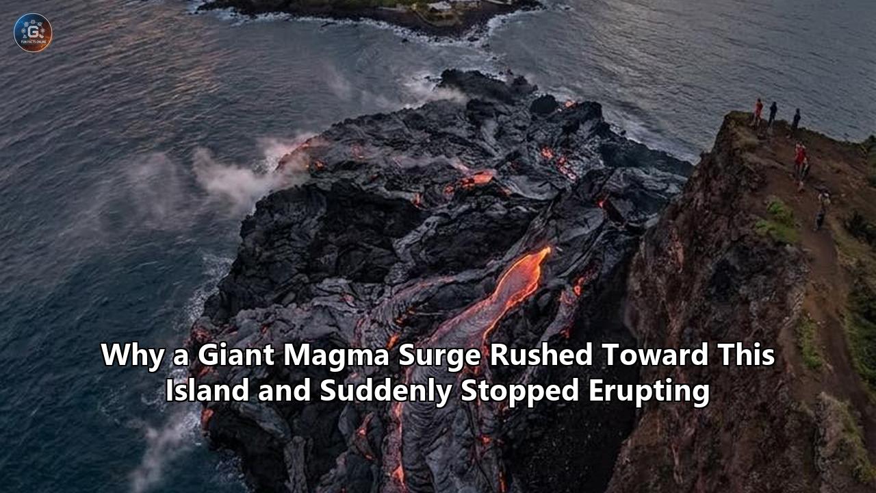
The coastal cliffs of São Jorge Island rise like a green, serrated knife from the deep blue of the mid-Atlantic. For nearly two centuries, this narrow strip of basalt—home to some 8,000 residents, steep cow pastures, and picturesque coastal plains known as fajãs—was considered a quiet, sleepy corner of the Azores Archipelago.
But on March 19, 2022, that peace was shattered.
Within hours, the ground began to tremble. Seismometers on the island, which normally recorded a handful of minor tectonic creaks a year, began registering hundreds, then thousands, of micro-earthquakes. In the streets of Velas, the island’s main port town, the scent of sulfur seemed to hang faintly in the salt air. Civil defense sirens wavered in the distance. Real-time satellite radar processing units began to flag an alarming trend: the central ridge of the island was bulging upward.
An underground monster was waking up.
By late March, local authorities had raised the volcanic alert level to V4 on a five-point scale—meaning an eruption was highly likely and potentially imminent. Terrified residents began lining up at the ferry terminals to flee to neighboring Pico or Faial islands. Evacuation routes were mapped, emergency shelters prepared, and international volcanologists rushed to deploy extra monitoring gear.
And then, just as the island braced for a catastrophic blast of lava and ash, the shaking began to taper off. The ground deformation stabilized. The threatened eruption never materialized.
For four years, the sudden halt of the 2022 São Jorge volcanic crisis remained one of the most tantalizing mysteries in modern volcanology. How could a massive geological system get so close to the brink of disaster, only to pull back at the final second?
The answer has finally been revealed. A landmark study published in Nature Communications by an international team of geophysicists, seismologists, and geodesists has reconstructed the underground crisis with unprecedented, high-resolution clarity.
By merging satellite radar data, ground-deformation models, and a dense network of onshore and ocean-bottom seismometers, researchers have mapped the exact path of a giant, "stealth" magmatic intrusion. What they uncovered is a remarkable story of a massive, deep-seated geological event that traveled almost entirely in secret, came within a mere 65 to 90 minutes of breaking the surface, and was ultimately stopped by a hidden structural "emergency brake" built into the island’s crust.
The findings are shaking up the fundamental assumptions of how volcanic eruptions are monitored, predicted, and managed worldwide.
The Silent Ascent: Why the Alarm Didn't Sound at 20 Kilometers Deep
To understand why this near-disaster caught volcanologists by surprise, one must first look at how standard volcanic monitoring works.
The traditional playbook of volcano forecasting relies on a simple, intuitive concept: as magma forces its way upward through the cold, brittle crust of the Earth, it must fracture the rock in its path. This fracturing creates high-frequency seismic signals—earthquakes—that grow shallower, more frequent, and more intense as the molten rock nears the surface. Volcano observatories track these seismic swarms to draw a vertical line of ascent, estimating when and where the magma will break through.
But beneath São Jorge in March 2022, the magma threw out the playbook.
Traditional Magma Ascent vs. The 2022 São Jorge "Stealth" Intrusion

[Traditional Ascent]
Magma cracks brittle rock -> Continuous earthquake swarms from deep to shallow
   Surface (Eruption!)
      ^
      |   * (Shallow Quakes)
      |   * *
      |   * * * (Mid-crustal Quakes)
      |   * * * *
      |   * * * * * (Deep Quakes)
   Deep Reservoir (Magma Source)

[São Jorge "Stealth" Intrusion]
Magma utilizes pre-existing fault -> Silent, aseismic ascent; Quakes only trigger AFTER stalling
   Surface (NO ERUPTION - Stalled at 1.6 km)
      ^
      |   ======================= [Stall Zone] -> Intense, late-stage earthquake swarm
      |   |                     |
      |   |   Pico do Carvão    |  <- (Aseismic upward glide; almost no deep earthquakes)
      |   |   Fault Zone        |
      |   |                     |
   Deep Reservoir (~20+ km Deep)
According to the study, led by Dr. Stephen P. Hicks of University College London (UCL) alongside co-authors from Portugal, Spain, and the UK, a massive vertical sheet of basaltic magma—known as a dike—burst out of a deep reservoir in the upper mantle, more than 20 kilometers beneath the Atlantic seafloor.
This was no minor trickle. The researchers calculated that the volume of the rising dike was roughly 79 million cubic meters. To put that in perspective, it is enough liquid rock to fill 32,000 Olympic-sized swimming pools.
Yet, as this colossal volume of molten rock shot upward through the first 15 kilometers of its journey, the island’s seismic network detected almost nothing. Much of the magma's climb was entirely aseismic.
"This was a stealthy intrusion," Dr. Hicks explained. "Magma moved quickly through the crust, but much of its journey was silent, making it difficult to forecast whether an eruption would occur."
This silent movement was possible because of the island's unique tectonic environment. São Jorge sits within the complex "triple junction" of the Azores, where the Eurasian, African, and North American tectonic plates slowly grind past and pull away from one another. This tectonic pulling has shredded the crust beneath the archipelago, leaving behind deep, pre-existing fault lines that slice all the way through the lithosphere.
Instead of having to blast through solid, unbroken stone, the 79-million-cubic-meter magma intrusion slid directly into one of these pre-existing structural weaknesses: the Pico do Carvão Fault Zone.
Because the fault zone was already fractured and structurally compromised, it offered a path of near-zero resistance. The magma did not need to break new rock to create space; it simply lubricated and pushed apart the pre-existing walls of the fault, gliding upward in near-silence.
By the time the first real swarm of earthquakes registered on the island's seismometers on March 19, the magma had already completed more than 90 percent of its vertical journey. It had bypassed the deep and mid-crustal monitoring zones entirely undetected.
For the volcanologists watching the real-time data feeds, the sudden onset of intense, shallow earthquakes was terrifying. They weren't watching the beginning of a volcanic build-up; they were looking at the final, eleventh-hour gasps of a magma body that was already sitting directly beneath their feet.
The Anatomy of a Near-Miss: 90 Minutes from Disaster
The geophysical modeling compiled in the 2026 paper reveals just how close São Jorge came to a historical catastrophe.
Historically, when basaltic magma breaches the surface on a narrow ridge like São Jorge, it creates spectacular but highly destructive "curtain of fire" eruptions. Highly fluid lava fountains erupt along fissures, feeding fast-moving lava flows that pour down the steep slopes, wiping out coastal villages and cutting off escape routes. The island’s last major subaerial eruptions, in 1580 and 1808, did exactly this, claiming lives and reshaping the coastline with thick, black basalt.
In March 2022, the magma dike ascended at an astonishing speed, driven by the intense tectonic tension of the Terceira Rift. It carved out a vertical fissure roughly 13 kilometers long, cutting directly across the central-western volcanic ridge of the island.
Using elastic dislocation models derived from satellite Interferometric Synthetic Aperture Radar (InSAR) and Global Navigation Satellite System (GNSS) data, the researchers calculated the exact geometry of the stalled dike.
The results were chilling: the top of the magma sheet had stalled at a depth of just 1.6 kilometers (about 1 mile) below the island’s surface.
São Jorge Cross-Section (March 2022)

             Central Ridge
               /\      _
              /  \    / \_  Velas
_____________/____\__/____\__________________ Sea Level
|            |    |
|            |    |  <- Stalled at 1.6 km depth
|            |====|     (Basaltic dike tip)
|            |    |
|            |    |  <- Magma traveling through
|            |    |     Pico do Carvão Fault Zone
|            |    |
|            |    |
|            /    \
|           /      \ <- Deep conduit to Upper Mantle (>20 km)
In the world of geophysics, 1.6 kilometers is a razor-thin margin. Under the pressure conditions of the shallow Azorean crust, magma rising at the velocities observed during the peak of the crisis would have required a mere 65 to 90 minutes of continued upward propagation to breach the surface and initiate a full-scale subaerial eruption.
Had the dike continued its upward trajectory for just an hour and a half longer, the town of Velas and the surrounding agricultural communities would have faced a sudden, highly explosive basaltic fissure eruption. Because much of the ascent had occurred in silence, civil defense authorities would have had almost no time to evacuate the western half of the island before the first fountains of molten rock broke through the pastures.
Yet, precisely when the pressure should have peaked, the upward progress of the dike ground to a sudden, absolute halt.
The physical mechanism of this sudden stop is the core scientific breakthrough of the new research, and it centers on a paradoxical geological truth: the very fault system that allowed the magma to rise so quickly also acted as the primary mechanism that prevented it from erupting.
The Double-Agent Fault: How the "Highway" Became a "Leak"
For decades, geologists have debated the precise relationship between tectonic faults and volcanic plumbing. Do faults actively pull magma upward, or do they act as structural barriers that trap it?
The 2022 São Jorge event provides the most definitive evidence yet that a single fault zone can play both roles simultaneously.
"The fault acted like both a highway and a leak," said Dr. Pablo J. González, co-lead author of the study from the Spanish National Research Council (IPNA-CSIC). "It helped magma rise, but may also have prevented an eruption."
The Pico do Carvão Fault Zone is not a single, clean crack in the earth. It is a highly complex, braided network of fractures, strike-slip shears, and minor normal faults that have developed over millions of years of plate tectonic pulling.
As the 79-million-cubic-meter magma sheet surged upward along this "highway," it eventually reached the shallow crust beneath the island's volcanic edifice. Here, the ambient pressures of the surrounding rock changed dramatically. The tight, confining pressures of the deep mantle gave way to highly fractured, lower-density volcanic deposits near the surface.
Under normal circumstances, this drop in confining pressure causes the dissolved gases (volatiles) trapped within the magma—such as water vapor ($H_2O$), carbon dioxide ($CO_2$), and sulfur dioxide ($SO_2$)—to rapidly come out of solution. This process, called exsolution, is highly explosive. It creates millions of rapidly expanding gas bubbles that act like a pressurized propellant, driving the magma upward in a self-sustaining vertical rush—much like shaking a bottle of champagne and popping the cork.
But as the magma entered the shallowest portions of the Pico do Carvão Fault Zone, it encountered a highly permeable network of lateral fractures.
Instead of being trapped within the rising magma body and driving it upward, these expanding gases and fluids found an immediate escape route. They surged sideways, leaking out of the main dike and venting laterally into the highly fractured rock layers to the west of the main fault line.
The "Highway and Leak" Mechanism

           Surface of Island
        _______________________
       /                       \
      /    [ Edifice Stress ]   \
     |                           |
     |         *   *   *         |
     |      *             *      |
     |==== [STALLED DIKE TIP] ===| <- 1.6 km depth
     |         ^       ^         |
     |   Gas   |       |   Gas   |
     |  Leaks <== [Dike] ==> Leaks <- Lateral escape of fluids
     |         |       |         |    & minor melt branches
     |         |       |         |
     |         |       |         | <- Rising through
     |         |       |         |    Pico do Carvão Fault
This lateral venting had three profound consequences:
- Loss of Driving Pressure: By allowing high-pressure gases and hydrothermal fluids to bleed off into the surrounding crust, the magmatic system lost its primary upward propellant. The driving overpressure within the dike tip plummeted.
- Thermal and Viscous Brake: Basaltic magma is highly sensitive to the presence of dissolved water. Water acts as a chemical "flux" that keeps the silicon-oxygen bonds within the liquid rock from linking up, keeping the magma fluid. When the dissolved water exsolved and escaped sideways through the leaky fault, the remaining magma underwent a process known as devolatilization crystallization. Its melting point effectively jumped, causing a rapid, runaway crystallization of mineral phases. Within hours, the fluid basalt turned into an incredibly stiff, sluggish mush, grinding its upward progress to a halt.
- Melt Branching: In addition to gas venting, the high-resolution seismic models showed that small "fingers" or branches of the liquid rock itself began to squeeze horizontally into the side-cracks of the fault. This lateral branching distributed the total volume and physical momentum of the magma surge eruption over a much wider horizontal area, preventing a single point of high pressure from breaking through to the surface.
The magma had run out of steam, literally and figuratively. The giant surge stalled, locked in place just over a mile beneath the green pastures of São Jorge, destined to slowly cool and solidify over decades into a subterranean wall of solid gabbro and basalt.
Inside the Command Center: The Geopolitics of a Invisible Crisis
While the physical drama played out deep underground, a parallel, highly tense human drama was unfolding in the emergency operations centers on the surface.
In March 2022, civil defense directors, scientific advisors, and local mayors faced an agonizing dilemma. The seismic monitoring networks were recording over 200 felt earthquakes a day. The vertical displacement of the island was unmistakable. If they delayed evacuations and an eruption occurred, thousands of lives could be lost. But if they ordered a full evacuation, they would freeze the island's economy, displace thousands of people, and trigger massive logistical and financial chaos—all for an event that might never happen.
"During a crisis like this, the pressure on decision-makers is immense," says Dr. Ricardo Ramalho, a co-author of the study and Senior Lecturer in Geo-Environmental Hazards at Cardiff University. "You are operating in a fog of war, looking at squiggly lines on a screen and trying to decide whether to tell families to abandon their homes."
Compounding the anxiety was a deep scientific division over what the seismic data actually meant.
At the time of the 2022 crisis, the regional monitoring networks caught only a fraction of the micro-seismicity. Traditional regional seismic algorithms initially located the earthquakes at depths of 5 to 9 kilometers, suggesting the magma was still deep in the mid-crust and moving slowly.
But behind closed doors, some researchers argued that the pattern of shaking was highly unusual. It didn't look like classic volcanic progression. Because São Jorge had a limited, sparse permanent monitoring network prior to 2022, scientists were essentially flying blind, trying to interpret a highly rapid, mostly silent intrusion with instruments designed for slow, tectonic tectonic activity.
The Real-Time Decision Dilemma (March 2022)

   [Available Real-Time Data]                [Actual Subsurface Reality]
- Earthquakes located at 5-9 km depth.    - Magma has already reached 1.6 km depth.
- Standard volcanic models suggest        - Ascent was 90% aseismic (silent).
  3-5 days of warning remaining.          - Eruption is 90 minutes away from starting.
              |                                         |
              v                                         v
   "We have time to wait and watch."       "We are on the absolute brink."
This structural mismatch created a highly dangerous paradox. The new 2026 reconstruction reveals that the peak of the seismic swarm—the very phase that triggered the highest state of alert and prompted thousands of residents to flee the island—actually occurred after the magma had already stalled and begun to cool.
The thousands of shallow, sharp earthquakes that rocked the island in late March and April were not the sound of magma blasting its way upward. Instead, they were "trigger-release" tectonic events: the surrounding crust adjusting to the massive new 79-million-cubic-meter volume that had just been forcibly wedged into it, coupled with the high-pressure gases and fluids venting laterally through the Pico do Carvão Fault Zone.
"In hindsight, the alarms we were reacting to in real-time were actually the sound of the system cooling down and locking up," says Dr. Hicks. "But because the initial upward surge was so silent, we didn't realize the critical danger had already passed. If the magma had not stalled, the eruption would have caught us completely off guard."
This disconnect highlights a terrifying vulnerability in how active volcanoes are monitored worldwide, particularly on ocean islands with limited seismic infrastructure.
Reconstructing the Crime Scene: The Forensic Tech Behind the Discovery
How did scientists manage to piece together a geological event that happened miles underground, years ago, and left no visible traces on the surface?
The answer lies in a remarkable feat of transnational scientific cooperation and cutting-edge geophysical forensics.
Immediately after the 2022 crisis began, researchers from University College London (UCL), the University of Lisbon, the Spanish National Research Council (CSIC), and Cardiff University pooled their resources. Securing emergency funding from the UK’s Natural Environment Research Council (NERC) and Portuguese scientific institutions, they deployed an array of ultra-precise seismic monitoring equipment.
Crucially, this deployment went beyond the shores of the island. Because São Jorge is a narrow strip of land just 35 miles long and 4 miles wide, onshore seismometers only provide a narrow, two-dimensional view of the Earth. To build a true three-dimensional model, the team had to look underwater.
They deployed specialized Ocean-Bottom Seismometers (OBS) on the deep Atlantic seafloor surrounding the island. These underwater instruments captured the seismic waves traveling through the submarine flanks of the volcanic ridge, providing a crucial, wrapping "stereo" view of the underground structures.
The 3D Geophysical Monitoring Array

                  Onshore Seismometers
                       [V]   [V]
                      _/\_____/\_  São Jorge Island
                    _/           \_
                   /               \
                  /                 \
  Ocean Surface _/___________________\_ _ _ _ _ _ _ _ _ _ _ _ _
               /                       \
              /                         \ Submarine Flanks
             /                           \
            /                             \
  _________/_______________________________\________ Ocean Floor
         [OBS]                             [OBS]
   Ocean-Bottom Seismometer          Ocean-Bottom Seismometer
Over the next two years, these instruments recorded an astonishing archive of ground motion. The researchers then ran this massive dataset through three advanced geophysical processing techniques:
1. Double-Difference Seismic Relocation (HypoDD)
Standard earthquake location algorithms look at a seismic signal and calculate its origin with an error margin of a few kilometers. For mapping a narrow magma dike, this is too blurry.
The research team used Double-Difference Relocation (HypoDD), a highly sophisticated mathematical algorithm that compares the travel times of seismic waves from thousands of closely spaced earthquakes recorded at the same stations. By analyzing the tiny differences in arrival times, the algorithm cancels out the distorting effects of the unknown subsurface geology, reducing the location error margin from kilometers to a few dozen meters.
This process produced "unprecedentedly sharp earthquake maps". Instead of a chaotic cloud of seismic dots, the relocated seismicity resolved into a razor-sharp, vertical plane tracing the exact contours of the Pico do Carvão Fault Zone and the lateral networks where the magmatic fluids had escaped.
2. Satellite Interferometric Synthetic Aperture Radar (InSAR)
To measure how much the island grew, the team processed radar data from the European Space Agency’s Sentinel-1 satellites. By bouncing radar beams off the island’s surface during consecutive orbital passes, they calculated how much the ground displaced toward or away from the satellite.
The InSAR analysis revealed that the central ridge of São Jorge had been pushed upward and outward by approximately 6 centimeters (2.4 inches) over just a few days in March 2022. By matching this surface "bulge" with elastic dislocation models, they confirmed the exact volume and depth of the underground dike, proving that a massive volume of molten rock had indeed wedged itself into the shallow crust.
3. Seismic Autocorrelation Imaging
To map the fault zone in three dimensions without relying solely on earthquakes, the team used a technique akin to a medical ultrasound for the Earth: Seismic Autocorrelation Imaging.
By constantly analyzing the ambient seismic noise—the continuous, subtle hum of ocean waves crashing against the island's shores—they were able to map the boundary interfaces between different rock layers and fault zones deep underground. This allowed them to construct a highly detailed 3D map of the Pico do Carvão Fault Zone, confirming the presence of the lateral, highly permeable fracture pathways that drained the magma's pressure.
The resulting model is the most detailed, high-resolution forensic reconstruction of a failed volcanic eruption ever compiled.
Why "Stealth" Intrusions Threaten Volcano Monitoring Worldwide
The implications of the São Jorge study extend far beyond the idyllic shores of the Azores. The discovery of a highly rapid, mostly silent magma surge eruption risk reveals a major, systemic blind spot in how global geohazards are monitored.
For decades, the standard scientific assumption has been that massive magma movements are noisy. Volcano-monitoring agencies and civil defense authorities operate under the belief that they will have a comfortable, multi-day window of escalating earthquake swarms to assess the risk, issue warnings, and execute orderly evacuations.
The 2022 São Jorge event proves that this window of safety is an illusion.
If magma can rise from the upper mantle (over 20 km deep) to the shallow crust (1.6 km deep) in less than 22 hours with almost zero seismic warning, our current early-warning systems are dangerously inadequate for certain types of eruptions.
Geological Hazards: The Monitoring Gap

   [Classic Volcano Model]                    [Stealth Magma Model (São Jorge)]
- Rising magma fractures thick rock.       - Magma utilizes pre-existing fault system.
- Generates weeks of escalating quakes.    - Rises 20 km in 22 hours in near-silence.
- Clear, progressive warning signals.       - Intense quakes only start AFTER stalling.
- Easy to forecast and plan evacuations.   - Eruption risk could peak before warnings issue.
This vulnerability is particularly acute in islands and coastal regions situated near major strike-slip faults or plate boundary rift systems. The 2026 study notes that similar tectonically mediated, rapid magmatic intrusions have likely occurred globally, but have gone completely undetected because of a lack of dense, high-precision monitoring arrays.
Consider these notable parallel cases:
1. Mount Marapi, Sumatra (December 2023)
On December 3, 2023, Mount Marapi in Sumatra, Indonesia, erupted with explosive violence, tragically killing 24 hikers. The eruption occurred with almost no warning.
Subsequent analyses suggest that the volcano's plumbing system is intimately tied to a branching normal fault of the Great Sumatran Fault—a major, crust-spanning strike-slip system. Geologists now suspect that a rapid, largely aseismic intrusion of magma slipped upward through this fault zone, bypassing the limited local monitoring network until the magma was already at the surface, triggering an instantaneous, fatal eruption.
2. Reykjanes Peninsula, Iceland (2023–2026)
Since late 2023, the Sundhnúkur crater row near Grindavík, Iceland, has experienced a relentless sequence of intense magma intrusions and fissure eruptions.
Monitoring teams at the Icelandic Meteorological Office (IMO) have noted that with each successive event, the time window between the first seismic warning signs and the actual outbreak of lava has shrunk dramatically—sometimes to less than 30 minutes.
This is because the crust beneath Reykjanes has been heavily fractured by successive dikes, creating a highly developed, low-resistance path of least resistance. The magma no longer needs to break rock; it simply glides through the pre-existing pathways, behaving exactly like the "stealth" surge observed at São Jorge.
3. Santorini and Kolumbo, Greece (2025)
In early 2025, the world-famous volcanic caldera of Santorini and its active submarine neighbor, Kolumbo, were rocked by over 60,000 earthquakes, triggering a massive state of emergency and widespread panic.
Subsequent high-precision relocations showed that a 13-kilometer-long, vertical magma dike had surged upward from a deep, shared magmatic reservoir, activating regional faults along its path. Like the São Jorge dike, the Santorini-Kolumbo intrusion stalled at a depth of 3 to 5 kilometers below the seafloor without breaching the surface.
The 2025 Greek crisis confirmed that these major submarine and island volcanic systems are connected at depth by a vast, shared magmatic heart, and that magma can mobilize horizontally and vertically across immense distances in a matter of days.
Technical Comparison of Modern "Stealth" Magmatic Events
The table below summarizes the key geophysical and operational parameters of recent high-profile "stealth" or rapid magmatic intrusions, highlighting the critical role that structural faults play in determining whether these events culminate in an eruption.
| Volcanic System / Event | Primary Fault Interaction | Intrusion Volume (Est.) | Minimum Depth Reached | Seismic Warning Window | Eruption Outcome |
|---|---|---|---|---|---|
| São Jorge Island, Azores (March 2022) | Pico do Carvão Fault Zone (Strike-slip/extensional) | ~79 million $m^3$ | 1.6 km below surface | Aseismic ascent; intense shaking only after stalling | Failed Eruption (Magma stalled due to lateral gas leak and devolatilization) |
| Santorini-Kolumbo, Greece (Jan–Feb 2025) | Regional NE-SW extensional faults | ~310 million $m^3$ | 3.0 to 5.0 km below seafloor | Aseismic initial rise; late-stage seismic swarm of 60,000+ events | Failed Eruption (Dike stalled in the mid-crust due to regional fault buffering) |
| Sundhnúkur Crater Row, Iceland (March 2024 Event) | Grindavík Rift Valley fault network | ~23 million $m^3$ | 1.2 km below surface | Less than 30 minutes of clear seismic warning | Failed Eruption (Dike stalled near Hagafell due to structural clogging from previous flows) |
| Mount Marapi, Sumatra (December 2023) | Great Sumatran Fault (Branching normal fault) | Unknown (Highly localized) | 0 km (Breached surface) | Almost zero warning; highly localized, undetected ascent | Explosive Eruption (Fatal phreatomagmatic/magmatic blast) |
Redefining Volcano Hazards: The Shift to "Fault-Coupled" Forecasting
The lessons of the 2022 São Jorge crisis are forcing a fundamental paradigm shift in how volcanologists and civil defense agencies approach volcanic risk.
For over a century, the scientific community has treated volcanic systems and tectonic fault systems as separate, distinct hazards. Volcanoes erupted; faults slipped.
The reality is that in active tectonic rifts—such as the Azores, Iceland, East Africa, and the Pacific Rim—these two systems are inextricably bound together. Faults are not passive cracks that simply get pushed aside by rising magma; they are active, dynamic actors that dictate the speed, path, and ultimate fate of a magma surge eruption.
The Future of Volcano Hazards: Integrated Monitoring

      [Old Volcano-Centric Paradigm]
      Monitor: Only the Volcanic Cone (Seismicity, Gases)
      Assumption: Magma rises in a simple vertical pipe.
      Result: Misses rapid, off-axis fault-guided intrusions.

      [New Fault-Coupled Paradigm]
      Monitor: Integrated Fault Systems + Volcano (Onshore/Offshore)
      Assumption: Magma utilizes crustal fault networks as conduits.
      Result: Captures silent, rapid intrusions; improves warning times.
To prevent future stealth intrusions from catching populated coastal zones off guard, geologists are calling for a massive overhaul of global volcanic monitoring infrastructure, focusing on three key initiatives:
1. Broadening the Footprint: Offshore and Seafloor Instrumentation
Historically, volcano monitoring has been onshore-focused. Geologists place seismometers, gas sensors, and GPS units directly on the flanks of visible volcanic cones.
But as São Jorge proves, the root systems of island and coastal volcanoes lie deep beneath the ocean floor. To accurately track a rising dike, monitoring networks must expand seaward.
This requires the permanent deployment of seafloor monitoring technologies, such as fiber-optic acoustic sensing (using existing submarine telecommunication cables) and permanent ocean-bottom pressure sensors that can detect the tiny seafloor bulges caused by rising magma reservoirs long before they trigger onshore earthquakes.
2. Transitioning to Real-Time Geodetic Modeling
Because the seismic signals of magma ascent can be incredibly quiet, monitoring agencies can no longer rely on seismology alone to sound the alarm.
Volcano observatories must integrate real-time, continuous GPS and satellite InSAR processing into their daily operations. If an island begins to bulge, even in the complete absence of earthquakes, authorities must treat it as an active magmatic intrusion.
Developing machine-learning systems that can process massive satellite radar datasets in real-time, searching for the telltale ground-deformation signatures of an underground dike, will be crucial to catching "stealth" surges before they reach the critical 90-minute margin.
3. Hazard Mapping That Includes Failed Eruptions
Finally, civil defense agencies must rewrite their emergency management playbooks to account for the unique psychological and logistical challenges of "failed eruptions".
When an active volcano undergoes an intense crisis of unrest that does not culminate in an eruption, it can create a dangerous "cry wolf" effect among the local population. Residents who spent days in terror, evacuated their homes, and suffered massive financial losses may be highly reluctant to comply with future evacuation orders.
Emergency planners must educate the public on the reality of stalled dikes. A failed eruption is not a false alarm; it is a massive, real-world volcanic event that simply happened to freeze a mile underground.
Furthermore, as the 2026 São Jorge study warns, a stalled dike is not a guarantee of future safety. While the 79-million-cubic-meter basaltic dike is currently freezing beneath the island, it has permanently altered the local geology. It has introduced massive structural stresses, shattered local fault zones, and left behind a heat engine that will drive hydrothermal activity for decades.
Most importantly, it has paved a highly fractured, low-resistance path from the upper mantle directly into the shallow crust.
What to Watch: The Unresolved Questions of São Jorge
As the dust settles on this scientific breakthrough, geophysicists are already looking to the future. Several crucial, unresolved questions remain:
- Is the Pico do Carvão Fault Zone permanently primed? While the 2022 dike is solidifying, the tectonic forces of the Terceira Rift continue to pull the Azores apart. Will the next magma surge eruption use this exact same pre-existing pathway, or has the newly solidified basaltic wall acted as a plug, forcing future magma to find an entirely new route through the island?
- How common are "stealth" surges globally? Because many volcanic islands in the Pacific, Indian, and Atlantic oceans have highly limited monitoring networks, how many massive magma dikes are silently rising and stalling beneath inhabited coasts without anyone ever realizing it?
- Can we detect the next one in time? If a similar rapid, fault-mediated intrusion begins tomorrow beneath another populated island, will we have the offshore sensors, the real-time satellite models, and the political courage to sound the alarm before the 90-minute countdown runs out?
The narrow escape of São Jorge Island in March 2022 was a masterclass in the complex, unpredictable physics of our planet. It showed that the Earth can mobilize immense, terrifying volumes of liquid fire in near-silence, and that our safety often depends on a delicate, chaotic balance of faults, fractures, and escaping gas miles beneath our feet.
As scientists continue to decode the secrets of this near-eruption, they are building a clearer, safer future—one where we can finally look beneath the surface and hear the silent whispers of the magma before they turn into a roar.
Reference:
- https://www.discovermagazine.com/silent-magma-surge-lifted-azorean-island-2-5-inches-then-stopped-abruptly-below-the-surface-49014
- https://www.cardiff.ac.uk/news/view/3041718-tracing-magmas-hidden-journey-researchers-show-fault-systems-guide-and-halt-volcanic-unrest
- https://www.youtube.com/watch?v=y5J8RuXDwlM
- https://www.youtube.com/watch?v=UsbE4x-hVTw
- https://www.earth.com/news/magma-surge-beneath-atlantic-island-shows-warning-signs-can-come-too-late/
- https://www.sciencedaily.com/releases/2026/05/260513221803.htm
- https://dailygalaxy.com/2026/05/massive-magma-surge-beneath-island/
- https://repositorio.ipl.pt/entities/publication/5c38eb38-10c1-4f3c-a4a5-729ad97ac74a
- https://en.wikipedia.org/wiki/Eldfell
- https://www.youtube.com/watch?v=I-5_dsMPUEE
- https://www.researchgate.net/publication/404120547_Fault-mediated_magma_propagation_and_triggered_seismicity_revealed_by_the_2022_Sao_Jorge_Azores_unrest
- https://eartharxiv.org/repository/view/8224/
- https://www.manchester.ac.uk/about/news/fault-lines-found-to-both-drive-and-dampen-volcanic-activity/
- https://en.vedur.is/about-imo/news/earthquake-in-brennisteinsfjoll-faster-subsidence-in-krysuvik-and-continued-magma-accumulation-at-svartsengi
- https://en.wikipedia.org/wiki/2023%E2%80%932025_Sundhn%C3%BAkur_eruptions
- https://www.youtube.com/watch?v=r-ZQboCAwO4
- https://www.youtube.com/watch?v=MRk2BVKdVi0