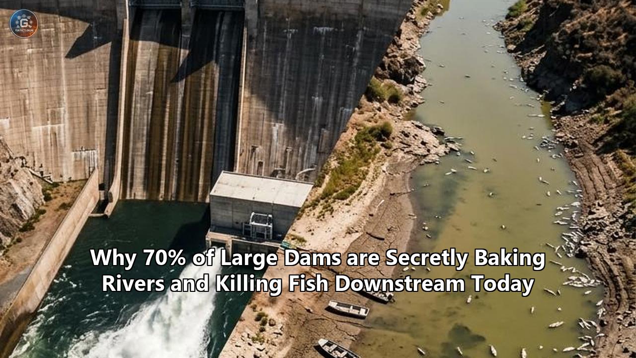
On July 10, 2026, a team of geoscientists published a landmark study in Science Advances that dismantled a century of river conservation policy with a single, chilling revelation. For decades, scientists, regulators, and environmental advocates have evaluated the ecological health of rivers by measuring water quantity—the volume of water flowing through channels, measured in cubic feet per second. But by using thermal infrared sensors mounted on Earth-orbiting satellites to peer down at hundreds of river systems across the United States, researchers discovered that dams are executing a quiet, systemic, and highly destructive restructuring of the aquatic world: they are fundamentally reorganizing the thermal cycles of rivers.
The study, led by Dr. Emily A. Ellis of Virginia Tech, analyzed Landsat satellite data spanning from 2013 to 2024, examining the water temperatures upstream and downstream of 287 large dams. The findings exposed a massive regulatory blind spot. A staggering 71% of these large dams significantly altered the water temperature downstream. Far from being isolated thermal blips, these temperature changes were sustained—and in many cases, continued to intensify—for at least 20 kilometers (12.4 miles) downstream of the structures.
Crucially, this thermal disruption is not a uniform cooling effect, as has long been assumed of deep-release reservoirs. In 60% of the cases where a temperature shift was detected, the downstream waters were significantly warmer than their natural state. At the most extreme end, reservoirs behind these dams caused sudden, artificial temperature shifts of 4 degrees Celsius (7.2 degrees Fahrenheit) or more. In the delicate, cold-water ecosystems of North American rivers, a 4-degree thermal spike is not a minor deviation; it is a lethal environmental shock.
+------------------------------------------------------------+
|        THE SATELLITE FINDINGS (Ellis et al., 2026)         |
+------------------------------------------------------------+
|  Total Large U.S. Dams Analyzed: 287                       |
|  Dams Causing Significant Downstream Thermal Alteration: 71%|
|  Of those altered, percentage that were WARMER: 60%        |
|  Minimum distance thermal disruption is sustained: 20 km   |
|  Extreme temperature shifts (>= ±4°C) tied to reservoirs: 91%|
+------------------------------------------------------------+
Water temperature is the master variable of aquatic life. It dictates dissolved oxygen levels, controls metabolic rates, and serves as the precise chronological trigger for fish migration and spawning. By flattening seasonal temperature variations, delaying spring warming, and baking rivers during critical summer months, dams are decoupling freshwater species from the environmental cues they have relied on for millennia. This is the invisible thermal footprint of river regulation—an environmental crisis unfolding in plain sight, yet largely obscured from the physical gauges used by water managers.
The Silent Thermodynamic Trap: How Reservoirs Become Thermal Batteries
To understand why the impact of dams on river ecosystems is so profoundly tied to temperature, one must look at the physics of impounded water. A natural river is a dynamic, fast-moving system. Because the water is constantly mixing and flowing over rocks, riffles, and shallow beds, it remains in close thermodynamic equilibrium with the local microclimate. Heat is rapidly absorbed from solar radiation during the day and shed back into the atmosphere at night.
When a dam is built, it halts this kinetic energy, transforming a shallow, shaded, fast-running stream into a massive, stagnant lake. These artificial reservoirs act as giant thermal batteries, collecting and storing solar radiation on an unprecedented scale.
   Natural River (High Kinetic Energy)      Reservoir behind Dam (Stagnant, Stratified)

        [Shallow, Shaded, Flowing]               [Solar Radiation / Sun]
                 ~~~~~~~                                    |
                 ~~~~~~~                                    v
          Direct Heat Exchange with               +-------------------+  <-- Warm Epilimnion
            Atmosphere & Canopy                   |      Warm Water   |
                                                  |~~~~~~~~~~~~~~~~~~~|  <-- Metalimnion (Thermocline)
                                                  |   Cold, Dense,    |
                                                  |   Anoxic Water    |  <-- Deep Hypolimnion
                                                  +-------------------+
In deep reservoirs, a physical phenomenon known as thermal stratification occurs during the spring and summer. The sun heats the upper layer of the reservoir, known as the epilimnion. Because warm water is less dense than cold water, this heated surface layer floats on top, isolated from the deeper waters. At the bottom of the reservoir lies the hypolimnion—a dark, dense, and icy pool of water that remains cut off from the atmosphere. Separating these two layers is the thermocline (or metalimnion), a zone of rapid temperature transition.
Because these water layers do not mix, they develop vastly different chemical and physical profiles:
- The Epilimnion (Surface): Becomes highly heated, absorbs solar radiation, and often hosts massive algal blooms fueled by agricultural runoff trapped in the reservoir.
- The Hypolimnion (Bottom): Reaches near-freezing temperatures, but because it is isolated from the air and filled with decomposing organic matter sinking from the surface, it becomes severely depleted of dissolved oxygen—a state known as anoxia.
The thermal destiny of the river downstream is determined entirely by where a dam’s intake gates are located. If a dam is designed to release water from the bottom of the reservoir (hypolimnetic release), it discharges icy, oxygen-deprived water into the river below. If it releases water from the surface (epilimnetic release), or if the reservoir is relatively shallow and easily mixed by wind, it discharges highly heated, stagnant water.
Both scenarios represent severe thermal pollution. During the summer, deep-release dams can drop downstream river temperatures by as much as 11.9 degrees Fahrenheit (6.6 degrees Celsius) compared to natural conditions, mimicking a perpetual winter that stunts fish growth and prevents spawning. Conversely, in the winter, the reverse occurs: because the deep layers of a reservoir are insulated from freezing air temperatures by the water column above, the dam releases water that is unnaturally warm, disrupting the winter dormancy cycles of aquatic insects and fish.
For shallow reservoirs and run-of-the-river dams—which make up the vast majority of the structures peppered across the global landscape—there is no deep, cold hypolimnion to draw from. The entire impounded body of water heats up under the sun. When this warm, slow-moving water spills over the top of the dam, it acts as a thermal blowtorch, baking the downstream riverbed. The 2026 study by Ellis et al. proved that this warming effect is not a localized issue that dissipates within a few hundred meters. The sheer mass of the thermal energy released allows these elevated temperatures to override natural atmospheric cooling, persisting for dozens of miles downstream and permanently shifting the local climate of the river.
The Downstream Carnage: When Water Temperature Kills
To understand the biological toll of this thermal disruption, one must look at the physiological constraints of freshwater species. Unlike mammals, fish are ectothermic—their internal body temperature is dictated entirely by the water around them. Every physiological process, from enzymatic reactions and digestion to cellular respiration and cardiac output, is fine-tuned to a narrow, species-specific thermal envelope.
When dams alter this envelope, they disrupt the evolutionary synchrony between aquatic species and their environment. One of the most devastating manifestations of this is the disruption of thermal cues for reproduction. Many native fish species rely on precise seasonal temperature gradients to initiate spawning.
In China, the construction of the massive Xinanjiang and Danjiangkou hydroelectric dams caused peak summer water temperatures downstream to drop by 4 to 6 degrees Celsius (7.2 to 10.8 degrees Fahrenheit). This artificial cooling delayed fish spawning by three to eight weeks. For the Reeves' shad (Macrura reevesii), a highly prized, culturally significant warm-water fish in the Qiantang River, this delay proved fatal. The fish were unable to spawn before seasonal flow regimes shifted, leading to the complete local extinction of the species.
                     CONSEQUENCES OF THERMAL ALTERATION ON FISH

      UNNATURALLY COLD RELEASES                 UNNATURALLY WARM RELEASES
   +-------------------------------+         +-------------------------------+
   | * Delayed spawning (3-8 weeks)|         | * Direct mortality (lethal)   |
   | * Stunted larval/juvenile growth|       | * Metabolic depletion (starving)|
   | * Disrupted insect hatching   |         | * Dissolved oxygen depletion  |
   | * Loss of warm-water species  |         | * Proliferation of parasites  |
   +-------------------------------+         +-------------------------------+
In Australia, the Keepit Dam on the Namoi River had a similar effect. Cold-water releases during the summer suppressed river temperatures downstream, flattening the seasonal thermal peaks that native warm-water fish, such as the golden perch and Murray cod, required to trigger their mating migrations. Entire generations of fish simply failed to reproduce, leaving the river populated only by aging adults and opening the door for invasive, temperature-tolerant species like common carp to overrun the basin.
But while cold-water pollution freezes ecosystems out of their reproductive cycles, warm-water pollution—the "baking" of rivers identified in 60% of the dams in the 2026 Science Advances study—presents an immediate, lethal threat to cold-water salmonids. Salmon, trout, and steelhead are highly sensitive to elevated temperatures.
"Water temperature is so much more than a single number," explains Dr. Ann Willis, a researcher at the University of California, Davis, who led an extensive study on river thermal regimes published in PLOS One. "Streams are the temperature they are because of complex interactions between the water, the trees, the snowmelt, and the groundwater, creating unique, highly dynamic temperature patterns. When we flatten those patterns with a dam, we destroy the ecological niches that different life stages of these fish rely upon."
                       Salmonid Thermal Thresholds

   50°F (10.0°C)           55°F (12.8°C)           68°F (20.0°C)      77°F (25.0°C)
   +-----------------------+-----------------------+------------------+------------+
   |   Optimal Egg         |   Optimal Juvenile    |   Severe         |   Lethal   |
   |   Incubation          |   Growth              |   Metabolic      |   Limit    |
   |                       |                       |   Stress         |            |
   +-----------------------+-----------------------+------------------+------------+
For instance, the water temperatures required for the successful incubation of salmon eggs are incredibly strict, typically requiring temperatures below 55°F (12.8°C). Once the eggs hatch, juvenile salmon can tolerate slightly warmer waters, but if temperatures rise above 68°F (20°C), they experience severe metabolic stress.
At these elevated temperatures, a fish’s metabolism accelerates, requiring them to consume massive amounts of food just to survive. However, because warm water holds significantly less dissolved oxygen than cold water, the fish are simultaneously starved of the oxygen needed to fuel this metabolic surge. They become lethargic, highly susceptible to diseases and parasites, and easy prey for warm-water predators like the northern pikeminnow, which thrive in the slow-moving, heated reservoirs created by dams.
If the water temperature reaches 77°F (25°C) and remains there for even a few days, it becomes directly lethal, causing rapid, widespread fish die-offs.
Peeling Back the Veil: Why In-Situ Gauges Kept the Secret for Decades
If the impact of dams on river ecosystems is so catastrophic, why has this thermal disruption remained a "secret" for so long? The answer lies in how we have historically monitored our rivers.
For the past century, physical water quality monitoring has relied almost exclusively on in-situ USGS gauge stations. These are physical sensors anchored to concrete pillars or bridge abutments, measuring temperature, flow, and turbidity at a single, fixed point in space. While these gauges provide highly accurate, real-time data for their specific location, they are incredibly sparse.
A 2022 study published in Nature Sustainability by a research group investigating global water infrastructure exposed a severe "placement bias" in the global river gauge network. Gauges are overwhelmingly placed near major cities, water treatment plants, or directly adjacent to dam operations to monitor compliance with minimum flow requirements. They are rarely distributed continuously along a river’s length.
               THE GAUGE BLIND SPOT VS. SATELLITE VISION

   In-Situ Gauge Monitoring (Sparsely spaced, misses longitudinal trends):
   [Dam] ---> [Gauge 1] -----------------------------> [Gauge 2 (25 miles away)]
                (Looks fine)                             (Looks warm, but why?)

   Satellite Thermal Infrared (Continuous spatial imagery):
   [Dam] ====================================================================>
         |<------------ Continuous 20 km Thermal Fingerprint Detected --------->|
This spatial scarcity created a massive scientific blind spot. A gauge placed immediately below a dam might show a water temperature of 55°F, leading regulators to believe the downstream fishery was safe. However, that gauge completely missed what happened five, ten, or fifteen miles downstream.
Because the dam has stripped the river of its natural velocity, canopy cover, and sediment structures, the water released from the reservoir moves sluggishly, absorbing solar heat at an accelerated rate. Without continuous measurements, scientists could not see that the river was rapidly heating up downstream, effectively creating a thermal barrier that blocked fish from reaching their upstream spawning grounds.
To solve this problem, Dr. Emily Ellis and the Global Rivers Group at Virginia Tech turned to the heavens. By utilizing thermal infrared sensors aboard Landsat satellites, they were able to bypass the physical limitations of ground-based gauges. Thermal infrared remote sensing measures the electromagnetic radiation emitted from the very surface of the water, allowing researchers to construct a continuous, high-resolution thermal profile of a river across its entire length.
"Using satellites allowed us to see the river as a continuous ribbon of heat, rather than a series of disconnected data points," Dr. Ellis explained during an academic seminar. "For the first time, we were able to track exactly how far the thermal fingerprint of a dam extends. And what we found was that the thermal boundaries set by these dams are incredibly resilient. They override the natural atmospheric cooling and tributary mixing that would normally stabilize river temperatures, carrying unnatural warmth or cold for tens of kilometers downstream."
This satellite-driven revelation has forced a major reconceptualization of the scale of human impact on freshwater systems. It proved that dams do not just segment rivers physically with concrete walls; they segment them thermally, creating vast, invisible zones of thermal pollution that are completely undetectable by traditional monitoring networks.
Ground Zero California: Shasta Dam and the Salmon Death Sentences
Nowhere is the collision between thermal dam pollution and biological survival more visible than in California’s Central Valley, where the state’s massive water infrastructure has pushed native salmon populations to the absolute brink of extinction.
The Sacramento River was once home to four distinct runs of Chinook salmon: fall, late-fall, spring, and winter. Each run evolved to utilize the river at different times of the year, taking advantage of the natural seasonal temperature cycles of the basin. The winter-run Chinook is particularly unique; they spawn during the heat of the summer, relying on the icy, groundwater-fed streams of the volcanic southern Cascades to keep their eggs alive.
When Shasta Dam was completed in 1945, it blocked the winter-run Chinook from accessing 100% of their historical spawning habitat in the cold, high-altitude reaches of the McCloud, Pit, and Upper Sacramento rivers. The salmon were forced to spawn in the mainstem of the Sacramento River, directly below the dam, where the water is naturally much warmer during the summer.
To prevent the immediate extinction of the run, the U.S. Bureau of Reclamation was forced to turn Shasta Dam into a giant, artificial refrigeration unit. In 1997, they completed construction of a massive, $80 million Temperature Control Device (TCD)—a 250-foot-tall steel shutter structure mounted to the back of the dam. The TCD allows operators to selectively draw water from different depths of Shasta Lake, attempting to release water that is exactly 53.5°F (11.9°C) to protect the developing salmon eggs downstream.
                          SHASTA DAM'S THERMAL TENSION

         [Shasta Lake Reservoir]
         +------------------------+
         | Warm Surface           |======\  <- Epilimnetic Draw (Summer Spill)
         |========================|      |
         | Cold Water Pool        |======|---> [Temperature Control Device]
         | (Dwindling in drought) |======/       releases 53.5°F water downstream
         +------------------------+              to save winter-run Chinook eggs.
But this engineering solution is highly vulnerable to the realities of a changing climate and changing water years. The 2026 Shasta Reservoir Temperature Management Plan highlights the precarious nature of this balancing act.
The winter of 2025–2026 in Northern California was mild. While heavy rains brought Shasta’s total water storage to 121% of its 15-year average, the mountain snowpack was a abysmal 8% of average. Because snowpack acts as the primary slow-release mechanism that feeds cold water into Shasta Lake throughout the spring, the lack of snow meant that the reservoir’s vital "cold-water pool"—the deep, icy layer at the bottom of the lake—was severely depleted, mirroring conditions typically seen during extreme drought years.
In its official 2026 operational forecast, the Bureau of Reclamation categorized the year as a "Bin 2A" management scenario. Under this designation, water managers are forced to make agonizing ecological trade-offs:
- The Mandate: Attempt to maintain a daily average temperature of 53.5°F at Clear Creek (CCR) and 56.0°F further downstream at Balls Ferry Bridge to protect the winter-run spawning grounds.
- The Reality: Because the cold-water pool is so small, operators must ration their cold-water releases. If they release too much cold water early in the summer, they will completely deplete the cold-water pool by August, leaving the river to bake under the late-summer sun and cook the salmon eggs in their gravel nests.
- The Trade-off: To save the winter-run eggs, managers must withhold water from other agricultural and municipal users, or allow downstream temperatures at Wilkins Slough to climb toward a staggering 68°F (20°C), creating a thermal barrier that blocks migrating adult spring-run salmon.
"It is a house of cards," says a California fisheries biologist who spoke on the condition of anonymity. "We are using an engineered band-aid to replicate an entire mountain climate system. When the snowpack fails, the band-aid rips off. We are one hot week in July away from losing an entire generation of winter-run Chinook."
This struggle is not unique to California. It is a stark reminder that even our most advanced engineering solutions to mitigate the impact of dams on river ecosystems are fundamentally limited by the thermodynamics of a warming planet.
Ground Zero Southwest: The 2026 Lake Mead and Hoover Dam Cooling Crisis
Three hundred miles southeast of Shasta, an even more dramatic thermal crisis unfolded in the spring of 2026, threatening not only a delicate desert river ecosystem but the clean energy grid of the American Southwest.
Lake Mead, the colossal reservoir created by the Hoover Dam on the Colorado River, has long been the focus of national anxiety due to its falling water levels. But in March 2026, the Bureau of Reclamation confirmed a terrifying new variable: the water inside Lake Mead is getting dangerously hot.
                 COLORADO RIVER SYSTEM THERMAL ESCALATION (2026)

   [Glen Canyon Dam / Lake Powell]
         |
         | Releases warm surface water (due to depleted reservoir levels)
         v
   [300 Miles of Open Desert]
         |
         | Water heats up 1.8°F for every 30 miles traveled
         v
   [Lake Mead / Hoover Dam]
         |
         | Inflows arrive 10.8°F warmer than historical averages
         | Turbines face operational shutdown if cooling water reaches 78.8°F
         v
   [Downstream Colorado River]
         |
         | Unnaturally warm water fuels toxic algal blooms (first detected March 13, 2026)
         | Non-native predators (smallmouth bass) expand; native humpback chub decline
Historically, Lake Powell—located 300 miles upstream behind the Glen Canyon Dam—acted as the cold-water buffer for the entire lower Colorado River. It released deep, cold water that traveled down through the Grand Canyon, keeping the river temperatures artificially low. But as Lake Powell’s water levels plummeted toward "dead pool," the reservoir lost its ability to stratify. Instead of drawing from a deep, cold hypolimnion, Glen Canyon Dam began releasing warm surface water—sometimes 15°F to 20°F warmer than the deep releases of previous decades.
As this water travels through 300 miles of open, scorching desert, it absorbs solar radiation, warming by roughly 1.8°F for every 30 miles it flows downstream. By the time this water arrives at Lake Mead, it is preheated. In February 2026, the Bureau of Reclamation confirmed that inflow temperatures into Lake Mead were projected to be at least 10.8°F (6°C) above normal by the fall of 2026.
This thermal surge has created a dual crisis:
- The Engineering Crisis: Hoover Dam’s 17 massive turbine generators, which produce 2,080 megawatts of electricity for 1.3 million homes across Nevada, Arizona, and California, do not cool themselves with air. They rely on Lake Mead’s water to cool their internal systems. The Bureau of Reclamation has confirmed that if the temperature of this cooling water reaches 78.8°F (26°C) for three consecutive days, the turbines face catastrophic thermal failure and must be shut down.
- The Ecological Crisis: The warm water entering Lake Mead has shattered the reservoir's biological equilibrium. On March 13, 2026, Southern Nevada officials detected the first toxic algal bloom of the year—weeks earlier than any previously recorded season. These cyanobacteria blooms release neurotoxins that are lethal to wildlife, domestic dogs, and humans, while their eventual decomposition strips the water of oxygen, suffocating fish.
Downstream of Hoover Dam, the impact of dams on river ecosystems has been thrown into reverse. For decades, the dam released water that was too cold for native species. Now, it is releasing water that is too hot.
The native humpback chub, a bizarre, armor-headed fish that has survived in the silty, turbulent Colorado River for millions of years, is highly adapted to seasonal temperature swings. But they cannot survive the warm-water generalist predators, like smallmouth bass and green sunfish, that are now pouring out of the warmed reservoirs and migrating upstream through the Grand Canyon.
The Colorado River is no longer a wild, self-regulating artery of the desert. It is an overheated, highly fragile plumbing system, where a rise of a few degrees in water temperature threatens to collapse both the natural ecosystem and the human infrastructure built to exploit it.
The Global Blueprint: Over 3,700 Planned Dams Threaten the World's Wildest Rivers
While the United States struggles to manage the thermal fallout of its aging, 20th-century dam infrastructure, the developing world is currently in the midst of an unprecedented dam-building boom. Globally, at least 3,700 medium and large hydropower dams are currently under construction or in the advanced planning stages, heavily concentrated in three of the planet’s most biodiverse river basins: the Amazon, the Congo, and the Mekong.
                 GLOBAL BASINS AT RISK OF THERMAL DISRUPTION

         Amazon Basin                  Congo Basin                  Mekong Basin
   +---------------------+       +---------------------+       +---------------------+
   | * 1,000+ planned    |       | * Grand Inga &      |       | * 11 mainstem dams, |
   |   and active dams   |       |   tributary dams    |       |   hundreds on tribs |
   | * Threatens world's |       | * Risk to ancient,  |       | * Disrups protein   |
   |   most diverse      |       |   deep-river fish   |       |   source for 60M    |
   |   freshwater fish   |       |   adapted to cold   |       |   people (80% of    |
   |   assemblage        |       |   canyon depths     |       |   Cambodian protein)|
   +---------------------+       +---------------------+       +---------------------+
To predict how this massive expansion of concrete will alter global river temperatures, a team of international researchers developed a machine learning model, published in Earth's Future. Led by Dr. Shahryar Ahmad, a hydrologist with NASA, the team analyzed the physical dimensions and reservoir capacities of 216 planned dams across the globe.
Their model revealed a highly concerning global blueprint:
- The Summer Cooling Threat: Approximately 73% of the planned dams would potentially cool downstream rivers during the summer by up to 11.9°F (6.6°C). This cooling would be most severe in the highly biodiverse Mekong and Amazon basins, where tropical species have zero evolutionary tolerance for cold-water anomalies.
- The Winter Warming Threat: In the winter, the trend would reverse, with dams warming downstream rivers by up to 3.6°F (2°C). This winter warming prevents the natural thermal restructuring that tropical floodplain forests rely on to initiate nutrient cycling.
The human stakes of this thermal disruption are incredibly high. In the Lower Mekong River Basin, which flows through China, Myanmar, Laos, Thailand, Cambodia, and Vietnam, more than 60 million people rely directly on the river for their livelihoods and food security.
Cambodians, for example, receive up to 80% of their animal protein from wild-caught freshwater fish, primarily from the Tonle Sap—a massive lake that connects to the Mekong. The productivity of this fishery depends entirely on the "flood pulse," a seasonal hydrological and thermal cycle where the rising, warming waters of the Mekong reverse the flow of the Tonle Sap River, flooding the surrounding forests and triggering a massive reproductive explosion of fish.
By constructing a cascade of mega-hydropower dams along the mainstem of the Mekong and its key tributaries (such as the Sesan, Srepok, and Sekong rivers, known as the 3S Basin), developers are flattening this flood pulse. Landsat thermal data analyzed by the Global Rivers Group revealed that within just one year of major dams beginning operations in the 3S Basin, dry-season water temperatures dropped by up to 2°C.
This artificial cooling, combined with the physical blockage of migration routes, is devastating the Mekong's migratory whitefish species, which cannot spawn without the precise seasonal warming cues that have now been engineered out of existence.
"We are repeating the exact same mistakes that the United States and Europe made during the 20th century, but on a far larger and more dangerous scale," warned Dr. Ahmad. "The Amazon, the Congo, and the Mekong are the biological engines of our planet's freshwater systems. If we disrupt their thermal regimes, we are not just losing fish species; we are dismantling the primary food security of millions of people."
The Regulatory Blind Spot: Why We Measure Flow and Ignore Heat
Why has the global regulatory framework failed so completely to address this thermal crisis? The root of the problem is structural, embedded in the very laws and metrics used to govern water resources.
In the United States, the Federal Energy Regulatory Commission (FERC) is responsible for licensing non-federal hydropower dams. When a dam’s license comes up for renewal—a process that happens only once every 30 to 50 years—FERC is required under the Clean Water Act and the Endangered Species Act to evaluate the dam's environmental impact.
However, these evaluations have historically suffered from a severe conceptual bias: they treat "environmental flows" as a question of water quantity, completely divorcing it from water quality.
                     THE DISCONNECT IN ENVIRONMENTAL FLOWS

      CONVENTIONAL FLOW METRICS (CFS)              THE THERMAL PULSE (THERMOGRAPH)
   +----------------------------------+         +----------------------------------+
   | Focuses purely on volume:        |         | Focuses on temperature dynamics: |
   | "Is there enough water in the    |   VS.   | "Is the water releasing seasonal |
   | channel to keep fish wet?"       |         | thermal cues needed for life?"   |
   |                                  |         |                                  |
   | RESULT: Constant, flat releases  |         | RESULT: Natural fluctuations that|
   | that deplete cold-water pools.   |         | preserve biological synchrony.   |
   +----------------------------------+         +----------------------------------+
Under standard regulatory guidelines, dam operators are typically required to release a set minimum instream flow, measured in cubic feet per second (cfs), to prevent downstream stretches from running dry. To meet water quality requirements, they are often given a single-degree temperature target—such as ensuring that the seven-day average of daily maximum temperatures (7DADMAX) does not exceed 68°F (20°C).
But this simplified, single-number target is fundamentally flawed. It ignores the fact that a healthy river does not have a flat, static temperature. Naturally, river temperatures fluctuate wildly throughout the day (diel variation) and across the seasons. These fluctuations are not noise; they are critical ecological signals.
For example, a river that naturally fluctuates between 50°F at night and 64°F during the day provides a diverse set of thermal niches. Cold-water trout can rest and digest their food in the cool night water, while their metabolism is stimulated by the warm daytime temperatures, allowing them to grow rapidly.
If a dam operator meets their regulatory target by releasing water at a flat, constant 57°F (13.9°C), they have technically stayed below the temperature ceiling. But they have completely flattened the thermal regime. The lack of daytime warming prevents the development of the aquatic insects that trout feed on, while the lack of nighttime cooling prevents the trout from entering their metabolic rest state. The fish become chronically stressed, their growth rates plummet, and the entire food web collapses.
"We have spent decades treating water temperature like it's a contaminant that we can dilute or manage with a thermostat," says Dr. Ann Willis. "But temperature is not a chemical. It is a dynamic physical process. Until our regulations move away from oversimplified, static temperature targets and begin protecting the natural, fluctuating thermal regimes of our rivers, our conservation efforts will continue to fail."
Engineering the Cure: From Selective Withdrawal to Dam Decommissioning
If the existing infrastructure is fundamentally designed to disrupt river temperatures, how do we fix it? Water resource engineers and conservationists are currently pursuing two very different pathways: engineering modifications to existing dams, and the complete physical removal of the structures.
Selective Withdrawal Systems: The Mechanical Thermostat
For dams that are too economically vital to remove—such as those providing critical flood control, municipal water storage, or grid-scale hydropower—the primary tool for thermal mitigation is the Selective Withdrawal System (SWS).
An SWS, like the Temperature Control Device mounted on Shasta Dam, is a mechanical structure that allows operators to draw water from different depths of a stratified reservoir. By blending warm water from the surface (epilimnion) with cold water from the depths (hypolimnion), operators can, in theory, dial in a specific, seasonally appropriate water temperature for the river downstream.
                     SELECTIVE WITHDRAWAL IN ACTION

         [Stratified Reservoir]              [Selective Withdrawal Tower]
         +--------------------+              +--+
         | Warm Epilimnion    |==============|  |==\  Warm Draw
         +--------------------+              |  |  |
         | Metalimnion        |==============|  |--+---> Blended Release
         +--------------------+              |  |  |     at Target Temp
         | Cold Hypolimnion   |==============|  |==/  Cold Draw
         +--------------------+              +--+
While SWS technology has proven effective at preventing immediate, catastrophic fish kills in highly managed systems, it has major limitations:
- High Capital Cost: Retrofitting an existing dam with a selective withdrawal tower is an incredibly expensive engineering feat, often costing tens or hundreds of millions of dollars—a cost that is rarely economically viable for older, smaller hydroelectric dams.
- Cold-Water Depletion: An SWS does not create cold water; it merely manages a finite resource. In dry, hot years, the cold-water pool at the bottom of a reservoir can be completely depleted early in the season, rendering the SWS useless by late summer.
- Operational Trade-offs: Drawing cold water from the bottom of a reservoir often means bypassing the dam’s hydroelectric turbines, which are typically aligned with mid-level intakes. Operators are forced to choose between generating clean electricity and saving downstream fish—a conflict that is almost always won by the energy grid.
Dam Decommissioning: The Ultimate Restorative Release
Because of the limitations and costs of mechanical mitigation, a growing movement of scientists and river advocates argues that the only true cure for the thermal footprint of dams is their complete physical removal.
Over the past three decades, the United States has emerged as a global leader in dam decommissioning, removing more than 2,000 obsolete, unsafe, or ecologically damaging structures. The benefits of dam removal on river thermal regimes are immediate, dramatic, and permanent.
The most profound real-world test of this restoration strategy is currently unfolding on the Klamath River, which flows from southern Oregon through northern California to the Pacific Ocean. Between 2023 and 2024, engineers executed the largest dam removal project in global history, dismantling four massive hydroelectric dams—Copco No. 1, Copco No. 2, John C. Boyle, and Iron Gate—that had blocked salmon migration and choked the river’s thermal regime for over a century.
                  KLAMATH RIVER RESTORATION METRICS (POST-DAM REMOVAL)

         With Dams (Pre-2023)                         Post-Dam Removal
   +-------------------------------+         +-------------------------------+
   | * 4 massive, toxic reservoirs |         | * 400+ miles of historic,     |
   | * Summer water temps > 75°F   |   ===>  |   cold-water habitat reopened |
   | * Lethal C. shasta parasite   |         | * Summer temperatures dropped |
   |   outbreaks in warm water     |         |   back to historic envelopes  |
   | * 95% reduction in salmon     |         | * Immediate rebound of wild   |
   |   spawning runs               |         |   chinook and coho spawning   |
   +-------------------------------+         +-------------------------------+
Prior to their removal, these dams created a series of shallow, unshaded reservoirs that acted as giant solar collectors. During the late summer, the water inside these impoundments reached temperatures well above 75°F (24°C), fueling massive blooms of toxic blue-green algae and creating a lethal breeding ground for Ceratonova shasta, a deadly parasite that decimated migrating juvenile salmon.
Following the removal of the dams, the Klamath River was liberated. The stagnant reservoirs were transformed back into a free-flowing, high-velocity river. Within months, scientists documented a dramatic shift: water temperatures downstream of the former dam sites dropped back into their historic, seasonal envelopes, and cold, groundwater-fed tributaries that had been blocked for a century were once again accessible to fish.
In the autumn of 2025, biologists witnessed a sight that many feared would never happen again: wild Chinook and Coho salmon, navigating by the natural thermal and chemical cues of the river, swam past the former sites of the Copco and Iron Gate dams, spawning in the cold, high-altitude headwaters of the Klamath Basin for the first time in 110 years.
Dam removal is not a viable solution for every river; our modern society relies heavily on water storage for agriculture, municipal supply, and flood control. But for the tens of thousands of aging, run-of-the-river mill dams and obsolete hydroelectric structures that no longer serve their intended economic purpose, decommissioning represents the single most effective tool we have to heal the fractured thermal arteries of our planet.
The Impending Collision: Climate Change, Aging Infrastructure, and the Path Forward
The discovery that 70% of large dams are significantly altering downstream river temperatures comes at a moment of unprecedented environmental tension. We are no longer living in the climate of the 20th century, when the vast majority of our global water infrastructure was designed and built. We are living in a warming world, where the baseline temperatures of our atmosphere, oceans, and rivers are steadily climbing.
This warming baseline creates a dangerous, compounding feedback loop with dam infrastructure:
               THE CLIMATE-DAM THERMAL FEEDBACK LOOP

                      [Rising Air Temperatures]
                                  |
                                  v
                      [Diminished Winter Snowpack]
                                  |
                                  v
              [Depleted Cold-Water Pool in Reservoirs]
                                  |
                                  v
             [Earlier Depletion of Thermal Safeguards]
                                  |
                                  v
               [Accelerated Downstream River Baking]
                                  |
                                  v
            [Collapsing Cold-Water Fisheries & Ecosystems]
As climate change drives earlier spring snowmelt and reduces mountain snowpack, reservoirs are receiving less cold water input. At the same time, hotter summer air temperatures accelerate the evaporation and heating of the reservoir surface, expanding the warm epilimnion and shrinking the vital cold-water hypolimnion. This means that dam operators have a smaller, more fragile thermal buffer to work with each year, leading to earlier depletion of cold-water pools and longer, more intense periods of downstream river baking.
The implications of this thermodynamic collision are clear. We can no longer manage our rivers using the static, volume-centric assumptions of the past. We must transition to a dynamic, holistic model of river management that treats temperature—the thermal regime—as a core, legally protected component of environmental flows.
To achieve this, we must leverage the very technologies that exposed this crisis. The satellite-based thermal monitoring techniques demonstrated by Dr. Emily Ellis and the Global Rivers Group must be integrated into our regulatory framework. Rather than relying on a handful of sparse, easily manipulated ground gauges, environmental protection agencies must use continuous satellite imagery to track the real-time thermal footprints of dams, holding operators accountable for the downstream warming they cause.
Furthermore, as the Bureau of Reclamation’s 2026 Lake Mead crisis demonstrated, we must design our infrastructure to withstand the thermal realities of a warming planet. We cannot afford to build new dams that cool rivers to the point of extinction in the summer, or bake them to the point of sterilization in the winter. We must demand that any future dam construction incorporates advanced thermal mitigation technology from the ground up, and we must aggressively pursue the decommissioning of obsolete structures that have outlived their economic utility.
The rivers of our world are not mere channels for moving water to serve human ambition; they are living, breathing thermodynamic systems that rely on a delicate, seasonal pulse of warm and cold to sustain life. If we continue to ignore the thermal fingerprint of our dams, we will continue to secretly bake our rivers, turning once-vibrant, biodiverse aquatic corridors into sterile, concrete-rimmed gutters. The satellites have peeled back the veil, exposing the invisible crisis beneath the surface. The evidence is clear, and the clock is ticking for the rivers—and the millions of species that depend on them.
References
- Ellis, E. A., Allen, G. H., Torgersen, C. E., & McQuillan, K. A. (2026). Satellite observations reveal widespread alteration of river thermal regimes by US dams. Science Advances, 12(28), eaeb5193. Link
- Ahmad, S. K., Hossain, F., Holtgrieve, G. W., Pavelsky, T., & Galelli, S. (2022). Predicting the thermal impact of future dams on global river ecosystems. Earth's Future, 10(2), e2021EF002444. Link
- Willis, A. D., Peek, R. A., & Yarnell, S. M. (2021). Classifying thermal regimes of cold-water streams in California to inform water management. PLOS One, 16(9), e0256286. Link
- Krabbenhoft, C. A., et al. (2022). Assessing placement bias of the global river gauge network. Nature Sustainability, 5, 1182–1192. Link
- U.S. Bureau of Reclamation. (2026). Shasta Reservoir Temperature Management Plan for Water Year 2026. California Central Valley Project Operations. Link
- Nevada Division of Environmental Protection. (2026). Warmer water in Lake Mead risks vital municipal and power operations. Bureau of Reclamation Lower Colorado Hydrologic Report. Link
Reference:
- https://www.inkl.com/news/scientists-found-us-dams-are-reshaping-river-temperatures-from-space-and-the-changes-stretch-upstream-and-downstream-across-seasonal-cycles
- https://timesofindia.indiatimes.com/world/us/scientists-found-us-dams-are-reshaping-river-temperatures-from-space-and-the-changes-stretch-upstream-and-downstream-across-seasonal-cycles/amp_articleshow/132310392.cms
- https://www.researchgate.net/publication/227679855_Incorporating_Thermal_Regimes_into_Environmental_Flows_Assessments_Modifying_Dam_Operations_to_Restore_Freshwater_Ecosystem_Integrity
- https://www.thehindu.com/sci-tech/science/science-snapshots-july-12-2026/article71213741.ece
- https://www.globalriversgroup.com/
- https://www.researchgate.net/publication/408624499_Satellite_observations_reveal_widespread_alteration_of_river_thermal_regimes_by_US_dams
- https://www.hcn.org/articles/south-water-deadbeat-dams-and-their-impact-on-cold-water-ecosystems/
- https://www.fisheries.noaa.gov/west-coast/endangered-species-conservation/how-dams-affect-water-and-habitat-west-coast
- https://eelriver.org/wp-content/uploads/2016/10/American-Rivers-_-Why-We-Remove-Dams.pdf
- https://pmc.ncbi.nlm.nih.gov/articles/PMC7215317/
- https://www.mass.gov/info-details/small-dams-have-large-impacts-on-water-quality
- https://www.americanrivers.org/threats-solutions/restoring-damaged-rivers/how-dams-damage-rivers/
- https://e360.yale.edu/digest/a-new-tool-shows-how-much-dams-will-alter-river-temperatures-threatening-marine-life
- https://www.mdpi.com/2072-4292/9/11/1175
- https://www.waterboards.ca.gov/drought/sacramento_river/docs/2026/draft-sacramento-river-temperature-management-plan.pdf
- https://www.globalriversgroup.com/research
- https://communicatingscience.isce.vt.edu/css-events/past-events/april-science-on-tap.html
- https://repository.library.noaa.gov/view/noaa/52949/noaa_52949_DS1.pdf
- https://www.nwcouncil.org/history/DamsImpacts/
- https://www.youtube.com/watch?v=uKFGdsBZwHg
- https://pubmed.ncbi.nlm.nih.gov/29074247/
- https://skepticalscience.com/
- https://www.mdba.gov.au/publications-and-data/publications/summary-outlook-basin
- https://www.researchgate.net/publication/227679855_Incorporating_Thermal_Regimes_into_Environmental_Flows_Assessments_Modifying_Dam_Operations_to_Restore_Freshwater_Ecosystem_Integrity
- https://www.researchgate.net/publication/354830114_Predicting_the_Likely_Thermal_Impact_of_Current_and_Future_Dams_Around_the_World