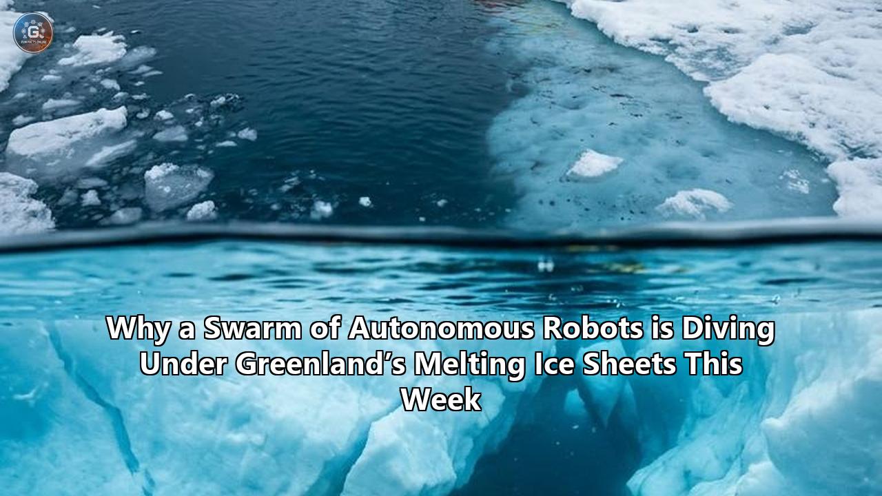
This week, the Royal Research Ship Sir David Attenborough will steam into the jagged, ice-choked fjords of southeast Greenland, carrying a payload that represents the next frontier of climate science. Onboard is a highly advanced robotic swarm—ranging from deep-diving autonomous submersibles to uncrewed aerial vehicles—tasked with answering one of the most urgent and terrifying questions in modern glaciology: How close is the Earth to crossing a catastrophic climate tipping point?
This deployment marks the physical launch of the GIANT (Greenland Ice sheet to AtlaNtic Tipping points from ice loss) project, a £20 million ($26 million) international research initiative funded by the UK government's Advanced Research and Invention Agency (ARIA). For the next two months, scientists will unleash this uncrewed squadron at the Kangerlussuaq Glacier, a perilous marine-terminating glacier where towering ice walls meet warming ocean waters. By utilizing a coordinated network of autonomous robots Greenland ice sheets research teams have deployed, scientists hope to map the microscopic physics of ice melt in real-time. This initiative seeks to provide the missing data needed to forecast a potential collapse of the North Atlantic's vital current systems.
The stakes could not be higher. For decades, satellites have monitored Greenland’s ice sheet from space, documenting a relentless loss of mass that currently averages 270 billion metric tons of ice per year. But satellite radar and optical sensors are blind to what is happening beneath the surface, where warming ocean currents quietly erode the glaciers from below. This hidden, underwater melting is the primary driver of ice sheet instability. If the Greenland Ice Sheet were to melt completely, global sea levels would rise by approximately seven meters, drowning coastal cities from London to New York.
Furthermore, the deluge of freshwater pouring from these glaciers threatens to disrupt the North Atlantic Subpolar Gyre and the Atlantic Meridional Overturning Circulation (AMOC). This vast ocean conveyor belt regulates climate patterns across Europe and the northern hemisphere. Some current models predict that this circulation system could collapse as early as the 2040s, a development that would plunge northern Europe into deep regional cooling, trigger severe droughts, and dramatically alter tropical monsoons.
"We are in a moment where our tools have finally caught up with our questions," says Dr. Kelly Hogan, a marine geophysicist at the British Antarctic Survey (BAS) and the lead creator of the GIANT project. "With autonomous vehicles, advanced sensors, and powerful modeling—boosted by artificial intelligence—we can explore glacier-ocean interactions in ways that were unimaginable just a few years ago."
The Ocean's Engine: The Subpolar Gyre and the AMOC
To comprehend why a fleet of robots is diving beneath Greenland’s ice this week, it is necessary to examine the physics of the North Atlantic Ocean. The Atlantic Meridional Overturning Circulation (AMOC) is the global climate system's radiator. It transports warm, salty surface waters from the tropics northward toward the North Atlantic. As these waters travel north, they release heat into the atmosphere, warming the climate of Western Europe.
Once this water cools, it becomes denser and heavier. In a cluster of seas close to Greenland—specifically the Labrador, Irminger, and Nordic Seas—this dense, cold, salty water sinks deep into the ocean abyss. This process is known as deep convection. Once at the seafloor, this cold water flows back southward, completing a massive, global three-dimensional conveyor belt.
Overseeing this entire system is the Subpolar Gyre, a large, counterclockwise current system situated south of Greenland. The gyre acts as the "intake manifold" of the AMOC, supplying the deep convection zones with the warm, salty water necessary to keep the engine running.
                [ Warm, Salty Surface Currents (Gulf Stream) ]
                                      │
                                      ▼
                        [ North Atlantic Subpolar Gyre ]
                                      │
                 ┌────────────────────┴────────────────────┐
                 ▼                                         ▼
         [ Labrador Sea ]                          [ Irminger Sea ]
                 │                                         │
        (Cooling & Sinking)                       (Cooling & Sinking)
                 │                                         │
                 └────────────────────┬────────────────────┘
                                      ▼
                         [ Deep, Cold Return Flow ]
The introduction of massive quantities of freshwater from Greenland's melting glaciers directly threatens this delicate mechanism. Freshwater is significantly less dense than saltwater. When huge volumes of fresh meltwater pour into the subpolar seas, they form a buoyant, low-salinity layer at the ocean surface. This freshwater "cap" acts as an insulating lid, preventing the warm, salty water below from interacting with the cold Arctic air. Unable to cool, the water cannot become dense enough to sink, effectively halting deep convection.
"The Subpolar Gyre is highly sensitive to these freshwater inputs," explains Dr. Bablu Sinha, a climate modeler at the National Oceanography Centre who is working on PROMOTE, a sister modeling project to GIANT. "Existing large-scale climate models, like the UK Earth System Model (UKESM), suggest that the subpolar gyre could experience a sharp weakening, or even a complete shutdown, within the next few decades. But these models currently suffer from a massive physics deficit. They cannot resolve the narrow, complex fjords of Greenland, meaning we don't actually know how much freshwater escapes into the open ocean, or how quickly."
The GIANT expedition aims to bridge this critical data gap by taking the RRS Sir David Attenborough directly into the Kangerlussuaq Fjord. By measuring the physical properties of the water at the glacier-ocean interface, the team hopes to establish the exact mechanisms of freshwater export, giving climate scientists the hard physical data needed to stress-test their models and determine whether a collapse of the AMOC is an imminent reality.
Why Human Eyes Cannot Watch the Melt: The Perils of the Ice Mélange
If the scientific need to study the glacier-ocean interface is so clear, why has it taken until 2026 to deploy a mission of this scale? The answer lies in the extraordinarily hostile nature of Greenland’s tidewater fjords.
Tidewater glaciers do not end in gentle, sloping beaches. Instead, they terminate in sheer, vertical ice cliffs that rise up to 100 meters above the sea surface and plunge hundreds of meters below. These massive ice structures are under immense gravitational and hydrostatic stress. Without warning, cracks propagate through the ice, causing skyscraper-sized blocks of glacier to fracture and collapse into the ocean—a process known as calving.
                                      ▲  ~100m Above Sea Level
                                      │
                            ┌─────────┴─────────┐
                            │  Tidewater        │
                            │  Glacier          │
                            │                   │
  ─ ─ ─ ─ ─ ─ ─ ─ ─ ─ ─ ─ ─ ┼ ─ ─ ─ ─ ─ ─ ─ ─ ─ ┼ ─ ─ ─ ─ ─  Sea Level
    [ Ice Mélange: Choked ] │                   │  ▲
    [ Ice & Slush        ]  │                   │  │
                            │   Vertical Ice    │  │  ~500m Submerged
                            │   Cliff Face      │  │  Boundary Layer
                            │                   │  │
                            │                   │  ▼
                            └─────────┬─────────┘
                                      ▼  Bedrock (Grounded)
The impact of these calving events is catastrophic. They generate localized tsunamis with wave heights that can easily capsize modern research vessels, crush smaller boats, and obliterate scientific instruments. Consequently, maritime safety regulations strictly prohibit manned research vessels from operating within several kilometers of active glacier fronts.
Furthermore, the surface of these fjords is typically choked by a dense, floating barrier known as an ice mélange. This is a tightly packed, semi-frozen matrix of sea ice, calved icebergs, and slush that acts as a physical buffer. Navigating a ship through an ice mélange is akin to driving through a minefield of floating concrete blocks. Icebergs hidden within the slurry can breach hulls, while the dense slush can clog sea chests, overheating a ship’s engines.
Beneath the surface, the environment is equally violent. In the summer, surface meltwater on the Greenland Ice Sheet pools into massive supraglacial lakes. These lakes can drain catastrophically in a matter of hours, sending millions of cubic meters of water rushing down through vertical, ice-walled shafts called moulins. This freshwater reaches the bed of the glacier, lubricating its path over the bedrock and accelerating its slide toward the sea.
When this pressurized subglacial freshwater finally escapes from the base of the glacier, hundreds of meters below sea level, it does not do so gently. Because freshwater is highly buoyant compared to cold, salty seawater, it bursts from the glacier’s grounding line in powerful, turbulent plumes. These plumes rush vertically up the face of the submerged ice cliff like an underwater geyser, drawing in warm, salty Atlantic water from the outer fjord.
This turbulent boundary layer—where the rising plume of fresh and salty water meets the solid vertical ice face—is the literal engine of glacier destruction. The shear forces, temperature fluctuations, and chemical gradients within this centimeters-thin boundary layer dictate how fast the glacier melts from below. Yet, because of the extreme physical dangers, this boundary layer has remained a complete scientific blind spot.
"We cannot model what we cannot observe," says Hari Vishnu, a sea ice acoustics expert at the National University of Singapore. "Until now, the danger of operating close to these active ice cliffs meant we could only study Greenland's glaciers from a distance, using satellites or safe, ship-based measurements miles away. This created a massive data deficit."
To overcome this limitation, the GIANT project is deploying a suite of advanced autonomous robots Greenland ice sheets researchers can direct into these hazardous zones. By sending robots where humans cannot survive, scientists can finally observe the microscopic physics of ice-ocean interactions.
Meet the Robot Fleet: Engineering the Sub-Ice Swarm
To map the glacier-ocean interface in unprecedented detail, the GIANT project is utilizing a diverse, multi-domain fleet. Rather than relying on a single, expensive multi-purpose submarine, the mission deploys a coordinated swarm of specialized robots, each engineered to operate in a specific niche of the hostile polar environment.
                          ┌────────────────────────┐
                          │ RRS Sir David          │
                          │ Attenborough           │
                          └───────────┬────────────┘
         ┌────────────────────────────┼────────────────────────────┐
         ▼                            ▼                            ▼
┌─────────────────┐          ┌─────────────────┐          ┌─────────────────┐
│  Air Domain     │          │  Surface Ocean  │          │  Sub-Ice Ocean  │
├─────────────────┤          ├─────────────────┤          ├─────────────────┤
│ • Windracers    │          │ • DriX USV      │          │ • Autosub       │
│   ULTRA UAV     │          │   (Hydrodynamic │          │   Long-Range    │
│   (LiDAR, Radar)│          │   Sonar Platform│          │   (Boaty Mc-    │
│                 │          │                 │          │   Boatface)     │
│ • Optical &     │          │ • Autonomous    │          │                 │
│   Multispectral │          │   Surface Boats │          │ • Gavia AUVs    │
│   Drones        │          │                 │          │                 │
└─────────────────┘          └─────────────────┘          └─────────────────┘
Autosub Long-Range (Boaty McBoatface)
Among the most famous members of the robotic fleet is Boaty McBoatface, an Autosub Long-Range (ALR) autonomous underwater vehicle developed by the National Oceanography Centre (NOC). Measuring approximately 3.5 meters in length and built to withstand hydrostatic pressures down to 6,000 meters, Boaty is designed for extreme endurance under ice.
Unlike conventional, short-range submersibles, Boaty is built to operate autonomously for months at a time, traveling thousands of kilometers on a single battery charge. For the GIANT mission, Boaty has been customized with a suite of specialized sensors:
- Upward-Looking Sonar (ULS): This system emits high-frequency acoustic pulses upward to map the precise, highly irregular geometry of the submerged glacier face and the underside of floating ice shelves.
- Acoustic Doppler Current Profilers (ADCPs): By measuring the Doppler shift of sound waves bouncing off moving particles in the water column, these sensors allow Boaty to map the three-dimensional velocity profile of the turbulent meltwater plumes rushing up the glacier face.
- Micro-Structure Turbulence Probes: These highly sensitive thermistors and shear shear-edge sensors measure rapid fluctuations in temperature and water velocity down to the millimeter scale, allowing researchers to quantify the rate of heat transfer from the ocean water to the ice.
Boaty's mission is to dive deep into the Kangerlussuaq Fjord, slip beneath the outer ice mélange, and navigate the dark, turbulent waters directly adjacent to the submerged glacial wall. Operating without real-time human control, the vehicle relies on advanced dead-reckoning and terrain-relative acoustic navigation to map the submerged cliff face before returning to the open ocean to upload its data.
DriX: The Wave-Dashing Sentinel
While Boaty McBoatface maps the depths, the surface of the fjord will be patrolled by DriX, an 8-meter-long uncrewed surface vessel (USV) manufactured by Exail. Featuring a unique, wave-piercing composite hull that resembles a hydrodynamic needle, DriX is engineered to operate at high speeds in rough sea states, providing an exceptionally stable platform for acoustic sensing.
DriX is equipped with a custom-built, sideways-pointing multibeam sonar system. While conventional multibeam sonars are mounted pointing downward to map the bathymetry of the seafloor, the GIANT team has jury-rigged the sonar array to the side of the USV's keel. This allows DriX to run parallel to the calving ice cliffs from a safe distance, continuously scanning the vertical submerged ice face and generating high-resolution, three-dimensional topographic maps of the glacier's underwater wall.
"DriX acts as our eye on the surface," says Dr. Kelly Hogan. "It can navigate close to the active glacier front, weaving through calving icebergs that would destroy a manned ship. Its sonar data lets us see how the submerged ice wall changes from day to day as the ocean melts it away."
In addition to its mapping duties, DriX serves as the communications gateway for the underwater fleet. Seawater is highly effective at blocking high-frequency radio waves, meaning submerged AUVs like Boaty McBoatface cannot use GPS or satellite communications. DriX is equipped with an acoustic modem that can send and receive data underwater. It can transmit command coordinates to the submerged subs and receive real-time telemetry, which it then relays via satellite to the Sir David Attenborough miles away.
The "Screw-In" Ice Wall Sensors
Among the most technically daring technologies deployed in the GIANT project is a class of micro-sensors designed to interact directly with the glacial ice. Developed in a collaboration between the British Antarctic Survey and engineering partners, these devices are essentially miniaturized oceanographic observatories packed into rugged, cylindrical cases.
To deploy these sensors, the team will use small, highly agile Gavia AUVs. These torpedo-shaped vehicles will be programmed to swim directly to the vertical submerged face of the glacier, 50 to 100 meters below sea level. Once the AUV reaches the ice wall, it will use its thrusters to hold its position while a mechanical drive system pushes the sensor package against the ice.
                  [ Gavia Autonomous Underwater Vehicle ]
                                     │
                                     ▼
                  [ Mechanical Screw-In Drive System ]
                                     │
                     ┌───────────────┴───────────────┐
                     ▼                               ▼
       [ High-Torque Ice Auger ]           [ Sensor Package ]
                     │                               │
                     ▼                               ▼
         (Screws 20cm into solid          (Micro-Thermistors,
          submerged glacial ice)           Turbulence Probes)
The sensor is equipped with a high-torque, titanium ice auger. Upon contact, the auger activates, screwing the sensor deep into the solid glacial ice. Once securely anchored, the Gavia AUV detaches and swims away, leaving the sensor embedded in the melting wall.
These "ice screws" are designed to measure the boundary layer in its purest form. Because they are physically anchored to the ice, they can measure the exact velocity and temperature of the water moving over the ice surface without any interference from the movement of a ship or submarine. The sensors are equipped with:
- PZT Acoustic Transducers: To measure the thickness of the adjacent boundary layer by tracking the reflection of sound waves off the water-ice interface.
- Conductivity-Temperature-Depth (CTD) Sensors: To measure the micro-scale salinity and temperature gradients driving the melt process.
- Ablation Trackers: Crucially, as the glacier melts, the face of the ice cliff recedes. These sensors are equipped with an internal motorized drive that allows them to automatically detect this ablation and screw themselves deeper into the ice, keeping the sensor flush with the active melting boundary.
These instruments will capture how the tiny air bubbles trapped within the glacial ice—compressed under thousands of pounds of pressure for millennia—are released as the ice melts. Scientists suspect that the rapid release of these high-pressure micro-bubbles creates intense local turbulence, which significantly accelerates the transfer of heat from the warming ocean water to the cold ice. By measuring this process at the millimeter scale, the "screw-in" sensors will provide data that has never been collected before.
GPS Javelins
To monitor how the melting of the submerged ice wall affects the structural stability of the glacier above, the GIANT project is deploying kinetic sensors dubbed "GPS Javelins."
These are heavy, aerodynamically weighted steel dart structures equipped with internal GPS receivers, inertial measurement units (IMUs), and satellite transmitters. Dropped from helicopters or long-range uncrewed aircraft like the Windracers ULTRA, these javelins are released over the heavily crevassed, highly dangerous "terminal zone" of the glacier—an area where human scientists cannot walk.
                     [ Windracers ULTRA UAV / Helicopter ]
                                      │
                                      ▼  (Kinetic Release)
                                █  GPS Javelin
                                █
                                █
                                │
                                ▼  (Impact)
                    ┌──────────────────────────┐
                    │  Highly Crevassed Upper  │
                    │  Glacier Surface         │
                    │  (Anchored in Ice)       │
                    └──────────────────────────┘
Upon impact, the heavy steel nose of the javelin penetrates deep into the glacial ice, anchoring the device securely in place. The rear of the javelin, containing a high-gain antenna and solar panels, remains above the snow line.
Once installed, the javelins continuously transmit high-precision, real-time data on the glacier's movement. By tracking subtle changes in velocity and acceleration down to the millimeter, researchers can observe how the glacier slips and deforms in response to the tidal cycles and the underwater melting occurring hundreds of meters below. This allows the team to link underwater oceanographic processes directly to the macroscopic calving of icebergs above.
Windracers ULTRA: The Airborne Workhorse
To tie these localized measurements together, the GIANT project is deploying the Windracers ULTRA, a twin-engine, twin-boom uncrewed aerial vehicle (UAV) designed for heavy-lift, long-endurance polar operations. Featuring a wing span of nearly 10 meters and a payload capacity of over 150 kilograms, the ULTRA can fly autonomous missions up to 2,000 kilometers.
For the Greenland campaign, the ULTRA has been customized with a suite of remote-sensing technologies:
- Ice-Penetrating Radar (IPR): This system transmits radio waves through the glacier, allowing researchers to map the thickness of the ice and the geometry of the bed over which it flows.
- Airborne LiDAR (Light Detection and Ranging): By emitting millions of laser pulses per second, the ULTRA will generate high-precision, three-dimensional topographic maps of the glacier's surface crevasses.
- Thermal Infrared Cameras: These sensors will map the surface temperature of the fjord’s ice mélange and the glacier, allowing the team to identify areas where warm air or warm surface water is driving rapid melting.
The ULTRA will fly continuous, pre-programmed grids over the Kangerlussuaq Glacier, mapping the entire glacial-fjord system from above while the AUVs map it from below. This coordinated, multi-layered observation network represents a fundamental shift in how polar science is conducted.
"In the past, we had to rely on a single instrument or a single field campaign to study one part of the system," says Dr. Jonathan Nash, an oceanographer at Oregon State University and a member of the GIANT project. "With this coordinated fleet, we can observe the air, the surface, the interior of the ice, and the deep ocean simultaneously. It is the only way to capture the full physics of this incredibly dynamic environment."
The AI Mind of the Mission: Solving the "Blind Spot" Problem
Coordinating a fleet of aerial drones, surface vessels, and deep-diving submersibles in a hostile, rapidly changing environment is a logistical and computational nightmare. If a human operator had to manually coordinate the paths of each vehicle, the risk of collisions, lost instruments, and missed scientific opportunities would be unacceptably high.
To solve this, the GIANT project is relying heavily on artificial intelligence to manage the fleet. Rather than using rigid, pre-programmed routes, the mission's robots are guided by an active learning AI system developed by the Alan Turing Institute and the University of Exeter.
                     ┌───────────────────────────┐
                     │ Satellite Imagery & Model │
                     │ Predictions (UKESM)       │
                     └─────────────┬─────────────┘
                                   │
                                   ▼
                     ┌───────────────────────────┐
                     │ AI Active Learning System │
                     │ (Bayesian Optimization)   │
                     └─────────────┬─────────────┘
                                   │
                                   ├─────────────────────────────┐
                                   ▼                             ▼
                      ┌─────────────────────────┐   ┌─────────────────────────┐
                      │ Dynamic Robot Routing   │   │ Target Scientific       │
                      │ (DriX, Boaty, ULTRA)    │   │ "Blind Spots"           │
                      └─────────────────────────┘   └─────────────────────────┘
The AI system begins by digesting massive amounts of baseline data, including high-resolution satellite imagery, atmospheric weather forecasts, and historical oceanographic models. Using this data, a Bayesian optimization algorithm identifies "blind spots"—regions where the scientific uncertainty regarding glacier melt rates or ocean currents is at its highest.
Once these blind spots are identified, the AI calculates the optimal deployment paths for the robotic fleet. Instead of distributing instruments evenly across the fjord, the system directs the robots to the exact coordinates where new data will have the greatest impact on improving the predictive accuracy of climate models.
Crucially, this AI coordination loop operates in real-time. As the robots collect data and transmit it back to the mothership, the AI continuously updates its internal model of the fjord. If the sensors detect an unexpected surge in subglacial meltwater discharge or a sudden opening in the surface ice mélange, the AI recalculates the mission parameters on the fly. It can redirect a Gavia AUV to deploy a "screw-in" sensor at a newly identified hotspot, or adjust the flight path of a Windracers drone to map a rapidly widening crevasse.
"The AI allows us to maximize our scientific return during a very brief, hazardous field season," explains Dr. Pierre Dutrieux. "By letting the algorithm decide where to send our sensors, we can ensure we are capturing the most critical, high-value data, even in areas where conditions are changing from hour to hour."
Beyond guiding the robots, this real-time data feed will be used to train a prototype, AI-driven Early Warning System. This online system, which combines satellite observations, field data, and statistical modeling, is designed to identify the subtle "precursors"—distinctive patterns in ice deformation, ocean temperature, or acoustic calving sounds—that precede a sudden, rapid acceleration in glacier retreat or a shift in ocean current stability.
The long-term goal is to build an operational early warning framework that can flag heightened risks of abrupt climate shifts, giving governments and coastal planners decades of advance notice to prepare for rising sea levels and shifting climate patterns.
The Ghost of Prudhoe Dome: Why the Mission is So Urgent
To understand why the British government and international research teams are launching this massive, high-risk robotic expedition this week, it is necessary to examine the startling scientific discoveries that have emerged from Greenland in recent months.
In April 2026, a team of researchers with the GreenDrill project—a multi-institution drilling initiative co-led by the University at Buffalo—published a paper in Nature Geoscience that shook the glaciological community. By drilling deep beneath the ice sheet at Prudhoe Dome in northwestern Greenland, the team recovered pristine rock and sediment samples that had been buried under the ice for thousands of years.
┌────────────────────────────────────────────────────────┐
│               GREENLAND ICE SHEET CORE                 │
├────────────────────────────────────────────────────────┤
│ ░░░░░░░░░░░░░░░░░░░░░░░░░░░░░░░░░░░░░░░░░░░░░░░░░░░░░░ │  ◄── Ice Core
│ ░░░░░░░░░░░░░░░░░░░░░░░░░░░░░░░░░░░░░░░░░░░░░░░░░░░░░░ │      (Modern Ice)
├────────────────────────────────────────────────────────┤
│ ▓▓▓▓▓▓▓▓▓▓▓▓▓▓▓▓▓▓▓▓▓▓▓▓▓▓▓▓▓▓▓▓▓▓▓▓▓▓▓▓▓▓▓▓▓▓▓▓▓▓▓▓▓▓ │  ◄── Rock Sediment
│ ▓▓▓▓▓▓▓▓▓▓▓▓▓▓▓▓▓▓▓▓▓▓▓▓▓▓▓▓▓▓▓▓▓▓▓▓▓▓▓▓▓▓▓▓▓▓▓▓▓▓▓▓▓▓ │      (Vanished 7ka)
└────────────────────────────────────────────────────────┘
  Cosmogenic nuclide exposure analysis of the bedrock
  revealed the Prudhoe Dome ice cap completely disappeared
  7,000 years ago during a period of modest natural warming.
By analyzing cosmogenic nuclides—rare isotopes produced when cosmic rays strike bare bedrock—the GreenDrill team demonstrated that the Prudhoe Dome ice cap had completely melted and vanished approximately 7,000 years ago. This melting did not occur during some ancient, extreme greenhouse period, but rather during the early Holocene—a relatively stable climate period when local temperatures were only 3 to 5 degrees Celsius warmer than pre-industrial levels.
"Prudhoe Dome was always considered one of the most stable, elevated, and resilient parts of the Greenland Ice Sheet," says Caleb Walcott-George, an assistant professor at the University of Kentucky and lead author of the study. "Finding out that it completely dissolved during a relatively mild, natural warming event in our recent geological past tells us that these supposedly stable ice caps are far more fragile than we once thought. It means we are on the verge of peeling back the ice sheet under today's human-driven warming, which could trigger rapid, irreversible ice loss."
This discovery has added a profound sense of urgency to the GIANT project. If a minor, natural warming event could melt Greenland's high-altitude ice caps, the current rate of human greenhouse gas emissions—which has already warmed the Arctic three to four times faster than the global average—is a recipe for catastrophic destabilization.
However, studying these fragile systems requires taking immense physical and financial risks. The scientific community was reminded of these risks in early 2024, when the autonomous submarine Ran, operated by the University of Gothenburg, disappeared beneath the Dotson Ice Shelf in West Antarctica.
Ran, a state-of-the-art, multi-million-dollar Kongsberg HUGIN vehicle, had successfully completed several historic dives, traveling deep into the pitch-black cavity beneath the floating glacier to map the melting ice ceiling. But during a high-stakes mission, the sub's navigation systems failed, or it became trapped in an underwater ice cave. Despite intensive search efforts, the vehicle was lost forever beneath the ice."It was a devastating loss, but it proved the point," says Dr. Anna Wåhlin, a physical oceanographer at Gothenburg. "Watching the robot disappear into the dark with no way to reach it was incredibly unnerving. But the data Ran sent back before it disappeared was unique in the world. If we want to understand these environments, we have to build machines designed to take risks that no human crew could ever survive. Disappearing on the job beats slowly gathering dust in a garage."
Rather than retreating from the risks after the loss of Ran, the international scientific community has doubled down on autonomous technology. The University of Gothenburg is currently preparing Ran II, a successor vehicle with enhanced emergency decision-making algorithms and redundant navigation systems, for delivery in late 2026.
Similarly, the GIANT project has integrated multiple layers of redundancy into its robotic fleet. The autonomous robots Greenland ice sheets research relies on this summer are equipped with advanced acoustic homing beacons, decentralized communication protocols, and AI-driven safety routines designed to guide the submersibles back to the RRS Sir David Attenborough even if their primary navigation systems fail.
"The loss of a robot is a setback, but the loss of our coastal cities is a global catastrophe," says Dr. Kelly Hogan. "We cannot let the fear of losing an instrument prevent us from gathering the data we need to save lives."
The Road to Petermann and Beyond: Predicting the Tipping Point
As the RRS Sir David Attenborough deploys its uncrewed squadron into the icy waters of Kangerlussuaq Fjord this week, the team is already looking toward the future.
The 2026 summer field season is only the first phase of a five-year, highly coordinated effort. While this summer's campaign targets the grounded tidewater glaciers of southeast Greenland, the team is already preparing for its 2027 mission. Next summer, the expedition will move to the far northwestern corner of the island to study the Petermann Glacier.
                     [ Two Contrasting Glacial Systems ]
                                      │
              ┌───────────────────────┴───────────────────────┐
              ▼                                               ▼
   [ Kangerlussuaq Glacier ]                         [ Petermann Glacier ]
      (Southeast Greenland)                           (Northwest Greenland)
              │                                               │
      (Grounded Bedrock)                             (Floating Ice Shelf)
              │                                               │
    • Tall vertical cliffs                          • Thick floating tongue
    • Frequent calving                              • Vulnerable to warm
    • Melting at vertical walls                       sub-shelf currents
These two targets represent two fundamentally different types of glacial systems, each offering contrasting but complementary insights into ice sheet stability:
- Grounded Tidewater Glaciers (Kangerlussuaq): Here, the glacier flows through a narrow fjord and ends in a vertical cliff grounded on bedrock. Melting occurs along the vertical face, and ice loss is dominated by the sudden, rapid calving of icebergs.
- Floating Ice Shelves (Petermann): Here, the glacier does not end at the coast. Instead, it extends far out over the ocean in a thick, floating tongue of ice. This ice shelf acts as a massive "brake," buttressing the glacier behind it and slowing its flow into the sea. Melting occurs primarily on the flat, horizontal underside of the shelf, driven by warm, deep ocean currents circulating within the sub-ice cavity.
By deploying their robotic swarm in both environments, scientists hope to construct a universal physical model of how ocean heat is transferred to glacier ice. This model will then be integrated directly into the UK Earth System Model, providing an immediate upgrade to the climate simulations used by governments around the world to plan for the future.
"By the end of this project, we will have built a comprehensive, physics-based understanding of the ice-ocean interface," says Dr. Donald Slater, a glaciologist at the University of Edinburgh and a member of the GIANT project. "We will finally be able to represent these 200 narrow Greenland fjords in our global climate models, allowing us to predict—with unprecedented accuracy—how much freshwater will enter the Subpolar Gyre, and when."
The findings of the GIANT expedition will likely take center stage at the upcoming COP31 climate negotiations in late 2026, where discussions regarding global temperature overshoots and climate adaptation funding are expected to dominate the agenda. As the world’s nations debate emissions targets and legal liabilities on land, a silent, highly sophisticated army of robotic pioneers is diving into the dark, freezing depths of Greenland’s fjords. They are fighting to map the future of our warming planet, millimeter by millimeter, before the ice runs out.
Summary of the GIANT Robotic Swarm & Instruments
| Instrument / Platform | Domain | Primary Scientific Mission | Key Sensors Onboard |
|---|---|---|---|
| Autosub Long-Range (Boaty McBoatface) | Sub-surface Ocean | Map sub-ice geometry, turbulent plume velocities, and temperature/salinity gradients. | Upward-Looking Sonar, ADCPs, Micro-Structure Turbulence Probes. |
| DriX USV | Surface Ocean | Sideways-pointing mapping of submerged vertical ice cliffs; act as surface acoustic communications gateway. | Custom-rigged Multibeam Sonar, Acoustic Transceiver, Satellite Modem. |
| Gavia AUVs | Sub-surface Ocean | Navigate active glacier fronts; deploy self-installing "screw-in" sensors into underwater ice walls. | Navigation Sonar, Acoustic Homing Beacons, Robotic Sensor-Deployer. |
| "Screw-In" Sensors | Glacial Ice (Submerged) | Measure micro-scale boundary layer melt, local turbulence, and air-bubble heat transfer. | Micro-Thermistors, Shear Probes, PZT Acoustic Ablation Trackers. |
| GPS Javelins | Glacial Ice (Surface) | Track glacier velocity, acceleration, and strain in high-danger, heavily crevassed zones. | High-precision GPS, Inertial Measurement Units (IMUs), Satellite Transmitter. |
| Windracers ULTRA UAV | Atmosphere / Surface | Map surface crevasse topography, measure ice thickness, and trace supraglacial lake drainage. | Ice-Penetrating Radar, LiDAR, Thermal Infrared Cameras. |
References
NOAA Arctic Report Card 2025: Greenland Ice Sheet.
Walcott-George, C., et al. (2026). "Complete vanishing of Prudhoe Dome during the early Holocene." Nature Geoscience, April 2026.
International Cryosphere Climate Initiative (ICCI). (2026). "Overshoot and Cryosphere Tipping Points: COP31 Science Preview."
NASA GRACE-FO Greenland Ice Mass Anomaly Data (2002-2025).
Times of India / TOI Science Desk. (2026). "Greenland is being swarmed by autonomous drones and underwater robots to study climate tipping points." July 8, 2026.
Jackson School of Geosciences, UT Austin. (2024). "TERMINUS Greenland: Submersible NUI maps underwater glacial walls." August 15, 2024.
Times of India / TOI Science Desk. (2026). "A robot army is heading to Greenland for a mission scientists once thought was impossible." July 8, 2026.
Science News. (2026). "A robot swarm is on a mission to map Greenland's perilous ice sheets." July 7, 2026.
Fierce Sensors. (2026). "GIANT scientists deploy sensors in drones and robot subs to map Greenland's melting ice." July 8, 2026.
University of Gothenburg. (2026). "Ran II: The successor to the sub-ice AUV lost under Dotson Ice Shelf." June 21, 2026.
Scottish Association for Marine Science (SAMS). (2025). "GIANT: Greenland Ice sheet to AtlaNtic Tipping points from ice loss." Project Launch Briefing, April 1, 2025.
Isaaffik Arctic Gateway. (2026). "GIANT Project Fieldwork Operations: Kangerlussuaq and Petermann Glaciers."
British Antarctic Survey (BAS). (2026). "GIANT: Exploring how warming oceans affect Greenland's ice sheet." BAS Project Portfolio.
British Antarctic Survey (BAS). (2026). "The future of the Subpolar Gyre: A major BAS expedition sets sail." July 6, 2026.
University of Edinburgh, School of GeoSciences. (2026). "GIANT: International collaboration to predict climate tipping points." March 11, 2026.
British Antarctic Survey (BAS). (2026). "Expedition Aims: Tidewater Glaciers and Ice Mélange Dynamics." March 11, 2026.
Windracers. (2026). "Windracers ULTRA deployed for Greenland climate research campaign." March 11, 2026.
Advanced Research + Invention Agency (ARIA). (2026). "Forecasting Tipping Points: ARIA funds £81m coordinated international effort." March 11, 2026.
University of Stirling. (2026). "Stirling glaciologists play key role in £20m ARIA GIANT project." March 11, 2026.
Advanced Research + Invention Agency (ARIA). (2026). "Forecasting Tipping Points Programme: Greenland and Subpolar Gyre Teams."
Reference:
- https://timesofindia.indiatimes.com/science/greenland-is-being-swarmed-by-autonomous-drones-and-underwater-robots-as-scientists-race-to-answer-one-question-how-close-is-earth-to-a-climate-tipping-point/articleshow/132258395.cms
- https://www.sciencenews.org/article/robot-mission-map-greenland-ice-climate
- https://www.fiercesensors.com/sensors-fusion/giant-scientists-deploy-sensors-drones-and-robot-subs-map-greenlands-melting-ice
- https://www.bas.ac.uk/blogpost/testing-a-tipping-point-inside-the-hunt-for-early-warnings-in-atlantic-currents/
- https://www.bas.ac.uk/project/giant/
- https://www.bas.ac.uk/news/scientists-race-to-understand-greenland-north-atlantic-climate-tipping-point/
- https://geosciences.ed.ac.uk/news-and-events/news/edinburgh-scientist-part-of-race-to-understand-greenland-north-atlantic
- https://www.sams.ac.uk/science/projects/giant/
- https://www.autonocion.com/us/drone-submarine-antarctic-glacier/
- https://arctic.noaa.gov/report-card/report-card-2025/greenland-ice-sheet-2025/
- https://isaaffik.org/projects/view/giant-greenland-ice-sheet-to-atlantic-tipping-points-from-ice-loss?iri=%2Fapi%2Fprojects%2Fa9680687-92fd-4048-8e43-c43dc23e851f
- https://www.sciencenews.org/article/robot-mission-map-greenland-ice-climate
- https://timesofindia.indiatimes.com/science/a-robot-army-is-heading-to-greenland-for-a-mission-scientists-once-thought-was-impossible/articleshow/132256173.cms
- https://nsidc.org/ice-sheets-today/analyses/greenlands-west-coast-leads-way-2025
- https://ig.utexas.edu/homepage-news/2024/robots-meets-glacier/
- https://windracers.com/blog/windracers-ultra-to-be-deployed-in-greenland-for-glacier-surveying/
- https://aria.org.uk/insights/a-coordinated-international-effort-to-develop-an-early-warning-system
- https://www.fiercesensors.com/sensors-fusion/giant-scientists-deploy-sensors-drones-and-robot-subs-map-greenlands-melting-ice
- https://www.sciencedaily.com/releases/2026/04/260417224503.htm
- https://aria.org.uk/opportunity-spaces/scoping-our-planet/forecasting-tipping-points/research-in-greenland
- https://news.climate.columbia.edu/2026/07/10/the-irreversible-global-impacts-of-earths-lost-frozen-regions/
- https://www.stir.ac.uk/news/2026/march-2026-news/stirling-scientists-part-of-race-to-understand-greenland-north-atlantic-climate-tipping-point/