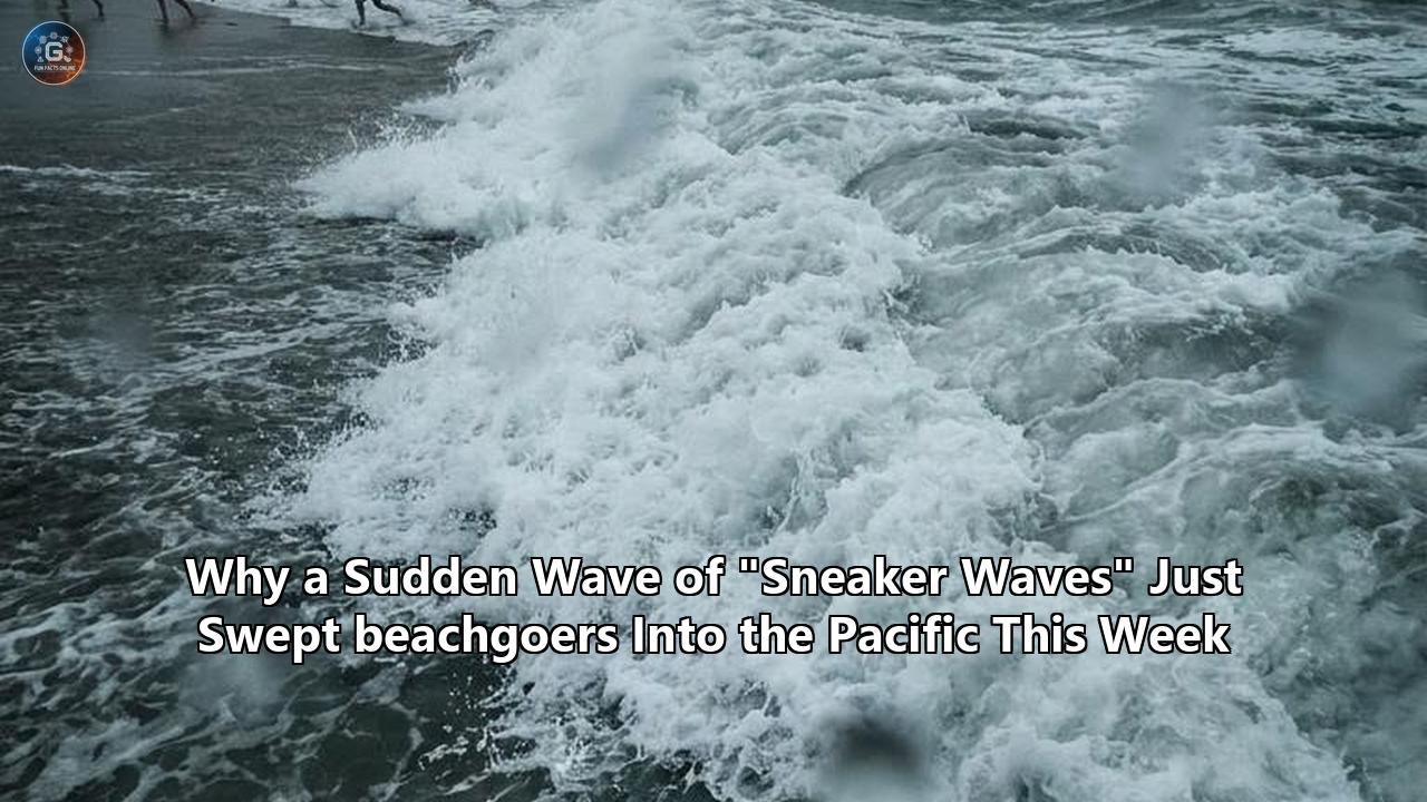
The Pacific Coast of the United States is currently grappling with the aftermath of one of the most volatile and tragic weeks of coastal hazards in recent memory. Over the course of mid-June 2026, a series of seemingly tranquil beach days erupted into a multi-state crisis as a sudden wave of sneaker waves caught coastal communities completely off guard. From the sun-drenched coves of Orange County to the rugged, fog-shrouded shores of the San Francisco Bay, unsuspecting beachgoers were violently swept into the frigid, churning waters of the Pacific Ocean.
This sudden surge in shoreline emergencies has left multiple families in mourning, search and rescue teams exhausted, and oceanographers scrambling to analyze the rare alignment of environmental forces that triggered this disaster. What began as an early-summer heatwave drawing millions to the water’s edge quickly collided with record-breaking summer tides, a brewing El Niño pattern, and a powerful, long-period ocean swell generated thousands of miles away in the Southern Hemisphere.
As the National Weather Service (NWS) extends its Beach Hazards Statements through the weekend, coastal authorities are warning that the danger is far from over. Tracing the chronological development of this crisis reveals how a sequence of subtle oceanic and atmospheric signals escalated into a historic public safety emergency.
June 9: The Laguna Beach Tragedy and the First Alarm
The first indication that the Pacific was harboring unusual, highly destructive energy occurred along the coast of Southern California. On Tuesday, June 9, 2026, temperatures across Orange County had climbed into the mid-80s, driving crowds of locals and tourists to popular beach destinations. Among them was a mother walking along the tideline at Treasure Island Beach in Laguna Beach with her two children—an adolescent son and her five-year-old daughter.
At approximately 7:30 p.m., as the sun was beginning to dip toward the horizon, the family was standing on what appeared to be dry, safe sand. Without warning, a massive wall of white water surged over 100 feet up the beach, instantly knocking all three off their feet and dragging them into the powerful backwash.
[June 9, 7:30 PM]
Treasure Island Beach, Laguna Beach
Family of three swept into surf by a sudden 10-foot wave surge.
      │
      ├─► Bystanders enter water immediately.
      │   ├─► Mother and son rescued.
      │   └─► 5-year-old girl pulled into deep water.
      │
      └─► Massive search and rescue launched by Coast Guard and local marine safety.
Bystanders immediately recognized the danger and rushed into the heavy surf. In a frantic struggle, civilians managed to pull the mother and her son back to the safety of the beach. However, the five-year-old girl was swept beyond the breaking waves into deep water.
"This is one of the most heartbreaking incidents I have witnessed during my time serving this community," Laguna Beach Mayor Mark Orgill stated the following morning, expressing the profound grief that gripped the coastal enclave.
The rescue attempt itself nearly claimed more lives. A civilian who had helped pull the mother and son to safety became trapped in the towering surf and had to be rescued by a city lifeguard. Ocean conditions at the time were highly deceptive. While the shoreline had appeared calm throughout the afternoon, the incoming swell was pushing waves up to 10 feet high in localized sets.
The Laguna Beach Marine Safety Department, the Orange County Sheriff’s Department Harbor Patrol, and the U.S. Coast Guard launched a coordinated search covering more than 90 square miles. After 30 hours of continuous operations under challenging conditions of low underwater visibility and intense rip currents, Captain Stacey Crecy, commander of Coast Guard Sector Los Angeles-Long Beach, announced the suspension of the search on the evening of June 10. The tragic loss of the young girl served as the opening salvo in a week of coastal devastation.
June 10: Santa Cruz and the Deceptive, Fatal Lulls
As Southern California rescue teams were suspending their search, the energy within the Pacific Ocean was steadily migrating northward, focusing its power on the rugged geology of Central California. On Wednesday, June 10, 2026, the hazard materialized at Yellow Bank Beach, a scenic pocket beach located north of Santa Cruz.
Yellow Bank Beach is characterized by its steep sandy incline and a natural rock arch that frequently attracts sightseers and college students from nearby universities. On this warm Wednesday evening, two young women—21-year-old Harsha Nair, a student at UC Berkeley, and 20-year-old Mahel Shron, a student at San Jose State University—were relaxing near the shoreline. According to witness reports, the ocean had looked remarkably flat and tranquil for long stretches of time, lulling beachgoers into a false sense of security. One of the young women was reportedly napping on the dry sand when the ocean suddenly mutated.
[June 10, Evening]
Yellow Bank Beach, Santa Cruz
Two college students swept out to sea from a seemingly calm beach.
      │
      ├─► Long-period lull (up to 20 minutes) abruptly ends.
      ├─► A single, massive wave surges over the dry sand.
      ├─► Both victims carried into cold, deep water.
      └─► CAL FIRE and Santa Cruz Fire deploy 8 rescue swimmers and a helicopter.
          └─► Tragically, both students are pronounced dead.
A solitary, towering wave surged high up the beach slope, inundating the dry sand, wrapping around the rock structures, and pulling both women into the frigid, 55-degree water.
The Santa Cruz Fire Department’s Marine Unit and CAL FIRE responded immediately, deploying eight rescue swimmers and an emergency helicopter. Despite their rapid deployment, the sheer force of the rip currents and the cold shock of the water proved insurmountable. Both students were pulled from the ocean but could not be revived.
The double fatality sent shockwaves through the local academic and coastal communities. "We extend our deepest sympathies to everyone affected by this tragic loss," a San Jose State University spokesperson said in a public address. "Our entire community shares in the grief felt by those who loved and cared for her."
In the days that followed, the Santa Cruz Fire Department reported that their marine units had performed eight separate water rescues in a single week—an unprecedented spike for mid-June, a month typically associated with gentler, more predictable summer surf.
June 13–15: Record Summer King Tides and El Niño’s Calling Card
By the weekend, meteorologists at the National Weather Service offices in San Francisco and Los Angeles had identified the underlying mechanisms driving these sudden, violent shoreline surges. The danger was not merely a localized anomaly; it was being amplified by a rare confluence of astronomical alignment and global climate patterns.
On Saturday, June 13, the NWS issued a Coastal Flood Advisory and an urgent Beach Hazards Statement spanning from Sonoma County down through the Monterey Bay. Forecasters warned of an impending spike in ocean energy, driven by what would become the highest summer tides on record for the West Coast.
Astronomical Forces (New Moon / Peak Alignment)
        +
El Niño Thermal Expansion (Warm water expanding volume)
        +
Southern Ocean Swells (15-22 second wave periods)
        =
[June 14-15] Record Summer King Tides (2.0 feet above normal baseline)
The astronomical high tides—often referred to colloquially as "King Tides"—peaked on Sunday, June 14, and Monday, June 15, driven by the alignment of the new moon. At the San Francisco tidal gauge, water levels peaked at 1.97 feet above normal on Sunday evening, shattering the previous summer record of 1.7 feet set in July 2022. By Monday, tides in Monterey County and San Francisco had reached a staggering 2.0 feet above normal.
This historic summer surge was not solely the work of the moon. Karleisa Rogacheski, a meteorologist with the NWS San Francisco Bay Area office, noted that the unusually high baseline water level had a direct link to the early stages of a developing, powerful El Niño system in the Pacific.
Under El Niño conditions, warmer-than-average waters expand across the equatorial Pacific and migrate toward the West Coast of North America. This thermal expansion, combined with persistent onshore winds, physically raises the sea level.
"It's potentially going to be the highest summer tides on record," Rogacheski warned as the weekend unfolded.
The physical manifestations of this record tide were immediate and severe:
- San Francisco: Seawater breached the sea wall, spilling onto the Embarcadero near Pier 14. Pedestrians and cyclists waded through ankle-deep ocean water on dry city streets.
- Marin County: In Corte Madera and Larkspur, tidal waters flooded neighborhoods, transforming Golden Hind Passage and Lucky Drive into temporary canals and prompting local authorities to stage road closures.
- Pacifica: The high-energy surf battered coastal infrastructure, causing a massive, structurally destabilizing crack to appear in the Pacifica Pier, forcing its indefinite closure and the demolition of the adjacent Chit Chat Cafe.
While coastal cities dealt with urban flooding, the combination of a raised sea level and highly energetic ocean waves created a lethal environment on the region's beaches. The elevated baseline water level meant that any incoming wave energy could travel significantly further inland than normal, stripping beaches of their safe zones and transforming wet sand into an active hazard zone.
June 18: The Baker Beach Emergency
The climax of this week-long coastal crisis occurred on the afternoon of Thursday, June 18, 2026, at San Francisco’s iconic Baker Beach. Positioned just outside the Golden Gate, Baker Beach is widely celebrated for its postcard-perfect views of the Golden Gate Bridge, but it is also notorious among local lifeguards for its deceptively steep shoreline and treacherous undertow.
Despite repeated Beach Hazards Statements broadcast by the NWS, the sunny afternoon lured hundreds of visitors to the sand. Walking along the shoreline near the rocky northeastern portion of the beach—closer to the cliffs of the Presidio—was a mother and her preteen daughter.
[June 18, 3:15 PM]
Baker Beach, San Francisco
Mother and daughter walking near rocky northern cliffs.
      │
      ├─► A sudden, high-velocity sneaker wave strikes.
      ├─► Both swept off their feet and dragged 100 feet out into the surf.
      │
      ├─► Bystanders (Good Samaritans) swim out and pull both back to dry sand.
      │
      └─► SFFD and Paramedics perform advanced life support.
          └─► Both victims transported to the hospital in critical/serious condition.
At approximately 3:15 p.m., a powerful sneaker wave surged around the rocks. Unlike the standard wave breaks that beachgoers had watched all afternoon, this particular wave did not break at the sandbar; instead, it rushed ashore with immense volume and velocity. It swept the mother and daughter off their feet, overcame them instantly, and dragged them roughly 100 feet out into the turbulent, wind-whipped surf.
Faced with a life-or-death scenario, several bystanders acted as Good Samaritans, diving into the rough water and fighting the undertow to reach the drowning pair. The civilian rescuers managed to drag both the mother and her daughter back onto the wet sand just as San Francisco Fire Department (SFFD) rescue crews and paramedics arrived.
SFFD Captain Jonathan Baxter reported that paramedics immediately initiated advanced life-support measures on the beach. Both the mother and her daughter were rushed to a local trauma center in critical and serious conditions.
"This occurred near the northeastern portion of Baker Beach, towards the rocky area," Captain Baxter stated during a press briefing on the sand. "Again, part of our safety message is never go on rocks, whether there is a beach hazard statement or not."
Baxter also emphasized the extreme risk taken by the bystanders who intervened, noting that while their actions were heroic and ultimately saved lives in this specific instance, civilian rescue attempts in such violent ocean conditions frequently end with the rescuers becoming casualties themselves.
The Baker Beach incident was the second major ocean rescue at that specific location in less than a month, following an incident on May 29 where a local fisherman was swept from the wet sand and left in critical condition. The frequency of these events has forced a broader public conversation on coastal safety and ocean literacy.
The Physics of the Phenomenon: What Are Sneaker Waves?
To understand why this sudden wave of emergencies occurred, it is essential to explore the underlying science and answer a fundamental question: what are sneaker waves?
                         THE ANATOMY OF A SNEAKER WAVE

 At Sea (Deep Water):
 Wave 1   Wave 2   Wave 3   Wave 4   Wave 5       ◄─── Long-period swells (15-22s)
   │        │        │        │        │               under the surface.
   └────────┴────────┴────────┴────────┴─── Constructive Interference (Merging)
                                                  │
                                                  ▼
 Near Shore (Shallow Water):             [Single Massive Wave]
                                                  │
   Deceptive Lull (20-30 mins)                    ▼
 ─────────────────────────────┐           ┌──────────────┐
  Dry Sand                    │           │              │  ◄─── Surges up to 150ft
 ─────────────────────────────┴───────────┴──────────────┴───   inland, lifting logs.
In the simplest terms, what are sneaker waves can be answered by looking at their behavior: they are disproportionately large, high-energy coastal waves that surge unexpectedly far up a beach, far exceeding the runup of the waves that preceded them. They are not tsunamis, and they are not caused by local seismic activity or immediate offshore winds. Instead, they are the result of complex wave mechanics operating over vast oceanic distances.
When oceanographers explain what are sneaker waves, they focus on several key physical processes:
1. Long-Period Swells and Wave Sorting
The life of a sneaker wave typically begins thousands of miles away. In the case of this week’s events, massive winter storms in the Southern Hemisphere generated intense wave energy. As these waves travel across the open expanses of the Pacific Ocean, they undergo a process called wave sorting or dispersion.
Shorter, choppier waves lose energy and dissipate, while the waves with the longest wavelengths and periods—often 15 to 22 seconds between wave crests—retain their energy and travel at high speeds across the globe. Because these swells have such a long period, they are almost invisible to the naked eye in deep water, traveling as broad, gentle undulations beneath the surface.
2. Deceptive Lulls and Wave Grouping
As these long-period swells approach the coast, they travel in distinct groups or packets. Due to a phenomenon known as constructive interference, individual wave trains can merge and reinforce one another, while destructive interference can cancel out wave energy in between. This creates a highly dangerous pattern of "wave sets."
For 20 to 30 minutes, the ocean may appear incredibly calm, with only small, gentle 1-to-2-foot waves breaking near the shore. This long lull is a psychological trap. It encourages beachgoers to walk closer to the wet sand, set up picnic blankets, or let their children play near the water’s edge.
However, when the peak of the merged long-period wave set finally arrives, it does not look like a normal wave. It manifests as a sudden, rapidly rising surge of water that rushes dozens or even hundreds of feet further up the dry beach than any previous wave.
3. Shoaling and "Infragravity" Waves
When asking what are sneaker waves from a hydrodynamic perspective, scientists point to a phenomenon called "infragravity waves." When a group of large waves approaches a shallow shoreline, they push water toward the beach, raising the average local sea level in a process called wave setup.
When the group of waves recedes, it releases this accumulated water as a low-frequency, long-wavelength wave that bounces back and forth. When this infragravity wave energy aligns perfectly with an incoming set of long-period swell waves, they undergo extreme wave shoaling—the rapid steepening and height increase that occurs when wave energy hits a shallow bottom.
The result is a wave runup event that acts more like a flash flood than a breaking wave, surging up the beach with immense kinetic energy.
4. Coastal Bathymetry (The Continental Shelf)
The geography of the U.S. West Coast makes it uniquely vulnerable to these events. Unlike the East Coast, which features a wide, gently sloping continental shelf that dissipates wave energy long before it reaches the sand, the West Coast has a narrow continental shelf with deep submarine canyons.
Deep water sits very close to the shoreline. This allows long-period swells to travel almost completely unimpeded and with minimal energy loss until they are right on top of the beaches, resulting in sudden, explosive shore breaks.
Why Sneaker Waves Are Exceedingly Deadly
When explaining what are sneaker waves, it is critical to highlight why they are so much more lethal than standard coastal waves. Their danger is not merely defined by the height of the water, but by the physical and environmental hazards they introduce.
| Hazard Element | Physical Action | Physiological/Physical Impact |
|---|---|---|
| Cold Shock | Immediate immersion in 50–55°F water | Triggering of the "gasp reflex," hyperventilation, rapid loss of motor control, and hypothermia within minutes. |
| Heavy Sand Suspending | High-velocity water churning up beach sand | Infuses clothing and footwear with hundreds of pounds of wet sand, making it impossible to swim or stand. |
| Driftwood and Debris | Lifting and rolling of dry shoreline logs | Moving logs weighing thousands of pounds, crushing limbs, causing severe trauma, or pinning victims underwater. |
| Steep Shoreline Slopes | Gravity-driven fast-flowing backwash | Generating an intense undertow that sweeps victims into deep water, even if they are in only ankle-deep water. |
The presence of driftwood is one of the most frequently overlooked hazards on Northern California and Oregon beaches. Beautiful, weathered logs that sit high on the dry sand, seemingly permanently anchored, can be lifted and rolled by a single sneaker wave. A log weighing several tons can easily roll over a person or a pet, pinning them beneath the water as the wave surges and recedes.
The Human Element: The Bystander Dilemma
The chronological escalation of this week’s wave of emergencies highlights a compounding factor in coastal search and rescue operations: the extreme danger of bystander intervention.
At Laguna Beach, Santa Cruz, and Baker Beach, civilian witnesses were the first line of defense. At Treasure Island Beach, bystanders successfully saved a mother and her son, but one of those rescuers had to be pulled from the water by professional lifeguards after getting trapped. At Baker Beach, the quick thinking of Good Samaritans saved a mother and daughter from drowning, but left the rescuers physically exhausted and vulnerable to the same currents.
Captain Jonathan Baxter of the SFFD addressed this dilemma directly during his press briefings, urging beachgoers to recognize their physical limitations.
"In most cases, we see people become victims themselves, requiring rescuing," Baxter warned. "While we dub these civilian rescuers as heroes, our safety message remains: if you see someone swept in, do not go in after them. Throw something that floats, keep eyes on the victim, and call 911 immediately."
                       THE BYSTANDER DILEMMA

               ┌─────────────────────────────────┐
               │  Bystander Sees Swimmer Swept   │
               └────────────────┬────────────────┘
                                │
       ┌────────────────────────┴────────────────────────┐
       ▼                                                 ▼
[Option A: Enter the Surf]                     [Option B: Stay on Shore]
       │                                                 │
       ├─► High risk of cold shock & rip currents.       ├─► Call 911 immediately.
       ├─► Often doubles the rescue load for SFFD├─► Locate floatation device.
       └─► 80% of secondary drownings are rescuers.       └─► Maintain constant visual on victim.
The psychological urge to dive into the water to save a struggling family member or stranger is incredibly powerful, but ocean safety experts emphasize that without professional rescue equipment—such as fins, a rescue buoy, or a wetsuit—a civilian’s chances of survival in a high-energy rip current are profoundly low. Cold shock alone can cause an adult to gasp involuntarily, inhaling water and initiating the drowning process within seconds of hitting the surf.
Preparing for a Warmer, More Volatile Coastline
As the current week’s crisis begins to subside, oceanographers and emergency management officials are looking forward, analyzing how changing global weather patterns will impact the frequency and predictability of these coastal hazards.
The alignment of a strong, rapidly developing El Niño in June 2026 is of particular concern to researchers at institutions like Oregon State University and the Scripps Institution of Oceanography. Historically, sneaker waves have been viewed primarily as a late-autumn and winter phenomenon. During the winter, the jet stream is more active, fueling massive North Pacific storms that send predictable, high-energy long-period swells crashing into the coast.
However, the events of this week have proven that summer is no longer a safe haven. The combination of thermal expansion raising the ocean's baseline height, climate-change-induced sea-level rise, and more volatile Southern Hemisphere winter storms means that coastal communities must prepare for year-round hazards.
"What was a 1-in-100-year tidal level at the end of the 19th century now occurs nearly every other year," noted climate scientists tracking the San Francisco tide gauges. With sea levels along the California coast projected to rise by up to a foot by 2050 and more than six feet by 2100, the baseline for wave runup is moving permanently inland. This means that waves that would have broken harmlessly on the lower beach decades ago can now transition into highly destructive sneaker waves.
Sea Level Rise Projection (San Francisco Tidal Gauge)
Year 1900: Baseline Normal
Year 2026: +2.0 ft Summer King Tide (Record High)
Year 2050: +1.0 ft Permanent Baseline Rise
Year 2100: +6.0 ft Projected Extreme Rise
Innovative Mitigation and Public Warning Systems
In response to this escalating threat, coastal cities are beginning to implement new warning technologies:
- Real-Time QR Code Warnings: Following the tragedies at Yellow Bank Beach, the Santa Cruz Fire Department has begun posting physical signs with QR codes at major beach access points. Visitors can scan these codes with their smartphones to instantly view real-time wave period data, swell heights, and localized hazard statements from the NWS.
- Predictive Artificial Intelligence Modeling: Researchers are working to integrate satellite bathymetry and deep-sea buoy arrays with machine learning algorithms. The goal is to develop highly localized, beach-by-beach sneaker wave forecasting models that can give lifeguards and park rangers hours of advance warning before a dangerous long-period swell set arrives.
- Enhanced Coastal Infrastructure: Structural failures like the crack in the Pacifica Pier have forced cities to redesign coastal recreation areas, moving public parking lots, trails, and observation platforms further inland to prevent them from being undermined by extreme high tides and wave surges.
Unresolved Questions and What to Watch For Next
As the West Coast moves into the heart of the summer season, several critical questions remain unanswered:
- How will the intensifying El Niño affect the late-summer surf? If equatorial waters continue to warm at their current rate, the coming winter could bring unprecedented coastal erosion, making West Coast beaches even steeper and more prone to severe shore breaks.
- Will state and federal agencies implement unified coastal zoning laws? As sea level rise reclaims dry sand, pressure is mounting on agencies like the California Coastal Commission to restrict access to historically dangerous pocket beaches and rocky intertidal zones during high-hazard events.
- Can public education close the ocean-literacy gap? Despite widespread news coverage and emergency alerts, thousands of beachgoers still visit hazardous coastlines without knowing the basic warning signs of a long-period swell, such as deceptive lulls.
For those planning to visit the Pacific Northwest or California coastlines in the coming weeks, the National Weather Service's core safety message remains absolute: never turn your back on the ocean. Watch the wave patterns for at least 20 minutes before approaching the sand, stay far back from the wet sand line, keep children and pets on leash and close at hand, and remember that an ocean that looks perfectly calm can transform into a lethal trap in a matter of seconds.
Reference:
- https://www.theguardian.com/us-news/2026/jun/15/king-tides-warning-california-coast
- https://bsky.app/profile/edwardsanthonyb.bsky.social
- https://www.cbsnews.com/sanfrancisco/news/san-francisco-baker-beach-rescue-dangerous-conditions/
- https://www.youtube.com/watch?v=gT6CVa02W9U
- https://www.sfgate.com/bayarea/article/bay-area-beaches-tides-22303954.php
- https://www.youtube.com/watch?v=gsZXbKrERxA
- https://hoodline.com/2026/06/sneaker-waves-poised-to-ambush-san-francisco-beachgoers-this-weekend/
- https://hoodline.com/2026/06/juneteenth-chill-and-sneaker-waves-put-san-francisco-coast-on-alert/
- https://www.sfgate.com/weather/article/sneaker-waves-bay-area-22284902.php
- https://www.lagunabeachcity.net/Home/Components/News/News/1529/13
- https://www.newsday.com/news/nation/laguna-beach-california-high-surf-missing-girl-a54118
- https://www.cbsnews.com/losangeles/news/laguna-beach-missing-girl-swimmer/
- https://www.accuweather.com/en/weather-news/deadly-sneaker-wave-season-has-started-in-the-pacific-northwest/1827870
- https://www.readers.id/en/sneaker-wave-sweeps-mother-child
- https://www.lagunabeachcity.net/Home/Components/News/News/1533/56
- https://www.wildcoastcompass.com/sneaker-wave-warning-issued/
- https://www.youtube.com/watch?v=PuUf4cuPrOE
- https://hoodline.com/2026/05/deadly-sneaker-waves-lurk-as-oregon-coast-packs-in-memorial-day-crowds/
- https://www.sfgate.com/news/editorspicks/article/california-coast-deaths-swell-sneaker-waves-ocean-15863127.php
- https://www.kqed.org/news/12087558/san-francisco-and-marin-face-flooding-amid-highest-summer-tide-on-record
- https://www.kqed.org/news/12087558/san-francisco-and-marin-face-flooding-amid-highest-summer-tide-on-record
- https://mavensnotebook.com/2026/06/17/daily-digest-6-17-trump-administration-ups-ante-in-quest-to-thwart-removal-of-pg-californias-shifting-snowpack-and-the-growing-water-gap-judge-upholds-protectio/
- https://mavensnotebook.com/2026/06/15/daily-digest-6-15-ca-californias-waterways-could-get-clogged-by-golden-mussels-the-scourge-of-the-delta-dredge-it-up-the-causes-and-consequences-of-harmful-algal-blooms-mark-arax-welc/
- https://www.reddit.com/r/sanfrancisco/comments/1u9qjmh/the_danger_of_sneaker_waves_again_mother_child_in/
- https://www.sfgate.com/news/bayarea/article/sf-mother-and-child-in-serious-condition-after-22312101.php
- https://www.newsweek.com/beach-warning-issued-california-oregon-nws-stay-away-ocean-11380754
- https://www.earth.com/news/distant-storms-trigger-sneaker-waves-on-the-pacific-coast/
- https://foxsportsradio.iheart.com/content/2026-06-10-search-underway-for-girl-who-was-swept-away-by-ocean-on-california-beach/
- https://mendovoice.com/2026/01/sneaker-wave-advisory-issued-for-mendocino-coast-b/
- https://www.scribd.com/document/509551778/nsf