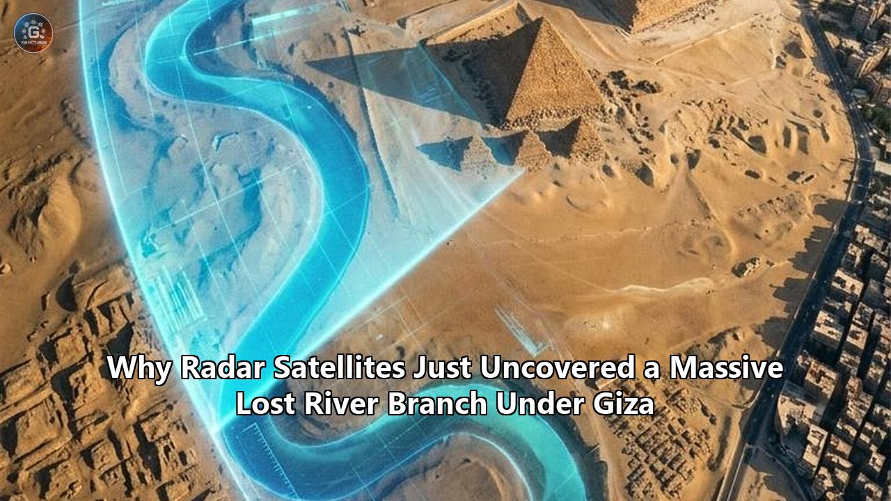
An international team of geomorphologists and earth scientists has mapped a massive, long-extinct arm of the Nile River hidden beneath desert sand and modern agricultural fields along the Western Desert plateau. Running approximately 64 kilometers (40 miles) between the modern town of Lisht and the northern edge of the Giza necropolis, the newly mapped paleochannel—formally named the Ahramat Branch, from the Arabic word for pyramids—directly fronts 31 major pyramid complexes built between the Third and Thirteenth Dynasties.
The research, led by Dr. Eman Ghoneim of the University of North Carolina Wilmington and published in Communications Earth & Environment, solves one of archaeology's most enduring spatial enigmas: why dozens of massive stone monuments, including the Great Pyramids of Khufu, Khafre, and Menkaure, were constructed along a narrow, inhospitable desert margin miles away from the modern course of the Nile.
Through the integration of spaceborne Synthetic Aperture Radar (SAR), high-resolution digital elevation models, geophysical surveys, and deep sediment coring, the researchers demonstrated that these monuments were not isolated desert installations. Instead, they were built along an active, deep-water river branch between 200 and 700 meters wide—comparable in scale to the modern Nile—with water depths ranging from two to eight meters. The causeways of the Giza and Saqqara complexes did not terminate in dry sand; they ended at massive valley temples that functioned as operational river quays and harbor basins directly on the channel’s banks.
This discovery reframes the spatial, logistical, and environmental history of early Egyptian civilization. Decades of debate over how millions of tons of limestone and granite were moved across the desert are resolved by the physical trajectory of the lost river branch Giza pyramid builders relied upon as an aquatic transport artery. The mapping also triggers immediate challenges: the ancient channel sits directly beneath the sprawling urban footprint of greater Cairo, intense agricultural networks, and shifting water tables, putting immense pressure on heritage preservation, urban infrastructure, and future field excavations.
Piercing the Desert: The Radar Technology Behind the Discovery
The Ahramat Branch went unmapped for centuries because traditional optical satellite photography and high-altitude aerial cameras can only document surface reflectance. To human vision and standard multi-spectral orbital sensors, the terrain west of the Nile floodplain appears as a monotonous blanket of windblown sand dunes, scrub-covered desert plateaus, and intensively irrigated modern agricultural plots.
Satellite radar operates under entirely different physical principles. Spaceborne Synthetic Aperture Radar (SAR) transmits microwave pulses that penetrate the dry, dielectric materials that coat arid environments. Wavelengths such as the C-band (~5.6 cm, utilized by the European Space Agency’s Sentinel-1 satellites) and longer L-band microwave pulses (~23.5 cm, gathered by the Japan Aerospace Exploration Agency’s ALOS PALSAR) pass through dry, loose sand to depths of several meters before reflecting off the denser, compacted geological structures beneath.
┌─────────────────────────────────────────────────────────────┐
│ SPACEBORNE RADAR SENSORS (Sentinel-1 SAR / ALOS PALSAR)    │
│ Transmit C-band (~5.6 cm) and L-band (~23.5 cm) microwaves  │
└──────────────────────────────┬──────────────────────────────┘
                               │
                               ▼
        ┌──────────────────────────────────────────────┐
        │ Penetrates loose, hyper-arid surface sand    │
        │ (1 to 5 meters depending on moisture)        │
        └──────────────────────┬───────────────────────┘
                               │
                               ▼
        ┌──────────────────────────────────────────────┐
        │ Reflects off compacted paleochannel margins, │
        │ buried silt-clay riverbeds, and gravel bars  │
        └──────────────────────┬───────────────────────┘
                               │
                               ▼
┌─────────────────────────────────────────────────────────────┐
│ GROUND VALIDATION: Sediment Coring & Geophysical Profiles   │
│ Proves deep-water fluvial sediments beneath cultivated land │
└─────────────────────────────────────────────────────────────┘
When microwave signals strike low-density, hyper-arid sand, the energy is not scattered back to space at the surface; it penetrates until it encounters a boundary of contrasting dielectric permittivity. In the Nile Valley, this boundary exists where dry sand sits atop compacted, fine-grained river muds, dense clay layers, buried gravel bars, and the carved limestone bases of ancient quays.
By merging these radar sweeps with digital elevation data from the German Aerospace Center’s TanDEM-X mission and the Shuttle Radar Topography Mission (SRTM), the team constructed topographic models that revealed subtle, long-overlooked surface depressions. These linear troughs mapped the ancient riverbed across 64 continuous kilometers.
Geophysical ground validation confirmed what the satellites detected from 700 kilometers in orbit. Field researchers deployed Ground-Penetrating Radar (GPR) and Electromagnetic Tomography (EMT) along a 1.2-kilometer profile near the ancient site of Jirza. The scans revealed a symmetrical, buried channel buried one to two meters beneath active agricultural fields. Subsequent deep-borehole sediment cores extracted fluvial clays, well-sorted quartz sands, and organic material typical of a sustained, high-energy river system. The satellite signal was not an artifact of modern irrigation or geological noise; it was the signature of a buried waterway.
Engineering the Pyramid Age: The Hydraulic Superhighway
Understanding the presence of a sustained waterway at the desert’s edge reshapes mechanical calculations for Old Kingdom construction logistics. The Great Pyramid of Khufu alone consists of approximately 2.3 million limestone and granite blocks, weighing an average of 2.5 metric tons each, with internal burial chamber lintels weighing up to 50 to 80 tons.
Transporting these vast masses by land across desert dunes on wooden sledges would have required tens of thousands of workers hauling across impossible friction surfaces. Egyptologists have long recognized that water transport was the only viable option. Tura limestone, used for pyramid outer casings, was quarried across the Nile on the eastern bank; heavy red granite was quarried in Aswan, more than 800 kilometers south.
Archaeologists had previously identified isolated artificial harbors and canal basins directly in front of individual monuments—such as the harbor complex at Mark Lehner’s excavations near the Heit el-Ghurab ("Lost City of the Pyramids") at Giza. What remained unexplained was how ships navigated from the primary Nile corridor, several kilometers to the east, into these discrete, localized basins.
The identification of the Ahramat Branch provides the trunk line. The waterway ran as a permanent, natural western distributary of the Nile, flowing north along the foot of the Western Desert Plateau. Rather than digging monumental east-west access canals across the entire floodplain for every single pyramid phase, Old Kingdom hydraulic engineers capitalized on a natural, north-flowing river channel.
                              [ ANCIENT QUARRY SITES ]
                           (Tura Limestone / Aswan Granite)
                                          │
                                          │ Transport by heavy cargo barge
                                          ▼
[ MODERN NILE BED ]  ──(Natural Distributary)──>  [ AHRAMAT BRANCH ]
(2.5 to 10 km East)                               (Width: 200–700m | Depth: 2–8m)
                                                          │
                                                          ▼
                                              [ HARBOR / VALLEY TEMPLES ]
                                              (Unloading Quays & Wharves)
                                                          │
                                                          │ Inclined Causeway Sledges
                                                          ▼
                                              [ PYRAMID CONSTRUCTION BASES ]
                                              (Giza, Saqqara, Dahshur, Lisht)
Engineers dredged short feeder channels and built specialized quays off this branch. When Nile floods crested between July and October, water depth inside the branch increased substantially, allowing massive, deep-draft wooden cargo vessels to moor immediately adjacent to the base of the construction inclines. Valley temples did not function solely as ceremonial gateways for funeral processions; they served as heavy-duty riverine dock installations and distribution hubs during the construction phase.
Who Is Affected: Stakeholders Across Five Disciplines
The formal mapping of the Ahramat Branch sends ripples across academic, regulatory, and engineering communities. By converting an abstract archaeological hypothesis into a confirmed geographic reality, the research forces adjustments across multiple sectors.
Field Archaeologists and Regional Excavation Teams
For more than a century, archaeological excavations along the western desert margin have operated in fragmented silos. Individual missions worked within the administrative confines of distinct necropolises: Giza, Zawyet el-Aryan, Abusir, Saqqara, Dahshur, and Lisht.
The confirmation that all 31 pyramid complexes were connected to a single continuous waterway shifts research design from monument-scale excavations to landscape-level survey work. Field directors must reorient their searches. Ancient settlements, worker quarters, storehouses, administrative customs houses, and boatyards are far more likely to sit buried along the newly mapped riverbanks than high on the desert plateaus. Valley temples must be re-excavated with hydraulic engineering methodologies, searching for mooring stanchions, dock walls, silted canal basins, and harbor sediments.
Egyptian Heritage Authorities and Urban Regulators
The Supreme Council of Antiquities and the Egyptian Ministry of Tourism and Antiquities face an urgent preservation challenge. The 64-kilometer corridor where the Ahramat Branch once flowed is one of the most rapidly urbanizing strips of land in the world.
Unplanned urban sprawl from western Giza and neighboring towns is pushing into the cultivated floodplains, directly over the banks and channels of the extinct river. Agricultural intensification—involving deep mechanical trenching, tile drainage systems, and heavy fertilizer use—threatens to destroy shallowly buried organic archaeological remains, wooden boats, and unexcavated mudbrick harbor facilities before they can be mapped or cataloged. Regulators must consider establishing protected archaeological buffer zones across land that is currently zoned for private agricultural or residential development.
┌──────────────────────────────────────┬────────────────────────────────────────────────────────┐
│ STAKEHOLDER GROUP                    │ DIRECT IMPACT & OPERATIONAL CHANGE                     │
├──────────────────────────────────────┼────────────────────────────────────────────────────────┤
│ Field Archaeologists & Egyptologists │ Shift from single-monument digs to riverbank landscape │
│                                      │ archaeology; targeting unexcavated harbors and quays.  │
├──────────────────────────────────────┼────────────────────────────────────────────────────────┤
│ Heritage & Antiquities Regulators   │ Emergency mapping of archaeological buffer zones along │
│                                      │ 64 km corridor threatened by rapid urban sprawl.       │
├──────────────────────────────────────┼────────────────────────────────────────────────────────┤
│ Geotechnical & Civil Engineers       │ Rerouting groundwater drainage; protecting Giza and    │
│                                      │ Saqqara monument foundations from localized pooling.   │
├──────────────────────────────────────┼────────────────────────────────────────────────────────┤
│ Paleoclimatologists & Earth Scientists│ Correlating river desiccation with the 4.2 ka BP mega- │
│                                      │ drought and historical societal disruptions.           │
└──────────────────────────────────────┴────────────────────────────────────────────────────────┘
Geotechnical Engineers and Infrastructure Planners
Modern municipal engineers handling water and sewage systems in the Giza governorate must contend with subterranean hydrogeology. Ancient paleochannels filled with porous sands and gravels act as preferential pathways for subsurface groundwater flow.
As the modern water table rises across greater Cairo—driven by leaking urban water lines, changed irrigation regimes post-Aswan High Dam, and regional drainage issues—the permeable path of the lost river branch Giza sits upon channels water directly toward the porous limestone foundations of the Sphinx and Giza valley temples. Understanding the exact geometry, depth, and sediment fill of the Ahramat Branch is critical for civil engineers modeling groundwater migration, designing interceptor wells, and preventing salt weathering from degrading ancient masonry.
Paleoclimatologists and Climate Modellers
The desiccation and eventual abandonment of the river branch provide real-world data points for climate change modeling. The river's drying aligns with mid-to-late Holocene environmental shifts in North Africa. Earth scientists now have a 64-kilometer physical record that can be correlated with historical environmental crises, such as the megadrought of roughly 4,200 years ago, demonstrating how fragile hydrological regimes respond to shifting monsoon belts and expanding desert margins.
What Changes: Structural Shifts in Archaeological Methodology
The mapping of the Ahramat Branch challenges decades of established practice in regional archaeology. The field has moved past relying solely on surface visual surveys, salvage excavations, and isolated trenching. The integration of satellite radar, automated topographic profiling, and geomorphological coring establishes a fresh methodological baseline.
From Monument-Centric to Hydro-Spatial Analysis
Traditional Egyptology long operated on a model where monuments were studied as insular artistic, religious, or structural feats. Architectural studies focused on stone-cutting techniques, internal chamber designs, and astrological alignments.
The confirmation of the Ahramat Branch forces a structural pivot: the architectural footprint of Old and Middle Kingdom Egypt was determined primarily by hydrology. Builders did not select pyramid coordinates based on aesthetics or spiritual orientation alone. They were restricted by navigational access.
Pyramids required deep-water channels capable of handling heavily loaded stone barges during seasonal flood spikes. Where the river ran deep and close to high-elevation bedrock ridges, pyramids were built. Where the river branched or veered away, construction halted.
               TRADITIONAL PARADIGM
    ┌─────────────────────────────────────────┐
    │ Monuments studied in geographic isolation│
    │ Focus on artistic, religious, and burial│
    │ characteristics of isolated necropolises │
    └─────────────────────────────────────────┘
                         │
                         ▼ (Orbital Radar & Core Validation)
               HYDRO-SPATIAL PARADIGM
    ┌─────────────────────────────────────────┐
    │ Monuments mapped as nodes along an active│
    │ regional transport network; site choices│
    │ dictated by river depth, quays, & floods │
    └─────────────────────────────────────────┘
Explaining the Eastward Shift of Dynastic Construction
The data reveals a previously unexplained architectural migration. During the Old Kingdom (c. 2686–2181 BCE), when dynasties erected the colossal stone monuments at Giza, Abusir, and northern Saqqara, the Ahramat Branch was in full flow immediately against the western plateau.
However, by the time of the Middle Kingdom (c. 2040–1782 BCE), pharaohs constructing pyramids at Dahshur, Lisht, and Hawara placed their monuments further east into the valley. Scholars once attributed this shift to changes in religious practices or economic constraints.
The geomorphological data paints a different picture: the river was migrating eastward. As windblown sands encroached from the Western Desert and tectonic tilting pushed the Nile’s primary drainage eastward, the Ahramat Branch silted up and narrowed. Middle Kingdom builders placed their construction sites further east simply to maintain proximity to the retreating water. Royal architects were running a multi-generational race against hydrological desiccation.
  WEST                                                                        EAST
  Western Desert Plateau                                       Modern Nile Valley Floor
    │                                                                           │
    ├───────── Old Kingdom Pyramids (c. 2686–2181 BCE)                          │
    │          (Giza, Saqqara: Built directly at plateau edge)                 │
    │                                                                           │
    │   [ AHRAMAT BRANCH: High discharge, active channel ]                      │
    │                                                                           │
    │          ▼ Desertification, drought, silt deposition (c. 2200 BCE)        │
    │                                                                           │
    │          ├───────── Middle Kingdom Pyramids (c. 2040–1782 BCE)            │
    │          │          (Lisht, Dahshur: Built further east)                  │
    │          │                                                                │
    │          │   [ AHRAMAT BRANCH: Migrates East, silts up into canals ]      │
    │          │                                                                │
    │          │          ▼ Siltation, tectonic tilting, canalization           │
    │          │                                                                │
    │          │          ├───────── Modern Remnants (Bahr el-Libeini canal)    │
    │          │          │          Modern Nile River bed today ───────────────┤
Reconciling Written Epigraphy with Physical Geography
In 2013, an archaeological mission at the Red Sea port of Wadi al-Jarf discovered the oldest written papyri ever found: the Diary of Merer. Merer, an Old Kingdom middle-ranking inspector, kept a logbook documenting the daily operations of his team of boatmen during the reign of Khufu. His records described loading limestone blocks at Tura, sailing them down the Nile, and delivering them to the "Pool of Khufu" or the "Horizon of Khufu" (the Great Pyramid complex) under the authority of Ankhhaf, the king’s half-brother and vizier.
For more than a decade, historians debated what Merer meant by these bodies of water. Were they artificial, hand-dug holding basins that required immense labor to maintain, or seasonal floodplains?
The radar identification of the lost river branch Giza provides the missing physical environment: Merer’s cargo barges sailed along an expansive natural river system. His crew did not navigate miles of shallow, narrow, human-dug trenches; they steered transport barges through an active Nile branch hundreds of meters wide, turning into dedicated inlet channels to reach the pyramid's harbor.
Short-Term Consequences: Operational Shifts on the Ground
The release of the continuous mapping data triggers several concrete field consequences that will shape archaeology and urban infrastructure in Egypt through the end of the decade.
┌────────────────────────────────────────────────────────────────────────┐
│                   TIMELINE OF SHORT-TERM IMPACTS                       │
├─────────────────┬──────────────────────────────────────────────────────┤
│ 2024–2025       │ • Emergency surface-penetrating radar ground surveys │
│                 │   over newly mapped Ahramat trace.                   │
│                 │ • Identification of high-priority harbor zones near  │
│                 │   Saqqara, Abusir, and Dahshur.                      │
├─────────────────┼──────────────────────────────────────────────────────┤
│ 2026–2027       │ • Launch of deep-sediment core campaigns targeting   │
│                 │   ancient biological indicators (pollens, snails).   │
│                 │ • Implementation of municipal drainage adjustments to│
│                 │   halt rising saline groundwater along the Giza edge. │
├─────────────────┼──────────────────────────────────────────────────────┤
│ 2028 and Beyond │ • Re-zoning of critical agricultural-urban margins;  │
│                 │   integration of satellite L-band SAR for routine    │
│                 │   national heritage monitoring across Egypt.         │
└─────────────────┴──────────────────────────────────────────────────────┘
Targeted Excavations at Ancient Inlet Junctions
Now that the coordinate trajectory of the Ahramat Branch is known, international field missions are adjusting their drill and trench programs. Attention is turning toward the river junctions—inlets where tributary streams and man-made causeways met the main waterway.
The research identified several such branch points, including a major tributary inlet near Giza that serviced the causeways of Khafre, Menkaure, and Queen Khentkaus. Immediate field campaigns are moving away from the crowded plateaus to conduct electromagnetic and seismic surveys in the lower cultivation fields to locate submerged wooden hulls, stone quays, and loading infrastructure preserved under anaerobic mud layers.
Halting the Destruction of Valley Temples by Groundwater
Subterranean water tables have risen significantly over the past two decades along the western fringe of greater Cairo, driven by intensive irrigation and uncontrolled municipal runoff. At the Valley Temple of Khafre and beneath the paws of the Great Sphinx, rising moisture carries soluble salts into the Eocene limestone masonry, causing stone peeling, flaking, and structural destabilization.
With the Ahramat Branch accurately mapped, hydrologists understand the sub-surface hydrology: the buried riverbed acts as a massive paleochannel reservoir. Because the paleochannel is filled with permeable sands and gravels rather than impervious clay, it collects groundwater from the Western Desert watershed and agricultural runoffs, funneling it directly beneath the lower monuments. Municipal authorities can now position deep dewatering wells within the paleochannel's boundaries, lowering the water table strategically rather than installing uncoordinated pumps across the plateau.
Urgent Policy Clashes over Urban Zoning
The immediate clash between heritage protection and urban real estate has intensified. Modern settlements such as Nazlet el-Semman, Saqqara village, and rural neighborhoods across the Giza governorate are expanding westward, directly onto the dried path of the lost river branch Giza.
The Ministry of Tourism and Antiquities has come under pressure to coordinate with the Ministry of Housing and local governorates to enforce construction moratoria over newly mapped harbor nodes. Developers pushing to build multi-story housing foundations across the floodplain face tighter permitting rules and mandatory geophysical clearance surveys before breaking ground.
Long-Term Consequences: Climate Dynamics and Future Discoveries
Looking beyond immediate excavation campaigns and urban planning battles, mapping the Ahramat Branch reshapes our understanding of long-term environmental degradation and guides the next generation of spaceborne exploration.
The 4.2 ka BP Megadrought and Ecological Collapse
The physical drying of the Ahramat Branch offers real-world evidence for one of the most turbulent periods in early human history: the 4.2-kiloyear event. Around 2200 BCE, severe, multi-century droughts destabilized bronze-age civilizations across Mesopotamia, the Aegean, the Indus Valley, and Egypt.
In ancient Egypt, this period corresponds with the collapse of the Old Kingdom and the slide into the political fragmentation of the First Intermediate Period. Ancient lamentation texts, such as the Admonitions of Ipuwer, describe the Nile drying up, widespread famine, and sand dunes creeping over farmland.
The satellite and sedimentological findings prove that this was not merely literary hyperbole. The Ahramat Branch began drying out and silting up precisely during this climatic transition. A reduction in annual precipitation over the Ethiopian Highlands diminished Nile flood discharge.
The secondary branches of the river—especially those along the arid desert margins—became stranded channels. Prevailing northwesterly desert winds deposited colossal volumes of sand into the low-discharge riverbed, choking the system and terminating the aquatic infrastructure that held the administrative core of the pyramid builders together.
Studying how this water network collapsed under sudden climatic stress helps earth scientists document the tipping points of river systems under severe desertification pressure.
                         ECOLOGICAL COLLAPSE PROGRESSION
                     ┌────────────────────────────────────┐
                     │ 4.2 ka BP Climatic Event Begins    │
                     │ Reduced Ethiopian Monsoon Rainfall │
                     └─────────────────┬──────────────────┘
                                       │
                                       ▼
                     ┌────────────────────────────────────┐
                     │ Dramatic Drop in Annual Nile Flood │
                     │ Peak Volume Across Lower Egypt     │
                     └─────────────────┬──────────────────┘
                                       │
                                       ▼
                     ┌────────────────────────────────────┐
                     │ Ahramat Branch Water Velocity Drops│
                     │ Distributary Cannot Clear Sediment │
                     └─────────────────┬──────────────────┘
                                       │
                                       ▼
                     ┌────────────────────────────────────┐
                     │ Severe Influx of Windblown Sand    │
                     │ Western Desert Dunes Choke Channel │
                     └─────────────────┬──────────────────┘
                                       │
                                       ▼
                     ┌────────────────────────────────────┐
                     │ Hydraulic Route Completely Stranded│
                     │ End of Large-Scale Stone Transport │
                     │ Regional Old Kingdom Fragility     │
                     └────────────────────────────────────┘
Next-Generation Spaceborne Archaeology
The methodology that located the Ahramat Branch establishes a precedent for archaeological prospecting in arid zones worldwide. For decades, spaceborne archaeology was largely restricted to examining optical contrast changes in vegetation, soil moisture patterns, or surface features on digital elevation maps.
The integration of advanced radar remote sensing highlights the potential of upcoming orbital systems. The deployment of the NASA-ISRO Synthetic Aperture Radar (NISAR) mission, along with the European Space Agency’s upcoming Sentinel-1C/D units and the future ROSE-L (Radar Observing System for Europe - L-band) satellite, will deliver higher spatial resolutions and dual-frequency polarimetric radar imaging.
These radar satellites will scan through arid overburdens with greater precision. They will be used to systematically map buried water systems throughout North Africa, the Arabian Peninsula, and the Taklamakan Desert:
- Tracing ancient irrigation canals across the Mesopotamian plain that have been covered by silt.
- Mapping lost paleo-river systems in the Sahara that sustained human green corridors during the African Humid Period.
- Pinpointing buried trading settlements, caravanserais, and oasis chains buried under shifting sand seas along historical trade corridors.
Uncovering the Settlement Infrastructure of Pyramid Builders
Perhaps the most far-reaching consequence will be uncovering the missing demographic infrastructure of Old Kingdom Egypt.
For centuries, the monuments have stood in the desert as majestic, isolated relics, leaving an unbalanced historical record dominated by tombs, sarcophagi, and elite funerary rites. Where the tens of thousands of workers, stonecutters, architects, logistics managers, scribes, and shipwrights lived, worked, and were buried remains mostly undiscovered.
Cities in antiquity were built along water, not in high desert sands. As the Ahramat Branch migrated, silted up, and was finally sealed under thick layers of modern alluvial mud, the working-class settlements that lined its riverbanks were buried. By plotting the exact historical channel banks, archaeologists now have a targeted search area.
The next half-century of excavation along the 64-kilometer corridor between Lisht and Giza will focus on discovering the settlements, barracks, bakeries, workshops, and administrative offices that powered the pyramid-building era. The focus of Nile Valley history is moving back down to the water’s edge.
Critical Debate and Unresolved Challenges
Despite the consensus on the paper's broad geomorphological footprint, the announcement of the Ahramat Branch has stirred debate within Egyptological circles.
Prominent Egyptologists, including former Minister of State for Antiquities Affairs Zahi Hawass and archaeologist Mark Lehner, have observed that the notion of an ancient Nile channel flowing west of the modern river is not entirely new. European cartographers and travelers—including Richard Pococke in 1737 and researchers involved in Napoleon’s Description de l'Égypte around 1800—documented relict waterways along the western margin.
Indeed, the modern Bahr el-Libeini canal runs along a portion of this low-lying topographic trough. Egyptologists have long cited the Libeini channel as a fossil remnant of a western Nile arm, and regional core samples dating back to the 1980s and 1990s had confirmed river deposits in front of select valley temples.
Where Ghoneim and her colleagues have advanced the field is by shifting the evidence from fragmented historical references and isolated point-cores into a contiguous, 64-kilometer orbital and geophysical map. Rather than relying on guesswork to connect isolated local canals, they proved that a single continuous, massive river branch existed across dynastic time, establishing its exact geometric path and sedimentological depth.
┌─────────────────────────────────┬─────────────────────────────────┐
│ EARLIER HISTORICAL HYPOTHESES   │ ORBITAL RADAR MAPPING           │
├─────────────────────────────────┼─────────────────────────────────┤
│ • 1737 (Pococke) & 1800         │ • Continuous 64 km high-res     │
│   (Napoleon): Hand-drawn maps of│   topographic tracking from     │
│   disjointed western canals.    │   Lisht to Giza.                │
│                                 │                                 │
│ • Local point cores at isolated │ • Unified spatial confirmation: │
│   valley temples (1980s–1990s). │   depth (2–8m) and width        │
│                                 │   (200–700m) proven.            │
│                                 │                                 │
│ • Debated whether channels were │ • Definite fluvial morphology:  │
│   natural or human-dug trenches.│   a natural, massive, ancient   │
│                                 │   distributary of the Nile.     │
└─────────────────────────────────┴─────────────────────────────────┘
Key technical questions remain unresolved:
- Discharge and Perennial Flow: Was the Ahramat Branch a perennial river flowing year-round, or did it function as an ephemeral distributary, carrying navigable water depths only during the three months of the annual Nile inundation (akhet)?
- Canalization and Artificial Modification: How much of this system was natural hydrography, and how much was artificially shaped, dredged, and maintained by pharaonic state labor?
- Sediment Chronology: While core samples demonstrate that the branch operated during the pyramid-building era, finer-grained radiocarbon and optically stimulated luminescence (OSL) dating of internal strata are needed to determine when specific segments silted up completely.
What to Watch Next
As field operations expand based on the orbital radar data, several milestones will indicate how this discovery transforms archaeological practice and regional management:
- OSL and Radiocarbon Core Datings: Forthcoming publications will establish exact chronological timelines for when each segment of the branch began losing water velocity, showing whether the drying moved gradually from south to north or occurred abruptly.
- Subsurface Ground-Penetrating Radar Surveys in Farmland: Teams are deploying targeted terrestrial geophysical arrays across agricultural plots immediately east of the Abusir and Dahshur necropolises, seeking buried wharf masonry and sunken vessel timbers.
- Heritage Buffer Zone Legislation: Observers are watching for official administrative decrees from the Egyptian government that formally establish protected heritage perimeters over the unexcavated banks of the paleochannel to curb unmonitored development.
- NISAR Radar Satellite Data Releases: Space agencies are preparing to evaluate how new, dual-frequency orbital radar systems improve subsurface imaging across the North African desert, opening the door to further paleohydrological discoveries beneath hyper-arid landscapes.
The mapping of the Ahramat Branch makes one reality clear: ancient Egypt’s greatest monuments were not built to defy the desert. They were built to exploit a river—one that has now resurfaced through the digital lens of radar satellites, reshaping our understanding of the monumental landscape of Giza.
Reference:
- https://gizmodo.com/lost-river-ancient-egypt-giza-pyramids-satellite-images-1851480421
- https://research-management.mq.edu.au/ws/portalfiles/portal/349481858/340048445.pdf
- https://dailygalaxy.com/2024/11/experts-use-space-to-finally-unlock-the-secret-of-how-ancient-egypts-pyramids-were-built/
- https://www.researchgate.net/publication/380631666_The_Egyptian_pyramid_chain_was_built_along_the_now_abandoned_Ahramat_Nile_Branch
- https://www.natureasia.com/en/nmiddleeast/article/10.1038/nmiddleeast.2024.179
- https://www.nationalgeographic.com/premium/article/egypt-pyramids-nile-ahramat-archaeology
- https://english.ahram.org.eg/NewsContentP/50/530833/AlAhram-Weekly/A-response-to-Ghoneim-et-al.aspx
- https://english.ahram.org.eg/News/576187.aspx
- https://www.google.com/search?q=time+in+%D8%A7%D9%84%D8%B8%D9%87%D9%8A%D8%B1+%D8%A7%D9%84%D8%B5%D8%AD%D8%B1%D8%A7%D9%88%D9%89+%D9%84%D9%85%D8%AD%D8%A7%D9%81%D8%B8%D8%A9+%D8%A7%D9%84,+EG
- https://www.google.com/search?q=time+in+Cairo,+EG
- https://www.instagram.com/p/Dcbj4NVDZDg/