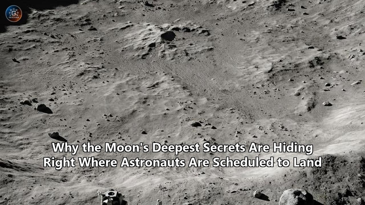
A stunning convergence of two major planetary discoveries has fundamentally rewritten the scientific objectives for humanity’s return to the Moon. In the span of just a few weeks, separate teams of geologists and planetary dynamicists have revealed that the precise coordinates selected for upcoming crewed missions contain a dual scientific treasure. The very craters designated as candidate landing zones harbor not only the solar system’s oldest, most pristine vaults of water ice but also exposed debris from the deep lunar mantle, blasted to the surface by a colossal protoplanetary collision billions of years ago.
For years, the public narrative surrounding the return to the Moon has focused primarily on resource utilization: harvesting water ice from the permanently shadowed regions (PSRs) near the lunar South Pole to produce drinking water, breathable oxygen, and hydrogen-based rocket fuel. However, two companion studies published by researchers at the Southwest Research Institute’s (SwRI) Center for Lunar Origin and Evolution (CLOE) in Science Advances and the Journal of Geophysical Research: Planets have dramatically escalated the scientific stakes.
Using high-performance supercomputer modeling and gravity data, the SwRI team demonstrated that the ancient impact that formed the massive South Pole-Aitken (SPA) basin—the Moon's oldest and largest crater—sprayed deep mantle-derived rocks directly across the exact regions where astronauts are scheduled to land.
This geological revelation directly intersects with another breakthrough published in Nature Astronomy. Researchers led by Paul Hayne at the University of Colorado Boulder mapped the thermal life cycles of lunar "cold traps," proving that these dark craters have been continuously accumulating water ice for up to 3.5 billion years.
Together, these findings mean that when astronauts step out of their landing vehicles, they will not merely be executing a resource-gathering mission. They will be standing on a chaotic, ancient debris field that bridges the deepest interior of the Moon with the oldest volatile history of the inner solar system.
Phase 1: The Dry Moon Myth and the Dawn of Polar Suspicion (1969–1998)
To understand how the lunar South Pole became the most coveted real estate in the solar system, one must trace the dramatic collapse of the mid-20th-century scientific consensus.
Between 1969 and 1972, the six Apollo missions landed exclusively in the Moon’s equatorial and low-latitude regions. These locations were selected for their predictable lighting, stable thermal environments, and direct line-of-sight communication with Earth.
The samples returned by the Apollo astronauts were geologically invaluable, but they possessed one striking characteristic: they were completely dry. Analysis of the lunar regolith showed water concentrations of less than several parts per billion. This led to a decades-long scientific paradigm that the Moon was a thoroughly desiccated, geologically dead body, stripped of all volatile compounds during its violent, impact-dominated birth.
       CHRONOLOGY OF LUNAR WATER & GEOLOGICAL DISCOVERY

       [1969-1972] ──────────────── [1994] ───────────────── [1998]
      Apollo Era                  Clementine             Lunar Prospector
     "Bone-Dry Moon"            Bistatic Radar          Neutron Spectrometer
    Equatorial Samples         Suggests Polar Ice         Hydrogen Detected

       [2009] ─────────────────── [2020] ───────────────── [2024]
     LCROSS Impact                 SOFIA                  Artemis Sites
     Cabeus Crater            Sunlit Molecular         NASA Refines List
    5.6% Water + Volatiles       H2O Confirmed           to 9 Regions

       [April 2026] ───────────── [June 2026]
     Nature Astronomy              SwRI / CLOE
    3.5-Billion-Year            Mantle Rocks Mapped
    Continuous Ice Trapping     at Artemis Landing Sites
The first crack in this paradigm appeared in 1994 with the launch of Clementine, a joint spacecraft mission between the U.S. Department of Defense and NASA. Clementine was designed to test lightweight sensors in deep space, but it also carried a bistatic radar experiment.
Planners directed radio signals from Clementine into the permanently shadowed craters of the lunar South Pole, reflecting the waves back to receiving dishes on Earth. The returned signals exhibited a polarization anomaly—an increase in circular polarization ratio (CPR)—consistent with reflections from pockets of clean water ice hidden in the dark. While critics argued that the radar signatures could have been caused by rough crater walls rather than ice, the seed of suspicion had been planted.
The suspicion deepened into near-certainty in 1998 with NASA's Lunar Prospector mission. Equipped with a highly sensitive neutron spectrometer, the spacecraft mapped the energy of neutrons bouncing off the lunar surface.
When cosmic rays bombard the Moon, they knock neutrons out of the atomic nuclei in the regolith. If these outgoing neutrons collide with hydrogen atoms—which are nearly identical in mass to a neutron—they lose a significant amount of energy, turning into "epithermal" neutrons.
Lunar Prospector detected a sharp, localized drop in epithermal neutrons over both poles, particularly the South Pole. It was the first global, chemical evidence of vast hydrogen reservoirs sequestered inside the polar depressions. The scientific community realized that if this hydrogen was bound to oxygen, the Moon was hiding billions of tons of water ice just beneath its dusty veneer.
Phase 2: Shattering the Paradigm (2008–2010)
The transition from orbital inference to physical verification required a series of international missions that shattered the "dry Moon" myth once and for all.
In 2008, the Indian Space Research Organisation (ISRO) launched Chandrayaan-1, carrying NASA’s Moon Mineralogy Mapper ($M^3$). The $M^3$ spectrometer was designed to detect absorption features of water and hydroxyl (OH) molecules in the near-infrared spectrum.
The instrument delivered a dual shock: not only did it confirm concentrated water ice signatures within the permanently shadowed polar craters, but it also detected widespread, low-level surface hydration in sunlit soils at higher latitudes. Water was not merely a localized anomaly; it was an active participant in a dynamic lunar surface cycle, continuously generated as solar wind protons interacted with oxygen-rich minerals in the soil.
                 LCROSS KINETIC IMPACT ARCHITECTURE (2009)

               [Spent Centaur Rocket Stage] (~2,200 kg)
                           │
                           │  Impacts at 9,000 km/h
                           ▼
                  * * * * * * * * *
               * *  EJECTA PLUME   * * ───► Analyzed by LCROSS Shepherding
             * * * * * * * * * * * * *      Spacecraft & LRO Instruments
             ▲                       ▲
             └─────── Cabeus ────────┘ (Permanently Shadowed Crater)
                       Floor
The definitive, undisputed proof of polar ice arrived via a deliberate act of cosmic violence on October 9, 2009. NASA’s Lunar Crater Observation and Sensing Satellite (LCROSS) mission crashed its spent Centaur upper-stage rocket—weighing approximately 2,200 kilograms—directly into the floor of the permanently shadowed Cabeus Crater near the South Pole.
Traveling at roughly 9,000 kilometers per hour, the impact blasted a plume of dust, vapor, and ice particles high above the crater rim, into the sunlight where orbital and ground-based instruments could analyze its composition.
The LCROSS shepherding spacecraft, following minutes behind the impactor, pushed through the rising debris plume, scanning it with near-infrared and ultraviolet spectrometers before itself crashing into the surface.
The results were unequivocal:
- Water Content: The plume contained roughly $155 \pm 12$ kilograms of water vapor and ice particles, indicating that the regolith in the impact zone contained approximately 5.6% water ice by weight.
- Volatile Diversity: Alongside water, the spectrometers detected a host of other highly volatile compounds, including light hydrocarbons (methane, $CH_4$, and ethylene, $C_2H_4$), carbon monoxide ($CO$), carbon dioxide ($CO_2$), ammonia ($NH_3$), and sulfur dioxide ($SO_2$).
These volatiles were not just random chemicals; they were a frozen chemical archive of the early solar system, preserved in a deep-freeze that had remained undisturbed for billions of years. The search for water was no longer a speculative academic exercise—it was the foundational pillar of a new era of deep-space exploration.
Phase 3: The Artemis Pivot and the Geometry of Shadows (2020–2022)
Armed with data from Clementine, Lunar Prospector, and LCROSS, NASA realized that any long-term human presence in deep space would require a physical foothold at the lunar South Pole. This realization culminated in the creation of the Artemis program, which explicitly bypassed the equatorial landing sites of the Apollo era in favor of the extreme, rugged terrain of the high southern latitudes.
The physics governing this region are dictated by a unique orbital geometry. While the Earth is tilted on its axis by a dramatic 23.5 degrees—giving us our pronounced seasons—the Moon's axial tilt relative to the ecliptic plane is a mere 1.5 degrees.
Because of this nearly perpendicular orientation, the Sun at the lunar poles never rises more than a fraction of a degree above the horizon. This produces a landscape characterized by extreme contrast:
- Permanently Shadowed Regions (PSRs): Deep impact craters and depressions never receive direct sunlight. The interiors of craters like Haworth, Shoemaker, and Faustini have been in pitch darkness for billions of years, creating cold traps where temperatures plummet below $-250^\circ\text{C}$ (40 Kelvin). These are among the coldest places measured in the entire solar system, colder even than the surface of Pluto.
- Peaks of Eternal Light: Conversely, elevated features such as crater rims, volcanic domes, and towering massifs rise high enough to catch the grazing rays of the Sun. Some of these high-altitude ridges experience near-continuous illumination for up to 80-90% of the lunar year.
                  THE POLAR LIGHTING EXTREME

         Sunlight ──►  _..-—''''—.._     ◄── High Ridge (Continuous Sun)
                     .'             '.
                    /   HAWORTH      \
                   |    CRATER        |   ◄── Crater Floor (Permanent Shadow)
                   |   (Cold Trap)    |       Temp: -250°C / 40 Kelvin
                    \                /
                     '.            .'
                       '-..____..-'
This stark geographic split presented mission planners with a profound engineering dilemma. To survive, an astronaut base needs continuous sunlight to generate solar power and maintain stable thermal operating temperatures.
Yet, to conduct the high-priority science and harvest the resources that make long-term colonization viable, astronauts must physically descend into the pitch-black, cryogenic depths of the nearby cold traps.
In August 2022, NASA announced an initial list of 13 candidate moon landing sites. Each of these sites was selected because it sat on an illuminated ridge or plateau immediately adjacent to a major permanently shadowed crater.
This geographical layout would allow a lander to touch down in safe, sunny conditions, establish power and communications, and then deploy astronauts or robotic rovers to make short, high-risk excursions into the neighboring icy darkness.
The complexity of this environment was further highlighted in 2020 when NASA’s airborne Stratospheric Observatory for Infrared Astronomy (SOFIA) detected molecular water ($H_2O$) in the sunlit Clavius Crater. Unlike the hydroxyl signatures detected by Chandrayaan-1, which could have been bound to other minerals, SOFIA’s 6-micron wavelength observations confirmed the presence of actual, free-standing water molecules, likely trapped inside microscopic impact glasses formed by micrometeorites.
This discovery proved that water was not merely static ice hidden in the dark, but was actively migrating, depositing, and binding across the lunar surface, making the high-latitude landing sites far more complex than previously imagined.
Phase 4: The Robotic Gold Rush and the Narrowing of the Target (2023–2024)
By 2023, the race to characterize the lunar South Pole had escalated into an international diplomatic and commercial scramble. No longer confined to theoretical models, space agencies and private corporations rushed to put hardware on the ground, revealing both the immense promise and the unforgiving difficulty of operating in the polar environment.
       ROBOTIC PRELUDES TO ARTEMIS (2023-2024)

  ┌────────────────────────────────────────────────────────┐
  │  Luna 25 (Russia - Aug 2023)                           │
  │  - Attempted high-latitude landing                     │
  │  - Status: CRASHED due to engine burn anomaly          │
  └──────────────────────────┬─────────────────────────────┘
                             │
                             ▼
  ┌────────────────────────────────────────────────────────┐
  │  Chandrayaan-3 (India - Aug 2023)                      │
  │  - Touchdown at 69° South                              │
  │  - Status: SUCCESS; measured subsurface soil temp      │
  └──────────────────────────┬─────────────────────────────┘
                             │
                             ▼
  ┌────────────────────────────────────────────────────────┐
  │  IM-1 "Odysseus" (Intuitive Machines - Feb 2024)       │
  │  - Commercial landing near Malapert Massif             │
  │  - Status: SUCCESS; tipped over but collected data     │
  └──────────────────────────┬─────────────────────────────┘
                             │
                             ▼
  ┌────────────────────────────────────────────────────────┐
  │  Chang'e-6 (China - June 2024)                         │
  │  - Sample return from South Pole-Aitken Basin (Far Side)│
  │  - Status: SUCCESS; returned 1,935g of ancient material │
  └────────────────────────────────────────────────────────┘
The high-stakes nature of this scramble was laid bare in August 2023. Within the span of a single week, two nations attempted to land spacecraft in the southern highlands.
On August 19, Russia's Luna 25 lander, designed to target Boguslawsky Crater, suffered an engine burn anomaly during orbit reduction and slammed into the surface.
Just four days later, on August 23, India’s Chandrayaan-3 successfully touched down at approximately 69 degrees south latitude, making India the first country to land a spacecraft in the southern polar region.
The Chandrayaan-3 lander and its Pragyan rover operated for a full lunar day, deploying the ChaSTE (Chandra's Surface Thermophysical Experiment) probe. ChaSTE drove a thermal needle 10 centimeters into the lunar soil, recording a dramatic temperature gradient: while the surface register sat at a comfortable $50^\circ\text{C}$, the temperature just 8 centimeters below plummeted to $-10^\circ\text{C}$. This thermal insulation confirmed that dry regolith acts as an incredibly efficient barrier, preserving cold temperatures—and potentially ice—just inches beneath sunlit terrain.
In February 2024, the commercial space sector entered the arena. Intuitive Machines’ IM-1 mission, utilizing the "Odysseus" Nova-C class lander, touched down at Malapert A crater, located near the imposing Malapert Massif.
Despite a landing anomaly that caused the spacecraft to fracture one of its landing legs and tip over onto its side on a 12-degree slope, Odysseus successfully transmitted scientific data and images back to Earth. It proved that commercial landers could navigate the extreme trajectories and complex topography required to reach the polar regions.
Four months later, in June 2024, China executed a masterstroke of robotic exploration with its Chang'e-6 mission. Landing in the Apollo basin within the immense South Pole-Aitken (SPA) basin on the lunar far side, the robotic probe collected 1,935 grams of geological material.
When the return capsule landed in Inner Mongolia on June 25, 2024, it delivered the first physical samples of the Moon’s oldest impact structure directly into the hands of terrestrial geologists. Initial analysis of these samples, which began filtering out in late 2024 and 2025, revealed norite and gabbroic rock fragments containing mineral structures that could only have crystallized from a massive, ancient magma sheet.
In October 2024, building on this deluge of new robotic data and refined engineering constraints from the SpaceX Starship Human Landing System (HLS), NASA officially narrowed its list of candidate moon landing sites for the Artemis III mission from 13 down to 9 target regions:
- Peak near Cabeus B: A highly rugged elevation adjacent to the site of the 2009 LCROSS kinetic impact.
- Haworth: A crater rim featuring dramatic elevation changes and direct access to one of the deepest, oldest cold traps on the Moon.
- Malapert Massif: A massive mountain rising 5,000 meters above the surrounding terrain, offering exceptional line-of-sight communications with Earth and long periods of sunlight.
- Mons Mouton Plateau: A flat, expansive high-altitude plateau that provides a relatively safe landing area for larger vehicles.
- Mons Mouton: A towering peak adjacent to the plateau, offering panoramic views and stable lighting.
- Nobile Rim 1: Located on the southwestern rim of Nobile Crater, this site sits at a high elevation with excellent solar exposure.
- Nobile Rim 2: Situated on the northeastern rim of Nobile Crater, offering a lower-elevation landing zone with unique geological characteristics.
- de Gerlache Rim 2: The closest candidate site to the true physical South Pole, located just 50 kilometers away.
- Slater Plain: A rolling, geologically diverse plain that represents the lowest elevation of the candidate regions, offering a unique sample set of high-latitude plains material.
To reach these locations, the Artemis architecture was designed around a highly elliptical, polar trajectory known as a Near-Rectilinear Halo Orbit (NRHO). This orbit keeps the Orion spacecraft close to the Moon’s poles while maintaining constant line-of-sight communication with Earth and minimizing the fuel required for a lander to descend to the surface.
Phase 5: Unlocking the Ice Vaults (April 2026)
With the physical target regions established, the scientific focus shifted back to a fundamental, unresolved question: Where did this water actually come from, and why is its distribution so patchy?
Data from the Lunar Reconnaissance Orbiter (LRO) had long shown that ice is not distributed evenly across the South Pole. Some permanently shadowed craters appeared to be highly concentrated with ice, while others, seemingly identical in temperature and structure, showed almost no hydrogen signature at all.
               CONTINUOUS ICE ACCUMULATION VS. SINGLE IMPACT

    [THEORY A: Single Comet Strike]          [THEORY B: Continuous Accumulation]

           * COMET IMPACT *                             * Volcanic Outgassing *
                  │                                     * Micrometeorite Rain *
         ┌────────┴────────┐                            * Solar Wind Hydrogen *
         ▼                 ▼                                       │
    [Haworth]         [Shoemaker]                                  ▼
    Same Ice          Same Ice                      [Haworth]             [Shoemaker]
    Quantity          Quantity                     (Old Crater)          (Young Crater)
                                                   3.5B Years Ice         Recent Ice Only
                                                   ▲                      ▲
                                                   └─── MATCHES DATA ─────┘
A major milestone in solving this mystery arrived on April 7, 2026. A team of researchers from Israel’s Weizmann Institute of Science and the University of Colorado Boulder, including planetary scientist Paul Hayne, published a study in Nature Astronomy that fundamentally changed our understanding of the lunar water cycle.
The team hit rewind on the Moon's history. Because of gravitational interactions with the Earth and major impact events, the Moon’s rotational axis has not remained static over geological time.
Its tilt, or obliquity, has shifted and wobbled over billions of years. As the Moon’s orientation relative to the Sun shifted, the boundaries of the permanently shadowed regions also moved. Craters that are in pitch darkness today may have been completely bathed in sunlight 2 billion years ago, vaporizing any ice that had previously accumulated inside them.
Using advanced computer simulations, the researchers modeled the thermal evolution of individual polar craters, tracing which specific "cold traps" remained continuously shadowed throughout these axial shifts.
The results were striking:
- The Age-Ice Correlation: Craters that had been in continuous shadow the longest correlated perfectly with the strongest ice signatures detected by LRO’s Lyman Alpha Mapping Project (LAMP) instrument.
- The Primordial Vaults: Craters like Haworth Crater have been in unbroken darkness for more than 3 billion years, acting as highly stable cryogenic vaults. Younger craters, on the other hand, showed significantly less ice.
"It looks like the Moon's oldest craters also have the most ice," Hayne explained in a public release. "That implies the Moon has been accumulating water more or less continuously for as much as 3 or 3.5 billion years."
This discovery effectively ruled out the popular theory that the Moon’s water arrived all at once in a single, catastrophic comet impact. If a single massive comet had delivered the water, the ice would be distributed randomly and relatively uniformly across all cold traps, regardless of their age.
Instead, the Weizmann-Boulder model proved that the ice was deposited gradually, over billions of years, through three primary mechanisms:
- Volcanic Outgassing: During the Moon’s youth, widespread volcanic activity erupted across the surface. These eruptions released massive volumes of water vapor from deep within the lunar mantle, which migrated to the poles and froze inside the oldest cold traps.
- The Micrometeorite Rain: A continuous, relentless rain of icy micrometeorites and small comets bombarded the Moon over geological timescales, slowly building up layers of ice.
- Solar Wind Synthesis: Protons (hydrogen ions) streaming from the Sun continuously struck oxygen-bearing minerals in the lunar regolith, synthesizing hydroxyl ($OH$) and molecular water ($H_2O$) that gradually migrated to the polar cold traps.
This meant that the ice inside Haworth Crater and other ancient cold traps was a highly stratified, chronological ice core of solar system history. Each layer of ice, mixed with dust, contains a chemical record of the volcanic eruptions, solar wind fluctuations, and comet impacts that occurred during the era when life was first emerging on Earth.
Phase 6: The June 2026 Breakthrough: Protoplanetary Debris at the Astronauts' Feet
Just as planetary scientists were digesting the Nature Astronomy paper, a second scientific wave hit. Published in June 2026, two companion studies from the Center for Lunar Origin and Evolution (CLOE) at the Southwest Research Institute introduced an entirely new scientific dimension to the Artemis landing sites.
The research revealed that the astronauts landing at the South Pole would not only have access to 3.5-billion-year-old water ice, but would also be walking across debris from the Moon’s deep interior.
                 OBLIQUE IMPACT OF THE SPA BASIN IMPACTOR

            Impactor (260-400 km wide, Differentiated with Iron Core)
                        \
                         \  Oblique Angle (~30 degrees)
                          ▼  North-to-South Trajectory
         __________________\___________  ◄── Lunar Crust (Thinned)
        /                  /           \
       /   Excavation     /             \ ◄── Lunar Mantle (Excavated)
      /    Cavity        v               \
     |                 [Melt Sheet]       |
      \                                  /
       \________________________________/  ───► Mantle-derived rocks sprayed
                                                downrange directly onto the
                                                Artemis landing sites at the South Pole!
To uncover this, the SwRI researchers turned their attention to the South Pole-Aitken (SPA) basin. Sprawling across 2,500 kilometers of the lunar far side and dropping to depths of over 8 kilometers, the SPA basin is the largest, deepest, and oldest recognized impact crater on the Moon, and one of the largest in the entire solar system.
Because of its immense scale, geologists have long theorized that the impact must have penetrated completely through the Moon’s outer crust, excavating material from the rocky mantle directly beneath it.
However, the exact mechanics of the collision had remained highly speculative. Where did the excavated mantle material end up? Did it remain confined to the deep far-side interior of the basin, or was it scattered further afield?
The SwRI team, led by Dr. William Bottke and Dr. Shigeru Wakita, used advanced, three-dimensional SPH (Smoothed Particle Hydrodynamics) computer simulations to reconstruct the impact event with unprecedented fidelity.
They compared their computational outputs with high-resolution gravity mapping data obtained by NASA’s Gravity Recovery and Interior Laboratory (GRAIL) mission and topographical data from LRO's laser altimeter.
The simulations revealed several key details:
- The Differentiated Impactor: The object that struck the Moon roughly 4.3 billion years ago was not a simple, uniform asteroid. It was a massive, differentiated protoplanet measuring between 260 and 400 kilometers in diameter—roughly the size of Saturn's icy moon Mimas. It possessed its own distinct, heavy iron core surrounded by a lighter, silicate rocky mantle.
- The Oblique Trajectory: This cosmic intruder did not strike the Moon head-on. Instead, it approached from the north and plunged into the lunar surface at a highly shallow, oblique angle of approximately 30 degrees from the horizontal, traveling at 13 kilometers per second.
- The Downrange Spray: Because of this shallow, northward-to-southward trajectory, the impactor’s dense iron core plowed deep into the lunar interior, while the violent excavation process blasted a massive, asymmetric spray of debris downrange—directly toward the Moon’s South Pole.
This asymmetric excavation process thin-sectioned the lunar crust, pulling up immense volumes of lower-crustal rocks and upper-mantle material (specifically olivine- and pyroxene-rich norites) and draping them over the southern rim and ejecta blanket of the forming basin.
"Our simulations show that the collision was so energetic it excavated mantle-derived rocks and flung them across hundreds of kilometers," explained Dr. Bottke. "And crucially, our gravity and impact modeling indicates that these key deposits of mantle-bearing ejecta blanket portions of the lunar south polar region."
               THE DUAL-VALUE ARTEMIS LANDING TARGETS

       [ Mons Mouton Plateau ]      [ Haworth Crater Rim ]      [ Nobile Rim ]
                 │                            │                       │
      ┌──────────┴──────────┐       ┌─────────┴─────────┐   ┌─────────┴─────────┐
      ▼                     ▼       ▼                   ▼   ▼                   ▼
  [ Mantle Ejecta ]    [ Water Ice ] [ Mantle Ejecta ] [ Water Ice ] [ Mantle Ejecta ] [ Water Ice ]
   Blasted by SPA       3.5B-Yr Ice   Blasted by SPA    3.5B-Yr Ice   Blasted by SPA    3.5B-Yr Ice
   Impact (4.3B Ga)     Core Vault    Impact (4.3B Ga)  Core Vault    Impact (4.3B Ga)  Core Vault
This is the ultimate escalation of the Artemis story. The refined moon landing sites selected by NASA—including Haworth Crater, Nobile Rim, and the Malapert Massif—sit directly on top of this ancient, downrange ejecta blanket.
This means that when Artemis astronauts step onto these landing sites, they will not merely find water ice to fuel their bases; they will be standing on top of pristine, ancient mantle materials excavated from hundreds of kilometers deep within the Moon's interior. They can sample both the Moon's deepest geological history and its billions of years of accumulated water ice in a single geological excursion.
The Nine Artemis Candidate Regions: A Dual-Value Map
To understand how this science will play out on the ground, we can examine how the two 2026 discoveries map onto the nine candidate landing regions selected for the upcoming human landing missions:
| Landing Region | Primary Ice Potential (April 2026 Model) | Primary Geological Potential (June 2026 Model) | Mission Operations Profile |
|---|---|---|---|
| Haworth Crater Rim | Maximum: Direct access to a 3-billion-year-old cold trap with highly concentrated, stratified ice layers. | High: Sits squarely on the thickest downrange ejecta sheet of the South Pole-Aitken basin impact. | High-contrast lighting, steep slopes descending into cryogenic shadows. |
| Malapert Massif | Moderate: Shallow shadowed cold traps on the northern and southern flanks. | Very High: Exposure of deeply excavated, shocked crustal massifs lifted by the SPA impact. | Exceptional line-of-sight communication with Earth; long-duration solar illumination. |
| Mons Mouton Plateau | Low-Moderate: Subsurface ice pockets shielded by a dry, protective layer of regolith. | High: Diverse mix of ancient highlands material and widely scattered SPA ejecta. | Broad, flat topography; safest landing region for heavy human landers. |
| Mons Mouton | Low: Dominated by highly illuminated peaks; minimal stable cold traps. | High: Elevated massifs containing uplifted primordial crustal material. | Prominent high-altitude terrain; optimal solar power generation. |
| Nobile Rim 1 | High: Immediate access to cold traps within Nobile Crater’s shadowed recesses. | Very High: Sits directly within the SPA basin boundary; rich in deep-seated impact melt norites. | High solar illumination on the southwestern rim of the crater. |
| Nobile Rim 2 | High: Access to cold traps on the northeastern rim. | Very High: Rich in deep-seated impact melt norites. | Low-elevation landing zone; unique geological characteristics. |
| de Gerlache Rim 2 | High: Shadowed alcoves that have preserved volatiles for billions of years. | Moderate-High: Distant downrange SPA ejecta mixed with polar highlands materials. | Located just 50 kilometers from the physical South Pole. |
| Peak near Cabeus B | Maximum: Adjacent to Cabeus Crater, the site of the 2009 LCROSS ice plume detection. | Moderate: Thick layers of highly shocked impact fallback material. | Highly rugged topography; challenging landing trajectories. |
| Slater Plain | Moderate: Deep subsurface cold traps beneath rolling hills. | High: Homogeneous mixture of ancient plains material and basin-scale ejecta. | Rolling, geologically diverse plains; lowest elevation of the candidate regions. |
Looking Ahead: The System-Level Challenge of the Lunar South Pole
As NASA and its international partners prepare for the physical execution of these missions, the focus is shifting from orbital mapping to the daunting system-level architecture required to operate in this newly revealed geological wonderland.
The physical environment confronting future astronauts is unlike anything humans have ever experienced. Because the Sun is always low on the horizon, the landscape will be dominated by long, pitch-black, highly distorted shadows that move dynamically across the terrain.
This creates severe optical illusions, making it incredibly difficult for astronauts to judge distance, slope, or the depth of craters by eye.
Furthermore, entering a permanently shadowed region means stepping into an absolute vacuum at $-250^\circ\text{C}$. Traditional spacesuits, such as those worn during the Apollo missions, would fail instantly under these conditions.
To meet this challenge, Axiom Space is developing the AxEMU (Axiom Extravehicular Mobility Unit) spacesuits for the Artemis program. These suits feature advanced insulation, custom-engineered joints that do not freeze in cryogenic environments, and highly specialized life-support systems designed to keep an astronaut warm and safe during hours-long excursions into the dark.
                 ARTEMIS EXPLORATION ARCHITECTURE (2026+)

       [ Lunar Gateway (NRHO Orbit) ]
                     │
                     ├─◄── Orion Spacecraft (Crew Transport)
                     ▼
       [ Starship HLS (Descends to South Pole) ]
                     │
                     ├─► Touchdown on Illuminated Crater Rim
                     │   (Malapert Massif / Nobile Rim)
                     │
                     ├─► Deploy Lunar Terrain Vehicle (LTV)
                     │
                     ├─► Excursion into Cryogenic Cold Trap (PSRs)
                     │   - Harvest 3.5B-Year Ice Cores
                     │   - Collect Excavated Mantle Rocks
                     ▼
       [ Return Sample to Earth for Analysis ]
At the same time, operating on the lunar surface requires a robust transportation and power infrastructure. NASA is actively developing the Lunar Terrain Vehicle (LTV), an unpressurized, high-mobility rover that will allow astronauts to travel kilometers across the rugged polar terrain.
The LTV will need to navigate steep, rocky slopes, operate its headlights in total darkness, and carry heavy drill rigs capable of penetrating the rock-hard, frozen regolith to extract pristine ice cores without allowing them to vaporize before they can be sealed in hermetic containers.
The upcoming years will see a series of critical milestones:
- Artemis II Progress: With the Artemis II crewed flyby mission underway to test the core Orion life-support and navigation systems in deep space, the technical foundation for the landing missions is being validated in real time.
- Commercial Robotic Landers: Over the next 18 to 24 months, a steady stream of Commercial Lunar Payload Services (CLPS) missions will head to the South Pole. These include the launch of NASA's Lunar Trailblazer orbiter—equipped with a high-resolution thermal imaging camera designed to map the exact locations of ice inside the cold traps—and private landers carrying advanced drill systems and mass spectrometers.
- Testing of Excavation Technology: Companies like Naicker Scientific are testing innovative systems, such as their "SonoChem System," which uses microwaves and ultrasound to extract and purify water ice from frozen polar soil.
The ultimate resolution of these mysteries will only come when astronauts physically hold these materials in their hands.
As Dr. Paul Hayne observed, "Ultimately, the question of the source of the Moon's water will only be solved by sample analysis. We will need to go to the Moon to analyze those samples there or find ways to bring them from the Moon back to Earth."
When those first samples are finally returned, they will write a new chapter in the history of science. They will tell us not only how our companion world formed, but how the vital ingredients of life—the very water that fills our oceans today—were delivered to the early Earth-Moon system billions of years ago.
Reference:
- https://www.discovermagazine.com/water-may-have-been-collecting-in-the-moon-s-south-pole-for-over-a-billion-years-48925
- https://themedialine.org/mideast-daily-news/israeli-and-us-scientists-sharpen-search-for-water-on-the-moon/
- https://scienmag.com/swri-researchers-reveal-insights-into-what-future-astronauts-might-encounter-on-the-moon/
- https://www.sciencedaily.com/releases/2026/06/260622014258.htm
- https://www.cbsnews.com/news/nasa-moon-landing-artemis-lunar-south-pole/
- https://earthsky.org/space/south-pole-aitken-basin-target-artemis-moon-missions/
- https://www.colorado.edu/today/2026/04/07/water-moon-new-study-narrows-down-most-likely-locations
- https://spacedaily.com/j-v-nasa-studied-the-entire-lunar-south-pole-and-narrowed-humanitys-landing-options-to-just-nine-candidate-regions-on-a-body-the-size-of-a-continent-the-ground-everyone-wants-is-barely-a-few-neighborh/
- https://skyandtelescope.org/astronomy-news/nasa-announces-potential-sites-for-artemis-iii-mission-to-the-moon/
- https://planetsync.blog/2026/04/06/lunar-water-what-we-know-what-we-dont-and-why-artemis-ii-matters/
- https://science.nasa.gov/moon/moon-water-and-ices/
- https://www.soci.org/chemistry-and-industry/cni-data/2025/5/the-hunt-for-water-on-the-moon
- https://www.accuweather.com/en/space-news/nasa-identifies-9-possible-landing-regions-for-artemis-iii-moon-mission/1708162
- https://mashable.com/article/nasa-moon-landing-sites-artemis-mission
- https://www.space.com/space-exploration/artemis/nasa-announces-9-possible-moon-landing-sites-for-artemis-3-lunar-mission
- https://academic.oup.com/nsr/article/12/6/nwaf103/8088430
- https://www.researchgate.net/publication/390101942_South_Pole-Aitken_massive_impact_425_billion_years_ago_revealed_by_Chang'e-6_samples
- https://www.hou.usra.edu/meetings/lpsc2026/pdf/1901.pdf
- https://www.nasa.gov/news-release/nasa-provides-update-on-artemis-iii-moon-landing-regions/
- https://www.astronomy.com/space-exploration/here-are-the-nine-sites-where-artemis-3-might-land-on-the-moon/
- https://www.swri.org/newsroom/press-releases/swri-lead-nasa-sservi-center-lunar-origin-evolution
- https://spacedaily.com/sd-n-artemis-astronauts-may-walk-on-lunar-mantle-simulations-suggest/
- https://en.wikipedia.org/wiki/South_Pole%E2%80%93Aitken_basin
- https://www.swri.org/newsroom/press-releases/swri-team-uncovers-clues-about-what-future-astronauts-may-find-the-moon
- https://thedebrief.org/scientists-say-we-need-to-prepare-astronauts-for-what-they-may-encounter-inside-the-moons-oldest-and-largest-crater/
- https://www.thebrighterside.news/post/new-discovery-reveals-how-the-moons-largest-and-oldest-crater-formed/
- https://www.researchgate.net/publication/404547765_A_southward_differentiated_impactor_forms_the_tapered_shape_of_the_South_Pole-Aitken_impact_basin_on_the_Moon