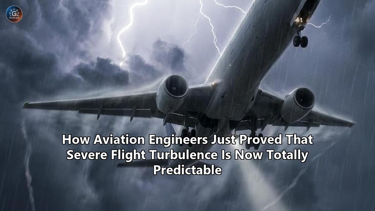
Over the North Atlantic, just south of Greenland, a heavily modified Boeing 777X testbed aircraft encountered an invisible wall of moving air at 35,000 feet. It was early May 2026, and the meteorological conditions were ripe for severe clear air turbulence (CAT)—a violent, sudden shifting of airmasses driven by jet stream shear, entirely devoid of moisture, and completely invisible to traditional weather radar.
Normally, an aircraft hitting this specific pocket of CAT would experience instantaneous vertical accelerations exceeding 1.5 Gs, enough to throw unbuckled passengers into the ceiling, severely damage the cabin, and overstress the airframe. Instead, 20 miles before the Boeing 777X reached the turbulent zone, a display on the flight deck illuminated. A highly specific three-dimensional geometric map rendered on the navigation screen, glowing with red and yellow vector lines.
The onboard system did not merely sense the turbulence; it commanded a micro-adjustment to the aircraft’s altitude and autonomously manipulated the ailerons and elevators in rapid succession. The aircraft slid through the turbulent pocket with barely a vibration.
Aviation engineers from a consortium including the Japan Aerospace Exploration Agency (JAXA), Caltech’s Center for Autonomous Systems and Technologies (CAST), and Lufthansa Systems had just achieved a milestone that aerodynamicists have chased for half a century. They proved that severe clear air turbulence is no longer an invisible, unavoidable hazard. By combining forward-looking Doppler LiDAR with real-time, physics-informed neural networks, predicting flight turbulence has officially transitioned from the realm of educated meteorological guessing into a precise, mathematical certainty.
The implications for global aviation are massive. In an industry where unexpected turbulence costs hundreds of millions of dollars annually in structural wear, fuel penalties, and passenger injury claims, the ability to "see" empty air fundamentally alters how commercial aircraft will operate. But getting to this point required solving some of the most complex fluid dynamics equations known to modern physics, miniaturizing high-powered lasers to fit inside an aircraft radome, and wiring the entire global fleet into a continuous, cloud-based nervous system.
Here is exactly how aerospace engineers cracked the code on clear air turbulence, the hardware making it possible, and what it means for the immediate future of commercial flight.
The Physics of Invisible Air
To understand the magnitude of this breakthrough, one must first understand why clear air turbulence has historically been impossible to detect.
Traditional aircraft weather radar operates in the X-band or C-band radio frequency ranges. These systems pulse electromagnetic energy ahead of the aircraft, which bounces off water droplets, hail, or ice crystals. By measuring the time it takes for the signal to return and the Doppler shift of that signal, the radar paints a picture of storm cells and convective turbulence. If there is water in the air, the radar can see it.
Clear air turbulence, however, contains no moisture. It typically occurs in the upper troposphere and lower stratosphere (between 20,000 and 40,000 feet), primarily driven by the collision of air masses moving at drastically different speeds. When the high-speed core of a jet stream interacts with slower surrounding air, the sheer friction creates violent, invisible eddies.
From a fluid dynamics perspective, modeling these eddies requires solving the Navier-Stokes equations—a set of partial differential equations that describe the motion of viscous fluid substances. The challenge is that turbulence is highly nonlinear and chaotic. Energy cascades from large-scale atmospheric structures down to microscopic eddies in a process that mathematically defies simple forecasting. For decades, the best defense pilots had against CAT was the Eddy Dissipation Rate (EDR), an algorithm that calculates how quickly turbulent energy is absorbed into the atmosphere. But EDR has always been reactive. A plane must fly through the rough air, register the physical jolts, and broadcast that EDR data to planes trailing behind it.
By the time the warning was broadcast, the airmass could have already shifted, rendering the data obsolete. The engineering challenge was clear: how do you detect the movement of something that is completely transparent, has no moisture, and changes state in milliseconds?
Bouncing Lasers Off Dust: The LiDAR Breakthrough
The foundational hardware that solved this problem is a highly specialized variant of Light Detection and Ranging (LiDAR).
Engineers realized that while there is no water in clear air turbulence, the upper atmosphere is not entirely empty. It contains microscopic aerosols—dust particles, volcanic ash, and trace chemical compounds—suspended in the stratosphere. When air violently shears, these aerosols are carried along with the wind currents.
If an aircraft could fire a laser into the air ahead and measure the scattered light bouncing off these microscopic particles, it could theoretically calculate the exact speed and direction of the wind before flying into it. This concept, known as Doppler LiDAR, is not new. However, making it work on a commercial airliner traveling at Mach 0.84 at 35,000 feet presented extreme physical limitations.
At high altitudes, aerosol density drops precipitously. Traditional ultraviolet LiDAR systems, which work perfectly near the ground, simply lack the power to get a return signal in the thin air of the tropopause. To solve this, researchers turned to dual-wavelength systems, primarily utilizing a 532-nanometer visible light airborne laser.
The 532 nm wavelength is critical. It relies on the indirect detection of atmospheric molecular density and utilizes the strong absorption characteristics of the iodine molecular 1109 absorption line. This highly specific setup eliminates the interference of standard aerosol scattering, isolating the weak molecular backscattering signal caused exclusively by turbulent wind shear.
The recent North Atlantic test flight utilized a forward-looking LiDAR system originally prototyped by JAXA and refined through Boeing’s ecoDemonstrator program. Emitting multiple laser beams from the nose of the aircraft, the system analyzes the light wavelength variation caused by the Doppler effect. Because the aircraft is moving forward at roughly 600 miles per hour, the system must continuously calculate the relative speed of the incoming air molecules against the true airspeed of the jet.
This hardware achieves a verified detection range of 20 miles (32 kilometers) ahead of the aircraft. For a plane traveling at cruising speed, this gives the flight control computers exactly two minutes of warning before impact. Two minutes is not enough time to alter the macro-routing of the flight path, but it is an eternity in the realm of modern avionics, offering more than enough time for automated systems to intervene.
Caltech’s FALCON and the Algorithmic Engine
Having a laser that can read wind shear is only half the equation. The sensor generates a staggering volume of raw data—millions of scattered light measurements every second. A human pilot cannot possibly interpret a raw LiDAR point cloud and calculate a safe trajectory in real time.
This is where artificial intelligence and machine learning intersect with fluid dynamics. Researchers at Caltech’s Center for Autonomous Systems and Technologies (CAST), in partnership with Nvidia, developed the computational brain capable of translating LiDAR data into actionable flight control commands. The system is known as FALCON (Fourier Adaptive Learning and CONtrol).
FALCON is built on a framework of Physics-Informed Neural Networks (PINNs). Traditional machine learning models require massive datasets to learn patterns, but relying purely on historical data is dangerous in aviation, where a single missed edge-case can be catastrophic. PINNs solve this by embedding the physical laws of aerodynamics—specifically the Reynolds-Averaged Navier-Stokes (RANS) models—directly into the neural network's loss function. The AI does not just guess what the air will do based on past data; it inherently understands the physics of how air must behave.
When the 532 nm LiDAR detects a shift in aerosol velocity, it feeds that data into FALCON. The system uses Fourier methods—representing the wind conditions as periodic waves or sinusoids. Within these waves, extreme unsteadiness shows up as a noticeable, rapid change in low-frequency energy. The AI identifies these frequency shifts, processes the incoming RANS equations, and generates a three-dimensional map of the turbulent pocket in under 40 milliseconds.
More importantly, predicting flight turbulence via FALCON involves reinforcement learning. The system continuously adapts to the specific aerodynamic profile of the aircraft it is installed on. It learns how the aircraft's mass, current fuel load, and center of gravity will react to the exact wind vectors mapped by the LiDAR. It then outputs a specific, mathematically optimized flight path to thread the needle through the calmest pockets of air.
The Integration Nightmare: Drag, Power, and Radomes
Proving the technology in a laboratory or a specialized testbed aircraft is vastly different from integrating it into a global commercial fleet of 25,000 aircraft. Bolting a multi-megawatt laser onto the front of a passenger jet is a masterclass in compromise.
Aviation engineers face three primary bottlenecks when adapting LiDAR for commercial use: aerodynamic drag, power consumption, and thermal management.
Commercial aircraft noses house the radome, a fiberglass or composite shell protecting the existing weather radar. The radome must remain entirely transparent to radio frequencies, but now, it must also accommodate optical lasers without distorting the beam. Creating an optical window in the nose of a pressurized aircraft that routinely experiences temperature swings from 120°F (49°C) on the tarmac in Dubai to -65°F (-54°C) at altitude is structurally demanding. The glass must withstand bird strikes, ice accumulation, and constant aerodynamic friction without scratching, as even micro-abrasions would scatter the 532 nm laser and corrupt the data.
Furthermore, generating a laser powerful enough to bounce off aerosols 20 miles away requires significant electrical draw. Modern airliners like the Boeing 787 and Airbus A350 have high-capacity electrical architectures, but retrofitting older airframes—like the Boeing 767 or early-model 737s—requires extensive upgrades to the aircraft's power generation systems.
Then there is the heat. High-power LiDAR systems generate intense thermal loads. Aircraft engineers had to design active liquid-cooling loops that snake through the forward avionics bay, utilizing the freezing outside air to bleed heat away from the laser diodes.
Because of these extreme engineering constraints, the industry is adopting a bifurcated approach. Line-fit installations—where the LiDAR is built into the aircraft on the assembly line—are already being finalized for the next generation of widebody jets. For older aircraft, the cost and weight of physical LiDAR retrofits remain prohibitive, which is why the industry has simultaneously built a massive, cloud-based workaround.
The Swarm Intelligence: IATA Turbulence Aware
For the thousands of aircraft that will not receive multi-million-dollar LiDAR upgrades this year, engineers have built a secondary layer of defense: a global data-sharing network that essentially turns the world's commercial fleet into a synchronized swarm of sensors.
In early 2026, major European carriers, spearheaded by Lufthansa, SWISS, and Edelweiss Air, achieved full fleet integration of the IATA Turbulence Aware platform. The system works by crowdsourcing precise atmospheric data in real time.
Historically, pilots reported turbulence via voice communications to Air Traffic Control (ATC), describing it subjectively as "light," "moderate," or "severe." A jolt that feels "moderate" in a massive Airbus A380 might feel "severe" in a smaller Embraer E190. This subjective reporting made it impossible to build accurate, uniform meteorological models.
The Turbulence Aware system eliminates human subjectivity. It utilizes the aircraft's existing inertial reference systems, accelerometers, and flight control computers to automatically calculate the Eddy Dissipation Rate (EDR). EDR is an objective, aircraft-independent metric. When an aircraft encounters rough air, the onboard software measures the exact energy dissipation and instantly beams an anonymized data packet via satellite to the IATA database.
This telemetry pipeline is staggering in its scale. In the first half of 2025 alone, participating airlines generated 24.8 million automated turbulence reports. By 2026, with the integration of major global hubs, the data flow became a continuous torrent.
This aggregated data is instantly pushed back out to trailing aircraft, displaying on the pilots' iPads or integrated navigation displays. Color-coded symbols map the exact location, altitude, time, and severity of the rough air. When combined with machine learning algorithms from platforms like SkyPath—which analyzes ADS-B data and even the background accelerometer readings from the pilots' mounted iPads—the system accurately forecasts the movement of the turbulent airmasses.
Therefore, predicting flight turbulence no longer relies on a single aircraft's hardware. If a LiDAR-equipped Boeing 777X maps a patch of CAT over the Atlantic, it not only dodges the hazard itself, but it instantly uploads the exact 3D coordinates and velocity of that airmass to the cloud. A non-LiDAR equipped Airbus A321 flying 40 miles behind it receives the data in milliseconds, allowing its flight computer to execute a minor altitude change long before reaching the zone.
The Economics of Smooth Skies
The push to conquer clear air turbulence is not purely driven by a desire for passenger comfort. It is heavily motivated by the brutal economics of modern aviation, where fuel efficiency, airframe longevity, and liability payouts dictate an airline's survival.
Airlines have historically managed turbulence through avoidance, but blind avoidance is highly inefficient. When meteorologists issue a blanket warning for clear air turbulence across a massive geographic area (for example, a 500-square-mile block over the Midwest United States), dispatchers route aircraft around the entire zone or mandate non-optimal cruising altitudes.
Flying an aircraft thousands of feet below its optimal aerodynamic ceiling drastically increases aerodynamic drag and fuel consumption. Dropping a widebody jet from 38,000 feet to 32,000 feet to avoid suspected rough air can burn thousands of extra pounds of jet fuel on a single transcontinental flight. Across a global fleet of 25,000 commercial aircraft flying every day, conservative routing based on inaccurate turbulence forecasts results in millions of metric tons of excess CO2 emissions and billions of dollars in wasted fuel.
By accurately predicting flight turbulence down to a localized, one-mile radius, airlines can stop treating the sky like a giant exclusion zone. Aircraft can fly their optimal, fuel-saving routes, making only micro-deviations to bypass the exact pockets of volatile air. Machine learning models applied to flight routing have already demonstrated fuel consumption reductions of up to 2%, translating to massive operational savings and significant progress toward the industry's net-zero carbon goals.
Beyond fuel, there is the issue of structural fatigue. Commercial airframes are designed to flex and absorb immense punishment, but repeated exposure to severe clear air turbulence accelerates metal fatigue and composite delamination. Every time a jet slams into a 1.5 G vertical wind shear, micro-stresses accumulate in the wing roots, engine pylons, and tail sections.
By eliminating high-G impact events, airlines can extend the operational lifespan of their airframes and stretch the time between heavy maintenance checks (D-checks), saving millions in maintenance, repair, and overhaul (MRO) costs.
Finally, the cost of passenger and crew injuries is severe. The fatal Singapore Airlines flight in May 2024, where a sudden drop caused over 100 injuries, served as a grim catalyst for accelerating the deployment of these technologies. Unanticipated CAT is the leading cause of in-flight injuries to flight attendants, who are often standing in the aisles operating heavy service carts. The legal liabilities, medical payouts, and reputational damage from a single severe turbulence encounter can cost an airline millions. Predictive technology allows the flight deck to reliably illuminate the seatbelt sign and secure the cabin crew precisely 10 minutes before an event, neutralizing the injury risk.
The Human-Machine Interface on the Flight Deck
Implementing predictive algorithms and laser sensors is an engineering triumph, but how the pilot interacts with this data is equally critical. The transition from reactive flying to proactive, AI-driven avoidance requires a fundamental shift in pilot psychology and the Human-Machine Interface (HMI).
For the past century, pilots have flown through turbulence by reacting to the physical sensations of the aircraft and scanning standard radar returns. They grip the yoke or sidestick, disengage the autothrottle if necessary to reach the turbulence penetration speed, and ride it out.
The new systems fundamentally alter this dynamic. On the flight decks of advanced test aircraft, the data from the Doppler LiDAR and the IATA database is integrated directly into the Head-Up Display (HUD) and the primary Navigation Display (ND). Instead of abstract weather reports, pilots see a synthetic vision rendering of the air ahead.
Turbulent zones appear as translucent, color-coded geometric polygons floating in the virtual space ahead of the aircraft. Green indicates light chop, yellow warns of moderate turbulence that will disrupt cabin service, and deep red highlights severe, structural-threat shear.
This presents a unique human-factors challenge. The AI algorithms process the RANS equations and plot an avoidance trajectory faster than a human pilot can comprehend the raw data. If the LiDAR spots a severe shear vector 10 miles out, the aircraft’s computer calculates that a 2-degree heading change and a 300-foot altitude adjustment will thread the aircraft through a safe corridor. The flight director prompts the pilot to execute the maneuver.
Pilot unions and human-factors engineers have spent the last two years debating the extent of automation in these scenarios. How much authority should the AI have to deviate from an assigned Air Traffic Control clearance to avoid a sudden pocket of CAT? Current EASA and FAA frameworks dictate that the pilot remains the final authority. The system suggests the optimal micro-routing, and the pilot must accept the command via the autopilot control panel.
However, engineering consortiums are already pushing for the next phase of this technology: Automated Gust Alleviation.
Automated Gust Alleviation: Active Suspension for Aircraft
While changing course is the preferred method for avoiding large blocks of clear air turbulence, there are scenarios where deviation is impossible. In heavily congested airspace, such as the North Atlantic Tracks or the approach corridors into London Heathrow, an aircraft may be boxed in by other traffic, unable to climb, descend, or turn.
In these moments, predicting flight turbulence serves a different purpose. Instead of avoidance, the data is used for mitigation.
Aviation engineers are integrating the forward-looking LiDAR directly into the aircraft's fly-by-wire flight control computers. Because the LiDAR can map the exact size, speed, and direction of a gust of wind 10 seconds before it strikes the wings, the flight control computers can preemptively act.
This system acts like an active, predictive suspension system on a high-end sports car. As the aircraft approaches the invisible wind shear, the fly-by-wire system calculates the precise aerodynamic loads that are about to hit the airframe. Milliseconds before the turbulence strikes, the computer automatically commands micro-deflections of the ailerons, elevators, and spoilers.
If the LiDAR detects an updraft that would normally throw the right wing upward, the computer instantly deflects the right aileron upward and deploys the micro-spoilers to kill the lift on that wing just as the wind hits. The result is a perfect cancellation of forces. The wind tries to push the aircraft up; the flight controls simultaneously push the aircraft down.
Inside the cabin, the passengers feel almost nothing. A severe jolt that would normally spill coffee and rattle the overhead bins is reduced to a mild, barely perceptible vibration. JAXA and Boeing have already proven the physics of this gust alleviation technology, demonstrating that it can reduce turbulence-induced structural shaking by up to 60 percent.
This requires a staggering level of computational speed. The servos and hydraulic actuators controlling the massive flight surfaces of a 500,000-pound aircraft must react in real time to the changing frequencies of the wind mapped by the Caltech FALCON system. The latency between the laser detecting the particle shift, the AI solving the fluid dynamics equation, and the hydraulic fluid moving the aileron must be virtually zero.
The Certification Battlefield
As with any paradigm shift in aerospace technology, the regulatory hurdles are just as steep as the engineering challenges. The Federal Aviation Administration (FAA) in the United States and the European Union Aviation Safety Agency (EASA) are notoriously meticulous when certifying new flight control software, particularly systems driven by artificial intelligence.
The core issue lies in the unpredictable nature of machine learning. Certification authorities historically require "deterministic" software—meaning if you input a specific set of parameters, the software will output the exact same result 100 percent of the time. Traditional code can be tested line by line.
Physics-Informed Neural Networks and reinforcement learning models, however, are constantly evolving. They learn and adapt based on the data they ingest. Regulators have had to develop entirely new frameworks to certify AI in the cockpit.
Currently, the LiDAR detection and the IATA Turbulence Aware data are certified as "advisory only." They provide enhanced situational awareness, but the systems cannot unilaterally seize control of the aircraft to dodge rough air. The next phase, integrating the predictive data directly into the autopilot for automated avoidance and gust alleviation, requires proving to the FAA that the AI will never interpret a sensor glitch as a wind shear and aggressively roll the aircraft into a dangerous attitude.
To satisfy regulators, manufacturers are implementing redundancy layers. The LiDAR data is cross-referenced with pitot-tube airspeed data, angle-of-attack sensors, and standard inertial reference units. If the laser detects a violent wind shear, but the other sensors disagree, the system disables the automated gust alleviation and reverts to manual pilot control, issuing an alert on the flight deck.
What Happens Next: The Road to 2030
The successful test flights over the North Atlantic in May 2026 mark the end of the experimental phase and the beginning of commercial standardization. The roadmap for the next four years is aggressive.
By the end of 2026, the majority of top-tier global airlines will have fully integrated into the IATA data-sharing network, ensuring that the southern hemisphere and previously data-dark regions over the Pacific Ocean and Africa are mapped in real time. The swarm intelligence model will reach critical mass, ensuring that practically every commercial flight has access to predictive, crowd-sourced EDR data.
Looking toward 2028, the first line-fit commercial aircraft equipped with integrated 532 nm forward-looking Doppler LiDAR will begin rolling off the assembly lines in Toulouse and Seattle. These aircraft will act as the apex predators of the data ecosystem. Not only will they actively map and dampen turbulence for their own passengers using fly-by-wire gust alleviation, but they will serve as ultra-precise, forward-scouting nodes for the rest of the fleet, uploading their laser-mapped telemetry to the IATA database.
By 2030, engineers plan to close the final loop: Low Earth Orbit (LEO) satellite integration. Currently, predicting flight turbulence relies on sensors attached to aircraft. Researchers are developing advanced satellite-based hyperspectral imaging that can monitor the displacement of stratospheric aerosols from space. When synchronized with the onboard LiDAR and the localized AI processing power of systems like FALCON, the aviation network will generate a persistent, real-time, global 3D model of atmospheric fluid dynamics.
The invisible wall at 35,000 feet has finally been rendered visible. Through the convergence of quantum-level laser optics, massive swarm-intelligence data pipelines, and artificial intelligence that inherently understands the laws of physics, aviation engineers have tamed the chaos of the atmosphere. The era of passengers holding their breath as an aircraft shakes violently through the jet stream is rapidly coming to an end. The skies are not getting any calmer, but the machines flying through them have finally learned how to see the wind.
Reference:
- https://www.mdpi.com/2304-6732/10/11/1185
- https://www.photonics.com/Articles/Onboard-Lidar-Detects-Turbulence-Volcanic-Ash/a62913
- https://www.electrooptics.com/news/preventing-air-turbulence-lidar-technology
- https://www.caltech.edu/about/news/ai-trained-vehicles-can-adjust-to-extreme-turbulence-on-the-fly
- https://aijourn.com/how-advanced-turbulence-forecasting-is-changing-air-travel/
- https://medium.com/@peterkakljugin/ml-for-turbulence-prediction-how-ai-and-ml-are-revolutionizing-forecasting-c9a2489d2167
- https://www.channelnewsasia.com/cna-insider/sq321-sia-lidar-laser-scanning-tech-clear-air-turbulence-4432221
- https://newsroom.lufthansagroup.com/en/lufthansa-introduces-iata-turbulence-aware-technology/
- https://aerospaceglobalnews.com/news/emirates-ai-turbulence-forecasting/
- https://www.iata.org/en/pressroom/opinions/navigating-turbulent-skies-with-certainty/
- https://www.mdpi.com/2076-3417/14/11/4419
- https://www.rtca.org/news/airborne-lidar-for-clear-air-turbulence-detection/
- https://www.airdatanews.com/lufthansa-adopts-iata-turbulence-aware-system-across-group-airlines/
- https://www.internationalairportreview.com/iatas-turbulence-aware-platform-expands-with-six-new-airlines-joining-in-2024-for-safer-flights/472810.article
- https://mexicobusiness.news/aerospace/news/lufthansa-adopts-iata-turbulence-aware-tool