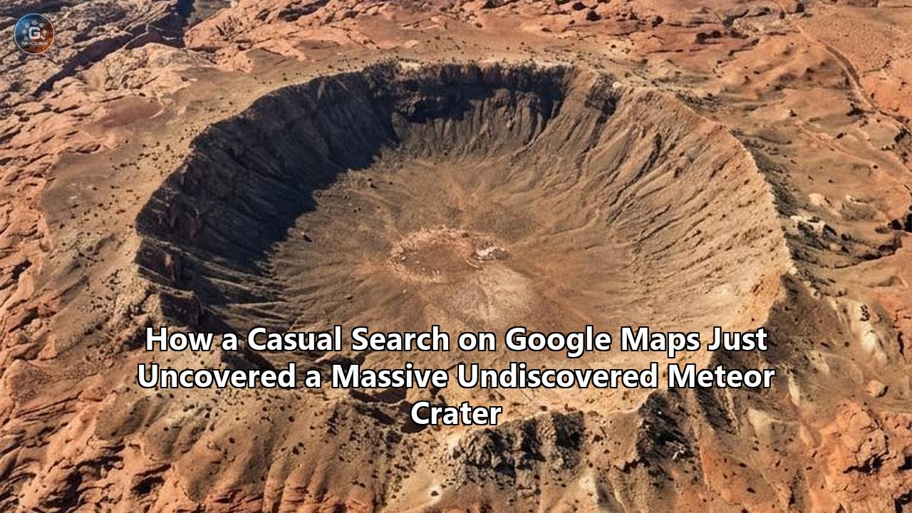
In July 2026, a team of planetary scientists and geologists delivered a stunning confirmation to the scientific community: a massive, 15-mile-wide (25-kilometer) circular depression in the remote wilderness of Quebec, Canada, is indeed a 390-million-year-old meteor impact crater.
The geologic structure, centered around the isolated Marsal Lake in Quebec’s rugged Côte-Nord region, has been named the Uhaachatik Crater. It represents one of the largest impact structures discovered on Earth in more than a decade. What makes this scientific milestone extraordinary is its origin story. The crater was not identified by a multi-million-dollar government satellite array or an institutional geological survey. Instead, it was spotted by Joël Lapointe, an ordinary citizen and amateur astronomer, who was casually scanning Google Maps to plan an upcoming camping and hiking trip.
What began as a routine digital scroll on a laptop screen has culminated in an international geological investigation, a grueling expedition into some of the most unforgiving terrain in North America, and a profound leap forward in our understanding of Earth’s ancient history. This discovery illustrates how modern, publicly available geospatial technology is democratizing planetary science. It also highlights the intricate, highly technical detective work required to prove that a circular dent in the Earth is not merely a product of mundane erosion, but the scarred ground zero of a cosmic cataclysm.
The Scroll That Sparked a Scientific Sensation
In 2024, Joël Lapointe was sitting at his computer, preparing for a backcountry hiking and camping excursion through Quebec's Côte-Nord region. Like thousands of outdoor enthusiasts, he loaded up Google Maps to evaluate the topography of his intended route, looking for accessible waterways, flat clearings, and optimal hiking paths.
As he hovered his cursor over a highly isolated zone roughly 100 kilometers (62 miles) north of the tiny coastal village of Magpie, something anomalous caught his eye.
[Magpie Lake & River] ---> (Arched topographic boundary)
                                |
                        [Ring of Mountains] (~8 km diameter)
                                |
                        [Marsal Lake] (Central depression)
                                |
                        [Outer Crater Rim] (~25 km diameter)
Directly surrounding Marsal Lake was a nearly perfect, concentric ring of small mountains. The lake itself sat nestled in the center of a dramatic, highly symmetrical circular depression approximately 15 miles in diameter. The surrounding landscape was defined by the chaotic, irregular paths of ancient glacial scraping, but this specific zone possessed a geometry that felt completely unnatural. To Lapointe's trained eye as an amateur astronomer, the circular pit bore an uncanny resemblance to the craters peppered across the surface of the Moon.
Intrigued, Lapointe decided not to dismiss his intuition. He reached out to professional researchers, eventually getting in touch with Pierre Rochette, a renowned geophysicist at the Centre de Recherche en Géosciences de l’Environnement (CEREGE) in Aix-en-Provence, France.
Rochette was immediately struck by the topographic symmetry of the Marsal Lake region. While geologists are routinely inundated with "false positives" from the public, the digital elevation profiles of this site were too compelling to ignore. Rochette partnered with Dr. Gordon "Oz" Osinski, a professor of planetary geology at Western University in Ontario and one of the world's leading authorities on impact cratering.
When Osinski reviewed the satellite imagery and preliminary geological maps, he agreed that the site was a major candidate. However, both scientists cautioned that proving the existence of an undiscovered meteor crater requires a level of physical proof that satellite imagery alone can never provide.
Finding an undiscovered meteor crater on our geologically active planet requires a highly systematic process of elimination. The researchers had to rule out volcanic calderas, salt domes, ring-dykes, and glacial sinkholes before they could declare that a cosmic intruder was responsible for the massive circular scar.
Braving the Côte-Nord Wilderness: The Hunt for Ground-Truth
To transition the Marsal Lake structure from a "serious candidate" to a confirmed impact site, the scientists had to get boots on the ground. This was easier said than done. The Côte-Nord region of Quebec is a dense, trackless wilderness characterized by thick boreal forests, muskeg swamps, vertical granite cliffs, and notoriously aggressive blackfly and mosquito populations.
In late 2025 and early 2026, Osinski, Rochette, and a team of specialized geologists launched a field expedition to the site. Osinski, who has led 25 expeditions to some of the most extreme environments on Earth—including the high Canadian Arctic, Antarctica, and remote African deserts—described this trek as one of the most physically punishing of his entire career.
Because there are no roads within 60 miles of Marsal Lake, the team had to charter a seaplane. The dense shoreline vegetation and shallow, rocky lake beds made landing treacherous. The pilot was forced to drop the researchers and their heavy geological gear roughly 150 feet offshore, forcing them to wade through waist-deep, freezing water to reach dry land.
Once onshore, the team faced days of "bushwhacking" through dense, overgrown brush, carrying rock hammers, drills, GPS systems, and sample bags, all while navigating the rugged ring of mountains that Lapointe had spotted from his computer.
The primary goal of this grueling expedition was to search for physical evidence of "shock metamorphism". When an asteroid slams into the Earth at hypervelocity, it releases a tremendous amount of kinetic energy almost instantaneously. This generates shock waves that exceed pressures of tens of gigapascals (GPa) and raise temperatures to thousands of degrees Celsius. No terrestrial volcanic or tectonic process can generate these extreme, short-duration pressures.
If Marsal Lake was truly the site of an ancient impact, the rocks would bear permanent, unmistakable structural deformations at both the macroscopic and microscopic levels.
The Ultimate Smoking Gun: The Physics of Shatter Cones
On the second day of the difficult expedition, the team found exactly what they were looking for: shatter cones.
Shatter cones are rare, highly distinctive geological features that serve as the premier macroscopic "smoking gun" for a meteorite impact. To the naked eye, they look like nested, fan-shaped or conical fractures in the bedrock, decorated with delicate, radiating striations that diverge from an apex. In nature, they are only known to form in two environments: the bedrock directly beneath a hypervelocity meteor impact crater, or the immediate vicinity of an underground nuclear test site.
                [Shock Wave Front]
                        |
                        v
                 (Apex of Cone)
                    /   \
                   /     \  <-- Striated, nested fractures
                  /       \     propagating downward
                 /_________\
The physics of shatter cone formation is a complex area of study in rock mechanics. When a meteorite strikes the surface of the Earth, it generates a shock wave that travels through the target rock at supersonic speeds—typically between 5 and 9 kilometers per second. As this shock front moves outward and downward, it is intensely compressive, temporarily squeezing the rock to a fraction of its original volume.
However, the Earth's crust is not a homogeneous block of glass; it is filled with microscopic and macroscopic heterogeneities, such as mineral crystals of varying hardness, fossil fragments, or tiny cavities. When the high-pressure shock wave encounters one of these tiny impurities, a phenomenon known as wave scattering occurs.
The primary shock wave interacts with secondary, scattered elastic waves generated by the impurity. At the boundaries of these interacting waves, the compressive stress is converted into extreme tensional stress. Because rocks are significantly weaker under tension than they are under compression, they fracture along these conical wave boundaries.
The resulting conical fractures radiate outward and downward from the point of inhomogeneity (which becomes the apex of the cone). The striations, or "grooves," carved into the rock surface are the physical tracks left behind by the rapidly propagating fracture fronts as they pass through the bedrock.
By mapping the spatial orientation of these shatter cones across the Marsal Lake structure, Osinski and his team could perform a crucial calculation. Because the apices of shatter cones almost always point back toward the origin of the shock wave, tracking their geometry allows scientists to reconstruct the exact path of the shock wave and pinpoint the precise "ground zero" of the ancient impact.
The discovery of extensive shatter cones on the cliffs of Lake Marsal was the definitive proof the geologists needed. It transformed Lapointe's curious observation into a scientifically verified reality: they had found a massive, previously undiscovered meteor crater.
Microscopic Secrets: Zircon and Impact Melt Rocks
While shatter cones provided unmistakable visible proof, the team's laboratory analysis of the collected rock samples yielded an even deeper look into the atomic-scale violence of the impact. Back in the laboratory, researchers subjected the samples to scanning electron microscopy (SEM), electron backscatter diffraction (EBSD), and Raman spectroscopy.
The Resilience of Zircon
One of the key minerals analyzed was zircon ($\text{ZrSiO}_4$). Zircon is an incredibly durable, accessory mineral that is highly prized by geologists because it is virtually indestructible under normal tectonic conditions. It can survive billions of years of weathering, river transport, and mountain-building events, acting as a tiny, highly reliable time capsule.
However, when subjected to the extreme shock pressures of an asteroid impact—specifically pressures exceeding 20 to 30 GPa—the crystal lattice of zircon undergoes dramatic, permanent changes.
- Phase Transformation to Reidite: Under intense shock compression, the atoms within the zircon lattice are squeezed into a much denser configuration, transforming the mineral into its high-pressure polymorph, reidite. Reidite has the same chemical composition as zircon but possesses a completely different tetragonal (scheelite-type) crystal structure. Because reidite can only form under these extreme pressures, its presence within the Lake Marsal rocks is a definitive indicator of a hypervelocity impact.
- Granular Recrystallization: If the post-shock temperatures exceed 1,100 to 1,700°C, the shocked zircon or reidite will recrystallize, forming a distinct "granular" microtexture comprised of tiny, sub-micron-sized subgrains. These granular zircons are unique to impact craters and provide a permanent record of the massive heat spike that followed the collision.
[Normal Zircon] ---> Shock Wave (>30 GPa) ---> [Reidite Transformation]
      |                                                |
      v                                                v
Tectonic Heat (Inert)                          Extreme Heat (>1100°C)
                                                       |
                                                       v
                                            [Granular Recrystallization]
Cliffs of Molten Earth
In addition to shocked zircons, the expedition uncovered spectacular cliffs of impact melt rock.
When a large asteroid strikes the Earth, its kinetic energy is instantly converted into thermal energy, vaporizing the asteroid and melting a vast volume of the target rock. At Lake Marsal, the temperature of the collision was so high that it literally melted tens of cubic kilometers of the Earth's crust. This molten rock pooled in the bottom of the newly formed crater, cooling slowly over thousands of years to form thick sheets of dark, glassy, igneous-like rock known as impactites.
By analyzing the radioactive decay of uranium isotopes into lead within the recrystallized zircons found inside these melt rocks, geologists were able to determine the precise age of the impact: 390 million years old.
Reconstructing the Devonian Cataclysm
To fully appreciate why the confirmation of the Uhaachatik Crater matters, we must travel back in time 390 million years to the Middle Devonian epoch—a critical era in the history of life on Earth.
During the Devonian period, the planet's continents were arranged in vast, unrecognizable configurations. The supercontinent of Gondwana dominated the southern hemisphere, while the smaller landmass of Euramerica (which included what is now eastern Canada) sat near the equator, bathed in a warm, tropical climate.
The Devonian is famously known as the "Age of Fishes." Earth's oceans teemed with bizarre armored fish called placoderms, ancient sharks, and early lobe-finned fishes.
On land, a quiet revolution was underway. The first terrestrial forests were beginning to emerge, dominated by primitive vascular plants and early trees like Archaeopteris. These early ecosystems were just beginning to stabilize the soil, generate complex organic environments, and pump oxygen into the atmosphere. Primitive, wingless insects and early tetrapods (four-limbed vertebrates) were taking their tentative first steps onto land.
It was into this lush, developing tropical world that a massive asteroid descended.
Based on the 15-mile (25-kilometer) diameter of the Uhaachatik Crater, physics allows us to estimate the size and energy of the impacting body. The asteroid was likely between 1 and 1.5 miles (1.6 to 2.4 kilometers) in diameter, hurtling through the atmosphere at a velocity of roughly 45,000 miles per hour (20 kilometers per second).
========================================================================
                      DEVONIAN IMPACT METRICS (ESTIMATED)
========================================================================
Asteroid Diameter:    ~1.0 to 1.5 miles (1.6 to 2.4 km)
Impact Velocity:      ~45,000 mph (20 km/s)
Crater Diameter:      ~15.5 miles (25 km)
Crater Depth:         ~1,000 feet (300 meters) post-collapse
Energy Released:      ~10,000 to 50,000 Megatons of TNT equivalent
Primary Target:       Ancient crystalline bedrock of the Canadian Shield
========================================================================
The moment of impact was cataclysmic. As the asteroid breached the atmosphere, it compressed the air ahead of it, creating a thermal shockwave that would have incinerated any vegetation for hundreds of miles before the rock even touched the ground.
Upon impact, the asteroid did not simply plunge into the soil; the sheer kinetic energy ($E_k = \frac{1}{2} mv^2$) was so vast that both the asteroid and a massive volume of the target crust were instantly vaporized in a blinding flash of light.
An expanding plume of superheated vapor, molten rock droplets, and pulverized dust shot upward into the stratosphere, blanketing the Earth and blocking out sunlight for months. The shock wave radiating through the Earth triggered massive, continent-scale earthquakes, while the displacement of the atmosphere generated a hyper-hurricane-force blast of wind that flattened forests across Euramerica.
On the surface, a deep, transient cavity was carved out within seconds, reaching a depth of several miles. Almost immediately, the gravity of the Earth caused the steep, unstable walls of this initial cavity to collapse inward.
The center of the crater floor rebounded upward, forming a central peak (the ring of mountains spotted by Lapointe), while the outer rim slumped, leaving behind the complex, multi-ringed 15-mile-wide crater we see today.
Earth vs. Moon: Why Our Planet Hides Its Scars
If you look at the Moon through a simple pair of binoculars, its surface appears crowded with craters. From the massive, ancient impact basins to tiny, sharp-rimmed pits, the lunar surface is a pristine, uninterrupted archive of solar system bombardment. Yet on Earth—a target that is physically larger and possesses a much stronger gravitational pull—there are only about 200 confirmed meteor impact craters in existence.
Why is our planet seemingly so untouched by cosmic debris?
The answer lies in Earth's dynamic, highly aggressive geological systems, which act as a giant, continuous eraser of its own history.
                     [COSMIC BOMBARDMENT]
                              |
                              v
                   +---------------------+
                   |   Impact Event      |
                   +---------------------+
                              |
            +-----------------+-----------------+
            |                                   |
            v                                   v
     [THE MOON'S FATE]                  [THE EARTH'S FATE]
  No Atmosphere / Water                Active Geologic Cycles
          |                                     |
  Pristine Preservation                - Plate Tectonics
  for Billions of Years                - Glacial Erosion
                                       - Sedimentation & Burial
                                       - Weathering & Water Flow
                                                |
                                                v
                                      Erosion / Obliteration
                                                |
                                                v
"The Scar is Erased"- Plate Tectonics: Earth's crust is divided into tectonic plates that are constantly moving, colliding, sinking, and recycling. Ocean floors are completely subducted back into the mantle every 200 million years, meaning any marine impact craters older than this are gone.
- Glacial Erosion: During successive ice ages, massive ice sheets—some up to two miles thick—slithered across continents like giant pieces of sandpaper. In Canada, the Laurentide Ice Sheet scraped across the Canadian Shield, shearing off mountain tops, filling in deep valleys, and grinding ancient impact craters down to their root structures.
- Sedimentation and Burial: Wind, rain, and rivers continuously transport sediment, burying massive craters under miles of sand, mud, and volcanic ash over millions of years. The famous Chicxulub crater in Mexico, which marks the extinction of the dinosaurs, is completely invisible from the surface, buried beneath hundreds of meters of limestone.
- Weathering and Vegetation: Water and atmospheric chemistry break down rocks, while dense vegetation overgrows, conceals, and physically degrades the structural boundaries of ancient craters.
Because of these persistent geologic forces, searching for an undiscovered meteor crater is like searching for a needle in a geological haystack.
The Canadian Shield, where the Uhaachatik Crater was found, is one of the very few places on Earth where ancient, stable Precambrian and Paleozoic crystalline basement rock is exposed near the surface. Even so, of the 31 previously confirmed craters in Canada, nearly a third are concentrated in Quebec, where intensive mining and exploration have driven geological mapping.
The survival of the 390-million-year-old Uhaachatik Crater is a geological miracle. While erosion has stripped away the topmost layers of the original crater rim and ejecta blanket, the deeper root structures, the central mountain ring, the shatter cones, and the impact melt rocks remained intact, waiting for the right pair of eyes to spot them.
The Democratization of Discovery: Citizen Science in the Satellite Era
The discovery of the Uhaachatik Crater highlights a profound shift in how scientific breakthroughs are achieved in the 21st century. Historically, planetary geology was an exclusive club, restricted to those with access to elite academic institutions, government-funded geological surveys, or high-altitude aerial reconnaissance equipment.
Today, that barrier of entry has been dismantled by the democratization of satellite data.
Platforms like Google Maps, Google Earth, and public geospatial databases have put high-resolution satellite imagery, multi-spectral data, and digital elevation models (DEMs) into the hands of anyone with an internet connection.
Satellite constellations such as NASA's Landsat, the European Space Agency's Sentinel, and commercial high-resolution imaging satellites capture detailed, multispectral views of the entire globe daily. This data is processed, stitched together, and served to the public through free, intuitive map interfaces.
For geologists like Dr. Gordon Osinski, this influx of citizen science is a double-edged sword. On one hand, his inbox is routinely flooded with emails from enthusiastic members of the public claiming to have found an undiscovered meteor crater.
"I get lots of messages from the public thinking they have found a crater, and 99/100 turn out not to be the case," Osinski explained. "This is one of those rare examples that shows this is possible".
========================================================================
                      THE CITIZEN SCIENCE FILTER
========================================================================
[Public Submissions] ----> ~99% False Positives (Glacial lakes, volcanic
                                calderas, salt domes, circular erosion)
                     ----> ~1% True Contenders (Symmetrical topography,
                                distinct ring-like mountains)
                                      |
                                      v
                             [Scientific Inspection]
                             - Satellite elevation profiling
                             - Preliminary rock sample gathering
                             - Identification of shocked minerals (Zircon)
                                      |
                                      v
                             [Field Expedition]
                             - Physical collection of shatter cones
                             - Mapping of impact melt rock sheets
                                      |
                                      v
                             [Official Confirmation]
========================================================================
The difference in Lapointe's case was his keen analytical approach and his willingness to collaborate with professionals. Rather than stopping at the visual observation, he initiated a scientific pipeline.
This citizen-led discovery has paved the way for automated planetary defense and geologic research. Today, scientists are developing machine learning algorithms trained on known impact structures to scan global satellite imagery and digital elevation models. These AI models are designed to search for the subtle, eroded signatures of impact structures that are invisible to the naked human eye, matching circular topography with gravitational and magnetic anomalies.
Yet, as the discovery of the Uhaachatik Crater proves, the human element—curiosity, intuition, and a willingness to look closer—remains irreplaceable.
Scientific and Economic Implications: Why This Matters
The confirmation of a new 15-mile-wide impact crater is not just an exciting piece of trivia for space enthusiasts. It holds deep scientific and economic implications that ripple across earth science and planetary exploration.
1. Understanding Planetary Bombardment Rates
By identifying and precisely dating impact craters on Earth, planetary scientists can calibrate the "impact cratering rate" for the inner solar system. Because the Moon has no atmosphere, we can count its craters, but dating them is extremely difficult without physical samples from each site. Earth, with its plate tectonics, allows us to physically date these impacts using isotopic methods. This provides a vital "clock" that allows scientists to estimate the age of surfaces on Mars, Mercury, and the Moon.
2. The Cradle of Ancient Hydrothermal Life
When an asteroid strikes the Earth, the massive heat generated creates a long-lived hydrothermal system. Rainwater and groundwater seep into the fractured, hot crater floor, warming up and circulating back to the surface as hot, mineral-rich springs.
These impact-induced hydrothermal systems can persist for tens of thousands of years, providing the perfect, protected environment for microbial life to thrive.
Many astrobiologists believe that hypervelocity impacts on early Earth—and potentially early Mars—may have served as the crucible where life itself first originated. Studying pristine, ancient impact sites like Uhaachatik allows scientists to understand how these hydrothermal systems function and what biosignatures we should search for on other planets.
3. Economic Geology: Hidden Ore Deposits
From an economic standpoint, impact craters are some of the most lucrative geological structures on Earth.
The extreme temperatures and pressures, combined with the subsequent hydrothermal activity, serve as powerful "concentrators" of valuable minerals.
- The Sudbury Basin (Ontario, Canada): This 1.8-billion-year-old, 130-kilometer-wide impact structure is home to one of the world's largest deposits of nickel, copper, and platinum group elements. The impact melted the Earth's crust, causing heavy metals to sink and concentrate at the base of the melt sheet.
- Vredefort Dome (South Africa): The largest verified impact crater on Earth is associated with the world's richest gold deposits.
- Hydrocarbon Traps: Many eroded craters act as natural structural "bowls," forming highly effective reservoir traps for oil and natural gas.
While it is too early to tell if the Uhaachatik Crater contains economically viable mineral deposits, its geological setting within the highly mineralized Canadian Shield makes it a highly attractive target for geophysical surveying and mineral exploration in the coming years.
What to Watch For Next
The discovery of the Uhaachatik Crater has opened up a brand-new scientific frontier, and the upcoming years will see a flurry of research centered around this ancient impact site.
In late August 2026, Osinski, Rochette, and their research team will travel to Germany to formally present their comprehensive field findings at one of the world's largest planetary science conferences. This presentation will lay out the precise structural maps of the crater, the mineralogical analysis of the shocked zircons, and the chemical signatures of the impact melt rock.
                                [AUGUST 2026]
                  Formal presentation of Uhaachatik Crater
                     at Planetary Science Conference
                               (Germany)
                                   |
                                   v
                         [LATE 2026 / 2027]
                  - High-resolution airborne geophysics
                  - High-precision U-Pb isotopic dating
                  - Environmental impact modeling
                                   |
                                   v
                             [2028 & BEYOND]
                  Deep-core scientific drilling campaign
Beyond the conference, the scientific road map for Uhaachatik includes several major milestones:
- Airborne Geophysical Surveys: Researchers plan to fly specialized aircraft equipped with magnetometers and gravimeters over Marsal Lake. These instruments will map the sub-surface density of the rock. Impact craters typically exhibit a distinct circular "gravity low" because the intense shock waves shattered and fractured the bedrock, making it less dense than the surrounding undisturbed earth.
- High-Precision Geochronology: While the crater has been dated to approximately 390 million years ago, advanced laboratory testing will aim to narrow down the error margin of this date. Pinpointing the exact year, or even season, of the impact will allow climatologists to cross-reference the event with known Devonian mass extinction pulses and sudden climate shifts recorded in the global sediment record.
- Deep-Core Drilling: The ultimate goal for the research team is to secure funding for a scientific drilling campaign. By drilling deep beneath the bed of Marsal Lake, scientists can retrieve pristine, unweathered core samples of the shock-melted rocks and the transition zones where the target rock was deformed. This will provide an unprecedented 3D view of how a 15-mile-wide complex crater collapses and stabilizes in the moments following an impact.
The incredible saga of the Uhaachatik Crater serves as an inspiring reminder of the endless frontiers that still exist on our own planet. It proves that the maps we carry in our pockets are not completely solved, and that a curious mind, paired with a free web browser, can still rewrite the geological history of the Earth.
As Joël Lapointe reflected shortly after the scientific confirmation of his find: "It's not every day that an ordinary citizen finds a 390-million-year-old crater. I encourage everyone to not ignore intuition or an observation, even if it isn't part of your field of expertise".
Reference:
- https://petapixel.com/2026/07/17/camper-accidentaly-discovers-ancient-meteor-crater-on-google-maps/
- https://www.livescience.com/planet-earth/geology/this-was-one-of-the-most-arduous-expeditions-ive-ever-done-scientists-confirm-that-15-mile-wide-pit-found-on-google-maps-is-ancient-meteor-crater
- https://en.clickpetroleoegas.com.br/man-was-looking-for-a-place-to-camp-on-google-maps-but-ended-up-discovering-a-surreal-25-km-and-390-million-year-old-crater-caused-by-a-mete-rpc95/
- https://www.businesstoday.in/technology/news/story/a-man-zoomed-into-google-maps-and-may-have-uncovered-a-390-million-year-old-secret-hidden-on-earth-543426-2026-07-16
- https://www.popularmechanics.com/science/environment/a62117881/impact-crater-quebec-canada-google-maps/
- https://universemagazine.com/en/google-earth-helps-discover-hidden-impact-meteor-crater/
- https://www.infobae.com/tecno/2026/07/18/descubrio-un-crater-de-meteorito-de-390-millones-de-anos-solo-usando-google-maps/
- https://www.livescience.com/planet-earth/geology/this-was-one-of-the-most-arduous-expeditions-ive-ever-done-scientists-confirm-that-15-mile-wide-pit-found-on-google-maps-is-ancient-meteor-crater
- https://allthatsinteresting.com/cote-nord-quebec-impact-crater
- https://cifar.ca/bios/gordon-oz-osinski/
- https://www.vice.com/en/article/google-maps-meteor-crater-discovery-quebec/
- https://portal.research.lu.se/en/publications/microstructural-deformation-of-zircon-during-impact-metamorphism/
- https://pubmed.ncbi.nlm.nih.gov/27532050/
- https://en.wikipedia.org/wiki/Shatter_cone
- https://en.clickpetroleoegas.com.br/man-was-looking-for-a-place-to-camp-on-google-maps-but-ended-up-discovering-a-surreal-25-km-and-390-million-year-old-crater-caused-by-a-mete-rpc95/
- https://www.impact-structures.com/impact-rocks-impactites/the-shatter-cone-page/
- https://micro.org.au/news/rare-minerals-reveal-huge-impact-crater/
- https://www.cps-jp.org/~mosir/pub/2009/2009-12-08/baratoux/pub-web/Shattercones_Kobe.pdf
- https://www.researchgate.net/publication/227737058_Shock-metamorphosed_zircon_in_terrestrial_impact_craters
- https://www.hou.usra.edu/meetings/lpsc2018/pdf/1418.pdf