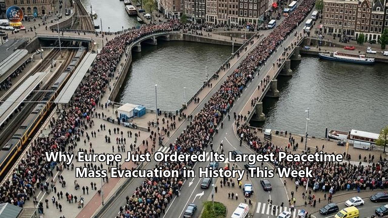
More than 375,000 people across Western Europe have been forced from their homes and holiday accommodations within a seven-day span, as an extreme summer heat wave and fast-moving wildfires triggered what civil defense authorities confirmed this week is the largest peacetime mass evacuation in modern European history.
In France’s southwestern Gironde region, civil emergency directors expanded mandatory clearance orders to cover 220,000 residents and tourists—including an emergency overnight surge that forced 55,000 people to flee as fire perimeters closed within 25 kilometers of the Bordeaux metropolitan area. Across the border in Spain, national emergency command was transferred to the armed forces after more than 90,000 people were evacuated across five provinces. Combined with secondary evacuations across Portugal and Italy, total confirmed displacements in Western Europe have surpassed 375,000 people, pushing regional logistics to unprecedented limits.
The operational scale of the disaster is defined by stark quantitative metrics:
- Total Displaced Population: 375,000+ individuals cleared across Western Europe in seven days, including 220,000 in southwest France and 90,000+ in central and eastern Spain.
- Acreage Burned: 98,000 hectares destroyed nationally in France (42,000 hectares in Gironde alone) and 25,000 hectares scorched west of Madrid.
- Peak Thermal Anomaly: 48.4°C recorded in Casteltermini, Sicily—the highest temperature logged in Europe during the current heatwave—alongside 44.0°C across Spain’s Guadalquivir Valley.
- Emergency Deployments: 3,700 active-duty military personnel, 12 heavy amphibious aircraft, and 1.5 million civil protection smoke masks deployed across affected sectors.
- Humanitarian Infrastructure: Conversion of the Bordeaux Exhibition Centre into a 6,000-bed super-shelter, operating alongside 85 secondary municipal triage centers across Nouvelle-Aquitaine.
French Interior Minister Laurent Nuñez confirmed the magnitude of the operation, stating that France had entered "what is probably the largest peacetime civilian evacuation the country has ever seen". As atmospheric conditions fuel continuous fire fronts exceeding 20 kilometers in length, disaster response agencies are managing a logistical exodus without modern precedent.
375,000 Displaced in Seven Days: The Quantitative Reality of Europe’s Wildfire Exodus
The rapid acceleration of evacuations across Western Europe stems from a compound climate event driven by Europe's third major heat dome of the summer season. Regional surface temperatures across France, Spain, Italy, and Portugal registered 14°C to 18°C above historical seasonal averages. This prolonged thermal pressure dried soil moisture levels to 45% below historical baselines across Southern Europe, transforming pine forests and scrublands into volatile fuel beds.
| Country / Region | Displaced Persons | Primary Cause / Location | Major Infrastructure Impacted |
|---|---|---|---|
| France (Gironde & Landes) | 220,000+ | Saumos & Teste-de-Buch Fire Complex | A63 Motorway, Bordeaux Regional Rail, Regional Power Grid |
| Spain (Madrid & Ávila) | 60,000+ | La Adrada Merged Fire Complex | N-403 Highway, Central Electricity Transmission Network |
| Spain (Valencia & Castellón) | 30,000+ | Coastal Brush & Forest Fires | Regional Commuter Rail, Coastal Highway Network |
| Spain (Toledo & Surrounds) | 10,000+ | Southwestern Agricultural Fire Fronts | Regional Secondary Arteries, Local Municipal Water Systems |
| Total Western Europe | 375,000+ | Compound Heatwave Wildfire Complex | Trans-European Transport & Energy Networks |
The demographic makeup of the displaced population complicated logistics. The Gironde region in southwestern France represents one of Western Europe’s premier summer holiday destinations. At the time mandatory evacuation orders were issued, seasonal tourists outnumbered permanent residents in coastal municipalities by an estimated ratio of 3 to 1.
The sudden influx of mobile vacationers—many staying in coastal campsites, short-term rentals, and coastal resorts—required civil protection agencies to process tens of thousands of individuals who lacked local family networks or permanent housing options. Emergency transit routing had to accommodate more than 80,000 private vehicles attempting to move north and east along regional transport corridors within a 24-hour window, leading to severe congestion on the A63 highway connecting Bordeaux to the Spanish border.
Mortality data tracked alongside the displacement underscores the environmental severity of the heatwave itself. Epidemiological monitoring by EuroMOMO attributed approximately 10,600 excess deaths across Western Europe to extreme thermal stress during the preceding weeks, while secondary analytical models identified over 14,000 excess deaths across six nations (Germany, France, Belgium, the Netherlands, Spain, and the UK) during peak temperature surges. The physical displacement of over 375,000 citizens occurred against this backdrop of high environmental mortality risk, creating elevated operational hazards for elderly residents and vulnerable populations during evacuation transit.
Gironde and Landes: Dissecting the 220,000-Person Clearance in Southwest France
The epicenter of the crisis centers on France’s southwestern Department of Gironde, where a wildfire complex that ignited near the commune of Saumos expanded across the maritime pine forests of the Landes de Gascogne. Over a seven-day period, the Saumos fire complex consumed more than 42,000 hectares of forest, progressing at speeds reaching 1.8 kilometers per hour under intense thermal updrafts and shifting wind vectors.
ELEVATED WILDFIRE EVACUATION TIMELINE (GIRONDE REGION)
==================================================================================
Day 1: Saumos Ignition -> Initial mandatory clearance of 15,000 residents/tourists
Day 2: Rapid Spread    -> Accumulative evacuations reach 110,000 across Landes coast
Day 3: Sector Expansion -> Total evacuees top 197,000; coastal camps cleared
Day 4: Partial Recede  -> 3,000 evacuees temporarily permitted return under clear skies
Day 5: Nocturnal Surge  -> Pyrocumulonimbus eruption; 55,000 ordered out in single night
Day 6: Metro Threat    -> Total cleared reaches 220,000; Bordeaux emergency plan drawn
==================================================================================
The evacuation proceeded in distinct, accelerating phases. Initial displacement orders issued on Day 1 targeted 15,000 residents in direct proximity to Saumos. However, as relative humidity levels dropped to 12% and surface temperatures breached 42°C, fire behavior bypassed constructed firebreaks. By Day 3, regional prefectural authorities had expanded evacuation zones to encompass 197,000 individuals across the Arcachon Bay basin and surrounding municipal districts.
Although a brief abatement in surface winds allowed emergency directors to permit approximately 3,000 residents to briefly return to inspect property on Day 4, the reprieve was short-lived. During the late hours of Day 5, an intense shift in atmospheric wind vectors re-ignited dormant flanks along the fire's eastern edge.
Overnight, French civil defense authorities issued mandatory evacuation texts via the FR-Alert broadcast system to an additional 55,000 citizens across Gironde. Families were instructed to leave within 45 minutes, resulting in nocturnal traffic flows that jammed secondary roads leading toward Bordeaux. By Day 6, the cumulative total of cleared individuals in Gironde and neighboring Landes reached 220,000—making it the concentrated focal point of Western Europe's displacement crisis.
Gironde Fire Complex Impact Profile:
----------------------------------------------------------------------------------
- Total Forest Area Burned:             42,000 Hectares (Gironde) / 98,000 (National)
- Total Displaced Persons:              220,000 Individuals
- Single-Night Evacuation Surge:        55,000 Individuals (Day 5 Nocturnal Expansion)
- Residential Structures Destroyed:     240+ Total Loss
- Active Fire Front Length:             20+ Kilometers Continuous
- Emergency Personnel Deployed:        3,000+ Firefighters / 1,500 Military Personnel
----------------------------------------------------------------------------------
Structural losses within the evacuation zones were significant. Preliminary surveys conducted by the Service Départemental d'Incendie et de Secours de la Gironde (SDIS 33) confirmed that at least 240 residential homes were completely destroyed, alongside dozens of commercial properties, holiday developments, and agricultural facilities.
Critical infrastructure was similarly impaired. The high-voltage 400kV electrical transmission lines supplying power to coastal communities were severed or deactivated as high heat threatened structural collapse, cutting electrical service to over 140,000 households across Nouvelle-Aquitaine. Transport rail lines between Bordeaux and Arcachon were suspended after thermal deformation warped track sections, forcing regional authorities to rely entirely on emergency bus corridors to complete municipal evacuations.
The Threat to Bordeaux: Metropolitan Contingency Planning for 274,000 Citizens
As active fire lines pushed eastward, the crisis threatened to transition from a rural and coastal emergency into an urban disaster. By the morning of Day 6, the perimeter of the primary fire complex was established between 25 and 30 kilometers (15 to 20 miles) from the city limits of Bordeaux—a municipality with a core population of over 274,000 residents and a metropolitan zone exceeding 800,000.
BORDEAUX METROPOLITAN CONCENTRIC THREAT ZONES
----------------------------------------------------------------------------------
[ Fire Front: 25-30 km Out ] ---> Active Uncontrolled Perimeter (Pyrocumulonimbus)
          │
          ▼
[ Outer Ring: 15-25 km ] --------> Mandatory Evacuation Zone (55,000 Cleared Overnight)
          │
          ▼
[ Suburban Belt: 5-15 km ] -------> Advance Alert Status / Heavy Smoke / Mask Distribution
          │
          ▼
[ Urban Core: 0-5 km ] ----------> Emergency Mass Evacuation Contingency Plans Drawn
----------------------------------------------------------------------------------
Bordeaux Mayor Thomas Cazenave characterized the advancing flames as positioned "at the gates of the metropolitan area," prompting municipal leadership to activate urban disaster management protocols. For the first time in modern French history, the Bordeaux City Council formally initiated preliminary operational mapping for a potential full or partial evacuation of the city.
Municipal contingency modeling evaluated the phased movement of urban populations across four designated evacuation quadrants. The plan envisioned using the Garonne River as a tactical boundary, utilizing maritime transport assets alongside rail routes heading north toward Angoulême and east toward Libourne.
Bordeaux Municipal Contingency Logistics Matrix:
----------------------------------------------------------------------------------
- Target Urban Population:            274,000 City Core / 800,000 Metro Belt
- Evacuation Vectors:                4 Quadrants (North Rail, East Rail, River, A10)
- Designated Assembly Points:        14 Urban Hubs (Including Place de la Bourse)
- Mass Transit Conversion:           100% Tram/Bus Fleet Reallocated to Transit Logistics
- Medical Evacuation Capacity:       2,400 Hospital Beds (CHU de Bordeaux Relocation)
----------------------------------------------------------------------------------
While municipal leaders later downplayed the immediate likelihood of executing a total evacuation of Bordeaux’s urban core, public facilities across the city were converted into emergency infrastructure to process peripheral evacuees. The CHU de Bordeaux (Bordeaux University Hospital) initiated Phase-1 emergency protocols, clearing 450 non-critical beds to accommodate medical transfers from outlying regional clinics and nursing homes located within the direct path of the smoke plume. Municipal transit operator TBM suspended standard city bus services, redirecting 180 articulated buses to operate continuous shuttle corridors between outer evacuation checkpoints and central emergency shelters.
Pyro-Atmospheric Physics: Pyrocumulonimbus Clouds and 20-Kilometer Fire Fronts
The intense volatility of the Gironde and Spanish fires was amplified by complex pyro-atmospheric feedbacks. Fire captains on the ground reported that the massive thermal energy released by burning pine canopies generated rare pyrocumulonimbus (pyroCb) storm clouds directly above the ignition zones.
PYROCUMULONIMBUS (PyroCb) ATMOSPHERIC FEEDBACK LOOP
==================================================================================
  1. Thermal Updraft: Extreme ground surface heat (1,000°C+ at fire core)
     │
     ▼
  2. Vertical Column: Buoyant plume rises rapidly to lower stratosphere (10-12 km)
     │
     ▼
  3. Condensation & Pyrometeors: Moisture condenses on smoke particles, forming clouds
     │
     ▼
  4. Erratic Surface Winds: Downbursts produce localized winds exceeding 80 km/h
     │
     ▼
  5. Fire Whirlwinds: Self-generated vortices ignite spot fires 2-3 km ahead of front
==================================================================================
Captain Nicolas Braz of the Gironde Fire Service noted that the Saumos fire generated extreme localized wind patterns independent of ambient meteorological forecasts. The rapid rise of superheated air created a powerful low-pressure zone at ground level, drawing in surrounding air and generating fire whirlwinds with localized wind speeds exceeding 80 kilometers per hour.
These internal wind dynamics caused the active flame front to expand across a continuous, erratic perimeter exceeding 20 kilometers in length. The vertical fire plume reached altitudes of over 10,000 meters, injecting thousands of tons of particulate matter into the upper troposphere. When these high-altitude plumes collapsed, they generated severe microbursts—localized downdrafts of cool, dry air that struck the surface and pushed fire embers up to 3 kilometers ahead of the main fire line.
Atmospheric & Environmental Operational Parameters:
----------------------------------------------------------------------------------
- Ground Surface Temperature at Fire Core:  > 1,050°C
- Cloud Base Height (PyroCb):               10,200 Meters
- Localized Downburst Wind Speeds:           82 km/h (Erratic Vectors)
- Fire Spotting Distance (Embers):          2.8 Kilometers Ahead of Active Front
- Ambient Particulate Matter (PM2.5):       485 µg/m³ (Bordeaux Air Quality Peak)
- Atmospheric Moisture Deficit:             12% Relative Humidity at Ground Level
----------------------------------------------------------------------------------
The resulting atmospheric smoke plume degraded air quality across a vast swath of Western Europe. In Bordeaux, concentrations of fine particulate matter ($PM_{2.5}$) peaked at 485 micrograms per cubic meter ($\mu g/m^3$)—more than 32 times the World Health Organization’s recommended 24-hour exposure limit ($15 \mu g/m^3$).
The thick layer of particulate haze reduced surface visibility to less than 150 meters across Gironde, grounding aerial firefighting reconnaissance craft for hours at a time. To mitigate acute respiratory distress among displaced citizens and emergency personnel, French civil defense authorities deployed emergency stockpiles, distributing more than 1.5 million high-filtration smoke masks across Nouvelle-Aquitaine.
Spain’s Tier-3 National Emergency: 90,000+ Evacuations Across Five Provinces
While French emergency services managed displacements in Gironde, Spain confronted a parallel operational emergency. Wildfires driven by sustained surface temperatures of 44.0°C across central and eastern regions prompted Spanish Prime Minister Pedro Sánchez and Interior Minister Fernando Grande-Marlaska to declare a Tier-3 National Emergency—transferring disaster command directly to the Spanish Armed Forces.
This declaration marked the first time in modern Spanish history that a national wildfire emergency was declared, granting the Ministry of Defence authority to requisition civilian assets and command regional emergency services nationwide.
SPAIN NATIONAL WILDFIRE DISPLACEMENT BREAKDOWN (5 PROVINCES)
==================================================================================
  [ Madrid & Ávila Sector ] ──────► 60,000 Evacuated (La Adrada Fire Mergers)
  [ Castellón Sector ]      ──────► 15,000 Evacuated (Mountainous Interior)
  [ Valencia Sector ]       ──────► 15,000 Evacuated (Manises Coastal Front)
  [ Toledo Sector ]         ──────► 5,000+ Evacuated (Southwestern Progress)
──────────────────────────────────────────────────────────────────────────────────
  TOTAL DISPLACED IN SPAIN:          95,000+ INDIVIDUALS
==================================================================================
The primary threat in central Spain materialized west of Madrid, where two major wildfire complexes merged across the boundary between Madrid Province and Ávila Province near the town of La Adrada. The merged fire burned through more than 25,000 hectares of dense pine and oak forest, advancing to within 50 kilometers of the Spanish capital.
In response, Spanish emergency services evacuated more than 60,000 people from municipalities west of Madrid, alongside 30,000 residents cleared from rural districts across Ávila. Carlos Novillo, Chief of Regional Emergency Services for Madrid, acknowledged the severity of the situation, stating that the fire was operating "at its peak and currently beyond the capacity of firefighters to contain".
Spanish Provincial Disaster Metrics:
----------------------------------------------------------------------------------
- Total Land Area Burned (West of Madrid):  25,000 Hectares
- Primary Ignitions Merged:                 2 Major Wildfire Complexes (La Adrada)
- Closest Approach to Capital:              50 Kilometers from Madrid City Limits
- Military Personnel Assigned (UME):        2,200 Active Operators
- Civilian Fatalities Confirmed:            1 (Manises, Valencia Region)
----------------------------------------------------------------------------------
In eastern Spain, a sudden acceleration of surface winds triggered a severe secondary front near the coastal city of Valencia. In the municipality of Manises, rapid fire movement isolated residential areas, forcing emergency services to execute an immediate coastal and land clearance of 15,000 residents. Tragically, local authorities confirmed one civilian fatality in Manises after a vehicle was engulfed by flames in a road ravine.
Simultaneously, inland fires in Castellón forced the evacuation of 15,000 residents across mountain villages, while new emergency orders issued near Toledo pushed total Spanish displacements past 90,000 people.
Logistical Mechanics: Military Airlifters, Super-Shelters, and Traffic Clearance
Executing the largest peacetime mass evacuation in modern European history required an extraordinary mobilization of military hardware, civil defense infrastructure, and mass transit assets across two nations. When traditional regional disaster resources were overwhelmed on Day 3, French President Emmanuel Macron and Spanish Prime Minister Pedro Sánchez ordered the full deployment of military forces to support civil protection agencies.
In France, 1,500 armed forces personnel were deployed to Gironde to manage land security, establish emergency transport corridors, and construct field shelters. For the first time in European aerial firefighting history, the French Air and Space Force deployed the Airbus A400M Atlas heavy military transport aircraft in active firefighting operations. Modified with modular roll-on/roll-off firefighting kits, the A400M delivered 20,000 liters (5,280 gallons) of water or chemical fire retardant per pass—more than triple the payload capacity of standard Canadair CL-415 amphibious water bombers (6,137 liters).
AERIAL FIREFIGHTING FLEET OPERATIONAL PAYLOAD COMPARISON
==================================================================================
  Airbus A400M Atlas (Military)   ████████████████████ 20,000 Liters / Pass
  Dash 8 Q400-MR (Civil Protection) ██████████ 10,000 Liters / Pass
  Canadair CL-415 (Amphibious)    ██████ 6,137 Liters / Pass
==================================================================================
To accommodate hundreds of thousands of displaced citizens, emergency management agencies converted major public facilities into high-capacity temporary shelters. The largest single shelter operation was established at the Parc des Expositions de Bordeaux (Bordeaux Exhibition Centre), where a 80,000-square-meter facility was converted into a emergency center.
Bordeaux Exhibition Centre Super-Shelter Throughput Metrics:
----------------------------------------------------------------------------------
- Overnight Resident Peak:            5,000 to 6,000 Displaced Persons / Night
- Total Camp Beds Assembled:          6,500 Units
- Daily Field Kitchen Meals Served:   18,500 Rations
- Medical Triage Consultations:      1,200 Daily (Red Cross & Military Medical)
- On-Site Emergency Responders:       450 Staff (Civil Protection, Fire, Police)
----------------------------------------------------------------------------------
Between 5,000 and 6,000 displaced residents slept at the Bordeaux Exhibition Centre each night, supported by field kitchens capable of producing 18,500 hot meals daily. Medical posts staffed by the French Red Cross (Croix-Rouge française) and military medical personnel conducted over 1,200 daily consultations, treating smoke inhalation, heat exhaustion, and chronic illness disruptions among evacuees. Displaced residents described the dramatic nature of their departure; Frederic Tavitian, a 70-year-old evacuee housed at the center, recalled fleeing as "columns of smoke, like a volcano about to erupt" rose behind his neighborhood.
In Spain, operational command of all land evacuations across central Spain was assumed by the military's Unidad Militar de Emergencias (UME). Deploying 2,200 specialized personnel, heavy armored earth-movers, and 300 tactical vehicles, the UME established temporary displacement camps in Ávila, Toledo, and western Madrid.
OPERATIONAL COMMAND STRUCTURE DURING EMERGENCY LOGISTICS
==================================================================================
                        [ Inter-National Coordination ]
                                       │
            ┌──────────────────────────┴──────────────────────────┐
            ▼                                                     ▼
 [ French Ministry of Interior ]                       [ Spanish Ministry of Defence ]
 (Laurent Nuñez - Civil Protection)                     (UME - Military Emergency Unit)
            │                                                     │
            ├─► 1,500 Military Personnel                          ├─► 2,200 UME Active Troops
            ├─► Airbus A400M Fleet Deployment                     ├─► National Emergency Command
            └─► Bordeaux Exhibition Centre Shelter                └─► Provincial Transit Clearances
==================================================================================
Traffic management represented one of the most critical logistical hurdles during the operational response. To prevent lethal gridlock on routes leading out of evacuation zones, civil defense authorities converted major regional motorways into one-way northbound corridors. On the A63 motorway in France, northbound capacity was doubled by clearing southbound lanes for northbound transit, allowing emergency services to process up to 4,200 vehicles per hour during peak evacuation windows.
Modern Historical Context: Benchmarking Against WWII Ordnance Cleared and Historic Disasters
To fully grasp the magnitude of Western Europe's displacement crisis, the event must be benchmarked against historical precedents. Prior to this week, single-event peacetime mass evacuations in Europe were typically driven by localized natural disasters or the discovery of unexploded World War II ordnance (UXO) during urban construction.
HISTORICAL EUROPEAN PEACETIME MASS EVACUATION BENCHMARKS
==================================================================================
Event / Location                              Year      Displaced Population
----------------------------------------------------------------------------------
Western Europe Wildfires (France & Spain)     2026      375,000+ (Record High)
Frankfurt WWII Bomb Defusal (Germany)         2017       60,000
Augsburg WWII Bomb Defusal (Germany)          2016       54,000
Hannover WWII Bomb Defusal (Germany)          2017       50,000
Campi Flegrei Seismic Swarm (Italy)           1983       40,000
Ahr Valley Floods (Germany)                   2021       40,000
Rhodes Wildfires Exodus (Greece)              2023       19,000
Cologne WWII Bomb Defusal (Germany)           2025       20,500
==================================================================================
In urban Germany, where unexploded Allied aerial bombs are frequently unearthed, municipal evacuations are a well-rehearsed civil defense procedure. The largest bomb-related clearance operations in German history include:
- Frankfurt (September 2017): 60,000 residents evacuated to defuse a 1.8-ton British HC 4000 "blockbuster" bomb.
- Augsburg (December 2016): 54,000 residents displaced on Christmas Day to neutralize a 1.8-ton aerial bomb.
- Hannover (May 2017): 50,000 citizens evacuated across three city districts following the discovery of three WWII bombs.
- Cologne (June 2025): 20,500 residents evacuated near Deutz to defuse three American aerial bombs—marking the city's largest post-war clearance.
Similarly, geological and flood emergencies have driven localized population displacements. The 1983 seismic swarms and bradyseismic ground inflation at the Campi Flegrei supervolcano near Pozzuoli, Italy, prompted the evacuation of roughly 40,000 people. In July 2021, severe flooding across Germany’s Ahr Valley displaced approximately 40,000 individuals, while the July 2023 wildfires on the Greek island of Rhodes forced 19,000 tourists and locals to flee.
Displacement Scale Factors (Multiples of Historic Benchmarks):
----------------------------------------------------------------------------------
- 6.25x larger than the 2017 Frankfurt Bomb Evacuation (60,000 evacuees)
- 9.37x larger than the 1983 Campi Flegrei Volcanic Clearance (40,000 evacuees)
- 18.29x larger than the 2025 Cologne Bomb Clearance (20,500 evacuees)
- 19.73x larger than the 2023 Rhodes Wildfire Exodus (19,000 evacuees)
----------------------------------------------------------------------------------
The 375,000+ simultaneous evacuations executed across France and Spain eclipse these historical precedents. At more than six times the size of the largest post-war German bomb clearance, this week's emergency demonstrates how widespread atmospheric disasters can scale far beyond localized urban infrastructure disruptions.
Financial and Infrastructure Impact: €2.4 Billion Exposure and Macroeconomic Shock
The economic consequences of Western Europe’s massive displacement crisis extend far beyond immediate emergency response costs. Preliminary financial modeling published by European reinsurance consortiums estimates that direct property damage, forestry losses, and emergency logistics expenditures across France and Spain will exceed €2.4 billion for the July 2026 fire season alone.
DIRECT & INDIRECT ECONOMIC LOSS BREAKDOWN (ESTIMATED € BILLIONS)
==================================================================================
  Timber & Forestry Destruct. (Landes)  ████████████ €0.85 Billion
  Tourism & Hospitality Lost Revenue     █████████ €0.65 Billion
  Structural Property Damage            ███████ €0.50 Billion
  Emergency Logistics & Deployment      ████ €0.28 Billion
  Agricultural & Vineyard Yield Loss    ██ €0.12 Billion
──────────────────────────────────────────────────────────────────────────────────
  TOTAL ESTIMATED ECONOMIC IMPACT:      €2.40 BILLION
==================================================================================
The forestry and timber sector in southwestern France sustained severe capital losses. The Landes forest represents Europe’s largest cultivated maritime pine forest, serving as a primary raw material source for Western Europe’s paper, construction timber, and chemical resin industries. The destruction of 42,000 hectares of commercial pine timber in Gironde represents an estimated loss of 6.8 million cubic meters of standing timber, with direct asset values erased by an estimated €850 million.
Sectoral Economic Impact Indicators:
----------------------------------------------------------------------------------
- Gironde Commercial Timber Asset Eradication: €850 Million (6.8M m³ Pine)
- Nouvelle-Aquitaine Tourism Revenue Deficit:  €650 Million (10-Day Peak Loss)
- Direct Private Property & Structure Losses:  €500 Million (Homes, Vehicles, Equipment)
- Emergency Response Operational Costs:        €280 Million (Military, Fuel, Shelters)
- Agricultural & Viniculture Yield Damage:     €120 Million (Bordeaux AOC Margins)
----------------------------------------------------------------------------------
The tourism and hospitality sector suffered an immediate macroeconomic shock. The Gironde coastline and Arcachon Bay typically generate over €1.8 billion in tourism revenue during the peak summer months of July and August. The complete clearance of coastal campsites, luxury resorts, and vacation rentals resulted in an estimated €650 million loss in booking revenues, cancelations, and indirect regional spending within ten days.
In the agricultural sector, the proximity of active fire fronts to prestige wine-producing appellations across the Bordeaux region raised severe operational concerns. Beyond direct vineyard thermal damage, winemakers face elevated risks of "taint" from prolonged atmospheric smoke exposure. Volatile phenols contained in wood smoke bind to grape skins, imparting unpalatable chemical compounds into wine vintages. Agricultural economists project smoke-related quality downgrades could reduce the commercial value of the 2026 Bordeaux grape harvest by €120 million.
Civil Defense Imperatives and Late-2020s Climate Projections
As fire containment efforts continue across Nouvelle-Aquitaine and Central Spain, European policymakers and emergency directors are evaluating systemic lessons from the evacuation. Spanish Prime Minister Pedro Sánchez called for a binding "major public pact on the climate emergency," emphasizing that European national disaster protocols must adapt to unprecedented environmental threats.
EU DISASTER RESPONSE CAPACITY VS. PREDICTED DISPLACEMENT DEMAND
==================================================================================
Year    Peak Heat Anomaly    rescEU Fleet Fleet Capacity    Evacuation Risk Pool
----------------------------------------------------------------------------------
2020         +8.2°C              12 Aircraft                 120,000 / Season
2023        +12.4°C              24 Aircraft                 210,000 / Season
2026 (Now)  +18.0°C              36 Aircraft                 400,000 / Season (Current Peak)
2030 (Proj) +21.5°C              50 Target                   650,000 / Season (Projected)
==================================================================================
Climate projection models published by the European Environment Agency (EEA) indicate that the atmospheric conditions driving the July 2026 crisis will become increasingly common across Western Europe over the coming decade. Under medium-to-high emission scenarios, the frequency of extreme heat domes capable of producing surface anomalies exceeding +15°C above seasonal baselines is projected to increase by 140% across the Mediterranean basin and Southwestern Europe by 2030.
Key Structural Policy & Defense Recommendations:
----------------------------------------------------------------------------------
1. Expansion of rescEU Aerial Fleet:   Scale permanent heavy airtankers from 36 to 50
2. Universal Emergency Alerts:        Standardize FR-Alert / EU-Alert mandatory protocols
3. Transport Corridor Reversibility:  Engineer automated contra-flow routing on motorways
4. Urban Evacuation Buffer Zones:     Mandate 500-meter brush-clearing zones near urban cores
5. Military Hardware Integration:     Standardize A400M modular firefighting kits across NATO
----------------------------------------------------------------------------------
To prepare for future environmental events, the European Commission is accelerating plans to expand the rescEU strategic civil protection reserve. The proposed revisions aim to increase the EU-financed firefighting aircraft fleet from 36 to 50 dedicated assets by 2028, alongside creating standardized cross-border command protocols for the military emergency units of member states.
The technical and structural challenges observed during this largest peacetime mass evacuation are driving immediate revisions to pan-European civil protection protocols. As climate models project even higher thermal extremes for the late 2020s, the operational lessons learned from this largest peacetime mass evacuation will shape European civil defense, municipal planning, and emergency transit logistics for decades to come.
Reference:
- https://www.wsws.org/en/articles/2026/07/26/jcad-j26.html
- https://www.thenews.com.pk/latest/1410281-europe-wildfire-over-300000-flee-as-france-spain-battle-massive-blazes
- https://www.anews.com.tr/europe/2026/07/26/thousands-crowd-shelters-as-wildfires-force-exodus-in-france-spain
- https://www.theguardian.com/world/live/2026/jul/26/europe-wildfires-spain-france-bordeaux-madrid-evacuations
- https://sharjah24.ae/en/Articles/2026/07/26/Wildfires-force-260000-evacuations-across-France-Spain
- https://www.manilatimes.net/2026/07/27/world/americas-emea/wildfires-force-exodus-in-france-spain/2391647
- https://gulfnews.com/world/europe/europe-wildfires-france-and-spain-evacuate-300000-as-blazes-intensify-1.500620331
- https://www.trtworld.com/article/0cd62c38d170
- https://www.youtube.com/watch?v=Hxn2HQ5nvHs
- https://www.scmp.com/news/world/europe/article/3313106/world-war-ii-bombs-defused-german-citys-biggest-post-war-evacuation
- https://en.wikipedia.org/wiki/World_War_II_bomb_disposal_in_Europe
- https://www.voanews.com/a/germany-hanover-world-war-two-era-bombs/3841583.html
- https://www.ucl.ac.uk/hazard-centre/research/volcanology/large-calderas/campi-flegrei