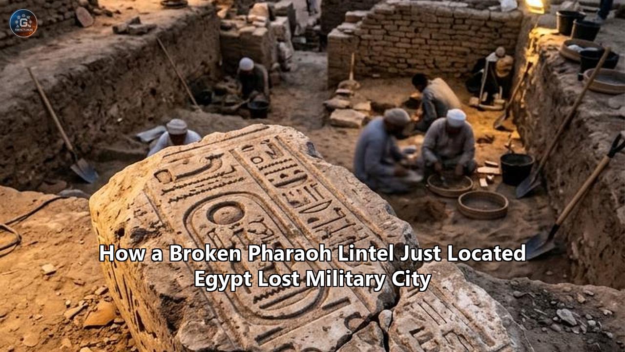
Egyptian archaeologists working along the Suez Canal corridor have identified a crucial missing link in the nation’s ancient frontier defenses. At Tell Abu Seify, an expansive mound near Qantara East in the Ismailia Governorate, an excavation mission led by the Supreme Council of Antiquities unearthed a massive sandstone door lintel split into two large fragments.
Carved across three faces with the royal cartouches and formal titulary of Pharaoh Ramesses II, the broken lintel bears an inscription that explicitly documents the imperial restoration of a sacred cult statue honoring Horus, designated specifically in the hieroglyphic text as the “Lord of the City of Masn”.
  ┌─────────────────────────────────────────────────────────────┐
  │         FRACTURED SANDSTONE LINTEL (TELL ABU SEIFY)         │
  │                                                             │
  │  [ Royal Titulary: Ramesses II ]    [ Sacred Restoration ]  │
  │  "Usermaatre Setepenre..."          "Statue of Horus..."    │
  │                                                             │
  │                  ┌───────────────────────┐                  │
  │                  │  Ḥr nb Msn            │                  │
  │                  │  "Lord of the City    │                  │
  │                  │   of Masn (Mesen)"    │                  │
  │                  └───────────────────────┘                  │
  │                                                             │
  │  ◄──────────── 140-Year Geographical Dilemma Solved ────────► │
  └─────────────────────────────────────────────────────────────┘
The discovery provides the long-sought epigraphic evidence linking the ruins of Tell Abu Seify to Masn (often transliterated as Mesen), an ancient fortified center celebrated in New Kingdom military annals, royal victory reliefs, and administrative papyri.
For nearly 140 years, Egyptologists and military historians debated the physical location of Masn, unsure whether the cult center of Horus of Mesen was an independent fortress, a secondary citadel, or an alternate designation for the nearby border fortress of Tjaru (modern Tell el-Habua). By anchoring the deity’s principal cult and royal monumental building works directly to Tell Abu Seify, the broken stone has clarified the territorial architecture of the Ways of Horus (Wawt Hor)—the ancient world’s most heavily defended desert highway.
"The inscription found on the lintel provides substantial archaeological and historical backing to the identification of Tell Abu Seify as ancient Masn," said Dr. Hisham El Leithy, Secretary General of Egypt’s Supreme Council of Antiquities. "This discovery clarifies how the New Kingdom secured its northeastern perimeter and organized troop mobilization, customs administration, and temple patronage along the gateway to the Levant".
Tracing how this discovery unfolded requires navigating a century-and-a-half timeline: from early 19th-century mapmaking errors and modern wartime disruptions in the Sinai to multi-decade stratigraphic excavations that transformed a neglected mudbrick mound into an imperial gateway.
CHRONOLOGICAL ESCALATION
│
├── 1880s–1920s: The Epigraphic Enigma (Early Canal Surveys & Papyrus Clues)
│
├── 1950s–1980s: The Militarized Isthmus (Sinai Conflicts & Barred Excavation)
│
├── 1990s–2010s: The North Sinai Megasurveys (Tell Habua Identified as Tjaru)
│
├── 2020–2025: Stratigraphy at Tell Abu Seify (Enclosure Walls, Roads & Scribe Statues)
│
└── 2026 Discovery: Fractured Sandstone & Confirmation of the Lost Military City
1880s–1920s: The Epigraphic Enigma and the 140-Year Hunt
The effort to locate Masn began during the late 19th century, spurred by the decipherment of the military campaign reliefs carved on the northern exterior wall of the Karnak Hypostyle Hall in Luxor. Commissioned by Seti I (c. 1290–1279 BC), these monumental stone scenes depict the pharaoh’s victorious march out of Egypt into Canaan along the Ways of Horus. The reliefs display a continuous strip of frontier fortifications, fortified water wells (bir), and fortified gateways, each guarded by defensive bastions and moats filled with reed-fringed water.
       SETI I FRONTIER RELIEFS: THE WAYS OF HORUS (WAWT HOR)
===================================================================
[Delta Border] ──► [Fortress of Tjaru] ──► [Masn / Cult of Horus]
                     │                       │
                     ▼                       ▼
            (Tell el-Habua)          (Tell Abu Seify)
                     │                       │
                     └───────────────┬───────┘
                                     │
                     [North Sinai Coastal Road]
                                     │
                                     ▼
                          [Gaza & Southern Levant]
===================================================================
Among the names inscribed in the hieroglyphic rosters was Masn, an ancient cult seat dedicated to Horus of Mesen, the spear-wielding falcon deity who served as the patron and divine protector of pharaonic armies marching into western Asia.
Late 19th-century philologists identified references to Masn across a suite of New Kingdom administrative and literary records:
- The Wilbour Papyrus and Papyrus Anastasi I: Ramesside scribal compositions that describe border officials inspecting military traffic and collecting tariffs along the frontier.
- Onomasticon of Amenope: A late 20th Dynasty geographic catalog placing Masn within the strategic network of the Fourteenth Nome of Lower Egypt (Khent-Ibt).
- The Myth of Horus of Edfu: Religious texts describing the legendary battles of the winged sun-disk against the forces of Seth, recording that the god established his northern base at Mesen to protect Egypt's Delta border from foreign incursions.
Despite extensive textual attestations, the physical location remained unknown.
When pioneering archaeologist Sir William Matthew Flinders Petrie surveyed the Eastern Delta in the 1880s, he located the garrison at Tell Dafana (Daphnae) and recorded massive enclosure walls. French engineer and antiquities inspector Jean Clédat conducted rapid surveys along the path of the newly built Suez Canal between 1900 and 1912, pinpointing mounds at Qantara, Tell Abu Seify, and Tell el-Habua. Clédat documented Roman-period brick installations and limestone blocks at Tell Abu Seify, noting the site's military posture, but lacked the stratigraphic depth and epigraphic evidence needed to tie it to the Pharaonic texts.
For over a century, academic debate fractured into competing camps:
- The Tjaru-Masn Equation: Scholars such as Alan Gardiner suggested that "Masn" was simply a religious or ceremonial epithet for the border capital Tjaru (Sile), arguing that Egypt would not have maintained two massive military-administrative hubs within a few miles of each other.
- The Far-Flung Citadel Hypothesis: Other researchers proposed that Masn was situated far deeper in the Sinai interior, or near Lake Menzaleh, functioning as a coastal lookout.
- The Tell Abu Seify Candidate: A minority of topographers hypothesized that Tell Abu Seify was the primary New Kingdom border bastion, which was subsequently renamed or modified in the Greco-Roman eras into the fortress city of Sile/Celasin.
Lacking in situ royal New Kingdom inscriptions, the search stalled, and the geographic coordinates of Masn remained unresolved in archaeological literature.
1950s–1980s: The Militarized Isthmus and Locked Frontiers
Mid-20th-century geopolitical conflicts transformed the Suez Canal zone and the Sinai Peninsula into an active war zone. The 1956 Suez Crisis, the 1967 Six-Day War, the War of Attrition, and the 1973 October War turned the ancient Ways of Horus back into modern military defensive lines.
MODERN CONFLICT & ARCHAEOLOGICAL CONFINEMENT
┌─────────────────────────────────────────────────────────────┐
│ 1956–1973: Suez Canal zone converted into active theater of │
│ war; archaeological tells covered in trenches and minefields│
├─────────────────────────────────────────────────────────────┤
│ 1970s: North Sinai Expedition (Eliezer Oren) charts coastal │
│ tells, identifying sprawling New Kingdom pottery scatters   │
├─────────────────────────────────────────────────────────────┤
│ 1982: Sinai returns fully to Egyptian civil administration; │
│ antiquities authorities face threat of agricultural canals  │
└─────────────────────────────────────────────────────────────┘
During this period, Tell Abu Seify, Tell el-Habua, and Tell el-Borg were fortified with modern artillery batteries, surface trenches, and minefields. Systematic archaeological fieldwork was impossible.
Despite the warfare, reconnaissance by the North Sinai Expedition during the 1970s, directed by Eliezer Oren of Ben-Gurion University, confirmed that the military road between the Suez Isthmus and Gaza contained high concentrations of Ramesside pottery, structural mudbrick remains, and imported Canaanite amphorae. The surveys showed that the pharaonic frontier was not a single boundary gate, but an interconnected chain of garrisons, watchtowers, and supply depots designed for logistical staging.
Following the 1982 return of the Sinai Peninsula to full Egyptian civil control, the Egyptian Antiquities Organization (now the Ministry of Tourism and Antiquities) faced a race against time. The planned construction of the El-Salam Canal—a massive irrigation project designed to transport Nile water beneath the Suez Canal to green thousands of acres of Sinai desert—threatened to submerge dozens of unexcavated ancient sites. Antiquities authorities organized salvage campaigns to document and preserve the military architecture of Egypt's eastern frontier before it was lost to infrastructural expansion.
1990s–2010s: The Sinai Megasurveys and the Tjaru Breakthrough
The 1990s marked the beginning of modern Egyptian archaeological operations in the North Sinai corridor. Spearheaded by Dr. Mohamed Abd El-Maksoud, the Egyptian North Sinai Archaeological Project launched excavations at Tell el-Habua, situated roughly 4 kilometers northeast of Qantara East.
Within a decade of continuous fieldwork, Tell el-Habua yielded evidence of a fortified metropolis:
- A pair of massive New Kingdom fortresses (Habua I and Habua II) enclosed by 4-meter-thick mudbrick walls reinforced with rectangular defensive towers.
- Royal administrative headquarters, monumental granaries capable of holding thousands of tons of grain, and deep defensive moats cutting through the sand.
- Stelae and lintels belonging to Thutmose III, Horemheb, Seti I, and Ramesses II, conclusively establishing Tell el-Habua as the legendary border city of Tjaru (the Roman fortress of Sile).
                   THE EASTERN DELTA GARRISON AXIS
======================================================================
  SITE               IDENTIFICATION      PRIMARY FUNCTION
──────────────────────────────────────────────────────────────────────
  Tell el-Habua      Tjaru (Sile)        Frontier Headquarters & Depot
  Tell el-Borg       Unnamed Fortresses  Dual 18th/19th Dyn. Forts
  Tell el-Kharouba   Frontier Fort       18th Dynasty Garrison Complex
  Tell Al-Abqain     Northwestern Fort   Western Libyan Defense Post
  Tell Abu Seify     Masn (Mesen)        Cult Sanctuary & Tactical Hub
======================================================================
While the identification of Tjaru was an important milestone in Eastern Mediterranean archaeology, it revived the unanswered question of Masn.
Excavations at nearby Tell el-Borg, directed by James K. Hoffmeier between 1999 and 2008, uncovered two distinct New Kingdom forts, defensive moats, and evidence of military engagements with Asiatic forces, but neither site produced an explicit in situ dedication identifying it as Masn.
If Tjaru was Tell el-Habua, where was the cult center of Horus of Mesen? Ancient liturgical texts indicated that the deity maintained an independent temple precinct near the frontier, complete with its own priesthood, royal endowment, and logistical garrison. Topographers redirected their focus toward Tell Abu Seify.
2020–2025: Stratigraphic Escalation at Tell Abu Seify
Beginning in 2020, an Egyptian archaeological mission directed by Dr. Hisham Hussein, Head of the Central Administration for Lower Egypt and Sinai, initiated an expansive, multi-season stratigraphic excavation across the elevated mounds of Tell Abu Seify.
Rather than a simple peripheral outpost, excavations revealed a long-lived, fortified administrative complex exhibiting continuous occupation from the New Kingdom down to the Late Roman and Byzantine eras.
TELL ABU SEIFY STRATIGRAPHIC COLUMN
┌─────────────────────────────────────────────────────────────┐
│ Byzantine Era (5th–6th c. AD)                               │
│ - Deconsecration; industrial lime production (2 kilns)     │
├─────────────────────────────────────────────────────────────┤
│ Roman Imperial Period (1st–3rd c. AD)                       │
│ - Castra barracks, military cantonment, narrow stone road  │
├─────────────────────────────────────────────────────────────┤
│ Ptolemaic Dynasty (3rd–1st c. BC)                           │
│ - Broad stone processional road, temple expansion          │
├─────────────────────────────────────────────────────────────┤
│ Saite Period (26th Dynasty, 664–525 BC)                     │
│ - Elite army scribe statue, limestone shrine dedication     │
├─────────────────────────────────────────────────────────────┤
│ New Kingdom (19th Dynasty / Ramesside Period, c. 1279 BC)    │
│ - Massive mudbrick enclosure, sandstone temple, royal lintel│
└─────────────────────────────────────────────────────────────┘
Between 2021 and 2024, the mission exposed a substantial mudbrick enclosure system. The outer walls, measuring several meters thick, were built with alternating courses of bonded mudbrick designed to withstand seismic settling and the erosive desert winds.
Within this perimeter, archaeologists uncovered:
- The Monumental Enclosure Gateways: Reinforced entrance corridors flanked by guard chambers, providing controlled access into a central sanctuary precinct.
- Storage and Administrative Magazines: A grid of linear, vaulted mudbrick storerooms running along the northern perimeter, containing large storage jars, carbonized grain remnants, and military ration vessels.
- Layered Processional Roads: Two distinct stone-paved thoroughfares leading toward the central enclosure. The lower, broader roadway dated to the Ptolemaic Period, constructed with finely fitted limestone slabs. Built directly atop its leveling layers was a narrower Roman paved road, demonstrating continuous institutional control over the access corridor across centuries.
             TEMPLE PRECINCT SCHEMATIC (TELL ABU SEIFY)
             ──────────────────────────────────────────

                 [ Northern Storage & Rations Depot ]
             ┌────────────────────────────────────────┐
             │  [Store]  [Store]  [Store]  [Store]    │
             │                                        │
[Ptolemaic / ├───────────┐                ┌───────────┤
 Roman Road] │ Gate A    │   SANCTUARY    │  Gate B   │
────────────►│           │    PRECINCT    │           │
             ├───────────┘   (Site of     └───────────┤
             │             Broken Lintel)             │
             │                                        │
             │  [Service] [Service] [Garrison Unit]   │
             └────────────────────────────────────────┘
                 [ Southern Quarters & Workshop Hub ]
As the trenches expanded, the team unearthed elite statuary indicating the site's high administrative status during the First Millennium BC. In one room, archaeologists uncovered a dark schist statue dating to the 26th Dynasty (Saite Period).
The sculpture depicted a high-ranking military scribe holding a naos (shrine). Though the naos had sustained ancient damage, the inscriptions detailed administrative oversight of border troops and tax assessments levied on Levantine maritime goods entering the Delta.
Adjacent layers yielded a headless royal torso carved from basalt, fragments of falcon statues rendered in both limestone and polished basalt, and broken royal stelae fragments from the Late Period.
               KEY ARTIFACT INVENTORY (2022–2025 SEASONS)
┌───────────────────────────┬───────────────────┬──────────────────────┐
│ ARTIFACT DESCRIPTION      │ MATERIAL          │ PERIOD/DYNASTY       │
├───────────────────────────┼───────────────────┼──────────────────────┤
│ Military Scribe Statue    │ Schist            │ 26th Dynasty (Saite) │
│ Royal Torso               │ Basalt            │ Late New Kingdom     │
│ Cultic Falcon Sculptures  │ Basalt / Limestone│ Late Period          │
│ Inscribed Jar Seals       │ Terracotta        │ Ramesside Period     │
│ Foundation Deposits       │ Ceramic / Stone   │ Ptolemaic            │
└───────────────────────────┴───────────────────┴──────────────────────┘
The artifacts confirmed that Tell Abu Seify was an administrative and military center, but the precise New Kingdom name of the city remained unconfirmed. The foundational Pharaonic core was buried beneath meters of Ptolemaic building works and Roman military barracks.
2026: Fractured Sandstone and the Epigraphic Breakthrough
During the 2026 excavation season, the mission focused on the deepest levels of the central temple precinct, excavating the collapse layers fronting the primary sandstone monumental gateway.
As field workers removed layers of late Roman debris and disintegrated mudbrick, they uncovered two large blocks of yellow-brown sandstone lying face-down in the dust. When cleared, conserved, and brought together, the blocks joined cleanly, forming a large architectural door lintel that had originally spanned the monumental stone portal of the sanctuary.
                  THE FRACTURED SANDSTONE LINTEL
        ◄────────────────────── 2.2+ METERS ──────────────────────►
  ┌──────────────────────────────┬──────────────────────────────┐
  │ [LEFT SECTION]               │ [RIGHT SECTION]              │
  │                              │                              │
  │  ╔════════════════════════╗  │  ╔════════════════════════╗  │
  │  ║ Wsr-mȝʿt-Rʿ Stp-n-Rʿ   ║  │  ║ Rʿ-ms-sw Mry-Jmn       ║  │
  │  ║ (Usermaatre Setepenre) ║  │  ║ (Ramesses Meryamun)    ║  │
  │  ╚════════════════════════╝  │  ╚════════════════════════╝  │
  │                              │                              │
  │  Inscribed: Face A, B & C    │  Inscribed: Face A, B & C    │
  │  Text: Royal Titulary        │  Text: Divine Restoration    │
  │                              │        "Ḥr nb Msn"           │
  │                   ▲                     ▲                   │
  │                   │                     │                   │
  └───────────────────┴─────────────────────┴───────────────────┘
                      ▲                     ▲
                      └────── FRACTURE ─────┘
                             (Clean Fit)
The lintel had suffered ancient breakage, falling from its structural pivots during an era of site remodeling, but its carved relief scenes and incised hieroglyphic columns remained legible. Inscribed on three of its exposed faces, the lintel presented a continuous epigraphic composition detailing the patronage of Ramesses II (c. 1279–1213 BC):
- The Royal Titulary: The horizontal registers on the front face display the two primary royal cartouches of Ramesses II—his prenomen (Usermaatre Setepenre, "The Justice of Ra is Powerful, Chosen of Ra") and his nomen (Ramesses Meryamun, "Fashioned by Ra, Beloved of Amun"). The names are surmounted by the double-plumed sun disk and flanked by uraei serpents holding ankh signs.
- The Cultic Epithet: Flanking the cartouches are vertical columns detailing the king's ritual obligations. The text records that Pharaoh Ramesses II undertook the physical renewal and re-consecration of a damaged cult statue representing the god Horus.
- The Crucial Toponym: The inscription designates the falcon deity not with a generic geographic title, but as Ḥr nb Msn—"Horus, Lord of the City of Masn".
                 HIEROGLYPHIC EPIGRAPHIC BREAKDOWN
┌─────────────────────────────────────────────────────────────┐
│ Transliteration: Ḥr nb Msn ... mnḫ mnw n Jmn-Rʿ ...         │
├─────────────────────────────────────────────────────────────┤
│ Hieroglyphic Elements:                                      │
│                                                             │
│   𓅃          𓎟            𓅓𓋴𓈖𓊖          𓇳𓏤𓄤𓊹          │
│  [Ḥr]       [nb]          [Msn + Niwt]      [Rʿ-nfr-nṯr]    │
│  Horus      Lord of       City of Masn      Good God, Ra    │
├─────────────────────────────────────────────────────────────┤
│ English Translation:                                        │
│ "The Living Horus, Strong Bull... King of Upper and Lower   │
│ Egypt, Usermaatre Setepenre, who restored the sacred monument│
│ of his father, Horus, Lord of the City of Masn..."          │
└─────────────────────────────────────────────────────────────┘
The presence of this inscription carved directly upon a primary sandstone load-bearing lintel—rather than a portable votive object or trade ostracon—alters the archaeological understanding of the site. In Egyptian temple construction, monumental stone lintels of this scale were quarried, inscribed, and hoisted into place exclusively at the cult center dedicated to the named deity.
Finding an explicit dedication to "Horus, Lord of the City of Masn" embedded in the core architectural fabric establishes that Tell Abu Seify is the physical site of Masn. This discovery located the long-searched lost military city Egypt had maintained along its frontier.
"This sandstone lintel is the epigraphic proof that topographers have sought for generations," stated Dr. Hussein during the on-site press briefing. "We are no longer guessing based on papyrological itineraries or secondary Roman itineraries. We are standing in the sanctuary of Horus of Mesen itself".
Anatomy of the Stone: Epigraphy, Quarrying, and Royal Propaganda
The lintel is made of silicified sandstone (orthoquartzite), a dense stone that was not available in the Nile Delta. Petrographic assessments indicate the material was quarried hundreds of kilometers to the south, at the royal sandstone quarries of Gebel el-Silsila in Upper Egypt.
                       MATERIAL LOGISTICS ROUTE
======================================================================
  [Gebel el-Silsila Quarries] ──► Transported via Nile Barges
                                             │
                                             ▼
  [Memphis Staging Hub]       ──► Channeled via Eastern Delta Canals
                                             │
                                             ▼
  [Tell Abu Seify / Masn]     ──► Carved In Situ & Hoisted into Portal
======================================================================
The logistical effort required to transport a multi-ton block of sandstone down the Nile, through Delta waterways, and onto the desert-frontier edge of the Sinai reflects the strategic value the crown placed on this fortress city.
The hieroglyphs are carved in sunk relief (relief en creux), a technique favored during the Ramesside period for exterior architectural surfaces exposed to intense sunlight. Sunk relief casts sharp interior shadows, ensuring the king’s names and theological proclamations remained visible across open parade grounds and courtyards.
                 RAMESSIDE TEMPLE RESTORATION SYNTAX
┌──────────────────────────────────────────────────────────────────┐
│ Formula: smnḫ mnw njt... ("The Renewal of Monuments...")         │
├──────────────────────────────────────────────────────────────────┤
│ Function:                                                        │
│ 1. Theological: Legitimizes the Pharaoh as the loyal son and     │
│    protector of the regional god (Horus of Mesen).               │
│ 2. Political: Asserts total crown control over frontier temple   │
│    estates, grain reserves, and tariff collection points.        │
│ 3. Military: Serves as monumental propaganda for outgoing troops │
│    mustering along the Ways of Horus toward Canaan.              │
└──────────────────────────────────────────────────────────────────┘
The syntax of the inscription conforms to the standard Ramesside smnḫ mnw formula, used when a pharaoh restored, repaired, or enlarged a sanctuary founded by his predecessors.
Ramesses II frequently toured and rebuilt the eastern frontier bases—including Pi-Ramesses (Qantir), Tjaru (Tell el-Habua), and Athribis (Tell Atrib)—to ensure logistical systems were prepared for major clashes against the Hittite Empire in Syria and the Levant.
The lintel demonstrates that Masn received dedicated royal patronage, confirming its status as a vital frontier base.
The 1,500-Year Life Cycle: Stratigraphy and Conversion
The discovery of the Ramesside lintel at Tell Abu Seify has also clarified the occupational stratigraphy of the mound. The site did not remain a static Pharaonic border post; it evolved over 1,500 years in response to shifting imperial masters, trade routes, and military doctrines.
                HISTORICAL TIMELINE OF TELL ABU SEIFY
┌───────────────────────────────────────────────────────────────────┐
│ 1300–1100 BC: New Kingdom Staging Base                            │
│ - Construction of Horus temple, mudbrick enclosure, granaries    │
├───────────────────────────────────────────────────────────────────┤
│ 664–525 BC: Saite Border Customs Hub                              │
│ - Administrative expansion; stationing of Greek/Carian mercenaries│
│   and elite military scribes                               │
├───────────────────────────────────────────────────────────────────┤
│ 305–30 BC: Ptolemaic Commercial Nexus                             │
│ - Overhaul of sanctuary; construction of stone processional road │
├───────────────────────────────────────────────────────────────────┤
│ 30 BC – 350 AD: Roman Frontier Castra                             │
│ - Sanctuary converted into military barracks; road repaved      │
├───────────────────────────────────────────────────────────────────┤
│ 400–600 AD: Byzantine Industrial Deconsecration                   │
│ - Construction of circular lime kilns over pagan sanctuary       │
└───────────────────────────────────────────────────────────────────┘
1. The New Kingdom Imperial Hub (c. 1550–1070 BC)
During the 18th and 19th Dynasties, Masn functioned as an administrative and defensive sister site to Tjaru. While Tjaru served as the primary customs terminal, fortress gate, and assembly point for the army's four divisions (Amon, Ra, Ptah, and Set), Masn was the cult sanctuary and tactical coordination center for the chariot corps and frontier scouts.
Its massive mudbrick enclosure walls shielded vast granaries, weapons repair shops, and the central stone temple dedicated to Horus of Mesen.
2. The Saite Dynasty Customs and Security Reorganization (664–525 BC)
Following centuries of political fragmentation during the Third Intermediate Period, Pharaoh Psamtik I and his successors refortified the eastern Delta to guard against Neo-Babylonian and Achaemenid Persian threats.
The Saite monarchs stationed foreign mercenary garrisons (Carians, Ionians, and Phoenicians) along the Isthmus, supervised by Egyptian administrative officers.
The discovery of the dark schist scribe statue at Tell Abu Seify shows that Saite administrative authorities maintained an active presence within the Horus temple, tracking supply lines and enforcing customs duties on incoming desert caravans.
                     SAITE SCRIBE STATUE CONTEXT
┌──────────────────────────────────────────────────────────────────┐
│ Material: High-density polished dark schist                      │
│ Date: 26th Dynasty (c. 600 BC)                                   │
│ Iconography: Squatting scribe holding a sacred naos (shrine)     │
│ Role: Royal frontier overseer managing customs and supply trains │
└──────────────────────────────────────────────────────────────────┘
3. The Ptolemaic Architectural Expansion (305–30 BC)
Under the Ptolemaic kings, Egypt’s trade with the Hellenistic Mediterranean and the Nabataean kingdom surged.
Tell Abu Seify was expanded, and its Pharaonic temple was renovated using limestone and sandstone masonry.
The mission excavated a stone-paved processional road dating to this era, showing that the sanctuary of Horus of Mesen continued to receive royal patronage, retaining its cultic and administrative standing under Macedonian-Greek rule.
                    THE DUAL PAVED ROAD SYSTEMS
======================================================================
  [Upper Layer: Roman Imperial Road]
  - Narrower width (approx. 3.5m)
  - Constructed using reused stone & compact pavers
  - Direct access to military barracks and administrative offices
──────────────────────────────────────────────────────────────────────
  [Lower Layer: Ptolemaic Processional Road]
  - Broad width (approx. 6.2m)
  - High-precision fitted limestone slabs
  - Direct ceremonial approach into the Horus Temple Sanctuary
======================================================================
4. The Roman Cantonment and Barracks (1st–3rd Century AD)
Following the Roman annexation of Egypt in 30 BC, the frontier was restructured under the Praefectus Aegypti. By the 3rd century AD, the sanctuary complex at Tell Abu Seify was repurposed into Roman military barracks (castra).
Excavators uncovered internal dividing walls of brick partitioning the former sacred courtyards into soldier cantonments, weapon storage cells, and communal cooking ovens. A narrower stone road was paved directly atop the Ptolemaic thoroughfare to accommodate cavalry patrols and military wagons.
        ROMAN CASTRA RESTRUCTURING OF THE HORUS SANCTUARY
┌─────────────────────────────────────────────────────────────┐
│  FORMER SACRED SANCTUARY     ►   ROMAN MILITARY CANTONMENT  │
├──────────────────────────────┬──────────────────────────────┤
│  Inner Cult Sanctuary        ►   Troop Barracks & Mess Hall │
│  Outer Open Courtyard        ►   Parade Ground & Wagon Park │
│  Ptolemaic Processional Way  ►   Narrowed Patrol Road      │
│  Temple Priestly Storerooms  ►   Armory & Grain Silos       │
└──────────────────────────────┴──────────────────────────────┘
5. Byzantine Industrial Use: The Lime Kilns (4th–6th Century AD)
The final ancient occupational phase brought the end of the site's monumental architecture. As Christianity spread across Late Roman and Byzantine Egypt, ancient pagan temples were decommissioned.
Archaeologists discovered two circular lime kilns built directly over the corners of the former Horus sanctuary. The kilns contained deep strata of burnt limestone, ash, and fragmented decorative reliefs.
               THE LATE ANTIQUE LIME-PRODUCTION KILNS
┌─────────────────────────────────────────────────────────────┐
│ Structure: Dual circular brick-and-mortar kilns (Dia: 4.8m) │
│ Location: Built directly over the corners of the Sanctuary  │
│ Contents: Vitrified limestone fragments, burnt mortar, ash  │
│ Function: Recycling Pharaonic/Ptolemaic masonry for mortar  │
└─────────────────────────────────────────────────────────────┘
Late Antique builders quarried the site's limestone walls and statues, burning the rock inside the kilns to produce quicklime for new building projects, churches, and defensive walls at Pelusium and Clysma.
The yellow sandstone lintel of Ramesses II survived this destruction because it was made of sandstone—which cannot be processed into lime—leading the workers to push it aside into the debris, preserving its inscription for modern excavators.
Frontier Geopolitics: The Horus Military Road and Border Defense
The definitive location of Masn at Tell Abu Seify reshapes how historians understand ancient Egypt’s border defenses. The northeastern frontier was guarded by an integrated defense network that controlled desert routes, regulated maritime and lagoon traffic, and supported rapid force projection.
                 THE WAYS OF HORUS DEFENSE SYSTEM
┌────────────────────────────────────────────────────────────────┐
│ 1. EARLY WARNING & PATROLS: Watchtowers and Shasu scout lines  │
├────────────────────────────────────────────────────────────────┤
│ 2. FRONTIER CHOKEPOINTS: Tjaru (Tell el-Habua) fortresses     │
├────────────────────────────────────────────────────────────────┤
│ 3. CULT & COMMAND HEADQUARTERS: Masn (Tell Abu Seify)         │
├────────────────────────────────────────────────────────────────┤
│ 4. WATER & LOGISTICAL CORRIDOR: Fortified wells (bir) to Gaza  │
├────────────────────────────────────────────────────────────────┤
│ 5. WESTERN COUNTERPART: Tell Al-Abqain fortress network       │
└────────────────────────────────────────────────────────────────┘
New Kingdom defense strategy operated across two fronts:
- The Eastern Axis (The Ways of Horus): Guarded Egypt from Levantine confederations, the Mitanni, the Hittites, and nomadic Shasu raiders. Anchored by the twin fortresses of Tjaru and Masn, it managed a line of fortified wells, watchtowers, and way-stations stretching across the North Sinai coast to Gaza.
- The Western Axis (The Libyan Frontier): Guarded against Libyan Meshwesh and Sea Peoples incursions. This flank was secured by garrison outposts like Tell Al-Abqain in the northwestern Delta, where excavations recently uncovered a Ramesside bronze sword, barracks, and granaries.
                     TWO-FRONT RAMESSIDE STRATEGY
======================================================================
  WESTERN DELTA FRONTIER          EASTERN DELTA FRONTIER
  (Libyan / Sea Peoples Defense)  (Levantine / Hittite Defense)
──────────────────────────────────────────────────────────────────────
  Anchor: Tell Al-Abqain          Anchor: Masn (Tell Abu Seify)
  Key Find: Ramesses II Sword     Key Find: Ramesses II Lintel
  Threat: Meshwesh Raiders        Threat: Levantine / Shasu Forces
======================================================================
Masn served as an essential operational center for Ramesside defense. Situated at the convergence of the Pelusiac branch of the Nile, the Ballah Lakes, and the Sinai desert trails, Masn controlled both land and water access.
Troops assembling for Levantine campaigns departed the capital at Pi-Ramesses, passed through the customs terminals at Tjaru, and gathered at Masn to receive blessings at the Temple of Horus of Mesen and collect final rations before marching across the Sinai desert.
With the lintel in situ, this lost military city Egypt built and rebuilt across dynasties can now be placed accurately on historical maps.
Archaeological Field Methods: Uncovering Tell Abu Seify
The recovery of the sandstone lintel and its surrounding temple complex showcases the methodologies employed by Egyptian archaeological teams.
                  EXCAVATION & ANALYSIS WORKFLOW
┌─────────────────────────────────────────────────────────────┐
│ 1. REMOTE SENSING: Magnetometer & Ground-Penetrating Radar  │
├─────────────────────────────────────────────────────────────┤
│ 2. STRATIGRAPHIC TRENCHING: Systematic removal of debris    │
├─────────────────────────────────────────────────────────────┤
│ 3. EPIGRAPHIC RECORDING: Photogrammetry & 3D mesh modeling  │
├─────────────────────────────────────────────────────────────┤
│ 4. PETROGRAPHIC ANALYSIS: Stone sourcing & quarry profiling │
├─────────────────────────────────────────────────────────────┤
│ 5. CONSERVATION & STABILIZATION: Desalination & assembly    │
└─────────────────────────────────────────────────────────────┘- Geophysical Prospection and Magnetometry: Prior to deep trenching, the mission mapped the subsurface architecture using fluxgate gradiometers. The resulting magnetic anomaly maps identified the buried mudbrick enclosure walls, internal partition rooms, and the stone-paved processional roads, allowing the team to excavate without damaging fragile mudbrick walls.
- Stratigraphic Trenching and Section Profiling: The team cleared post-depositional overburden, documenting the Late Roman lime kilns and Ptolemaic road levels before exposing the Ramesside foundational strata.
- Photogrammetric Epigraphy and 3D Modeling: Following the discovery of the two lintel fragments, specialists completed high-resolution digital photogrammetry. The digital models captured every incised hieroglyphic character, weathering pattern, and tool mark.
- Desalination and Structural Conservation: Centuries of exposure to Sinai groundwater and agricultural drainage had introduced soluble salts into the sandstone blocks. Conservators isolated the lintel fragments in controlled drying facilities, applying poultices to extract salt crystals before structurally joining the two halves with non-invasive fiberglass reinforcement rods.
              DIGITAL PHOTOGRAMMETRIC DATA WORKFLOW
┌─────────────────────────────────────────────────────────────┐
│ 400+ High-Resolution RAW Photographs (Cross-Polarized Light)│
│                              │                              │
│                              ▼                              │
│ Dense Point-Cloud Generation & 3D Polygonal Mesh Modeling   │
│                              │                              │
│                              ▼                              │
│ Texture Mapping & Digital Elevation Relief Models           │
│                              │                              │
│                              ▼                              │
│ Sub-Millimeter Epigraphic Drawing & Hieroglyphic Collation  │
└─────────────────────────────────────────────────────────────┘
The Next Horizon: Upcoming Milestones in Frontier Archaeology
The discovery of the Ramesses II lintel at Tell Abu Seify provides fresh impetus for archaeological research across the Sinai corridor.
                UPCOMING EXCAVATION MILESTONES
┌─────────────────────────────────────────────────────────────┐
│ 1. Deep Core Drilling: Probing pre-19th Dynasty layers      │
├─────────────────────────────────────────────────────────────┤
│ 2. Harbor Basin Survey: Mapping ancient anchorages          │
├─────────────────────────────────────────────────────────────┤
│ 3. Digital GIS Mapping: Integrating Tjaru, Masn, and Sinai  │
├─────────────────────────────────────────────────────────────┤
│ 4. Museum Display: Preparing the conserved lintel for loan  │
└─────────────────────────────────────────────────────────────┘
1. Deep Probing of Pre-Ramesside Strata
Excavations will push below the 19th Dynasty temple foundations to reach Middle Kingdom and Second Intermediate Period (Hyksos) horizons. Discovering whether Masn served as a fortified stronghold during the Hyksos era (c. 1650–1550 BC) could provide new insight into the military campaigns of Pharaoh Ahmose I, who drove the Hyksos out of the Delta.
2. Harbor and Basin Prospection
Geomorphologists working alongside the archaeological team are conducting sediment core drilling around the perimeter of Tell Abu Seify. The goal is to locate the ancient harbor or canal basin that connected Masn to the Pelusiac Nile branch and the Mediterranean lagoon system, clarifying the logistics of military troop transport by boat.
              ANCIENT HYDROLOGICAL PROFILE (PROJECTED)
======================================================================
  [Pelusiac Nile Branch] ──► [Fortified Harbor Basin at Masn]
                                        │
                                        ▼
  [Navigable Lagoon System] ──► Direct Access to the Mediterranean Sea
======================================================================
3. Integrated GIS Mapping of the Frontier Network
The Ministry of Tourism and Antiquities is compiling a comprehensive Geographic Information System (GIS) database linking data from Tell Abu Seify, Tell el-Habua (Tjaru), Tell el-Borg, Tell el-Kharouba, and Tell el-Maskhuta. This spatial model will map troop march times, signaling networks between watchtowers, and supply transport times along the Ways of Horus.
4. Conservation, Museum Exhibition, and Cultural Tourism
Following final conservation treatment, the Ramesses II sandstone lintel will be placed on display, likely within the Grand Egyptian Museum (GEM) in Giza or the Ismailia Museum, which houses regional artifacts from the Suez Canal and Sinai excavation projects.
The identification of Tell Abu Seify as Masn solves a 140-year-old geographical mystery, revealing how a broken sandstone lintel helped researchers locate the lost military city Egypt relied on to defend its northeastern border. Excavations at the site continue to unearth new chapters in the long military history of Egypt’s eastern frontier.
======================================================================
                     SUMMARY OF SITE DISCOVERY
──────────────────────────────────────────────────────────────────────
  • Location: Tell Abu Seify, Qantara East, Ismailia Governorate
  • Identification: Masn (Mesen), Cult Seat of Horus of Mesen
  • Key Artifact: Silicified Sandstone Lintel of Ramesses II
  • Historical Range: New Kingdom (c. 13th c. BC) to Byzantine Period
  • Significance: Resolves a 140-year debate on the Ways of Horus
======================================================================
Reference:
- https://www.thenationalnews.com/arts-culture/2026/08/16/archaeologists-may-have-found-egypts-lost-city-of-masn/
- https://www.arabianbusiness.com/abnews/archaeologists-find-lost-city
- https://economictimes.indiatimes.com/news/new-updates/a-3000-year-old-ramesses-ii-inscription-sparks-fresh-mystery-over-egypts-lost-city-of-masn/articleshow/133516726.cms?from=mdr
- https://archaeology.org/news/2026/08/19/new-discoveries-link-sinai-site-with-lost-egyptian-city/
- https://armstronginstitute.org/1354-3500-year-old-egyptian-fortress-uncovered
- https://www.smithsonianmag.com/smart-news/these-ancient-egyptian-barracks-paint-a-vivid-picture-of-military-life-during-the-reign-of-Ramses-ii-180985082/
- https://timesofindia.indiatimes.com/world/rest-of-world/a-3000-year-old-inscription-naming-masn-may-help-archaeologists-identify-the-lost-egyptian-city/articleshow/133297906.cms
- https://www.britishmuseum.org/collection/object/Y_EA1344
- https://www.britishmuseum.org/collection/object/Y_EA1708
- https://www.facebook.com/Cosmocuriouss/posts/a-3000-year-old-inscription-naming-an-ancient-egyptian-city-has-emerged-as-a-new/122205827072762872/