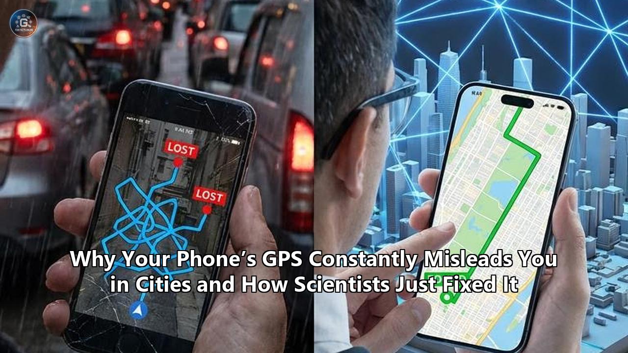
On the wet, historic streets of Trondheim, Norway, an electric test vehicle equipped with a standard consumer-grade satellite receiver navigated a series of narrow, cobblestone alleys lined with tall, brick warehouses. To a typical smartphone, these towering structures represent a navigational dead zone—a place where the blue location dot begins to drift wildly, jumping across blocks, placing the vehicle on rooftops, or stranding it on the wrong side of a canal. Yet, the dashboard computer on this vehicle registered its location with unwavering, sub-decimeter precision.
This real-world test marked the public debut of SmartNav, a positioning engine developed by a research team at the Norwegian University of Science and Technology (NTNU). Led by doctoral fellow Ardeshir Mohamadi, alongside professors Hossein Nahavandchi and Amir Khodabandeh, their work represents a major transition in urban localization: the mathematical elimination of the "urban canyon" error that has plagued global navigation satellite systems (GNSS) since their civilian inception.
By combining three distinct technologies—phase-only wave tracking, precise global corrections, and 3D digital twins of cities—the NTNU team succeeded in making cheap, mass-market receivers almost as accurate as the $10,000 specialized instruments used by professional land surveyors. In real-world urban testing, SmartNav delivered a positioning accuracy of better than ten centimeters in 90% of cases.
This is not just a minor software update; it is a fundamental restructuring of how devices interact with the physical world. For years, the inability of satellite signals to reliably penetrate and navigate dense urban areas has been the quiet roadblock holding back level 4 and 5 autonomous driving, precision drone delivery corridors, and seamless augmented reality. The science behind how your phone’s GPS has misled you for decades—and the exact mechanisms of the scientific breakthrough that finally fixed it—reveals a high-stakes arena where physics, software, and international geopolitics collide.
The Mechanics of the Glitch: Why Is My GPS Inaccurate?
To comprehend how scientists resolved this multi-decade challenge, one must first dismantle the mechanics of satellite navigation and understand why the environment of a modern city is fundamentally hostile to its design.
Civilian satellite navigation relies on a process called trilateration. A GNSS receiver—whether it is the chip inside your smartphone, a smartwatch, or a modern automobile—does not actually "communicate" with satellites. It is a one-way radio receiver. Overhead, constellations of satellites (such as the American GPS, the European Galileo, the Chinese BeiDou, and the Russian GLONASS) continuously broadcast radio signals.
These signals contain two primary pieces of information: the satellite's precise position in space (ephemeris data) and the exact nanosecond the signal was transmitted, governed by highly stable onboard atomic clocks.
[Satellite] (Precise Ephemeris + Nanosecond Timestamp)
    │
    │  ~20,000 km travel distance (at the speed of light)
    ▼
[Smartphone] (Measures Time-of-Arrival vs. Local Quartz Clock)
The receiver captures this signal and compares the timestamp of transmission against its own internal quartz clock. By calculating the time difference and multiplying it by the speed of light ($c \approx 299,792,458 \text{ meters per second}$), the receiver determines its distance from the satellite, known as a "pseudorange".
Because the receiver’s internal clock is far less accurate than a satellite’s atomic clock, it introduces a clock bias. To solve for its precise three-dimensional coordinates (latitude, longitude, and altitude) as well as its internal clock error, the receiver must acquire signals from a minimum of four satellites simultaneously, solving a system of four quadratic equations:
$$\rho_i = \sqrt{(x_i - x)^2 + (y_i - y)^2 + (z_i - z)^2} + c \cdot (\delta t_{rcv} - \delta t_{sat}) + I_i + T_i + M_i + \epsilon_i$$
Where:
- $\rho_i$ is the measured pseudorange to satellite $i$.
- $(x_i, y_i, z_i)$ are the known coordinates of the satellite.
- $(x, y, z)$ are the unknown coordinates of the receiver.
- $c$ is the speed of light.
- $\delta t_{rcv}$ is the receiver clock bias.
- $\delta t_{sat}$ is the satellite clock bias.
- $I_i$ and $T_i$ represent ionospheric and tropospheric atmospheric delays.
- $M_i$ represents multipath interference.
- $\epsilon_i$ represents receiver system noise.
Under ideal conditions—such as a flat highway with a clear, unobstructed line-of-sight to the open sky—this system works beautifully, yielding horizontal accuracies within three to five meters. But when you step off the subway and walk into a downtown area, this math breaks down, prompting many to ask: why is my gps inaccurate when navigating between city blocks?
Multipath Propagation: The Mirror Effect
The primary physical culprit in urban environments is multipath propagation. In a dense cityscape, the direct line-of-sight between your phone and a satellite is frequently blocked by skyscrapers made of glass, steel, and concrete. However, radio waves do not simply vanish when they hit a building; they bounce.
  Line-of-Sight Blocked
       [Satellite]
            │
            │   Reflected Signal (Delayed Path)
            ▼       ╱
     [Skyscraper]  ╱
          │  ╲    ╱
          │   ▼  ▼
          │  [Smartphone] (Tricked by the longer path length)
If your receiver cannot view the satellite directly but catches a signal that has reflected off a glass tower across the street, it records a delayed arrival time. Because radio signals travel at the speed of light, a detour of a mere 100 meters (roughly 330 feet) as the signal bounces off a facade adds approximately 333 nanoseconds to the travel time.
To the mathematical processing engine of your phone, this delay makes the satellite appear 100 meters further away than it actually is. When the receiver integrates this inflated pseudorange into its trilateration calculations, the coordinate system warp throws your calculated position off by dozens of meters, shifting your blue dot onto a parallel street or inside a solid building.
Dilution of Precision (DOP)
This problem is severely compounded by a geometric phenomenon known as Dilution of Precision (DOP). To calculate an accurate 3D coordinate, a receiver needs satellites to be widely distributed across the sky—some directly overhead, others low on the horizon to the north, south, east, and west. This open distribution provides a strong geometric foundation, minimizing the area of uncertainty where the distance spheres intersect.
In an urban canyon, however, the tall buildings acting as walls block the low-elevation satellites. The receiver can only "see" a narrow strip of sky directly overhead.
Consequently, all visible satellites are clustered closely together. This poor geometric layout results in high Dilution of Precision (specifically, Horizontal Dilution of Precision, or HDOP), which acts as a mathematical multiplier on any existing errors. A minor 5-meter multipath reflection error, when multiplied by an HDOP of 8, instantly escalates into a 40-meter positioning error on the ground.
The Hardware Bottleneck: Why Your Smartphone is Physically Blind to Reflections
To understand why this issue has persisted for so long, we must look beyond the math and examine the physical hardware constraints of modern consumer electronics. Professional surveying equipment can achieve centimeter-level accuracy even in challenging environments, but these systems are physically and economically unfeasible for everyday use.
The primary difference lies in the antenna. To appreciate why is my gps inaccurate on a standard smartphone, we have to look at the massive compromise made during the industrial design of consumer mobile devices.
Right-Hand vs. Left-Hand Polarization
GNSS satellites transmit their signals using Right-Hand Circular Polarization (RHCP). This means the electric field of the radio wave rotates clockwise as it propagates through space.
When an RHCP radio wave reflects off a surface—such as the glass window of a skyscraper or a metal bus stop—its polarization reverses, converting it into a Left-Hand Circular Polarized (LHCP) wave.
[Satellite] (RHCP Wave) ───> [Skyscraper Facade] (Reflection Point) ───> (LHCP Wave) ───> [Receiver]Professional, geodetic-grade GNSS antennas (which are often large, heavy, saucer-like structures costing thousands of dollars) are meticulously engineered to accept only RHCP signals. They feature high polarization purity, meaning they naturally reject LHCP signals.
When a reflected, delayed wave hits a professional antenna, it is electronically filtered out. Furthermore, geodetic setups often use "choke rings"—concentric, heavy metal rings that physically trap and ground low-elevation reflections coming up from the dirt or nearby structures.
Now, consider the smartphone in your pocket. To maintain a sleek, thin profile, manufacturers cannot use large circular-polarized ceramic patches. Instead, they rely on highly compact, cheap linear-polarized antennas, typically structured as Planar Inverted-F Antennas (PIFAs) or integrated directly into the metal frame of the phone.
A linear-polarized antenna is omnidirectional and completely blind to the polarization of incoming waves. It accepts RHCP (direct) and LHCP (reflected) waves with equal efficiency.
Your phone physically cannot distinguish between a pristine, direct signal coming from space and a corrupt, multipath reflection that has bounced off three different buildings. It swallows both, throwing the raw data into a chaotic state.
Duty Cycling: The Battery-Saving Saboteur
Compounding this poor antenna quality is a software-level battery-saving technique implemented by mobile operating systems called "duty cycling".
Operating a GNSS chip at full capacity is one of the most power-hungry processes a smartphone can perform. To preserve battery life, mobile operating systems periodically power down the GNSS hardware. The chip might wake up for a fraction of a second to take a quick reading (measuring the code phase) and then sleep for the remainder of that second.
While this duty cycling is highly effective for battery conservation, it introduces a massive technical trade-off: it destroys the continuity of the carrier phase of the satellite signal. If the receiver is constantly shutting down and restarting, it cannot maintain a continuous lock on the raw radio waves.
It experiences frequent "cycle slips"—unpredictable jumps in the wave tracking loop that prevent the phone from utilizing advanced carrier-phase positioning techniques. For years, this meant smartphones were strictly limited to coarse, code-based positioning, which is highly vulnerable to urban reflection errors.
The 2016 Raw GNSS Revolution
The landscape began to shift in 2016 when Google released Android Nougat (OS 7.0). For the first time, Google opened up an API that allowed developers to bypass the internal, proprietary "black box" chipsets of smartphone manufacturers and access raw GNSS measurements.
Suddenly, researchers and developers could read the raw pseudoranges, Doppler shifts, and accumulated delta ranges (carrier phase) directly from the device.
┌─────────────────────────────────────────┐
│          Old Android Architecture       │
│  [GNSS Chip] ──> [Closed Proprietary OS]──> [Finished NMEA Coordinate String]
└─────────────────────────────────────────┘

┌─────────────────────────────────────────┐
│        Modern Android (Post-2016)       │
│  [GNSS Chip] ──> [Raw GNSS API] ────────> [Raw Carrier Phase, Pseudoranges, Doppler]
└─────────────────────────────────────────┘
This API opening sparked a global academic race, culminating in events like the Google Smartphone Decimeter Challenge, as researchers attempted to write software engines that could clean up this incredibly noisy, reflection-heavy mobile data. This raw data accessibility laid the technical groundwork for the development of SmartNav.
Pillar 1: Phase-Only Positioning (The Mathematics of Waves)
To overcome the physical limitations of cheap mobile hardware and the brutal environment of city streets, the NTNU research team turned to a sophisticated mathematical technique: Phase-Only Positioning.
To understand this breakthrough, we must look at the two layers of information transmitted by GNSS satellites: the code and the carrier wave.
Carrier Wave (e.g., L1 Frequency: 1.575 GHz, Wavelength: ~19 cm)
  /\    /\    /\    /\    /\    /\    /\    /\
 /  \  /  \  /  \  /  \  /  \  /  \  /  \  /  \

PRN Code (Modulated on top, Binary "Chips", Width: ~300 meters)
 ───┐   ┌───┐       ┌───┐   ┌───────┐   ┌───
    └───┘   └───────┘   └───┘       └───┘
Historically, civilian GPS receivers have relied on the binary code (the Pseudo-Random Noise, or PRN, code) to calculate distance. The standard civilian GPS code (L1 C/A code) has a chipping rate of 1.023 MHz, meaning each binary "chip" of the code is approximately 300 meters wide.
A standard receiver’s internal delay lock loop (DLL) tries to align a locally generated version of this code with the incoming signal. Under perfect conditions, the DLL can resolve this alignment to about 1% of the chip width, giving an inherent hardware precision of about three meters.
However, because the code chips are so physically wide, a delayed multipath reflection can easily merge with the direct signal, shifting the correlation peak by dozens of meters without the receiver even noticing.
SmartNav addresses this by ignoring the binary code entirely. Instead, it tracks the underlying carrier wave itself—specifically, the L1 carrier wave, which operates at a frequency of 1.575 GHz.
The wavelength of this radio wave is not 300 meters; it is roughly 19 centimeters. If a receiver can track the phase of this carrier wave (determining whether the wave is rising, falling, or at its peak when it strikes the antenna), it can mathematically resolve the distance to the satellite down to a fraction of a millimeter.
The Integer Ambiguity Problem
But carrier-phase tracking introduces a massive mathematical hurdle known as the Integer Ambiguity Problem. While your receiver can measure the exact fractional phase of the incoming wave (for instance, that it is currently 45 degrees into its cycle, representing 2.3 centimeters of travel), it has no way of knowing how many full 19-centimeter waves are currently in transit between the satellite, orbiting 20,000 kilometers away, and the device.
This unknown, integer number of full wavelengths is represented by the variable $N$.
$$\Phi = r + c \cdot (\delta t_{rcv} - \delta t_{sat}) - I + T + \lambda \cdot N + M_{\Phi} + \epsilon_{\Phi}$$
Where:
- $\Phi$ is the measured carrier phase (expressed in meters).
- $\lambda$ is the wavelength of the carrier signal (e.g., 19 cm for L1).
- $N$ is the unknown integer ambiguity.
- $M_{\Phi}$ is the carrier phase multipath error.
- $\epsilon_{\Phi}$ is the carrier phase noise.
This equation highlights why phase-only tracking is so attractive: while code-multipath errors ($M_i$) can easily exceed 50 to 100 meters in cities, carrier-phase multipath errors ($M_{\Phi}$) are physically bounded. They can never exceed a quarter of the carrier wavelength—meaning that for the L1 signal, the maximum possible carrier multipath error is physically capped at roughly 4.75 centimeters.
But how do you solve for $N$ when you have thrown out the code measurements that usually guide you to the correct ballpark?
Historically, solving for $N$ required the receiver to remain completely stationary in an open-sky environment for 15 to 30 minutes, slowly observing the orbital motion of the satellites until the changing geometry allowed the mathematical filters to "converge" and isolate the exact integers. This is known as static initialization.
Clearly, requiring a pedestrian or a self-driving car to sit motionless for half an hour before navigating a city street is a non-starter.
Resolving Ambiguities in Motion: The LAMBDA Transformation
To bypass this initialization bottleneck, the NTNU researchers implemented a sophisticated multi-epoch mathematical engine based on the LAMBDA (Least-squares AMbiguity Decorrelation Adjustment) method, originally formulated by Dutch geodetic scientist Paul Teunissen in 1995.
The fundamental challenge in resolving integer ambiguities on a moving platform is that the variables are highly correlated with one another. If you change your guess for the integer ambiguity of Satellite A, it shifts your mathematical solution for Satellite B, C, and D.
This creates an extremely complex, multi-dimensional search space where finding the absolute correct set of integers is computationally overwhelming for a mobile processor.
The LAMBDA method performs an integer bootstrapping transformation. It applies a mathematical matrix that decorrelates the raw phase measurements, transforming the elongated, highly correlated multi-dimensional search ellipse into a near-perfect sphere.
Correlated Search Space (Elongated Ellipse)
     (  ●   ●   ●   ●   ●  )
    (  ●   ●   ●   ●   ●  )    <── Very difficult to isolate the true integer set
     (  ●   ●   ●   ●   ●  )

LAMBDA Decorrelation Transformation
            │
            ▼
Decorrelated Search Space (Perfect Sphere)
         ┌─────────┐
         │  ●   ●  │
         │●   ★   ●│       <── True integer (★) is easily and rapidly isolated
         │  ●   ●  │
         └─────────┘
Once decorrelated, a highly efficient search tree algorithm can instantly isolate the correct integer set ($N$) in real-time, even while the receiver is moving.
Partial Ambiguity Resolution (PAR)
In an urban canyon, however, even the best algorithms can fail if some of the satellites are experiencing extreme signal degradation or rapid phase changes (cycle slips). If a system tries to solve for all visible satellites simultaneously, a single highly corrupt signal will ruin the entire calculation, preventing the integer engine from locking.
To solve this, SmartNav incorporates a Partial Ambiguity Resolution (PAR) strategy. Instead of forcing a "full" integer fix across every satellite in view, the software continuously assesses the signal-to-noise ratio (SNR) and phase stability of each satellite.
It dynamically selects a subset of the cleanest, highest-elevation satellites (typically those with an elevation angle above 30 degrees and stable carrier-to-noise ratios), resolves the integer ambiguities for this select group, and uses them to establish a rock-solid positioning baseline.
The more corrupt, low-elevation signals are either filtered out or treated as "float" variables, ensuring that a reflection off a single nearby building cannot corrupt the entire navigation system.
Pillar 2: Democratic Precision via PPP-RTK and the Galileo HAS Disruption
While Phase-Only Positioning provides the mathematical framework to achieve millimeter-level measurements, these measurements are useless without external corrections. Even if your receiver can perfectly measure the phase of a wave, it cannot account for global systemic errors.
As a radio signal travels from a satellite to your phone, it must pass through the ionosphere and the troposphere. The free electrons in the ionosphere and the water vapor in the troposphere slow down and refract the radio wave, introducing variable delays that can distort positioning calculations by up to 30 meters.
To make matters worse, satellite orbits experience minor drifts due to solar radiation pressure and gravitational variations, and their onboard atomic clocks experience nanosecond-level drifts.
To correct these errors, professional positioning has historically relied on two different correction architectures: RTK (Real-Time Kinematic) and PPP (Precise Point Positioning).
| Feature | Traditional RTK | Traditional PPP | The PPP-RTK Hybrid |
|---|---|---|---|
| Infrastructure | Dense local base stations (<20 km apart) | Global network of sparse stations | Sparse global network + atmospheric models |
| Accuracy | Centimeter-level (<2 cm) | Decimeter-level (10–20 cm) | Centimeter-level (<5 cm) |
| Convergence | Near-instantaneous | Slow (30 to 60 minutes) | Rapid (<5 minutes globally) |
| Cost | Extremely expensive paid subscriptions | Moderate to high paid subscriptions | Free via Galileo HAS Phase 2 |
The Geodetic Game-Changer: Galileo HAS
The crucial development that made the SmartNav engine viable for the mass public was the rollout of the European Union's Galileo High Accuracy Service (HAS).
Declared operational in its Initial Service phase in January 2023, and transitioning to Phase 2 (Full Operational Capability) in 2025/2026, Galileo HAS is the first global satellite constellation to broadcast real-time precise PPP-RTK corrections directly from space, completely free of charge.
                [Galileo HAS Ground Segment]
                             │
                             ▼ (Calculates real-time orbit, clock, & bias corrections)
                     [Galileo Satellite]
                             │
                             ▼ (E6-B Signal at 1278.75 MHz)
                       [Smartphone] ───> (Applies corrections in real-time)
The Galileo ground segment constantly monitors the orbits and clocks of all Galileo and GPS satellites. It computes highly precise orbit, clock, and phase bias corrections.
Instead of requiring an internet connection or a paid cellular subscription, these corrections are uploaded to the Galileo satellites and broadcast globally directly in space on the Galileo E6-B signal frequency (1278.75 MHz).
Devices with modern GNSS chips (such as those designed by Broadcom, u-blox, and Qualcomm) can decode this E6-B signal directly.
Phase 2: Solving the Convergence Bottleneck
The transition to Galileo HAS Phase 2 in 2026 has resolved the last great bottleneck of PPP positioning: convergence time. Under Phase 1, Galileo only broadcast corrections for satellite orbits and clocks, leaving out phase biases.
Without phase biases, a receiver could not perform Integer Ambiguity Resolution (IAR); it had to rely on "float" solutions, which took up to 60 minutes to converge to decimeter accuracy.
Galileo HAS Phase 2 introduces Service Level 2 (SL2). By partnering with atmospheric modeling experts at the Polytechnic University of Catalonia (UPC), the European Union Agency for the Space Programme (EUSPA) designed a system that estimates and broadcasts real-time ionospheric and tropospheric delay corrections for regional areas (starting with Europe).
By transmitting these precise atmospheric corrections alongside satellite phase biases, Galileo HAS Phase 2 allows receivers running SmartNav to resolve their integer ambiguities and achieve sub-10cm accuracy in under 120 seconds.
By integrating these free, space-based PPP-RTK corrections into its Phase-Only math, SmartNav bypasses the need for expensive localized ground stations. It allows a standard smartphone to calculate its absolute position on Earth down to the centimeter level, regardless of where the user is standing, without any external hardware or paid subscriptions.
Pillar 3: The Spatial Twin (Google 3D Map Integration)
Even with Carrier-Phase tracking and PPP-RTK corrections, there is one final physical hurdle that pure math and satellite signals cannot resolve: complete Line-of-Sight blockage.
If a skyscraper stands directly between you and a satellite, the direct signal is completely physically blocked. The only signal that can possibly reach your phone is the reflection off the building across the street.
In this scenario, because there is no direct signal to track, the carrier-phase algorithm will lock onto the reflected wave. Even though carrier-phase multipath is limited to a maximum of 4.75 centimeters of phase error, the physical detour of the bounced wave (the extra distance it traveled from the skyscraper to your phone) can be hundreds of meters.
To solve this, SmartNav does something that has never been done in traditional geodetic positioning: it makes the navigation software aware of the surrounding physical architecture.
Ray-Tracing in the Palm of Your Hand
This layer of the solution relies on a massive geospatial asset: Google’s 3D Building Models. Over the past decade, Google has constructed highly detailed, metrically accurate 3D digital twins of buildings in nearly 4,000 major cities worldwide.
SmartNav integrates this 3D model data directly into its positioning engine, using the smartphone's processor to run real-time, localized ray-tracing simulations.
              [Satellite]
                  │ \
                  │  \  Ray-Tracing Check
                  │   \
            ┌─────┴┐   ╲
            │Glass │    \  (Line-of-Sight Blocked)
            │Tower │     \
            └──────┘      ▼
               ▲      [Smartphone] (Flagged as NLOS)
               │      (Subtracts calculated detour distance)
               └────── Corrected Bounce Path
The process operates in five distinct computational steps:
- Initial Coarse Fix: When you turn on your device, the system calculates a rough, coarse position (typically within a 15-meter radius) using cell towers, Wi-Fi beacons, and raw code-phase GNSS.
- Model Retrieval: The engine queries Google's local cache to pull the 3D polygon geometry of every building within a 100-meter radius of this coarse fix.
- Azimuth and Elevation Calculation: Using the satellite ephemeris data, the engine calculates the exact azimuth (compass bearing) and elevation angle of every visible satellite in the sky.
- Ray-Tracing Intersect: The algorithm draws a virtual straight vector from each satellite to the phone's estimated position. It then checks if these vectors intersect with any of the polygons in the 3D building model.
Line-of-Sight (LOS): If the vector does not intersect a building, the signal is direct. The engine assigns a high mathematical weight to this satellite's data in the Kalman filter.
Non-Line-of-Sight (NLOS): If the vector intersects a building, the direct signal is blocked. If the phone is still receiving a signal from that satellite, the engine flags it as a reflection.
- Detour Correction: Instead of simply discarding the NLOS satellite (which would dangerously reduce the number of visible satellites and ruin the DOP geometry), SmartNav uses the 3D map to find the reflecting surface. It calculates the exact coordinates where the radio wave would have bounced off the neighboring building to reach the phone.
By calculating the physical length of this detour path, the engine determines how much the reflection delayed the signal. It then mathematically subtracts this detour distance from the signal’s travel time, correcting the delay before feeding the measurement into the carrier-phase algorithm.
This elegant integration specifically resolves the frustrating "wrong-side-of-the-street" problem. If you are walking on the west side of a street but your map insists you are on the east side, it is because satellites to the east are reflecting off the buildings on the west.
By using the 3D model, SmartNav instantly recognizes that the eastern signals are reflections, calculates the detour, corrects the distance, and pulls your blue dot back to the correct sidewalk.
The Geopolitical and Corporate Chessboard
The deployment of technologies like SmartNav is not taking place in an academic vacuum. It is the center of a quiet but highly aggressive geopolitical and corporate struggle for spatial dominance.
The Constellation Wars: US GPS vs. European Galileo
For decades, the United States Global Positioning System (GPS) was the undisputed global standard. However, the US GPS constellation is currently facing severe technological competition from the European Union's Galileo network.
While the US has been slow to modernize its satellites, Galileo was designed from the ground up for civilian-first, high-precision utility.
                     Civilian Precision Capabilities

US GPS Constellation
┌──────────────────────────────────────────────────────────────┐
│  • Primarily code-phase focused for civilian use             │
│  • Precise corrections require paid third-party subscriptions│
└──────────────────────────────────────────────────────────────┘

European Galileo Constellation
┌──────────────────────────────────────────────────────────────┐
│  • Built-in High Accuracy Service (HAS) Phase 2              │
│  • Free, global, real-time precise PPP-RTK corrections        │
│  • Open Service Navigation Message Authentication (OSNMA)    │
└──────────────────────────────────────────────────────────────┘
By broadcasting the Galileo High Accuracy Service (HAS) for free directly from its satellites, Europe has effectively bypassed the commercial correction market. The US GPS, by contrast, still relies on commercial providers (such as Trimble, Fugro, or Hexagon) to distribute high-precision corrections.
These commercial services require expensive proprietary hardware and annual subscriptions that can run into thousands of dollars per user, rendering them completely inaccessible to the mass consumer market.
Galileo's open-access model has forced a rapid democratization of high-precision data, prompting academic researchers and consumer tech giants to build their systems around the European constellation.
The Corporate Wall: Google vs. Apple
In the corporate sphere, this breakthrough has intensified the battle between Google's Android and Apple's iOS. Google has championed the open-data movement.
By providing developers with direct, raw GNSS logging APIs since 2016 and actively sponsoring global developer challenges to write high-precision algorithms, Google has positioned Android as the primary playground for advanced localization research.
Furthermore, Google's ownership of the world's most complete 3D urban mapping database gives it a massive competitive moat. By integrating 3D models into Android's core location services, Google can run ray-tracing corrections directly at the operating system level, providing a native, seamless correction experience that Apple is struggling to match.
Apple, true to its historic "walled garden" philosophy, has kept its core location processing engine deeply proprietary. While modern iPhones contain dual-frequency GNSS chips capable of receiving Galileo and GPS signals, iOS does not expose the raw carrier phase measurements to third-party developers in the same open manner as Android.
Instead, Apple relies on its own closed, sensor-fusion algorithms that combine Wi-Fi networks, Bluetooth beacons, cellular signals, and onboard inertial sensors (IMUs) to estimate position.
However, as the demand for centimeter-level accuracy grows for applications like autonomous driving, micro-mobility, and urban drone delivery, pressure is mounting on Apple to open up raw GNSS APIs to match Google’s developer ecosystem.
The Disruption of the Geodetic Market
The commercial implications for the traditional positioning industry are profound. For decades, companies like Trimble, Leica Geosystems, and Topcon built highly profitable business models selling high-end geodetic equipment and proprietary correction data to surveyors, construction companies, and agricultural firms.
When a standard consumer smartphone running an open-source engine like SmartNav with free Galileo HAS corrections can achieve sub-10cm accuracy, the market for $5,000 to $15,000 dedicated hand-held receivers begins to rapidly collapse.
These industrial giants are having to rapidly pivot from selling hardware to developing specialized software layers, high-end integrity monitoring, and safety-critical services for industrial automation.
Looking Ahead: The Frictionless City
The successful integration of Phase-Only Wave Tracking, Galileo HAS Phase 2, and 3D digital twins has solved the urban canyon crisis, laying the physical foundation for the next generation of urban technology.
                     The SmartNav Convergence

  ┌────────────────────────────────────────────────────────┐
  │  Pillar 1: Phase-Only Wave Tracking                     │
  │  Tracks 19cm L1 carrier waves for millimeter precision │
  └───────────────────────────┬────────────────────────────┘
                              │
  ┌───────────────────────────▼────────────────────────────┐
  │  Pillar 2: Galileo HAS Phase 2 Corrections             │
  │  Provides free, real-time PPP-RTK satellite data       │
  └───────────────────────────┬────────────────────────────┘
                              │
  ┌───────────────────────────▼────────────────────────────┐
  │  Pillar 3: Google 3D Spatial Twins                     │
  │  Calculates and corrects building signal reflections   │
  └───────────────────────────┬────────────────────────────┘
                              │
                              ▼
            [10-Centimeter Urban GPS Precision]
As this technology transitions from academic testing into native operating systems and vehicle navigation platforms over the coming years, we will see a dramatic transformation in how cities operate.
Autonomous Vehicles Without the Eye-Watering Price Tag
Currently, autonomous vehicle developers (such as Waymo and Cruise) must pack their cars with incredibly expensive sensor arrays, including multiple LiDAR units, high-definition cameras, and extremely costly tactical-grade Inertial Navigation Systems (INS).
They rely on these sensors because standard GPS is too erratic in cities; a 10-meter drift could cause a self-driving car to mistake a sidewalk for an open lane or clip a pedestrian barrier.
By delivering reliable sub-10cm positioning directly at the GNSS chip level, SmartNav provides a highly resilient, low-cost localization layer.
Autonomous vehicles can use this precise absolute positioning as a reliable "ground truth" coordinate, allowing them to dramatically reduce their reliance on expensive, compute-heavy real-time sensor processing. This will drastically lower the manufacturing cost of self-driving cars, accelerating their deployment in major metropolitan areas worldwide.
The Elimination of Scooter Clutter
The micro-mobility industry (electric rental scooters and bikes) has long been a source of tension in major cities. Municipalities have struggled with scooters parked haphazardly on sidewalks, blocking wheelchair ramps, and cluttering public plazas.
While operators try to enforce virtual "no-parking zones," standard mobile GPS is too inaccurate to enforce these rules, frequently letting users park scooters in restricted areas because the system thinks the scooter is in a designated parking bay five meters away.
With SmartNav-level precision, micro-mobility companies can enforce geofencing down to a single tile on a sidewalk.
If a user tries to park a rental scooter outside a designated 2x2 meter parking zone, the system can instantly detect the infraction, refuse to end the rental session, and continue charging the user's credit card until the vehicle is placed precisely where it belongs.
Urban Drone Delivery Corridors
The dream of commercial drone delivery has been severely bottlenecked by the hazards of the urban environment. To safely deliver a package to a specific apartment balcony or a designated drop-box in a dense city center, a drone must navigate a chaotic web of high-rises, power lines, street lamps, and traffic signals.
A standard GPS drift of three to five meters is the difference between a successful delivery and a catastrophic drone crash into a glass tower.
       [Delivery Drone]
              │
              ├─── (Navigating narrow urban corridors)
              │
              ▼   (Requires precise sub-10cm alignment)
     [Apartment Balcony Drop-Box]
Centimeter-level urban positioning allows aviation authorities to map out ultra-precise, digital "drone lanes" between high-rises. Drones can fly autonomously through these invisible, tightly defined corridors, landing safely on specific balconies and drop-boxes without any risk of hitting surrounding buildings or drifting into oncoming traffic.
Unresolved Frontiers to Watch
While the mathematical and computational hurdles of the urban canyon have been cleared, several challenges remain as this technology scales:
- Processor Overhead: Real-time 3D ray-tracing of multiple buildings is a highly intensive computational process. Researchers are actively working to optimize these algorithms so they can run on cheap, low-power smartphone chips without rapidly draining the battery.
- Rapid Urban Dynamism: 3D digital twins are only effective if they are perfectly accurate. If a new skyscraper is constructed, or an old one is demolished, the local 3D map must be updated immediately. Any lag in updating the city's digital twin will cause the ray-tracing engine to calculate incorrect detours, re-introducing positioning errors.
- Security and Spoofing: As GPS positioning becomes incredibly precise and highly critical for automated systems, it becomes a high-value target for hackers, cargo thieves, and hostile state actors. Integrating authentication features, such as Galileo’s Open Service Navigation Message Authentication (OSNMA), directly into high-precision engines like SmartNav will be paramount to prevent spoofing attacks.
The era of the wandering blue dot is officially drawing to a close. By bridging the gap between raw radio physics, space-based corrections, and 3D digital cartography, scientists have transformed satellite navigation from a coarse approximation tool into a precise spatial framework, forever changing how we navigate the modern city.
References
- Mohamadi, A., Nahavandchi, H., & Khodabandeh, A. (2025). "Phase-Only positioning in urban environments: assessing its potential for mass-market GNSS receivers." Journal of Spatial Science, 70(3), 557. DOI: 10.1080/14498596.2025.2536567.
- European Union Agency for the Space Programme (EUSPA). "Galileo High Accuracy Service (HAS) Service Definition Document."
- Google Smartphone Decimeter Challenge (GSDC) Datasets and Developer Documentation (2021–2024).
- GMV Aerospace and Defence. "Development of the Galileo HAS High Accuracy Data Generator (HADG) Phase 2." Press Release, Jan 2025.
Reference:
- https://www.sciencedaily.com/releases/2025/10/251009033124.htm
- https://scitechdaily.com/your-gps-lies-in-cities-scientists-finally-fixed-it/
- https://engtechnica.com/city-gps-reimagined-precision-returns-to-the-urban-jungle/
- https://www.tandfonline.com/doi/full/10.1080/14498596.2025.2536567
- https://www.space-travel.com/reports/The_Future_of_GPS_What_Will_Change_in_Global_Geolocation_by_2026_999.html
- https://www.gmv.com/en/communication/press-room/press-releases/space/gmv-will-develop-new-version-galileo-high-accuracy
- https://vajiramandravi.com/current-affairs/global-navigation-satellite-system/
- https://norwegianscitechnews.com/2025/10/making-regular-gps-ultra-precise/
- https://home.csis.u-tokyo.ac.jp/~dinesh/GNSS_Train_files/202501/PresentationMaterials/03_Galileo-HAS.pdf
- https://dr.ntu.edu.sg/server/api/core/bitstreams/4a253f7f-0c4e-4587-ae46-13937ae9a007/content
- https://navi.ion.org/content/73/1/navi.748
- https://pmc.ncbi.nlm.nih.gov/articles/PMC9788430/
- https://www.traffictechnologytoday.com/news/connected-vehicles-infrastructure/gps-vs-urban-canyons-new-breakthrough-in-nyc-connected-vehicle-pilot.html
- https://www.unibw.de/lrt9/lrt-9.2/forschung/isgnss2019-009_p1.pdf
- https://radionavlab.ae.utexas.edu/images/stories/files/papers/denseNetworkIonPlans2016.pdf
- https://www.mdpi.com/1424-8220/23/3/1205
- https://norwegianscitechnews.com/2025/10/making-regular-gps-ultra-precise/
- https://mycoordinates.org/precise-gnss-positioning-for-mass-market-applications/
- https://www.ion.org/gnss/abstracts.cfm?paperID=16962
- https://scitechdaily.com/your-gps-lies-in-cities-scientists-finally-fixed-it/
- https://ascelibrary.org/doi/10.1061/%28ASCE%29SU.1943-5428.0000085
- https://ieeexplore.ieee.org/document/7479708/
- https://eos-gnss.com/blog/galileo-high-accuracy-service-early-observations
- https://mycoordinates.org/exciting-predictions-for-gis-users-using-gnss-technology-in-2025/
- https://www.gsc-europa.eu/sites/default/files/sites/all/files/Galileo_HAS_Info_Note.pdf
- https://www.uncrewed-systems.com/improving-the-urban-canyon/
- https://highways.today/2025/12/30/smarter-urban-positioning/
- https://nairametrics.com/2026/03/04/gps-2026-the-hidden-breakthroughs-powering-the-next-era-of-navigation/
- https://engineering.stanford.edu/news/future-gps