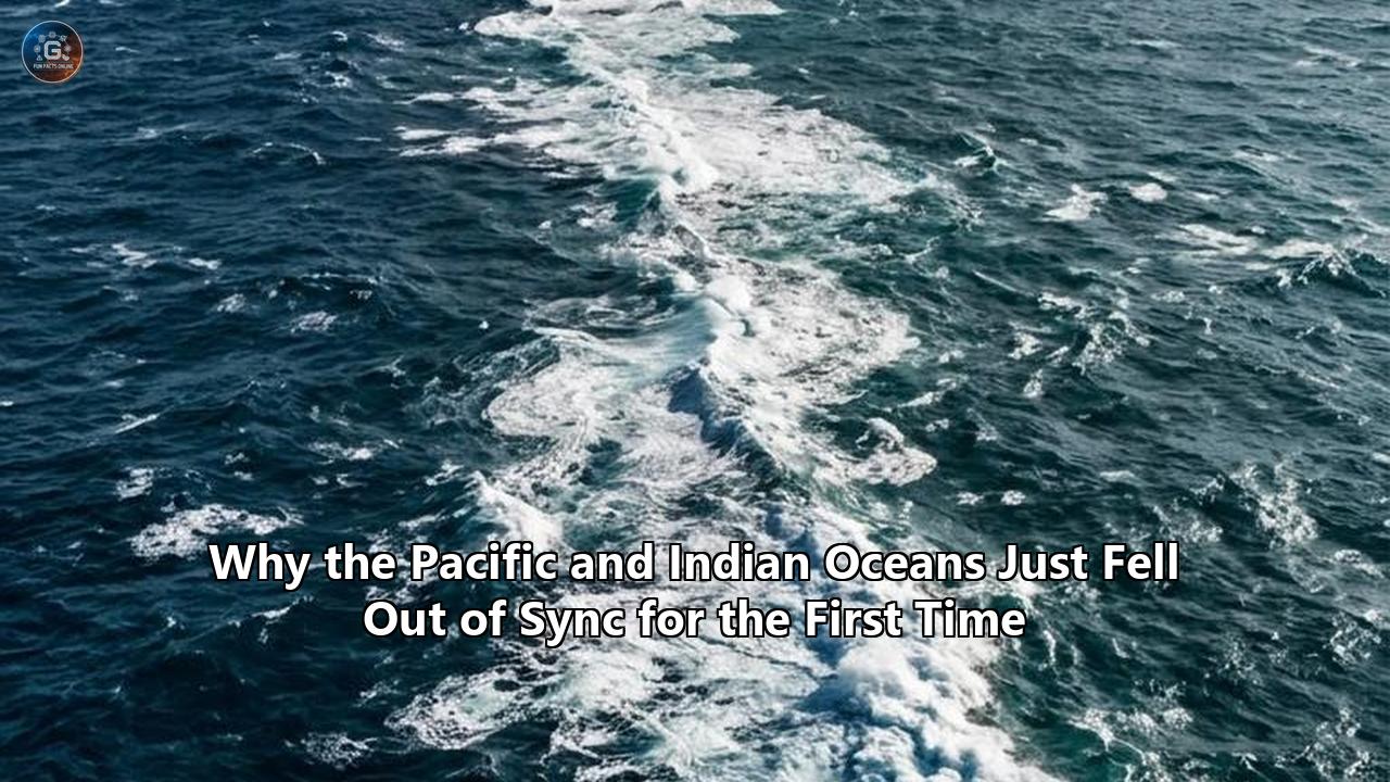
For four hundred years, the tropical Pacific and Indian oceans moved across seasons in disciplined synchronization. When the waters of the central and eastern Pacific warmed during an El Niño event, atmospheric ripples traveled thousands of miles west, reliably driving up temperatures across the Indian Ocean basin months later. That vast teleconnection functioned as the master timing belt of the planetary atmosphere, dictating monsoon rains across South Asia, shaping drought cycles in eastern Africa, and guiding the timing of bushfire seasons in Australia.
That clockwork system has now fractured.
According to research led by the Woods Hole Oceanographic Institution (WHOI) and published in Nature Communications, the tropical Pacific and Indian oceans have decoupled outside any natural baseline recorded over the past millennium. The investigation, led by climate scientists Shawn S. Wang, Caroline Ummenhofer, and Delia Oppo, reveals that the centuries-old Pacific Walker circulation is no longer dictating Indian Ocean temperatures as it once did. Instead, the modern correlation between these two oceanic giants has drifted completely outside the 95 percent historical confidence interval, marking an unprecedented divergence driven by greenhouse gas-induced warming.
"A key finding is that global warming and human emissions are now overwhelming the Pacific's natural influence on the Indian Ocean," said Ummenhofer.
The decoupling represents a major operational challenge for global meteorology, food security, and climate adaptation. Seasonal forecasting models across the globe have long treated the tropical Pacific as the undisputed engine of interannual climate variability. With that transmission belt slipping, forecasters, commodity markets, and humanitarian agencies are encountering blind spots, where traditional oceanic precursors no longer yield expected regional weather patterns.
The Scale of the Challenge: When the Atmospheric Bridge Collapses
The relationship between the tropical Pacific and Indian basins is not merely an oceanographic curiosity; it is the thermodynamic linchpin for global atmospheric circulation. The mechanism that historically kept them aligned is known as the "atmospheric bridge," governed by the Pacific Walker circulation.
Under normal historical conditions, trade winds sweep westward across the equatorial Pacific, pushing solar-heated warm surface water into the Indo-Pacific Warm Pool around the Maritime Continent of Indonesia. The warm air above these waters ascends, traverses the upper troposphere, and descends over the cooler waters of the eastern Pacific, completing a massive convective loop.
When an El Niño event occurs, that loop weakens. Atmospheric convection shifts eastward toward the central Pacific, suppressing cloud cover and altering wind regimes thousands of kilometers away over the Indian Ocean. This dynamic historically triggered the Indian Ocean Basin Mode (IOBM), an anomalous warming of the entire tropical Indian Ocean that would peak roughly three to six months after an El Niño reached its climax.
HISTORICAL CONVECTIVE COUPLING (Pre-1980s)
========================================================================
[ Eastern Indian Ocean ] <---- Atmospheric Bridge <---- [ Pacific Ocean ]
   Warming/Cooling in                                    ENSO (El Niño/
   predictable lockstep                                  La Niña) serves
   with Pacific cycles                                   as primary driver
========================================================================

MODERN DECOUPLING (Present Era)
========================================================================
[ Indian Ocean Heat Reservoir ]        [ Pacific Walker Circulation ]
   Independent warming (>0.1°C/dec)       Strengthening wind anomalies
   Autonomous convection regimes          Decoupled from basin response
   Erratic Indian Ocean Dipole (IOD)      Statistical correlation flips
========================================================================
The WHOI study reveals that this atmospheric transmission line has broken down. To evaluate whether the modern breakdown was simply an extreme swing in natural variability, the researchers turned to natural paleoclimate archives, examining coral skeletons, tree-ring chronologies, and cave stalagmites dating back to the year 1600. These proxies, verified against thousand-year simulations from the Community Earth System Model (CESM), demonstrated that the tropical oceans maintained continuous co-variability across centuries.
Only one brief anomaly appeared in the pre-industrial record: between 1810 and 1850, the synchronization slipped. That disturbance was triggered by a series of massive tropical volcanic blasts, including the 1815 eruption of Mount Tambora, which injected reflective sulfur dioxide into the stratosphere, cooled the western basins unevenly, and generated temporary westerly wind bursts that muffled Pacific teleconnections.
Yet that nineteenth-century disruption was a temporary shock caused by planetary cooling. The modern breakdown, which began manifesting in the 1980s and has accelerated dramatically over the 1945–2025 assessment window, is structural, persistent, and occurring under sustained planetary heating. The statistical sign of the relationship between the Pacific Walker circulation and the Indian Ocean Basin Mode has actually inverted.
The breakdown of the Pacific and Indian Oceans connection means that meteorologists can no longer look at Pacific sea-surface temperatures and reliably forecast what the Indian Ocean will do across the subsequent two quarters. For the 2.5 billion people residing around the Indian Ocean rim, that missing link undermines the baseline predictability of the rains they depend on for food and water security.
The Heat Sponge: Why the Indian Ocean Went Rogue
Understanding what went wrong requires looking at the changing energetics of the Indian Ocean itself. Although it covers only about 20 percent of the world's tropical and subtropical ocean surface, the tropical Indian Ocean has acted as an immense planetary heat sponge. Since the 1950s, its upper layers have warmed at an average rate of 0.1 degrees Celsius per decade, outstripping the warming pace of the Atlantic and Pacific basins.
This rapid thermal accumulation has fundamentally altered the ocean's physical profile. Delia Oppo, an emeritus research scholar at WHOI and co-author of the study, emphasized the basin's newfound autonomy:
"The Indian Ocean is a huge heat reservoir, and it can decouple from what the Pacific Ocean is doing. The results of this study underscore the independent behavior of the Indian Ocean."
Three primary factors have driven the Indian Ocean to sever its traditional atmospheric dependency on the Pacific:
- Upper-Ocean Heat Budget Saturation: The Indian Ocean has absorbed more than a quarter of all excess oceanic heat generated by greenhouse emissions over the last half-century. This persistent thermal flux has elevated baseline sea surface temperatures (SST) above the critical 28°C threshold required for deep atmospheric convection across almost the entire equatorial basin year-round, freeing it from the need for external Pacific triggers to spark major atmospheric disturbances.
- Thermocline Flattening and Stratification: Relentless surface warming has intensified stratification, making it harder for deeper, cooler water to mix with the surface. The equatorial thermocline—the boundary separating warm surface water from cold deep water—has shoaled in key sectors, altering how the ocean interacts with atmospheric winds.
- The Indonesian Throughflow Bottleneck: The physical channel through which the Pacific and Indian oceans trade water—the Indonesian Throughflow (ITF)—has experienced fluctuating mass and heat transport. As warm water piles up in the western Pacific and cascades through the Makassar and Lombok straits, it injects vast quantities of heat into the upper layers of the eastern Indian Ocean, feeding internal convective instabilities independent of the atmospheric Walker loop.
       WESTERN PACIFIC                           EASTERN INDIAN OCEAN
   [ Warm Pool Convergence ]                    [ Rapid Heat Uptake ]
             │                                            │
             │           Indonesian Throughflow           │
             └─────────── (ITF Deep/Surface) ─────────────┘
                                   │
              Shoaling Thermocline & Severe Stratification
                                   │
                Persistent Convective State (>28°C SST)
                                   │
             ==============================================
               AUTONOMOUS REGIONAL CLIMATE FEEDBACK LOOPS
             ==============================================
Because the Indian Ocean is partially landlocked to the north by the Asian landmass, it cannot vent heat toward the Arctic pole like the Pacific or Atlantic oceans. Trapped by this geography, heat accumulates until it triggers violent ocean-atmosphere feedbacks.
As a result, the Indian Ocean is no longer acting as a passive recipient of Pacific weather signals. Instead, it has transformed into an active, self-contained climate generator, launching its own atmospheric waves that can override or deflect the teleconnections once maintained by the Pacific.
Downstream Consequences: Broken Models and Unstable Monsoons
The destabilization of the historical Pacific and Indian Oceans connection carries immediate consequences across multiple continents, scrambling the seasonal rhythms that support global agriculture and disaster preparedness.
The South Asian Monsoon Puzzle
The Indian Summer Monsoon, which delivers over 70 percent of India's annual rainfall and sustains crops for a sixth of humanity, was historically governed by a well-established equation: El Niño meant a weak or deficient monsoon; La Niña heralded strong, abundant rainfall. Over the past three decades, however, that correlation has unraveled.
In several recent years, severe El Niño events in the Pacific failed to induce the expected nationwide droughts across the subcontinent. Conversely, neutral or weak Pacific signals have coincided with devastating regional agricultural dry spells punctuated by catastrophic localized cloudbursts.
Because the Indian Ocean basin is warming independently, local thermal gradients now overpower the descending branch of the Pacific Walker circulation. When the Indian Ocean creates its own atmospheric high-pressure or low-pressure anomalies, it can neutralize or exaggerate Pacific signals without warning, turning long-range monsoon forecasting into an operational gamble.
East African Whiplash and the Indian Ocean Dipole
Along the rim of the western Indian Ocean, the decoupling has aggravated the behavior of the Indian Ocean Dipole (IOD)—an irregular oscillation of sea-surface temperatures between the western and eastern halves of the basin. Historically, positive IOD events, which warm the western Indian Ocean near Somalia and cool the eastern waters off Sumatra, tended to synchronize with El Niño episodes.
With the basins out of step, the IOD is frequently triggering independently or falling out of phase with Pacific patterns. When a fierce positive IOD forms without an accompanying El Niño to anchor global winds, torrential downpours strike the Horn of Africa, devastating crops and driving humanitarian crises across Kenya, Somalia, and Ethiopia, while parts of Indonesia and Western Australia endure unpredicted, prolonged drought conditions.
+--------------------+-----------------------------+-----------------------------+
| Climate Factor     | Historical Paradigm         | Current Decoupled State     |
+--------------------+-----------------------------+-----------------------------+
| Teleconnection     | Pacific Walker circulation  | Inverted sign; local Indian |
| Reliability        | dictates Indian Ocean Basin | Ocean heating overpowers    |
|                    | Mode (IOBM) within 6 months | external Pacific signals    |
+--------------------+-----------------------------+-----------------------------+
| South Asian        | El Niño = Monsoon Drought;  | Weakened correlation;       |
| Monsoon Impact     | La Niña = Heavy Rainfall    | localized rain extremes and |
|                    |                             | false-alarm seasonal models |
+--------------------+-----------------------------+-----------------------------+
| East African       | IOD phases synchronized     | Independent, severe IOD     |
| Hydrology          | with ENSO cycles via the    | events creating unexpected  |
|                    | atmospheric bridge          | flood-drought whiplash      |
+--------------------+-----------------------------+-----------------------------+
| Australian         | Compound risks when El Niño | Conflicting signals between |
| Climate Hazards    | and Positive IOD overlap    | basins; sudden unforecasted |
|                    | predictably                 | bushfire weather conditions |
+--------------------+-----------------------------+-----------------------------+
The Australian Climate Dilemma
Australia sits directly between these two oceanic engines. For generations, the Australian Bureau of Meteorology (BOM) relied on the interplay between ENSO in the east and the IOD in the west to predict seasonal bushfire danger, agricultural yields in the Murray-Darling Basin, and pasture growth.
When the Pacific and Indian oceans fall out of phase, they send conflicting atmospheric waves across the Australian continent. One ocean signals moisture while the other suppresses rainfall, creating volatile weather conditions that defy historical analog modeling. Farmers preparing for rain based on Pacific indicators are blindsided by sudden dry winds driven by unexpected Indian Ocean dynamics.
Proliferating Marine Heatwaves
The decoupling has also unleashed unprecedented ecological destruction within the marine environment itself. As the Indian Ocean breaks free from external wind regulation, localized hot spots persist for months at a time. The northern Arabian Sea, the Bay of Bengal, and the waters around the Ningaloo Reef off Western Australia have experienced severe marine heatwaves.
These events trigger widespread coral bleaching, devastate artisanal fisheries, and alter fish migration routes, hitting coastal communities that lack the economic safety nets necessary to absorb sustained marine ecosystem collapse.
The Forecasting Deficit: Why Numerical Models Are Blind to the Split
The practical problem facing atmospheric scientists is that current predictive systems were largely developed and calibrated during an era when the tropical oceans operated in synchrony.
Most dynamical climate models—including operational systems running at the European Centre for Medium-Range Weather Forecasts (ECMWF) and the US National Oceanic and Atmospheric Administration (NOAA)—rely heavily on data assimilation schemes and parameterizations that reflect the late-twentieth-century climate state. These systems treat anomalies in the equatorial Pacific, particularly the Niño 3.4 region, as the primary source of seasonal predictive skill across the globe.
                     TRADITIONAL PREDICTIVE PIPELINE
  [ Pacific Niño 3.4 Index ] ───────────► [ Atmospheric Teleconnections ]
                                                      │
                                                      ▼
                                         [ Downstream Global Weather ]
                                        (Assumed Indian Ocean Coupling)
                                                      │
                                                      ▼
                                       CRITICAL FORECAST DEFICIT:
                                    Fails when Indian Ocean behaves
                                        as an independent driver
When an operational model assumes that a warming Pacific will reliably translate into a specific thermodynamic signature across the Indian Ocean, it introduces systematic biases into its outputs. If the Indian Ocean fails to follow those rules, the entire model forecast begins to drift:
- Convective Misplacement: Global models miscalculate the position of ascending convective branches, projecting storms over regions that end up suffering drought.
- Teleconnection Distortions: Rossby and Kelvin waves modeled as traveling outward from the Pacific are absorbed, reflected, or altered by the Indian Ocean's independent convective cells, degrading weather predictions in North America and Europe weeks later.
- The "False Analog" Trap: Many seasonal outlooks still rely on statistical downscaling against historical "analog years." However, because modern warming has created a thermodynamic state with no precedent in four centuries, analog forecasting is losing its reliability.
As Caroline Ummenhofer noted in the WHOI findings, continuing to analyze the basins in isolation—or assuming a simple, static link between them—is no longer viable for modern climate science. The scientific community faces an urgent imperative to redesign the architecture of global ocean-atmosphere monitoring.
Solutions in Action: Modernizing the Indo-Pacific Monitoring Grid
Confronting this challenge requires a coordinated, multi-layered response that spans deep-sea observation, algorithmic overhauls, and international climate policy. Oceanographers, atmospheric modelers, and global meteorological bodies have already begun mobilizing resources to bridge the gap left by the fractured connection.
+--------------------------------------------------------------------------+
|                     THE THREE-PILLAR RECOVERY STRATEGY                    |
+--------------------------------------------------------------------------+
|  1. OBSERVATIONAL UPGRADES                                               |
|     * IndOOS-2 implementation across the equatorial Indian Ocean         |
|     * RAMA-2 deep-water mooring expansion                                |
|     * Deployment of Core and Biogeochemical Argo floats (to 2,000m)       |
+--------------------------------------------------------------------------+
|  2. COMPUTATIONAL & PREDICTIVE ADVANCES                                  |
|     * Multi-basin dynamic assimilation replacing single-basin priors     |
|     * Hybrid physics-informed AI modeling (e.g., AIFS, GraphCast)        |
|     * High-resolution non-linear air-sea coupling frameworks             |
+--------------------------------------------------------------------------+
|  3. ADAPTIVE POLICY & ACTION                                             |
|     * UN "Early Warnings for All" deployment in South Asia and Africa    |
|     * Recalibration of parametric catastrophe bonds & crop insurance    |
|     * Dynamic agricultural cropping advisories replacing analog systems  |
+--------------------------------------------------------------------------+
1. The IndOOS-2 Rollout and Autonomous Profiling
For decades, the Indian Ocean was among the most under-observed oceanic realms on Earth, trailing far behind the dense observational arrays deployed across the North Atlantic and equatorial Pacific. In response to recent erratic basin behavior, the international scientific community has accelerated the implementation of the second-generation Indian Ocean Observing System (IndOOS-2).
A core element of this effort is the expansion and maintenance of the Research Moored Array for African-Asian-Australian Monsoon Analysis and Prediction (RAMA). Scientists from the US, India, Japan, Indonesia, and Australia are working together to reoccupy and upgrade deep-sea moorings that measure ocean temperature, salinity, and surface meteorological variables from the surface down to depths of 500 meters.
Complementing the mooring arrays is the deployment of next-generation autonomous Argo floats:
- Over 1,200 active profiling floats now operate in the Indian and western Pacific basins, diving to depths of 2,000 meters every ten days to map internal heat content.
- Biogeochemical Argo floats equipped with sensors for dissolved oxygen, pH, and nitrate are tracking how intense stratification and heat waves impact marine biological productivity.
- Fleets of autonomous surface uncrewed vehicles (gliders and Saildrones) are patrolling the Indonesian Throughflow passages, providing real-time measurements of heat transport between the Pacific and Indian oceans.
2. Rewriting the Dynamics of Earth System Models
To address forecasting failures, modeling centers are moving away from treating the Pacific as the sole primary driver of the global tropics. Scientists are overhauling coupled general circulation models to incorporate multi-basin dynamic interactions without baked-in linear assumptions.
At ECMWF, updates to the Integrated Forecasting System (IFS) are directly addressing how air-sea fluxes are calculated in the tropics. Rather than using stationary sea-surface temperatures to drive atmospheric responses, the system now uses high-resolution dynamic ocean coupling updated at hourly intervals. This allows the model to capture the emergence of localized convective anomalies across the Indian Ocean before they propagate into the global atmosphere.
Similarly, India's Ministry of Earth Sciences has initiated major updates to the Monsoon Mission Coupled Forecast Model at the Indian Institute of Tropical Meteorology (IITM). By assimilating high-resolution deep-ocean data from IndOOS-2 directly into their dynamical models, researchers are training the system to weight regional Indian Ocean thermodynamic shifts alongside Pacific signals, reducing seasonal rainfall forecasting errors across South Asia.
3. Machine Learning and Non-Linear Teleconnections
Artificial intelligence is emerging as a critical tool for navigating the decoupled tropical climate. Traditional statistical methods struggle when physical systems move outside historical parameters, but physics-informed machine learning architectures are proving adept at identifying non-linear patterns that conventional tools miss.
New hybrid models, including ECMWF’s Artificial Intelligence Forecasting System (AIFS) and research tools based on deep neural network architectures like GraphCast, are being trained on multi-decadal reanalysis products that include modern post-1980s data. These neural networks do not rely on static rules about the Pacific and Indian Oceans connection. Instead, they evaluate the entire global ocean surface dynamically, identifying subtle cross-basin interactions and local heat anomalies that trigger unexpected shifts in regional weather patterns weeks in advance.
Policy Adaptations: Managing Life in an Unsynchronized Climate
Adapting to the split between the Pacific and Indian oceans requires changes that extend far beyond research laboratories. Governments, international organizations, and vulnerable communities are re-evaluating how they prepare for climate risks.
Overhauling Early Warning Systems
The United Nations "Early Warnings for All" initiative has directed resources into the Indian Ocean basin, prioritizing regional bodies such as the IGAD Climate Prediction and Applications Centre (ICPAC) in Nairobi and the ASEAN Specialised Meteorological Centre (ASMC) in Singapore.
Rather than relying on generic, six-month seasonal outlooks based on Pacific ENSO alerts, these regional centers are shifting to dynamic, sub-seasonal-to-seasonal (S2S) early warning bulletins. These frameworks assess regional ocean heat states on two-to-four-week horizons, giving disaster response agencies time to mobilize flood barriers, clear drainage infrastructure, or position food supplies ahead of sudden uncoupled IOD storms.
Restructuring Crop Strategies and Water Resources
In the agricultural sector, where millions of smallholder farmers plan their planting schedules around seasonal rains, agricultural extension agencies are transitioning away from historical seasonal analogs.
In India, the Indian Council of Agricultural Research (ICAR) is working with state meteorological offices to deploy district-level agro-advisories that respond to real-time regional moisture dynamics rather than distant Pacific indicators. When models detect that the Indian Ocean is behaving autonomously, advisories recommend short-duration crop varieties, drought-resilient legumes, or diversified planting cycles that can weather abrupt seasonal shifts.
Water resource managers across Australia's Murray-Darling basin are adjusting reservoir management protocols. Instead of releasing or conserving water based on broad-brush El Niño or La Niña declarations, water managers are using ensemble models that account for conflicting signals between the Indian and Pacific basins, maintaining flexible storage margins to mitigate flash droughts or sudden unpredicted downpours.
Recalibrating Parametric Disaster Insurance
Financial institutions and disaster risk financiers are confronting the economic realities of oceanic decoupling. Sovereign catastrophe risk pools, such as the African Risk Capacity (ARC), rely on parametric triggers—such as rainfall deficits measured via satellite—to release insurance payouts to drought-stricken governments.
Historically, the underlying risk profiles used to price and structure these catastrophe bonds assumed stable teleconnections between Pacific anomalies and regional rainfall. With the breakdown of that balance, risk models are undergoing revisions. Actuaries are recalculating baseline hazard probabilities to reflect the greater frequency of independent, extreme Indian Ocean variability, helping prevent risk funds from facing insolvency or failing to deliver emergency liquidity during unexpected weather events.
What to Watch Next: The Changing Architecture of the Tropics
The rupture of the long-standing synchronization between the Pacific and Indian oceans is not a distant, theoretical concern; it is an active reality that is reshaping global climate mechanics. The findings from Woods Hole confirm that human greenhouse gas emissions have pushed the planetary climate engine into territory unseen since the pre-industrial era.
Over the coming months and years, scientists and policymakers will be closely monitoring several critical milestones:
- The Evolution of IndOOS-2 Deployment: Tracking whether international funding and logistical commitments can fully realize the 100 percent completion of the RAMA mooring array and maintain high-density Argo coverage across the tropical Indian Ocean.
- Model Validation in Forthcoming Climate Cycles: Observing how the next major transitions between El Niño and La Niña interact with an overheated Indian Ocean, providing an empirical test for the new generation of multi-basin dynamic and AI-driven forecasting models.
- The Indonesian Throughflow Dynamics: Monitoring data from acoustic Doppler current profilers situated throughout the Makassar Strait to determine whether shifting inter-basin oceanic currents will further accelerate the decoupling process.
- CMIP7 Model Deployments: Reviewing how the next round of the Coupled Model Intercomparison Project (CMIP7) integrates the paleoclimate constraints uncovered by the WHOI researchers into future global climate projections.
The Earth's tropical oceans are moving away from their historical dependencies. As the Indian Ocean charts an independent path, the global community must let go of past assumptions about how the seas communicate, learning to read an oceanic playbook written for an altered, unsynchronized world.
Reference:
- https://oceanographicmagazine.com/news/volcanoes-and-climate-change-behind-indian-pacific-breakdown/
- https://www.sciencealert.com/global-warming-is-breaking-the-link-between-two-major-oceans
- https://ecomagazine.com/news/research/whoi-study-links-volcanic-eruptions-and-climate-change-to-indian-pacific-ocean-decoupling/
- https://www.whoi.edu/press-room/news-release/volcanicoceans/
- https://www.youtube.com/watch?v=DRUqCkkx5uo
- https://timesofindia.indiatimes.com/etimes/trending/global-warming-may-break-the-400-year-link-between-the-indian-ocean-and-the-pacific-ocean/articleshow/134237637.cms
- https://medium.com/age-of-awareness/when-oceans-stop-talking-the-surprising-science-of-the-indo-pacific-breakup-5b87059eca63
- https://www.quora.com/What-is-the-Indian-Ocean-Dipole-and-how-does-it-impact-weather-patterns-with-El-Ni%C3%B1o
- https://www.researchgate.net/publication/240687122_Interaction_between_El_Nino_and_Extreme_Indian_Ocean_Dipole
- https://www.downtoearth.org.in/climate-change/combined-impacts-of-super-el-nino-and-indian-ocean-dipole-to-be-recorded-between-august-and-october-wmo
- https://cpo.noaa.gov/research-presents-new-links-between-major-climate-patterns-in-the-tropical-pacific-and-indian-oceans/