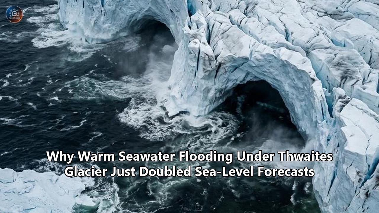
A computer model calibrated to nearly three decades of satellite radar observations has altered the mathematical baseline of polar glaciology. According to a study published in Nature Communications by a team of glaciologists from the University of California, Los Angeles, NASA’s Jet Propulsion Laboratory, and the University of California, Irvine, Thwaites Glacier’s direct contribution to global sea-level rise by the end of the century will reach up to 30 millimeters (1.2 inches)—approximately double the 15-millimeter average previously projected by international modeling ensembles.
The revised calculation does not rely on future atmospheric warming scenarios or hypothetical carbon emission spikes. It is the outcome of correcting a mathematical omission in how glaciologists model the glacier's underbelly.
For years, standard ice-sheet models treated the transition between the ice resting on bedrock and the ice floating on the ocean as a narrow, razor-thin boundary. The new study, led by UCLA project scientist Mattia Poinelli, incorporates an observed physical reality: high-pressure, warm seawater does not stop at a fixed line. Instead, ocean tides actively pump warm, dense seawater between two and five kilometers (1.2 to 3.1 miles) deep into the subglacial cavity beneath grounded ice.
This tidal pumping dynamic creates a sprawling, pressurized "grounding zone" where basal ice is melted at rates far exceeding prior thermodynamic calculations. When Poinelli and his co-authors ran their observation-constrained model forward to 2100 with this dynamic active, the projected sea-level contribution doubled.
While 30 millimeters of water spread across the global ocean surface may sound manageable in isolation, glaciologists emphasize that Thwaites is not merely a single glacier. It is the physical keystone of West Antarctica. Stretching across a front of 120 kilometers (75 miles) and draining an ice basin covering 192,000 square kilometers—an area comparable to Great Britain or the state of Florida—Thwaites holds enough ice on its own to raise global sea levels by 65 centimeters (2.1 feet). More critically, it functions as a structural dam blocking the wider West Antarctic Ice Sheet. If Thwaites unhinges, it will draw down adjacent basins, unlocking more than 3 meters (10 feet) of potential sea-level rise over subsequent centuries.
By proving that ocean-driven basal melt is progressing twice as fast as consensus models assumed, the new findings compress the timeline for global coastal adaptation, forcing municipal planners, maritime engineers, and climate economists to overhaul their risk projections.
The Knife-Edge Fallacy in Classical Glaciology
To understand why forecasts shifted so abruptly, one must look at how computerized ice sheet models have historically depicted the contact point between ice, rock, and water.
For decades, numerical ice models—including those informing the Intergovernmental Panel on Climate Change (IPCC) Sixth Assessment Report through the Ice Sheet Model Intercomparison Project for CMIP6 (ISMIP6)—relied on the "grounding line" approximation. In these computational grids, the grounding line was rendered as an infinitely thin, one-dimensional boundary. On the landward side of this mathematical line, the ice was treated as 100 percent grounded: sitting firmly on bedrock, subject to basal friction, and sealed off from contact with liquid ocean water. On the seaward side, the ice was treated as floating: forming an ice shelf with its underside exposed to ocean thermal currents.
This binary abstraction made computational physics manageable. Modeling continental ice sheets requires calculating stress tensors, visco-plastic flow equations (such as Glen’s Flow Law), friction laws, and thermodynamic heat transfers across thousands of square kilometers of varied terrain. Simplifying the boundary between land-based ice and the sea into a clean, geometric line allowed supercomputers to run centuries of simulations without grinding to a halt.
Yet, nature does not operate with geometric clean edges.
Classical Model (One-Dimensional Hinge):
[ Grounded Ice ]  --->  (Sharp Grounding Line)  --->  [ Floating Ice Shelf ]
   (No Seawater)                                         (Warm Seawater)
-------------------------------------------------------------------------
New Empirical Reality (Dynamic Grounding Zone):
[ Grounded Ice ]  <== [ Seawater Intrusions: 2-5 km ] ==> [ Floating Shelf ]
                         ^ High-Pressure Tidal Pumping
                         ^ Vigorous Basal Melting
The real interface at the base of Thwaites Glacier is a dynamic boundary where the ice sheet flexes under the gravitational pull of ocean tides. When the tide rises, it generates tremendous hydrostatic pressure along the margin. Because ice is less dense than seawater (approximately 917 kilograms per cubic meter for glacier ice versus roughly 1,027 kilograms per cubic meter for Antarctic seawater), buoyant forces lift the glacier off its bed.
Instead of an impenetrable seal, the subglacial environment consists of uncompacted, water-saturated sediments (till), bedrock hollows, and hydraulic channels. As high tides lift the ice, warm, salty ocean water is drawn inland under high pressure, traveling several kilometers beyond the traditional grounding line. When the tide falls, the ice settles back down, squeezing some water out while trapping pockets of saline water in subglacial cavities and channels carved into the bedrock.
By ignoring this dynamic "grounding zone," older models assumed that kilometers of ice along the coastal margin were immune to ocean thermal melting. In reality, that ice was being melted continuously from beneath.
The Satellite Data That Overwrote the Theory
The empirical turning point occurred when glaciologists stopped relying purely on theoretical models and looked at high-cadence radar imagery gathered by commercial Earth-observation satellites.
Between March and June 2023, the Finnish satellite operator ICEYE trained its constellation of synthetic aperture radar (SAR) satellites on Thwaites Glacier. Unlike optical satellites, which are blinded by the long polar night and chronic cloud cover of the Amundsen Sea, SAR instruments beam microwave radar pulses down to Earth’s surface and measure the phase of the reflected signal. By comparing radar passes captured from identical orbital coordinates at short time intervals—a technique known as Differential Interferometric Synthetic Aperture Radar (DInSAR)—scientists can detect vertical shifts in the Earth's surface down to millimeters.
The ICEYE constellation orbits Earth every few hours, allowing researchers to observe Thwaites daily, perfectly matching the semi-diurnal and diurnal cycles of Antarctic ocean tides.
The resulting interferograms, analyzed by Eric Rignot of UC Irvine and Christine Dow of the University of Waterloo, exposed a relentless breathing motion across the ice. As the tide surged, vast slabs of ice—previously classified as solidly grounded on bedrock—lifted by centimeters, tilted upward, and allowed ocean water to flood inland under enormous pressure.
"There are places where the water is almost at the pressure of the overlying ice, so just a little more pressure is needed to push up the ice," explained Rignot during the initial observational discovery. "The water is then squeezed enough to jack up a column of more than half a mile of ice."
The satellite data revealed that warm seawater was migrating between 2 and 6 kilometers inland along the glacier's main trunk during tidal peaks.
When Mattia Poinelli, Eric Larour, and their team at NASA’s Jet Propulsion Laboratory took these measurements and integrated them into the Ice-sheet and Sea-level System Model (ISSM), they set up an algorithmic showdown. They forced their models to simulate the actual behavior of Thwaites Glacier between 1996 and 2023—a period during which satellite records documented approximately 25 kilometers of grounding-line retreat along the fastest-flowing sectors.
The outcome was unequivocal: traditional models relying on a sharp, one-dimensional grounding line failed to replicate the real-world retreat of the past three decades. They were four times less likely to match observed satellite measurements than models that included a dynamic, melting grounding zone 2 to 5 kilometers wide.
When that observation-calibrated model was extended to the year 2100, the projected sea-level contribution shot up from the 15-millimeter benchmark to 30 millimeters (±6 mm). The missing physics had finally been accounted for—and the rate of mass loss doubled.
The Thermodynamics of Basal Melting: Why Warm Water Packs Such a Punch
To understand why a few kilometers of seawater intrusion can accelerate ice sheet loss so drastically, one must look at the specific heat and physical properties of the water invading the subglacial margin.
The water driving Thwaites Glacier melting is not cold surface water; it is Circumpolar Deep Water (CDW).
In the Southern Ocean, the water column is stratified into distinct thermodynamic layers:
- Antarctic Surface Water: A cold, relatively fresh, and buoyant surface layer directly influenced by freezing winter air and seasonal sea-ice melt (temperatures typically range from -1.8°C to -1.0°C).
- Winter Water: A subsurface remnants layer maintaining near-freezing temperatures.
- Circumpolar Deep Water (CDW): A dense, highly saline water mass originating in the northern ocean basins that flows southward at depths between 400 and 1,000 meters.
CDW is warm by polar standards—hovering between +1.0°C and +2.5°C (34°F to 36.5°F). For decades, CDW was largely kept away from the Antarctic continental shelf by powerful circumpolar winds and stable ocean currents that pinned cold shelf waters against the coast. Over recent decades, however, shifting atmospheric pressure patterns and altered Westerly winds—linked to anthropogenic climate change—have pushed the boundary currents farther south, allowing tongues of unmodified, warm CDW to spill over the continental shelf break and funnel through deep submarine troughs directly toward the underbellies of coastal glaciers.
When CDW comes into contact with ice deep below sea level, thermodynamic physics triggers an aggressive phase change.
The Oceanographic Stratification:
------------------------------------------------------ Sea Level
 Cold Antarctic Surface Water (~ -1.5°C)
------------------------------------------------------
 Sills and Continental Shelf Edge
------------------------------------------------------
 Circumpolar Deep Water (CDW: +1.0°C to +2.5°C)
   ===> Funneled via bathymetric troughs directly under ice
------------------------------------------------------ Seafloor (-800m to -1200m)
The melting point of ice decreases under pressure according to the Clausius-Clapeyron relation—by approximately 0.075°C for every 100 meters of depth. At the base of Thwaites Glacier, where the grounding zone sits 800 to 1,200 meters below sea level, the freezing point of water drops to roughly -2.5°C (-3°F).
When seawater at +1.5°C enters an environment where ice melts at -2.5°C, the water carries 4.0 degrees Celsius of "thermal driving"—a large temperature surplus in glaciological terms. Because the latent heat of fusion of water is high (approximately 334 kilojoules per kilogram), melting requires significant energy. But because the ocean continuously circulates and flushes fresh batches of warm CDW through the subglacial cavity via tidal pumping, the heat engine does not run out of fuel.
Furthermore, as the basal ice melts, it produces freshwater. This freshwater is less dense than the surrounding saline ocean water. Buoyant freshwater plumes shoot upward along the sloping base of the glacier, drawing even more heavy, warm CDW into the grounding zone behind it like an oceanographic siphon.
This feedback loop causes intense, concentrated erosion right at the anchoring root of the glacier.
Retrograde Beds and Marine Ice Sheet Instability
Understanding why Thwaites Glacier is considered the most fragile sector on the planet requires looking at the bedrock topography beneath the ice.
Most continental glaciers sit on bedrock that rises as you travel inland. If the terminus of an ordinary glacier retreats, it backs up into shallower elevations, reducing the surface area exposed to water and stabilizing itself.
Thwaites Glacier sits on the exact opposite geometry: a retrograde bed.
Prograde Bed (Stable):
Ice Sheet ===> [ Glacier Tongue ]
Bedrock:    / (Shallows inland - naturally self-stabilizing)

Retrograde Bed (Unstable / Thwaites Geometry):
Ice Sheet ===> [ Glacier Margin ]
Bedrock:    \ (Deepens inland toward -2,500m Bentley Trench)
               ^ As the grounding line retreats, the ice cliff thickens,
                 increasing flux, flow speed, and ocean exposure.
The rock bed beneath the ice does not slope upward; it slopes downward as it moves inland toward the heart of West Antarctica. The front of Thwaites rests on shallow submarine sills and ridges—most notably the underwater Mouginot Ridge—located between 600 and 800 meters below sea level. But directly behind this pinning ridge, the topography slopes into a vast interior trough known as the Bentley Subglacial Trench, which plunges to more than 2,500 meters (8,200 feet) below sea level.
Glaciologists describe this vulnerability through the theory of Marine Ice Sheet Instability (MISI):
- Discharge Scales with Thickness: The volume of ice that an ice sheet discharges into the ocean is directly proportional to the thickness of the ice at its grounding line.
- Retreat into Deep Water: Because the bedrock slopes downward inland, every kilometer the grounding line retreats causes the ice column at that boundary to become thicker.
- Runaway Ice Export: A thicker grounding line pushes more ice across the threshold under its own internal gravitational stress.
- Self-Sustaining Acceleration: The faster the ice flows, the faster it thins, forcing the grounding line to retreat further into the interior basin, creating an irreversible feedback loop that continues even if atmospheric warming stops.
Until recently, researchers hoped that pinning points like the Mouginot Ridge would anchor Thwaites for decades, slowing the inland march of the grounding line.
The findings published in Nature Communications upend those hopes. By showing that tidal pumping drives warm water underneath the ice across a wide zone, the study demonstrates that seawater is already bypassing these shallow structural sills. Seawater is unpinning the ice from the Mouginot Ridge from below, eroding the friction that holds the glacier in place long before the ice edge officially shears off.
Marine Ice Cliff Instability (MICI)
Beyond MISI, an even more abrupt physical process threatens Thwaites: Marine Ice Cliff Instability (MICI).
Ice has finite structural strength. If the floating ice shelf in front of Thwaites completely shatters—a scenario glaciologists predict could occur within years due to structural fracturing—the glacier will expose sheer vertical walls of ice directly to the open ocean.
Physical tests show that an unsupported vertical ice cliff cannot stand under its own weight if its height exceeds roughly 100 meters (330 feet) above the waterline. Because ice shelves act as buttresses that push back against the ice sheet, their removal leaves vertical cliffs towering hundreds of meters above the sea surface, with an additional 800 to 1,000 meters submerged below.
Once these colossal ice cliffs collapse under structural shear stresses, they shear off cleanly, exposing an even taller cliff behind them. This process can produce rapid, domino-style calving that outpaces anything observed in historical records. By halving the structural anchoring time of the grounding zone through basal intrusion, the new findings bring humanity closer to testing whether the MICI threshold will trigger in our lifetime.
Deconstructing the Math: ISMIP6 vs. the New Observation-Calibrated Projections
To assess the global significance of these findings, one must analyze the raw numbers produced by previous glaciological ensembles compared with the newly calibrated models.
For the IPCC's Sixth Assessment Report (AR6), hundreds of glaciologists and climate scientists collaborated on the Ice Sheet Model Intercomparison Project for CMIP6 (ISMIP6). ISMIP6 ran a standardized suite of 14 numerical ice sheet models to predict how the Greenland and Antarctic ice sheets would respond to various emissions pathways between 2015 and 2100.
| Simulation Parameter | Traditional ISMIP6 Ensemble Average | New Observation-Constrained Model (2026) |
|---|---|---|
| Grounding Line Representation | 1D fixed/sharp contact line | Dynamic 2–5 km grounding zone |
| Basal Melt at Grounding Zone | Zero melting landward of the line | Active tidal ocean intrusion melting |
| Calibrated to 1996–2023 Retreat? | Theoretical parameterization | High empirical match to ICEYE/satellite data |
| Thwaites SL Rise Contribution (2100) | ~15 millimeters (0.6 inches) | 30 ± 6 millimeters (1.2 inches) |
| Atmospheric Warming Requirement | Relied heavily on CMIP6 warming curves | Achieved with zero additional ocean warming |
The ISMIP6 models projected that West Antarctica would contribute modestly to global sea level rise during the 21st century, with Thwaites Glacier contributing an average of approximately 15 millimeters (0.59 inches) by 2100 under moderate-to-high warming pathways. The models assumed the glacier's massive interior inertia would resist rapid structural collapse for decades.
The study by Poinelli et al. highlights the risk of relying on theoretical modeling without empirical calibration. When the researchers tested the traditional ISMIP6 sharp-line parameterization against real-world satellite measurements from 1996 to 2023, the classic models could not match the observed thinning and retreat rates. The ice was retreating faster than the math permitted.
Only by introducing an active grounding zone where ocean water intrudes 2 to 5 kilometers beneath the grounded ice did the model successfully match three decades of observed satellite data.
Extending that calibrated model through 2100 revealed that Thwaites will shed mass at twice the previously calculated speed. The projection climbed to 30 millimeters from Thwaites alone.
Crucially, this doubling does not require the Southern Ocean to warm any further. It occurs under the current ocean temperatures already observed today. If greenhouse gas emissions continue to drive additional warming into the Circumpolar Deep Water, the 30-millimeter projection may prove to be a conservative lower bound.
Gravitational Fingerprints: Why Sea-Level Rise Is Highly Uneven
One of the most persistent misconceptions in climate science is the bathtub model of sea-level rise: the assumption that when an ice sheet melts, the water spreads evenly across the world's oceans like water filling a tub.
In reality, the global ocean surface is uneven, shaped by Earth's rotation, prevailing ocean currents, and gravitational physics. When Thwaites Glacier collapses, the sea level will not rise uniformly. In fact, it will rise significantly more along the coastlines of North America, Europe, and the global equator than it will near Antarctica itself.
This counterintuitive distribution is governed by sea-level fingerprinting, driven by three geophysical mechanisms:
1. Gravitational Self-Attraction
Vast ice sheets exert a powerful gravitational pull on surrounding water. The West Antarctic Ice Sheet is so massive that it pulls the Southern Ocean toward itself, creating a permanent bulge in sea surface height around Antarctica.
As Thwaites Glacier melting accelerates and sheds billions of tons of ice into the sea, the glacier loses gravitational mass. As its gravitational pull weakens, the ocean bulge collapses, and water sloshes away from Antarctica, redistributing itself across the northern hemisphere.
Consequently, within 2,000 kilometers of Thwaites Glacier, sea levels will actually fall. But thousands of miles away—along the Atlantic coast of the United States, the Caribbean, and the Indo-Pacific—the relative sea-level rise will be 20 to 30 percent higher than the global average.
Gravitational Mass Loss & Sea-Level Fingerprint:
[ Massive Antarctic Ice Sheet ] ===> Exerts strong gravitational pull, creating local ocean bulge
                     ||
              Mass Shedding via Melt
                     \/
[ Thwaites Loses Mass ]  ===> Gravitational pull collapses
  - Local Sea Level near Antarctica: DROPS
  - Far-field Sea Level (New York, Miami, Tokyo): RISES 20-30% HIGHER than global mean
2. Crustal Rebound (Glacio-Isostatic Adjustment)
The crust of the Earth underneath West Antarctica is currently depressed by hundreds of meters under the crushing weight of the ice sheet. As the ice thins and melts away, the solid Earth rebounds upward in a process called post-glacial rebound.
This uplift pushes the seafloor up, displacing additional water into the global ocean basin and amplifying the volume of water forced toward northern coastlines.
3. Rotational Feedback
The redistribution of trillions of metric tons of mass from the South Pole toward the equator changes the Earth's moment of inertia, altering its rotational axis by fractions of a degree. This true polar wander redistributes water across equatorial latitudes, concentrating sea-level rise across vulnerable island nations and coastal megacities in the tropics.
A 30-millimeter global mean contribution from Thwaites Glacier translates into nearly 40 millimeters of actual sea-level rise for cities like New York, Boston, Miami, and Mumbai.
The Compounding Math: Why Millimeters Dictate Trillions of Dollars
In the context of standard human experience, 30 millimeters (1.2 inches) sounds negligible—a height smaller than the diameter of a golf ball.
However, in coastal engineering and hydrodynamic risk modeling, sea-level rise is exponential, not linear, in its economic impact.
Global sea-level rise operates as an elevated platform for storms. A hurricane or nor'easter does not deliver a localized, calm increase in water; it generates destructive storm surges driven by low atmospheric pressure and wind stress.
A fundamental rule of coastal hydrology states that every centimeter of baseline sea-level rise drives a disproportionate increase in the frequency and inland reach of episodic coastal flooding:
- The 100-Year Event Shift: A baseline rise of just 100 millimeters (4 inches)—a milestone accelerated by decades under the new Thwaites findings—converts what was historically a once-in-a-century catastrophic flooding event into an event that recurs every 10 to 20 years across many low-lying regions.
- Sunny-Day / Nuisance Flooding: Tidal flooding without any storm activity, caused simply by seasonal astronomical high tides, has surged by more than 400 percent along the U.S. Gulf and East Coasts over the last three decades. Adding another inch of baseline water pushes high tides directly over seawalls, into underground storm drain outfalls, and across low-lying coastal roads.
- Saltwater Intrusion into Aquifers: As ocean levels rise, the hydrostatic pressure of seawater forces saline water into freshwater aquifers that supply municipal drinking water and agricultural irrigation. Communities in South Florida, the Nile Delta, and coastal Vietnam are already encountering saltwater contamination in municipal wells, requiring expensive reverse-osmosis desalination infrastructure.
Economic Ramifications of Compressed Sea-Level Rise Timelines:
-------------------------------------------------------------------------
 Municipal Budgets       --> Accelerated spending on seawalls, pumps, drainage
 Insurance Markets       --> Escalating premiums, reinsurance retreat, uninsurable zones
 Real Estate Valuation   --> Depreciating asset values in high-risk coastal corridors
 Capital Allocation      --> Transition from defense engineering to managed retreat
-------------------------------------------------------------------------
The compression of the timeline is where the economic damage lies.
If coastal infrastructure projects have 80 years to adapt to a specific sea-level threshold, civil engineers can amortize capital improvement projects—such as raising seawalls, installing high-capacity stormwater pumps, and retrofitting sewage treatment plants—over normal infrastructure replacement lifecycles.
When that timeline is cut in half, municipalities are forced into emergency bond issuances, capital reallocation, and painful political negotiations over managed retreat—the systematic abandonment of coastal corridors.
In financial markets, the impact will be felt first not through physical inundation, but through uninsurability. Reinsurance firms adjust their risk pricing annually.
As updated ice sheet models double the projected contribution of polar glaciers to baseline sea levels, catastrophe models incorporate higher flood probabilities. The cascading result is escalating private insurance premiums, the withdrawal of private carriers from high-risk coastal zones, the straining of state-backed insurers of last resort (such as Citizens Property Insurance in Florida), and the ultimate repricing of coastal real estate values.
Can Planetary Geoengineering Intervene?
As empirical data confirms that natural dynamics are outpacing conventional climate interventions, a growing cohort of polar engineers, glaciologists, and oceanographers has begun researching radical interventions: polar geoengineering.
Rather than altering atmospheric chemistry via solar radiation management, polar interventions focus on mechanical and civil engineering projects designed to shield the glacier's grounding zone from warm ocean water.
1. The Subsea Curtain Concept
Championed by glaciologist John Moore of the University of Lapland and colleagues at the University of Cambridge, the subsea curtain concept proposes installing a flexible, seabed-anchored buoyant barrier across the ocean floor in front of Thwaites Glacier.
Extending across deep bathymetric troughs over a length of 80 kilometers (50 miles), the curtain would float at depths between 300 and 600 meters below sea level. Its objective would not be to block the entire water column, but to act as a barrier against dense, warm Circumpolar Deep Water flowing along the sea floor, redirecting it away from the subglacial grounding zone while allowing colder surface water and sea ice to pass above.
Subsea Curtain Concept:
                               Surface Sea Ice & Cold Water (Allowed through)
~~~~~~~~~~~~~~~~~~~~~~~~~~~~~~~~~~~~\ ~~~~~~~~~~~~~~~~~~~~~~~~~~~~~~~~~~~~~~~~~
                                     \
                                      | <--- Flexible Buoyant Curtain
 Warm Circumpolar Deep Water          |      Anchored to Seafloor
 ===================================> | (Blocks bottom-hugging warm water)
                                     /
===================================[ Anchor ]==================================
Seafloor Trough (-800m)
2. Artificial Seabed Sills
Another proposal explores the mechanical construction of artificial underwater mounds or berms across critical submarine channels using gravel and rock riprap. These berms would physically recreate the pinning points that natural glaciers use to stabilize themselves, providing structural resistance to slow the ice shelf’s seaward surge.
3. Subglacial Water Extraction
A third engineering concept involves drilling through miles of ice to reach the subglacial till and installing high-capacity geothermal extraction pumps. By draining the pressurized water lubricating the boundary between ice and bedrock, engineers theorize they could increase basal friction, clamping the glacier onto its rock foundation and slowing its sliding speed.
The Scientific Pushback
Despite their theoretical ingenuity, these geoengineering concepts face substantial skepticism within the glaciological community:
- The Logistics of the Amundsen Sea: The marine environment offshore of Thwaites is among the most inhospitable on Earth. It is battered by polar storms, choked with heavy pack ice and towering icebergs that calve without warning, and accessible to heavy industrial maritime shipping for only a few weeks each year. Installing and maintaining hundreds of miles of tethered subsea structures under these conditions would require unprecedented logistical infrastructure.
- The Scale of the Forces: The kinetic energy of Thwaites Glacier is immense. An ice sheet more than a kilometer thick sliding under billions of tons of gravitational stress exerts forces that could shear through artificial barriers.
- Ecological Disruption: Rerouting Circumpolar Deep Water would fundamentally alter ocean circulation patterns in the Southern Ocean, with unknown impacts on the global nutrient conveyor belt and polar marine ecosystems.
- The Moral Hazard: Many climate scientists warn that entertaining multi-billion-dollar geoengineering projects provides policymakers with an excuse to delay the primary imperative: the immediate phaseout of global fossil fuel emissions.
Geoengineering cannot replace emissions reductions, but the fact that serious research institutions are modeling subsea curtains highlights the urgency of the problem.
The Broader Landscape of West Antarctic Instability
The realization that tidal pumping causes rapid basal melting is not unique to Thwaites. It exposes a systemic flaw across the entire physics architecture governing polar projections.
Thwaites Glacier is flanked by several other major ice streams in the Amundsen Sea Embayment that share its structural vulnerabilities:
- Pine Island Glacier: Located just north of Thwaites, Pine Island Glacier is currently one of the fastest-thinning ice streams in Antarctica. It accounts for a significant portion of Antarctica's modern mass loss and has retreated past several pinning points over the last two decades.
- Smith, Pope, and Kohler Glaciers: Smaller adjacent glaciers that drain into the Dotson and Crosson ice shelves. Satellite radar data has already revealed extraordinary grounding-line retreats across these systems—in some sectors exceeding tens of kilometers within single decades.
These glaciers rest on retrograde beds carved into the same contiguous tectonic rift system.
The West Antarctic Ice Sheet is not a solid block of granite covered in frost; it is an archipelago of mountainous islands buried beneath miles of compressed ice, resting in an active geological rift system where the crust is thin and geothermal heat flux is elevated.
Amundsen Sea Embayment Contiguous Basins:
[ Pine Island Glacier ] <---> [ Thwaites Glacier ] <---> [ Haynes / Smith / Kohler ]
           \                       |                       /
            \                      |                      /
             ===> All drain into the BENTLEY SUBGLACIAL TRENCH <===
                    (Deep interior marine basin down to -2,500m)
The fear shared by glaciologists is structural synchronization: if warm seawater intrusions decouple Thwaites from its bedrock pinning points, the rapid evacuation of its ice will pull the lateral margins of neighboring glaciers inward.
Like a structural row of dominos, the ungrounding of Thwaites removes the lateral shear margins that hold Pine Island and Pope Glaciers in dynamic equilibrium.
The discovery that tidal pumping drives vigorous basal melting miles inland across grounded zones means that current ice-loss estimates for the entire Amundsen Sea Embayment must be re-evaluated.
The systemic vulnerability identified by Poinelli et al. suggests that models treating other marine-grounded sectors of Antarctica—such as the massive Totten and Denman Glaciers in East Antarctica—as stable may also be underestimating basal melt dynamics.
What Comes Next: The Observational Frontier
While the revised computer models have recalculated our timelines, immense empirical work remains to be done. To resolve remaining uncertainties, an international coalition of polar research institutes is preparing new field deployments designed to observe these subglacial processes directly.
Upcoming Observational Roadmap:
---------------------------------------------------------------------------------
 2026–2027   Expanded InSAR monitoring via high-frequency SAR constellations
 2027–2028   Direct hot-water borehole drilling into Thwaites' dynamic grounding zone
 2028        Subglacial deployment of autonomous submersibles beneath the ungrounded margins
 2028–2030   Integration of dynamic grounding-zone physics into IPCC AR7 models
---------------------------------------------------------------------------------
Hot-Water Borehole Drilling
Modeling subglacial cavities is a vital step, but nothing matches in-situ physical measurements. Building on expeditions by the International Thwaites Glacier Collaboration (ITGC), research teams are preparing hot-water drilling systems to bore directly through 800 meters of solid ice into the dynamic grounding zone identified by ICEYE and Poinelli's team.
Lowering sensor arrays into this cavity will allow scientists to directly measure the temperature, salinity, turbulence, and velocity of the water as it is pumped inland by ocean tides, replacing theoretical friction coefficients with hard physical data.
Autonomous Underwater Submersibles
Deploying autonomous robotic vehicles—such as the hybrid submersible Ran and the Icefin tethered vehicle—beneath the floating shelf and directly into the grounding zone will provide high-resolution sonar maps of the underside of the glacier.
These robotic missions will map the conduits, subglacial river mouths, and localized shear zones where basal melting eats into the ice, validating the scale of tidal flushing detected from orbit.
Global Climate Model Modernization
The immediate computational priority is updating global climate simulations. The next generation of models feeding into the IPCC Seventh Assessment Report (AR7) must overhaul their basal boundary conditions.
Supercomputing facilities at NASA, the European Centre for Medium-Range Weather Forecasts (ECMWF), and international academic consortia are racing to replace sharp grounding lines with high-resolution, sub-grid grounding-zone parameters capable of simulating tidal intrusion without requiring unmanageable computing power.
The Reality of a Compressed Timeline
The discovery that warm seawater flooding beneath Thwaites Glacier has doubled its century-end sea-level forecast is a stark reminder of natural feedbacks.
For decades, society has treated the cryosphere as a distant, slow-moving giant—a system whose response to carbon emissions would unfold across centuries, leaving ample time for future generations to adapt.
The radar beams bouncing off West Antarctica are telling a very different story.
The physics of polar ice loss are accelerating. High-pressure, warm seawater is already deep beneath the ice, exploiting structural cracks, lifting miles of grounded ice off its rocky footing, and carving away the structural foundation of the West Antarctic Ice Sheet.
The doubling of Thwaites Glacier's sea-level forecast from 15 to 30 millimeters by 2100 is not just a revision of a single metric; it is an early warning that the global ocean is responding to physical forces far more aggressively than previously understood.
For urban planners designing flood mitigation in low-lying deltas, for financial institutions pricing 30-year coastal mortgages, and for coastal communities planning their futures, the horizon for decision-making has narrowed. The ice is not waiting for our models to catch up; it is responding directly to the physics of an ocean that has already arrived at its doorstep.
Reference:
- https://allatra.media/news/environment-thwaites-grounding-zone-sea-level
- https://www.futuretimeline.net/blog/2026/10/15-thwaites-glacier-sea-level-rise-estimate-doubles.htm
- https://greekreporter.com/2026/10/18/thwaites-glacier-sea-level-rise/
- https://ground.news/article/doomsday-glacier-could-contribute-twice-as-much-to-sea-level-rise-by-2100-scientists-warn
- https://uwaterloo.ca/news/warm-seawater-speeding-melting-doomsday-glacier-scientists
- https://gizmodo.com/ocean-water-is-seeping-under-the-doomsday-glacier-and-its-sea-level-threat-just-doubled-2000825851
- https://thwaitesglacier.org/news/warm-seawater-speeding-melting-thwaites-glacier
- https://www.eurekalert.org/news-releases/1045245
- https://www.kqed.org/science/1992917/new-research-on-antarcticas-thwaites-glacier-could-reshape-sea-level-rise-predictions