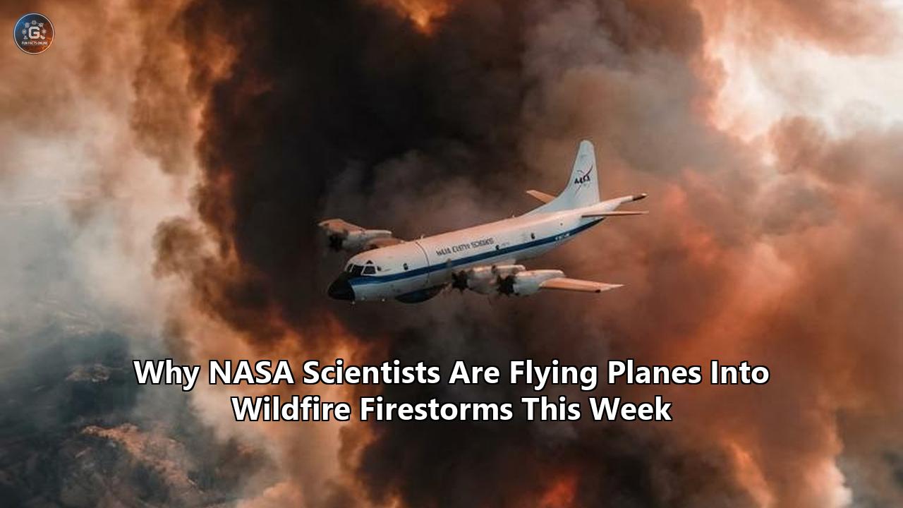
On July 27, 2026, a high-altitude Lockheed ER-2 research aircraft climbed out of its operational base in Montana and set a heading directly toward a towering, obsidian-black column of smoke rising over the American West. At 65,000 feet, where the sky fades into the dark vacuum of space, the NASA aircraft positioned itself directly over a monstrous, self-generating thunderstorm born not from a atmospheric cold front, but from the raw heat of an escalating wildfire.
Simultaneously, a modified Gulfstream V jet operated by the National Science Foundation and the National Center for Atmospheric Research dove into the upper boundaries of the smoke plume, its specialized intake tubes sampling toxic gases and superheated aerosols in real time.
This high-stakes aerial operation marks the official field launch of INSPYRE—the Injected Smoke and PYRocumulonimbus Experiment. Led by the U.S. Naval Research Laboratory (NRL) in close coordination with NASA, the National Oceanic and Atmospheric Administration (NOAA), and multiple university partners, this five-year suborbital campaign represents the most aggressive airborne scientific effort ever assembled to study wildland firestorms.
These NASA wildfire research flights are targeting one of the planet’s most destructive atmospheric phenomena: pyrocumulonimbus (pyroCb) clouds. Commonly known as "firestorms" or "fire clouds," pyroCbs occur when intense wildfires generate fierce thermal updrafts that act like chimneys, lofting moisture, soot, and toxic chemicals into the upper atmosphere. Once there, these plumes create severe thunderstorms capable of generating erratic hurricane-force winds, dry lightning, violent fire whirls, and massive smoke injections that reach the stratosphere.
"Pyrocumulonimbus is a unique type of severe weather linked specifically to wildfires," explained Dr. David Peterson, research meteorologist at NRL Monterey and lead principal investigator for INSPYRE. "Some of these storms produce significant lightning and others produce very little. We know that lightning can ignite new fires, but we don't yet understand what drives those differences. INSPYRE gives us our first opportunity to study that process with a full suite of airborne measurements."
As record-breaking heat waves and prolonged droughts continue to create tinderbox conditions across North America, the frequency and scale of pyroCb events have exploded. Yet, atmospheric scientists and wildland fire managers remain severely hindered by a critical knowledge gap: spaceborne satellites and ground-based radar often cannot penetrate the dense smoke or track the rapid atmospheric feedback loops that turn a standard wildfire into an unstoppable atmospheric engine.
To solve this challenge, scientists are taking to the sky, placing state-of-the-art sensors directly inside and above the inferno to decode the mechanics of fire-driven severe weather.
The Violent Physics of Pyrocumulonimbus Storms
To understand why researchers are flying multi-million-dollar aircraft into firestorms, one must first grasp the violent atmospheric dynamics behind a pyrocumulonimbus cloud.
Under extreme fire conditions—typically driven by high ambient temperatures, low humidity, dense dry fuels, and strong surface winds—a intense megafire releases immense amounts of sensible and latent heat over a short period. This rapid release of thermal energy creates an extreme surface low-pressure zone, sucking in surrounding air and driving a violent, highly buoyant updraft.
               [ STRATOSPHERE ] (Above 40,000 ft)
                      ^
                      |  Aerosol Injection (Soot, Black Carbon)
        +-----------------------------------+
        |      Pyrocumulonimbus Anvil       |  <-- High-altitude Ice/Smoke Cloud
        +-----------------------------------+
          /          |             |       \
    Lightning    Downdrafts     Downbursts  Erratic Winds
       |             |             |           |
       v             v             v           v
  [New Fires]  [Rapid Spread]  [Extreme Turbulence]
                     ^
                     | Violent Updraft (30-50 m/s)
         +--------------------------+
         |   Extreme Surface Fire   |  (Thermal Energy Engine)
         +--------------------------+
As this hot air rises at velocities exceeding 30 to 50 meters per second, it carries immense volumes of biomass combustion products—water vapor, carbon dioxide, carbon monoxide, soot, organic aerosols, and ash. As the air column ascends into the colder troposphere, the water vapor (produced both by combustion and ambient air entrainment) condenses.
Crucially, the trillions of microscopic smoke particles act as Cloud Condensation Nuclei (CCN). Unlike pristine atmospheric thunderheads, where water vapor condenses into larger raindrops, the overwhelming abundance of smoke particles forces water vapor to split across an immense number of tiny droplets.
This microphysical alteration changes everything:
- Inhibited Warm Rain Processes: The tiny cloud droplets are too small to efficiently collide and coalesce into falling raindrops. Instead of producing heavy surface rain that could douse the flames below, the water remains suspended as the updraft blasts it higher into sub-freezing atmospheric layers.
- Latent Heat Acceleration: As these supercooled droplets freeze into ice crystals and graupel high above the fire, they release vast amounts of latent heat of fusion. This extra thermal boost acts as an atmospheric turbocharger, accelerating the updraft even further and driving the cloud top past the tropopause—the boundary separating the troposphere from the stratosphere.
- Electrical Charge Separation: The violent collision of ice particles, graupel, and soot particles within these intense freezing updrafts generates massive electrostatic charges. The result is a thunderstorm generated entirely by fire, capable of producing thousands of lightning strikes in a span of hours.
The ground-level consequences are catastrophic. The cloud anvil can spread out over hundreds of square miles, blocking sunlight and casting an eerie twilight over the landscape. Beneath the cloud, intense convective downdrafts and microbursts can crash back toward the surface, slamming into the ground and scattering firebrands in every direction. These erratic, hurricane-force wind shifts can trap ground firefighters, blow out established containment lines, and transform a manageable flank into an out-of-control firefront within minutes.
Even worse, pyroCb lightning strikes frequently fall miles outside the main fire perimeter in dry, unburned vegetation. Because these storms often produce little to no surface rain ("dry lightning"), these strikes spark secondary blazes, creating a self-sustaining cycle where the primary firestorm spawns dozens of new satellite fires.
Why Satellites and Ground Radars Fall Short
For decades, wildland fire managers and weather forecasters relied on a combination of geostationary environmental satellites (such as NOAA's GOES-18), polar-orbiting satellites (like JPSS), and ground-based Doppler weather radars (NEXRAD) to track wildland fires and smoke. However, when applied to pyrocumulonimbus dynamics, these traditional systems encounter severe physical limitations.
The Optical Thickness and Thermal Masking Obstacle
Geostationary satellites orbit Earth at an altitude of approximately 22,236 miles (35,786 km). While they provide excellent broad-scale imaging, their spatial resolution for thermal infrared bands is typically limited to 1 to 2 kilometers per pixel.
When a fire generates a massive pyroCb plume, the cloud top becomes optically opaque. The dense blanket of upper-level cloud ice and thick soot absorbs and scatters the thermal infrared radiation emitting from the active combustion zone beneath it.
To a satellite sensor, the top of a pyroCb storm looks freezing cold—often below -50°C (-58°F)—effectively masking the multi-hundred-degree fire raging underneath. As a result, automated satellite fire-tracking algorithms can register a false "burn-out" signal precisely when the fire on the ground is burning at its most violent intensity.
+-------------------------------------------------------------------+
|                  TRADITIONAL SATELLITE LIMITATION                 |
+-------------------------------------------------------------------+
| Satellite Sensor (GOES / VIIRS)                                   |
|       |                                                           |
|       v (Thermal IR signal blocked)                               |
| [ Dense PyroCb Anvil Cloud: Cold Ice & Soot Mask (-50°C) ]         |
| ~~~~~~~~~~~~~~~~~~~~~~~~~~~~~~~~~~~~~~~~~~~~~~~~~~~~~~~~~~~~~~~~~ |
| [ Opaque Smoke & Particle Column: Optical Depth > 10 ]            |
|                                                                   |
| [ Extreme Active Fire Surface: Intense Heat Invisible ]           |
+-------------------------------------------------------------------+
Temporal and Spatial Blind Spots
Polar-orbiting satellites provide much higher spatial resolution (up to 375 meters for VIIRS), but they only pass over a given location twice a day. A pyroCb storm, however, can form, shoot into the stratosphere, generate thousands of lightning strikes, and collapse all within a three-to-six-hour window.
Relying on polar-orbiting passes is equivalent to taking two snapshots per day of an ongoing chemical reaction—missing the critical operational triggers that dictate fire safety.
Ground-based Doppler radar networks suffer from their own geometric and atmospheric distortions:
- Beam Geometry and Terrain Blocking: In the mountainous terrain of the Western U.S. and Canada where pyroCbs frequently form, high topography often blocks low-level radar beams, creating vast coverage gaps near the ground where updraft initiation occurs.
- Aerosol Attenuation: NEXRAD radars are calibrated primarily to detect rain droplets and snow crystals. The unique mixture of ash, charred pine needles, soot, and tiny cloud droplets within a smoke plume severely attenuates S-band radar signals, distorting estimates of cloud water content and updraft intensity.
- Electromagnetic Ambiguity: Standard ground radar cannot easily differentiate between a cloud consisting of liquid rain vs. one packed with dry ash and non-spherical carbonaceous debris, making it nearly impossible for meteorologists to determine whether a rising column will produce rain, dry lightning, or severe downdrafts.
These observational blind spots leave incident commanders working blind during the most dangerous hours of a fire's lifecycle. Without real-time, high-resolution data on plume dynamics, atmospheric forecasting models struggle to predict when a fire will transition from a plume-dominated burn to a fully developed pyrocumulonimbus firestorm.
Inside the INSPYRE Mission Strategy
To overcome these physical limitations, the INSPYRE campaign deploys a coordinated, multi-aircraft strategy designed to capture every layer of a firestorm simultaneously. By flying specialized research platforms both far above and directly alongside active pyroCb plumes, scientists are building a three-dimensional, real-time diagnostic map of fire-atmosphere interactions.
===================================================================
                  INSPYRE HIGH-ALTITUDE ARCHITECTURE
===================================================================

 [ Lockheed ER-2 / WB-57 ]  <-- Flying at 60,000 - 65,000 feet
   - iSTORM (Gamma-ray / Lightning detection)
   - AVIRIS-3 & PIRS (Hyperspectral & Infrared tracking)
   - Lidar Cloud Profilers
   -------------------------------------------------------------
   | (Remote sensing looking down through cloud tops)          |
   v                                                           v

                 [ PYROCUMULONIMBUS ANVIL PLUME ]

   ^                                                           ^
   | (Direct in-situ air sampling at plume margins)            |
   -------------------------------------------------------------
 [ NSF/NCAR Gulfstream V ]  <-- Flying at 20,000 - 45,000 feet
   - Aerosol Mass Spectrometers
   - Optical Particle Counters
   - Gas Analyzers (CO, CO2, Ozone, NOx)

   -------------------------------------------------------------
 [ NASA FireSense Aircraft (B200 / A90) ] <-- Mid-Altitude Mapping
   - G-LiHT Thermal Imagers
   - FireKite & Real-Time Data Relays
   -------------------------------------------------------------

         [ GROUND TEAMS ] Mobile Doppler Radars & Lidar Units
===================================================================
The Aircraft Platforms and Their Specific Roles
The NASA wildfire research flights rely on a precise division of labor across distinct atmospheric zones:
1. NASA Lockheed ER-2 (High-Altitude Remote Sensing)
Operating out of Great Falls, Montana, with mission command in Colorado, NASA’s ER-2 is a civilian derivative of the U-2 high-altitude reconnaissance aircraft. Flying at altitudes up to 65,000 feet—well above the top of any weather system—the ER-2 acts as an agile suborbital satellite simulator.
Because it operates above 99% of Earth's atmosphere, the ER-2 provides an unobstructed view of the pyroCb cloud top, looking down through the plume using a suite of advanced remote sensors. Joining the ER-2 in high-altitude sweeps is NASA’s WB-57 high-altitude research plane, extending coverage across major wildfire zones in the Western U.S. and Canada.
2. NSF/NCAR Gulfstream V (In-Situ Plume Sampling)
While high-altitude aircraft look down from above, the NSF/NCAR Gulfstream V jet operates within mid-to-high atmospheric layers (20,000 to 45,000 feet). When atmospheric conditions permit, the Gulfstream V executes direct penetrations into the outer edges, anvil boundaries, and outflow regions of active pyroCb plumes.
Equipped with specialized air-intake probes mounted on its fuselage and wings, the plane ingests soot, ice crystals, and trace gases, measuring particle size distributions, chemical evolution, and cloud microphysics in real time.
3. NASA FireSense Aircraft Fleet (Mid-Altitude Fire Dynamics)
Coordinated closely with INSPYRE are the flight operations of NASA’s FireSense project. Utilizing Dynamic Aviation King Air B200 and Beechcraft A90 aircraft, FireSense operates at lower altitudes directly adjacent to active fires.
These aircraft map ground-level fuel conditions, active combustion intensity, and immediate plume rise dynamics, feeding low-altitude data directly into the higher-altitude atmospheric observations.
+---------------------------------------------------------------------------------------+
|                    INSPYRE & FIRESENSE INSTRUMENTATION MATRIX                         |
+-------------------+----------------------+--------------------------------------------+
| Instrument Name   | Lead Institution     | Primary Scientific Function                |
+-------------------+----------------------+--------------------------------------------+
| iSTORM            | Naval Research Lab   | Terrestrial gamma-ray flashes, electric    |
|                   |                      | field intensity, and lightning dynamics.   |
+-------------------+----------------------+--------------------------------------------+
| AVIRIS-3          | NASA JPL             | High-resolution imaging spectroscopy for    |
|                   |                      | active fire thermal output & fuels.        |
+-------------------+----------------------+--------------------------------------------+
| PIRS              | NASA JPL / LaRC      | Infrared sounding of temperature and water |
| (Pyro-Atmosphere) |                      | vapor profiles through smoke columns.      |
+-------------------+----------------------+--------------------------------------------+
| G-LiHT            | NASA Goddard         | Airborne LiDAR for forest canopy structure |
|                   |                      | and aerosol extinction profiling.          |
+-------------------+----------------------+--------------------------------------------+
| FireKite          | Logos Technologies   | Real-time wide-area infrared motion vector |
|                   |                      | tracking of fire fronts.                   |
+-------------------+----------------------+--------------------------------------------+
Unlocking the Electrical Secret: The iSTORM Payload
One of the most groundbreaking instruments flying aboard the ER-2 during the campaign is iSTORM (integrated Space-borne Terrestrial gamma-ray & Optical Radiation Monitor), developed by the U.S. Naval Research Laboratory’s Space Science Division.
Scientists have long known that pyroCb clouds produce lightning, but their electrical behavior is fundamentally strange. Some firestorms generate violent barrage lightning that ignites dozens of new blazes, while other equally large firestorms produce virtually no electrical activity at all.
iSTORM is designed to solve this mystery by measuring high-energy radiation, optical flashes, and electromagnetic pulses associated with terrestrial gamma-ray flashes (TGFs) and charge build-up inside the smoke cloud.
When intense electric fields accelerate electrons within the turbulent cloud top, they collide with air molecules, producing brief bursts of gamma rays. By measuring these radiation bursts alongside optical lightning sensors, iSTORM allows researchers to map the internal electrical charging mechanism of a firestorm for the first time.
"If we can identify the specific atmospheric and fuel conditions that cause a pyroCb to start sparking lightning, we can give operational wildland fire agencies advance warning hours before dry lightning strikes hit unburned forests," noted Peterson.
From Atmospheric Physics to Operational Firefighting
While understanding the fundamental physics of pyrocumulonimbus storms is a major goal for atmospheric scientists, the research flights are tied to immediate, practical solutions for emergency responders on the ground.
Wildland firefighting is undergoing a operational shift, driven by the realization that extreme fire behavior requires real-time predictive technology rather than reactive suppression.
+-------------------------------------------------------------------+
|               BRIDGING SCIENCE TO FRONTLINE OPERATIONS            |
+-------------------------------------------------------------------+
| 1. AIRBORNE SENSING (INSPYRE & FireSense)                         |
|    - ER-2 / Gulfstream V map plume dynamics & thermal output      |
+-------------------------------------------------------------------+
                                  |
                                  v
| 2. DATA PROCESSING & MODELING                                     |
|    - High-speed assimilation into atmospheric forecast models     |
|    - Plume rise and downburst prediction algorithms               |
+-------------------------------------------------------------------+
                                  |
                                  v
| 3. NASA ACERO INTERFACE (PAMS Suitcase Mesh Network)              |
|    - Autonomous airspace management for 24/7 drone deployment    |
|    - Deconfliction of manned tankers & unmanned scout aircraft    |
+-------------------------------------------------------------------+
                                  |
                                  v
| 4. FRONTLINE INCIDENT COMMAND ACTION                             |
|    - Early warning for convective cloud collapse & downdrafts      |
|    - Precise targeted nighttime aerial retardant drops            |
+-------------------------------------------------------------------+
Nighttime Suppression and NASA’s ACERO Project
Historically, wildland firefighters had a critical operational advantage: the "nighttime recovery." Under normal atmospheric conditions, ambient temperatures drop at night, relative humidity rises, and wind speeds decay, causing fire intensity to decrease significantly. Ground crews traditionally relied on these hours to build containment lines safely.
However, in modern megafires and pyroCb environments, the traditional nighttime recovery is increasingly failing. Severe fires now burn aggressively through the night, driven by low atmospheric humidity and local wind dynamics created by the fire itself.
Compounding the problem, conventional firefighting aircraft—such as heavy airtankers and spotter helicopters—are legally grounded after sunset under Visual Flight Rules (VFR). Pilots cannot safely navigate low over rugged, smoky terrain at night without colliding with topography or other aircraft.
To break this barrier, NASA's Aeronautics Research Mission Directorate is deploying technology tested under its ACERO (Advanced Capabilities for Emergency Response Operations) project. Managed out of NASA’s Ames Research Center, ACERO is engineering airspace management infrastructure that enables remotely piloted and fully autonomous drones to monitor and suppress wildfires 24 hours a day.
"We're aiming to provide new tools—including airspace management technologies—for 24-hour drone operations for wildfire response," said Min Xue, project manager of the ACERO project. "Current aerial firefighting operations are limited to times when aircraft have clear visibility—otherwise, pilots run the risk of flying into terrain or colliding with other aircraft."
At the core of this system is the Portable Airspace Management System (PAMS). Packaged into a rugged suitcase-sized container, each PAMS unit incorporates:
- High-performance edge computing modules running tactical airspace management software.
- Ad-hoc mesh radios for secure ground-to-air and unit-to-unit data exchange.
- Automatic Dependent Surveillance-Broadcast (ADS-B) receivers to track all nearby crewed and uncrewed aircraft traffic.
By deploying PAMS units around an active wildfire perimeter, incident commanders create an automated, digital airspace shield. The software continuously calculates safe flight corridors for autonomous, heavy-lift water-dropping drones and high-altitude thermal scouting UAVs, keeping them safely separated from crewed aircraft even in dense smoke or total darkness.
Data collected during the NASA wildfire research flights feeds directly into these airspace systems, providing high-resolution wind vectors and smoke density profiles that allow autonomous drones to navigate severe weather safely.
+-------------------------------------------------------------------+
|               PORTABLE AIRSPACE MANAGEMENT SYSTEM (PAMS)           |
+-------------------------------------------------------------------+
| [ Carry-on Suitcase Form Factor ]                                 |
|                                                                   |
| +-------------------------+   +---------------------------------+ |
| | Edge Compute Processing |   | Mesh Network Communications     | |
| | - Deconfliction engine  |   | - Inter-unit tactical radio     | |
| | - Terrain avoidance     |   | - Low-latency telemetry link    | |
| +-------------------------+   +---------------------------------+ |
| +---------------------------------------------------------------+ |
| | ADS-B Receiver & Radar Integration                            | |
| | - Real-time tracking of crewed airtankers & thermal drones    | |
| +---------------------------------------------------------------+ |
+-------------------------------------------------------------------+
Direct Delivery to the Front Lines: The WFSI Portal
Scientific measurements are useless to a firefighter on the line if they remain locked in an academic repository. To ensure data collected during INSPYRE and FireSense reaches decision-makers in real time, NASA and its partner agencies developed the Wildland Fire Science Initiative (WFSI) Data Portal.
During campaign operations, onboard processors on the ER-2 and B200 aircraft rapidly process raw spectral and thermal imagery into compressed geotiffs and vector shapefiles. Within minutes of an aircraft passing over a fire, these data products are beamed via satellite link to the WFSI portal.
Incident Management Teams (IMTs) on the ground can view:
- Active Fire Vectors: Precise 3D maps pinpointing active flame fronts beneath smoke layers, accurate down to single meters.
- Pyrocumulonimbus Blow-Up Alerts: Automated warnings derived from airborne sounders indicating that a plume is reaching critical atmospheric instability thresholds.
- Plume Dispersion & Air Quality Maps: High-resolution smoke trajectory forecasts detailing where hazardous surface soot concentration will strike downwind communities.
Global Atmospheric Impacts and Strategic Implications
The stakes of understanding pyrocumulonimbus storms extend far beyond local wildfire perimeters. The scientific data collected during these missions addresses a growing concern among global climate scientists: the role of wildland firestorms as major drivers of stratospheric chemistry and global radiative balance.
+-------------------------------------------------------------------+
|                GLOBAL IMPACT OF STRATOSPHERIC SMOKE               |
+-------------------------------------------------------------------+
| PyroCb Stratospheric Injection (40,000 - 55,000+ ft)              |
|       |                                                           |
|       +---> Black Carbon Aerosols                                 |
|       |     - Solar energy absorption -> Stratospheric warming    |
|       |     - Surface solar dimming -> Regional climate shifts    |
|       |                                                           |
|       +---> Water Vapor & Reactive Organic Carbon                 |
|             - Heterogeneous chemical reaction on soot surfaces    |
|             - Catalytic catalytic destruction of Stratospheric O3 |
|             - Accelerated Ozone Layer Thinning                    |
+-------------------------------------------------------------------+
PyroCbs as Atmospheric Volcanoes
Historically, atmospheric scientists believed that only massive volcanic eruptions—such as the 1991 eruption of Mount Pinatubo—possessed enough explosive kinetic energy to punch through the tropopause and inject megatons of aerosols directly into the stratosphere.
However, satellite observations over the past decade, validated by NASA airborne studies, revealed that extreme pyrocumulonimbus events act like "subaerial volcanoes".
For example, the historic 2017 Pacific Northwest pyroCb event and Australia’s "Black Summer" firestorms of 2019–2020 each injected amounts of smoke aerosol into the stratosphere comparable to moderate volcanic eruptions.
Once smoke particles reach the calm, non-convective stratosphere, they are not washed out by rain. Instead, strong stratospheric jet streams capture the smoke plumes, dispersing them across entire hemispheres within weeks. These aerosol layers can remain suspended in the upper atmosphere for over a year.
Climate Radiative Forcing and Ozone Layer Destruction
The presence of persistent smoke in the stratosphere alters Earth's radiative balance in complex ways:
- Direct Radiative Forcing: Black carbon (soot) particles in the plume strongly absorb incoming solar radiation. This causes localized heating of the stratosphere while simultaneously preventing sunlight from reaching the ground, a phenomenon known as "surface solar dimming." The resulting differential thermal profile can shift regional circulation patterns, jet stream trajectories, and monsoon precipitation cycles.
- Ozone Layer Chemistry: Stratospheric smoke injections carry organic molecules, nitrogen oxides (NOx), and water vapor into an environment that is normally extremely dry and pristine. Recent chemical transport modeling suggests that heterogeneous chemical reactions occurring on the surfaces of hot soot particles accelerate the catalytic destruction of stratospheric ozone ($O_3$). This thins the protective ozone shield that protects Earth’s surface from harmful ultraviolet radiation.
"For the military, commercial aviation, and atmospheric modeling, knowing where those smoke layers are and how they behave matters because they travel thousands of miles downwind within days," said Peterson. "INSPYRE will study the effect of smoke on Earth's radiative budget, providing the data needed to integrate these extreme events into long-term climate projections."
+---------------------------------------------------------------------------------------+
|                    MAJOR MILESTONES IN NASA WILDFIRE RESEARCH                         |
+---------------+-----------------------------------------------------------------------+
| Year          | Mission Milestone / Advancement                                       |
+---------------+-----------------------------------------------------------------------+
| 2019          | FIREX-AQ campaign achieves first landmark DC-8 in-plume sampling of   |
|               | an active pyroCb storm over Washington State.                         |
+---------------+-----------------------------------------------------------------------+
| 2024–2025     | NASA ACERO tests Portable Airspace Management Systems (PAMS) for 24/7 |
|               | nighttime drone operations in smoky airspace.                         |
+---------------+-----------------------------------------------------------------------+
| July 2026     | INSPYRE campaign officially launches flight operations with NASA ER-2,|
|               | WB-57, and NSF/NCAR Gulfstream V.                                     |
+---------------+-----------------------------------------------------------------------+
| 2026–2027     | Dual-summer field flight phases track pyroCb storms across Western    |
|               | United States and Canada.                                             |
+---------------+-----------------------------------------------------------------------+
| 2028–2030     | Multi-year analysis phase synthesizes airborne data into next-gen     |
|               | predictive fire-atmosphere and climate models.                        |
+---------------+-----------------------------------------------------------------------+
What to Watch Next in Wildfire Atmospheric Science
As the INSPYRE flight campaign progresses through its summer field phase, several key milestones and long-term developments will shape the future of wildfire research and operational safety:
1. The 2026–2027 Flight Deployments
The current flight operations running through September 2026 mark only the first active deployment phase of the INSPYRE mission. A second major flight campaign is scheduled for the summer of 2027, focusing on expanding the geographic sampling domain into high-latitude boreal forests across Northern Canada and Alaska. Boreal fires burn through deep peat and organic soil layers, producing chemically unique smoke profiles that exert a disproportionately large impact on Arctic warming dynamics.
2. Integration into Next-Generation Satellite Architectures
Data gathered by the ER-2's remote sensing sensors will directly inform the calibration and algorithm development for NASA’s upcoming Atmospheric Observing System (AOS) satellite constellation. By pairing airborne truth measurements with satellite observations, NASA scientists are designing future satellite sensors that will be able to look through optically thick smoke clouds and detect hidden thermal signatures on the ground.
3. Regulatory Adoption of Autonomous Firefighting Airspace
On the operational side, the ongoing field evaluations of NASA’s ACERO project and PAMS units are expected to accelerate Federal Aviation Administration (FAA) regulatory approvals for Beyond Visual Line of Sight (BVLOS) autonomous drone operations during wildland fire emergencies.
If successfully adopted by federal agencies like the U.S. Forest Service and the Bureau of Land Management, automated 24/7 aerial suppression could become standard protocol across North America before the end of the decade.
+-------------------------------------------------------------------+
|                   THE FUTURE OF FIRE MANAGEMENT                   |
+-------------------------------------------------------------------+
|  [ AIRBORNE SCIENCE ]     [ REAL-TIME MODELS ]   [ 24/7 ACTION ]  |
|   INSPYRE ER-2 Flights ->  WFSI Data Portal   -> Autonomous Drones|
|   (Plume Microphysics)    (Predictive Vectors)   (Night Suppression)|
+-------------------------------------------------------------------+
4. Resolving the Lightning Ignition Paradox
In the coming months, initial publications from the INSPYRE team will release analysis of the iSTORM gamma-ray and lightning data. Discovering why certain pyroCbs generate dry-lightning blizzards while others remain electrically quiet will mark a major leap forward in severe weather forecasting, giving frontline communities precious hours to prepare before new firefronts ignite.
The sight of NASA planes flying into towering columns of fire and smoke is a striking reminder of the lengths scientists must go to understand our changing planet. By chasing these violent firestorms into the stratosphere, researchers are pulling back the curtain on one of nature's most dangerous weather phenomena—ensuring that those tasked with fighting fires on the ground are no longer forced to fight in the dark.
Reference:
- https://www.dvidshub.net/news/567546/nrl-leads-nasa-wildfire-research-mission-better-predict-pyrocumulonimbus-storm-hazards
- https://dailydispatch.com/fire-news/wildland/nasa-led-mission-based-in-colorado-will-chase-wildfire-thunderstorms-across-the-west/
- https://www.independent.co.uk/news/science/nasa-planes-wildfires-storm-clouds-weather-b3018916.html
- https://www.techno-science.net/en/news/planes-pyrocumulonimbus-wildfires-science-atmosphere-29127
- https://www.altadena-now.com/main/science-technology/nasa-earth-science-flights-to-begin-with-jpl-instruments-aboard-first-mission/
- https://www.cbsnews.com/colorado/news/research-jet-wildfire-smoke-colorado/
- https://wildfiretoday.com/flying-through-a-pyrocumulonimbus-cloud/
- https://science.nasa.gov/earth/earth-observatory/flying-through-a-fire-cloud-145446/
- https://cce.nasa.gov/firesense/airborne_campaigns.html
- https://www.nasa.gov/aeronautics/wildland-fire-tech-tested/
- https://www.nasa.gov/stmd-flight-opportunities/flight-summaries/stoking-innovation-protecting-lives-via-flight-testing/