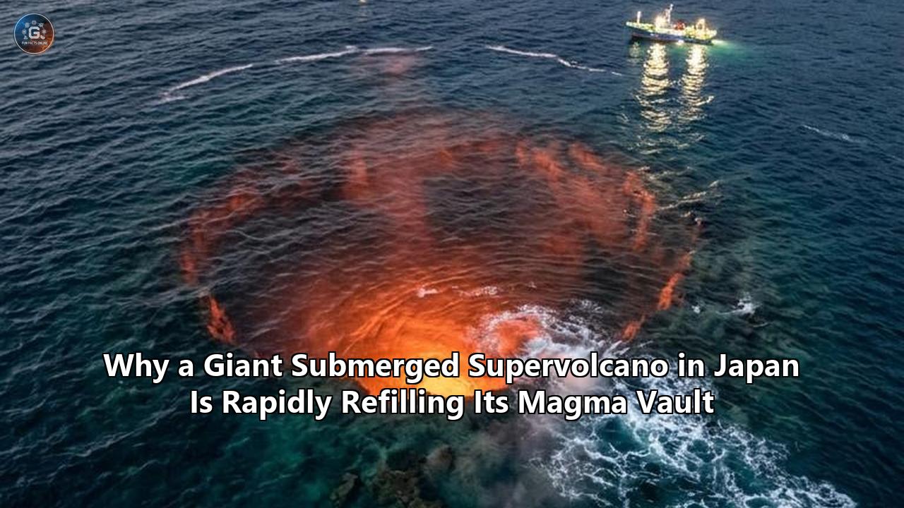
A landmark marine seismic survey led by researchers at Kobe University and the Japan Agency for Marine-Earth Science and Technology (JAMSTEC) has revealed that the subterranean magma reservoir beneath the Kikai Caldera is actively refilling. Located roughly 50 kilometers south of Kyushu Island in southwestern Japan, the mostly submerged volcanic crater was responsible for the Kikai-Akahoya eruption 7,300 years ago—the largest volcanic event of the Holocene epoch.
The study, published in Communications Earth & Environment by lead author Akihiro Nagaya and geophysicist Nobukazu Seama, provides direct geophysical evidence that fresh, molten rock is accumulating in a shallow vault between 2.5 and 6 kilometers beneath the seafloor. Using an array of 39 ocean-bottom seismometers along a 175-kilometer profile, alongside ship-mounted airgun arrays, the research team mapped a distinct low-velocity seismic anomaly directly under the caldera’s central lava dome. This low-velocity zone marks a major concentration of newly injected magma occupying the exact structural plumbing system that drove the ancient prehistoric catastrophe.
The confirmation of a Japan supervolcano magma refill process beneath the East China Sea highlights a fundamental challenge for modern volcanology: detecting, interpreting, and mitigating hazards from giant submarine calderas. Unlike terrestrial supervolcanoes, which can be continuously monitored via satellite radar, land-based GPS, and dense seismometer networks, submerged calderas mask their subterranean dynamics under hundreds of meters of sea water. The findings confirm that caldera-forming supervolcanoes do not simply go dormant or slowly cool after catastrophic collapses; instead, they can rapidly re-establish their magma supply, resetting the clock for future volcanic cycles.
Submarine Architecture of the Kikai Caldera
===================================================================
Seafloor Depth: ~400–500 meters
│
├── Submarine Central Lava Dome (~32 km³ volume, ~600 m height)
│   └── Active Hydrothermal Vents & Gas Bubbling
│
├── Shallow Crustal Boundary (0 – 2.5 km depth)
│
├── RECHARGING MAGMA RESERVOIR (2.5 km – 6.0 km depth)
│   ├── Low-velocity seismic anomaly detected by 39 OBS units
│   └── Influx of fresh, mantle-derived felsic/rhyolitic melt
│
└── Deep Magma Supply System (>10–30 km depth)
===================================================================
The Submerged Crisis: Why Underwater Calderas Disguise Their Preparation
For decades, geoscientists debated whether post-collapse volcanic activity at giant calderas represented the final, dying heat of residual magma or the start of a completely new eruptive cycle. Because Kikai’s vast structure lies submerged beneath the ocean, observing its behavior has presented severe technical obstacles.
When a supervolcano erupts, it empties hundreds of cubic kilometers of molten rock in a matter of hours or days. The roof of the underground magma chamber collapses into the evacuated void, forming a broad, shallow basin known as a caldera. At Kikai, this collapse created a double-caldera structure measuring roughly 17 kilometers across.
Caldera Cycle Mechanics: From Collapse to Recharge
----------------------------------------------------------------------------------
1. Catastrophic Eruption  ──> Rapid evacuation of >100 km³ magma chamber
2. Roof Collapse          ──> Ground sinks, creating 17 km submarine depression
3. Post-Caldera Rest      ──> Residual heat dissipates, minor hydrothermal venting
4. Fresh Melt Injection   ──> Deep magma rises into original shallow storage zone
5. Resurgence / Doming    ──> Growth of central lava dome (~32 km³ at Kikai)
----------------------------------------------------------------------------------
The challenge for hazard assessment is that water absorbs and muffles many of the classic physical signals that geophysicists rely on to predict volcanic eruptions on land.
On land, a refilling magma chamber causes the ground above it to bulge upward—a process called deformation. Satellite-borne Synthetic Aperture Radar (InSAR) and Global Navigation Satellite Systems (GNSS) can track millimeter-scale surface uplifts across sites like Yellowstone in North America or Campi Flegrei in Italy. Deep under water, satellite radar cannot penetrate the sea surface.
Furthermore, small-magnitude seismic swarms caused by moving magma are easily attenuated by ocean sediment layers and water columns, making them difficult for inland seismometers on the Japanese mainland to detect or locate precisely.
As a result, marine supervolcanoes can quietly accumulate enormous volumes of pressurized, gas-rich magma without generating obvious surface warning signs. Geoscientists previously lacked the empirical tools needed to determine whether the magma storage system beneath Kikai was permanently disrupted by its ancient collapse or if it remained capable of holding new melt. The new seismic tomography data resolves that mystery, confirming that the original chamber remains structurally intact and is accumulating fresh melt.
Anatomy of a Holocene Catastrophe: The Historic Threat of Kikai
To grasp why the recharge of Kikai matters, one must examine the scale of its last major outburst. About 7,300 years ago, the Kikai-Akahoya eruption ejected an estimated 160 cubic kilometers of dense rock equivalent (and over 500 cubic kilometers of bulk volcanic material) into the atmosphere and ocean. It stands as the most explosive eruption of the Holocene—the current geological epoch that began 11,700 years ago.
Eruption Volume Comparison (Dense Rock Equivalent)
==================================================================================
1991 Mount Pinatubo (Philippines) │ 5 km³
1912 Novarupta (Alaska, USA)     │ 13.5 km³
7,300 BP Kikai-Akahoya (Japan)   │ ████████████████████████████████████ 160+ km³
==================================================================================
The Kikai-Akahoya event was roughly 11 times larger than the 1912 eruption of Novarupta in Alaska and more than 32 times larger than the 1991 eruption of Mount Pinatubo in the Philippines.
During the Akahoya event, boiling clouds of ash, gas, and rock—known as pyroclastic flows—traveled across open water for more than 100 kilometers, reaching the southern coast of Kyushu. The eruption blanketed nearly all of Japan in a thick layer of fine volcanic ash (tephra), with trace deposits extending to the Korean Peninsula.
Archaeological and geological records indicate that the eruption wiped out the prehistoric Jōmon civilization in southern Kyushu. The combination of lethal pyroclastic flows, toxic ash fall, and long-term agricultural collapse rendered southern Japan uninhabited for centuries.
Geophysical Footprint of the Kikai-Akahoya Eruption
┌─────────────────────────────────────────────────────────────────────────┐
│ Primary Impact Zone (Radius 0–100 km):                                  │
│ Complete obliteration via marine-crossing pyroclastic flows.             │
├─────────────────────────────────────────────────────────────────────────┤
│ Regional Tephra Blanket (Radius 100–1,000 km):                         │
│ Heavy ash fallout across Kyushu, Shikoku, Honshu, and Korean Peninsula. │
├─────────────────────────────────────────────────────────────────────────┤
│ Atmospheric / Global Zone:                                              │
│ Massive sulfur dioxide injection into the stratosphere causing global   │
│ volcanic winter and temporary climate cooling.                          │
└─────────────────────────────────────────────────────────────────────────┘
If an event of comparable magnitude occurred today, the consequences would be catastrophic:
- Humanitarian and Population Impact: Southern Kyushu is home to millions of residents, alongside major metropolitan centers such as Kagoshima and Miyazaki. Pyroclastic flows and immediate ash fallout would require massive regional evacuations.
- Economic and Supply Chain Disruption: Kyushu is known as Japan's "Silicon Island," housing a critical concentration of global semiconductor manufacturing plants. Fine volcanic ash destroys electronic fabrication facilities, clogs air filtration systems, and halts precision manufacturing.
- Infrastructure Collapse: Ash deposits exceeding just a few centimeters ground commercial aviation, derail high-speed rail lines, disable electricity grids by shorting transformers, and contaminate municipal water reservoirs across East Asia.
- Global Climate Anomalies: A supereruption releasing tens of millions of tons of sulfur dioxide into the stratosphere would block solar radiation, inducing a global "volcanic winter" that could reduce global temperatures by 1 to 2 degrees Celsius for several years, devastating global agriculture.
Geochemical Forensics: Proving the Influx of Fresh Magma
The discovery that Kikai is actively recharging relied on combining advanced seismic imaging with geochemical analysis of rock samples retrieved from the seabed.
Following the collapse 7,300 years ago, a massive lava dome began rising from the floor of the underwater crater. Oceanographic expeditions led by Kobe University’s Training Vessel Fukae Maru and JAMSTEC’s Deepsea Research Vessel Chikyu used remotely operated vehicles (ROVs) and dredging equipment to extract rock samples directly from this underwater dome.
Geochemical Distinctions in Kikai's Volcanic Material
──────────────────────────────────────────────────────────────────────────────────
Feature                 7,300 BP Akahoya Ejecta       Post-3,900 BP Central Dome
──────────────────────────────────────────────────────────────────────────────────
Magma Type              Depleted Felsic Rhyolite      Enriched Fresh Felsic Melt
Isotopic Profile        Residual Crustal Signature    New Deep Crust/Mantle Influx
Dome Volume Contribution Minimal (Pre-Collapse)        ~32 km³ (Post-Collapse Growth)
Storage Depth           Primary Chamber (Evacuated)    Recharged Chamber (2.5–6 km)
──────────────────────────────────────────────────────────────────────────────────
Analytical chemistry revealed that the central lava dome has grown to an astounding volume of roughly 32 cubic kilometers—making it one of the largest single lava domes on Earth. More importantly, isotopic and trace-element testing of the dome’s rhyolitic lava showed that its chemical composition differs significantly from the ash and pumice ejected during the 7,300-year-old Akahoya super-eruption.
If the dome were simply formed by leftover, stagnant magma squeezed out after the ancient collapse, its chemical signature would match the original eruption. Instead, the distinct geochemical profile proves that new, melt-rich material has been generated deep in the Earth's crust and injected upward into the shallow storage zone over the past 3,900 years.
"This means that the magma that is now present in the magma reservoir under the lava dome is likely newly injected magma," explained Professor Nobukazu Seama.
Subsea Seismic Refraction Surveying (KOBEC/JAMSTEC Method)
===================================================================
Research Vessel (Surface)
   │
   ├── Airgun Array ──> Generates artificial acoustic pulses
   │                       │
   │                       ▼
   ~~~~~~~~~~~~~~~~~ Ocean Water ~~~~~~~~~~~~~~~~~
   │                       │
   │                       ▼
   ├── Seafloor ─────────────────────────────────
   │                       │  (Acoustic waves penetrate crust)
   │                       ▼
   └── 39 Ocean-Bottom Seismometers (OBS)
       └── Measures velocity variations (Low-velocity = Molten Rock)
===================================================================
To map the physical boundaries of this newly injected magma, the research team deployed 39 Ocean-Bottom Seismometers (OBS) across a 175-kilometer seismic line traversing the caldera. Powerful surface airguns emitted low-frequency sound waves that penetrated kilometers into the oceanic crust beneath the seafloor.
As these seismic waves traveled through the Earth, their speed altered depending on the density and temperature of the rock. Sound waves slow down dramatically when passing through hot, partially molten rock compared to cool, solid crust.
The resulting tomographic models revealed a trapezoidal low-velocity zone between 2.5 and 6 kilometers below the seabed. This low-velocity zone matches the lateral dimensions of the inner caldera floor, providing physical proof that a large, melt-bearing magma reservoir has reformed beneath the volcano.
Global Implications: A Universal Blueprint for Supervolcanic Recharging
The insights gathered at Kikai extend far beyond Japan. Giant caldera volcanoes are located across the globe, including Yellowstone and Long Valley in the United States, Lake Toba in Indonesia, Lake Taupō in New Zealand, and Campi Flegrei in Italy. Understanding how these behemoths recharge after a major collapse has long been one of geophysics' most persistent unknowns.
Selected Global Supervolcano Systems & Storage Depths
==================================================================================
Volcanic System        Location           Last Super-Eruption    Chamber Depth
==================================================================================
Kikai Caldera          Japan              7,300 BP (Akahoya)     2.5 – 6.0 km
Yellowstone Caldera    United States      640,000 BP             5.0 – 17.0 km
Lake Toba Caldera      Indonesia          74,000 BP              5.0 – 15.0 km
Campi Flegrei          Italy              39,000 BP              3.0 – 8.0 km
==================================================================================
Historically, scientists lacked comprehensive observational models detailing how magma reservoirs rebuild themselves over millennia. Some models suggested that supervolcanoes require tens or hundreds of thousands of years of complete quiescence before deep mantle forces can build up enough shallow magma to support another eruption.
However, the Kikai survey proves that shallow magma reservoirs can begin refilling almost immediately on a geological timescale—re-establishing active melt storage within a few thousand years of a massive collapse.
Because Kikai is underwater, it offers an advantage for deep seismic imaging. On land, complex topography, urban infrastructure, and varying surface rock layers distort seismic waves, creating noise that obscures deep structures. The uniform water layer above Kikai allows marine geophysicists to conduct controlled, high-resolution acoustic surveys that produce clearer images of shallow magma storage than are possible at many terrestrial supervolcanoes.
The discovery confirms a two-stage model for caldera evolution:
- The Post-Collapse Extraction Phase: Following an eruption, residual magma cools, crystallizes, and degasses near the surface while the caldera floor subsides.
- The Shallow Reservoir Re-injection Phase: Deep-seated basaltic melt continues to rise from subduction zones, heating the lower crust and driving fresh felsic (rhyolitic) melt upward into the existing crustal weakness left by the previous eruption.
By demonstrating that newly injected magma reoccupies the same shallow crustal vault rather than forming an entirely new chamber elsewhere, the Kikai study gives geologists a clearer framework for interpreting seismic anomalies beneath Yellowstone, Toba, and Campi Flegrei.
The Solution Matrix: How Scientists and Leaders Are Responding
While the discovery that Kikai is accumulating magma highlights a serious long-term natural hazard, volcanologists emphasize that an eruption is not necessarily imminent. Recharging a supervolcano's magma vault to the critical pressure thresholds required for a catastrophic eruption typically takes thousands of years.
However, the rapid accumulation of fresh magma elevates the risk of smaller, localized hazards—such as explosive lava dome eruptions, submarine flank collapses, and tsunamis. In response, Japanese research institutions, government agencies, and international scientific teams are deploying a multi-layered defense strategy.
Action Plan: Subsea Volcanic Hazard Mitigation
┌─────────────────────────────────────────────────────────────────────────┐
│ 1. Ocean-Bottom Monitoring Arrays                                       │
│    Continuous deployment of fiber-optic cables, ocean-bottom            │
│    seismometers (OBS), and absolute sea-pressure gauges.                │
├─────────────────────────────────────────────────────────────────────────┤
│ 2. Geochemical Forensics & Gas Monitoring                               │
│    Regular AUV/ROV cruises sampling hydrothermal vents for Helium-3,    │
│    CO2 fluxes, and magmatic temperature spikes.                         │
├─────────────────────────────────────────────────────────────────────────┤
│ 3. Automated Seismic & Acoustic Early Warning                           │
│    AI-driven real-time analysis of micro-earthquakes and acoustic hydro- │
│    phone signals linked directly to the Japan Meteorological Agency.   │
├─────────────────────────────────────────────────────────────────────────┤
│ 4. Civil Protection & Tsunami Modeling                                  │
│    Updating coastal inundation maps for southern Kyushu and island      │
│    chains based on potential submarine lava dome collapse scenarios.     │
└─────────────────────────────────────────────────────────────────────────┘
1. Expanding Submarine Real-Time Networks
Japan’s National Research Institute for Earth Science and Disaster Resilience (NIED), alongside JAMSTEC, is extending real-time undersea monitoring networks to cover vulnerable island arcs. While land-based systems like S-net and DONET monitor subduction zone earthquakes off Japan’s eastern coast, offshore monitoring around the Ryukyu Arc is being upgraded.
Engineers are deploying permanent ocean-floor monitoring nodes equipped with absolute pressure gauges, broad-band seismometers, and hydrophones directly into the Kikai Caldera. These sensors connect via fiber-optic cables to land-based facilities on Satsuma Iwo-jima and Kyushu, transmitting continuous, real-time data on crustal tilt, ocean-floor uplift, and low-frequency micro-seismicity.
Submarine Real-Time Monitoring Nodes (Kikai Network)
===================================================================
Surface Data Relay / Satellite Link
   ▲
   │ (Acoustic / Telemetry Signal)
   ▼
Seafloor Optical Fiber Cable Array
   ├── Absolute Pressure Sensors (Detects mm-level uplift/subsidence)
   ├── Broadband Seismometers (Tracks magmatic fluid movement)
   └── Hydrophone Transducers (Listens for subsea explosive degassing)
===================================================================
2. Autonomous Geochemical and Thermal Sensing
Because seismic data alone cannot reveal the pressure and gas saturation of accumulating magma, Kobe University’s Ocean Bottom Exploration Center (KOBEC) has launched regular monitoring cruises using Autonomous Underwater Vehicles (AUVs). These self-navigating submersibles sweep meters above Kikai’s central lava dome to measure thermal anomalies, pH shifts, and dissolved gas concentrations in the water column.
Hydrothermal Fluid Gas Ratios as Volcanic Indicators
----------------------------------------------------------------------------------
Chemical Marker        Baseline State                Magmatic Intrusion State
----------------------------------------------------------------------------------
Helium Isotope Ratio   Low ³He/⁴He (Crustal)         High ³He/⁴He (Deep Mantle Influx)
Carbon Dioxide (CO₂)   Stable hydrothermal flux      Exponential surge in degassing
Dissolved Sulfur (SO₂) Minimal trace levels          Elevated concentrations / Acidification
Methane / Heat Ratio   High CH₄ relative to heat     Low CH₄, high thermal output
----------------------------------------------------------------------------------
A key indicator monitored by researchers is the helium isotope ratio ($^3\text{He}/^4\text{He}$) in subsea hydrothermal vents. A sudden spike in $^3\text{He}$ relative to $^4\text{He}$ signals an active injection of pristine, mantle-derived gas—providing an early warning that fresh magma is ascending into the shallow chamber long before major surface fracturing occurs.
3. Advanced 3D Seismic Tomography and AI Analysis
Building on the recent survey published in Communications Earth & Environment, geophysicists are scaling up acoustic mapping using advanced 3D seismic reflection techniques. By firing multi-angle airgun arrays and recording reflections across thousands of ocean-floor data points, scientists are creating high-resolution 3D visualizations of the Japan supervolcano magma refill zone.
Artificial intelligence algorithms are being trained on these seismic datasets to filter out ocean background noise—such as wave action and marine traffic—allowing researchers to detect micro-fracturing events caused by magma intruding into upper rock strata.
Seismic Tomography Wave Velocity Profiles
==================================================================================
Vp/Vs Velocity Ratio   Rock State Interpretation   Subsurface Hazard Assessment
==================================================================================
> 1.90                 High Melt Fraction          Active Magma Storage (Refilling)
1.75 – 1.85            Partially Fractured Rock    Hydrothermal System / Fluid Passage
< 1.70                 Solid Granitic Crust        Stable Structural Bedrock
==================================================================================
4. Coastal Tsunami Modeling and Regional Preparedness
The primary short-to-medium-term threat from a submarine caldera like Kikai is not necessarily an immediate super-eruption, but rather a tsunamigenic event caused by a partial collapse of its 32-cubic-kilometer lava dome.
If rising magma causes the giant central dome to become unstable, a sudden underwater landslide could displace hundreds of millions of cubic meters of water, sending localized tsunami waves toward Kyushu, Shikoku, and the Ryukyu Islands within 15 to 30 minutes.
Tsunami Generation Scenarios from Submarine Calderas
┌─────────────────────────────────────────────────────────────────────────┐
│ Scenario A: Explosive Steam/Gas Burst (Phreatomagmatic)                │
│ Rapid water vaporization generates localized shockwaves and displacement. │
├─────────────────────────────────────────────────────────────────────────┤
│ Scenario B: Lava Dome Flank Collapse (Slope Failure)                   │
│ Massive undersea landslide displaces water, triggering regional tsunami. │
├─────────────────────────────────────────────────────────────────────────┤
│ Scenario C: Caldera Resurgence Displacement                             │
│ Rapid upward bulging of caldera floor forces sea surface elevation.     │
└─────────────────────────────────────────────────────────────────────────┘
In response, the Japan Meteorological Agency (JMA) and regional prefectural governments have updated coastal inundation maps and tsunami early-warning systems across southern Japan. High-speed supercomputer simulations now model various dome-collapse scenarios, integrating real-time seafloor pressure data directly into emergency broadcast systems.
Forward Horizon: Monitoring the Crucial Indicators
The revelation that Kikai’s magma vault is actively filling shifts volcanology from a reactive science to a long-term observational one. Researchers are now focused on establishing baseline rates for how fast fresh magma is entering the chamber.
Tracking the rate of this Japan supervolcano magma refill in real time provides an unprecedented opportunity to observe a supervolcano during its recharge phase—a process previously known only through ancient rock strata.
Key Scientific Milestones for Kikai Caldera Research
==================================================================================
Target Date    Milestone Event                   Primary Objective
==================================================================================
Ongoing        Deepsea Drilling (D/V Chikyu)     Extract core samples from boundary
                                                 of 2.5 km magma vault
2027           High-Density 3D OBS Array         Map full lateral volume and melt
                                                 fraction of low-velocity zone
2028           Fiber-Optic Seafloor Expansion    Establish continuous real-time
                                                 geophysical data stream to JMA
2030           Global Comparative Synthesis     Apply Kikai recharge model to
                                                 Yellowstone and Toba systems
==================================================================================
Over the coming years, international research teams plan to use the deep-sea scientific drilling vessel Chikyu to drill core samples directly into the rock layers directly above the magma chamber. These core samples will reveal the stress levels, heat flow, and fluid pressures in the crust overlying the reservoir.
Understanding the timeline of a Japan supervolcano magma refill remains a multi-decade scientific endeavor. While Kikai poses no immediate threat of a catastrophic blast today, the discovery that its subterranean engine is running proves that Earth's largest volcanic systems are far more dynamic—and persistent—than previously understood. By combining ocean-bottom seismology, satellite telemetry, and deep-sea robotics, scientists are building the tools needed to monitor these subterranean giants, helping ensure coastal communities are prepared for whatever lies beneath.
Reference:
- https://www.techexplorist.com/japan-giant-caldera-volcano-appears-refilling-7300-years/102481/
- https://www.kobe-u.ac.jp/en/news/article/20260327-67665/
- https://watchers.news/epicenter/kikai-caldera-magma-system-shows-signs-of-refilling-after-vei-7-eruption-7-300-years-ago/
- https://www.sciencealert.com/one-of-earths-most-explosive-volcanoes-is-quietly-refilling-with-magma
- https://www.sciencedaily.com/releases/2026/07/260725105644.htm
- https://pmc.ncbi.nlm.nih.gov/articles/PMC5807397/
- https://www.courthousenews.com/giant-lava-dome-confirmed-in-japans-kikai-caldera/
- https://www.jpost.com/science/article-892365
- https://caliber.az/en/post/magma-accumulating-again-beneath-japan-s-supervolcano
- https://www.jamstec.go.jp/e/about/press_release/20240822/
- https://sciencesprings.wordpress.com/2026/03/27/from-kobe-university-jp-via-scitechdaily-volcanology-this-supervolcano-is-refilling-with-magma-after-7300-years/