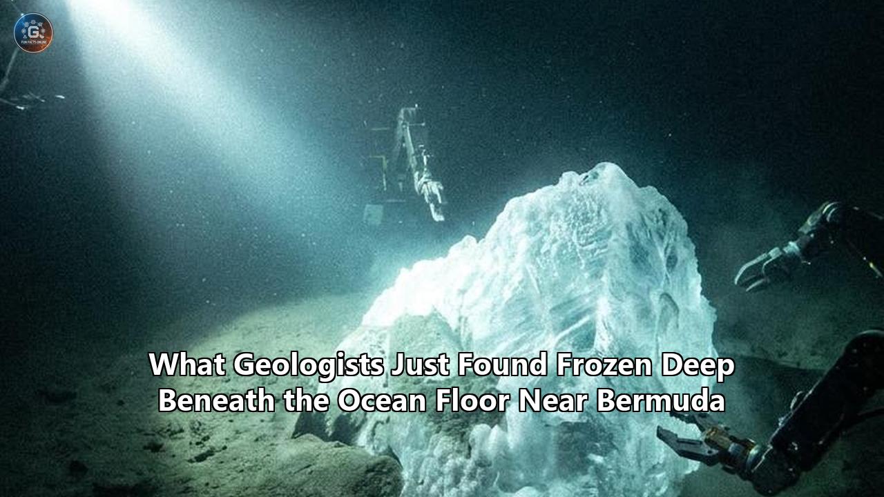
Late in November 2025, a team of geophysicists published a study in Geophysical Research Letters that quietly upended our understanding of the deep ocean floor. Nestled deep beneath the pristine, turquoise waters of Bermuda, researchers detected a colossal, previously unknown geological structure. Measuring an astonishing 12.4 miles (20 kilometers) in thickness, this massive layer of rock is wedged directly beneath the oceanic crust, embedded within the North American tectonic plate.
Led by seismologists William Frazer of the Carnegie Institution for Science and Jeffrey Park of Yale University, this geological discovery Bermuda has finally resolved a decades-old paradox that has baffled marine geophysicists: why this ancient volcanic archipelago refuses to sink.
Under standard plate tectonic theory, volcanic islands have a predictable lifecycle. As they drift away from the thermal hotspots that birthed them, the underlying lithosphere cools, contracts, increases in density, and gradually subsides. Bermuda’s volcanic activity ceased roughly 31 to 35 million years ago. By all physical laws of lithospheric cooling, the islands should have long since eroded and slipped beneath the waves of the Atlantic, leaving behind a chain of submerged seamounts.
Instead, Bermuda remains defiantly elevated on a massive bathymetric dome known as the Bermuda Swell, which lifts the regional seafloor by nearly 1,640 feet (500 meters) above the surrounding abyssal plain.
The newly discovered 20-kilometer-thick structure explains this anomaly. It is a massive, low-density "geological underplate"—mantle rock that was injected into the lower crust during Bermuda's ancient volcanic phase and "froze" in place. Acting like a colossal, buoyant raft permanently welded to the bottom of the tectonic plate, this structure keeps the entire region afloat without requiring any active, underlying heat source.
As Dr. Frazer returned to Bermuda in mid-2026 with an array of advanced instruments to map the subtle geological shifts of this structure, the scientific community began looking at this find as more than just a localized anomaly. It has become a premier case study. By examining the deep mechanics of the Bermuda underplate, geologists are extracting universal principles that redefine how tectonic plates store buoyant material, how the boundary between the crust and mantle is structured, and how volcanic features across the globe—and even on other planets—sustain themselves over deep time.
The Thermodynamic Paradox of the Bermuda Swell
To appreciate why this structure is such a significant finding, one must first examine the thermodynamic rules that govern the depth of the world's oceans. The topography of the deep ocean floor is not random; it is tightly regulated by the thermal history of the oceanic lithosphere.
Classic Hotspot Lifecycle (e.g., Hawaii)
Active Plume -> Thermal Uplift -> Plate Drifts -> Cooling & Subsidence -> Atolls/Seamounts

Bermuda Anomaly Lifecycle
Active Volcanism (35Ma) -> Magmatic Underplating -> Low-Density "Raft" Frozen -> Permanent Compositional Buoyancy
The Physics of Plate Cooling
When new oceanic crust is generated at mid-ocean ridges, it is incredibly hot and buoyant. As it moves laterally away from the ridge axis, it loses heat to the cold overlying ocean through conduction. Geophysicists model this process using the Half-Space Cooling Model (HSCM) or the Plate cooling model. These mathematical formulations state that the depth ($d$) of the ocean floor is directly proportional to the square root of its tectonic age ($t$):
$$d(t) = d_0 + C \sqrt{t}$$
where $d_0$ is the depth at the ridge axis (typically around 2,500 meters) and $C$ is a constant determined by the thermal properties of the mantle (usually around 350 meters per square root of million years).
For crust older than about 70 million years, this relationship begins to flatten out as the lithosphere reaches a thermal equilibrium, a state modeled by treating the tectonic plate as having a constant basal temperature. The oceanic lithosphere beneath Bermuda is ancient—roughly 110 to 120 million years old. According to these standard cooling curves, the seafloor in this region of the North Atlantic should sit at a deep, cold equilibrium depth of approximately 5.5 kilometers (18,000 feet).
Yet, the bathymetry around Bermuda tells an entirely different story. The islands sit atop a broad, circular dome of elevated seafloor that stretches hundreds of kilometers wide. This Bermuda Swell elevates the ocean crust by 500 meters above the predicted thermal baseline.
The Hawaii vs. Bermuda Contrast
In active volcanic archipelagos like Hawaii or the Galapagos, bathymetric swells are supported by dynamic, thermal buoyancy. A hot, narrow column of buoyant mantle material—a mantle plume—ascends from deep within the Earth, impinging on the underside of the lithosphere. The intense heat from this plume thermally thins the lithospheric plate and reduces its overall density, causing the seafloor to dome upward.
Because the tectonic plates are constantly moving over these stationary plumes, the thermal support is temporary. As a portion of the plate drifts off the plume, conduction slowly cools the lithosphere once again. The rock contracts, its density increases, and the swell subsides. This is why the Hawaiian-Emperor chain exhibits a perfect progression from high, active volcanic islands in the southeast to low-lying, eroded atolls and eventually drowned guyots in the northwest.
Bermuda completely defies this lifecycle. Its last major volcanic eruption occurred over 31 million years ago. There is no active mantle plume beneath the North American plate at this latitude, and heat flow measurements across the swell show no anomalous thermal signals. Under standard geodynamical assumptions, the Bermuda Swell should have completely subsided tens of millions of years ago, dragging the islands down into the abyss.
The discovery of the 20-kilometer-thick rock layer beneath the island chain has finally resolved this long-standing mystery by proving that the buoyancy sustaining the swell is not thermal, but compositional.
Seismic Tomography: How Earthquakes Map the Deep Crust
Because the structure sits between 12 and 20 miles beneath the ocean floor, scientists cannot observe it directly. The deepest scientific ocean drilling projects have only managed to penetrate a few kilometers into the basaltic crust. To "see" through miles of solid rock, Frazer and Park had to rely on seismic tomography—a geophysics technique that uses the elastic waves generated by earthquakes to construct highly detailed, three-dimensional images of the Earth's interior.
Earthquake Source (Distant)
      │
      ▼ (Seismic Waves: P & S)
Deep Mantle
      │
      ▼ (Refraction & Reflection)
Bermuda Underplate (20 km thick)  <-- Changes wave velocity & converts P to S
      │
      ▼ (Seismic Station recordings)
Receiver Function Processing
The Mechanics of Receiver Functions
The researchers collected data from a permanent, highly sensitive seismic station operating on Bermuda. Over several years, this station recorded the vibrations from 396 major earthquakes that occurred at great distances across the globe. When an earthquake occurs—for example, in the subduction zones of the Pacific Ring of Fire—it releases massive amounts of energy in the form of body waves:
- P-waves (Compressional Waves): These are longitudinal waves that compress and dilate the rock in the direction of travel. They are the fastest seismic waves and can travel through both solid and liquid material.
- S-waves (Shear Waves): These are transverse waves that displace the rock perpendicular to the direction of travel. They are slower than P-waves and can only propagate through solid media.
As these seismic waves travel thousands of miles through the Earth's mantle and approach the seismic station on Bermuda, they encounter local geological boundaries. Whenever a seismic wave passes through an interface where the rock density or elastic properties change abruptly, its behavior changes:
- Refraction and Reflection: The wave changes direction and speed.
- Phase Conversion: A portion of the wave’s energy is converted into a different wave type. Crucially, when a compressional P-wave strikes a sharp boundary from below, it generates a converted shear S-wave (referred to by seismologists as a $Ps$ phase) that travels upward to the receiver.
By analyzing the time delay between the arrival of the direct P-wave and the slower, converted $Ps$ wave, geophysicists can calculate the precise depth and thickness of the boundary that caused the conversion. This analytical method is known as receiver function analysis.
Deconstructing the Waveforms
When Frazer and Park stacked and filtered the seismic data from the 396 earthquakes, they observed a highly anomalous pattern in the receiver functions.
In a standard patch of mature oceanic crust, the seismograms are simple. The receiver functions show a single, sharp, positive peak corresponding to the Mohorovičić discontinuity (the Moho)—the boundary separating the basaltic and gabbroic oceanic crust (seismic P-wave velocity $V_p \approx 6.5\text{ to }7.0\text{ km/s}$) from the ultra-mafic mantle peridotite ($V_p \approx 8.1\text{ km/s}$). In such regions, this boundary is located at a depth of just 6 to 7 kilometers.
Beneath Bermuda, however, the seismic waveforms revealed a much more complex, multi-layered structure:
- Upper Layer (0–6 km): Standard oceanic crust, composed of basalts and sheeted dikes, exhibiting normal seismic velocities.
- Intermediate Layer (6–26 km): A massive, 20-kilometer-thick zone characterized by intermediate seismic velocities ($V_p \approx 7.2\text{ to }7.6\text{ km/s}$). This velocity is too high to be standard oceanic crust but too low to be pristine, unaltered mantle peridotite.
- Deep Boundary (26+ km): The true upper mantle, where seismic velocities finally reach standard values of $8.1\text{ km/s}$.
This intermediate, low-density layer represents the newly discovered underplate. By calculating the density of this rock layer from its seismic velocities, the researchers confirmed that it is significantly lighter than the normal upper mantle. The underplate's low density translates directly into buoyancy, providing the exact upward force needed to keep the Bermuda Swell elevated above the Atlantic floor.
The Geochemical Fingerprint: Carbon, Volatiles, and the Transition Zone
While seismic imaging successfully mapped the physical dimensions of the 20-kilometer-thick underplate, understanding why this rock layer is so buoyant and low-density requires integrating these findings with geochemical data. The chemical clues to this puzzle were actually discovered years prior, locked within rock cores recovered from the deep interior of the island.
The 1972 Deep Drill Core
In 1972, scientists drilled a continuous core sample nearly 1,000 meters deep into the volcanic bedrock of Bermuda (the Bermuda Deep Drill). Decades later, in 2019, an international research team led by geologist Sarah Mazza of Smith College analyzed the chemistry of these ancient lava flows. What they found was highly unusual and challenged standard models of intraplate volcanism.
Mantle Transition Zone (410-660 km deep)
      │
      ▼ (Enriched with Carbon, Water, Recycled Crust)
Low-Silica, Volatile-Rich Magma
      │
      ▼ (Decompressional Melting)
Ascends into Lithosphere
      │
      ├─► Erupts (Formed Bermuda's volcanic peaks)
      │
      └─► Trapped & Frozen (Formed the 20-km underplate)
Typical oceanic islands, such as those in Hawaii or Iceland, are composed of tholeiitic and alkaline basalts. These rocks contain moderate amounts of silica ($SiO_2$) and are derived from melting shallow asthenospheric mantle or deep mantle plumes.
Bermuda's volcanic rocks, however, are extremely poor in silica (often containing less than 40% $SiO_2$ by weight) and are highly enriched in volatile elements—specifically carbon dioxide ($CO_2$) and water ($H_2O$). These rocks are classified as melilitites and nephelinites, representing a highly specialized class of silica-undersaturated, alkaline magmatism.
The Mantle Transition Zone Source
The isotopic signatures of lead, neodymium, and strontium within the Bermuda samples revealed that this magma did not originate from the shallow upper mantle or from a standard core-mantle boundary plume. Instead, the geochemical fingerprint pointed directly to the Mantle Transition Zone, a high-pressure boundary layer located between 410 and 660 kilometers deep.
The transition zone acts as a vast planetary recycling bin. When tectonic plates subduct at the edges of ocean basins, they carry cold crustal rocks, water-rich minerals, and carbon-rich marine sediments deep into the earth. Many of these subducted slabs stall and accumulate in the transition zone.
Approximately 30 to 35 million years ago, a major tectonic disruption in the North Atlantic—potentially related to the reorganization of plates during the breakup of Pangea—triggered a disturbance in the mantle beneath what is now Bermuda. This disturbance caused a portion of the volatile-rich transition zone material to rise.
The Chemistry of Compositional Buoyancy
Because this ascending mantle material was highly enriched in carbon dioxide and water, its physical properties were fundamentally altered:
- Flux Melting: Volatiles act as "fluxes" that drastically lower the melting temperature of solid rock. As this carbonated mantle rose and decompressed, it underwent extensive melting at far deeper levels than dry mantle rock would.
- Intrusion and Underplating: While some of this highly fluid, carbon-rich magma erupted at the surface to build the volcanic peaks of Bermuda, a massive portion of it was trapped just beneath the pre-existing oceanic crust.
- Mineralogical Composition: As this trapped magma cooled and solidified within the tectonic plate, it did not form dense, iron-rich peridotite. Instead, the high volatile and carbon content favored the crystallization of low-density, calcium- and sodium-rich minerals, along with carbonaceous phases.
This volatile-rich, silica-undersaturated mineral assemblage is significantly lighter than the iron- and magnesium-rich rocks that typically make up the oceanic lithospheric mantle.
When the volcanic activity subsided 31 million years ago, this massive volume of low-density rock was permanently "frozen" in place at the base of the crust. It is this compositional difference—not ongoing volcanic heat—that provides the permanent buoyancy sustaining the Bermuda Swell.
Case Study Principle 1: Compositional Buoyancy and the Lifespan of Lithospheric Swells
Analyzing this geological discovery Bermuda as a case study reveals several fundamental principles that challenge long-standing assumptions in geodynamics. The first major principle involves how we calculate and model the buoyancy and lifespan of features within the Earth's tectonic plates.
Thermal Buoyancy (Transient)
Elevation supported by thermal expansion (Hot, low-density rock)
Equation: Δρ = -ρ₀ α ΔT
Result: Subsidence occurs as heat conducts away into the ocean.

Compositional Buoyancy (Permanent)
Elevation supported by mineralogical differences (Light minerals, carbon/volatiles)
Equation: Δρ = ρ_(mantle) - ρ_(underplate) (constant over time)
Result: Permanent elevation; swell persists indefinitely after volcanism ceases.
The Limits of Thermal Isostasy
For decades, the standard geodynamical model for oceanic swells has been rooted in thermal isostasy. Isostasy is the state of gravitational equilibrium between the Earth's lithosphere and asthenosphere, such that the tectonic plates "float" at an elevation proportional to their thickness and density.
In thermal isostasy models, the density difference ($\Delta\rho$) supporting an elevated swell is temperature-dependent:
$$\Delta\rho = -\rho_0 \alpha \Delta T$$
where $\rho_0$ is the reference density of the mantle, $\alpha$ is the coefficient of thermal expansion, and $\Delta T$ is the temperature anomaly of the hot plume material. Because heat is constantly lost to the cold ocean water above through thermal conduction, $\Delta T$ must decay over time once the heat source is removed. The thermal decay of an oceanic swell is described by the 1D heat diffusion equation:
$$\frac{\partial T}{\partial t} = \kappa \frac{\partial^2 T}{\partial z^2}$$
where $\kappa$ is thermal diffusivity. This equation predicts that any purely thermal swell will completely dissipate within 10 to 20 million years after volcanic activity ceases.
Compositional Pratt Isostasy
The Bermuda case study demonstrates that compositional variations can completely override thermal cooling, establishing a permanent state of "Compositional Pratt Isostasy." Under Pratt isostasy, elevations are supported by lateral density variations in the crust or upper mantle.
Because the low density of the 20-kilometer underplate is driven by its mineralogical and chemical makeup (high volatile, low silica, and high carbonate content), the density contrast ($\Delta\rho$) is a static, chemical property:
$$\Delta\rho = \rho_{\text{mantle}} - \rho_{\text{underplate}}$$
This chemical density difference is entirely independent of temperature. As the North American plate cools, the underplate cools at the same rate, but it retains its lower density relative to the surrounding mantle.
The lesson from this discovery is clear: we can no longer assume that ancient ocean basins were flat, featureless plains. If magmatic underplating can permanently weld buoyant, low-density rafts to tectonic plates, then high-elevation bathymetric features can persist for tens or even hundreds of millions of years without requiring active volcanism.
This mechanism directly impacts how paleogeographers reconstruct ancient oceans, map ancient sea-level fluctuations, and model historical ocean currents, all of which are deeply influenced by the topography of the seafloor.
Case Study Principle 2: Redefining the Mohorovičić Discontinuity
The second major principle highlighted by the discovery of the Bermuda underplate is that the Mohorovičić discontinuity (Moho) is far more complex than the simple, binary boundary described in introductory geology textbooks.
Classic Textbook Moho
Oceanic Crust (6-7 km, Vp ~6.8 km/s)
───────────────────────────────────────────────────────────── [Sharp Boundary]
Mantle Lithosphere (Vp ~8.1 km/s)

Bermuda's Modified Moho
Oceanic Crust (0-6 km, Vp ~6.8 km/s)
───────────────────────────────────────────────────────────── [Top of Underplate]
Magmatic Underplate (6-26 km, Vp ~7.4 km/s) - "Frozen Raft"
───────────────────────────────────────────────────────────── [Bottom of Underplate / True Moho]
Mantle Lithosphere (26+ km, Vp ~8.1 km/s)
The Binary Moho Assumption
Since its discovery in 1909 by Croatian seismologist Andrija Mohorovičić, the Moho has been treated as a sharp, global interface separating the Earth’s thin crust from the underlying, highly dense mantle. In both seismic interpretation and tectonic modeling, the Moho is typically mapped as a distinct jump in seismic P-wave velocity from approximately $6.8\text{ km/s}$ to over $8.0\text{ km/s}$.
This binary model of the Moho is critical for calculating:
- Crustal Thickness: Used to estimate the total volume of continental and oceanic crust.
- Lithospheric Strength: The elastic thickness ($T_e$) of a tectonic plate depends heavily on the depth of the Moho, as the crust and mantle have very different mechanical strengths and rheological behaviors.
- Thermal Models: Estimating the heat flow from the Earth's interior relies on knowing the thickness of the crust, which contains higher concentrations of heat-producing radioactive elements (uranium, thorium, potassium) than the mantle.
The Leaky, Gradational Boundary
The 12.4-mile-thick structure beneath Bermuda demonstrates that in regions impacted by alkaline, volatile-rich volcanism, the Moho is not a sharp, binary boundary but a wide, gradational zone of transition.
The underplate represents a massive "hybrid" zone where mantle-derived magmas have heavily intruded, reacted with, and modified the base of the crust and upper lithosphere. Seismically, this creates a 20-kilometer-thick layer of intermediate velocity ($7.2\text{ to }7.6\text{ km/s}$) that blurs the transition between the crust and mantle.
If geophysicists were to apply standard binary Moho processing techniques to Bermuda’s seismic data, they would face a major dilemma. Depending on the frequency of the seismic waves analyzed, they might map the Moho at the top of the underplate (at 6 km depth) or at the bottom (at 26 km depth).
The Bermuda case study forces us to view the Moho as a "leaky" boundary. It is highly susceptible to localized modification by deep-seated magmatic events. This underplating process leaves permanent "lithospheric scars" that fundamentally alter the mechanical strength, thermal properties, and seismic signatures of tectonic plates long after the surface volcanism has died away.
Case Study Principle 3: The Deep Recycled Volatile Engine
The third core principle revealed by this geological discovery Bermuda concerns the profound role that the Earth’s deep volatile cycles play in driving intraplate volcanism and crustal modification.
Classic Plume Model (Thermal-Driven)
Core-Mantle Boundary (D'' Layer) -> Thermal Plume -> Active Volcanism -> Linear Island Chain

Bermuda Transition Zone Model (Volatile-Driven)
Transition Zone (410-660 km) -> Volatile Release (H2O, CO2) -> Deep Melting -> Underplating & Swell
Beyond the Wilson Plume Model
For over half a century, the dominant framework for explaining intraplate volcanism—volcanoes that occur far from plate boundaries—has been the classic "hotspot" theory proposed by geophysicist J. Tuzo Wilson in 1963. This model attributes intraplate volcanism to deep, narrow plumes of hot mantle rising from the core-mantle boundary. These thermal plumes act like blowtorches, melting the crust of the overriding plates to create long, linear volcanic island chains.
However, the combination of Sarah Mazza’s 2019 geochemical data and Frazer and Park’s 2025 structural modeling outlines an entirely different, volatile-driven mechanism for intraplate magmatism.
How Deep Volatiles Drive Magmatism
Rather than requiring a thermal plume rising from the core-mantle boundary, the Bermuda model shows how localized volcanism can be driven by the release of volatiles (carbon dioxide and water) trapped within the mantle transition zone.
When subducted oceanic plates carry carbonates and hydrous minerals down to the transition zone (410–660 km depth), these materials remain stable under specific pressure and temperature conditions. However, tectonic disruptions can disturb this reservoir, triggering the upward migration of these volatile-rich rocks.
As these rocks ascend into the upper mantle, the sudden decompression triggers massive melting. Crucially, this melting is not driven by extreme heat, but by volatile fluxing. The presence of $CO_2$ and $H_2O$ lowers the solidus (the temperature at which rock begins to melt) by hundreds of degrees Celsius. This allows massive volumes of buoyant, highly fluid, carbonated melt to form and rise through the lithosphere.
This volatile-driven magmatic engine has a unique structural footprint. Because it does not rely on a continuous, deep thermal plume, it does not build a long, age-progressive chain of volcanic islands. Instead, it creates isolated, highly anomalous volcanic structures resting on massive, buoyant underplates.
The Bermuda case study proves that the Earth's deep volatile cycles—specifically the carbon and water cycles operating hundreds of miles beneath our feet—do not just fuel quiet, deep-mantle chemistry. They are a dynamic engine capable of directly altering the bathymetry of the ocean floors, building islands, and structurally engineering the very architecture of our tectonic plates from below.
Global Analogues: Where Else are Underplates Hidden?
If a massive, 12.4-mile-thick rock layer can remain undetected beneath Bermuda for decades, we must ask: where else in the global ocean are similar structures hidden?
Applying the lessons from the geological discovery Bermuda offers a fresh lens through which to examine several other long-standing bathymetric mysteries across the globe.
┌─────────────────────────┬─────────────────────────┬─────────────────────────┐
│ Region                  │ Observed Anomaly        │ Potential Underplate    │
│                         │                         │ Mechanism               │
├─────────────────────────┼─────────────────────────┼─────────────────────────┤
│ Bermuda Swell           │ No volcanism for 31 Ma; │ Proven 20-km thick, low-│
│                         │ 500m elevation          │ density underplate      │
├─────────────────────────┼─────────────────────────┼─────────────────────────┤
│ Cape Verde Swell        │ Anomalous high          │ Suspected compositional │
│                         │ elevation; complex,     │ underplate from carbon- │
│                         │ non-linear volcanism    │ rich mantle source      │
├─────────────────────────┼─────────────────────────┼─────────────────────────┤
│ Canary Islands          │ Prolonged magmatic      │ Deep, crustal-mantle    │
│                         │ history; lack of neat   │ transition zone         │
│                         │ age progression         │ underplating            │
├─────────────────────────┼─────────────────────────┼─────────────────────────┤
│ Azores Plateau          │ Broad, elevated bathy-  │ Tectonic-magmatic under-│
│                         │ metric plateau near     │ plating at plate triple │
│                         │ triple junction         │ junction                │
└─────────────────────────┴─────────────────────────┴─────────────────────────┘
The Cape Verde Swell
Located in the eastern Atlantic Ocean off the coast of West Africa, the Cape Verde archipelago sits atop one of the largest bathymetric swells on Earth. The Cape Verde Swell rises more than 2.2 kilometers (7,200 feet) above the surrounding ocean floor and stretches over 500 kilometers wide.
Like Bermuda, Cape Verde has long puzzled geologists. While it has active volcanism, the sheer size of the bathymetric swell cannot be explained by standard thermal plume models alone. The heat flow measured across the swell is far too low to account for the massive uplift.
Scientists have hypothesized that the lithosphere beneath Cape Verde has been chemically altered or underplated. The Bermuda discovery provides a concrete physical blueprint for this model. It suggests that a massive, low-density compositional underplate—derived from deep, volatile-rich mantle melts—could be propping up the Cape Verde Swell, explaining the massive elevation despite the lack of a sufficient thermal signature.
The Canary Islands
The Canary Islands, located north of Cape Verde, exhibit an incredibly complex volcanic history that spans over 60 million years. Unlike Hawaii, the Canaries do not show a clear, linear age-progression. Several islands have experienced multiple, distinct phases of volcanic activity separated by millions of years of dormancy.
Geophysicists have struggled to reconcile this behavior with a simple, drifting plate over a stationary plume. The Bermuda case study offers an elegant alternative: the lithosphere beneath the Canary Islands may contain an extensive network of magmatic underplates and volatile-rich reservoirs. These structures could store and periodically release magma over tens of millions of years, triggered by localized tectonic stresses rather than the passage of a deep-seated plume.
The Azores Plateau
The Azores Plateau is a broad, triangular region of elevated seafloor in the North Atlantic that sits near the triple junction where the North American, Eurasian, and African tectonic plates meet. The plateau is characterized by highly anomalous, silica-undersaturated, alkaline volcanism.
While some researchers have proposed a weak mantle plume beneath the Azores, others argue that the plateau is sustained by the interaction of plate tectonics with a highly volatile-rich mantle source. The structural model developed for Bermuda—where carbonated melts from the transition zone underplate the crust—could explain the broad, buoyant elevation of the Azores Plateau without requiring a classic, deep-seated thermal plume.
Planetary Geodynamics: Earth's "Stagnant Lid" Microcosm
Expanding this case study beyond Earth reveals that the geological discovery Bermuda holds profound implications for planetary science, particularly for understanding the geodynamics of other rocky bodies in our solar system.
Earth's Active Tectonics
Plates constantly drift. Hotspots build linear chains (e.g., Hawaii) as plates slide over mantle sources.

Stagnant Lid Geodynamics (Mars/Venus/Bermuda Interior)
The outer shell is immobile. Magma ascends repeatedly in the same location, building massive vertical volcanic piles and massive, deep-seated underplates.
The Stagnant Lid Regime
Earth is the only known planet in our solar system that exhibits active plate tectonics. Other rocky worlds—such as Mars, Venus, the Moon, and Mercury—operate under a "stagnant lid" geodynamic regime. On these planets, the outer lithosphere is a single, continuous, and immobile tectonic shell that wraps around the entire planetary body.
Because the outer shell of a stagnant lid planet cannot drift, mantle plumes and magmatic upwellings are stationary relative to the surface. When magma rises from the interior, it repeatedly erupts in the exact same location over hundreds of millions of years. This allows stagnant lid planets to build colossal volcanic structures, such as Olympus Mons on Mars (the largest volcano in the solar system, rising 21 kilometers high).
The Role of Underplating on Mars and Venus
Beneath these massive surface volcanoes, geophysicists calculate that an immense volume of magma fails to erupt. Instead, it gets trapped and cools within the thick lithospheric lid—a process identical to the magmatic underplating observed beneath Bermuda.
Because we cannot deploy seismometers across Mars or Venus to image these structures directly, planetary scientists must rely on gravity and topography data to model their interiors. These models suggest that:
- The Tharsis Bulge on Mars: This massive volcanic province, which covers a quarter of the Martian surface, is supported by an incredibly thick, buoyant lithospheric root. Planetary geologists believe this root is composed of extensive magmatic underplating that has structurally reinforced the Martian crust for billions of years.
- Venusian Tesserae and Volcanic Rises: Broad, elevated highlands on Venus, such as Beta Regio, exhibit massive gravitational anomalies that suggest they are supported by low-density compositional underplates rather than active thermal plumes.
Bermuda as a Terrestrial Micro-Analogue
Because Bermuda sits in the interior of the North American plate—far from active plate boundaries—the local lithosphere behaves much like a patch of stagnant lid. The plate moves incredibly slowly, and the magmatic system that formed the underplate operated in an isolated, stationary fashion.
As a result, the 20-kilometer underplate beneath Bermuda serves as a perfect terrestrial micro-analogue for the deep structures supporting the massive volcanic provinces of Mars and Venus.
By studying how the Bermuda underplate supports its bathymetric swell, planetary scientists can refine their models of lithospheric strength, gravity-topography relationships, and thermal evolution on stagnant lid planets. It provides a real-world, Earth-based laboratory to test the physics of deep-seated underplating, helping us unlock the structural secrets of other worlds without ever leaving our own.
The 2026 Field Campaign: Mapping the Next Frontier
With the foundational 1D model of the underplate established in late 2025, William Frazer returned to Bermuda in mid-2026 to launch a comprehensive field campaign. Armed with an array of next-generation geophysical instruments, Frazer and his team are working to answer the critical questions that remain unresolved.
William Frazer's 2026 Geophysical Toolkit
├── Broadband Seismometer Array ───► High-Resolution 3D Tomography (Map boundary geometry)
├── Magnetotelluric (MT) Sensors ──► Map electrical conductivity (Confirm carbon/volatile content)
└── Micro-Seismicity Monitors ─────► Detect localized plate stress and micro-fracturing
The Scientific Objectives of the 2026 Mission
The 2025 study was a massive step forward, but it was limited by the available data. The researchers relied on a single permanent seismic station on Bermuda, which only provided a narrow, vertical "slice" of the earth directly beneath the island.
To build a complete, high-resolution three-dimensional model of this geological anomaly, the 2026 campaign is deploying several advanced geophysical systems across the island chain and the surrounding seafloor:
1. Dense Broadband Seismometer Array
The team is deploying a temporary network of broadband seismometers across the 181 islands of the Bermuda archipelago. By recording ambient seismic noise and distant earthquakes from a wide variety of angles, this array will allow the researchers to use 3D Seismic Tomography to map the exact geometry of the underplate.
- The Key Question: Is the underplate a flat, uniform slab, or does it have a bowl-like shape that extends outward beneath the surrounding ocean floor? Understanding its geometry will tell scientists exactly how much total buoyant force it exerts on the North American plate.
2. Magnetotelluric (MT) Sounding
Magnetotellurics is an electromagnetic geophysical method that measures natural variations in the Earth's magnetic and electrical fields to map the electrical resistivity of the subsurface.
- The Key Question: What is the exact compositional makeup of the underplate? Low-density, carbon-rich, and hydrated rocks (like those proposed to exist beneath Bermuda) are highly conductive compared to dry, dense mantle peridotite. The MT data will help verify the carbon- and volatile-rich nature of the underplate, providing a direct link between the physical structure and Sarah Mazza’s 2019 geochemical models.
3. Monitoring Micro-Seismicity and Plate Stress
While Bermuda is generally considered tectonically quiet, it does experience occasional minor tremors. For example, in 2011, a magnitude 4.6 earthquake rattled the island, cracking tile floors in the capital of Hamilton.
- The Key Question: How is the North American plate responding to the presence of this massive, buoyant raft? The 2026 instruments will monitor micro-seismicity to detect tiny, deep-seated fractures occurring along the boundaries of the underplate. This will help geophysicists understand the localized stress field and determine if the plate is experiencing bending or shearing stresses as it "rides" over this buoyant structure.
What to Watch For next: Unresolved Questions and Global Impact
As the 2026 field campaign progresses, the scientific community is eagerly awaiting the first wave of data. The implications of this geological discovery Bermuda extend far beyond the academic realm, with potential impacts on several major areas of geophysics and planetary science:
1. Does the Underplate Have a Magnetic Signature?
Recent mineralogical studies and historical magnetic anomalies in the region suggest that the volcanic rocks beneath Bermuda contain significant amounts of magnetite—a naturally occurring mineral known for its powerful magnetic properties.
Scientists are currently investigating whether the deep 20-kilometer underplate also carries a strong magnetic signature. If so, this could help explain historical reports of localized magnetic anomalies that disrupted early maritime navigation instruments in the area, adding a fascinating geological layer to the legendary lore of the North Atlantic.
2. Is the Underplate Stable or Slowly Eroding?
Over deep time, structures trapped within tectonic plates can undergo physical and chemical changes:
- Thermal Equilibration: As the underplate remains welded to the cool oceanic lithosphere, does it undergo mineral phase transitions that could slowly change its density?
- Mantle Delamination: If parts of the underplate become denser due to mineralogical alteration, could they eventually detach and sink back into the deep mantle? This process, known as delamination, would cause the Bermuda Swell to suddenly lose its buoyant support, leading to rapid subsidence of the seafloor and the eventual drowning of the islands.
Understanding the long-term stability of the underplate is crucial for modeling the future of Bermuda and similar volcanic archipelagos.
3. Rewriting Global Sea-Level and Ocean Basin Models
Finally, the realization that tectonic plates can host massive, buoyant, and permanent underplates may force oceanographers to re-evaluate their long-term sea-level models.
The volume of the world’s ocean basins is directly controlled by the depth of the seafloor. If underplating is a common, global phenomenon that keeps large patches of the ocean floor elevated long after volcanism has ceased, then our current estimates of ocean basin volume may be off.
Discovering more of these hidden underplates could lead to more accurate models of how the volume of the oceans has changed over hundreds of millions of years, refining our understanding of the long-term carbon cycle, global climate shifts, and the evolutionary history of marine life.
Lessons from the Deep
The discovery of the 12.4-mile-thick rock layer frozen beneath Bermuda has shifted the spotlight from urban legends to the far more compelling mysteries of Earth’s geodynamics.
By showing that the Bermuda Swell is sustained by a permanent, low-density compositional underplate rather than a transient, hot mantle plume, this discovery has challenged the traditional lifecycle of volcanic islands and introduced a new mechanism for long-term lithospheric buoyancy.
As seismologists and geochemists continue to analyze the data from the ongoing 2026 field campaigns, the principles extracted from this North Atlantic anomaly will undoubtedly reshape our models of plate tectonics, redefine our understanding of planetary boundaries, and illuminate the hidden, volatile-rich systems that continue to shape our world from the deep.
References
- Frazer, W., & Park, J. (2025). "Seismic evidence for a ~20-km-thick underplate beneath the Bermuda Swell." Geophysical Research Letters, 52(22).
- Mazza, S. E., Gazel, E., et al. (2019). "Sampling the transition zone beneath the Bermuda volcanic platform." Nature, 569, 398–403.
- Turcotte, D. L., & Schubert, G. (2014). Geodynamics (3rd ed.). Cambridge University Press. (Contextual textbook on lithospheric cooling equations and Pratt/Airy isostasy).
Reference:
- https://www.greenmatters.com/pn/geologists-discover-giant-mysterious-structure-deep-beneath-bermuda
- https://thedebrief.org/bermuda-mystery-surfaces-with-discovery-of-massive-underground-structure-revealing-a-new-deep-earth-anomaly/
- https://www.livescience.com/planet-earth/geology/giant-structure-discovered-deep-beneath-bermuda-is-unlike-anything-else-on-earth
- https://www.sciencealert.com/mysterious-structure-identified-beneath-bermuda-could-explain-its-weird-geology
- https://www.discovermagazine.com/a-hidden-rock-layer-beneath-bermuda-explains-a-mysterious-swell-in-the-ocean-s-crust-48407
- https://www.popularmechanics.com/science/environment/a69781799/bermuda-swell/
- https://www.uniladtech.com/science/scientists-discover-giant-structure-beneath-bermuda-917734-20251216
- https://www.indiatvnews.com/science/bermuda-triangle-mystery-solved-scientists-find-massive-underground-rock-layer-beneath-which-could-explain-atlantic-ocean-mystery-2026-05-15-1041253
- https://www.royalgazette.com/general/news/article/20260601/whats-beneath-us-science-offers-clues-to-islands-bedrock/
- https://www.youtube.com/watch?v=hfFbGYZzSrg
- https://www.hindustantimes.com/world-news/bermuda-triangle-mystery-finally-solved-scientist-reveals-theory-involving-magnetic-rocks-101780170758570.html