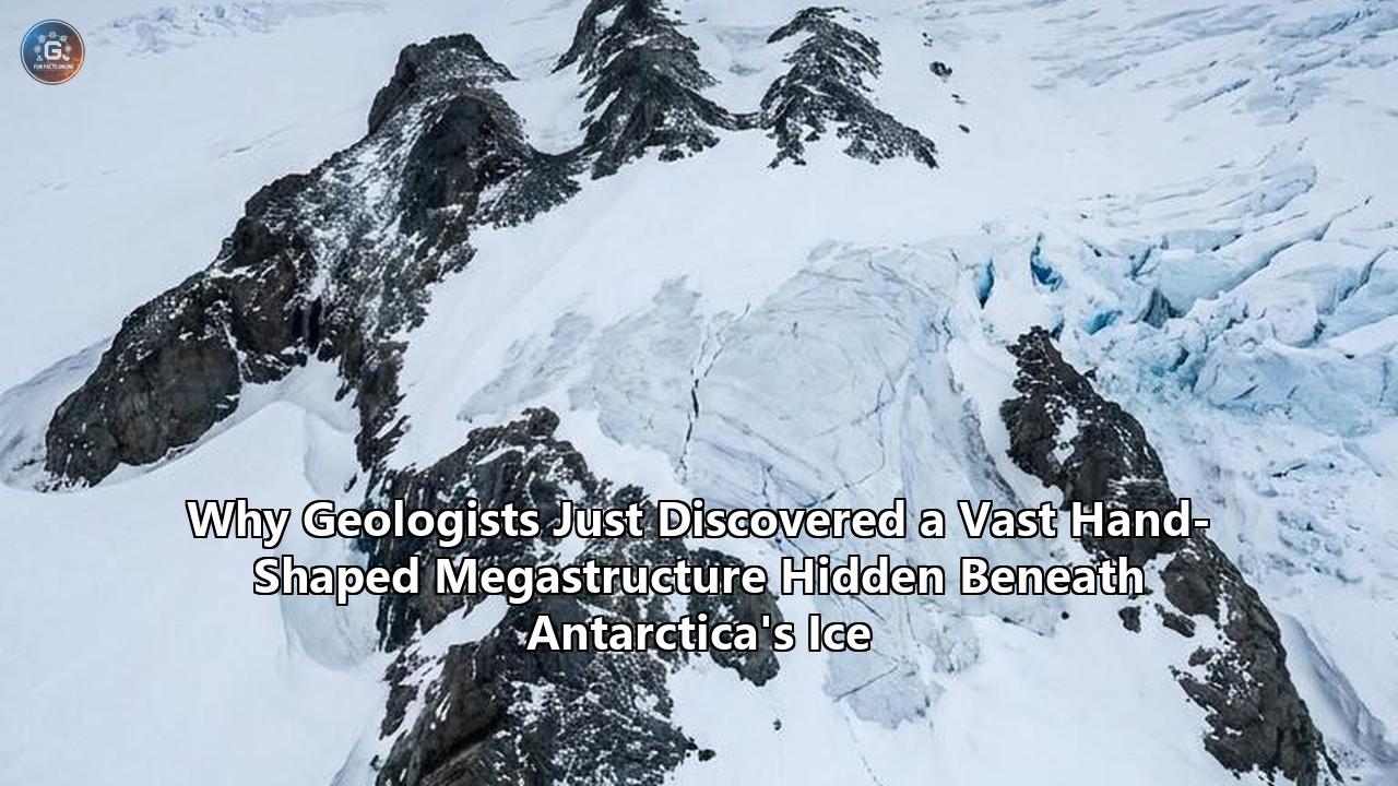
Deep beneath the white, featureless expanses of the East Antarctic Ice Sheet, a team of international geophysicists has mapped a semi-continent-sized geological formation that challenges long-held assumptions about how the southern continent—and indeed, the modern world—was shaped.
Publishing their findings in Nature Geoscience, an international research consortium led by Dr. Egidio Armadillo of the University of Genoa has revealed that a series of massive, deep basins previously thought to be separate, isolated valleys are actually the interconnected "fingers" of a single, colossal, hand-shaped geological system. Officially designated the East Antarctic Fan-shaped Basin Province (EAFBP), this newly recognized Antarctica ice megastructure stretches over thousands of kilometers, radiating outward from a central pivot point near the South Pole like a giant handheld fan or an open hand.
               [ NORTHERN TRANS-CURRENT EDGE ]
                (Antarctica-Australia Margin)
               /        |       |       \
              /         |       |        \
             /          |       |         \
     [Wilkes Basin]     |       |     [Aurora Basin]
            \           |       |           /
             \     [Lake Vostok]           /
              \         |       |         /
               \        |       |        /
                \       |       |       /
                 \______|_______|______/
                    \   |   |   /
                     \  |   |  /
                      \ |   | /
                       \|   |/
                        [PIVOT]
                    (Near South Pole)
The scale of the discovery is staggering. Buried beneath up to three kilometers (nearly two miles) of solid ice, the EAFBP encompasses some of the most famous and ecologically sensitive subglacial features on Earth, including the Wilkes Basin, the Aurora Basin, and the massive subglacial cavity that houses Lake Vostok—the largest subglacial lake on the planet, which has been sealed from the atmosphere for up to 30 million years.
Using this landmark discovery as a analytical lens, we can extract profound insights into how geologists map the unseen, how ancient tectonic forces dictate the modern flow of ice, and why planetary "blind spots" can harbor secrets capable of rewriting Earth's history.
Anatomy of the Megastructure: The Geodynamics of Rotational Extension
To understand how this vast structure formed, geologists point to a process known as distributed rotational extension. Historically, when geophysicists modeled the rifting and tearing apart of continents, they typically relied on linear models of extension—similar to a piece of paper being pulled apart from two opposing sides. In linear extension, the resulting rift valleys and fault lines run roughly parallel to one another.
However, the crustal architecture of the East Antarctic Fan-shaped Basin Province tells a very different story. Instead of parallel rifts, the basins of the EAFBP diverge radially from a central point, or Euler pole, located near the South Pole (specifically mapped close to 86.4° S, 129.9° E).
The Metaphor of the Spreading Hand
The research team compares this layout to an opening hand. If the base of your thumb remains fixed in place while you spread your fingers apart, the distance between your fingertips increases while the base remains relatively stationary. In geological terms:
- The Pivot Point: The fixed base near the South Pole acted as the rotational anchor.
- The Fingers: The radiating ridges of stretched continental crust.
- The Gaps Between Fingers: The deep, V-shaped, sediment-filled basins (such as the Wilkes and Aurora basins) that formed as the crust tore open.
This radial geometry is highly characteristic of a tectonic feature known as a sphenochasm. First defined by geologist S. Warren Carey in 1955, a sphenochasm is a triangular gap of crust separating two cratonic blocks that converges to a pivot point, created by the rotation of one block relative to the other. The EAFBP is now recognized as potentially one of the largest examples of distributed rotational extension ever identified in continental crust.
LINEAR RIFTING                     ROTATIONAL EXTENSION (SPHENOCHASM)
=============> [Pull]              =============> [Pulling outward in an arc]
  |   ||   |                         \   |   /
  |   ||   |                          \  |  /  <-- Basins widen outward
  |   ||   |                           \ | /
=============> [Pull]                    * [Fixed Pivot Point]
(Parallel basins/faults)           (Radial, fan-shaped basins)
The structural boundaries of these radial basins are defined by massive, longitudinal normal faults. As the crust stretched outward, block-faulting occurred, dropping massive sections of the Earth's crust downward to form steep valleys (grabens) separated by elevated ridges (horsts). Transverse strike-slip faults, organized into semi-circular shear zones known as the Transantarctic Circular Shear Belts (TSCBs), cut across these radial valleys, offsetting them and adding a complex lattice of fractures to the sub-ice bedrock.
The Methodological Breakthrough: How We See Through 3 Kilometers of Ice
How do you map a semi-continental structure when 99% of its surface is obscured by a moving ice sheet that is miles thick? The discovery of the EAFBP was not the result of a single "eureka" moment or a newly invented sensor. Instead, it is a classic case study in multispectral geophysical synthesis—the art of combining disparate, low-resolution datasets to reveal a unified, high-resolution physical reality.
The international team, which included scientists from Italy, Switzerland, Germany, and the United Kingdom, built their model by layering several distinct types of data:
- Radio-Echo Sounding (Ice-Penetrating Radar): Over decades, airborne radar campaigns (such as those led by the international ICECAP collaboration) bounced radio waves through the ice sheet to map the rugged topography of the underlying rock.
- Satellite Gravity Anomalies: Because denser rocks exert a slightly stronger gravitational pull than less dense rocks or thick ice, highly sensitive gravity maps allowed the researchers to estimate the thickness of the Earth's crust and locate deep sedimentary basins.
- Aeromagnetic Surveys: Magnetometers flown on research aircraft detected minute variations in the Earth's magnetic field caused by different rock types, mapping the deep-seated fault lines and tectonic boundaries hidden beneath the sediment.
- Seismic Refraction and Reflection: By recording how shockwaves from controlled explosions or seismic thumper trucks traveled through the ice and rock, the team determined the depth and elasticity of the crustal layers.
The Rebound Principle: Unlocking the Tectonic Skeleton
The true breakthrough that allowed the researchers to recognize the "hand" shape was a mathematical process called isostatic rebound modeling.
Currently, the East Antarctic Ice Sheet contains roughly 27 million cubic kilometers of ice. This unimaginable mass acts like a giant lead weight, pressing down on the Earth's lithosphere and forcing it to sink into the semi-fluid asthenosphere below. This downward flexing distorts the true, original shape of the bedrock.
ICE-LOADED CRUST (Present Day)       REBOUNDED CRUST (Ice Removed)
      [  Ice Sheet  ]
==============================       _____      ___      _____
\____/  \____/  \____/  \____/       \___/      \_/      \___/
   ^       ^       ^       ^           ^         ^         ^
 (Depressed & warped bedrock)       (True tectonic shape restored)
Dr. Guy Paxman of Durham University led the calculations to determine what East Antarctica would look like if this ice sheet were completely removed. When a massive ice sheet melts, the Earth's crust slowly bounces back upward—a process known as post-glacial rebound or isostatic adjustment. In East Antarctica, this rebound would raise the land surface by as much as one kilometer in vertical altitude.
By calculating and applying this rebounded topography, Paxman and his colleagues stripped away the distorting elastic warp caused by the ice's weight. Once this "rebounded bedrock elevation" was modeled, the visual noise of millions of years of local glacial carving faded, and the pristine, radial, fan-like geometry of the EAFBP popped into sharp focus.
This methodology offers a vital lesson for modern geophysics: Visualizing deep-time structures requires removing not just physical barriers (like ice), but also the mechanical footprints (like elastic warping) that those barriers impose on the Earth.
Lesson 1: The Principle of Tectonic Interconnectedness
Perhaps the most significant geological revelation of the EAFBP study is how a single, localized tectonic event can trigger a cascade of geological events thousands of miles away. Geologists refer to this as the continental-scale ripple effect.
Before the publication of this study, features like the Gamburtsev Subglacial Mountains, the Transantarctic Mountains, and the separation of Australia from Antarctica were treated as largely distinct tectonic chapters. The EAFBP model links them all together as consequences of a single, massive rotational opening.
                 [CONSEQUENCE 3: NORTH]
           Tearing apart of Gondwana; guided
           the separation of Australia & Antarctica
                          ^
                          |
[CONSEQUENCE 1: WEST] <-- [ ROTATIONAL ] --> [CONSEQUENCE 2: EAST]
Compressive forces        [  EXTENSION ]     Clockwise rotation (~20°);
pushed crust inward;      [ OF THE EAFBP]    thermal buoyancy uplift
uplifted the hidden                          of Transantarctic Mountains
Gamburtsev Mountains
Consequence 1: The Uplift of the Gamburtsev Mountains (West)
The Gamburtsev Subglacial Mountains are one of Earth’s greatest geological anomalies. Rising to over 2,700 meters (9,000 feet) above sea level, this jagged mountain range is entirely buried under the ice and has never been seen by human eyes. Because they are located in the stable interior of the Antarctic craton—far from any active tectonic plate boundaries—their origin has long puzzled geophysicists.
The EAFBP discovery provides an elegant solution. As the "hand" of the EAFBP rotated open, spreading eastward and northward, it exerted a massive, lateral, compressional force on the lithosphere to its west. This compression squeezed the crust, forcing it to buckle and crumple upward, forming the Gamburtsev Mountains. The mountains are, in effect, the crumpled wall built by the outward swing of the EAFBP's western flank.
Consequence 2: The Twist and Rise of the Transantarctic Mountains (East)
To the east of the fan, the rotational movement had the opposite effect. The clockwise rotation twisted the northernmost segment of the Transantarctic Mountains by approximately 20 degrees.
This rotation forced that mountain segment directly over the thin, hot lithosphere of the West Antarctic Rift System. As the cold mountain roots overrode this subterranean heat source, the thermal buoyancy of the hot mantle below pushed the mountain range upward. This uneven heating segmented the Transantarctic Mountains into three distinct crustal blocks, each rising at different rates.
Consequence 3: The Split of Gondwana and the Australia Connection (North)
Perhaps the most far-reaching consequence occurred at the northern, outer edge of the fan. As the fingers of the hand spread apart, the outermost "fingertips" sheared against the adjoining continental crust, creating a semi-circular zone of extreme crustal shearing and lithospheric weakness.
When the ancient supercontinent of Gondwana began to break apart, this curved line of weakness acted as a pre-cut tear in a piece of cardboard. It guided the propagation of the rift that eventually split the Australian continent away from Antarctica.
This explains a feature that has puzzled geographers for centuries: the striking, matching semi-circular curves of the southern coast of Australia (the Great Australian Bight) and the corresponding coastline of East Antarctica. They are the physical scars left behind by the outer edge of the EAFBP's rotational arc.
This interconnectedness yields a fundamental geological principle: In continental geodynamics, there are no isolated systems. A localized stretching in one sector of a continent must be balanced by compression, rotation, or rifting in another.
Lesson 2: Bedrock as the Invisible Hand of Glaciology
While reconstruction of the tectonic past is valuable for historical geology, understanding this buried Antarctica ice megastructure is not merely a geodynamic curiosity. It is a critical component of modern glaciology and climate forecasting.
An ice sheet is not a static block of ice; it is a slow-moving, dynamic fluid that flows under the influence of gravity. The speed, direction, and stability of this flow are almost entirely dictated by the topography of the bedrock beneath it.
[ SURFACE ICE SHEET ] --> Flat, featureless, deceptively stable
      |
      v (Flows downward via gravity)
======================================================
[ THE BEDROCK GATEKEEPERS (EAFBP BASINS) ]
* Wilkes Basin   --> Channelling ice streams to the ocean
* Aurora Basin   --> Creating subglacial lakes & marine conduits
* Lake Vostok    --> Geothermal heat pools & ice lubrication
======================================================
The basins within the EAFBP act as massive, sub-ice highway systems for ice. Because they are deep, V-shaped, and run for hundreds of miles, they channel ice from the high-altitude interior of East Antarctica toward the Southern Ocean.
The Threat of Marine Ice Sheet Instability
This channeling effect is particularly critical in the Wilkes and Aurora basins. Both of these basins are "sub-sea-level" basins, meaning that although they are currently choked with miles of ice, the rock bed itself sits well below sea level.
If warm ocean water penetrates the edges of the ice sheet, it can seep into these deep, radially-aligned basins. Because the basins widen and deepen as they head inland (a consequence of their fan-shaped rotational origin), they create a topographically unstable slope. This can trigger a runaway process known as Marine Ice Sheet Instability (MISI), where the retreat of the glacier's grounding line becomes self-sustaining and rapid.
| Basin / Feature | Depth of Ice Cover | Geological Origin (EAFBP) | Modern Glaciological Role |
|---|---|---|---|
| Wilkes Basin | Up to 3.0 km | Outer "finger" of rotational rift | Main conduit for East Antarctic ice streams |
| Aurora Basin | Up to 3.2 km | Adjacent "finger" of rotational rift | High-risk zone for Marine Ice Sheet Instability |
| Lake Vostok Basin | Up to 4.0 km | Central rift valley of the fan | Subglacial lake reservoir; base lubrication |
Furthermore, the geothermal heat flux in these basins is highly variable. The deep crustal faults that bound the EAFBP's basins act as conduits, allowing heat from the Earth's mantle to rise to the surface. This geothermal heat melts the bottom layer of the ice sheet, creating subglacial lakes and thin films of liquid water. This water acts as a lubricant, slicking the interface between ice and stone, allowing glaciers to slide toward the sea at accelerated rates.
By identifying the EAFBP as a single, unified province, scientists can now refine their ice-sheet models. Instead of treating the Wilkes and Aurora basins as separate glaciological domains, they can model the hydrological and physical interactions across the entire Antarctica ice megastructure, leading to far more accurate predictions of global sea-level rise.
Lesson 3: The Paradox of Planetary Blind Spots
The discovery of the EAFBP highlights a profound paradox in modern science: We often know more about the surfaces of distant worlds than we do about the hidden regions of our own planet.
To put this in perspective, planetary scientists have mapped the surface of Mars, Venus, and even the Moon to a resolution of a few meters using orbital radar and optical satellites. Yet, the bedrock of East Antarctica—comprising roughly 10% of the Earth's landmass—has remained largely blank, a vast terra incognita hidden beneath a shroud of ice.
This "planetary blind spot" exists because ice is an incredibly difficult medium to penetrate. While optical sensors are blocked by its reflective surface, traditional radar struggles with warm, wet ice, and ground-based seismic arrays are logistically nightmarish to deploy across thousands of miles of sub-zero, wind-swept plateau.
       [ EARTH'S STRATOSPHERE / SPACE ]
                      |
      +---------------+---------------+
      |                               |
      v                               v
[ ORBITAL SENSORS ]           [ GROUND PENETRATION ]
High-res mapping of:          Blocked by 3km of ice;
* Martian plains              Requires complex fusion of:
* Lunar craters               * Airborne gravity
* Venusian volcanoes          * Magnetics & Isostasy
Implications for Astrobiology and Ocean Worlds
The interdisciplinary methodology used to map the Antarctica ice megastructure has direct, exciting applications for the search for life in our solar system.
Ocean worlds like Jupiter's moon Europa and Saturn's moon Enceladus are covered by global ice shells that are estimated to be between 15 and 40 kilometers thick. Beneath these frozen crusts lie vast, liquid water oceans warmed by tidal forces. Astrobiologists believe these sub-ice oceans are among the most promising places to look for extraterrestrial life.
      EUROPA / ENCELADUS                  EAST ANTARCTICA (EAFBP)
     [ Ice Shell (15-40km) ]              [ Ice Sheet (1-3km) ]
     =====================                ====================
     [ Sub-Ice Ocean       ]              [ Lake Vostok / Basins ]
     =====================                ====================
     [ Rocky Core / Crust  ]              [ Bedrock / Lithosphere]
              ^                                      ^
              |                                      |
              +---[ SAME GEOPHYSICAL TOOLKIT ]-------+
                  * Gravitational modeling
                  * Magnetics & Tidal Flexure
                  * Ice-Penetrating Radar (REASON/RIME)
However, landing on Europa and drilling through miles of ice is a technological challenge that is decades away. In the meantime, planetary geologists must rely on orbital data to infer what lies beneath the ice.
The EAFBP case study shows us how to do this. By combining orbital gravity measurements (which detect variations in the rocky core below) with radar sounding of the ice shell's surface and models of the ice's elastic deformation, scientists can map the topography of Europa's seafloor and locate underwater volcanic vents or tectonic rifts without ever touching the ice.
Antarctica is not just a continent; it is a planetary laboratory where we hone the tools and mathematical models required to explore the outer solar system.
Future Horizons: Unresolved Questions and Next Milestones
Like all great scientific discoveries, the mapping of the East Antarctic Fan-shaped Basin Province raises as many questions as it answers. While the geometry of the megastructure is now clear, its chronology remains a subject of intense scientific debate.
The research team has identified three competing hypotheses for when this massive rotational extension occurred:
  HYPOTHESIS A: Permian-Triassic (250-300 Ma)
  [==== Widespread Erosion ====] --------------------+
                                                     |
  HYPOTHESIS B: Gondwana Breakup (180-65 Ma)         v
  [=== Splitting of Continents ===] --------> [ WHEN DID THE ]
                                              [ EAFBP FORM?  ]
  HYPOTHESIS C: Cenozoic Faulting (35-55 Ma)         ^
  [=== Eocene-Oligocene cooling ===] ----------------+
Hypothesis A: The Permian-Triassic Erosion Event (250–300 Million Years Ago)
This hypothesis places the formation of the EAFBP during a period of massive global upheaval. During the Permian-Triassic transition, Gondwana was subjected to major tectonic pulling and widespread surface erosion. If the EAFBP formed during this era, it means the hand-shaped structure lay exposed to the sky for millions of years, carved by rivers and ancient winds before Antarctica drifted south and was entombed in ice.
Hypothesis B: The Gondwana Breakup (180–65 Million Years Ago)
The most widely supported theory is that the rotational stretching was directly linked to the fracturing of the Gondwana supercontinent. As South America, Africa, India, and Australia began their long slow drift away from Antarctica, the continent-sized rotational torque literally twisted East Antarctica, pulling the "hand" open and creating the basins.
Hypothesis C: The Cenozoic Faulting Event (35–55 Million Years Ago)
This controversial hypothesis dates the EAFBP to a much more recent geological epoch. During the Eocene and Oligocene, the Earth underwent a dramatic cooling phase, transitioning from a "greenhouse" world to an "icehouse" world. This transition was accompanied by significant faulting and tectonic adjustments across Antarctica. If this hypothesis is correct, the EAFBP is a young, fresh scar that formed just as the first glaciers began to seed the modern ice sheet.
Resolving the Debate: The Next Scientific Frontier
To resolve this chronological mystery, scientists will need to move from remote sensing to direct physical sampling. This will require drilling through kilometers of ice to extract core samples of the sedimentary rock sitting at the bottom of the Wilkes and Aurora basins.
                [ ICE SHEET SURFACE ]
                         |
                         |  (Future Drilling Target:
                         |   Deep ice-core & rock sampling)
                         v
     ~~~~~~~~~~~~~~~~~~~~~~~~~~~~~~~~~~~~~~~~~  ~ ~ ~
    |                 ICE                    |   ~ 3 km
     ~~~~~~~~~~~~~~~~~~~~~~~~~~~~~~~~~~~~~~~~~  ~ ~ ~
    |              SEDIMENT                  |
    +----------------------------------------+
    |         EAFBP BASEMENT ROCK            |  <-- Core sample reveals
    |     (Unlocks geological age & history)  |      the exact age of origin
    +----------------------------------------+
Analyzing the pollen, microfossils, and radioisotopes trapped in these deep sediments will tell us exactly when these valleys were open to the air, what kind of forests grew in them, and precisely when the first ice sheets slid down their slopes to seal them away from the world.
Upcoming Milestones to Watch
Over the next several years, the scientific community will monitor several high-profile initiatives designed to build on the EAFBP discovery:
- The Ring of East Antarctica (REA) Project: An upcoming, multi-nation airborne survey aimed at mapping the coastal boundaries of the EAFBP at unprecedented resolution.
- Targeted Subglacial Drilling Campaigns: International consortiums are drafting proposals for deep-access hot-water drilling rigs to pierce the ice sheet over key EAFBP fault lines, aiming to retrieve the first physical bedrock samples from the province.
- Refinement of IPPC Sea-Level Models: Climate scientists are integrating the EAFBP's high-resolution bedrock map into the next generation of ice-sheet simulation software, which will dramatically reduce the uncertainty in predictions for the ice sheet's behavior over the 21st and 22nd centuries.
The discovery of the East Antarctic Fan-shaped Basin Province reminds us that our planet still holds secrets of continental proportions. By looking past the blank white shield of the ice sheet and reconstructing the dynamic skeleton of the rock below, geologists have not only solved long-standing mysteries of our tectonic past—they have handed us the key to understanding the future of our changing world.
Reference:
- https://thedebrief.org/in-antarctica-scientists-just-discovered-a-massive-hidden-structure-deep-below-the-frozen-surface/
- https://www.reddit.com/r/InterstellarKinetics/comments/1txa0j9/discovery_scientists_have_identified_a_vast/
- https://www.miragenews.com/vast-hidden-structure-found-under-antarctic-ice-1686691/
- https://www.sci.news/othersciences/geoscience/east-antarctic-fan-shaped-basin-province-14826.html
- https://www.iflscience.com/a-gigantic-hand-shaped-megastructure-has-been-discovered-beneath-east-antarcticas-ice-sheet-83751
- https://www.researchgate.net/publication/405844762_A_fan-shaped_subglacial_basin_province_in_East_Antarctica_formed_by_rotational_extension
- https://astrobiology.com/2026/06/ice-planet-recon-giant-fan-shaped-geological-structure-discovered-beneath-east-antarctica.html
- https://www.sciencealert.com/scientists-discover-a-vast-structure-hiding-beneath-antarcticas-ice
- https://www.researchgate.net/figure/Northern-EAFBP-transcurrent-fault-release-system-evolution-explaining-the-semicircular_fig4_398845016
- https://www.techexplorist.com/massive-hidden-formation-found-east-antarctica/103190/
- https://nautil.us/vast-hidden-structure-discovered-beneath-antartica-1281798
- https://www.sciencedaily.com/releases/2026/06/260604044244.htm
- https://sciencesprings.wordpress.com/2026/06/09/from-science-alertau-scientists-discover-a-vast-structure-hiding-beneath-antarcticas-ice/
- https://communities.springernature.com/posts/a-hidden-fan-beneath-east-antarctica-how-a-radial-system-of-buried-basins-may-record-continent-scale-rotational-extension
- https://www.iflscience.com/a-gigantic-hand-shaped-megastructure-has-been-discovered-beneath-east-antarcticas-ice-sheet-83751