The drilling rig was anchored into the red gravel plains near Guaizihu, in the barren expanse of the western Yin’gen-Ejinaqi Basin of Inner Mongolia, hunting for copper. The diamond-tipped drill bit, cooled by a steady torrent of pressurized mud, was grinding through the Lower Cretaceous bedrock nearly 1,550 feet beneath the surface when the hydraulic gauges on the control panel registered a subtle, momentary shift in torque.
To the rig operators, it was a routine flutter in the rock line—the kind of trivial vibration caused by transitioning from hard siltstone into a soft lens of mudstone. The industrial drill continued its mechanical descent, cutting a continuous cylindrical sample of rock just a few inches wide from the ancient Bayan Gobi Formation.
When the wireline hoisted the steel core barrel back to the surface and the crew slid the freshly extracted cylinder into split PVC trays, field geologists began their standard survey: checking lithology, scanning for mineralized fractures, and logging the stratigraphy for signs of copper sulfides. Instead, midway down the dark gray sedimentary column at a recorded depth of 473.2 meters, they hit an anomaly that defied every expectation of mining geology.
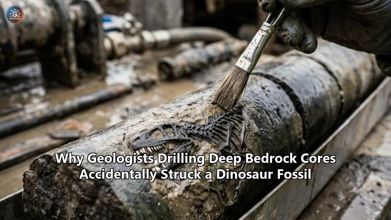
Embedded flush within the stone core was a dense cluster of bone. Not a microscopic trace of pollen, nor the flattened carbon film of an ancient leaf, but dense, three-dimensional skeletal architecture: four articulated caudal vertebrae, six delicate neural arches, a sacral rib, and thin, ossified tendons frozen in stone. The copper exploration survey had driven a steel cylinder straight through the tail of an Early Cretaceous ornithischian dinosaur that died 115 million years ago.
The specimen, cataloged as 208GPV01 and formally described by a research team led by Dr. Tianyu Li, Dr. Lida Xing, and Dr. Xing Xu, expanded the known geographic boundaries of the Bayan Gobi dinosaur fauna. Yet its most startling feature was not merely its taxonomic classification, but the physical method of its extraction.
The finding in the Yin’gen-Ejinaqi Basin is not an isolated fluke. Just months prior, beneath the asphalt parking lot of the Denver Museum of Nature & Science in Colorado, a two-and-a-half-inch exploratory core drilled 763 feet down for a municipal geothermal heating project pulled up an intact vertebral centrum belonging to a Late Cretaceous ornithopod. Decades earlier, out in the stormy waters of the northern North Sea, an offshore oil drilling rig working the Snorre field punched a drill string 7,402 feet beneath the ocean floor and retrieved a crushed knucklebone belonging to a Triassic Plateosaurus.
In a continental landmass spanning hundreds of millions of square kilometers, where an exploration borehole is an almost invisible pinprick no wider than a coffee mug, geologists have repeatedly dropped mechanical drill bits thousands of feet into the crust and hit the skeletal remains of animals that vanished tens of millions of years ago. The physical and taphonomic trail reveals that these unexpected collisions are not pure luck; they are the natural consequence of how deep Earth resources are formed, where ancient life accumulated, and how modern exploration technologies intersect with deep time.
The Mechanical Collision: When Diamond Crowns Meet Ancient Bone
To understand how a core drill captures a vertebrate fossil, one must examine the extreme violence and pinpoint geometry of the diamond coring process. In deep geological drilling—whether for mineral exploration, geothermal assessments, or stratigraphical mapping—engineers do not dig a trench. They bore a vertical shaft using a hollow, ring-shaped drill bit encrusted with industrial diamonds or polycrystalline diamond compact (PDC) cutters.
As the drill string rotates at speeds between 200 and 1,000 revolutions per minute, the circular crown grinds away a narrow channel of rock, allowing an intact, central column of stone—the core—to slide upward into an internal collection tube known as the core barrel. Bentonite drilling mud or polymer fluid is pumped continuously down the interior of the drill pipe, lubricating the cutting teeth, preventing the high frictional heat from cooking the rock, and flushing pulverized debris up the borehole annulus to the surface.
Under normal circumstances, the diamond bit destroys everything in its annular path, turning siltstone, quartz, and shale into micro-particulate slurry. The only thing preserved is what enters the hollow mouth of the barrel.
"You have to visualize the scale of the intrusion," explains Dr. James Hagadorn, curator of geology at the Denver Museum of Nature & Science, who oversaw the analysis of the 763-foot Denver Basin core. "A drill core sample is essentially like a physician using a thin hypodermic needle to draw fluid from a specific organ in a human body. You are sending a two- or three-inch cylinder blind through hundreds or thousands of feet of solid overburden. You cannot see what is ahead. You are steering entirely by stratigraphical models and geophysical logging."
When the core barrel at the Denver site descended into the D1 Sequence of the Denver Formation—a rock package laid down roughly 67.5 million years ago during the Maastrichtian stage of the Late Cretaceous—it struck a pocket of carbonaceous mudstone. The circular diamond bit cut cleanly through the surrounding matrix and sliced straight through a small vertebra without shattering it.
       SURFACE LEVEL (Asphalt / Desert Basin / Seafloor)
                            │
               Downhole Rotary Drill String
                            │
              ~400 to 2,500+ Meters Overburden
                            │
                     [ Drill Core Barrel ]
                            ▼
          ┌───────────────────────────────────┐
          │     Rock Column: Silt & Shale     │
          │  ═══════════════════════════════  │
          │   [  Permineralized Bone  ]      │ ◄── 2.5–3 Inch Diameter Bit
          │  ═══════════════════════════════  │     Slices Cleanly Across
          │     Organic-Rich Pond Mudstone    │     Skeletal Horizon
          └───────────────────────────────────┘
When the core was extracted and washed, Hagadorn and his colleagues observed a dark, dense cross-section interrupting the stratified layers of river silt. The bone was dark brown and mineralized, displaying the architectural characteristics of vertebrate anatomy: a defined cortical shell, cancellous interior structures, and the distinct dorsal arc of a neural canal.
The drill had intersected the spine of an ornithopod—a bipedal herbivore related to Thescelosaurus or Edmontosaurus—at the exact angle required to center the vertebra within the rock cylinder. A shift of two inches in any horizontal direction would have resulted in the drill either pulverizing the bone into unrecognizable cutting fragments or missing the fossil horizon altogether.
"When you realize what has happened, your first reaction is sheer disbelief," Hagadorn says. "The chances of dropping a circular hole of that size from the surface and hitting a single bone from a single animal are infinitesimally small. It is the geological equivalent of hitting a hole-in-one from the moon".
The Forensic Trail: Separating Bone from Stone
The primary reason accidental subterranean fossil discoveries go unrecorded is not that drill bits never hit them, but that identification requires specialized forensic training. Deep underground, permineralized bone does not resemble the cleaned, articulated skeletons mounted under museum spotlights. Encased under immense lithostatic pressure, bones take on the color, density, and mineralogical matrix of the surrounding bedrock.
In the case of China’s 208GPV01 find, the discovery depended entirely on the trained eye of the geologists logging the core. In mineral exploration rigs, speed is paramount; geologists log dozens of meters of core per shift, recording fracture density, rock quality designation (RQD), and alteration halos indicative of ore bodies.
When the core barrel brought up the 473.2-meter section from the Yin’gen-Ejinaqi Basin, the team noted that the rock transitioned abruptly from reddish-brown fluvial sandstones into dark gray, fine-grained lacustrine mudstone. Within that mudstone lay a series of aligned, asymmetrical forms that did not match typical sedimentary features like rip-up clasts, clay nodules, or hydrothermal veins.
The specimen was transported to the laboratory, where researchers subjected the stone cylinder to high-resolution micro-computed tomography (micro-CT) scanning and petrographic thin-section analysis. The non-destructive imaging peeled back the dense mudstone layer by layer:
- Skeletal Articulation: The scans revealed four sequential caudal vertebrae arranged in natural anatomical order.
- Neural Structures: Six delicate neural arches, which normally detach easily during post-mortem river transport, remained closely associated with the vertebral centra.
- Soft-Tissue Proxies: Running parallel along the dorsal side of the neural arches were thin, mineralized cords: ossified tendons, preserved intact within the stone matrix.
- Taxonomic Diagnosis: Geometric morphometric comparisons of the vertebral proportions demonstrated that the specimen belonged to an Early Cretaceous ornithischian, expanding the reach of the famed Jehol Biota radiation westward into sedimentary basins where no dinosaur fossils had ever been cataloged.
         CROSS-SECTION: DRILL CORE WITH VERTEBRAL CENTRUM
       ┌─────────────────────────────────────────────────────┐
       │   Fine-grained platy mudstone (Overburden matrix)   │
       │                                                     │
       │           ┌─────────────────────────────┐           │
       │           │ Dense Cortical Bone Margin  │           │
       │      ┌────┴─────────────────────────────┴────┐      │
       │      │   Spongy Cancellous Trabeculae        │      │
       │      │   (Secondary Calcite/Silica Infill)   │      │
       │      │                                       │      │
       │      │      (•) Neural Canal Passage         │      │
       │      └────┬─────────────────────────────┬────┘      │
       │           │ Basal Suture / Articulation │           │
       │           └─────────────────────────────┘           │
       │                                                     │
       │   Organic carbonaceous shale (Anoxic pond floor)    │
       └─────────────────────────────────────────────────────┘
The diagnostic process mirrors the historic events of well 34/4-9S in the North Sea's Snorre field. In February 1997, geologists Morten Bergan and Johan Petter Nystuen were examining core samples recovered from an exploration well drilled by Saga Petroleum. At an astonishing depth of 2,256 meters (over 1.4 miles) beneath the sea bottom, the drill had penetrated the Late Triassic Lunde Formation, a thick package of continental red sandstones and shales.
Inside a freshly cut core of white-gray reservoir sandstone, Bergan spotted a curved, tubular white structure that stood out sharply against the quartz grains. Initial logging hypotheses assumed the structure was a large piece of compressed plant matter or a caliche nodule. The mystery lingered for several years until the core sample reached Dr. Jørn Harald Hurum at the University of Oslo and Dr. Nicole Klein and Dr. Martin Sander at the University of Bonn.
Klein and Sander are global authorities on bone histology—the microscopic cellular architecture of skeletal tissue. They cut wafer-thin sections from the North Sea specimen, polished them down to a thickness of 30 microns (where stone becomes translucent to light), and placed them under cross-polarized light microscopy.
The results were immediate and conclusive. The mineralized matrix revealed osteocyte lacunae—the tiny microscopic cavities where bone cells lived—organized in a distinct radial fibro-lamellar pattern. The bone displayed clear lines of arrested growth (LAGs), which reflect seasonal pauses in an animal's metabolic development.
This specific histological pattern is unique to terrestrial dinosaurs. By comparing the cellular growth rings and vascular patterns with well-documented skeletal beds in Germany and Switzerland, Klein confirmed that the white structure extracted from beneath the North Sea was a crushed knucklebone from Plateosaurus, a four-ton, long-necked herbivore that walked across Pangaea 200 million years ago. It remains the deepest confirmed fossil bone ever recovered from the Earth's crust.
Each accidental dinosaur fossil discovery highlights a key reality: across different continents, depths, and target minerals, industrial drills are striking fossil beds because of the specific geological conditions that govern sedimentary basins.
The Mathematical Paradox: Why the Odds are Higher Than They Appear
When scientists announce that a drill bit a few inches wide hit a dinosaur bone buried hundreds of feet under a city parking lot or beneath miles of ocean, public commentary inevitably frames the event as an impossible miracle. If you spread the biomass of all dinosaurs that ever lived across the billions of square miles of the global geological record, the spatial density appears to approach zero.
A standard spatial Poisson distribution would suggest that drilling blind boreholes should virtually never strike a large vertebrate skeleton. Yet drilling campaigns do strike them. To explain this apparent contradiction, geochemists and basin modelers look beyond simplistic probability models. The earth is not an evenly mixed bin of sand; it is an organized, hierarchical depositional system where both industrial resources and dinosaur remains are systematically concentrated into identical geographic funnels.
                  THE GEOLOGICAL CONVERGENCE FUNNEL

       [ Low-Energy Basin Architecture ]
                     │
       ┌─────────────┴─────────────┐
       ▼                           ▼
[ INDUSTRIAL TARGETS ]      [ TAPHONOMIC RETENTION ]
- Geothermal Aquifers       - Rapid River Mud Burial
- Copper-Rich Siltstones    - Low-Oxygen Swamp Beds
- Hydrocarbon Reservoirs    - Minimal Microbial Decay
       │                           │
       └─────────────┬─────────────┘
                     ▼
          CRITICAL INTERSECTION:
   Drills probe the exact sedimentary
   environments that preserved fossils.
The mathematical paradox dissolves when evaluating four structural variables that drive these collisions:
1. The Sediment Trap Mechanism
Dinosaurs did not fossilize across vast highlands or rolling hills; they fossilized almost exclusively in low-lying, subsiding sedimentary basins—regions where tectonic forces caused the crust to sink, creating an environmental bowl that continuously collected sand, mud, and water.
Bones left on open ground decay completely within a few decades due to UV radiation, oxygen exposure, scavengers, and acidic soil chemistry. For an animal the size of an ornithopod or a plateosaur to enter the fossil record, it had to be buried rapidly in an anoxic (oxygen-depleted) environment, such as a river flood delta, an oxbow lake, a subsiding coastal swamp, or a lake-bottom sinkhole.
2. The Resource Overlap
The exact low-energy, subsiding depositional environments that preserved dinosaur bones are the very engines that produce modern economic wealth:
- Hydrocarbons: Algae, terrestrial plant matter, and organic detritus accumulate in subsiding river deltas and lakes, getting buried and heated over millions of years to generate crude oil and natural gas. The Snorre oil platform was drilling into the Lunde Formation precisely because that ancient braided river valley had deposited massive beds of porous sandstone capable of trapping petroleum.
- Geothermal Energy: Deep aquifers capable of transferring geothermal heat require alternating packages of permeable sandstones and insulating, fine-grained cap rocks. In the Denver Basin, these Cretaceous sandstone-shale transitions represent the exact ancient floodplains traversed by duck-billed dinosaurs.
- Sedimentary Ore Deposits: In basins like the Yin’gen-Ejinaqi, circulating hydrothermal fluids carrying copper and other base metals are chemically precipitated when they hit permeable, organic-rich reduced shale beds—the ancient lake floors where animal remains collected.
3. Continuous Volumetric Sampling
A mining or geothermal project does not drill a single hole; it systematically cores a target basin across a grid. Over the past century, mining concerns, oil consortiums, and geological surveys have pulled hundreds of thousands of linear miles of core out of the global sedimentary veneer. When an industry cores continuously through thousands of feet of target-rich sedimentary strata, the cumulative volumetric sampling eventually intersects even rare anomalies.
4. Skeletal Surface-Area Projection
When an animal dies in a river channel, its skeletal elements are frequently disarticulated by water currents and distributed across a localized "lag deposit." A single large herbivore does not present a target the size of a single bone; it leaves a spatial debris field of hundreds of dense skeletal elements spanning tens of square meters across a single bedding plane.
When an exploration drill descends vertically through that specific horizon, it is not aiming for a single target, but passing through an ancient depositional graveyard where skeletal remains are concentrated.
The Two Worlds of Paleontology: Outcrop Hunting vs. Core Retrieval
The accidental dinosaur fossil discovery highlights a deep divide in modern paleontology: the stark difference between traditional surface fieldwork and subsurface sampling.
For nearly two centuries, paleontology has operated under a severe geographical limitation known as outcrop bias. Because paleontologists lack the multi-million-dollar budgets required to drill exploratory boreholes into solid bedrock, they look for fossils where nature has already stripped away the overlying earth.
Scientists travel to arid badlands—such as the Hell Creek Formation of Montana, the Dinosaur Park Formation of Alberta, the Ischigualasto Formation of Argentina, or the Flaming Cliffs of the Gobi Desert. In these locations, tectonic uplift has elevated ancient rock packages, and wind and rain have eroded away modern topsoil, leaving fossilized bones exposed on the cliffsides.
PALEONTOLOGY BY SURFACE EXCAVATION (OUTCROP SEARCH)
─────────────────────────────────────────────────────────────────
• Geographically restricted to arid badlands, canyons, and roadcuts
• Samples less than 0.1% of global sedimentary basin volume
• Relies entirely on natural erosion to expose ancient layers
• Exposes fossils to modern weathering, freeze-thaw cycles, and oxidation
• Skewed heavily toward uplifted margins and tectonic plate boundaries

PALEONTOLOGY BY DEEP DRILLING CORE RETRIEVAL
─────────────────────────────────────────────────────────────────
• Probes completely sealed, intact basins far from erosional fronts
• Samples continuous time-series stratigraphy through miles of crust
• Traps fossils in pristine, unweathered lithological settings
• Slices cleanly through deep urban, agricultural, and offshore terrains
• Captures rare specimens preserved in low-energy, un-eroded basinal sinks
Surface hunting, while responsible for nearly every major museum mount on Earth, represents less than one-tenth of one percent of the planet’s surviving sedimentary volume. The remaining 99.9% of fossil-bearing rock lies buried beneath urban developments, farmland, forests, lakes, and oceans, untouched by erosion.
"Outcrop paleontology only shows us the edges of ancient worlds—the places where rocks happen to be peeling away at the modern surface," Hagadorn points out. "When you take a core, you are sampling the deep interior of an intact sedimentary basin. It is an entirely different vantage point. You are looking at layers that have not seen the light of day, or the destructive forces of surface weathering, for 70 million years".
In urban environments like Denver, surface hunting is completely impossible. The D1 Sequence lies beneath skyscrapers, asphalt highways, manicured parks, and suburban developments. Had the Denver Museum not undertaken a sustainable energy survey to assess the feasibility of geothermal heating, the late-Cretaceous ornithopod vertebra lying 763 feet beneath the parking lot would have remained forever undetected.
The core revealed something surface exposures in Colorado often obscure: the detailed progression of ancient micro-environments. As the Denver drilling team logged the core upward from 800 feet, they documented the landscape changing millimeter by millimeter:
- 780–770 feet: Coarse, rooted gray mudstones representing the dry floodplains and natural levees of a broad river system.
- 765–763 feet: Platy, dark-gray mudstone rich in organic plant detritus, recording the transition of the river plain into a stagnant, standing swamp.
- 763 feet: A thin, bone-bearing carbonaceous shale—the exact edge of an ancient Cretaceous pond.
- 760 feet and above: Carbon-rich muds capped by compressed, lignitic coal beds, marking the complete drowning of the forest by an expanding wetland.
The dinosaur bone rested on the ancient pond boundary. The animal likely died along the water's edge, where its body was gently buried by low-energy silt wash rather than being torn apart by high-energy river gravels.
The continuous core sample preserved not only the bone itself, but the entire environmental context—the plants, the standing water chemistry, and the climate conditions—stacked neatly in a vertical timeline that researchers could read like tree rings.
The Pulverized Millions: What Gets Lost in the Mud
The discovery of articulated bones in intact core samples raises an unsettling question for vertebrate paleontologists: How many thousands of dinosaur fossils have been struck by industrial drill bits and pulverized into dust without anyone ever knowing?
The answer lies in the mechanics of petroleum and geotechnical exploration. Diamond coring—the process that pulls intact cylinders of stone to the surface—is expensive, slow, and operationally complex. Mining projects core continuously to assess ore grade, but oil and gas companies typically core only small, selected intervals of an oil-bearing formation to measure porosity and permeability.
The overwhelming majority of industrial boreholes are drilled using rotary tricone bits or solid-face PDC bits. These tools do not cut a cylinder. They are heavy, rotating iron teeth that grind, crush, and pulverize the entire diameter of the hole into chips the size of coarse sand and gravel, known as drill cuttings.
ROTARY TRICONE DRILLING (Destructive)
   ┌───────────────────────┐
   │ Hollow Drill Pipe     │
   └──────────┬────────────┘
              │ ◄── High-Pressure Mud Injected
              ▼
        [ TRICONE BIT ]
        (Rotating Teeth)
              │
              ▼
   ░░░░░░░░░░░░░░░░░░░░░░░░░
   ░░ CRUSHED ROCK & BONE ░░ ◄── Fossil is pulverized into coarse sand
   ░░░░░░░░░░░░░░░░░░░░░░░░░
              │
              ▼
   Mud carries pulverized cuttings UP through the annulus
   to surface shale shakers; bone fragments are discarded as calcitic debris.

vs.

DIAMOND WIRELINE CORING (Preservational)
   ┌───────────────────────┐
   │ Outer Core Barrel     │
   ├───────────────────────┤
   │ [ Inner Core Tube ]   │ ◄── Intact, solid cylinder of rock moves upward
   │                       │
   │   [ INTACT BONE ]     │ ◄── Fossil sliced cleanly in place
   │                       │
   └──────────┬────────────┘
              ▼
        [ DIAMOND CROWN ]
        (Annular Cutter)
In standard rotary operations, drilling mud carries these crushed rock chips thousands of feet up the wellbore to the surface, where they pass through vibrating mesh screens called "shale shakers" to remove solids before the mud is recycled back downhole.
On oil rigs and deep gas installations, the task of inspecting these chips falls to mudloggers—geologists who sit in monitoring trailers 24 hours a day, examining cuttings under stereomicroscopes every 10 to 30 feet to identify the lithology and test for hydrocarbon fluorescence.
To a mudlogger scanning through thousands of nearly identical trays of crushed rock chips, a shattered dinosaur bone looks identical to ordinary sedimentary debris. Permineralized bone fragments are made of calcium phosphate (apatite), secondary calcite infill, and silica. Under a binocular field microscope, a fractured sliver of dinosaur bone crushed by a tricone bit appears as a generic, translucent white or pale-brown calcitic flake.
Unless the fragment preserves an unmistakable, pristine pattern of vascular canals, it is logged routinely as "trace limestone," "calcite cement," or "fossil shell hash" and dumped into the waste pit.
The Snorre field discovery occurred only because Saga Petroleum was taking a continuous wireline core through the reservoir sandstones to test rock mechanics and flow properties. Had well 34/4-9S been drilled using a standard destructive rotary bit, the Plateosaurus knucklebone would have been pulverized into microscopic grit in less than four seconds, pumped out into the North Sea mud separators, and washed away unnoticed into the sea.
The implication is inescapable: Over a century of industrial exploitation—spanning millions of exploratory and production wells across the Permian Basin, the Gulf of Mexico, Western Canada, the Middle East, and the North Sea—drill bits have undoubtedly struck countless articulated dinosaur skeletons, marine reptiles, and fossilized ancient ecosystems, crushing them into anonymous rock flour.
The Sleeping Menagerie: Millions of Feet of Forgotten Core
While many fossils have been destroyed by tricone bits, an enormous, untapped fossil archive already sits safely above ground, preserved in stone cylinders that have never been examined by a paleontologist.
Across the globe, government geological surveys and corporate archives store millions of linear feet of continuous core samples. Facilities like the U.S. Geological Survey (USGS) Core Research Center in Lakewood, Colorado, the Norwegian Offshore Directorate core store in Stavanger, and provincial repositories in Calgary, Perth, and Beijing contain tens of thousands of warehouse racks stacked to the rafters with wooden and cardboard core boxes.
These collections represent billions of dollars of exploratory drilling across every major continental basin on Earth. Yet virtually every foot of this material was cataloged through an exclusively industrial lens:
- Petroleum engineers evaluated cores for porosity, permeability, and hydrocarbon saturation.
- Mining geologists assayed cores for parts-per-million concentrations of gold, lithium, or copper.
- Hydrogeologists mapped aquifers for transmissive faults and salinity barriers.
Almost none of these cores have ever been surveyed by a vertebrate paleontologist.
THE INDUSTRIAL CORE PROCESSING PIPELINE
┌───────────────────────────┐
│ Industrial Coring Project │ (Mining, Geothermal, Hydrocarbon)
└─────────────┬─────────────┘
              ▼
┌───────────────────────────┐
│ Surface Lithological Log  │ (Mudlogging, RQD, Porosity, Mineralization)
└─────────────┬─────────────┘
              ▼
┌───────────────────────────┐
│ Archival Core Repository  │ (USGS Lakewood, Stavanger, Beijing Core Vaults)
└─────────────┬─────────────┘
              │
              ├─────────────────────────────────────────┐
              ▼                                         ▼
   Standard Destiny:                         The Subsurface Paleontological
   Stored on warehouse racks;                 Opportunity:
   assayed for mineral extraction;            Re-scanning legacy cores with
   never inspected for micro- or              micro-CT and AI vision systems to
   macro-vertebrate fossil remains.           reveal unrecognized ancient life.
"Core repositories are essentially libraries where millions of books are sitting on the shelves, but we have only ever read the page numbers and measured the thickness of the paper," says one USGS researcher familiar with the Lakewood core repository. "There are cores pulled from Cretaceous, Jurassic, and Triassic strata in the western United States during the uranium and oil booms of the 1950s and 70s that have spent half a century in dark warehouses. They were logged for sand-to-shale ratios and never looked at again."
The recent discovery of the Bayan Gobi ornithischian from a copper survey core in Inner Mongolia and the Denver geothermal core find are prompting a quiet revolution in how scientists view these repositories. Paleontological institutions are beginning to discuss systematic partnerships with mineral exploration firms and energy archives.
Modern non-destructive imaging technologies make such investigations viable at scale:
- Dual-Energy Computed Tomography (DE-CT): Industrial medical-grade scanners can process whole core boxes without opening them, detecting density differentials between sedimentary rock and permineralized apatite bone.
- Portable X-ray Fluorescence (pXRF): Handheld spectrometers run down the length of a core can register instant geochemical spikes in phosphorus, calcium, and rare-earth elements (REEs)—the chemical fingerprint left behind when bones absorb minerals from surrounding groundwater over millions of years.
- Hyperspectral Core Imaging: Automated sensor systems can scan core trays at speeds of meters per minute, using short-wave infrared (SWIR) and thermal infrared light to identify mineral alterations associated with fossilized organic materials.
If a handful of accidental drill strikes have produced the oldest dinosaur from Denver, the deepest dinosaur on Earth, and the first ornithischian from the western Yin'gen-Ejinaqi Basin, thousands of other specimens are almost certainly resting silently on warehouse pallets, waiting for someone to look at them with the right instruments.
Deep Time in the Urban Underworld: The Denver Basin Record
To appreciate how an accidental core strike changes scientific consensus, consider the broader stratigraphical picture established by the 763-foot Denver find.
For over a century, Denver’s paleontology was defined by surface fragments found along the foothills of the Front Range—outcrops at Dinosaur Ridge near Morrison, trackways near Golden, or urban construction discoveries made when bulldozers cut into sub-surface foundations in suburbs like Highlands Ranch or Broomfield. These discoveries gave scientists a fragmented picture of Late Cretaceous life along the margins of the ancient Western Interior Seaway.
The core drilled beneath the Denver Museum parking lot provided an unprecedented continuous cross-section of the D1 Sequence. Named by geologists to describe the thick package of synorogenic sediments shed off the rising Rocky Mountains between 69 and 64 million years ago, the D1 Sequence documents the final chapter of the age of dinosaurs and the dawn of the age of mammals.
STRATIGRAPHY OF THE DENVER CITY PARK DRILL CORE
Depth (ft)    Epoch / Age         Depositional Environment          Fossil Content
──────────────────────────────────────────────────────────────────────────────────
0–50'         Quaternary          Modern Urban Alluvium / Soil      None
50–400'       Early Paleocene     Post-Impact Mammal Forest Beds    Fossil leaves, palynomorphs
400–600'      K-Pg Boundary       Mass Extinction Transition Zone   Iridium anomaly, fern spike
600–760'      Late Cretaceous     Fluvial Channels & Silt Levees    Lignite coals, plant stems
763'          Late Maastrichtian  Anoxic Lacustrine Pond Margin     ORNITHISCHIAN VERTEBRA
              (~67.5 Ma)                                            (DMNH EPV.148007)
765–800'+     Late Cretaceous     Low-Energy Meandering River Plain Rootlet zones, paleosols
Before the core was pulled, geologists knew the D1 Sequence was fossiliferous, but they had no precise radiometric and stratigraphical anchors for the deep rocks sitting directly beneath the downtown core of Denver. The bone, designated DMNH EPV.148007, was found within a sequence capped by carbonaceous mudstone.
By analyzing the palynology (fossil pollen and spores) and volcanic ash layers preserved above and below the fossil horizon, researchers pinned the age of the bone to approximately 67.5 million years ago.
This precise geochronology revealed that the City Park ornithopod is older than the famous Triceratops and hadrosaur discoveries made in the nearby upper Denver Formation beds, making it the oldest and deepest dinosaur ever discovered within the municipal limits of Denver.
"It tells us that this entire metropolitan basin was a vibrant, sprawling, dynamic floodplain ecosystem millions of years before the Chicxulub asteroid struck," Hagadorn observed during the presentation of the specimen. "You look out across the concrete, the traffic on Colorado Boulevard, the glass skyscrapers, and you realize that 760 feet straight down, there were duck-billed dinosaurs walking along the muddy banks of a warm swamp under palm trees and ferns".
The drill bit had not just hit a fossil; it had extracted a pristine physical record of an ecosystem frozen in time. The bone exhibited no weathering fractures or sun-bleaching cracks typical of bones that lay exposed on the surface before burial, confirming that the dinosaur died and was sealed beneath sediment almost immediately.
The preservation was so complete that the delicate trabecular architecture—the spongy, internal strut system that transfers mechanical stress through living bone—remained intact, with secondary calcite and silica crystals filling every individual microscopic pore.
The Western Yin’gen-Ejinaqi Basin: Expanding the Jehol Biota
While the Denver discovery filled an urban chronological gap, the deep core strike at Guaizihu in Inner Mongolia solved a longstanding paleobiogeographical puzzle.
The Bayan Gobi Formation, an Early Cretaceous rock unit spanning the Aptian to Albian stages (roughly 125 to 105 million years ago), has long been recognized as a critical window into the evolution of Cretaceous Asian ecosystems. It was during this time that feathered theropods, early birds, and diverse ornithischian groups diversified across northern China, an evolutionary radiation broadly recognized as the Jehol Biota.
However, nearly all previously documented dinosaur fossils from the Bayan Gobi Formation came exclusively from natural badland exposures in the eastern part of the Yin’gen-Ejinaqi Basin. The vast western half of the basin—hundreds of miles of flat, wind-swept, gravel-covered desert—showed virtually no natural rock outcrops.
Paleontologists had long debated whether the Jehol fauna had ever reached this western region or if ancient mountain ranges and geographic barriers had prevented them from migrating into the interior.
The mining team drilling for copper settled the debate without a chisel.
               THE GEOGRAPHIC EXPANSION OF THE JEHOL BIOTA

   [ Western Yin'gen-Ejinaqi Basin ]        [ Eastern Yin'gen-Ejinaqi Basin ]
   Flat gravel plains / No outcrops          Known badland exposures
   ─────────────────────────────────        ─────────────────────────────────
   • Historically zero dinosaur records     • Abundant documented fauna:
   • Subsurface geology buried by drift       - Penelopognathus (hadrosauroid)
   • 2026 Core Discovery (208GPV01):          - Psittacosaurus (ceratopsian)
     Ornithischian tail vertebrae             - Bannykus (alvarezsauroid)
     recovered from 473.2m depth.           • Proved active Cretaceous ecosystem.
                     │                                      │
                     └──────────────────┬───────────────────┘
                                        ▼
                 Direct evidence confirming the Jehol Biota
                 extended continuously across northern China.
When specimen 208GPV01 was brought to the surface from 473.2 meters down, it gave researchers direct physical evidence that the western basin hosted the same rich, river-and-lake-dwelling dinosaur fauna found hundreds of miles to the east.
The geological core showed that the western basin during the Early Cretaceous was not an arid upland, but an active, subsiding rift basin filled with deep, stratified lakes surrounded by lush vegetation. The presence of ossified tendons in the fossil—delicate structures that rapidly degrade if exposed to scavengers or flowing water currents—confirmed that the animal was buried in a low-energy, oxygen-starved lake-bottom environment, preserving anatomical details rarely seen in surface-collected weathered specimens.
The mining company’s industrial survey accomplished in a single drilling campaign what decades of surface paleontological expeditions had failed to do: it proved that the dinosaur record of western China is continuous, vast, and waiting hundreds of meters beneath an outcrop-free desert floor.
The Future of Subsurface Paleontology
The era of deep subterranean paleontology is just beginning. As nations accelerate their clean-energy transitions, geotechnical projects are probing depths and geographies that traditional science could never afford to explore.
- Deep Geothermal Exploration: Cities and university campuses across North America and Europe are drilling test boreholes hundreds to thousands of feet beneath their foundations to install ground-source heat pumps and geothermal district heating systems. Every one of these urban boreholes punches directly through the buried sedimentary history of populated valleys.
- Critical Mineral Mapping: The global quest for copper, nickel, lithium, and rare-earth elements is driving diamond coring campaigns into deep, unexplored rift basins across Africa, South America, Australia, and Asia, core-drilling unexposed strata that have never been mapped paleontologically.
- Carbon Capture and Storage (CCS): Industrial sequestration projects require deep, continuous cores through impermeable shale caps and porous sandstone reservoirs miles underground to verify whether deep rock formations can permanently trap supercritical carbon dioxide.
These industrial projects represent an unprecedented scientific opportunity. The key challenge is creating standard protocols between drilling engineers and paleontology research institutions.
Forward-thinking initiatives are already taking shape. At the Denver Museum of Nature & Science, the successful extraction of the City Park ornithopod has established a local protocol: museum geologists maintain close communication with regional drilling operations, ensuring that whenever a scientific or municipal core penetrates fossil-bearing strata, core logs are cross-checked for skeletal anomalies.
In the drilling trailers of the future, AI-assisted computer vision systems mounted directly over core collection troughs could soon scan every extracted rock cylinder in real-time. Using hyperspectral sensors, these cameras could instantly alert rig hands when a drill core contains the chemical signature of bone apatite or the distinct symmetry of an ancient skeletal structure.
The Unseen World Beneath
Human understanding of prehistoric life has been defined by the surface landscape: by the dry ravines of the American West, the limestone quarries of southern Germany, and the eroded badlands of the Gobi. We have built our evolutionary trees, our extinction theories, and our museum exhibits from the tiny fraction of stone that wind, water, and continental collisions have accidentally exposed to the sunlight.
Yet the discoveries in Inner Mongolia, Denver, and the North Sea prove that the earth’s crust remains an unimaginably vast, sealed vault of deep time. Miles beneath the bustling traffic of modern cities, deep below offshore waves, and far under sterile desert gravels, entire lost worlds remain preserved in pristine, unweathered lithological detail.
Every day, across thousands of industrial drilling sites, thin diamond crowns chew silently downward through the bedrock. Most of the time, they find only quartz, basalt, and mud. But every so often, down in the dark at hundreds of atmospheres of pressure, the spinning teeth of an industrial core drill hit a bone, bringing a creature that walked the Earth a hundred million years ago back to the surface one cylindrical slice at a time.
Reference:
- https://www.sci.news/paleontology/cretaceous-dinosaur-fossil-deep-drill-core-china-15048.html
- https://www.facebook.com/groups/789853862066520/posts/1725685755149988/
- https://timesofindia.indiatimes.com/science/in-2024-drilling-beneath-a-museum-parking-lot-uncovered-a-rare-dinosaur-bone/articleshow/131255619.cms
- https://pubs.geoscienceworld.org/uwyo/rmg/article/60/1/1/657560/Denver-s-deepest-dinosaur
- https://www.thedriller.com/articles/84850-drilling-core-produces-the-world-s-deepest-dinosaur-finding
- https://www.9news.com/article/life/style/colorado-guide/dinosaur-fossil-discovered-denver-museum-nature-science/73-352ce30e-303f-4fd1-a0ed-7268d8a9d8a9
- https://www.uwyo.edu/news/2025/07/uws-geology-journal-marks-60-years-with-denver-dinosaur-discovery-article.html
- https://pubs.geoscienceworld.org/uwyo/rmg/article/60/1/1/657560/Denver-s-deepest-dinosaur
- https://www.youtube.com/watch?v=JwAJVEogT8Y
- https://www.facebook.com/DMNSorg/videos/earlier-this-year-a-deep-core-drilling-project-beneath-our-own-parking-lot-led-t/654652554313111/
- https://www.ogj.com/home/article/17224125/dinosaur-discovered-in-snorre
- https://www.norskolje.museum.no/en/dinosaur-bone-from-the-deeps/
- https://www.guinnessworldrecords.com/world-records/706335-deepest-dinosaur-fossil
- https://jurassic-park-institute.fandom.com/wiki/Plateosaurus
- http://www.oldearth.org/curriculum/dinosaur/dinosaur_plateosaurus.htm
- https://www.eurekalert.org/news-releases/860874
- https://www.researchgate.net/publication/393512741_Denver's_deepest_dinosaur
- https://www.facebook.com/DMNSorg/videos/earlier-this-year-a-deep-core-drilling-project-beneath-our-own-parking-lot-led-t/654652554313111/
- https://www.kpbs.org/news/2016/05/06/geologists-find-clues-in-crater-left-by-dinosaur
- https://www.goodnewsnetwork.org/denver-museum-finds-fossil-while-drilling-underneath-the-parking-lot-an-infinitesimally-small-coincidence/
- https://www.sci.news/paleontology/cretaceous-dinosaur-fossil-deep-drill-core-china-15048.html