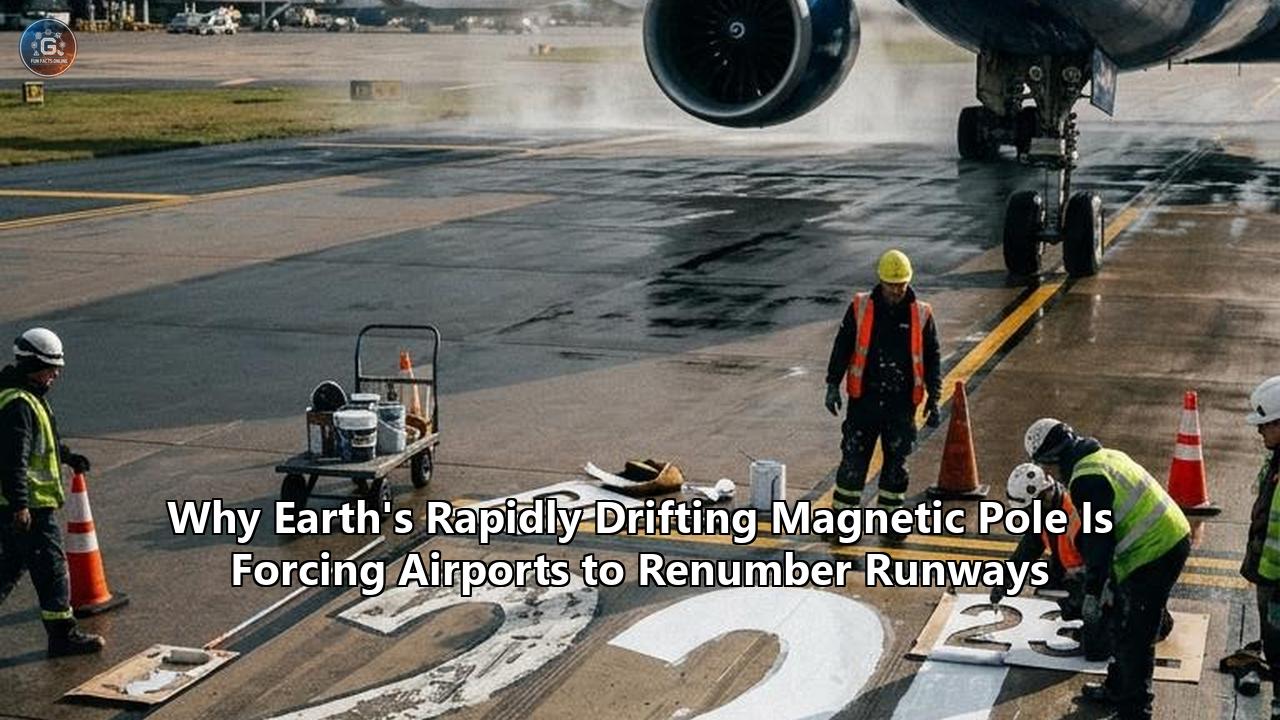
At airports around the world, maintenance crews are working under the cover of night to execute a delicate, high-stakes overhaul. Heavy machinery grinds away thousands of square feet of thick white paint from tarmac surfaces. Specialized crews replace illuminated taxiway guidance signs, while avionics technicians recalibrate ground-based radio transmitters and update software across flight management databases.
This operational disruption is not caused by crumbling infrastructure or shifting flight patterns. It is triggered by a fluid, turbulent body of molten iron churning nearly 1,800 miles beneath the surface of the planet.
The Earth's magnetic north pole is moving from the Canadian Arctic toward Siberia. This deep-earth dynamic regularly invalidates the official designations of airport runways—forcing aviation authorities, including the Federal Aviation Administration (FAA) and the International Civil Aviation Organization (ICAO), to order complete physical and digital renumberings of runways worldwide.
The joint release of the World Magnetic Model (WMM2025 and WMMHR2025) by the National Oceanic and Atmospheric Administration (NOAA) and the British Geological Survey (BGS) highlighted the persistent instability of Earth's geomagnetic core. The model, updated every five years, forms the baseline for global navigational systems.
The latest data confirms that while the pole's drift has recently decelerated from a peak speed of over 50 kilometers per year to approximately 36 to 40 kilometers per year, its position continues to skew magnetic compass headings across every continent.
When those local compass headings drift past a specific mathematical threshold, airport runways—which are named strictly according to their magnetic orientation—must be renumbered to maintain alignment with pilot instruments.
┌────────────────────────────────────────────────────────────────────────┐
│                        RUNWAY RENUMBERING TRIGGER                      │
├────────────────────────────────────────────────────────────────────────┤
│  Physical Runway Axis: Fixed geographic alignment (e.g., 094° True)   │
│  Geomagnetic Shift: Local magnetic declination alters heading over time│
│                                                                        │
│   Year 1995: Magnetic Heading 094° ──► Rounds to 090° ──► Runway 09    │
│   Year 2025: Magnetic Heading 096° ──► Rounds to 100° ──► RUNWAY 10    │
│                                                                        │
│  Action Required: Repaint markings, swap signs, update ILS & charts    │
└────────────────────────────────────────────────────────────────────────┘
This phenomenon creates a physical paradox: concrete runways laid firmly into the bedrock do not move, yet the magnetic numbers painted on their ends must change to keep aircraft landing safely.
Decoding Runway Math: Why 184 Degrees Demands a Paintbrush
To understand why a shifting magnetic field requires heavy construction equipment, one must look at how airports label their runways. Runway names are not chosen arbitrarily, nor are they named after local geographical landmarks. They are directional compass bearings expressed in a simplified two-digit code.
A standard compass rose consists of 360 degrees, where 360° represents North, 090° East, 180° South, and 270° West. In aviation, every runway is designated by its magnetic heading rounded to the nearest ten degrees, with the final trailing zero dropped.
- A runway oriented along a magnetic heading of 090° is designated Runway 09.
- A plane landing on that same strip of asphalt in the opposite direction travels along a heading of 270°, making that end Runway 27.
- Together, this single strip of pavement is designated as Runway 09/27.
If an airport has parallel runways, designator letters are added to distinguish them: L for Left, R for Right, and C for Center. For example, Tampa International Airport historically operated parallel runways designated 18L/36R and 18R/36L.
                     COMPASS BEARING TO RUNWAY NUMBER

                000° / 360° [North] ──► Runway 36
                         │
      315° [NW]          │          045° [NE]
         ╲               │               ╱
          ╲              │              ╱
           ╲             │             ╱
270° [West] ─────────────┼───────────── 090° [East]
Runway 27                │                Runway 09
           ╱             │             ╲
          ╱              │              ╲
         ╱               │               ╲
      225° [SW]          │          135° [SE]
                         │
                  180° [South] ──► Runway 18
Because aviation relies on this rounding system, small changes in local magnetic declination—the angular difference between True Geographic North and Magnetic North—can sit undetected for decades. However, once local magnetic drift pushes a heading across a half-way rounding mark, a mandatory update is triggered.
Consider a runway constructed with a physical magnetic orientation of 184°. Under standard rounding rules, 184° rounds down to 180°, yielding Runway 18.
If decades of subterranean magnetic movement alter the local magnetic declination by just two degrees, the compass heading in the cockpit reading during alignment shifts to 186°. Under international regulations, 186° no longer rounds down to 180°; it rounds up to 190°.
Overnight, Runway 18 becomes Runway 19. The concrete has not moved an inch, but the mathematical relationship between the runway and Earth's magnetic core has broken the threshold.
Earth's Engine Room: The Science Behind the Magnetic North Pole Shift
The physical mechanism forcing these airport updates originates deep below the crust, inside Earth's liquid outer core.
Understanding the underlying causes of the magnetic north pole shift requires looking down 1,800 miles to a 1,400-mile-thick ocean of liquid iron and nickel heated to temperatures exceeding 4,000 degrees Celsius.
┌────────────────────────────────────────────────────────────────────────┐
│                        EARTH'S INTERIOR LAYERS                         │
├────────────────────────────────────────────────────────────────────────┤
│                                                                        │
│   [ Solid Crust & Mantle ] ──► ~1,800 miles thick                      │
│                                                                        │
│   [ Liquid Outer Core ]    ──► Molten Iron & Nickel (4,000°C - 5,000°C) │
│                                Convection + Coriolis = Geodynamo       │
│                                Creates shifting magnetic field lines   │
│                                                                        │
│   [ Solid Inner Core ]    ──► High-pressure Solid Iron Sphere          │
│                                                                        │
└────────────────────────────────────────────────────────────────────────┘
This liquid metal is in constant, violent motion, driven by two primary forces:
- Thermal Convection: Intense heat escaping from the solid inner core causes buoyant, hotter liquid metal to rise toward the mantle, where it cools and sinks back down.
- The Coriolis Effect: As Earth rotates on its axis, it twists these rising and sinking columns of liquid metal into giant, churning spirals aligned with the planet’s rotational axis.
Because liquid iron is an electrically conductive fluid, its movement generates electric currents. These currents, in turn, generate magnetic fields—a self-sustaining feedback loop known as the geodynamo.
If the liquid outer core flowed in a perfectly uniform, symmetrical pattern, Earth’s magnetic poles would remain static, neatly aligned near the geographic poles. But fluid dynamics inside the outer core are chaotic, asymmetric, and turbulent.
When Arctic explorer Sir James Clark Ross first located the magnetic north pole in northern Canada in 1831, it was relatively stationary, drifting at a modest pace of roughly 10 to 15 kilometers (6 to 9 miles) per year.
By the late 1990s, however, satellite observations and ground-based geomagnetic observatories detected an acceleration. The pole accelerated northward out of the Canadian Arctic, crossing the International Date Line and speeding across the Arctic Ocean toward Siberia at rates exceeding 50 kilometers (31 miles) per year.
                   HISTORICAL DRIFT OF MAGNETIC NORTH

    1831 (Discovered by Ross) ──► Northern Canada (Slow: ~10-15 km/yr)
                │
                ▼
    1990s Acceleration       ──► Speeding across Arctic Ocean
                │
                ▼
    2000s Peak Speed         ──► ~50-60 km/yr toward Russia
                │
                ▼
    Present Day (WMM2025)    ──► Moderated to ~36-40 km/yr toward Siberia
Geophysicists analyzing satellite data from the European Space Agency’s Swarm constellation discovered that this accelerated magnetic north pole shift is driven by competition between two massive subterranean patches of negative magnetic flux. One patch sits beneath northern Canada, and the other lies beneath Siberia.
Between 1970 and 1999, changes in flow patterns within the outer core weakened the Canadian magnetic blob, allowing the Siberian blob to exert a stronger pull.
This pulled the magnetic pole across the northern hemisphere.
Although the latest WMM2025 readings show this drift speed has moderated to around 36 kilometers per year, the pole continues its trajectory toward Russia, altering local declination values across the globe every day.
Safety in the Cockpit: Why Aviation Can't Just Ignore Magnetic North
A common question among passengers is straightforward: In an age dominated by GPS, satellite navigation, and digital flight computers, why does commercial aviation still rely on an unpredictable magnetic field?
The short answer is safety through redundancy. Modern commercial aviation operates under strict fail-safe standards. While long-haul airliners rely on Global Navigation Satellite Systems (GNSS) like GPS and onboard Inertial Reference Systems (IRS) for primary navigation, the magnetic compass remains the ultimate, non-electric, un-hackable backup instrument.
┌────────────────────────────────────────────────────────────────────────┐
│                   AIRCRAFT NAVIGATION HIERARCHY                        │
├────────────────────────────────────────────────────────────────────────┤
│  PRIMARY:   Global Navigation Satellite Systems (GNSS / GPS)           │
│             Offers precise global positioning and track logs.          │
│                                                                        │
│  SECONDARY: Inertial Reference Systems (IRS / Gyroscopes)              │
│             Calculates position via acceleration without external signals.│
│                                                                        │
│  FAIL-SAFE: Standby Magnetic Compass & Ground Magnetic Signals         │
│             Operates passively without aircraft electrical power;      │
│             Resistant to GPS spoofing, solar storms, and system crash. │
└────────────────────────────────────────────────────────────────────────┘
If an airliner experiences a total electrical failure, solar storm interference, or localized satellite signal jamming—an increasing concern in modern congested airspace—the standby magnetic compass on the dashboard is the pilot's final orientation tool.
If the runway numbers painted on the tarmac do not match the standby compass reading or the magnetic headings programmed into ground-based guidance systems, human error risks rise significantly.
                     ILS APPROACH ALIGNMENT SCHEMATIC

    Aircraft Approach Path (Heading 190° Magnetic)
   ─────────────────────────────────────────────────►
                                                     │
                                                     ▼
   ┌───────────────────────────────────────────────────────────────────┐
   │                       RUNWAY MARKING: 19                         │
   └───────────────────────────────────────────────────────────────────┘
   ▲                                                                   ▲
   │◄──────────────────── Physical Tarmac Strip ──────────────────────►│

   * CRITICAL REQUIREMENT: Cockpit Compass (190°), Runway Paint (19),
     ILS Localizer Signal (190°), and FMS Database MUST MATCH EXACTLY.
Furthermore, airport infrastructure is hardwired to magnetic bearings:
- Instrument Landing Systems (ILS): Ground arrays send radio beams along the runway centerline to guide aircraft during low-visibility landings. These signals are calibrated to match the runway's precise magnetic bearing.
- Flight Management Systems (FMS): Onboard flight computers continuously cross-reference satellite positions with ground radio beacons (such as VORs) and local magnetic variations stored in regional databases.
- Aeronautical Charts and AIRAC Cycles: World aviation operates on a strict 28-day update schedule known as the Aeronautical Information Regulation and Control (AIRAC) cycle. If an airport renumbers a runway, every airline database, paper chart, and digital navigation software globally must be synchronized on the exact same effective date.
If an airport delays updating a runway designation that has crossed a magnetic threshold, a dangerous discrepancy emerges. A pilot flying a Category III instrument approach in zero-visibility fog would see a magnetic heading on their Primary Flight Display that conflicts with visual airport markings and air traffic control instructions. In commercial aviation, eliminating such ambiguities is essential.
The Logistics and Economics of Renumbering an Airport
Renumbering an airport runway involves much more than painting over a few numbers on asphalt. It is a complex logistics operation that requires months of technical planning, regulatory approval, and physical installation.
                 RUNWAY RENUMBERING OPERATIONAL TIMELINE

  Phase 1: Survey & Modeling (12–18 Months Prior)
  └── Monitor local magnetic declination via WMM data; confirm threshold breach.

  Phase 2: Regulatory Filings & Charting (6–12 Months Prior)
  └── Submit documentation to FAA/ICAO; schedule AIRAC cycle release date.

  Phase 3: Physical Retrofit Preparation (1–3 Months Prior)
  └── Fabricate new airfield signage; procure friction-rated paint & glass beads.

  Phase 4: Execution Night (Overnight Closure)
  ├── Hydro-blast old runway pavement markings.
  ├── Paint new numbers with retroreflective glass bead coating.
  ├── Swap out physical taxiway/runway hold-short light boxes.
  └── Recalibrate ILS transmitters and AWOS automated weather frequencies.

  Phase 5: Go-Live & Database Cutover (Effective AIRAC Date)
  └── Synchronize global flight databases, charts, and ATC operational systems.
1. Removing and Applying Markings
The white numbers painted at the ends of commercial runways are massive—typically measuring up to 60 feet (18 meters) tall and 20 feet wide. They are applied using thick, high-friction, specialized airfield paints embedded with retroreflective glass beads for visibility in bad weather.
Simply painting over old numbers is illegal under aviation safety rules, as wearing paint could reveal the old numerals and confuse pilots. Crews must use ultra-high-pressure water jets (hydro-blasting) or abrasive sandblasting to strip the old paint down to raw asphalt or concrete before applying multiple coats of fresh paint.
2. Airfield Signage Overhaul
Runways are surrounded by complex taxiway networks lined with illuminated guidance signs. Mandatory instruction signs—featuring white text on red backgrounds—tell pilots they are about to enter a active runway.
When Geneva International Airport renumbered its main runway, crews replaced over 100 sign panels across the airfield and applied hundreds of pounds of paint to update runway labels.
At major hubs with parallel and intersecting runways, swapping these panels requires changing hundreds of electrical housing boxes, lens plates, and airfield lighting circuits.
                     AIRFIELD SIGNAGE REPLACEMENT

       BEFORE RENUMBERING                    AFTER RENUMBERING
   ┌─────────────────────────┐           ┌─────────────────────────┐
   │  [RED BG]  18R - 36L    │   ───►    │  [RED BG]  19R - 1L     │
   └─────────────────────────┘           └─────────────────────────┘
     Mandatory Hold Sign                   Mandatory Hold Sign
3. Recalibrating Navigation Hardware
Ground-based navigation aids must be manually recalibrated. Technicians adjust ILS localizer transmitters so that the directional signals broadcast to approaching aircraft align with the updated magnetic values.
Automated Weather Observing Systems (AWOS) and Automated Surface Observing Systems (ASOS)—which broadcast wind speed and direction to pilots—must also be reprogrammed so that reported wind directions align correctly with the renumbered runway.
4. Global Database Synchronization
On the chosen AIRAC cutover date, the new runway numbers must go live across every aviation system simultaneously. If an airport paints "19" on the tarmac, but an arriving airline's flight management software still lists "18," flight computers can trigger error warnings or reject automated landing approaches.
| Airport | Original Designation | New Designation | Reason / Context |
|---|---|---|---|
| Geneva International (GVA) | 05/23 | 04/22 | Magnetic drift required panel/paint overhaul across entire layout. |
| Tampa International (TPA) | 18R/36L | 19R/1L | Required changing 140+ signs, sandblasting pavement, closing main runway. |
| Fairbanks International (FAI) | 1L/19R | 2L/20R | High polar latitude accelerates local magnetic drift (~24 year cycle). |
| Las Vegas Harry Reid (LAS) | 7L/25R | 8L/26R | Shift reached 4 degrees, forcing first renumbering in airport history. |
| London Stansted (STN) | 05/23 | 04/22 | Shift in UK magnetic declination pushed bearing past rounding mark. |
| Oakland International (OAK) | 27 | 28 | Historic runway designation updated following shift in coastal declination. |
The financial impact of these changes is substantial. Closing a primary runway at a major airport costs tens of thousands of dollars per hour in lost capacity and flight delays, while physical construction, signage fabrication, and technical recalibration routinely push total costs into hundreds of thousands—or even millions—of dollars per airport.
Tech Beyond Tarmac: Smartphones, Submarines, and Global Defense
The broad operational impact of the magnetic north pole shift extends far beyond commercial aviation runways. Modern electronic devices and military networks rely heavily on the World Magnetic Model to maintain accurate spatial positioning.
                     TECHNOLOGIES DEPENDENT ON THE WMM

   ┌───────────────────┐    ┌───────────────────┐    ┌───────────────────┐
   │    SMARTPHONES    │    │ MILITARY DEFENSE  │    │ MARITIME SHIPPING │
   ├───────────────────┤    ├───────────────────┤    ├───────────────────┤
   │ Converts raw chip │    │ Submarines, UAVs, │    │ Ocean tankers     │
   │ magnetometer      │    │ and artillery in  │    │ backup navigation │
   │ readings into     │    │ GPS-denied or     │    │ during satellite  │
   │ true-north maps.  │    │ jammed airspace.  │    │ blackouts.        │
   └───────────────────┘    └───────────────────┘    └───────────────────┘
Smartphone Navigation
Virtually every modern smartphone contains a micro-electro-mechanical system (MEMS) magnetometer—a tiny sensor that measures Earth's magnetic field strength along three axes.
When a user opens Google Maps or Apple Maps, the app reads data from this internal sensor to show which direction the phone is pointed.
However, street maps are drawn relative to True Geographic North, not Magnetic North. Smartphones use embedded WMM software algorithms to automatically convert raw magnetic readings into true north headings. Without periodic updates to the World Magnetic Model, smartphone compass needles would drift out of alignment, mispointing walking directions and turn-by-turn navigation.
Military and Defense Operations
The United States Department of Defense, NATO forces, and the UK Ministry of Defence rely on the WMM for critical navigation systems.
Undersea submarines operating deep beneath Arctic ice sheets cannot receive GPS satellite signals. They depend on inertial guidance systems calibrated against geomagnetic models.
Similarly, military aircraft, uncrewed aerial vehicles (UAVs), and targeted munitions operating in contested electronic warfare environments—where GPS signals are jammed or spoofed—rely on magnetic reference models to maintain directional accuracy.
Polar Navigation and "Blackout Zones"
As the magnetic pole moves across the Arctic, it changes the extent of geomagnetic "blackout zones". Near the magnetic poles, Earth's magnetic field lines plunge nearly straight down into the ground rather than running parallel to the surface.
In these regions, standard horizontal magnetic compasses become unstable and spin aimlessly.
The high-resolution WMMHR2025 model provides refined mapping of these polar blackout zones, allowing polar commercial flights and Arctic shipping vessels to safely transition between magnetic guidance and inertial/true north navigation systems.
The Long Horizon: Will Aviation Ever Abandon Magnetic North?
As the costs and operational headaches of runway renumbering continue to pile up, a fundamental question divides the international aviation community: Why not abandon Magnetic North entirely and switch all aviation operations to True Geographic North?
┌────────────────────────────────────────────────────────────────────────┐
│                   MAGNETIC NORTH VS. TRUE NORTH DEBATE                 │
├────────────────────────────────────────────────────────────────────────┤
│  MAGNETIC NORTH (CURRENT STANDARD)                                     │
│  PROS: Works passively without power; accessible via simple compass.  │
│  CONS: Requires periodic runway renumbering, chart edits, database shifts.│
│                                                                        │
│  TRUE NORTH (PROPOSED ALTERNATIVE)                                     │
│  PROS: Fixed geographic headings; runway numbers stay permanent forever. │
│  CONS: Requires global fleet avionics overhaul; legacy hardware risks. │
└────────────────────────────────────────────────────────────────────────┘
Geographic North is fixed permanently by the rotational axis of the planet. If runways were numbered according to True North, runway designations would never need to be painted over or renamed again.
Navigating by True North is technically possible and already used in specific northern regions. In extreme northern latitudes (such as northern Canada and parts of Alaska), where proximity to the magnetic pole makes magnetic compasses unusable, aviation authorities mandate the use of True North navigation procedures. Modern airliner flight computers can easily calculate True North headings using internal gyroscopes and satellite positioning.
However, transitioning the entire global aviation infrastructure from Magnetic North to True North represents a massive coordination challenge:
- Global Harmonization: Aviation safety requires absolute global uniformity. A partial transition—where some countries adopt True North while others retain Magnetic North—would introduce severe safety risks during international flights. Every civil aviation authority across more than 190 nations would need to agree on a single synchronized transition timeline.
- Legacy Aircraft Fleets: Thousands of older general aviation aircraft, regional turboprops, and legacy military transport planes operate with mechanical compasses and simple flight instruments that read raw magnetic orientation. Retrofitting these aircraft with electronic True North heading systems would cost billions of dollars across the global fleet.
- Ground Infrastructure: Changing to True North would require renumbering almost every airport runway on Earth simultaneously during a single transition event, rather than updating a few airports per year as local thresholds are crossed.
For the foreseeable future, regulatory bodies like the FAA and ICAO have chosen to keep the existing magnetic system in place.
As the magnetic north pole shift continues to carry Earth's magnetic core along its path toward Siberia, scientists, airport operators, and maintenance crews will keep monitoring geomagnetic models.
The next time your flight touches down, look out the window at the bold white numbers painted on the tarmac. Those numbers are more than visual markers for pilots—they are a direct link between modern global transport and the hidden, fluid engine churning at the center of the Earth.
Reference:
- https://nbaa.org/aircraft-operations/airports/how-changes-in-magnetic-north-are-impacting-airports/
- https://avgeek.ph/why-airport-runways-are-renumbered-the-impact-of-magnetic-shifts/
- http://www.kathrynsreport.com/2017/08/magnetic-shifts-prompt-renumbering-for.html
- https://www.smithsonianmag.com/smart-news/earths-magnetic-north-pole-is-shifting-toward-siberia-and-raising-questions-about-unusual-movement-180985892/
- https://watchers.news/epicenter/magnetic-north-pole-shift-brings-updates-to-world-magnetic-model-2025/
- http://www.geomag.bgs.ac.uk/research/modelling/WorldMagneticModel.html
- https://www.ncei.noaa.gov/news/world-magnetic-model-2025-released
- https://www.ncei.noaa.gov/news/2025-wmm-annual-report-released
- https://simpleflying.com/airport-runways-renumbered/
- https://www.facebook.com/original.zemtv/videos/why-airports-are-changing-runway-numbers/1956319331660351/
- https://www.ncei.noaa.gov/news/airport-runway-names-shift-magnetic-field
- https://spacedaily.com/k-something-happening-far-below-the-surface-of-the-earth-is-quietly-forcing-airports-all-over-the-world-to-close-their-runways-and-repaint-them-and-almost-no-passenger-has-any-idea-why-it-happens/