A 17.4-meter cylinder of gray-green marine mud, extracted from 3,082 meters beneath the surface of the southeastern Pacific Ocean, has delivered a striking verdict on global ocean teleconnections. Recovered roughly 150 kilometers off the Chilean coast by the Japanese research vessel Mirai, this deep-sea sediment column preserves an unbroken geochemical diary of the climate swings that rattled the Southern Hemisphere during the last glacial epoch. For decades, oceanographers have understood that when the Atlantic Meridional Overturning Circulation (AMOC)—the planet’s primary ocean conveyor belt—slows, the North Atlantic cools sharply. But an international investigation published in the Proceedings of the National Academy of Sciences (PNAS) by a team led by Takuto Kasuya of the Japan Agency for Marine-Earth Science and Technology (JAMSTEC) and Kyushu University reveals an alarming corollary: whenever the AMOC shuts down or decelerates, it acts as an oceanic heat valve that redirects planetary thermal energy directly into the Southern Hemisphere.
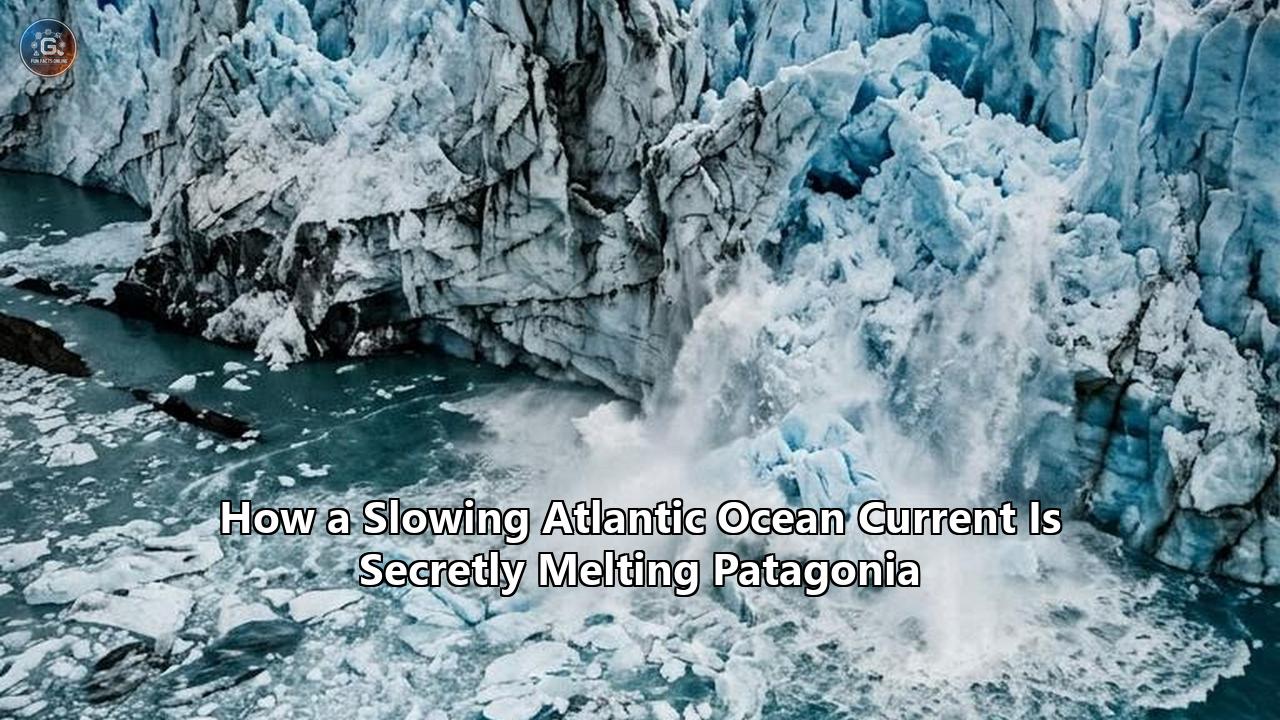
The immediate casualty of this redirection is Patagonia. Through a planetary atmospheric and oceanic relay known as the thermal bipolar seesaw, the deceleration of Atlantic circulation warms the South Pacific, shifts ferocious atmospheric winds, and funnels moisture-saturated warm air directly into the southern Andes. The resulting climatic transformation accelerates Patagonia glacier melting from the low-lying margins upward, undermining ice masses long considered far removed from the cold currents of the North Atlantic.
The revelation could not come at a more precarious moment. Modern oceanographic arrays deployed across the Atlantic Basin—from the RAPID mooring array along the 26th parallel north to the OSNAP array spanning the subpolar gyre—have recorded a systematic, decadal decline in overturning volume. The AMOC is currently operating at its weakest circulation velocity in more than a thousand years. While European and North American policymakers have anxiously debated whether this weakening will plunge northern latitudes into agricultural disruption and severe winters, field glaciologists in Chile and Argentina have been grappling with a parallel, unexplained crisis on the ground: the rapid, synchronized collapse of outlet glaciers across the Northern and Southern Patagonian Icefields.
The PNAS findings connect these two phenomena. Far from being a localized tragedy governed solely by rising baseline atmospheric temperatures, the accelerating demise of Patagonian ice is being actively steered by the remote unraveling of the Atlantic conveyor. The physical mechanisms tying the subpolar North Atlantic to the fjords of the southern Andes reveal that when the ocean's greatest circulation engine falters, the entire global climate system tilts on its axis.
The Bipolar Seesaw: The Forgotten Physics of Interhemispheric Heat
Most public and political discussions surrounding AMOC destabilization focus on a single geographic theater: northwestern Europe. Headlines routinely warn of collapsed agricultural yields in the United Kingdom, freezing conditions across Scandinavia, and the enigmatic "cold blob" of subpolar North Atlantic surface water that persistently defies the wider trajectory of global atmospheric warming. Yet this northern focus ignores a fundamental law of geophysical fluid dynamics: Earth’s climate is a closed thermodynamic system. Heat not transported poleward does not simply vanish into space.
       CONVENTIONAL VIEW (Northern Bias)
       [ AMOC Weakening ] ──> [ North Atlantic Cools ] ──> Regional Freezing

       REAL-WORLD THERMAL BIPOLAR SEESAW
       [ AMOC Weakening ]
               │
               ├──> North Atlantic Cools (Rapid Atmospheric Response)
               │
               └──> Planetary Heat Export Blocked at Equator
                            │
                            ▼
                    Southern Ocean & South Pacific Heat Accumulation
                            │
                            ▼
                    ITCZ Shifts Southward / Hadley Cell Adjusts
                            │
                            ▼
                    Southern Westerly Winds Shift Poleward & Intensify
                            │
                            ▼
                    Accelerated Patagonia Glacier Melting & Basal Lubrication
In an undisturbed climate state, the AMOC operates as a massive meridional heat engine. Warm, saline surface waters flow northward through the tropical and subtropical Atlantic, cross the equator, and release enormous volumes of sensible and latent heat into the atmosphere over the subpolar North Atlantic—equivalent to roughly 1.3 petawatts of continuous power. This oceanic heat release is what grants Western Europe its anomalously mild maritime climate relative to its latitude. As this water surrenders its thermal energy and gains density through cooling and evaporation, it sinks in the Labrador and Nordic Seas, forming North Atlantic Deep Water (NADW). This cold, dense water mass then creeps southward thousands of meters beneath the surface, eventually crossing into the Southern Ocean.
When freshwater floods the North Atlantic—whether from accelerated meltwater runoff off Greenland's margins or calving events in the subpolar seas—it blankets the salty ocean with a buoyant layer of lower-density liquid. This freshwater cap inhibits deep convective overturning. The vertical conveyor stalls.
The thermodynamic consequences of this slowdown were first formalized by Thomas Stocker and Sigfús Johnsen in their foundational 2003 thermodynamic model of the "thermal bipolar seesaw". Because the Atlantic conveyor is the only ocean circulation system capable of transporting cross-equatorial heat from the Southern Hemisphere into the Northern Hemisphere, an AMOC disruption slams the heat valve shut. Denied its northward exit, thermal energy begins accumulating in the South Atlantic, the Southern Ocean, and the southeastern Pacific.
"The prevailing public narrative has always framed an AMOC slowdown as a localized Atlantic cooling crisis," explains a senior paleoclimatologist familiar with the modeling data. "In reality, the Southern Ocean acts as an enormous thermodynamic sponge. When you choke the Atlantic pipeline, the southern oceans absorb that excess thermal capacity. You do not get planetary cooling; you get a profound interhemispheric reallocation of energy that dramatically reshapes wind vectors, ocean currents, and moisture pathways in the southern mid-latitudes."
This thermal imbalance triggers rapid atmospheric compensation. The Earth’s atmosphere cannot tolerate extreme cross-equatorial temperature gradients without reconfiguring its primary circulation cells. As the northern mid-latitudes chill, the Intertropical Convergence Zone (ITCZ)—the equatorial meteorological belt where the trade winds meet—migrates southward. This displacement compresses and alters the Hadley and Ferrel atmospheric circulation cells in the Southern Hemisphere, kicking off a chain reaction that reaches all the way to the southern tip of South America.
Inside Core MR16-09 PC3: Decoding 17.4 Meters of Abyssal Evidence
To prove that this theoretical seesaw operates in the real world—and that its impacts strike the Patagonian ice fields directly—requires geological ground truth. That evidence was secured aboard the JAMSTEC oceanographic vessel Mirai during cruise MR16-09 Leg 2.
Stationed at 46.4°S latitude and 77.3°W longitude, the vessel lowered a specialized piston corer through more than three kilometers of open water into the eastern South Pacific, roughly 150 kilometers west of the Chilean coastline. The target site was chosen deliberately: situated just offshore from the Golfo de Penas and the Taitao Peninsula, the abyssal seabed here acts as an undisturbed sediment trap for the material flushed out by the rivers, fjords, and tidewater glaciers draining western Patagonia.
The corer pulled up a 17.4-meter continuous archive of terrigenous mud, sand, and biogenic ocean sediments representing tens of thousands of years of sedimentation. Back on land, an international consortium of researchers from JAMSTEC, Kyushu University, the University of Tokyo, Kochi University, Hokkaido University, the Alfred Wegener Institute in Germany, and the COPAS Coastal center at Chile’s Universidad de Concepción subjected the core to ultra-high-resolution elemental analysis.
The technical centerpiece of the investigation relied on micro-X-ray fluorescence (XRF) scanning, measuring continuous down-core elemental intensities at millimeter scales. The researchers focused on the logarithmic ratio of titanium to bromine ($\ln(\text{Ti}/\text{Br})$):
- Titanium ($\text{Ti}$) serves as an unequivocal geochemical tracer of terrestrial, mineral-rich runoff. The rugged mountain spine of western-central Patagonia is constructed predominantly from two geological terranes: the Patagonian Batholith (a massive belt of Mesozoic-Cenozoic granitoids) and metamorphic complexes including the Chonos Metamorphic Complex and the Eastern Andean Metamorphic Complex. When ice fields grind against this bedrock and meltwater streams scour the valleys, titanium-rich silt is swept offshore into the ocean basin.
- Bromine ($\text{Br}$), conversely, binds to marine organic matter produced in surface waters. It tracks biological productivity and marine pelagic sedimentation occurring in the open sea.
A high $\text{Ti}/\text{Br}$ ratio indicates an overwhelming deluge of continental detritus and glacial meltwater surging off the South American landmass, swamping the baseline marine background.
When Kasuya and his colleagues plotted the $\text{Ti}/\text{Br}$ profile alongside Greenland and Antarctic ice cores, the correspondence was unmistakable. The South Pacific sediment record displayed sharp, millennial-scale pulses of terrigenous discharge that lined up precisely with Heinrich stadials.
Heinrich stadials are well known to paleoclimatologists: they represent catastrophic episodes during the last glacial period when the Laurentide Ice Sheet broke apart, launching armadas of icebergs into the North Atlantic. The resulting torrent of freshwater caused near-complete collapses of the AMOC. In core MR16-09 PC3, every major Heinrich stadial (HS 1 through HS 6) matched an explosive increase in sediment discharge from the ancient Patagonian Ice Sheet.
The sediment record revealed that this was not a localized Pacific anomaly. Through isotopic and mineral provenance matching, the team confirmed that the detrital material originated directly from the eroded granitic cores of the Andean interior. When the North Atlantic stopped circulating, Patagonia eroded at extraordinary speed, flushing vast volumes of continental sediment into the sea.
The Atmospheric Relay: How a Stalled Current Hijacks the Westerlies
Finding Patagonian silt in the abyssal Pacific proved the correlation, but determining the exact causal mechanism required advanced climate modeling. To bridge the physical distance between the subpolar Atlantic and the fjords of Chile, the researchers deployed MIROC4m—a fully coupled atmosphere-ocean general circulation model developed by Japanese research institutes—running on JAMSTEC’s supercomputer, the Earth Simulator 4 (ES4).
┌────────────────────────────────────────────────────────────────────────┐
│                        MIROC4m SUPERCOMPUTER COUPLING                  │
├────────────────────────────────────────────────────────────────────────┤
│ 1. Freshwater Hosing (North Atlantic)                                  │
│    └─> Shuts down NADW formation; cools Northern Hemisphere            │
│                                                                        │
│ 2. Bipolar Seesaw Activation                                           │
│    └─> Traps heat in South Atlantic / Southeastern Pacific (+0.5°-1.5°C)│
│                                                                        │
│ 3. Intertropical Convergence Zone (ITCZ) Shift                         │
│    └─> Shifts 2° to 5° southwards; Hadley cell contracts               │
│                                                                        │
│ 4. Southern Hemisphere Westerly Winds (SWW) Hijack                     │
│    └─> SWW core shifts south of 45°S; intensifies along Patagonian spine│
│                                                                        │
│ 5. Clausius-Clapeyron Vapor Escalation                                 │
│    └─> Warmer coastal SSTs increase evaporation; fuels Pacific plumes  │
│                                                                        │
│ 6. Asymmetric Mass Balance Impact                                      │
│    ├─> High Accumulation Plateau: Increased snowfall (+10-20%)         │
│    └─> Low-Elevation Margins: Extreme liquid rain & melt runoff        │
└────────────────────────────────────────────────────────────────────────┘
The supercomputer simulations modeled an abrupt, freshwater-induced AMOC shutdown under glacial boundary conditions, tracking every atmospheric and oceanic vector across centuries of model time. The simulation illuminated a tightly coupled sequence of atmospheric changes:
1. Southern Ocean Warming and Coastal SST Rise
Following the collapse of overturning in the North Atlantic, the thermal bipolar seesaw generates an immediate heat retention anomaly across the southern oceans. In the simulations, sea surface temperatures (SSTs) across the South Pacific and along the Chilean continental margin warmed significantly. This warmed coastal ocean transformed the regional atmosphere.
2. Southward Migration of the Westerly Wind Belt
The Southern Hemisphere Westerly Winds (SWW) represent one of the most powerful wind systems on the planet, driving the Antarctic Circumpolar Current and dictating the climate of southern South America. The simulations demonstrated that the combination of tropical Hadley cell adjustments and the steepening thermal gradient between the warming Southern Ocean and Antarctica displaced the core of the Southern Westerlies southward, while intensifying wind speeds south of 45°S.
3. Evaporative Moisture Loading
According to the Clausius-Clapeyron relation, every degree Celsius of ocean warming increases the water-vapor carrying capacity of the overlying atmosphere by approximately 7%. The warmer SSTs modeled along the Chilean margin supercharged the lower troposphere with moisture.
4. Orographic Smashing
The intensified, southward-shifted westerly winds swept this moisture-laden air mass across thousands of kilometers of open ocean before slamming directly into the sheer vertical topography of the Patagonian Andes. Blocked by mountains rising abruptly from sea level to over 3,000 meters, this maritime air was forced upward, cooling and condensing into extreme orographic precipitation along the western Andean flank.
This atmospheric-oceanic relay reveals how an ocean event in the North Atlantic transforms weather patterns in Patagonia. It is not a weak, diluted signal by the time it reaches the Southern Hemisphere. Instead, the atmospheric shift magnifies the ocean's initial temperature change, weaponizing the westerly winds into a high-speed conveyor of moisture aimed directly at the Patagonian Ice Sheet.
The Glaciological Paradox: Snow at the Crest, Torrential Rain at the Terminus
The supercomputer results presented Kasuya's team with a seeming contradiction—one that explains why modern field observations of Patagonia have often produced confusing, disputed data.
In the MIROC4m simulations, the total mass of the Patagonian Ice Sheet showed an ambiguous net response during an AMOC slowdown. At high altitudes—along the ice fields' accumulation zones above 1,500 meters—the enhanced orographic moisture fell into sub-zero air, producing massive increases in snowfall. Up on the high plateau, the ice sheet was actually gaining mass.
Yet at the exact same time, the sediment core showed that erosion and sediment discharge into the ocean spiked.
The solution to this paradox lies in the vertical structure of Patagonian glaciology. Patagonia does not host dry, cold, polar ice sheets like those in East Antarctica. Its glaciers are temperate, maritime, and dynamic, balanced directly on the physical margin of melting point throughout much of their depth.
| Glaciological Zone | Altitude Range | Primary Climate Forcing Under Weak AMOC | Physical Impact on Glacier System |
|---|---|---|---|
| Upper Accumulation Plateau | >1,500 m | Enhanced orographic moisture at cold temperatures | Net positive Surface Mass Balance (SMB); increased snowpack thickness. |
| Transient Equilibrium Line (ELA) | 800 m – 1,500 m | Shifting zero-degree isotherm; mixed precipitation | Downward percolation of rain into firn layers; rapid warming of internal ice. |
| Marginal & Outlet Tongues | Sea level – 800 m | Coastal SST warming (+1°C); heavy liquid rainfall | Extreme surface ablation; thermal erosion; rapid sediment transport. |
| Subglacial Bedrock Interface | Below ice column | Massive volumes of liquid meltwater injection | High basal water pressure; cavitation; accelerated basal sliding velocities. |
| Terminus (Fjord / Proglacial Lake) | Sea level to lake depths | Warm water upwelling; mechanical cliff thinning | Accelerated calving; convective melting; flotation and structural collapse. |
When an AMOC slowdown warms the South Pacific and intensifies the westerlies, the regional freezing level (the zero-degree isotherm) climbs several hundred meters up the mountainside. While the highest mountain ridges still receive heavy snow, the vast low-elevation outlet tongues—which stretch down through river valleys into deep sea fjords and immense piedmont lakes—get hit with torrential, warm liquid rain.
             High-Altitude Plateau (>1,500 m)
                 ▲    [Heavy Snow Accumulation]
                / \          │
               /   \         ▼
              /     \   Ice Flow Acceleration (Increased driving stress)
             /       \       │
            /         ▼      ▼
           /      [Crevasses / Moulin Infiltration]
          /                  │
         /                   ▼ High Basal Water Pressure
        /            [Subglacial Cavitation & Lubrication]
       /                     │
      /                      ▼
    ~/~~~~~~~~~~~~~~~~~~~~~~~~~~~~~~~~~~~~~~~~~~~~~~~~~~~~~~~~~~~~~~~
    │ Low-Elevation Margins (<800 m):
    │ • Warm Liquid Rainfall & Coastal SST Warming
    │ • Catastrophic Surface & Subaqueous Melting
    │ • Rapid Fluvial/Detrital Flushing -> Deep-Sea Core Signature
    │ • Calving Front Collapse into Deep Fjords/Lakes
    └────────────────────────────────────────────────────────────────
This rain-on-snow dynamic triggers severe surface melting. Warm liquid water does not simply melt ice from above; it pours into structural crevasses and deep moulins, carrying thermal energy straight to the glacier's bed. Once at the base, this water cannot drain quickly through the subglacial plumbing. Water pressure spikes, partially floating the glacier, decoupling the ice from bedrock friction, and dramatically accelerating basal sliding velocities.
The glacier accelerates downhill toward the sea or proglacial lake like an unbraked conveyor. As ice flows faster into low-altitude zones, its exposed surface area is consumed by warm air and rain, producing the massive pulses of pulverized rock, sand, and titanium-rich sediment captured in core MR16-09 PC3.
This explains why Patagonia glacier melting can accelerate even when regional high-altitude snow accumulation looks healthy on paper. The lower sections are being rapidly sheared away, calved into fjords, and melted out from underneath.
The On-the-Ground Crisis: From Perito Moreno's Tipping Point to Proglacial Lake Tsunamis
While Kasuya’s PNAS paper reconstructed this mechanism using evidence from the last ice age, modern satellite constellations and field glaciologists are watching the exact same physical sequence unfold in real time.
The Northern Patagonian Icefield (NPI, ~4,000 km²) and the Southern Patagonian Icefield (SPI, ~12,000 km²) are the largest contiguous ice masses in the Southern Hemisphere outside of Antarctica. Over the past three decades, geodetic surveys using satellite radar and laser altimetry—from the Shuttle Radar Topography Mission (SRTM) and TanDEM-X to NASA’s ICESat-2 and GRACE-FO gravimetry missions—have revealed alarming ice loss across this terrain. Patagonian glaciers are losing mass faster per unit area than almost any other glacier system on Earth, shedding between 24 and 48 gigatons of ice annually into the oceans, contributing significantly to global sea-level rise.
           PATAGONIAN ICEFIELD MASS LOSS TRAJECTORY
  ┌─────────────────────────────────────────────────────────────┐
  │ Historic Period (1976–2000):                                │
  │ • NPI Geodetic Balance: -0.63 ± 0.03 m w.e. yr⁻¹            │
  │ • SPI Geodetic Balance: -0.33 ± 0.05 m w.e. yr⁻¹            │
  ├─────────────────────────────────────────────────────────────┤
  │ Modern Period (2000–2020s Acceleration):                    │
  │ • NPI Geodetic Balance: -0.86 ± 0.03 m w.e. yr⁻¹ (1.2x rate)│
  │ • SPI Geodetic Balance: -1.23 ± 0.04 m w.e. yr⁻¹ (2.4x rate)│
  │ • Modern Regional Mass Loss: ~24 to 48 Gt yr⁻¹              │
  │ • Total Post-1940s Ice Volume Lost: Over 25%                │
  └─────────────────────────────────────────────────────────────┘
Long-term mass-balance reconstructions reveal that between 1976 and 2000, the SPI lost ice at an average geodetic rate of $-0.33$ meters of water equivalent per year ($\text{m w.e. yr}^{-1}$). Between 2000 and 2020, that thinning rate surged to $-1.23\text{ m w.e. yr}^{-1}$—an acceleration factor of 2.4. Since the 1940s, more than 25% of the total regional ice volume has vanished.
For years, this rapid loss was chalked up to general global warming coupled with local microclimatic shifts. But glaciologists struggled to explain notable anomalies:
- Why were glaciers on the Pacific and Atlantic flanks thinning simultaneously at rates that far outstripped regional atmospheric temperature rise?
- Why was ice loss accelerating even as high-altitude precipitation indices remained high or fluctuated without clear trend?
A 2025 study published in Nature Communications by Brice Noël and colleagues at the University of Liège supplied the first contemporary atmospheric clue. Using high-resolution regional climate models, Noël demonstrated that over the last 40 years, the subtropical high-pressure systems of the South Pacific had systematically shifted poleward. This shift pushed the storm tracks of the Southern Hemisphere Westerly Winds southward, channeling warmer, moisture-laden air directly into Patagonia's lower-elevation glacial margins.
What Noël observed in modern satellite records matches the physical mechanism Kasuya’s team identified in the 17.4-meter sediment core. The modern weakening of the AMOC is already reproducing the atmospheric footprint of ancient Heinrich events, pulling the southern storm tracks poleward and funneling warm maritime air straight into the ice fields.
                     PERITO MORENO GLACIER
          A Century of Equilibrium Collapses (2018–2026)
  ┌─────────────────────────────────────────────────────────────┐
  │ Historic Status (1900–2017):                                │
  │ • Famous "stable/advancing" outlier                         │
  │ • Maintained bedrock pinning point at Lake Argentino        │
  │ • Cyclic damming and rupture of the Brazo Rico              │
  ├─────────────────────────────────────────────────────────────┤
  │ Structural Collapse Phase (2018–2026):                      │
  │ • Mass balance shifts into permanent negative territory     │
  │ • Terminal wall retreat: Nearly 2,000 meters                │
  │ • Unpinning from bedrock thresholds                         │
  │ • Basal water pressure acceleration                         │
  │ • Irreversible retreat trajectory declared by field teams   │
  └─────────────────────────────────────────────────────────────┘
Nowhere is this crisis more starkly visible than at the Perito Moreno Glacier.
For nearly a century, Perito Moreno—a massive 260-square-kilometer glacier in Argentina’s Los Glaciares National Park—stood as the defying exception to global glacier retreat. While its neighbors, Upsala and Viedma, suffered historic retreats, Perito Moreno stayed pinned to a stable bedrock threshold at the Península de Magallanes, regularly damming Lake Argentino’s Brazo Rico arm before spectacularly rupturing.
Between 2017 and 2018, that stability broke down.
Glacier monitoring directed by geophysicist Pedro Skvarca and geologist Lucas Ruiz revealed that Perito Moreno has transitioned into what glaciologists designate an irreversible retreat. Driven by rising base temperatures, elevated liquid precipitation, and subglacial water accumulation, the glacier began sliding faster into Lake Argentino, losing more ice to frontal calving than it could replace from its accumulation basins. Over the past seven years, its lateral margins have shrunk by nearly 2,000 meters. Its towering vertical terminal cliff—long an icon of cryospheric resilience—has thinned and collapsed at an unprecedented rate.
At Upsala Glacier, the retreat has turned into a rout. Terminating in the cold, deep waters of Lake Brazo Upsala, the glacier has retreated more than 5 kilometers since the early 2000s. The ice tongue has thinned so drastically that it has ungrounded from its subaqueous bedrock pinning points, floating off the floor of the fjord-lake.
Once a glacier floats, its calving dynamics decouple from simple surface air temperatures. Water temperature deep below the surface begins driving the ablation. At glaciers like Upsala, Jorge Montt, and Viedma, water temperatures in proglacial lakes and maritime fjords have warmed by fractions of a degree—driven by increased surface runoff and the altered wind-driven circulation of lake and fjord waters. This subsurface heat attacks the calving wall from below, cutting subaqueous notches into the ice face. Structurally undermined, the subaerial ice cliff above snaps along vertical crevasse lines, dropping megaton bergs into the water.
The consequences extend far beyond disappearing ice. As the glaciers rapidly retreat up their valleys, they leave behind unstable moraine dams that hold back vast volumes of meltwater. These high-altitude proglacial lakes are ticking time bombs for Glacial Lake Outburst Floods (GLOFs).
Across Chilean Patagonia's Aysén Region, repeated GLOF events have torn through the valleys of the Baker and Colonia rivers. When a moraine dam collapses—often triggered by an ice avalanche falling from higher cliffs into the lake—a catastrophic wall of water, mud, and displaced boulders surges down the river systems. These sudden floods wipe out bridges, sever the Carretera Austral highway, destroy livestock farms, and threaten downstream indigenous and rural communities. What began as a slowing ocean current in the stormy waters off Greenland ends as a flash flood in a remote Andean valley.
The Southern Ocean Carbon Valve: A Self-Amplifying Planetary Feedback
The revelation that an AMOC slowdown accelerates Patagonia glacier melting uncovers an even larger danger: a runaway planetary carbon cycle feedback loop.
In their PNAS analysis, Kasuya and his team highlight an unsettling parallel. During the ancient Heinrich stadials, every period of detrital sediment discharge from Patagonia matched an abrupt surge in global atmospheric carbon dioxide ($CO_2$), as recorded in Antarctic ice cores like EPICA Dome C and the WAIS Divide.
This correlation is not coincidental. It is driven by the exact same physical mechanism.
                 THE EXPANDING CARBON-CRYOSPHERE LOOP
        ┌────────────────────────────────────────────────────────┐
        │  AMOC Weakening / Conveyor Stalls                      │
        └──────────────────────────┬─────────────────────────────┘
                                   │
                                   ▼
        ┌────────────────────────────────────────────────────────┐
        │  Thermal Bipolar Seesaw Traps Energy in Southern Ocean  │
        └──────────────────────────┬─────────────────────────────┘
                                   │
                                   ▼
        ┌────────────────────────────────────────────────────────┐
        │  Southern Westerlies Shift South & Intensify           │
        └──────────────┬──────────────────────────┬──────────────┘
                       │                          │
                       ▼                          ▼
        ┌────────────────────────┐      ┌────────────────────────┐
        │ Orographic Rain & Heat │      │ Wind-Driven Upwelling  │
        │ Slams Andes            │      │ (Ekman Suction)        │
        └──────────────┬─────────┘      └─────────┬──────────────┘
                       │                          │
                       ▼                          ▼
        ┌────────────────────────┐      ┌────────────────────────┐
        │ Extreme Patagonia      │      │ Venting of Ancient CO₂ │
        │ Glacier Melting        │      │ from Southern Ocean    │
        └────────────────────────┘      └─────────┬──────────────┘
                                                  │
                                                  ▼
                                        ┌────────────────────────┐
                                        │ Planetary Greenhouse   │
                                        │ Warming Accelerates    │
                                        └─────────┬──────────────┘
                                                  │
                                                  ▼
                                        ┌────────────────────────┐
                                        │ Further AMOC           │
                                        │ Destabilization        │
                                        └────────────────────────┘
The Southern Ocean acts as Earth’s primary biological and physical carbon pump. Its cold surface waters absorb roughly 40% of all anthropogenic $CO_2$ taken up by the global oceans. Millions of tons of organic carbon sink into its abyssal depths, safely locked away from the atmosphere for centuries.
However, the deep waters of the Southern Ocean also store vast reserves of ancient, respired $CO_2$. What keeps that carbon trapped down deep is the delicate balance of surface winds and ocean stratification.
When an AMOC slowdown forces the Southern Hemisphere Westerly Winds to shift poleward and intensify over the Southern Ocean, it supercharges wind-driven upwelling through Ekman suction. The roaring winds push surface waters away, forcing deep, carbon-rich water masses to the surface.
Once exposed to the atmosphere, this deep ocean water degasses, venting massive plumes of stored $CO_2$ into the sky.
A 2026 study published in Communications Earth & Environment by Da Nian, Matteo Willeit, and Johan Rockström at the Potsdam Institute for Climate Impact Research (PIK) modeled this dynamic under modern boundary conditions. Their findings were sobering: a collapse of the AMOC at modern atmospheric greenhouse gas levels (which currently hover around 430 ppm) would flip the Southern Ocean from an essential carbon sink into an active carbon source. This ocean degassing would dump hundreds of billions of tons of carbon into the atmosphere, adding an extra 0.2°C to 0.3°C of global warming that climate projections currently miss.
This mechanism creates a dangerous feedback loop:
- Melting ice in Greenland and the North Atlantic slows the AMOC.
- The thermal bipolar seesaw traps heat in the South and pushes the Southern Westerly Winds poleward.
- The relocated westerlies melt the low-elevation margins of the Patagonian Icefields while driving ocean upwelling that vents deep-sea carbon into the atmosphere.
- The vented $CO_2$ accelerates planetary warming, which further accelerates Arctic ice loss, driving more freshwater into the North Atlantic and slowing the AMOC even more.
The disappearing glaciers of Patagonia are not just passive casualties of global warming. They are early warnings of an interconnected planetary feedback loop that is beginning to spin up.
Geopolitics, Monitoring Gaps, and the Future Horizon
The realization that the North Atlantic and the Patagonian cryosphere are linked through this planetary pipeline exposes serious gaps in global climate diplomacy and regional environmental management.
In South America, glaciology is deeply political. The border between Chile and Argentina runs along the spine of the southern Andes, slicing through the Southern Patagonian Icefield. Large sections of the boundary along the ice plateau remain contested, with demarcations subject to long-standing bilateral agreements and joint cartographic commissions.
This complex political geography has made it difficult to coordinate scientific monitoring. Glaciological surveys have historically been divided between Chile’s Dirección General de Aguas (DGA) and Argentina’s Instituto Argentino de Nivología, Glaciología y Ciencias Ambientales (IANIGLA). While both agencies run capable field programs, their resources are dwarfed by the sheer vastness and hostility of the terrain.
       PATAGONIAN FIELD OBSERVATION INFRASTRUCTURE: CRITICAL GAPS
┌───────────────────────────────────────┬───────────────────────────────────────┐
│ Pacific Western Flank (Chile)         │ Atlantic Eastern Flank (Argentina)   │
├───────────────────────────────────────┼───────────────────────────────────────┤
│ • Hyper-maritime precipitation        │ • Arid continental rain shadow        │
│   (up to 10,000 mm/yr)                │ • Piedmont lakes / tourism hubs       │
│ • Extremely dense, impassable fjords  │ • Greater road access; vulnerable     │
│ • Severe lack of long-term high-      │   to agricultural water-stress        │
│   altitude weather stations           │ • Legislative battles over mining and │
│ • High logistical barrier for         │   glacier protection laws             │
│   calving-front acoustic monitors     │ • Limited deep bathymetric data       │
└───────────────────────────────────────┴───────────────────────────────────────┘
The western, maritime flank of the ice fields in Chile receives some of the highest precipitation on Earth—often exceeding 7,000 to 10,000 millimeters per year—delivered by ferocious storms that barrel in off the Pacific. Setting up and maintaining automated weather stations, subglacial sensors, or radar altimetry stakes on this windswept ice plateau is logistically grueling. Stations are regularly destroyed by 150 km/h wind gusts, crushed by heavy wet snowpacks, or swallowed by gaping crevasses.
As a result, climate models often rely on reanalysis data products like ERA5 that lack enough high-altitude empirical calibration in the southern Andes. Until Kasuya’s team analyzed core MR16-09 PC3, scientists lacked long-term, continuous geological data tracking how these glaciers respond to changes in oceanic circulation.
This lack of data is compounded by domestic policy fights. In Argentina, the National Glacier Act (Ley de Glaciares)—which provides federal protections to glaciers and periglacial environments, banning mining and oil exploration within their boundaries—has faced repeated legislative challenges from provincial governors and industrial lobbies seeking to deregulate mineral exploration in the Andes. In Chile, similar legislative pushes to establish strict glacier protection laws have faced fierce resistance from large copper and lithium mining corporations that rely on Andean water supplies.
While policymakers argue over regional regulatory boundaries, global emissions continue to weaken the North Atlantic overturning circulation.
               UPCOMING SCIENTIFIC OBSERVATION MILESTONES
  ───────────────────────────────────────────────────────────────────
  2027–2028:
  • Deployment of deep-mooring acoustic arrays in Chilean fjord basins
    to measure tidewater calving dynamics in real time.
  • Launch of next-generation SAR interferometry satellites
    designed to measure sub-weekly ice velocity vectors in Patagonia.

  2029–2030:
  • Expansion of the SAMBA (South Atlantic MOC Basin-wide Array)
    to integrate South Atlantic heat-transport data with Southern
    Ocean westerly wind trackers.
  • Synthesis reports reconciling CMIP7 climate runs with
    bipolar seesaw proxy records from Southeast Pacific marine cores.
  ───────────────────────────────────────────────────────────────────
International oceanographic teams are mobilizing to fill these critical monitoring blind spots:
- Consortia from Japan, Germany, and Chile are preparing return voyages to the southeastern Pacific, aiming to collect a longer transect of piston cores running from 40°S to 55°S. These will map precisely how the core of the westerly wind belt shifted over past climate cycles.
- Glaciologists are installing fiber-optic acoustic sensing lines along fjord beds near the San Rafael and Jorge Montt glaciers to continuously measure underwater ice melt and calving.
- Physical oceanographers are working to expand deep-mooring arrays across the South Atlantic—such as the South Atlantic MOC Basin-wide Array (SAMBA)—to better track the southward accumulation of heat that the North Atlantic fails to carry away.
These monitoring efforts are essential, but they cannot replace climate mitigation. For years, the scientific and public conversation around AMOC stability treated it as an isolated regional hazard—a problem for North America, Iceland, and the United Kingdom. The 17.4-meter core recovered from the bottom of the Pacific proves that this framing is fundamentally flawed.
The planet’s ocean currents do not recognize regional boundaries. An AMOC slowdown does not stay confined to the North Atlantic; it acts as a planetary heat shunt, redirecting thermal energy southward, restructuring global wind patterns, and fueling rapid Patagonia glacier melting thousands of kilometers away.
As the North Atlantic conveyor continues to sputter under an accelerating influx of Arctic meltwater, the storm-battered ice fields of Patagonia are beginning to feel the heat. What is happening along the edge of South America is not a distant, localized disaster. It is the visible, unmistakable signal of a planetary seesaw that has begun to tilt.
Reference:
- https://copas-coastal.cl/2026/09/14/patagonian-ice-sheet-discharge-enhanced-by-amoc-slowdown-through-thermal-bipolar-seesaw/
- https://www.pnas.org/doi/10.1073/pnas.2532733123
- https://japan.co.jp/e/reports/japan-north-atlantic-circulation-patagonia-glaciers-2026.html
- https://www.hokudai.ac.jp/news/pdf/260916_pr.pdf
- https://www.sciencedaily.com/releases/2025/04/250423112148.htm
- https://www.researchgate.net/publication/414343163_Detecting_glacier-scale_mass-balance_heterogeneity_using_ASTER_DEM_differencing
- https://www.ucdavis.edu/news/melting-icebergs-can-weaken-massive-far-ocean-current-system
- https://japan.co.jp/e/reports/japan-north-atlantic-circulation-patagonia-glaciers-2026.html
- https://www.pnas.org/doi/10.1073/pnas.2532733123
- https://www.pnas.org/doi/10.1073/pnas.2532733123
- https://app.ingemmet.gob.pe/biblioteca/pdf/RGC28-91.pdf
- https://www.bas.ac.uk/data/our-data/publication/mesozoic-cenozoic-evolution-of-the-north-patagonian-batholith-in-aysen-southern-chile/
- https://www.jamstec.go.jp/j/about/press_release/20260915/
- https://www.researchgate.net/publication/414312440_Patagonian_Ice_Sheet_discharge_enhanced_by_AMOC_slowdown_through_thermal_bipolar_seesaw
- https://www.frontiersin.org/journals/earth-science/articles/10.3389/feart.2022.813574/full
- https://www.researchgate.net/publication/399475671_Glaciers_of_the_Andes
- https://english.elpais.com/climate/2025-05-20/the-perito-moreno-glacier-is-suffering-an-irreversible-retreat-after-losing-nearly-2000-meters-in-seven-years.html
- https://www.researchgate.net/publication/361837718_Glacier_inventory_and_recent_variations_of_Santa_Ines_Icefield_Southern_Patagonia
- https://www.researchgate.net/publication/366424859_Glacier_elevation_change_from_SAR_interferometry_-_Glacier_mass_change_and_volume_reconstruction_from_remote_sensing_acquisitions_in_the_European_Alps_and_subpolar_polar_regions
- https://argentinapura.com/blog/upsala-glacier-depth-guide/
- https://glacierchange.blog/2012/05/31/jorge-montt-glacier-retreat/
- https://www.pik-potsdam.de/en/news/latest-news/amoc-collapse-could-turn-southern-ocean-into-carbon-source-adding-0-2degc-to-global-warming
- https://ecomagazine.com/news/research/amoc-collapse-could-turn-southern-ocean-into-carbon-source/
- https://oceanographicmagazine.com/news/pacific-ocean-meltwater-poses-unexpected-threat-to-amoc-study-says/
- https://interactive.carbonbrief.org/amoc-explainer/index.html
- https://www.facebook.com/newscientist/posts/the-collapse-of-the-amoc-would-be-catastrophic-how-will-we-know-when-its-coming/1528033789365233/