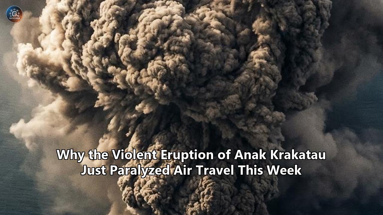
The Sunda Strait turned into an operational chasm for global aviation this week as a violent, 25-hour continuous paroxysm from Mount Anak Krakatau sent pulverized rock, vitrifying silica, and sulfur dioxide roaring up to Flight Level 500—an altitude of 50,000 feet.
The explosive episode, which began late Friday night and sustained continuous high-energy venting into the weekend, severed the primary aerial arteries connecting Java and Sumatra. Indonesia’s Ministry of Transportation enacted emergency operational groundings across seven regional aviation gateways, shutting down Jakarta’s Soekarno-Hatta International Airport, Halim Perdanakusuma Airport, Lampung’s Radin Inten II and Muhammad Taufiq Kiemas airports, West Java’s Husein Sastranegara Airport, and Banten’s Pondok Cabe and Budiarto facilities.
By Monday evening, the disruption tally reported by Indonesian Transportation Minister Dudy Purwagandhi had climbed to 2,961 canceled, delayed, or rerouted flights—consisting of 2,339 domestic segments and 622 international services—leaving roughly 341,000 passengers stranded and backlogging air cargo across Southeast Asia.
                     ANAK KRAKATAU ERUPTION: SYSTEM IMPACT

  [ Volcanic Vent: Sunda Strait ]
                 │
                 ├── Ash Plume: FL500 (50,000 ft) into Jet Stream
                 │
  ┌──────────────┴──────────────────────────┐
  │                                         │
  ▼                                         ▼
[ Operational Paralysis ]            [ Airspace Confrontation ]
  • 2,961 Flights Disrupted           • Conservative Ground Stops (DGCA)
  • 341,000 Stranded Flyers           • Tactical Rerouting (Int'l AOCCs)
  • 7 Airports Shut (CGK, HLP, etc.)  • Tarmac "Paper Tests" vs. Satellites
  • $84M Daily Trade Interrupted      • Binary Polygon vs. Density Limits
The Geological Agency at Indonesia’s Ministry of Energy and Mineral Resources (ESDM) tracked the climax of the eruption from 11:07 p.m. local time on September 4 until 12:04 a.m. on September 6. Lana Saria, head of the Geological Agency, confirmed that while the sustained paroxysmal phase transitioned back into intermittent Strombolian activity, the volcano remained at Alert Level III (Siaga), with magma continuously charging the shallow sub-caldera reservoir.
"We are taking a conservative approach because wind conditions are very dynamic," Purwagandhi stated in Jakarta, justifying an extended multi-airport ground stop even as grounded crews stared up at seemingly clear horizons. "We want to ensure that volcanic ash moves away from airports surrounding Mount Anak Krakatau".
Behind the logistical standstill lies an acute operational friction. As high-altitude winds sheared the umbrella cloud eastward over the Banten coast and across the Jakarta Terminal Maneuvering Area (TMA), aviation authorities, meteorological agencies, and international carriers found themselves locked in a technical confrontation.
The crisis forced a clash between two fundamentally irreconcilable operating philosophies: the hyper-conservative blanket shutdown mandated by civil aviation regulators prioritizing systemic zero-risk, versus the sensor-driven, performance-based rerouting protocols deployed by modern airline flight dispatch operations.
The Physics of the Plume: Why Hydrovolcanic Ash Weaponizes Modern Turbofans
To understand why the latest Anak Krakatau eruption triggered a shutdown of this magnitude, one must look at the specific petrological and hydrovolcanic dynamics at play in the Sunda Strait caldera.
Following the cataclysmic flank collapse of December 2018, which lopped off two-thirds of the volcanic cone and triggered a lethal tsunami, Anak Krakatau’s vent sat submerged or directly adjacent to sea level. The eruption witnessed this week was phreatomagmatic: ascending magma collided violently with intruding seawater, creating an explosive steam-expansion mechanism that fragmented the magma with extreme efficiency.
HYDROVOLCANIC ASH ENGINE INGESTION DYNAMICS

Magma + Seawater Contact ──► Hyper-Fine Fragmentation (<63µm Shards)
                                         │
                                         ▼
                             Plume Injection: FL500
                                         │
                                         ▼
Turbofan Intake ──► Hot Section Combustor (1,400°C - 2,000°C)
                         │
                         ├─► Ash Melting Point (~1,100°C - 1,200°C)
                         │
                         ▼
        Vitrification: Molten Silicate Slag Formed
                         │
                         ├─► Cooled on Turbine Vanes & Nozzles (Solid Glass)
                         ├─► Choked High-Pressure Turbine Flow
                         ├─► Flameout & Compressor Stall
                         └─► Pitot-Static Clogging / Airspeed Loss
This interaction produces fine-grained, angular ash particles measuring under 63 micrometers in diameter. Unlike the coarser, vesicular scoria associated with purely dry subaerial eruptions, hydrovolcanic ash is rich in hard, dense, sharp-edged glass shards with high silica contents—predominantly basaltic andesite to dacite.
When high-bypass commercial turbofans—such as the CFM LEAP-1A, Pratt & Whitney PW1100G, or Rolls-Royce Trent 1000—encounter this particulate cloud, several catastrophic mechanical failure modes initiate simultaneously:
- Combustor Melting and Vitrification: The core combustor operating temperatures of modern jet engines typically exceed 1,400°C, frequently reaching 1,700°C to 2,000°C in high-pressure turbine sections. Volcanic ash composed of aluminosilicates has a melting point between 1,100°C and 1,200°C. Ingested ash melts instantly within the combustion chamber, transforming into liquid silicate slag.
- Turbine Nozzle Solidification: As this molten glass accelerates through the high-pressure turbine nozzle guide vanes, it enters cooler expansion areas where it flashes into a solid, vitrified ceramic glaze. This glaze coats the nozzle vanes, clogs cooling channels, chokes the engine’s core airflow, and triggers unrecoverable compressor stalls and flameouts.
- Pneumatic and Pitot-Static Sensor Blockage: At lower ambient densities, high-velocity angular ash micro-particles rapidly pack into pitot tubes, static ports, and total air temperature (TAT) probes. The physical blockage distorts pneumatic pressure readings, sending invalid airspeed and altitude telemetry to Air Data Computers (ADCs), instantly disabling autopilot channels and flight augmentation protections.
- Optical and Thermal Abrasion: Windshields undergo instant scouring and crazing, rendering forward cockpit visibility near zero for landing operations. Leading edges of wings, nacelles, and horizontal stabilizers experience severe mechanical erosion, disrupting boundary layer laminar airflow.
The regional memory of this vulnerability runs deep. In June 1982, British Airways Flight 9, a Boeing 747-200 flying over West Java, entered the high-altitude ash cloud from Mount Galunggung. All four Rolls-Royce RB211 engines choked on molten glass and flamed out, forcing the crew to glide silently toward the sea before restarting the engines as descending temperatures allowed the brittle glass deposits to fracture off the turbines.
Four decades later, modern jet engines operate with tighter tolerances, higher internal operating temperatures, and thinner protective ceramic thermal barrier coatings (TBCs) on single-crystal nickel alloy turbine blades. The physical tolerance of a contemporary commercial aircraft engine to airborne silicate dust is actually lower, not higher, than that of the jets flying in 1982.
Ground-Stop Conservatism vs. Tactical Flight Dispatch: The Operational Divide
The primary institutional dispute that paralyzed regional skies this week emerged from the contrasting protocols used by Indonesia's Directorate General of Civil Aviation (DGCA) and the operational flight dispatchers of international carriers.
COMPARING THE COMPETING CRISIS RESPONSES

CRITERION                DGCA PRECAUTIONARY DOCTRINE             AIRCRAFT DISPATCH SMS
Primary Mandate          Systemic zero-liability, loss prevention Commercial continuity, risk tolerance
Trigger Point            Visible ash forecast anywhere in TMA    Probabilistic concentration thresholds
Geographic Boundary      Macro-polygon: full FIR / Airport gate  Micro-corridor: waypoint-level offsets
Detection Reliance       Downscaled regional dispersion models    Airborne sensors, real-time pilot reports
Cost Burden              Mass cancellations, downstream cascades  Fuel penalties, circuitous en-route time
Regulatory Status        Binding sovereign airspace closure      Operational leeway within open flight levels
When the eruption breached FL500, the Australian Bureau of Meteorology’s Volcanic Ash Advisory Centre (Darwin VAAC) began issuing advisories mapping the projected trajectory of the particulate cloud.
The Indonesian DGCA operates under an institutional precautionary doctrine. Its standard operating procedure treats any active volcanic ash polygon intersecting an airport’s Standard Instrument Departures (SIDs), Standard Terminal Arrival Routes (STARs), or airport boundary zones as a trigger for a total operational suspension.
Under this model, the government halted operations across the seven airports. The benefit of this approach is indisputable: it guarantees that zero commercial passenger flights encounter airborne abrasive dust during critical low-altitude departure and approach phases, where engine failure is least survivable.
Yet, this blunt regulatory instrument carries immense collateral consequences. Soekarno-Hatta International Airport is not an isolated terminal; it is the dominant spoke-and-hub nucleus of an archipelago stretching over 3,000 miles.
Grounding Jakarta severed flights between Sumatra, Kalimantan, Sulawesi, and Papua. Domestic travelers were not simply delayed; entire families and business operations were immobilized because Indonesian civil aviation authorities shut down the runway gates entirely.
                     REGIONAL AIRPORT CLOSURE NEXUS

                        [ Anak Krakatau ]
                               │
               ┌───────────────┼───────────────┐
               ▼                               ▼
       [ Sumatra Sector ]              [ Java Sector ]
    • Radin Inten II (TKG)         • Soekarno-Hatta (CGK)
    • Taufiq Kiemas (TFY)          • Halim Perdanakusuma (HLP)
                                   • Husein Sastranegara (BDO)
                                   • Pondok Cabe (PCB)
                                   • Budiarto (BTO)
Conversely, major long-haul carriers operating in the region—including Qantas, Singapore Airlines, Cathay Pacific, and Emirates—utilize Safety Management Systems (SMS) developed in the wake of the 2010 Eyjafjallajökull eruption in Iceland. These systems do not rely on binary open/shut decisions.
Instead, airline Airline Operations Control Centers (AOCCs) calculate real-time four-dimensional trajectories (4DT), utilizing dynamic weather forecast grids to reroute aircraft around the fringes of ash clouds.
International flight planners argued that the upper-level ash was moving east-southeast in a relatively narrow horizontal band driven by wind shear between FL350 and FL480, while the lower atmosphere over Jakarta exhibited moderate northwesterly drift.
Under an SMS framework, flights from the north and west could have accessed Jakarta’s runways via revised, lower-altitude arrivals that descended beneath the high-altitude cloud well out over the Java Sea, entirely avoiding the Sunda Strait axis.
However, because the Indonesian DGCA ordered a complete aerodrome shutdown rather than sectorized terminal airspace restrictions, this tactical flexibility was legally unavailable. Foreign carriers were forced to cancel long-haul routes entirely or turn aircraft around mid-flight over the Indian Ocean.
Runway "Paper Tests" vs. Orbital Remote Sensing: The Detection Paradox
The crisis highlighted an extraordinary technological contrast: while advanced orbital satellites tracked the microscopic plume from space, officials on the ground were making operational decisions using masking tape and paper.
As the eruption cloud drifted toward the coastline, maintenance personnel and ground safety inspectors at Soekarno-Hatta, Halim, and Radin Inten II airports conducted what the Indonesian aviation sector refers to as "paper tests". Ground workers laid out specialized white adhesive plates, sheets of adhesive paper, or dark collection boards along runway thresholds, taxiway intersections, and terminal aprons for set collection periods.
If inspection of the collection surfaces under magnifying loupes reveals zero deposited particulate matter, the airport infrastructure is deemed empirically clear of surface fallout.
THE ASH DETECTION SPECTRUM: TRADE-OFF ANALYSIS

METHODOLOGY               PRIMARY ADVANTAGES                   CRITICAL LIMITATIONS
Runway Paper / Plate Test Direct empirical ground truth;       Fails to detect ash held aloft;
                          zero false positives on tarmac       no forward-looking predictive power
Geostationary Thermal IR  Continuous 10-minute refresh;        Moisture and cirrus masking;
(Himawari-9 AHI)          broad synoptic tracking              underestimates low-density edges
Spaceborne Lidar          Pinpoint vertical layer resolution;  Narrow nadir curtain; orbital gaps
(CALIOP / EarthCARE)      precise micro-layer altimetry        of hours/days over target zone
Eulerian Dispersion Model Broad forward hazard projection;     Subject to wind-field errors;
(VAAC / HYSPLIT)          proactive airspace isolation         generates conservative macro-polygons
During this event, repeated paper tests at Soekarno-Hatta Airport returned negative results. There was no measurable grit settling on the tarmac, no volcanic ash film covering the fuselages of parked aircraft, and ground-level air quality indexes remained within acceptable particulate margins.
Airport operators cited these negative paper tests to push for immediate reopening. Yet, the Darwin VAAC refused to remove its critical hazard designations, maintaining red-coded Volcanic Ash Advisories (VAA) and graphic polygons that encompassed the skies directly above the terminals.
This divergence reveals the core limitation of surface-level empirical assays. A negative paper test proves only that ash has not precipitated to the earth's surface; it provides zero intelligence on what is suspended at 3,000, 15,000, or 40,000 feet. Volcanic ash does not sink immediately. Fine silica particles can linger in dry, stratospheric, or upper-tropospheric layers for days, kept aloft by atmospheric turbulence and thermal lift.
An airliner climbing out from an airport whose runways are immaculate can strike a concentrated horizontal ash layer at 8,000 feet during high-power climb, precisely when the engines are demanding maximum thermal margins.
                   THE SENSOR DISCONNECT SCENARIO

  FL500 ─── [ High-Altitude Silicate Cloud: Darwin VAAC Tracked ]
            ▲                                                  │
            │ (Invisible to Runway Teams)                      │
  FL250 ─── ┼──────────────────────────────────────────────────┼─ High Engine
            │                                                  │  Vitrification
            │                                                  │  Hazard
  FL100 ─── ┼──────────────────────────────────────────────────┼─
            │                                                  ▼
   SURFACE  [ Clean Runway: "Paper Tests" Negative ] ◄── DGCA Impasse
To map the actual hazard aloft, meteorologists at Darwin VAAC rely on orbital instrumentation, primarily the Advanced Himawari Imager (AHI) aboard Japan’s Himawari-9 geostationary meteorological satellite.
The primary tool for tracking volcanic clouds is the thermal infrared "split-window" technique. By subtracting the brightness temperature measured at 12 micrometers from that measured at 11 micrometers (the 11µm–12µm Brightness Temperature Difference, or BTD), analysts can distinguish volcanic ash from meteorological water and ice clouds:
$$\Delta T_{\text{BTD}} = T_{11\mu\text{m}} - T_{12\mu\text{m}}$$
Water and ice droplets have positive split-window signatures ($\Delta T_{\text{BTD}} > 0$), while silicate particles, due to their unique refractive indices, produce negative values ($\Delta T_{\text{BTD}} < 0$).
Yet, this spaceborne technique possesses blind spots that became acutely apparent during the Anak Krakatau eruption:
- Tropical Moisture and Cirrus Masking: Over the Sunda Strait, intense convective thunderheads surrounded the volcanic column. When high-altitude meteorological cirrus or thunderstorm anvils drift above or mix with an ash plume, the water ice coats the ash shards or shields them from view. The satellite sensor reads the thermal signature of the overlying ice, driving the $\Delta T_{\text{BTD}}$ value into positive territory and effectively blinding the split-window algorithm to the presence of dense volcanic ash beneath.
- Sulfur Dioxide Decoupling: While satellite spectrometers can track the sulfur dioxide ($SO_2$) gas released during eruptions, $SO_2$ gas and silicate ash particles separate downwind due to different molecular weights and wind shear at varied altitudes. Relying on $SO_2$ imagery as an ash proxy risks designating empty airspace as hazardous, or worse, clearing an airspace zone that is devoid of gas but packed with engine-shredding glass.
- Lidar Curtain Limitations: Active lidar sensors, such as those historically deployed on NASA’s CALIPSO satellite and experimental airborne platforms, shoot laser pulses through the atmosphere to provide razor-sharp vertical profiles of ash layer concentrations. However, these spaceborne lidars have pencil-thin tracks that provide data only along a single line directly beneath the satellite. They cannot provide the synoptic, wide-angle views required to clear broad departure corridors over West Java.
The standoff between negative ground-level paper tests and satellite-derived dispersion forecasts left airlines paralyzed. Airport executives pushed to fly based on tarmac empirical evidence; civil aviation authorities refused to authorize takeoffs into an airspace column that satellites suggested was dangerous.
Regulatory Frameworks: Zero Tolerance vs. Modern Contaminant Thresholds
The disruption over Indonesia also highlighted the philosophical gap between the regulatory standards used in the Asia-Pacific region and those developed in Europe.
Following the 2010 Eyjafjallajökull crisis, which cost airlines billions of dollars over six days of total European airspace shutdown, the European Union Aviation Safety Agency (EASA), the UK Civil Aviation Authority, and major engine manufacturers conducted extensive hot-section ingestion testing. They abandoned the historic International Civil Aviation Organization (ICAO) "zero ash" standard, recognizing that modern jet engines can safely tolerate minute, measurable densities of volcanic material without catastrophic core damage.
                   GLOBAL VOLCANIC AIRSPACE FRAMEWORKS

  [ EUROPE / EASA POST-2010 MODEL ]          [ INDONESIA / ASIA-PACIFIC MODEL ]
  Three-Tiered Concentration Contours         Binary Exclusion Zone

  Low Contamination Zone:                     Red Alert Polygon:
  < 2.0 mg/m³                                 "Discernible Ash" Forecast
  Action: Unrestricted Flight Permitted       Action: Total Airspace / FIR Closure

  Medium Contamination Zone:                  Tarmac Reality:
  2.0 mg/m³ to 4.0 mg/m³                      Negative Runway Tests Ignored
  Action: Operations Require Approved SMS
                                              Liability Reality:
  High Contamination Zone:                    OEM Warranties Voided if Flown
  > 4.0 mg/m³                                 Into Any VAAC Advisory Area
  Action: Airspace Closed to Civil Aircraft
Under the European framework, airspace is partitioned into three distinct operational contamination zones:
- Low Contamination Area ($<2.0 \times 10^{-3} \text{ g/m}^3$): Flight is permitted under normal operating procedures without special manufacturer clearances.
- Medium Contamination Area ($2.0 \times 10^{-3} \text{ g/m}^3 \text{ to } 4.0 \times 10^{-3} \text{ g/m}^3$): Flights are authorized subject to an approved operator Safety Risk Assessment, with mandatory post-flight engine inspections and borescopic checks.
- High Contamination Area ($>4.0 \times 10^{-3} \text{ g/m}^3$): Defined as an absolute exclusion zone where commercial flight is illegal.
In contrast, the regulatory architecture governing the airspace affected by the Anak Krakatau eruption does not recognize concentration-based flight corridors.
The Darwin VAAC, operating under ICAO Annex 3 standards, does not routinely forecast quantitative milligram-per-cubic-meter density boundaries for active operations. Instead, it issues advisories based on the concept of "discernible ash"—a binary classification.
If numerical dispersion models, satellite radiance observations, or pilot reports indicate the presence of ash aloft, the area is drawn as a closed polygon, and the airspace is effectively designated as a no-go area.
This divergence puts airlines and civil regulators in an impossible legal bind regarding engine warranties and hull insurance. Major engine original equipment manufacturers (OEMs)—GE Aerospace, Safran, Rolls-Royce, and Pratt & Whitney—maintain engine warranty language stipulating that operations in airspace designated by a VAAC as containing volcanic ash without specific state and manufacturer exemptions will void power-by-the-hour maintenance agreements and shift the liability for engine damage onto the airline operator.
Even if an airline’s Chief Pilot is confident that the ash over Banten has diluted to negligible levels below $1.5 \text{ mg/m}^3$, entering a Darwin VAAC-designated polygon without an active sovereign regulatory framework like EASA's exposes the airline to massive financial risks.
If an engine suffers an uncontained blade failure, turbine bearing overheating, or minor erosion six months later, the insurer or OEM can point to telemetry proving the aircraft traversed an active VAAC warning zone, invalidating the claim.
Consequently, Indonesian authorities opted for widespread closures, preserving legal compliance and passenger safety at the expense of regional connectivity.
Supply Chain Interruption: Belly-Cargo Fragility and the Java-Sumatra Bottleneck
The grounding of roughly 3,000 flights hit more than just passengers. The shutdown of Soekarno-Hatta International Airport sent a seismic shockwave through Indonesia's trade logistics.
In advanced logistics systems, high-value, time-sensitive cargo relies on the passenger network. Globally, over 50% of all air freight travels not on dedicated cargo freighters, but inside the underfloor holds of passenger aircraft—known as "belly cargo."
In Indonesia, that figure climbs above 70% for domestic inter-island trade. When the Ministry of Transportation grounded passenger fleets across the seven regional hubs, it crippled the country's logistical circulatory system.
                LOGISTICAL INTERACTION: SUNDA STRAIT AIR-TO-SURFACE

                          [ Airspace Interdiction ]
                      7 Airports Shut / Belly Cargo Halted
                                      │
                                      ▼
                        [ Diverted Freight Pressure ]
                   Shifted to Merak-Bakauheni Ferry Corridor
                                      │
         ┌────────────────────────────┴────────────────────────────┐
         ▼                                                         ▼
[ Severe Ferry Bottlenecks ]                              [ Economic Impact ]
 • Overloaded Ferry Terminal Aprons                        • $84M Daily Gross Trade Disrupted
 • Dangerous Marine Ash Fall                               • $28M Delay per 8 Hours
 • 12-to-24-Hour Cross-Strait Delays                       • Perishable Agricultural Spoilage
 • Accelerated Highway Gridlock (Java-Sumatra)             • High-Tech / Pharma Shortages
Supply Chain Indonesia (SCI) pointed out the scale of this vulnerability. Setijadi, the organization's chief executive officer, noted that non-oil and gas export trade flowing through Soekarno-Hatta Airport alone reached $20.77 billion in 2025.
The airport processes an average daily trade flow valued at $84.03 million and handles 479 tons of international imports daily. SCI's modeling demonstrated that an eight-hour complete operational halt at Soekarno-Hatta holds back roughly $28 million in international commerce, encompassing $9.04 million in exports and $18.97 million in critical imports, before factoring in domestic inter-island cargo.
The trade-offs involved in pivoting to alternative transportation channels underscore why this event was so damaging:
1. Air Freight Diversion vs. Airport Saturation
Airlines attempted to divert long-haul freighters to alternative international gateways, notably Juanda International Airport (SUB) in Surabaya, East Java, and Kualanamu International Airport (KNO) in Medan, North Sumatra.
However, neither facility possesses the customs processing clearance capacity, cold-chain storage footprint, or ground-handling equipment to digest an overnight diversion of Jakarta’s volume.
Aircraft sat on aprons in Surabaya for hours awaiting fuel tenders and ramp space, creating secondary ground congestions that rippled across Java.
2. The Surface Alternative: The Merak-Bakauheni Ferry Chokepoint
With passenger flights and belly cargo grounded between Java and Sumatra, logistics operators scrambled to shift express cargo to overland freight trucking. This required crossing the Sunda Strait via roll-on/roll-off (RoRo) ferry services running between the Port of Merak in Banten and the Port of Bakauheni in Lampung.
Yet, this land-sea alternative presented its own acute operational challenges:
- Geographic Vulnerability: The Merak-Bakauheni ferry lanes navigate the waters of the Sunda Strait, passing within 30 to 40 nautical miles of the erupting volcano. While the air was dangerous for aircraft engines, the sea surface experienced fallout of coarse ash, reducing navigational visibility for marine vessels and clogging diesel intake filters on older transport ferries.
- Terminal Saturation: The sudden influx of thousands of commercial trucks, perishable food haulers, and stranded bus passengers overwhelmed the terminal aprons at Merak. Wait times to board ferries spiked from a typical two hours to over 14 to 20 hours.
- Decoupled Supply Chains: High-value pharmaceutical consignments, temperature-controlled vaccines, and live seafood exports from Sumatra to East Asia simply cannot survive a 30-hour intermodal surface transit delay through a maritime bottleneck.
The economic fallout highlighted an often-ignored aviation reality: the modern economy has eliminated inventory buffers. When a violent eruption closes an urban hub's airspace, the damage spills far beyond passenger ticket refunds into industrial manufacturing lines, hospital supplies, and high-tech supply chains that cannot easily switch to surface transit.
The Indonesian Volcanic Landscape: Anak Krakatau vs. Historical Eruptions
Indonesia sits atop the convergence of the Indo-Australian, Eurasian, and Pacific tectonic plates, hosting over 120 active volcanoes. Yet, the chaos triggered by the Anak Krakatau eruption this week stands apart from other recent volcanic episodes, such as the eruptions of Mount Lewotobi Laki-Laki in East Nusa Tenggara (2024–2026), Mount Ruang in North Sulawesi (2024), and Mount Merapi in Central Java.
                    CROSS-EVENT ERUPTION COMPARISON

ERUPTION EVENT        GEOLOGIC TYPE    PLUME FLIGHT LEVEL   AIRSPACE ENVIRONMENT    DISRUPTIVE PROFILE
Anak Krakatau (2026)  Phreatomagmatic  FL500 (50,000 ft)    Terminal Maneuvering    Catastrophic: Severed
                      Island-Caldera                        Area for Major Hubs     Megacity Trunk Routes
                                                            (CGK, HLP)              (2,961 Flights Grounded)

Lewotobi Laki-Laki    Subaerial        FL300 to FL600       Oceanic / Secondary     Localized: Bali Tourist
(2024-2026)           Stratovolcano    (18,000 m bursts)    Routes (DPS, Labuan     Corridors and Trans-
                                                            Bajo)                   Tasman Reroutes

Mount Ruang (2024)    Island Composite FL550 to FL650       Trans-Borneo / North    Regional: Interrupted
                      Stratovolcano    (19,000 m violent)   Sulawesi Routes         Manado (MDC) & East
                                                            (MDC, KK, East Malay)   Malaysian Corridors

Mount Merapi (2010)   Continental      FL400 to FL550       Continental Trunk       Inland Interdiction:
                      Pyroclastic                           Aviation Spine          Yogyakarta (JOG) & Solo
                      Composite                             (Overland Java Axis)    (SOC) Shuttered
A comparison of these eruptive events illuminates what made this week's crisis unique:
1. Vent Geography: Island-Caldera Hydrovolcanism
Mount Merapi in 2010 produced devastating, deadly pyroclastic flows and injected ash clouds up to FL550. However, Merapi is an inland, continental stratovolcano. Its ash, while voluminous, is generated by the explosive decompression of viscous andesitic gas-rich domes.
Anak Krakatau’s vent sits within a marine caldera basin. The constant interaction between the magmatic column and the surrounding sea creates fine, highly fragmented hydrovolcanic glass shards that loft more easily, remain suspended longer, and pose an elevated vitrification threat to jet combustors per unit volume.
2. Proximity to Airspace Infrastructure
When Mount Ruang exploded in North Sulawesi in April 2024, it generated plumes exceeding FL600, triggering airport closures in Manado and disrupting flight paths into eastern Malaysia. Similarly, Lewotobi Laki-Laki’s recurrent paroxysms on the remote island of Flores forced repeated cancellations of holiday flights to and from Bali’s Ngurah Rai International Airport.
Yet, in both cases, the primary impact was on long-haul transit routings and regional tourism outposts. Air traffic controllers could route around the active exclusion zone by swinging aircraft wide through the Ujung Pandang (Makassar) Flight Information Region (FIR).
Anak Krakatau sits directly at the throat of Jakarta’s air traffic corridor. The volcano is located roughly 130 kilometers west-northwest of Soekarno-Hatta International Airport—a mere 8 to 12 minutes of flight time for an outbound jet climbing through 10,000 to 20,000 feet.
The Sunda Strait is the primary approach and departure gate for the entire international and domestic air route system entering Jakarta from the Indian Ocean, western Sumatra, and the vital northwest routes to Singapore, Kuala Lumpur, and Bangkok.
                      THE JAKARTA AIRSPACE JUGULAR

  [ To Singapore / Bangkok / Europe ]
                 ▲
                 │
                 ├── Trans-Sunda Jetway W11
                 │
        [ ANAK KRAKATAU ] ◄── 130 km ──► [ SOEKARNO-HATTA (CGK) ]
                 │                                │
                 │ Plume Drift East-Southeast     ▼
                 └───────────────────────► [ JAKARTA TMA ]
                                                  │
                                            70% of Domestic
                                            Flights Choked
When an ash cloud reaches FL500 in this corridor, there is simply no open airspace left for air traffic control to route traffic safely.
You cannot vector an Airbus A330 or Boeing 777 around an ash cloud when that cloud sits directly on top of the instrument arrival transitions to one of the world's most congested dual-runway airports.
Anak Krakatau combines high-altitude explosive energy with proximity to an aviation hub, turning an ordinary volcanic event into a systemic crisis.
The Technological Frontier: Mitigating the Next Ash Cloud
As clean-up crews swept runways and Indonesian authorities moved to reopen airports following the transition to lower-energy Strombolian explosions, the crisis focused attention on the tools required to prevent another systemic grounding.
Aviation’s current defensive posture against volcanic hazards remains largely reactive: an eruption occurs, an advisory center draws a conservative bounding polygon based on satellite imagery, and governments close hundreds of miles of airspace.
Navigating the next eruption will require an evolution in onboard aircraft sensor suites, satellite remote sensing, and real-time engine telemetry.
                  THE NEXT-GENERATION DETECTION MOSAIC

  [ SATELLITE TIER ]
  • Multispectral Hyperspectral Infrared (IASI-NG, MTG-IRS)
  • Direct quantitative retrieval of mass loading (mg/m³)
  • Separation of water-ice shielding from silicate cores
                  │
                  ▼
  [ ONBOARD SENSOR TIER ]
  • Airborne Volcanic Object Imaging and Detector (AVOID)
  • Forward-looking dual-band IR cameras (100+ km warning)
  • Real-time automated cockpit avoidance vectors
                  │
                  ▼
  [ TURBINE TELEMETRY TIER ]
  • Optical particulate mass-spectrometers in turbofan intakes
  • Real-time core blade coating temperature modulators
  • Variable combustion derating to stay below vitrification point
Three emerging technological approaches offer alternatives to broad airspace shutdowns:
1. Airborne Volcanic Ash Detection Systems (AVOID)
Rather than relying solely on satellite passes that refresh every 10 to 60 minutes, commercial airliners can be equipped with forward-looking airborne detection systems.
The AVOID system, developed by flight-technology engineers and tested on testbed Airbus aircraft, utilizes dual-band fast-sampling infrared cameras mounted on the aircraft’s vertical tail or forward fuselage.
These cameras continuously scan the airspace 50 to 100 kilometers ahead between the 10µm and 12µm spectral channels:
- The system detects minute differences in thermal radiance, identifying invisible ash layers at cruising altitudes.
- The algorithms calculate particulate concentration in real time, alerting the flight crew up to ten minutes before an encounter.
- This warning provides pilots with sufficient tactical time to descend, climb, or adjust their heading by 15 nautical miles, avoiding the hazard without relying on broad ATC ground stops.
2. Next-Generation Hyperspectral Satellite Sounders
The ongoing deployment of geostationary hyperspectral infrared sounders, such as the Meteosat Third Generation Infrared Sounder (MTG-IRS) and next-generation Asian geostationary platforms, will soon overcome the limitations of the split-window technique.
These instruments divide the infrared spectrum into thousands of narrow thermal channels. This hyperspectral capability enables algorithms to isolate the spectral absorption fingerprint of fine silicate dust even when it is buried beneath dense tropical cirrus cloud decks or mixed with convective thunderstorm steam.
This enables meteorologists to deliver high-resolution vertical cross-sections of an ash cloud, replacing wide blanket polygons with precise, altitude-tiered safe transit channels.
3. Real-Time Engine Ingestion and Turbine Temperature Modulation
Engine manufacturers are researching intake sensors that sample the air entering the bypass duct and core combustor for mineral particulates.
If an aircraft unknowingly encounters a low-concentration ash field, the engine’s Full Authority Digital Engine Control (FADEC) can automatically execute mitigating adjustments:
- The system can slightly throttle back combustor temperatures to drop the flame temperature below the 1,100°C silicate vitrification threshold.
- This prevents inhaled dust from melting and sticking to the high-pressure turbine nozzles, converting dangerous liquid slag into dry particulate ash that blows harmlessly out the exhaust nozzle.
- The trade-off is a minor loss of engine thrust and fuel efficiency, but the safety payoff is profound: the aircraft can safely fly through low-density ash clouds without risking sudden engine flameout.
The Looming Horizon: Magmatic Reservoirs and Unresolved Airspace Protocols
The groundings of this week may prove to be a prelude rather than an isolated shock. Lana Saria and volcanologists at Indonesia’s Center for Volcanology and Geological Hazard Mitigation (PVMBG) have noted that Anak Krakatau’s seismic data reveals persistent, deep-seated volcanic tremors.
Magma continues to ascend into the shallow chamber beneath the Sunda Strait. Volcanologist Erik Klemetti pointed out that following the major 25-hour paroxysm, while smaller Strombolian explosions are currently dominant, recurrent high-energy explosive pulses remain a continuous threat as long as the vent stays in contact with seawater and magma lines remain open.
The geopolitical and regulatory framework governing regional aviation, however, has not shifted. The ASEAN Single Aviation Market (ASAM) initiative has spent years lowering economic and bilateral barriers to cross-border routes, yet Southeast Asia possesses no unified, central air traffic flow management authority capable of orchestrating regional responses during environmental crises.
Instead, airspace management remains fractured along national boundaries:
- Indonesian aviation authorities will continue to shut down broad sectors of their national airspace to protect passenger safety and avoid liability whenever an ash plume approaches critical domestic corridors.
- International airlines will continue to face the choice between costly diversions or outright route cancellations dictated by distant insurance underwriters and engine warranty clauses.
- Ground personnel will continue to monitor collection plates on the runway asphalt, while orbital satellites track ash plumes drifting ten miles overhead.
The violent Anak Krakatau eruption has delivered an expensive warning to global aviation. As long as one of the world's most hyperactive volcanic systems continues to grow in a narrow maritime strait beneath one of the planet's busiest flight corridors, air travel through this crossroads will remain fragile.
Until aviation authorities and engine manufacturers deploy modern sensors and transition from blanket ground stops to precise, concentration-based corridor navigation, the volcanic vents of the Sunda Strait will retain the power to paralyze the skies of Southeast Asia at a moment's notice.
Reference:
- https://www.surfer.com/news/anak-krakatau-eruption-mega-tsunami-risk-video
- https://www.insurancebusinessmag.com/au/news/catastrophe/the-krakatau-known-event-question-brokers-need-to-answer-now-588984.aspx
- https://jakartaglobe.id/news/anak-krakataus-25hour-eruption-ends-volcano-remains-on-alert
- https://en.tempo.co/read/2119130/anak-krakatau-ash-hits-2961-flights-leaves-341000-passengers-stranded
- https://en.tempo.co/read/2119127/sci-krakatau-ash-halts-flights-endangers-trade-flow
- https://science.nasa.gov/earth/earth-observatory/anak-krakatau-rumbles-again/
- https://www.facebook.com/thetravelernetwork/posts/volcanic-ash-from-indonesias-anak-krakatau-has-forced-six-airports-to-suspend-op/1808450884205408/
- https://www.facebook.com/aeronauticstime2/posts/the-mount-anak-krakatau-eruption-and-subsequent-ash-cloud-has-grounded-flights-a/1068430459277537/
- https://earthsky.org/todays-image/anak-krakatau-erupts-indonesia-september-2026/