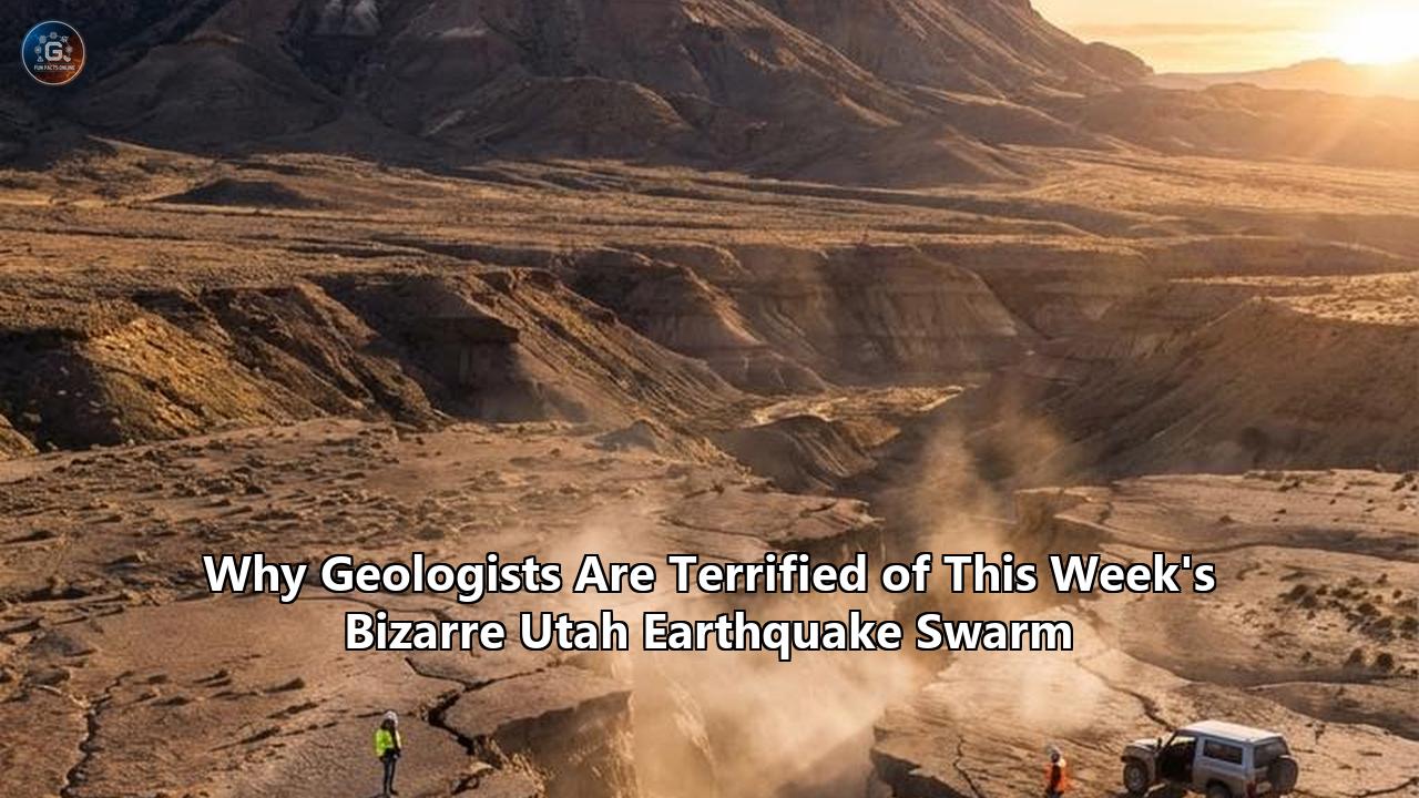
At 5:45 a.m. on Sunday, April 19, 2026, the seismic sensors buried deep in the arid soil of southern Millard County, Utah, detected a subtle vibration. It was too small to wake the residents of nearby Kanosh, a tiny agricultural town sitting on the eastern edge of the Great Basin. But over the next 48 hours, that single microscopic tremor fractured into a cascade of geological violence. By Monday evening, the University of Utah Seismograph Stations (UUSS) had logged at least 32 distinct earthquakes in a tight cluster, peaking with a magnitude 3.6 rupture just after breakfast.
To the general public, a magnitude 3.6 event is barely a curiosity—a brief rattle of the china cabinet, easily dismissed as a heavy truck passing by. Yet, within the sterile, monitor-lined rooms of the UUSS and the Utah Geological Survey (UGS), this specific seismic sequence triggered immediate, heightened scrutiny.
The reason for their concern lies in the precise nature of the event. This was not a traditional earthquake, which typically features a singular, violent mainshock followed by a decaying trail of aftershocks. Instead, seismologists classified the Kanosh sequence as a Utah earthquake swarm. If a standard fault rupture is the sudden, catastrophic snap of a dry tree branch, a swarm behaves more like a bag of microwave popcorn—dozens of individual, moderate pops occurring rapidly as localized energy is released in increments across a specific subsurface area.
But it is not the mechanics of the swarm that has geologists quietly on edge this week. It is the location, the trigger, and the terrifying implications it holds for the heavily populated Wasatch Front just to the north.
The Kanosh swarm erupted exactly eight miles south of town, directly adjacent to the Black Rock Desert volcanic field. It sits squarely in a zone where the Earth's crust is actively thinning, stretching, and warping. For geologists who spend their lives measuring the invisible accumulation of tectonic stress, a swarm in this specific corridor is akin to seeing smoke curl from the engine of a commercial airliner. It is a stark, undeniable indicator that the subsurface plumbing of the Intermountain West is highly active, shifting fluids and transferring stress toward the Wasatch Fault—a 240-mile geological time bomb that is statistically overdue for a catastrophic magnitude 7.0 rupture.
The Magmatic Ghost of the Black Rock Desert
To understand why this week's swarm requires such rigorous analysis, one must look closely at the bedrock beneath Millard County. Most residents driving south on Interstate 15 through central Utah see only endless expanses of sagebrush and smooth, dark hills. In reality, they are driving through the youngest and most unpredictable volcanic field in the state.
The Black Rock Desert Volcanic Field is a sprawling, 2,000-square-mile complex divided into five distinct subfields: Cove Fort, Twin Peaks, Beaver Ridge, Ice Springs, and Fumarole Butte. While volcanism here began approximately six million years ago—producing the rhyolite chambers that forged Topaz Mountain's world-famous red beryl deposits, currently valued at up to $50,000 per carat—the field is far from dead. The most recent eruption occurred at Ice Springs a mere 9,500 years ago. That event generated towering lava fountains in a violent Strombolian eruption, ultimately burying 16.6 square miles of the Utah landscape beneath a thick, sterile sheet of basalt.
Because of this geologically recent activity, the U.S. Geological Survey (USGS) officially classifies the Black Rock Desert complex as a moderate-threat active volcano.
When a similar Utah earthquake swarm occurred in the Black Rock Desert in September 2018 and again in April 2019, it completely reshaped how researchers view the region's seismic profile. Those earlier sequences, which peaked at magnitudes 4.0 and 4.1, were initially dismissed by some as routine tectonic settling. However, detailed analysis by researchers like Maria Mesimeri, a postdoctoral seismologist at the UUSS, revealed a far more complex reality. The 2018 and 2019 swarms were not purely tectonic; they were driven by the movement of subsurface fluids.
The Mechanics of Fluid-Driven Seismicity
Earthquakes require friction to build up and slip to release. In a highly active tectonic regime, faults are essentially locked in place by the immense weight of the overlying rock. But in volcanic fields like the Black Rock Desert, another element enters the equation: deep crustal fluids.
Far beneath the Kanosh swarm's epicenter, the thinning of the North American plate allows the Earth's mantle to decompress and melt. This immense heat source warms subterranean aquifers and releases massive volumes of carbon dioxide and other magmatic gases. As these superheated fluids migrate upward through the crust, they are forced into microscopic fractures and ancient, "shattered" faults.
When highly pressurized fluid injects itself into a fault zone, it dramatically alters the local physics. The fluid acts as a high-pressure lubricant, physically pushing the two sides of the fault apart and reducing the normal stress—the clamping force that holds the fault shut. With the friction artificially lowered, the fault can no longer hold back the regional tectonic strain. It slips, causing an earthquake. But because the fluid migration is slow and continuous, the fault doesn't slip all at once. It slips in hundreds of tiny increments.
This fluid-migration mechanism is exactly what triggered this week's events. Geologists looking at the seismic waveform signatures of the Kanosh sequence see the telltale, lower-frequency signals of fluid lubricating the deep crust. While this does not indicate that magma is currently racing toward the surface to trigger an imminent eruption, it confirms that the deep thermal and fluid engine of the Basin and Range province is operating at high capacity.
High-Fidelity Surveillance: How the Swarm Was Detected
Ten years ago, a swarm like the one occurring this week might have been recorded as a mere handful of vague, low-resolution bumps on a regional seismograph. Today, geologists are monitoring central Utah with an unprecedented, almost invasive level of precision, thanks largely to a massive federal geothermal energy initiative operating just 19 miles south of the Black Rock Desert.
The Frontier Observatory for Research in Geothermal Energy (FORGE), funded by the U.S. Department of Energy and operated by the University of Utah, is an experimental site near Milford designed to test Enhanced Geothermal Systems (EGS). To ensure their fluid injection tests do not trigger hazardous induced seismicity, the FORGE team installed one of the most sophisticated, high-resolution seismic networks on the planet.
The FORGE network utilizes a technology known as Distributed Acoustic Sensing (DAS). Rather than relying solely on traditional surface seismometers, which must filter out the noise of wind, traffic, and atmospheric pressure changes, engineers lowered fiber-optic cables deep into vertical boreholes—some descending more than 3,000 feet into the solid granite. By firing rapid laser pulses down the fiber-optic cable and measuring the microscopic backscatter of light, the cable itself is transformed into thousands of individual seismic sensors. If a seismic wave stretches or compresses the cable by even a fraction of a millimeter, the computer detects it.
Through this network, seismologists can detect microearthquakes down to a magnitude of -2.0. A -2.0 magnitude earthquake releases roughly the same amount of acoustic energy as a gallon of milk falling off a kitchen counter.
Because the Kanosh swarm is occurring in the shadow of the FORGE array, the data streaming into the UUSS servers in Salt Lake City is breathtakingly detailed. Researchers can map the exact three-dimensional migration pathway of the deep crustal fluids in real-time. They can watch the fluid ascend, branch out through the fault network, and trigger individual microquakes along the way.
This level of surveillance has revealed a disturbing reality: the crust beneath Utah is under far more strain than surface observations previously suggested. And that strain is being systematically transferred toward the state's ultimate geological hazard.
The Tectonic Time Bomb: The Wasatch Fault Zone
To understand the quiet terror spreading among structural geologists and emergency managers in response to the Kanosh swarm, one must zoom out and look at the broader regional architecture of the Intermountain Seismic Belt.
The Earth's crust from the Sierra Nevada in California to the Wasatch Mountains in Utah is actively pulling apart, a phenomenon known as Basin and Range extension. This east-west stretching is literally ripping the continent at the seams. As the crust stretches, it thins, fractures, and drops down along massive sheer planes known as normal faults.
The granddaddy of all these fractures is the Wasatch Fault.
Stretching 240 miles from southern Idaho down to the town of Fayette in central Utah, the Wasatch Fault is the longest active normal fault in the United States. It acts as the rigid eastern boundary of the Basin and Range province. Over millions of years, the valley floor on the western side of the fault has dropped thousands of feet, while the Wasatch Range on the eastern side has thrust upward, creating the spectacular, jagged peaks that dominate the Salt Lake City skyline.
The Wasatch Fault is not a single, continuous fracture. It is heavily segmented into ten distinct sections. The five central segments—Brigham City, Weber, Salt Lake City, Provo, and Nephi—are highly active and run directly beneath the most densely populated urban corridor in the interior West. Currently, 80 percent of Utah’s population, or roughly 1.6 million people, live within a few miles of this fault line.
Geologists use paleoseismology to track the history of the Wasatch Fault. By digging massive trenches across the fault scarps—such as the recent excavations at the North Creek site on the Nephi segment—researchers expose the subterranean soil layers. When a major earthquake occurs, the fault rips the surface, creating a vertical cliff up to 20 feet high. Over time, the loose soil on the high side of the cliff collapses, forming a distinct, wedge-shaped deposit of rubble known as a colluvial wedge. By extracting trapped organic matter from beneath these wedges and subjecting it to radiocarbon dating, scientists can pinpoint exactly when past earthquakes occurred.
The paleoseismic data is chilling.
Over the past 6,000 years, the central segments of the Wasatch Fault have ruptured at least 19 times in massive, surface-faulting earthquakes of magnitude 6.5 to 7.5. On average, a catastrophic rupture occurs somewhere along the central Wasatch Front once every 300 to 400 years.
However, looking at the individual segments reveals a loaded gun. The Salt Lake City segment last ruptured approximately 1,300 years ago. The Brigham City segment has not produced a major earthquake in 2,500 years—vastly exceeding its historical average.
When the Working Group on Utah Earthquake Probabilities (WGUEP)—a joint task force comprising the UGS, the USGS, and academia—ran their advanced probabilistic models, the results forced a total reassessment of regional emergency management. The WGUEP concluded that there is a 43 percent probability of one or more magnitude 6.75 or greater earthquakes striking the Wasatch Front region within the next 50 years, and a 57 percent probability of a magnitude 6.0 or greater event.
This is why a Utah earthquake swarm in the south causes such immense anxiety in the north. The Earth's crust is highly interconnected. When fluid movement and localized swarms relieve stress in one area of the Intermountain Seismic Belt, that strain does not simply disappear; it is transferred to neighboring fault segments. The Kanosh swarm is tangible proof that the regional tectonic engine is steadily cranking, pushing the Wasatch Fault closer to its inevitable breaking point.
The Physics of a Megaquake on a Normal Fault
If the Wasatch Fault ruptures tomorrow, the mechanics of the event will look drastically different from the famous strike-slip earthquakes of California's San Andreas fault. On a strike-slip fault, the two sides slide horizontally past one another. On a normal fault like the Wasatch, the movement is predominantly vertical.
During a major Wasatch event, the valley floor (the "hanging wall" in geological terms) will suddenly and violently drop downward relative to the mountains (the "footwall").
Recent structural geology studies have revealed alarming new details about how this drop will manifest. At Utah State University, geophysicist Srisharan Shreedharan and his team recently published groundbreaking research analyzing the specific rock textures pulled directly from the Wasatch Fault zone. Their laboratory experiments combined friction analysis with microscopic examination of the rock structure.
What they found overturned long-held assumptions. Geologists previously believed that the Wasatch Fault plunged into the earth at a very steep, high angle (between 45 and 90 degrees) near the surface. A steep dip angle typically dampens some of the most violent surface shaking during an earthquake, directing much of the seismic energy downward.
However, Shreedharan’s research, spurred by anomalous data gathered during the 2020 Magna earthquake, showed that the fault rocks themselves are heavily degraded, ground down into a weak, slick powder known as fault gouge. This extreme physical weakness allows the fault to slip at much shallower angles than previously modeled.
"This means that an earthquake rupture could lead to stronger, more intense shaking at the surface—meaning a greater chance of injury and destruction," the Utah State University researchers noted in their findings.
The March 2020 Magna earthquake served as a brutal preview of this phenomenon. Registering at a magnitude 5.7, the Magna quake struck just west of Salt Lake City at a shallow depth of roughly 9 kilometers. Because it slipped along a shallowly dipping portion of the fault network, the seismic energy was trapped near the surface, violently shaking the Salt Lake Valley and causing nearly $50 million in property damage.
And the Magna quake was tiny compared to what the Wasatch is capable of producing. A magnitude 7.0 earthquake releases approximately 90 times more energy than the 5.7 Magna event.
The Lake Bonneville Amplifier and the Liquefaction Threat
The physical characteristics of the fault are only half the problem. The other half lies in the dirt upon which Utah’s largest cities are built.
During the last Ice Age, the Salt Lake Valley and much of the Wasatch Front was submerged beneath Lake Bonneville, a massive freshwater inland sea. Over thousands of years, rivers deposited vast amounts of soft silt, clay, and sand into the lake bottom. When the lake eventually drained away, it left behind deep, unconsolidated sediment deposits.
Today, downtown Salt Lake City, the Salt Lake City International Airport, and countless residential subdivisions sit directly on top of these soft lake sediments.
When seismic waves generated by a fault rupture hit solid bedrock, they move very quickly with low amplitude. But when those same waves transition from bedrock into the soft, uncompacted sediments of the Salt Lake Valley, they slow down significantly. To conserve energy, the amplitude of the waves must increase. The ground essentially acts like a bowl of gelatin, amplifying the violent shaking by a factor of three or four compared to adjacent bedrock zones.
This amplification triggers a secondary, highly destructive geological hazard: liquefaction.
When saturated, loose soils are subjected to intense, prolonged shaking, the water pressure between the individual grains of sand and silt spikes. The soil completely loses its structural strength and begins to behave like a thick liquid.
During a major Wasatch fault earthquake, large swaths of the Salt Lake Valley will liquefy. Buildings will sink into the earth. Underground utilities—including pressurized natural gas lines, water mains, and raw sewage pipes—will fracture and float to the surface. Entire transportation corridors will be rendered impassable.
Recent trenching studies have confirmed a nightmare scenario regarding liquefaction. Geologists sampling the West Valley fault zone—a smaller fault network that runs parallel to the Wasatch Fault on the western side of the Salt Lake Valley—have discovered that the West Valley fault frequently ruptures simultaneously with the main Wasatch Fault.
The two fault systems actually converge deep beneath the valley floor into a single master fracture. If a magnitude 7.0+ earthquake originates on the Salt Lake City segment of the Wasatch Fault, it will likely trigger a synchronous rupture on the West Valley fault. The valley block between the two faults will instantaneously drop down and tilt, creating a massive zone of tectonic subsidence.
This broad, permanent tilting of the valley floor would violently disrupt the local hydrology. Gravity-flow systems like sewer lines and canals would immediately back up or reverse flow. Shorelines along the Great Salt Lake and nearby reservoirs would flood eastward, permanently submerging highly developed, low-lying communities.
The Politics of Preparedness: The Human Cost
This perfect storm of geological hazards—a highly loaded fault system, weak fault rock chemistry, soft sediment amplification, and liquefaction—has forced seismologists to take on an increasingly political role. It is no longer enough to merely study the data; researchers are desperately lobbying lawmakers to prepare for the inevitable.
The most pressing issue facing the Wasatch Front is not the earthquake itself, but the human-built environment.
"Utah is a state that just has a big building stock of these unreinforced masonry structures, and what we say, you know, in seismology and earthquake sciences, it's not earthquakes that kill people. It's the buildings that kill people," warned Dr. Keith Koper, director of the University of Utah Seismograph Stations, following the Magna earthquake.
An unreinforced masonry (URM) building is a structure built primarily of brick or cinderblock with no internal steel rebar to hold the walls together during lateral shaking. Because of Utah's unique settlement history, pioneer architecture, and rapid urbanization before the adoption of modern seismic building codes in the 1970s, the state has an astronomical number of these deadly structures. Current estimates suggest there are over 140,000 URM buildings along the Wasatch Front.
When a magnitude 7.0 earthquake strikes, the intense lateral S-waves and Love waves will tear the mortar of these buildings apart. The load-bearing brick walls will bow outward and shatter, causing the heavy roofs to collapse inward, pancake-style, onto the occupants.
In April 2006, Bob Carey of the Utah Division of Emergency Management (UDEM) released a comprehensive damage projection for a catastrophic Wasatch Fault rupture centered in Salt Lake City. The numbers remain a benchmark for worst-case scenario planning. Carey’s report estimated that a direct hit from a magnitude 7.0 or greater earthquake could kill up to 6,200 people, injure 90,000, and cause upwards of $40 billion in direct economic losses.
To put that in perspective, the economic devastation would rival some of the worst hurricanes in U.S. history, but concentrated entirely within a single landlocked valley. In addition, the report noted that approximately 50 percent of the hospital beds in Salt Lake City would be rendered unusable right when they are needed most. Many critical facilities, including hospitals, schools, and fire stations, sit precariously close to, or directly atop, the fault trace itself.
The frustration among the scientific community regarding infrastructure vulnerability has reached a boiling point. Brady Cox, a civil engineering professor at Utah State University, has pointed out a glaring institutional blind spot: despite being one of the most seismically hazardous regions in the country, Utah is the only high-risk state without a dedicated Earthquake Engineering Research Center.
"There's certain parts of our infrastructure that aren't engineered very well, in regards to seismic issues, and those happen to be in people's homes," Cox noted during a push to establish a research hub in Logan. "We just need to make sure that we start incrementally improving and not just get overwhelmed and do nothing. Because that would be the worst thing that we can do".
The lack of political urgency is directly tied to the timeline of geological events. Because the recurrence interval of major Wasatch earthquakes is measured in centuries, human beings struggle to internalize the threat. The pioneer settlers of Utah arrived in 1847, meaning the modern state of Utah has never experienced a major surface-rupturing earthquake on the central Wasatch Fault in its recorded history. The threat exists almost entirely in the abstract—in mathematical probabilities, paleoseismic trench data, and the digital readouts of deep borehole sensors.
But a Utah earthquake swarm like the one happening this week in Kanosh rips away that abstraction. It forces emergency managers to look at the blinking lights on the UUSS monitors and confront the reality that the crust beneath their feet is violently alive.
Beyond the Epicenter: Measuring the Invisible Strain
While the public fixates on the shaking they can feel, geologists are far more concerned with the movement they cannot see. The Kanosh swarm is just one symptom of a massive regional deformation. To track this, scientists rely on high-precision Global Positioning System (GPS) networks.
The University of Utah Seismology and Active Tectonics Research Group operates a sprawling network of continuous GPS stations stretching across the Wasatch Front and up into the Yellowstone-Snake River Plain volcanic field. These are not the commercial GPS units found in smartphones; they are highly specialized, deeply anchored geodetic instruments capable of measuring crustal movement down to a fraction of a millimeter.
By analyzing years of GPS data, researchers have mapped the exact speed at which the Basin and Range province is tearing itself apart. The data reveals that the Wasatch Fault is accumulating a "slip deficit" at a rate of roughly 0.8 to 1.2 millimeters per year.
This might sound like an insignificantly small number, but in geophysics, time is the ultimate multiplier. If a fault segment is locked in place and accumulating 1.2 millimeters of strain per year for 1,300 years (the time since the last Salt Lake City segment rupture), that segment has accumulated over 1.5 meters (nearly 5 feet) of elastic strain energy.
When the fault finally succumbs to the pressure, the rock will aggressively snap back to its unstressed state, instantly releasing 5 feet of pent-up displacement in a matter of seconds.
The Kanosh swarm, sitting on the eastern margin of the Basin and Range, represents a localized failure of the crust to handle this regional strain. The fluids moving beneath the Black Rock Desert lowered the friction threshold just enough for the crust to snap. But as the Millard County micro-faults slip and settle, the unreleased strain is shoved eastward and northward, piling onto the locked segments of the Wasatch.
Every time a swarm rattles the southern deserts, the geological spring beneath Salt Lake City winds just a tiny bit tighter.
The Forward Perspective: What to Watch For Next
As the April 2026 Kanosh sequence continues to evolve, the teams at the UUSS, UGS, and UDEM are maintaining a strict, coordinated vigil. The primary concern in the immediate aftermath of a swarm is distinguishing between transient fluid migration and the pre-slip nucleation of a much larger tectonic event.
Most swarms, as seismologists are quick to point out in public briefings, are entirely self-contained. The pressurized fluids eventually diffuse through the bedrock, the local stress is relieved, and the microquakes naturally fizzle out. Statistically, there is only a very marginal increase in the probability of a larger mainshock occurring in the immediate vicinity following a swarm of this size.
However, the scientific community is no longer satisfied with simply waiting for the shaking to stop. The Kanosh swarm is prompting a rapid deployment of additional temporary seismic assets to the Black Rock Desert perimeter. Researchers are actively looking for specific anomalies in the data that could signal a more dangerous shift in the subsurface dynamics.
First, they are monitoring the exact depth of the hypocenters. If the swarm begins to migrate aggressively upward toward the surface, it could indicate a more forceful magmatic intrusion, elevating the volcanic threat level of the Black Rock Desert complex.
Second, they are closely analyzing the frequency spectrum of the seismic waves. Tectonic earthquakes caused by dry rock snapping produce sharp, high-frequency waveforms. Fluid-driven earthquakes often produce a lower-frequency, resonating signature—sometimes referred to as harmonic tremor. Tracking the ratio of these waveforms allows geologists to map the exact ratio of tectonic stress release versus fluid injection.
Third, they are feeding the real-time swarm data into the regional strain models to calculate exactly how much stress has been transferred to the southern segments of the Wasatch Fault, specifically the Nephi and Levan segments.
The Utah Earthquake Program—a collaborative partnership uniting the UUSS, UGS, UDEM, and professional engineering chapters—is utilizing this week's heightened public awareness to push critical policy initiatives. The urgency to retrofit unreinforced masonry structures, secure vulnerable utilities crossing the fault trace, and establish a dedicated engineering research hub has never been higher.
The quiet terror felt by geologists this week does not stem from a belief that the world is ending tomorrow. It stems from the absolute, mathematical certainty that a catastrophic rupture is coming, juxtaposed against a society that has largely built its infrastructure as if the ground will remain forever still. The Kanosh swarm is not the main event. It is the Earth clearing its throat. It is a stark, measurable reminder that the deep geologic engine of the American West is fueled, running, and steadily pushing the Wasatch Front toward its inevitable breaking point.
Reference:
- https://www.theoutdoorwire.com/releases/2026/04/the-april-2026-kanosh-utah-earthquake-swarm/
- https://en.wikipedia.org/wiki/Wasatch_Fault
- https://www.youtube.com/watch?v=Cj9nnPXh9k4
- https://attheu.utah.edu/facultystaff/unusual-earthquakes-highlight-central-utah-volcanoes/
- https://www.youtube.com/watch?v=iQ5FT_7iHZA
- https://www.researchgate.net/publication/259103124_Subalkaline_volcanism_in_the_Black_Rock_Desert_and_Markagunt_Plateau_volcanic_fields_of_south-central_Utah
- https://www.usgs.gov/observatories/yvo/news/whats-all-these-earthquakes-and-will-they-affect-yellowstone
- https://uusatrg.utah.edu/
- https://www.sciencedaily.com/releases/2025/05/250506131515.htm
- https://www.upr.org/utah-news/2021-11-02/a-proposed-research-center-would-help-utah-better-prepare-for-big-earthquakes
- https://earthquakes.utah.gov/ussc/earthquake-program/
- https://www.youtube.com/watch?v=Tg57_XapAZk