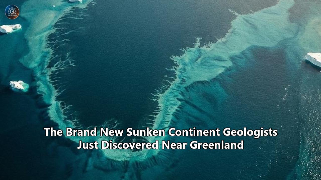
Deep-sea geological surveys mapping the frigid, turbulent waters between Canada and the Arctic have finalized the structural boundaries of a massive, anomalous geological feature beneath the seafloor. Sitting directly between Baffin Island and the western coast of Greenland, a thick slab of ancient continental crust—measuring 19 to 24 kilometers in depth—has been formally classified by researchers as a newly mapped proto-microcontinent. Unlike typical ocean basins lined with thin, dense basaltic rock, the Davis Strait harbors an unusually buoyant, granitic landmass that tore away from the North American craton but failed to fully separate into an independent tectonic plate.
Initially identified through preliminary tectonic reconstructions published by researchers from the UK and Sweden in the journal Gondwana Research, subsequent high-resolution seismic modeling has now provided a definitive map of this geological anomaly. The data proves that this sunken continent near Greenland survived tens of millions of years of intense tectonic stress largely intact. The confirmation of the Davis Strait proto-microcontinent immediately forces a reevaluation of how landmasses fracture, who legally claims jurisdiction over the Arctic seabed, and how deep-ocean currents behaved during periods of ancient climate upheaval.
The Structural Anatomy of a Failed Landmass
To understand the scale and significance of the Davis Strait anomaly, one must examine the fundamental differences between the types of crust that make up the Earth's surface. Textbooks traditionally present a binary model: oceanic crust is thin (typically 5 to 10 kilometers), incredibly dense, and composed of dark basaltic rock; continental crust is thick (averaging 30 to 50 kilometers), highly buoyant, and composed of lighter granitic rock rich in quartz and feldspar.
The structure sitting beneath the Davis Strait defies both standard classifications. Bathymetric and seismic readings reveal a crustal block that is 19 to 24 kilometers thick—substantially thinner than a stable continental craton, but far too thick to be classified as standard oceanic crust. This central landmass is bordered by narrow bands of highly thinned continental material measuring just 14 to 17 kilometers thick, acting as geological moats that separate it from both the Canadian mainland and the Greenland ice sheet.
Geologists designate the Davis Strait feature as a "proto-microcontinent" rather than a true microcontinent. While landmasses like Madagascar successfully broke away from larger supercontinents and drifted into isolated positions, the Davis Strait block is a failed rupture. The rifting process initiated, stretched the crust to the breaking point, and then inexplicably stalled. The result is a massive, suspended fragment of continental architecture permanently trapped beneath the freezing waves of the North Atlantic, hiding complex geological structures that have remained undisturbed for millions of years.
The Mechanical Autopsy: Why Continental Rifting Stalled
The existence of this submerged landmass acts as a detailed forensic record of a tectonic collision that occurred millions of years ago. The physical separation of the Davis Strait proto-microcontinent aligns precisely with a violent shift in the orientation of tectonic spreading.
Approximately 61 million years ago, the North American and Greenland tectonic plates began to separate. Initially, the plates moved in a diagonal, northeast-to-southwest trajectory. This immense tearing action gave rise to the Labrador Sea to the south and Baffin Bay to the north. As the plates pulled apart, magma welled up from the mantle to fill the void, creating new oceanic crust in a process that typically results in a clean break and the formation of a vast new ocean basin.
However, the Earth's tectonic engine is rarely perfectly synchronized. Between 58 and 49 million years ago, the spreading direction abruptly pivoted. The plate motion shifted from a diagonal pull to a harsh, north-south alignment. This directional shift subjected the newly forming Davis Strait to extreme compressional forces. Instead of simply pulling apart, the landmasses began to grind against one another in a process known as transpression—a destructive combination of strike-slip faulting and lateral compression.
Along a volatile boundary known as the Ungava Fault Zone, the crust was sheared, thickened, and forcefully jammed into its current position. Rather than cleanly separating Baffin Island from Greenland, the tectonic engine essentially choked. By roughly 33 million years ago, the seafloor spreading in the Labrador Sea and Baffin Bay ceased entirely. The geological violence stopped, leaving the thickened, mangled slab of continental material permanently submerged and frozen in time.
Technological Catalysts: The Sensor Matrix That Unmasked the Seabed
Identifying a 24-kilometer-thick slab of rock buried beneath kilometers of seawater and shifting Arctic ice requires immense computational and sensory power. The discovery and subsequent mapping of the Davis Strait proto-microcontinent relied on a synthesis of deep-penetration seismic reflection surveys, satellite altimetry, and advanced mantle modeling.
Researchers deploy specialized research vessels that tow long arrays of hydrophones—sometimes stretching several kilometers behind the ship. Acoustic pulses are fired into the ocean depths, traveling through the water column and penetrating deep into the seabed. As these sound waves encounter different rock densities—moving from soft marine sediment into dense granite, and eventually hitting the Moho discontinuity where the crust meets the mantle—they bounce back to the surface at different speeds.
By analyzing these returning signals, geophysicists construct detailed cross-sectional images of the Earth's interior. In the Davis Strait, these seismic profiles revealed a stark velocity anomaly. The seismic waves were traveling at speeds consistent with continental granite rather than oceanic basalt, and the reflection boundary mapping the bottom of the crust was positioned far deeper than it should have been.
This acoustic data was cross-referenced with gravity anomaly maps generated by Earth-observing satellites. Because continental rock is less dense than the mantle material that typically sits closer to the surface in ocean basins, a massive block of submerged granite creates a slight, localized dip in the Earth's gravitational field. By overlapping the seismic reflection profiles with satellite gravity gradients, scientists successfully traced the exact perimeter of the failed landmass.
The Geopolitics of Arctic Boundaries: Who Claims the Seabed?
The confirmation of continental material in the Davis Strait triggers immediate legal and geopolitical consequences, drastically altering how nations define their territorial borders in the Arctic. The primary legal framework governing maritime territory is the United Nations Convention on the Law of the Sea (UNCLOS). Under UNCLOS Article 76, a coastal state can extend its Exclusive Economic Zone (EEZ) beyond the standard 200-nautical-mile limit if it can scientifically prove that the seabed is a natural prolongation of its continental landmass.
The legal burden of proof lies entirely in geological data. If the seabed is standard oceanic crust, international waters apply. However, if the seabed consists of continental crust, the adjacent nations have the legal right to claim exclusive sovereignty over the resources located on and beneath that ocean floor.
The precise borders of a sunken continent near Greenland directly impact the overlapping maritime claims of Canada and the Kingdom of Denmark, which acts on behalf of Greenland. While the two nations recently settled their long-standing border dispute over the barren Hans Island further north, the delineation of the deep-water continental shelf in the Davis Strait represents a much higher-stakes negotiation. The identification of this proto-microcontinent provides both nations with fresh geological ammunition to submit revised, expanded territorial claims to the UN Commission on the Limits of the Continental Shelf (CLCS). The resulting treaties will dictate who controls the shipping lanes, environmental protection zones, and resource rights in the critical Northwest Passage corridor for the next century.
Economic Repercussions: Mineral Rights and Deep-Sea Scrutiny
The jurisdictional battle over the Davis Strait is driven by intense economic calculations. The composition of the seabed dictates the type of resources that may be hidden beneath it. Standard oceanic crust is relatively uniform, but continental crust is highly complex, forged through billions of years of volcanic activity, erosion, and tectonic pressure.
Continental rock is far more likely to host commercially viable deposits of rare earth elements (REEs), lithium, cobalt, and quartz—materials desperately needed to supply the global battery manufacturing sector and high-tech supply chains. Furthermore, the margins where continental crust thins out and meets oceanic crust are notorious for hosting massive structural traps capable of capturing immense hydrocarbon reserves. The thick, sediment-draped flanks of the Davis Strait proto-microcontinent represent prime geological real estate for both deep-sea mineral exploration and offshore drilling.
The immediate consequence of this geological discovery is an acceleration of exploratory interest from multinational resource extraction firms. Deep-sea mining companies closely monitor geological reclassifications of this magnitude. However, the prospect of industrial activity in the Davis Strait introduces severe environmental risks. The region is characterized by extreme weather, seasonal ice cover, and treacherous currents. Any potential resource extraction on this submerged landmass would force regulators to balance lucrative economic opportunities against the high probability of an ecological disaster in one of the planet's most fragile maritime environments.
Rewiring Paleoclimate and Oceanographic Models
Beyond borders and resources, the presence of a massive, anomalous block of crust in the Davis Strait forces a fundamental revision of paleoceanography and global climate modeling. The Davis Strait acts as a critical choke point for the global ocean system, serving as the primary gateway for cold, fresh Arctic water flowing south into the Atlantic. This flow of cold water is a primary driver of the Atlantic Meridional Overturning Circulation (AMOC), the vast network of ocean currents that regulates the climate of the Northern Hemisphere.
Ocean currents are strictly dictated by bathymetry—the physical shape and depth of the ocean floor. Water cannot flow through solid rock; it must flow over and around it. For decades, climate modelers attempting to simulate historical ocean currents assumed the Davis Strait possessed a standard, relatively deep oceanic profile. The confirmation of a 19-to-24-kilometer-thick continental block severely alters the bathymetric map.
During the Eocene and Paleocene epochs, when the Earth's climate was undergoing extreme fluctuations and greenhouse gas concentrations were vastly different than today, this submerged continent acted as a massive underwater dam. It constricted the flow of deep-water currents between the Arctic and the Atlantic, forcing water up toward the surface and altering global heat distribution. Paleoceanographers must now run their historical climate simulations again, factoring in the bathymetry of a sunken continent near Greenland to accurately model how ocean currents behaved 50 million years ago. Refining these historical models is highly critical; understanding how the ocean responded to physical chokepoints and warming temperatures in the deep past is the most accurate method scientists have for forecasting how modern ocean currents will react to contemporary climate change.
Reevaluating Global Tectonic and Hazard Forecasts
The mechanics of how the Davis Strait proto-microcontinent formed carry urgent implications for modern hazard forecasting. If the separation of tectonic plates is chaotic enough to leave massive shards of continental crust stranded in the ocean, our foundational assumptions about the stability of the world's coastlines must be challenged.
Geologists categorize coastlines into two types: active margins and passive margins. Active margins, like the Pacific Ring of Fire, are defined by colliding plates, frequent earthquakes, and intense volcanic activity. Passive margins, like the eastern coast of North America, the western coast of Africa, and the margins of the North Atlantic, are considered geologically quiet. They are the healed scars of ancient continental rifts, theoretically free from major tectonic stress.
The discovery of the Davis Strait anomaly proves that passive margins are not uniform, stable slopes of rock. They are littered with failed rifts, stalled faults, and fragmented microcontinents buried under heavy marine sediment. These structural irregularities create zones of hidden weakness within the tectonic plate. As massive plates drift across the Earth's mantle, stress inevitably accumulates along these ancient, hidden fracture lines.
Seismologists and hazard forecasters are directly affected by this realization. Unexplained intraplate earthquakes—seismic events that occur far away from active plate boundaries—often puzzle researchers. The identification of the Davis Strait structure provides a mechanical explanation for these anomalies. Hidden fragments of thickened crust act as rigid blocks that resist the smooth transfer of tectonic stress, causing pressure to build and eventually release in the form of deep, offshore earthquakes. Hazard models for coastal cities situated along supposedly stable passive margins must now account for the possibility of ancient, fragmented crustal blocks acting as hidden seismic triggers.
The Search for the Ocean's Missing Pieces
The confirmation of the Davis Strait anomaly is not an isolated geographical novelty; it is a catalyst for a global geological audit. Just as the formal mapping of Zealandia—a massive, mostly submerged continent in the South Pacific—shifted our understanding of the Australian plate boundary, the identification of a sunken continent near Greenland acts as a Rosetta Stone for locating other missing landmasses.
If a directional shift in tectonic spreading can strand a 24-kilometer-thick block of granite in the North Atlantic, the exact same transpression mechanism likely occurred in other oceans. Researchers are already turning their attention back to the Indian Ocean, analyzing the Kerguelen Plateau and the Seychelles microcontinent with fresh analytical frameworks. Similarly, theories regarding "Greater Icelandia"—a proposed stretch of submerged continental crust spanning from Greenland to the Faroe Islands—are receiving renewed funding and rigorous scientific scrutiny.
Geological institutes are currently reprogramming their satellite data filters. Instead of looking for clean breaks and sharp oceanic-continental boundaries, artificial intelligence algorithms analyzing gravitational and magnetic data are now specifically calibrated to hunt for "messy" margins. They are actively searching the Atlantic and Indian Oceans for the specific gravimetric signatures of stalled rifts and submerged granitic blocks, meaning the maps of the seafloor will likely undergo numerous, rapid revisions over the next decade.
What Happens Next in the Davis Strait
The mapping of the Davis Strait proto-microcontinent transitions the scientific community from a phase of discovery into a phase of physical extraction and intense monitoring. While seismic waves and satellite gravity gradients provide highly accurate structural blueprints, they cannot determine the exact chemical composition, the precise age of the rock, or the specific biological ecosystems thriving on its elevated bathymetry.
The next major milestone involves physical core sampling. International geological coalitions, such as the International Ocean Discovery Program (IODP), are actively drafting proposals to deploy deep-water drill ships into the Davis Strait. The objective is to bore through the thick layers of marine sediment and extract physical cylinders of the ancient granitic crust. By analyzing zircon crystals trapped within the core samples, geochemists will be able to radiometrically date the exact moment the crust stretched, heated, and stalled, locking in a flawless timeline of the tectonic collision.
Simultaneously, marine biologists are preparing to survey the benthic ecosystems anchored to the submerged landmass. Because continental crust interacts with seawater differently than oceanic basalt, the chemical runoff and topography of the proto-microcontinent likely support distinct deep-sea habitats. Remotely operated vehicles (ROVs) will be deployed to map the hydrothermal anomalies and biological communities utilizing the elevated ridges of the failed rift as a sanctuary against the harsh deep-water currents of Baffin Bay.
Ultimately, the revelation hiding beneath the Davis Strait serves as a powerful reminder of how much of the Earth remains uncharted. The seafloor is not a uniform expanse of basalt, but a highly fragmented, dynamic graveyard of failed oceans and torn continents. As drilling expeditions prepare to pierce the surface of this newly mapped landmass, the data extracted will continue to alter our understanding of the planet's volatile past and refine our predictions for its tectonic future.
Reference:
- https://en.wikipedia.org/wiki/Davis_Strait_proto-microcontinent
- https://www.indy100.com/science-tech/new-continent-davis-strait-2675353686
- https://indiandefencereview.com/new-continent-found-under-greenland/
- https://currentaffairs.chinmayaias.com/davis-strait-proto-microcontinent/
- https://pubs.geoscienceworld.org/gsa/books/edited-volume/2323/chapter/130412282/Icelandia