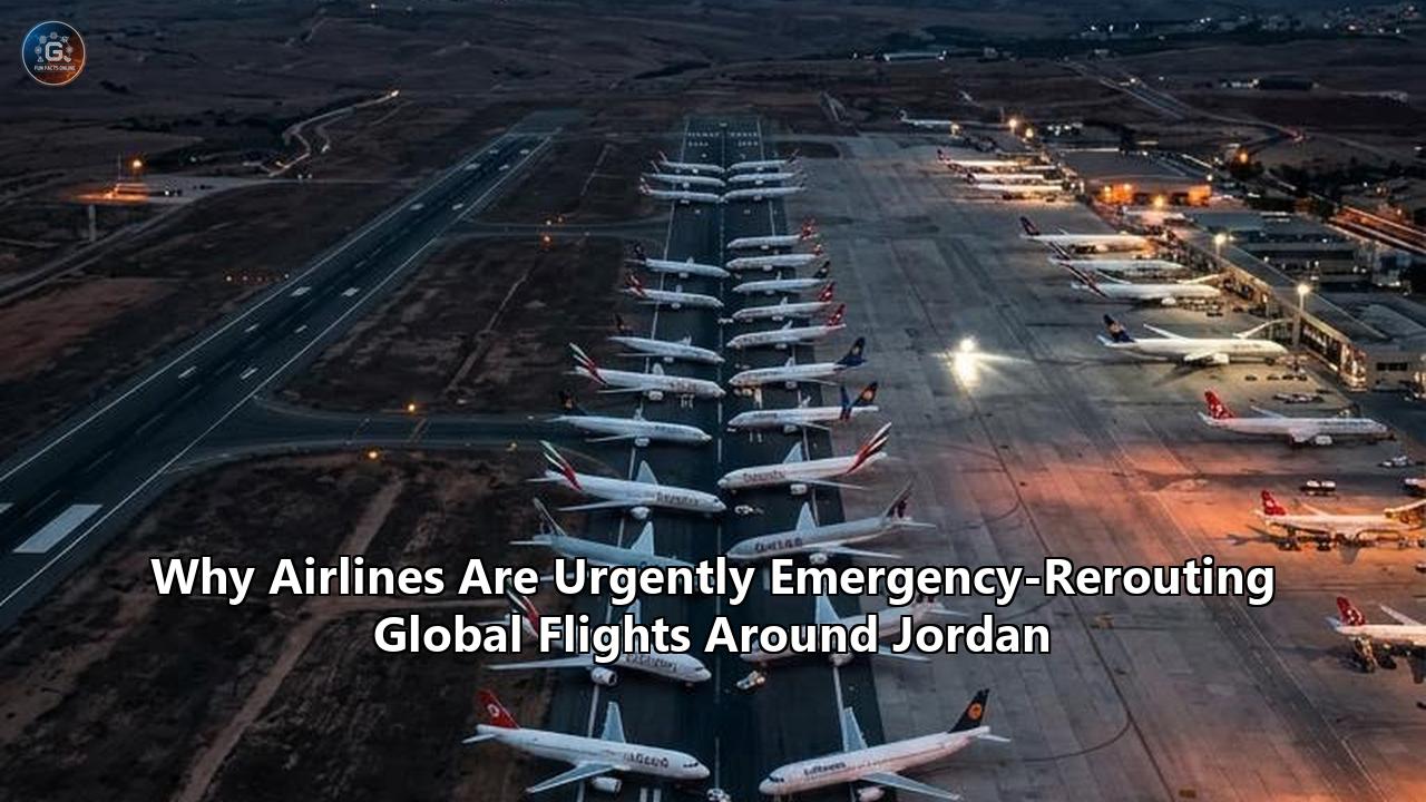
A radical shift in global flight tracking map layouts occurred on July 22, 2026, when the European Union Aviation Safety Agency (EASA) issued a high-priority security bulletin instructing commercial air carriers to immediately suspend all operations within the Amman Flight Information Region (FIR). Covering the entirety of Jordanian airspace, the advisory effectively closed the last remaining stable air corridor bridging Europe, the Mediterranean, and the Persian Gulf.
EASA's directive extended existing regional conflict advisories through August 31, 2026, while explicitly elevating Jordan from a monitored transit buffer to a full high-risk zone. The trigger was an acute military escalation on July 20 and 21, during which multiple Iranian ballistic missiles and long-range attack drones crossed directly through Jordanian skies en route to regional targets. Jordanian air defense batteries actively engaged and intercepted three ballistic missiles and at least five attack drones over Amman and the eastern desert territories.
               [ Northern Bypass Corridor ]
   Western Europe ---> Turkey ---> Caucasus ---> Central Asia ---> East/South Asia
                           |
                           v  (Avoided Airspace)
              +----------------------------------+
              | Syria  |  Iraq  |  Iran          |
              |--------+--------+----------------|
              |     [ Amman FIR / JORDAN ]       | <--- EASA No-Fly Warning
              |--------+-------------------------|      (Ballistic Missiles,
              | Israel | Saudi Arabia | Red Sea  |       Drones, GPS Spoofing)
              +----------------------------------+
                           ^
                           |
   Western Europe ---> Egypt ---> Red Sea Corridors ---> Saudi Arabia ---> Gulf / Asia
               [ Southern Bypass Corridor ]
For years, as the skies over Syria, Iraq, and Iran closed or became restricted due to persistent conflict, the Amman FIR (designated as OJAC by the International Civil Aviation Organization) served as civil aviation’s essential sanctuary. International flight dispatchers routed hundreds of daily long-haul services through a narrow air strip over Jordan to connect Europe with Asia, Africa, and the Gulf States.
That sanctuary has collapsed. International airlines are enacting emergency bypass routings, adding thousands of miles, burning tens of thousands of extra tons of jet fuel, and completely restructuring long-haul networks. The emergency crisis over Jordan highlights competing operational philosophies, severe navigational disruptions from electronic warfare, and an operational split between supranational safety regulators and local aviation authorities.
The Safe Corridor Collapses: Why Amman FIR Is Compromised
The geopolitical geography of the Levant left Jordan in an exposed position. Wedged between Syria to the north, Iraq to the east, Saudi Arabia to the south, and Israel and the West Bank to the west, the Amman FIR functions as a narrow geographic neck through which air traffic between the Mediterranean Sea and the Arabian Peninsula must pass.
                +-------------------------------------------------+
                |                  SYRIA (OSTT)                   |
                +-------------------------------------------------+
                |                                                 |
  MEDITERRANEAN |                 JORDAN (OJAC)                   |   IRAQ
      SEA       |            Amman FIR / Capital: AMM             |  (ORBB)
                |                                                 |
                +-------------------------------------------------+
                |               SAUDI ARABIA (OEJD)               |
                +-------------------------------------------------+
When Iranian airspace (OIIX) and Iraqi airspace (ORBB) were subjected to flight restrictions, airlines funneled their aircraft through a designated west-east transit band running through Egyptian, Israeli, Jordanian, and Saudi Arabian airspace. This route permitted aircraft to safely fly over the Middle East without entering active conflict zones.
The events of mid-July 2026 dismantled the assumptions supporting that arrangement. During recent kinetic exchanges between U.S., Israeli, and Iranian forces, ballistic missiles transited the upper atmosphere at flight levels directly overlapping commercial cruising altitudes (FL300 to FL400). Simultaneously, low-altitude, long-range kamikaze drones traversed Jordanian airspace.
The hazard to commercial civil aviation in the Amman FIR stems from four distinct kinetic and electronic vectors:
- Unannounced Ballistic Missile Trajectories: Ballistic projectiles moving at hypersonic speeds through high-altitude airways provide zero warning to civilian Air Traffic Control (ATC) units, creating catastrophic collision risks.
- Active Air Defense Interceptions: The deployment of surface-to-air missile (SAM) systems—including Jordanian Patriot batteries and allied air defense platforms—creates active threat corridors. Missile engagements produce unpredictable intercept points and mid-air explosions.
- Falling Kinetic Shrapnel: Interceptions occurring at 30,000 to 50,000 feet generate widespread, high-velocity debris fields that drop through civil flight corridors.
- Widespread High-Power GPS Spoofing: Electronic warfare systems deployed throughout the Levant spoof Global Navigation Satellite System (GNSS) signals, injecting false position data into aircraft Flight Management Systems (FMS).
EASA highlighted these risks in its July 22 bulletin, stating that the rapid escalation of kinetic military engagements and the absence of dependable, real-time safety advisories from local ground control made operating within the Amman FIR an unacceptable risk for commercial passengers.
Operating Strategies: Total Avoidance vs. Daylight Windows vs. Tactical Corridors
The implementation of Jordan flight rerouting has exposed contrasting risk management methodologies among international airlines. Rather than acting as a single uniform block, the airline industry has split into three distinct operational stances.
+--------------------------------------------------------------------------------------------------+
|                             AIRLINE OPERATIONAL STRATEGIES COMPARED                              |
+--------------------------+-----------------------------------+-----------------------------------+
| Strategy                 | Key Carriers                      | Core Tradeoffs                    |
+--------------------------+-----------------------------------+-----------------------------------+
| Total Airspace           | Lufthansa Group, KLM, Air France, | + Maximum risk mitigation         |
| Avoidance                | British Airways, Delta, United    | - High fuel burn & flight times   |
|                          |                                   | - Severe payload restrictions     |
+--------------------------+-----------------------------------+-----------------------------------+
| Daylight-Only            | Royal Jordanian, select regional  | + Retains hub connectivity        |
| Operations               | European carriers (interim)       | - Flight schedule compression     |
|                          |                                   | - Extreme ground congestion       |
+--------------------------+-----------------------------------+-----------------------------------+
| Tactical High-Altitude   | Select Gulf and Asian carriers    | + Shorter flight times            |
| Corridors                | (e.g., Emirates, Air India)       | - Cockpit workload spike          |
|                          |                                   | - Vulnerable to sudden NOTAMs     |
+--------------------------+-----------------------------------+-----------------------------------+
1. Total Airspace Avoidance (European and North American Legacy Carriers)
Legacy operators including the Lufthansa Group (Lufthansa, Swiss, Austrian Airlines, Brussels Airlines), KLM, Air France, and major U.S. carriers executed absolute air-space avoidance protocols immediately following EASA's announcement.
Under this model, flight paths are planned to bypass the Amman FIR entirely, regardless of whether local controllers mark corridors as open. These airlines canceled all direct passenger services to Queen Alia International Airport (AMM) in Amman and instructed flight dispatchers to route transiting long-haul flights far to the south via Egypt and Saudi Arabia, or far to the north via Turkey and Central Asia.
- The Tradeoff: This approach prioritizes safety and regulatory compliance while minimizing legal liability and insurance exposure. However, it inflicts significant financial costs. Transcontinental flights between Europe and Asia or the Gulf incur 45 to 110 additional minutes of flight time per leg.
The added time inflates fuel consumption by 6 to 14 metric tons per flight on widebody aircraft like the Boeing 777-300ER and Airbus A350-900, requiring severe payload cuts (offloading cargo or capping passenger seating) to comply with Maximum Takeoff Weight (MTOW) limits.
2. Daylight-Only Operations and Managed Windows (Regional & Middle Eastern Carriers)
Before EASA’s blanket directive—and continuing among select non-EU operators—airlines utilized a daylight-restricted operational framework. Civil aviation authorities, including Jordan’s Civil Aviation Regulatory Commission (CARC), instituted daily partial closures, shutting the airspace during night hours (typically 18:00 to 06:00 local time) while maintaining monitored daylight transit channels.
Royal Jordanian and a subset of regional operators squeezed their flight schedules into these daylight slots. The logic relied on military surveillance patterns: long-range drone and ballistic missile launches in the region historically occur during night hours to maximize tactical surprise and strain air defense networks. Daylight hours offer enhanced visual identification, improved radar separation, and active civil-military coordination.
- The Tradeoff: Squeezing 24 hours of flight traffic into a 10-to-12-hour operational window creates severe logjams at Queen Alia International Airport. Aircraft experience extended taxi delays, holding patterns, and ground turnarounds, disrupting connecting banks for hub carriers.
When regional tensions spike during the daytime, ground controllers must issue emergency holding orders or force immediate mid-flight diversions to alternate airports like Cairo (CAI) or Larnaca (LCA), causing severe passenger strandedness.
3. Tactical High-Altitude Corridors (Gulf and Asian Carriers)
Carriers based in the Gulf Cooperation Council (GCC) states and select Asian operators (such as Air India) have historically utilized real-time tactical routing. These operators closely track local Notice to Air Missions (NOTAMs) issued by CARC, requesting upper-tier cruising levels (FL380, FL390, and FL400) to pass above regional air threats.
When local authorities maintain that a corridor is safe, these airlines continue operations along narrow, tightly defined airways, relying on real-time intelligence feeds from regional military liaisons.
- The Tradeoff: This strategy saves substantial fuel and preserves published schedule times. However, it places immense operational stress on flight crews and dispatchers. Cockpit crews flying through tactical corridors operate under heightened alert states, preparing for emergency evasive maneuvers or sudden air traffic control diversions.
If a missile engagement occurs while an aircraft is within the Amman FIR, flight crews must execute sudden lateral offset maneuvers (SLOP) or emergency descents without standard ATC clearance, pushing civilian operations close to military danger thresholds.
The Navigation Technology Crisis: Satellite GNSS vs. Analog Inertial Guidance
The conflict in the Levant has transformed the skies surrounding Jordan into an aggressive electronic warfare operational zone. Airlines execute Jordan flight rerouting not only to dodge physical missiles and drones, but to protect their aircraft from severe navigation system corruption caused by terrestrial Global Navigation Satellite System (GNSS) spoofing.
+--------------------------------------------------------------------------------------------------+
|                            AIRCRAFT NAVIGATION PARADIGMS IN WAR ZONES                            |
+--------------------------+-----------------------------------+-----------------------------------+
| Technology               | Mechanism                         | Vulnerability / Operational Risk  |
+--------------------------+-----------------------------------+-----------------------------------+
| GNSS / GPS               | Satellite triangulation           | High vulnerability to terrestrial |
| Navigation               | (Galileo, GPS, GLONASS)           | spoofing/jamming; triggers false  |
|                          |                                   | TAWS alerts & FMS map shifts      |
+--------------------------+-----------------------------------+-----------------------------------+
| Inertial Reference       | Laser-gyro accelerometer          | Immune to electronic spoofing;    |
| Systems (IRS/INS)        | self-contained tracking           | suffers position "drift" over     |
|                          |                                   | time without radio update         |
+--------------------------+-----------------------------------+-----------------------------------+
| Ground DME/DME           | Terrestrial VHF/UHF radio         | Unspoofable physical line-of-     |
| Radio Beacons            | beacon cross-checking             | sight; limited range & sparse    |
|                          |                                   | desert coverage                   |
+--------------------------+-----------------------------------+-----------------------------------+
The Mechanism of Levant GNSS Spoofing
Unlike conventional GPS jamming—which floods satellite frequencies with noise to block receivers—GPS spoofing broadcasts high-power counterfeit satellite signals from ground-based transmitters. These counterfeit signals trick an aircraft’s onboard GPS receiver into calculating a false position.
Over Jordan and adjacent sectors in Syria, Iraq, and Israel, commercial airliners flying at 37,000 feet have experienced sudden, massive location shifts on their primary displays. Within seconds, the aircraft's Flight Management System (FMS) may indicate that the jet is flying over Beirut, Cairo, or Baghdad, despite actually being positioned tens or hundreds of miles away in Jordanian airspace.
This technological corruption creates three main hazards for commercial airliners:
- Terrain Awareness and Warning System (TAWS) False Triggers: When spoofed signal data indicates the aircraft is over mountainous terrain (such as the Lebanon mountain range), the onboard TAWS issues loud, automated cockpit commands ("TERRAIN! TERRAIN! PULL UP!"). Executing emergency climbs based on false TAWS alerts in controlled airspace risks mid-air collisions with surrounding aircraft.
- Flight Management System (FMS) Map Shifts: Modern automated navigation systems integrate GNSS data into the primary navigation display. A sudden GPS spoofing attack causes the onboard map to shift instantly, causing the autopilot to execute unintended turns to realign with the false flight track.
- Corrupted ADS-B Out Tracking: Aircraft automatically broadcast their position via Automatic Dependent Surveillance-Broadcast (ADS-B) to ground control and other airplanes. Spoofed signals cause aircraft to transmit false positional coordinates, blinding Air Traffic Control radar units and preventing automated collision-avoidance systems (TCAS) from functioning correctly.
                    SPOOFED SIGNAL
             [ False Satellite Transmitters ]
                          |
                          v
   [ REAL FLIGHT PATH ] -------> [ Corrupted FMS Display ]
   A350 at FL370 over           System believes aircraft is
   Eastern Jordan               120 nm West over Beirut
                          |
                          +---> Triggers TAWS "PULL UP!"
                          +---> Autopilot executes uncommanded turn
                          +---> ADS-B broadcasts false position to ATC
The Analog Countermeasure: Reverting to Unassisted Inertial Reference
To operate safely near compromised skies, flight crews are forced to disable modern satellite navigation inputs. Flight crews operating near the Amman FIR perform manual FMS overrides, deselecting GPS updating within the navigation control unit.
This forces the aircraft to rely exclusively on its self-contained Inertial Reference System (IRS) or Inertial Navigation System (INS). Modern widebody aircraft use three independent laser-gyro IRUs that track position by measuring physical acceleration along three axes, making them completely immune to ground-based radio spoofing or jamming.
However, unassisted IRS navigation presents its own performance limitations:
- Positional Drift: IRS systems experience positional "drift" over time. Without GNSS or ground radio beacon updates, an aircraft's calculated position drifts by 0.5 to 2.0 nautical miles per hour of flight time.
- DME/DME Cross-Checking Limits: To correct IRS drift, the FMS uses Distance Measuring Equipment (DME) radio stations on the ground, cross-checking distances between two or more physical beacons to establish a precise position. However, ground-based navigation infrastructure across desert regions in Jordan, Iraq, and Syria is sparse, damaged, or turned off for military security.
When operating on pure IRS mode with minimal DME infrastructure, aircraft cannot maintain the tight navigation precision (RNP 0.1 or RNP 0.3) required for dense airway structures.
Air traffic controllers must increase lateral and longitudinal separation between aircraft from standard 5-nautical-mile gaps to 20- or 30-nautical-mile gaps. This necessity drastically reduces airspace capacity, backing up air traffic across adjacent FIRs in Egypt, Saudi Arabia, and Turkey.
Geographic Bypass Paths: The Southern Red Sea Corridor vs. The Northern Caucasus Route
With the Amman FIR designated as a high-risk zone, flight operations departments are forced to route around the geographic block formed by Israel, Jordan, Syria, Iraq, and Iran. Civil aviation now relies on two primary bypass tracks to bridge Europe and the East.
+--------------------------------------------------------------------------------------------------+
|                            GEOGRAPHIC BYPASS CORRIDORS EVALUATED                                 |
+--------------------------+-----------------------------------+-----------------------------------+
| Route Metric             | Option A: Southern Red Sea Route  | Option B: Northern Caucasus Route |
+--------------------------+-----------------------------------+-----------------------------------+
| Primary FIRs Traversed   | Cairo (HECC), Jeddah (OEJD),      | Istanbul (LTBB), Tbilisi (UGGG),  |
|                          | Riyadh (OERH)                     | Baku (UBBA), Tashkent (UTAK)      |
+--------------------------+-----------------------------------+-----------------------------------+
| Added Flight Time        | +45 to +90 minutes                | +60 to +120 minutes               |
| (Europe to South Asia)   |                                   |                                   |
+--------------------------+-----------------------------------+-----------------------------------+
| Primary Operational Risk | Severe ATC capacity congestion;   | Overcrowding; weather turbulence; |
|                          | high ambient air temperatures     | proximity to active war zones     |
+--------------------------+-----------------------------------+-----------------------------------+
| Geopolitical Exposure    | Red Sea kinetic spillover         | Proximity to Russian airspace     |
|                          | (Yemen/Houthi missile ranges)     | restrictions                      |
+--------------------------+-----------------------------------+-----------------------------------+
Option A: The Southern Bypass (Egypt – Red Sea – Saudi Arabia)
The Southern Bypass serves as the primary alternate route for traffic traveling between Western Europe, East Africa, and the Persian Gulf.
Aircraft fly south across the Mediterranean, enter the Cairo FIR (HECC) over Egypt, turn south down the Red Sea transit corridor, and enter the Jeddah FIR (OEJD) across Saudi Arabia. From there, flights cross Saudi Arabian airspace eastward toward Dubai, Doha, Abu Dhabi, or onward across the Arabian Sea to India and South Asia.
Western Europe ---> Mediterranean ---> Cairo FIR (Egypt)
                                            |
                                            v
Persian Gulf / Asia <--- Jeddah FIR <--- Red Sea Corridor
Tradeoffs of the Southern Bypass
- Congestion Bottlenecks: Funneling hundreds of diverted long-haul flights into Egyptian and Saudi airspace creates severe ATC saturation. The narrow corridor down the Red Sea experiences heavy air traffic density, leading to extended airborne holding patterns and ground slot delays at European origins.
- Extreme Overflight Costs: Routing aircraft through Egyptian and Saudi airspace forces carriers to pay substantial overflight fees to local civil aviation authorities. For a daily widebody operation, accumulated annual overflight fees increase operating expenditures by millions of dollars.
- Thermal Operating Ceilings: During summer months, high ambient air temperatures over the Egyptian and Saudi deserts reduce high-altitude air density. Fully loaded long-haul aircraft carrying extra contingency fuel cannot reach fuel-efficient cruising altitudes (FL390–FL410), remaining trapped at lower flight levels (FL310–FL330) where hot, dense air increases drag and fuel burn.
Option B: The Northern Bypass (Turkey – Black Sea – Caucasus – Central Asia)
The Northern Bypass serves as the alternate track for long-haul routes connecting Northern/Central Europe with South Asia, Southeast Asia, and East Asia.
Flights head east over the Black Sea, enter Turkish airspace (LTBB), pass through the Caucasus via Georgia (UGGG) and Azerbaijan (UBBA), cross the Caspian Sea, and navigate through Central Asian FIRs in Turkmenistan (UTAK), Uzbekistan, and Afghanistan/Pakistan corridors down into Asia.
Northern Europe ---> Black Sea ---> Turkey (LTBB)
                                         |
                                         v
South/East Asia <--- Turkmenistan <--- Caucasus (Georgia/Azerbaijan)
Tradeoffs of the Northern Bypass
- Excess Distance for Gulf Destinations: The Northern Bypass provides an effective path for flights traveling directly from London or Frankfurt to Delhi or Bangkok. However, using this route for flights bound for Gulf destinations (like Dubai, Doha, or Muscat) requires long circuitous tracks southward through Central Asia, adding up to two hours of flight time and making many routes commercially unviable.
- Caucasian Airspace Capacity Limits: The narrow airspace corridors between the Black Sea and the Caspian Sea feature high mountain ranges and limited radar coverage. Squeezing diverted European traffic into these narrow mountain corridors leads to frequent ATC flow-control restrictions.
- Geopolitical Proximity Risks: The Northern Route flies close to restricted Russian airspace zones to the north and volatile sectors in the regional conflict landscape to the south. Any shift in regional military engagements threatens to close this narrow Caucasian window, leaving dispatchers with no clear northern alternative.
Regulatory Conflicts: Supranational Directives vs. Sovereign Airspace Authorities
The emergency situation surrounding the Amman FIR highlights a recurring operational conflict in international aviation: the divergence between sovereign aviation authorities and supranational regulatory safety agencies.
                 [ COMMERCIAL AIRLINE ]
                           |
         +-----------------+-----------------+
         |                                   |
         v                                   v
[ Sovereign Authority: CARC ]     [ Safety Regulator: EASA/FAA ]
  - Issues local NOTAMs             - Issues binding CZIB advisories
  - Economic goal: Keep corridors   - Safety goal: Risk mitigation
    open & collect overflight fees  - Direct threat of insurance
  - Asserts airspace stability        cancellation upon breach
Sovereign Authority: Jordan’s Civil Aviation Regulatory Commission (CARC)
Under Article 1 of the Chicago Convention on International Civil Aviation, every sovereign state possesses complete and exclusive sovereignty over the airspace above its territory. Jordan's CARC holds the exclusive legal authority to open, restrict, or close the Amman FIR.
CARC’s strategy aims to maintain civil connectivity, preserve overflight revenue, and protect Jordan's role as a regional transport hub. To achieve this, CARC uses flexible NOTAMs, announcing targeted daily closures during active military operations or night hours while maintaining that high-altitude airways remain safe during daytime conditions under active Jordanian air defense oversight.
Supranational Regulators: EASA and the FAA
Regulators such as EASA (Europe) and the Federal Aviation Administration (FAA in the United States) operate under safety-first mandates shaped by historical disasters, including the 2014 downing of Malaysia Airlines Flight MH17 over Ukraine and the 2020 shootdown of Ukraine International Airlines Flight PS752 over Iran.
These agencies issue Conflict Zone Information Bulletins (CZIBs) and Special Federal Aviation Regulations (SFARs). Their risk assessment frameworks do not depend on whether a local state claims its skies are open.
If EASA determines that a sovereign state cannot reliably prevent ballistic missiles, attack drones, or surface-to-air engagements from entering civil airways, it issues a binding no-fly recommendation to all operators under its jurisdiction.
EASA's July 22 bulletin effectively overrode CARC's open-corridor assertions, ordering European airlines to treat the Amman FIR as an active conflict zone.
The Insurance Enforcement Mechanism
The ultimate power in enforcing airspace avoidance directives lies with global war-risk insurance syndicates operating out of centers like Lloyd's of London. Aviation insurance policies contain strict clauses regarding operation in designated conflict zones.
When EASA or the FAA issues a formal conflict zone directive for an FIR, war-risk underwriters quickly adjust policy terms. Insurers either levy expensive war-risk hull and liability insurance surcharges (ranging from $2,000 to $10,000 per single overflight) or cancel coverage entirely for aircraft entering the specified FIR.
Because operating an un-insured airliner violates international leasing agreements and commercial operator certificates, even non-European carriers that utilize aircraft leased from Western firms are forced to comply with EASA directives and execute Jordan flight rerouting plans to maintain insurance coverage.
Logistical and Economic Impacts on Global Aviation
The emergency avoidance of Jordanian airspace creates significant operational consequences across the international aviation industry.
+--------------------------------------------------------------------------------------------------+
|                            COMPOUNDING LOGISTICAL AND FINANCIAL COSTS                            |
+--------------------------+-----------------------------------------------------------------------+
| Operational Vector       | Measured Impact across Long-Haul Networks                             |
+--------------------------+-----------------------------------------------------------------------+
| Fuel Consumption         | +6 to +14 metric tons of Jet-A fuel per flight leg                    |
+--------------------------+-----------------------------------------------------------------------+
| Payload Penalties        | 10% to 25% reduction in cargo volume or passenger capacity            |
+--------------------------+-----------------------------------------------------------------------+
| Crew Duty Time (FDL)     | Max duty limits breached; mandatory tech-stops in Larnaca/Cairo/Athens|
+--------------------------+-----------------------------------------------------------------------+
| Network Aircraft Use     | Up to 15% reduction in daily fleet utilization rate                   |
+--------------------------+-----------------------------------------------------------------------+
1. The Fuel Burn and Carbon Emissions Spike
Jet fuel accounts for 30% to 45% of an airline's total operating expenses. Forcing flights onto circuitous bypass routes around Jordan significantly increases fuel burn:
$$\text{Additional Fuel Burn per Flight} = \text{Extra Flight Time (hrs)} \times \text{Fuel Burn Rate (tons/hr)} + \text{Weight Drag Penalty}$$
A standard Boeing 777-300ER burns approximately 7.5 to 8.0 metric tons of jet fuel per hour. Adding 75 minutes to a flight leg between London and Dubai results in roughly 10 extra tons of jet fuel burned per leg.
Across hundreds of daily diverted flights, the aviation sector burns thousands of additional tons of fuel daily, generating substantial unanticipated operating costs and increasing carbon emissions during a period of strict international environmental monitoring.
2. Payload Capacity Cuts and Weight Limits
Carrying extra contingency fuel creates a compounding weight penalty: fuel itself adds weight, requiring the engine to burn more fuel just to carry that extra fuel load.
To remain below Maximum Takeoff Weight (MTOW) limits on extended detour routes, airlines are forced to restrict payloads:
[ Maximum Takeoff Weight (MTOW) Capacity Limit ]
===================================================
|  Base Operational Empty Weight  |  Passenger Vol | <--- Payload Cut Range
|  + Extended Contingency Fuel   |  & Cargo Cut   |      (10% to 25% forced offload)
===================================================- Cargo space is restricted first, forcing high-value freight off long-haul passenger flights and disrupting global supply chains.
- If fuel requirements remain high, airlines implement passenger caps, leaving 20 to 50 seats empty on widebody aircraft. This dynamic reduces ticket supply while pushing fare prices higher on remaining operational routes.
3. Flight Crew Duty Limitations (FDL) and Unscheduled Tech-Stops
Civil aviation authorities strictly regulate Flight Duty Limitations (FDL) to prevent pilot fatigue. Standard long-haul crew rosters are built around planned flight times.
When unexpected routing detours extend planned 12-hour flights into 14- or 15-hour journeys, flight crews hit their legal duty thresholds. If an aircraft encounters air traffic delays while on a bypass route, the crew risks exceeding legal operating hours mid-flight.
To prevent crews from exceeding duty limits, airlines must deploy augmented crews (adding a third or fourth pilot to ultra-long-haul cockpits) or plan technical refueling and crew-change stops at intermediate airports such as Larnaca (LCA), Athens (ATH), or Cairo (CAI).
These technical stops add substantial ground handling costs, disrupt aircraft rotation schedules, and cause downstream flight cancellations across domestic networks.
4. Economic Toll on Jordan’s Aviation Sector
The disruption severely impacts Jordan’s domestic economy. Queen Alia International Airport (AMM), which underwent major expansions to become a modern Levant transport hub, faces sharp traffic declines.
Cancellations by international carriers reduce passenger transit fees, duty-free retail revenue, aeronautical landing charges, and aviation fuel sales. Royal Jordanian, the national flag carrier, faces severe operational disruptions, balancing public service mandates with high war-risk insurance costs and mounting schedule delays.
Long-Term Outlook for Levant Airspace
The emergency rerouting around Jordan marks a long-term structural shift in how international civil aviation navigates geopolitical conflict zones.
Historically, regional airspace closures were brief operational shocks, resolving within days as regional tensions settled. However, the integration of long-range ballistic weapons, low-cost attack drones, and high-powered terrestrial GPS spoofing has altered the risk equation for civilian high-altitude flight paths.
Key developments will dictate the future structure of global air corridors:
- The August 31 EASA Benchmark: EASA’s advisory deadline of August 31, 2026, represents a critical review window. If kinetic military activity and electronic warfare tactics persist along Jordan's borders, regulators will likely extend the Amman FIR CZIB advisory through late 2026 or into 2027, making bypass routes a permanent feature of airline winter flight schedules.
- Commercial Anti-Jamming Hardware Adoption: Airline fleets are pushing for rapid certification and installation of Controlled Radiation Pattern Antennas (CRPA) and multi-frequency anti-spoofing GNSS receivers. These technologies, adapted from military hardware, filter out terrestrial spoofing signals to maintain satellite lock during electronic warfare attacks.
- Structural Realignment of Global Air Corridors: Long-haul carriers are permanently updating their operational models. Instead of treating the Levant as a reliable default transit zone, flight scheduling systems are coding the Middle Eastern airspace system as a variable, high-risk sector.
As airlines rebuild global networks, traffic is shifting toward permanent northern bypass tracks through Central Asia and southern routes across the Red Sea and Saudi Arabia. The collapse of the Amman safe corridor demonstrates that high-altitude airways can no longer be protected from ground conflicts.
Until international frameworks establish enforceable protection protocols for civil aviation in active military sectors, global airlines will continue to fly the longer, costlier path around the skies of Jordan.
Reference:
- https://minutemirror.com.pk/easa-issues-urgent-advisory-warning-airlines-to-avoid-jordanian-airspace-596805/
- https://www.thetraveler.org/middle-east-flight-suspensions-and-rerouting-intensify-in-july/
- https://www.thetraveler.org/jordan-flight-chaos-grows-as-iranian-attacks-hit-air-routes/
- https://www.thenationalnews.com/travel/2026/07/21/jordan-flight-cancellations-continue-as-iranian-attacks-disrupt-air-travel/
- https://today.lorientlejour.com/article/1542139/eu-aviation-agency-adds-jordan-to-no-fly-warning-list-as-fighting-continues.html
- https://www.travelandleisureasia.com/my/news/iran-iraq-jordan-israel-airspace-closure/
- https://simpleflying.com/how-gps-jamming-airspace-closures-are-affecting-airline-routes/
- https://www.thenews.com.pk/latest/1409888-eu-aviation-agency-easa-adds-jordan-to-no-fly-list-amid-escalating-conflict
- https://www.thenationalnews.com/news/mena/2024/04/18/jordanians-say-problems-caused-by-israeli-gps-jamming-have-worsened/
- https://www.travelpulse.com/news/airlines-airports/airlines-suspend-and-reroute-middle-east-flights-amid-security-concerns
- https://en.royanews.tv/news/66763/No-airline-rerouting-affecting-Jordan-as-regional-airspace-tensions-persist
- https://jordantimes.com/news/local/jordan-to-partially-close-airspace-amid-regional-tensions
- https://www.zoortours.com/is-jordan-airspace-open/