For centuries, humanity’s understanding of lightning was confined to a fleeting, localized phenomenon—a brilliant, jagged spark connecting an angry cloud to the earth, or darting briefly between cloud layers. The common wisdom held that if you could hear thunder, you were close enough to be struck, but if the storm passed, the danger faded with the darkening skies. Our empirical measurements reinforced this belief: a typical lightning bolt extends anywhere from one to ten kilometers in length, exists for a fraction of a second, and discharges its localized pocket of electrical potential before the atmosphere resets. It is a terrifying, magnificent burst of localized energy.
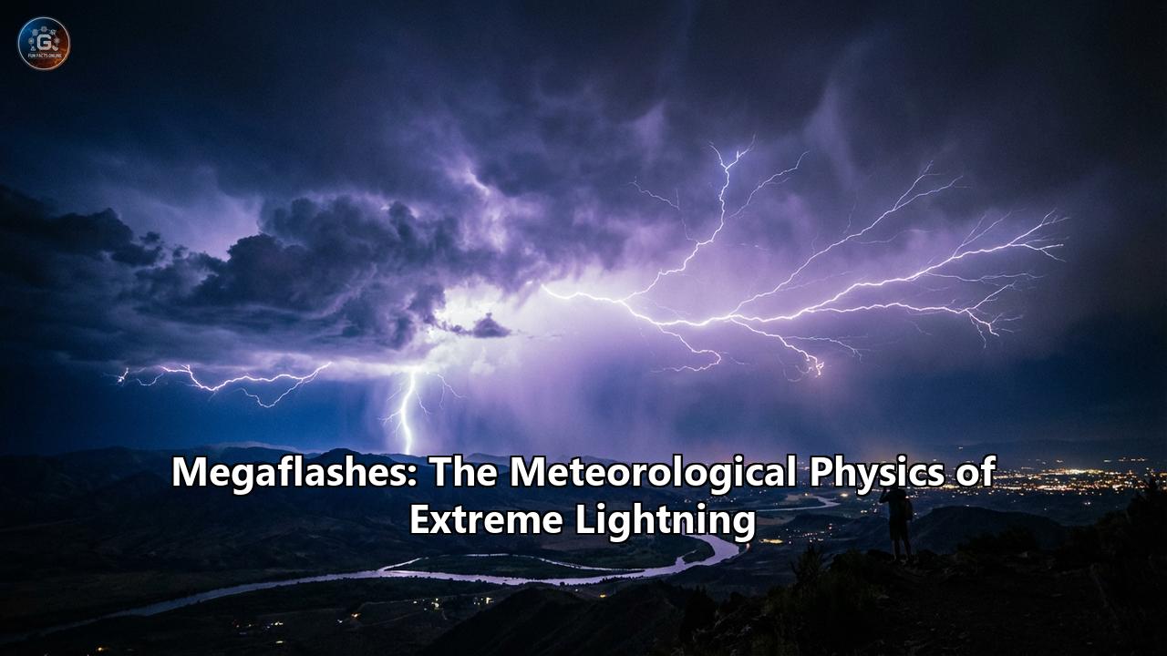
However, hidden within the upper echelons of massive, continent-spanning storm systems, a completely different beast roams the skies. These are the "megaflashes"—continuous lightning discharges of such unfathomable scale and duration that they defy our traditional definitions of weather phenomena. Spanning hundreds of kilometers and lasting for double-digit seconds, megaflashes are not merely scaled-up lightning bolts; they are the result of highly specific, finely tuned meteorological physics. They represent the maximum limits of what the Earth's atmosphere can electrically produce, fundamentally rewriting the textbooks on atmospheric electricity, storm dynamics, and public safety.
To understand the megaflash, we must dive deep into the thermodynamic engines of the sky, the architecture of Mesoscale Convective Systems, the microphysics of ice and charge separation, and the cutting-edge satellite technology that finally allowed meteorologists to map these invisible atmospheric leviathans.
The Scale of the Impossible: The World Records
Before delving into the atmospheric physics that forge these titans, one must appreciate their sheer, staggering scale. The metrics used to quantify ordinary lightning are entirely insufficient for megaflashes, which are formally defined by meteorologists as single, continuous horizontal flashes that extend for 100 kilometers (62 miles) or more.
For years, scientists using ground-based radar and radio-frequency arrays debated just how large a single flash could become. It was only with the advent of continuous space-based monitoring that the true extent of these events was revealed.
In July 2025, the World Meteorological Organization (WMO) officially certified a newly discovered distance record that stunned the scientific community. By utilizing reprocessed data from the Geostationary Lightning Mapper (GLM) aboard the GOES-16 satellite, a committee of international experts verified a single lightning flash that covered a horizontal distance of 829 ± 8 kilometers (515 ± 5 miles). This extraordinary megaflash occurred on October 22, 2017, initiating in eastern Texas and propagating in a massive, uninterrupted dendritic web all the way to the vicinity of Kansas City, Missouri. To put this into perspective, a single continuous spark stretched across a distance equivalent to the journey between Paris, France, and Venice, Italy, or from New York City to Columbus, Ohio. It would take a commercial airliner about an hour and a half to fly the length of this single lightning bolt. This 2017 titan shattered the previous WMO-recognized distance record of 768 kilometers (477 miles), which occurred on April 29, 2020, stretching across the southern United States and the Gulf of Mexico.
While the 2017 megaflash holds the crown for horizontal distance, the WMO recognizes a different event for the world record in duration. On June 18, 2020, a thunderstorm complex over Uruguay and northern Argentina birthed a single lightning flash that developed continuously for an agonizingly long 17.102 ± 0.002 seconds. For more than seventeen seconds, the sky was continuously discharging a single, interconnected electrical event. By comparison, an average lightning strike lasts about 0.2 seconds.
These extreme values pose an immediate scientific question: How can the atmosphere sustain a continuous electrical breakdown over hundreds of miles and dozens of seconds without the channel collapsing or the charge depleting? The answer lies not in the lightning itself, but in the unique architecture of the storms that give birth to it.
The Crucible of the Megaflash: Mesoscale Convective Systems (MCS)
Megaflashes do not, and cannot, occur in ordinary, isolated, single-cell or multicell thunderstorms. A standard summertime "pop-up" thunderstorm is simply too small; its physical dimensions are only a few dozen kilometers across, and its internal wind shears and violent updrafts are far too chaotic to maintain the delicate horizontal charge reservoirs required for a megaflash.
Instead, megaflashes are exclusively the product of Mesoscale Convective Systems (MCS). An MCS is a massive complex of thunderstorms that becomes organized on a scale larger than individual storms but smaller than extratropical cyclones, normally persisting for several hours, and sometimes up to a few days. They frequently take the form of squall lines, bow echoes, or Quasi-Linear Convective Systems (QLCS).
The defining structural characteristic of an MCS that makes megaflashes possible is its bipartite anatomy: the leading convective line and the trailing stratiform region.
- The Leading Convective Line: This is the ferocious, violent vanguard of the storm complex. It is characterized by intense, towering updrafts, torrential rainfall, severe wind gusts, and high-frequency, localized lightning. Here, strong vertical winds force supercooled water, ice crystals, and graupel (soft hail) to collide violently.
- The Trailing Stratiform Region: Behind the violent leading edge lies a massive, sprawling deck of lighter, steadier precipitation known as the stratiform region. This area can span hundreds of thousands of square kilometers. Unlike the chaotic, vertical churning of the leading line, the stratiform region is characterized by gentler, widespread mesoscale updrafts and downdrafts. Crucially, the air currents in this region flow horizontally, stretching out anvil clouds and carrying ice particles far backward from the initial point of convection.
It is within the vast, seemingly placid canopy of the trailing stratiform region that the meteorological conditions for a megaflash are perfected.
The Microphysics of Extreme Electrification
To build a megaflash, the storm must first build a "mega-battery." Lightning is fundamentally a mechanism to neutralize an electrical imbalance in the atmosphere. This imbalance is created by the non-inductive charging mechanism, a microphysical process driven by the collisions of different forms of water in the cloud.
In the powerful updrafts of the leading convective line, lighter ice crystals are thrust upward, while heavier, slushy graupel particles fall or remain suspended lower down. When an ice crystal and a graupel particle collide in the presence of supercooled liquid water, charge is transferred. The temperature profile of the cloud dictates the polarity: typically, at temperatures around -15°C, the lighter ice crystals acquire a positive charge and are carried to the top of the cloud, while the heavier graupel acquires a negative charge and settles in the middle layers. This creates the classic electrical "tripole" of a thunderstorm: a main positive charge region at the top, a main negative charge region in the middle, and a smaller positive charge region near the cloud base.
However, in an MCS, the fierce upper-level winds—often known as the front-to-rear flow—take these charged ice crystals and sweep them backward into the trailing stratiform region. This horizontal advection of charged particles creates sprawling, contiguous layers of uniform charge that stretch for hundreds of kilometers.
Furthermore, as the ice particles drift into the stratiform region, they begin to slowly aggregate and fall. The distinct vertical motions of the stratiform region often lead to an inverted charge structure compared to the convective line. The result is a massive, unbroken "reservoir" of electrical charge—often a massive pool of positive charge—hanging in the middle-to-upper troposphere, isolated from the chaotic electrical short-circuits of the leading edge.
The Trigger and the Highway: How a Megaflash Propagates
Having established a massive, uninterrupted reservoir of charge, the MCS requires two final ingredients to produce a megaflash: a low localized flash rate, and a trigger.
In the violent convective line, the intense charge generation is matched by a high flash rate; lightning is constantly discharging the built-up energy, preventing it from accumulating over a wide area. But in the stratiform region, the charge generation is slow and steady, and the flash rate is exceptionally low. The energy is allowed to pool, untouched, storing up hundreds of millions of volts of potential across a continuous horizontal plane.
The megaflash usually begins near the back of the leading convective line or the transition zone. A standard lightning leader—a stepped channel of ionized plasma—initiates to neutralize a local pocket of charge. But instead of terminating out in the open air or striking the ground, the leader's tendrils tap into the edge of the sprawling stratiform charge reservoir.
Because the stratiform reservoir is continuous and untouched by competing flashes, the lightning leader finds a path of least resistance that stretches to the horizon. The physics of dielectric breakdown take over. The highly conductive plasma channel propagates horizontally, moving bidirectionally through the cloud at speeds exceeding 100,000 miles per hour.
This propagation is characterized by "spider lightning" or dendritic branching. The leader channels branch out fractally, crawling along the underside of the stratiform cloud deck or embedded deep within it, mapping the contours of the charge reservoir. Because the charge density in the stratiform region is relatively low compared to the convective core, the lightning leader does not dump all its energy instantly. Instead, it feeds slowly and continuously, drawing charge from further and further away, extending its lifespan from milliseconds into whole seconds, and its length from kilometers into hundreds of kilometers. This is why megaflashes have such extreme durations: the plasma channel remains hot and conductive, continuously sweeping through the cloud, draining the massive battery drop by drop.
During this immense lateral journey, the megaflash may occasionally throw downward "dart leaders" toward the Earth, resulting in multiple cloud-to-ground (CG) strikes separated by tens or even hundreds of miles, all born from the exact same parent flash. An observer on the ground in Texas might witness a strike, and seconds later, an observer in Oklahoma might see a strike, both entirely unaware that they are witnessing different limbs of the exact same 800-kilometer megaflash.
The Technological Revolution: Seeing the Invisible
The existence of mesoscale lightning was theorized decades ago. In 1956, meteorologist Myron Ligda utilized early, fast-scanning weather radar to observe lightning echoes extending up to 160 kilometers rearward from a storm's leading edge. However, for the next fifty years, these observations were treated largely as atmospheric anomalies. Ground-based lightning detection networks, like the National Lightning Detection Network (NLDN), primarily tracked the radio frequency pulses emitted by cloud-to-ground strikes. They could pinpoint where a bolt hit the ground, but they were largely blind to the massive, horizontal intracloud architecture of a megaflash.
The paradigm shifted with the invention of 3D Lightning Mapping Arrays (LMAs). By using dozens of ground-based antennas to measure the precise time-of-arrival of Very High Frequency (VHF) emissions produced by the breakdown of air in the lightning leader, meteorologists could finally render 3D maps of a lightning channel inside the cloud. In 2007, an LMA in Oklahoma successfully mapped a flash spanning 321 kilometers, which became the first WMO-certified "longest flash" record.
However, ground-based LMAs are limited by their geographical footprint. A storm that moves out of the array's range cannot be mapped in its entirety. To truly capture the scale of megaflashes, humanity had to take to space.
The ultimate game-changer was the Geostationary Lightning Mapper (GLM), launched aboard the NOAA GOES-16 and GOES-17 satellites. Orbiting at 35,000 kilometers above the equator, the GLM is a highly specialized optical transient detector. It continuously monitors the Earth in the near-infrared spectrum (specifically, the 777.4 nanometer wavelength, a distinct emission line of excited atomic oxygen produced by lightning plasma) at a rate of 500 frames per second.
The GLM does not just map ground strikes; it registers the optical energy of the lightning illuminating the cloud canopy from within. Because the GLM stares continuously at the entire Western Hemisphere, it can capture a megaflash from its initiation in Texas to its termination in Missouri without ever losing sight of it.
In 2024, meteorologists undertook a massive supercomputing project to reprocess the entire historical data record of the GLM using newly developed, highly efficient computational methods. It was this reprocessing that successfully stitched together the fragmented optical data of the October 22, 2017 storm, finally revealing the uninterrupted 829-kilometer structure of the world's largest megaflash. As future platforms like the European Meteosat Third Generation (MTG) Lightning Imager and the Chinese Fengyun-4A Lightning Mapping Imager come online, scientists expect to map extreme lightning on a truly global scale.
Geographical Hotspots: Where the Giants Roam
Megaflashes are not evenly distributed around the globe. Because they require expansive, highly organized Mesoscale Convective Systems, their occurrence is tightly constrained to specific geographical "hotspots" that feature the perfect blend of atmospheric instability, moisture, and wind shear.
Currently, the two undisputed global capitals of megaflashes are the Great Plains of North America and the La Plata Basin in South America.
In North America, the unique topography of the Rocky Mountains and the Gulf of Mexico creates a meteorological powder keg. Warm, extremely moist air from the Gulf of Mexico is pulled northward by powerful low-level jet streams. As this moisture collides with dry, cold air descending from the Rockies, violent convection erupts. The vast, flat expanse of the Great Plains allows these MCSs to organize and propagate eastward for thousands of miles uninterrupted, developing the massive, trailing stratiform regions necessary to fuel an 800-kilometer megaflash.
Similarly, in South America, the Andes Mountains play a parallel role. The South American Low-Level Jet transports deep Amazonian moisture southward into the La Plata Basin (encompassing parts of Argentina, Uruguay, Paraguay, and southern Brazil). This moisture meets cold frontal systems sweeping north from Patagonia. The resulting thunderstorms over the Pampas are among the deepest and most electrically active on the planet, frequently giving rise to extreme megaflashes, such as the 17.1-second duration record holder of June 2020.
While other regions, such as the Congo Basin in Africa or the foothills of the Himalayas, produce immense amounts of lightning, they generally feature isolated, diurnally driven cellular convection rather than the highly organized, massive MCS squall lines required for megaflash propagation.
The Hazard: "Bolts from the Blue" and Aviation Risks
The discovery and certification of megaflashes is not merely an academic exercise in breaking records; it has profound implications for public safety.
For decades, public lightning safety has relied on the "30-30 Rule": if it takes less than 30 seconds to hear thunder after seeing lightning, you must go indoors, and you should wait 30 minutes after the last clap of thunder before resuming outdoor activities. This guidance implies that lightning is a localized hazard, intimately tied to the visible presence of a dark, menacing convective core.
Megaflashes thoroughly invalidate this assumption. Because a megaflash can propagate hundreds of kilometers horizontally through the visually innocuous, lightly raining stratiform region of a storm, it can drop deadly cloud-to-ground strikes far away from the parent thunderstorm. These are the legendary "bolts from the blue"—lightning strikes that occur when the sky directly overhead appears relatively calm, or when the main body of the thunderstorm is literally located in a different state. An observer standing under the stratiform cloud shield in Missouri could be struck and killed by a lightning bolt that was physically initiated by a convective updraft located hours away in Texas.
Furthermore, the ground strikes associated with the stratiform region of a megaflash are distinctly different from typical convective lightning. A high percentage of ground strikes generated by the trailing stratiform region are Positive Cloud-to-Ground (+CG) flashes. While normal negative strikes transfer negative charge to the ground, +CGs transfer positive charge. +CGs are notorious for being exceptionally powerful, often carrying peak currents hundreds of times greater than negative strikes.
Crucially, because a megaflash taps into a massive, continuous reservoir of charge, the resulting +CG ground strikes often exhibit "continuing current". Instead of the energy discharging in a microsecond pulse, the current flows continuously down the lightning channel for tens to hundreds of milliseconds. This sustained thermal energy makes megaflashes exceptionally effective at igniting wildfires. The sheer heat transfer provided by the continuing current of a megaflash limb is a primary culprit behind lightning-ignited forest fires in the dense timberlands of North America.
The aviation industry also faces unique hazards from megaflashes. Commercial aircraft are routinely routed to fly through or under the less-turbulent stratiform regions of an MCS to avoid the violent hail and updrafts of the convective leading line. However, the realization that these seemingly docile, expansive cloud decks are actively harboring continuous, horizontally propagating megaflashes means that aircraft could inadvertently intercept a massive electrical discharge channel.
The Upper Atmosphere: Sprites, Elves, and Blue Jets
The awe-inspiring nature of megaflashes extends not just outward, but upward. Megaflashes are intrinsically linked to one of the most enigmatic phenomena in atmospheric physics: Transient Luminous Events (TLEs), primarily Sprites.
Sprites are massive, fleeting flashes of cold plasma that occur high in the mesosphere, up to 80 kilometers above a thunderstorm. They appear as brilliant, jellyfish-like structures of red and blue light. For decades, their cause was a mystery. Today, meteorologists know that sprites are directly triggered by the immense electrical field changes caused by the +CG ground strikes associated with megaflashes.
When a megaflash propagates through the stratiform region and unleashes a massive +CG strike with continuing current, it suddenly and violently removes a huge amount of positive charge from the cloud's upper layers. This abrupt change creates an intense, momentary quasi-static electric field that extends all the way into the near-vacuum of the upper atmosphere. The thin air of the mesosphere undergoes sudden dielectric breakdown, causing nitrogen molecules to fluoresce red—birthed directly by the megaflash sweeping through the storm below.
In fact, some megaflashes are so expansive that they trigger multiple sprites in sequence. Using low-light cameras, scientists have recorded "dancing sprites"—a sequence of massive upper-atmospheric plasma bursts illuminating the edge of space, marching sequentially across the sky in perfect synchronization with the horizontal propagation of the megaflash through the cloud deck hundreds of kilometers below.
Climate Change and the Future of the Megaflash
As the global climate system warms due to anthropogenic climate change, the atmospheric variables that dictate the formation of Mesoscale Convective Systems are shifting. Warmer air can hold more water vapor—approximately 7% more moisture per degree Celsius of warming. This increased moisture provides more latent heat, the primary fuel source for the violent updrafts of the convective lines that initiate MCS development.
Furthermore, increased atmospheric instability over the Great Plains and the La Plata basin could lead to more frequent and more expansive organized storm systems. A 2023 study highlighted by the Royal Meteorological Society suggested a potential 12 percent increase in overall lightning frequency for every 1°C of global warming.
However, the specific impact on megaflashes is far more complex. While increased moisture fuels the storms, the changing temperature gradients between the poles and the equator may alter the low-level jet streams and upper-level wind shears that are necessary to construct the sprawling, horizontal stratiform charge reservoirs. If climate change results in storms that are more intensely convective but less horizontally organized, the frequency of true megaflashes could theoretically decrease, even as overall lightning counts rise.
Conversely, if the structural organization of QLCS and squall lines becomes more pronounced in a warmer world, we may see atmospheric charge reservoirs that dwarf even the 2017 Texas-to-Missouri event. The scientific consensus is still evolving, but continuous space-based monitoring guarantees that any changes in the frequency or scale of these titans will be precisely documented.
A New Horizon in Meteorological Physics
The recognition of the megaflash represents a profound paradigm shift in how humanity understands the sky. The old adage that lightning is a localized spark, striking the tallest tree in a sudden summer downpour, represents only a fraction of the truth. Above the gentle, steady rain of a sprawling storm complex, invisible rivers of plasma are continuously flowing. They spider web across state lines and national borders, lingering for dozens of seconds, tapping into vast atmospheric batteries, and tying the surface of the Earth to the very edge of space in a single, unbroken circuit.
As the WMO rapporteur of weather and climate extremes, Randall Cerveny, noted following the certification of the latest 829-kilometer record, "These are extraordinary records from single lightning flash events. Environmental extremes are living measurements of the power of nature, as well as scientific progress in being able to make such assessments".
Every passing second, somewhere on Earth, roughly fifty lightning flashes occur. Most are small, swift, and localized. But occasionally, when the wind shear aligns perfectly, when the stratiform ice crystals layer themselves into a massive, undisturbed battery, the atmosphere releases a giant. As satellite detection technology continues to advance, scanning wider swathes of the globe with sharper, faster optical sensors, there is absolute certainty among meteorologists: greater extremes still exist. The 829-kilometer megaflash of 2017 and the 17-second megaflash of 2020 are currently the undisputed heavyweights of the meteorological world. But in the dark, churning depths of tomorrow's super-storms, an even larger titan is waiting to be born.
Reference:
- https://physicstoday.aip.org/quick-study/megaflashes-the-worlds-longest-lightning-discharges
- https://journals.ametsoc.org/view/journals/bams/106/9/BAMS-D-25-0037.1.xml
- https://repository.library.noaa.gov/view/noaa/53945/noaa_53945_DS1.pdf
- https://www.ufa.cas.cz/DATA/publikace/2022_Kolma%C5%A1ov%C3%A1_New%20WMO%20Certified%20Megaflash%20Lightning%20Extremes%20for%20Flash%20Distance%20and%20Duration%20Recorded%20from%20Space.pdf
- https://wmo.int/news/media-centre/wmo-certifies-megaflash-lightning-record-usa
- https://journals.ametsoc.org/downloadpdf/view/journals/bams/101/1/bams-d-19-0033.1.pdf
- https://skybrary.aero/articles/mesoscale-convective-system-mcs
- https://en.wikipedia.org/wiki/Mesoscale_convective_system
- https://www.weather.gov/media/lmk/soo/MCS_Traits_Propagation.pdf
- https://www.osti.gov/servlets/purl/1844162
- https://www.cbsnews.com/news/lightning-flash-megaflash-new-world-record/