The atmosphere is not a clockwork machine; it is a turbulent ocean of energy where a butterfly’s wing in Brazil can indeed set off a tornado in Texas. For decades, meteorology has tried to tame this chaos with brute-force calculus. Now, a new paradigm is emerging from the intersection of topology and artificial intelligence—one that stops trying to solve the equations of chaos and starts mapping its shape.
The Illusion of Linearity in a Non-Linear World
For the better part of a century, weather forecasting has been dominated by Numerical Weather Prediction (NWP). These models view the atmosphere as a massive grid of fluid dynamics equations. To predict the future, they measure the state of every grid cell—temperature, pressure, humidity, wind vector—and run the physics forward in time.
For general weather, this works miracles. But for chaotic floods—those sudden, violent, localized inundations caused by complex interactions between topography, sudden cloudbursts, and saturated soil—NWP often hits a wall. The equations are too sensitive to initial conditions. A tiny error in the measurement of soil moisture or a slight shift in wind direction can lead to a forecast error of hundreds of miles or widely different rainfall totals. This is the classic "Butterfly Effect" in action.
The problem isn't just computing power; it's the dimensionality of the data. Weather data exists in a "hyper-dimensional" space where dozens of variables interact simultaneously. Traditional statistical methods try to flatten this space into lines and curves, often losing the subtle, twisted relationships that signal a coming disaster. To predict the unpredictable, we don't need a better calculator; we need a better map.
Enter the Self-Organizing Map (SOM)
In the early 1980s, Finnish professor Teuvo Kohonen introduced a type of artificial neural network that learns differently from the rest. Unlike the deep learning models of today that require millions of labeled examples (supervised learning), Kohonen’s network was unsupervised. It didn't need to be told what a "flood" looked like; it just needed to look at the data and find the structure itself.
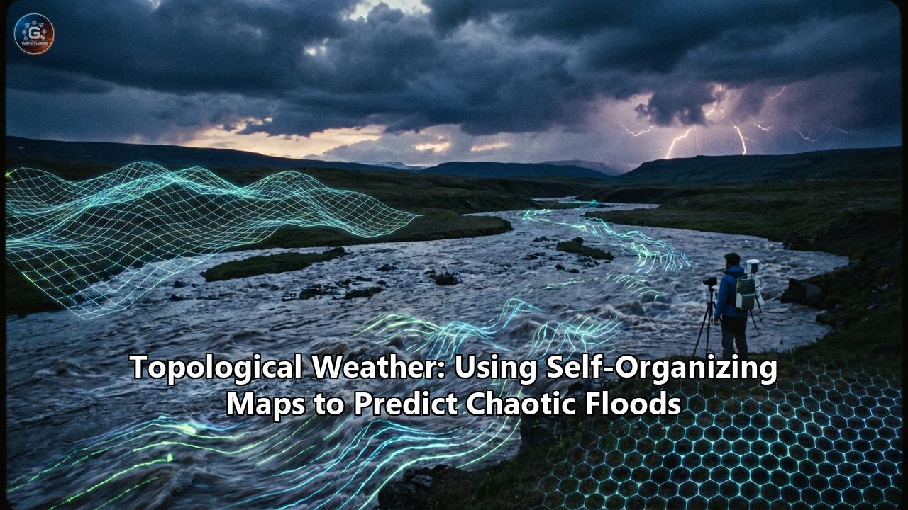
This architecture is known as the Self-Organizing Map (SOM). Imagine a flexible net thrown into a cloud of data points. As the network "learns," the net stretches, twists, and wraps itself around the data, taking on its shape. It creates a low-dimensional (usually 2D) map that preserves the topology of the high-dimensional data.
In the context of weather, an SOM takes the chaos of millions of atmospheric readings and organizes them into a visual "landscape" of weather patterns. On this map, similar weather days are grouped together. A sunny day with high pressure might live in the top-left corner; a humid, pre-storm atmosphere might live in the bottom-right. And crucially, the chaotic, rare conditions that lead to catastrophic flooding form distinct, recognizable clusters—often long before the rain starts falling.
The Mathematics of Topology: Finding the Shape of Rain
Topological Data Analysis (TDA) is based on the idea that data has shape, and that shape has meaning. When we apply SOMs to weather, we are essentially performing TDA. We are asking: "What is the geometric shape of a flash flood?"
The High-Dimensional Input
To build a Topological Weather model, meteorologists feed the SOM a vector containing variables such as:
- Geopotential Height: The pressure landscape of the upper atmosphere.
- Specific Humidity: The raw moisture available for precipitation.
- Zonal and Meridional Winds: The steering currents.
- Soil Saturation Indices: The ground's ability to absorb water.
- Topographic Gradients: The slope of the terrain.
A single data point might have 50 or 100 dimensions. To a human, or a linear regression model, this is noise. To an SOM, it is simply a coordinate in a space waiting to be mapped.
The Training Process: Competitive Learning
The SOM consists of a grid of "neurons," each holding a weight vector. During training, the network cycles through historical weather data. for every historical weather event, the neurons compete to see which one most closely resembles that event. The winner—called the Best Matching Unit (BMU)—gets to adjust its internal weights to look even more like that weather event. Crucially, the winner's neighbors on the grid also adjust their weights.
This neighborhood cooperation is the magic sauce. It ensures that topologically similar weather events end up close to each other on the map. Over thousands of iterations, the grid self-organizes. The result is a "Weather Topology Map" where the infinite chaos of the atmosphere is distilled into a finite set of archetypes.
Reading the Map: The Signature of Disaster
Once an SOM is trained, it offers a radical new way to forecast. Instead of running physics simulations, forecasters look at the trajectory of the current weather on the map.
The U-Matrix and Component Planes
The U-Matrix (Unified Distance Matrix) is the primary visualization tool. It uses color gradients to show the "distance" between neurons. Dark valleys might represent stable, common weather patterns, while high, light-colored ridges represent unstable transitions—the "tipping points" where weather shifts violently.
Component Planes break the map down by variable. By overlaying the "Humidity Plane" on top of the "Wind Shear Plane," forecasters can visually identify the specific regions on the map where dangerous ingredients overlap. A flood isn't just "a lot of rain"; topologically, it is a specific intersection of high moisture, low pressure, and specific wind vectors that occurs in a rare corner of the map.
Case Study: Typhoon Tracks in Taiwan
One of the most compelling applications of this technology comes from researchers in Taiwan, an island frequently battered by typhoons. Traditional models struggle to predict exactly how much rain a typhoon will dump on a specific watershed because the interaction between the typhoon's rotation and Taiwan's steep central mountain range is non-linear and chaotic.
Researchers employed an SOM to analyze historical typhoon tracks. The SOM clustered these tracks not just by their path, but by their "hydro-signature"—the specific combination of speed, angle of approach, and atmospheric pressure.
The Result: The SOM identified specific "clusters" of typhoon tracks that were historically associated with catastrophic flooding in specific reservoirs. By identifying which cluster an approaching typhoon belonged to days before landfall, the system could predict flood hydrographs (water level rise charts) with significantly higher accuracy than traditional methods. This allowed reservoir managers to release water early, creating capacity for the incoming deluge—a decision that saves lives.
Case Study: The Atmospheric Rivers of New England
In the Northeastern United States, flooding often comes from "Atmospheric Rivers"—long, narrow corridors of concentrated moisture transport. These events are notoriously difficult to forecast because they depend on synoptic-scale patterns thousands of miles away.
Researchers at Northeastern University utilized SOMs to aggregate nearly 50 years of weather data. The SOM revealed four distinct "land-atmosphere patterns" that act as precursors to flooding. While traditional models saw a messy mix of pressure systems, the SOM clearly separated the data into topological groups. It revealed that certain "silent" interactions between soil moisture and distant pressure anomalies were reliable predictors of floods, even when precipitation forecasts were ambiguous.
Hybrid Architectures: When Topology Meets Deep Learning
The cutting edge of this field is Hybrid Modeling. While SOMs are excellent at classification and pattern recognition, they are not designed for time-series prediction (predicting when the next step happens). To solve this, data scientists are coupling SOMs with Long Short-Term Memory (LSTM) networks.
In this architecture, the SOM acts as the "feature extractor." It simplifies the chaotic weather data into a topological state (e.g., "We are currently in State #42 on the map"). The LSTM then watches the sequence of these states. Instead of trying to learn the physics of fluid dynamics, the LSTM learns the "grammar" of the map. It learns that "State #42" is almost always followed by "State #15" (Heavy Rain) within 6 hours.
This combination reduces the computational cost of forecasting by orders of magnitude. Instead of a supercomputer crunching fluid equations, a trained Hybrid SOM-LSTM model can run on a standard server, providing real-time flood probabilities for thousands of specific locations simultaneously.
Infilling the Gaps: The Lake Chad Breakthrough
One of the greatest challenges in flood prediction, particularly in developing regions like the Lake Chad basin in Africa, is missing data. Weather stations break, sensors fail, and records are lost. Traditional models simply crash when fed incomplete data.
SOMs have a unique "healing" property. Because the map is topologically continuous, if a weather station reports 4 out of 5 variables, the SOM can find the neuron that best matches those 4 variables and "infill" the missing 5th variable based on the weights of that neuron. This capability has allowed hydrologists to reconstruct historical rainfall records in data-scarce regions, training flood prediction models where it was previously thought impossible.
The Future: Digital Twins and Edge Computing
As we move forward, Topological Weather is set to merge with Digital Twin technology. Cities are building virtual replicas of their sewer systems, river banks, and topography. An SOM running on the "Edge"—integrated into local IoT sensors—could monitor local weather topology in real-time.
Imagine a city where the storm drains themselves "know" the shape of a coming flood. Sensors detect a shift in the topological weather pattern that matches a known flood cluster. Before a drop of rain hits the ground, the system reroutes traffic, lowers reservoir levels, and sends targeted alerts to specific neighborhoods.
Conclusion: Respecting the Chaos
Topological Weather prediction represents a philosophical shift as much as a technological one. It acknowledges that we may never perfectly solve the differential equations of the atmosphere. But by using Self-Organizing Maps, we don't need to solve the chaos—we just need to recognize its face.
By mapping the topology of the sky, we are finding that even in the most turbulent storms, there is a structure, a geometry, and a predictability that was hidden from us only because we were looking at the numbers, rather than the shape.