The Celestial Compass: Unveiling the Secrets of Bronze Age Maritime Navigation
In an era long before the invention of the magnetic compass or the convenience of GPS, a revolutionary chapter in human history was being written on the vast, open canvases of the Mediterranean, the Aegean, and the Indian Ocean. During the Bronze Age, a period stretching roughly from 3300 to 1200 BCE, intrepid mariners from diverse civilizations embarked on daring voyages, transforming treacherous seas into bustling highways of trade, cultural exchange, and exploration. These ancient seafarers, aboard vessels constructed with remarkable ingenuity, were the unsung pioneers of globalization, connecting empires and cultures through a complex web of maritime routes. Their secret to conquering the seemingly boundless oceans lay not in a single instrument, but in a sophisticated understanding of the world around them, a deep knowledge passed down through generations. They navigated by the sun's daily journey, the predictable patterns of the stars, the rhythm of the waves, the direction of the winds, and the migratory paths of birds. This is the story of how Bronze Age mariners, through a combination of keen observation, astronomical knowledge, and raw courage, became the masters of the open sea.
The Dawn of Seafaring: A World Awash with Trade
The Bronze Age was a time of immense technological and social advancement, fueled by the demand for resources, particularly the copper and tin needed to create bronze. This demand spurred the establishment of extensive trade networks that crisscrossed continents and, most importantly, seas. Maritime travel became essential for the flourishing of great civilizations such as the Minoans in Crete, the Mycenaeans in mainland Greece, the Egyptians of the New Kingdom, and the Harappans of the Indus Valley. These cultures, separated by vast distances, were interconnected by the courage and skill of their sailors, who braved the open waters to transport not only metals and luxury goods but also ideas, technologies, and cultural influences.,
The discovery of the Uluburun shipwreck, a Late Bronze Age vessel found off the coast of Turkey, stands as a testament to the incredible scope of this maritime trade., Dating back to the late 14th century BCE, the ship's cargo was a microcosm of the ancient world's interconnectedness. It carried over ten tons of copper ingots from Cyprus, one ton of tin from as far as modern-day Afghanistan or Uzbekistan, and a dazzling array of finished goods from at least seven different cultures., These included Canaanite jars filled with resin, Egyptian ebony and ivory, Mycenaean pottery, and even a golden scarab bearing the name of the Egyptian queen Nefertiti., The presence of such a diverse cargo on a single vessel highlights the routine nature of long-distance sea travel and the sophisticated economic systems that were in place during the Bronze Age.
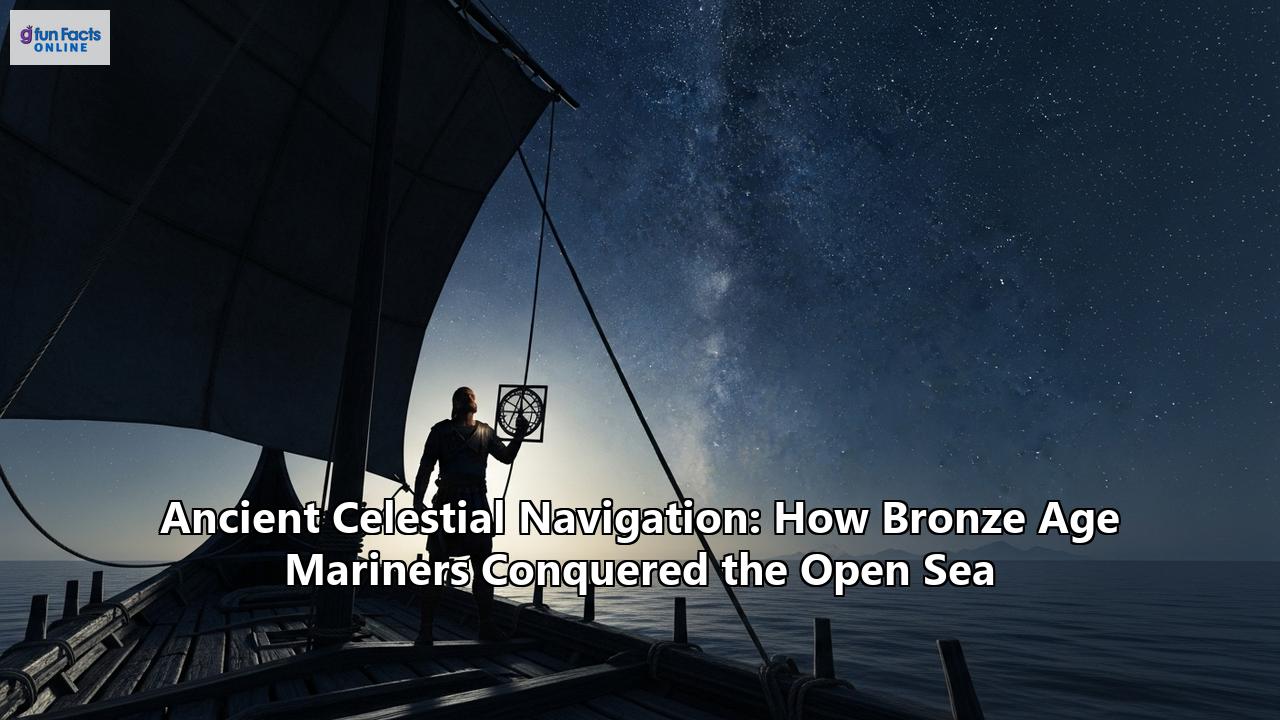
The Celestial Toolkit: Navigating by the Sun, Moon, and Stars
Without the aid of modern instruments, Bronze Age sailors turned to the heavens for guidance. Celestial navigation, the art of finding one's way by the sun, moon, and stars, was a fundamental skill for any mariner venturing out of sight of land. This was not a rudimentary practice but a highly developed system of knowledge that required years of observation and learning.
The Sun: The Daytime Compass
The sun was the most obvious and reliable guide during the day. Its predictable path across the sky from east to west provided a constant directional reference. Ancient navigators could have used simple "sun compasses," which may have been as basic as a vertical stick on a flat surface, to track the sun's shadow and determine direction. While no definitive archaeological evidence for a Bronze Age sun compass has been found, the concept is plausible given their understanding of solar movements. The Vikings, centuries later, were known to use a form of sun compass, and it is likely that earlier seafaring cultures possessed similar knowledge.
The Stars: The Night's Guiding Lights
As darkness fell, the celestial sphere transformed into a detailed map for the skilled navigator. In the Northern Hemisphere, the North Star, Polaris, served as a fixed point around which the other stars appeared to revolve. However, due to the precession of the Earth's axis, Polaris was not the pole star during the Bronze Age. Instead, a star called Thuban in the constellation Draco held that position. Knowing which constellations were circumpolar—never setting below the horizon—and their positions relative to the pole star was crucial for maintaining a steady course.
Ancient texts and archaeological findings suggest a deep-seated astronomical knowledge. Homer's Odyssey, which has roots in the Bronze Age, describes Odysseus navigating by keeping the constellation Ursa Major (the Great Bear) on his left. This indicates a practical application of celestial observation for directional guidance. The Nebra Sky Disc, a bronze artifact from Germany dating to around 1600 BCE, is adorned with gold symbols representing the sun, a crescent moon, and a cluster of stars identified as the Pleiades. While likely a ritual object, it demonstrates a sophisticated awareness of the cosmos that was undoubtedly shared by seafarers of the time.
The Minoans: Masters of the "Star Paths"
The Minoan civilization, which flourished on the island of Crete from approximately 2600 to 1100 BCE, is considered one of the earliest and most accomplished maritime powers of the Bronze Age. Their extensive trade network reached across the Aegean and into the Eastern Mediterranean, connecting them with Egypt and the Levant. Recent research suggests that the Minoans employed a sophisticated form of celestial navigation using what are termed "star paths."
This theory, proposed by skyscape archaeologist Alessandro Berio, posits that Minoan sailors navigated by aligning their course with the rising or setting of specific bright stars or linear constellations. Remarkably, the palaces of Crete, such as the grand palace at Knossos, appear to be oriented towards these same navigational stars. For instance, the axis of the palace at Knossos aligns with the rising of the star Spica in the constellation Virgo, which would have guided a ship directly to the important trading port of Sidon in modern-day Lebanon. This alignment of architecture with celestial navigation routes suggests a deep cultural and practical connection to the sea and the stars, where the palaces themselves may have served as symbolic and even practical extensions of these maritime highways. This knowledge would have been a closely guarded secret, a source of power and prestige for the Minoan elite who controlled these vital trade routes.
The Mycenaeans: Inheritors of the Sea Lanes
On the Greek mainland, the Mycenaeans rose to prominence, eventually supplanting the Minoans as the dominant power in the Aegean. Initially, their maritime ventures were likely limited by Minoan control of the seas, but by the 14th century BCE, they had inherited and expanded upon the Minoan trade routes. Mycenaean pottery and other goods have been found throughout the Mediterranean, from Cyprus and the Levant to Italy and Sardinia, a clear indication of their extensive seafaring activities.
Like the Minoans, the Mycenaeans would have relied heavily on celestial navigation. Their ships, which included oared galleys designed for speed and warfare, would have been crewed by experienced sailors who understood the patterns of the stars. While direct evidence of their specific navigational techniques is scarce, the sheer scale of their maritime network implies a sophisticated understanding of open-sea navigation. The epic poems of Homer, which recount the tales of Mycenaean heroes, are filled with references to seafaring and the importance of the stars for guidance, offering a literary window into their maritime world.
The Egyptians: Navigating the Nile and Beyond
Ancient Egypt's primary artery was the Nile River, and for millennia, they perfected the art of riverine navigation. However, the Egyptians of the New Kingdom (c. 1550-1070 BCE) were also accomplished seafarers who embarked on ambitious expeditions into the Mediterranean and the Red Sea. Reliefs from the temple of Queen Hatshepsut at Deir el-Bahri depict a large-scale trading expedition to the land of Punt, a resource-rich region believed to be located in the Horn of Africa. These voyages required not only sturdy, seaworthy vessels but also skilled navigators capable of traversing the open waters of the Red Sea.
Egyptian astronomical knowledge was highly advanced, primarily for religious and calendrical purposes. Temple alignments were carefully calculated to correspond with celestial events, and their understanding of the stars was detailed in texts and on tomb ceilings. It is highly probable that this astronomical knowledge was also applied to maritime navigation. Egyptian sailors would have used their understanding of the stars to guide their ships, particularly on multi-day voyages where the coastline was not visible.
The Indus Valley Civilization: Riding the Monsoon Winds
In the east, the Indus Valley Civilization (also known as the Harappan Civilization) flourished from around 3300 to 1300 BCE. They engaged in extensive maritime trade with Mesopotamia, with Harappan seals and goods found in ancient Sumerian cities. These long-distance voyages across the Arabian Sea were made possible by a deep understanding of the monsoon winds. These seasonal winds, which reverse direction twice a year, provided a reliable means of propulsion for their ships.
Harappan seals depicting ships with masts and sails, along with terracotta models of boats, provide archaeological evidence of their maritime capabilities. While their knowledge of celestial navigation is not as well-documented as that of the Mediterranean cultures, it is almost certain that they would have used the stars for guidance on their long journeys to Mesopotamia. The combination of harnessing the power of the monsoon winds and navigating by the stars would have made the Harappans formidable long-distance traders.
Beyond the Stars: A Multi-Sensory Approach to Navigation
While celestial navigation was paramount, Bronze Age mariners employed a whole suite of other techniques, drawing on their intimate knowledge of the natural world. This multi-sensory approach to navigation provided a crucial backup when the skies were overcast or when sailing in unfamiliar waters.
Reading the Waves and Swells
The open ocean is not a featureless expanse to the trained eye. The patterns of waves and swells can reveal the direction of the wind and even the presence of distant land. Polynesian navigators, much later, were masters of interpreting these subtle cues, and it is likely that Bronze Age sailors possessed similar skills. A consistent swell pattern could indicate a steady trade wind, providing a directional guide even on cloudy days. As swells approach land, they change shape and often break, signaling the proximity of a coastline or hidden reefs.
Following the Birds
The migratory patterns of birds provided another natural compass for ancient seafarers. The regular, seasonal flights of certain species could indicate the direction of land. Polynesian and Viking sailors are known to have used this method, and it is plausible that Bronze Age mariners did as well. Some may have even carried "shore-sighting" birds on their voyages, releasing them to see which direction they flew, a living compass pointing the way to the nearest landmass.
The Vessels of the Bronze Age: Built for the Open Sea
The navigational skills of Bronze Age mariners would have been useless without vessels capable of withstanding the rigors of the open ocean. Ship construction during this period was a sophisticated craft, with different cultures developing designs suited to their specific needs. Early Aegean vessels were often long and narrow, propelled by paddles. Over time, the oar, which was more efficient, became the primary means of propulsion, and the sail was introduced, revolutionizing seafaring.
Archaeological finds and iconography reveal a variety of ship types. The Minoans and Mycenaeans built ships with high, curved prows and sterns, powered by both oars and a single square sail. Egyptian seagoing ships were characterized by a lack of a keel, instead using a "hogging truss"—a massive cable that ran from stem to stern to provide structural support. The Uluburun shipwreck itself was constructed of Lebanese cedar using the mortise-and-tenon joint technique, a testament to the advanced shipbuilding skills of the time.
Experimental archaeology has provided invaluable insights into the capabilities of these ancient vessels. The reconstruction of the "Magan Boat," a Bronze Age ship from the Persian Gulf region, demonstrated that these vessels were highly seaworthy and capable of carrying significant cargo over long distances. Similarly, the "Morgawr" project, which reconstructed a Bronze Age sewn-plank boat from Britain, has shed light on the construction techniques and potential performance of these early ships. These experiments have shown that, far from being primitive, Bronze Age ships were sophisticated machines, perfectly adapted to the challenges of the open sea.
The End of an Era: The Bronze Age Collapse and the Legacy of the Ancient Mariners
Around 1200 BCE, the vibrant and interconnected world of the Bronze Age Mediterranean experienced a rapid and widespread collapse. The great palatial centers of the Mycenaeans were destroyed, trade routes were disrupted, and the intricate network of maritime connections that had defined the era unraveled. The reasons for this collapse are still debated by historians, with theories ranging from climate change and foreign invasions (by the so-called "Sea Peoples") to internal strife and systemic failure.
Whatever the cause, the end of the Bronze Age brought about a "dark age" in many parts of the Mediterranean, and with it, a likely decline in the sophisticated navigational knowledge that had been cultivated for centuries. However, the legacy of these Bronze Age mariners endured. Their pioneering voyages laid the foundation for the maritime traditions of the Phoenicians, the Greeks, and the Romans. The knowledge of celestial navigation, shipbuilding, and the rhythms of the sea was not entirely lost but was instead passed down and built upon by subsequent generations of seafarers.
The story of the Bronze Age mariners is a powerful reminder of human ingenuity and our enduring quest to explore and connect with the world around us. In a time without the technological crutches we rely on today, they learned to read the language of the sky, the sea, and the wind. They were the original masters of celestial navigation, and their voyages not only shaped the course of ancient history but also left an indelible mark on the human spirit of discovery.
Reference:
- https://www.worldhistory.org/Uluburun_Shipwreck/
- https://oxfordre.com/classics/display/10.1093/acrefore/9780199381135.001.0001/acrefore-9780199381135-e-8688?d=%2F10.1093%2Facrefore%2F9780199381135.001.0001%2Facrefore-9780199381135-e-8688&p=emailA8BKldQ2icFa6
- https://en.wikipedia.org/wiki/Uluburun_shipwreck
- https://www.google.com/search?q=time+in+Tikrit,+IQ
- https://www.ancient-origins.net/artifacts-other-artifacts/uluburun-shipwrecks-001962
- https://nauticalarch.org/projects/uluburun-late-bronze-age-shipwreck-excavation/
- https://bushcraftbuddy.com/ancient-navigation-methods-before-electricity/
- https://www.skyatnightmagazine.com/space-science/sailors-stars-navigate-sea
- https://nuttersworld.com/bronze-iron-age-shipbuilding-mediterranean/1600-1200BC/
- https://astroedu.iau.org/en/activities/navigation-in-the-ancient-mediterranean-and-beyond/
- https://www.donsmaps.com/skydisc.html
- https://psyche.co/ideas/bronze-age-people-looked-to-the-skyscape-to-navigate-their-lives
- https://popular-archaeology.com/article/ancient-european-wayfinders-the-minoans-who-sailed-by-the-stars/
- https://knossos-palace.gr/minoan-economy-trade-routes/
- https://arkeonews.net/minoan-civilization-may-have-used-celestial-navigation-techniques/
- https://www.heritagedaily.com/2023/03/minoan-civilisation-may-have-used-celestial-star-path-navigation-techniques/146340
- https://www.cambridge.org/core/books/abs/maritime-networks-in-the-mycenaean-world/mycenaeans-and-the-sea/B79D575798E0E23F18400D316E7C1943
- https://europe.factsanddetails.com/article/entry-917.html
- https://library.fiveable.me/greek-archaeology/unit-6/mycenaean-society-economy/study-guide/yScQAhDDW80Lamtt
- https://medium.com/the-bronze-age/the-bronze-age-ancestry-of-ancient-sailing-vessels-ffa9b7effd17
- https://africame.factsanddetails.com/article/entry-1196.html
- https://rsc.byu.edu/bible-readers-history-ancient-world/egypts-new-kingdom
- https://www.ancientportsantiques.com/wp-content/uploads/Documents/ETUDESarchivees/Navires/Min%20of%20the%20Desert/Min-Ward2021.pdf
- https://www.penn.museum/sites/expedition/egyptians-and-libyans-in-the-new-kingdom/
- https://www.khanacademy.org/humanities/world-history/world-history-beginnings/ancient-india/a/the-indus-river-valley-civilizations
- https://www.harappa.com/answers/was-trade-relationship-between-harappans-and-mesopotamians-direct-one
- https://courses.lumenlearning.com/suny-hccc-worldcivilization/chapter/harappan-culture/
- https://www.penn.museum/sites/expedition/shipping-and-maritime-trade-of-the-indus-people/
- https://stanwicklakes.org.uk/big-bronze-age-boat-build-launch/
- https://www.iflscience.com/4000-year-old-bronze-age-boat-replica-taken-for-93-kilometer-sailing-trip-75268
- https://www.goodnewsnetwork.org/this-bronze-age-ship-replica-made-from-reeds-and-goat-hair-just-sailed-50-nautical-miles/
- https://the-past.com/shorts/the-picture-desk/building-a-bronze-age-boat/
- https://www.newsweek.com/bronze-age-boat-sails-replica-made-using-4000-year-old-shopping-list-1924614
- https://the-past.com/feature/building-morgawr-seafaring-bronze-age-style/