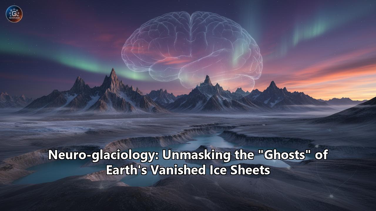
Neuro-glaciology: Unmasking the "Ghosts" of Earth's Vanished Ice Sheets
An invisible world, etched into the very fabric of our planet, tells a story of immense power and dramatic transformation. It's a world of colossal ice sheets, long vanished, that once held continents in their frozen grasp. These titans of the Cryosphere are gone, but they have left behind a trail of clues, a ghostly fingerprint on the landscape that scientists are now learning to read with unprecedented clarity. This is the realm of neuro-glaciology, a pioneering field where the fusion of artificial intelligence and Earth science is unmasking the "ghosts" of Earth's vanished ice sheets, revealing the secrets of our planet's deep past and providing a crucial lens through which to view its future.
For centuries, the signs of these ancient ice giants have been hiding in plain sight. The rolling hills of Ireland, the Great Lakes of North America, the fjords of Norway—all are monuments to the sculpting power of ice. But understanding the full scope of these past glaciations, the sheer scale and dynamic behavior of these departed ice sheets, has been a monumental challenge. Traditional methods of mapping and modeling, while foundational, are often painstaking and limited in scope. Now, the burgeoning field of neuro-glaciology is offering a quantum leap forward. By harnessing the power of artificial neural networks, a form of machine learning, scientists are beginning to automate the analysis of vast datasets, to see patterns that were once invisible, and to reconstruct the epic history of our planet's ice ages with breathtaking detail.
This is more than an academic exercise. The ghosts of past ice sheets hold the key to understanding how our planet responds to climatic shifts. As our own world warms at an alarming rate, the lessons learned from these ancient ice masses are becoming increasingly urgent. How quickly can ice sheets collapse? What are the tipping points that, once crossed, lead to irreversible melting? By training artificial intelligence on the rich geological record of past climate change, we can build more robust models to predict the future of our remaining ice sheets in Greenland and Antarctica, and in doing so, better prepare for the sea-level rise that will inevitably follow.
This article will embark on a journey into the heart of neuro-glaciology. We will first explore the "ghosts" themselves—the stunning variety of landforms that bear witness to the passage of ancient ice. Then, we will delve into the revolutionary techniques of neuro-glaciology, examining how artificial intelligence is being taught to see and interpret these ghostly signatures. Finally, we will look at how this new understanding is not just rewriting the history books, but also providing a critical tool for navigating the climatic challenges of the 21st century and beyond.
The Spectral Signatures: Reading the Landscape of a Vanished World
Before we can unmask the ghosts of vanished ice sheets, we must first learn to see them. These are not ethereal spirits in the conventional sense, but tangible, physical imprints left on the Earth's surface by the colossal weight and movement of ice. Glacial geomorphology, the study of these landforms, is akin to forensic science, where every hill, valley, and scratch on a rock is a piece of evidence in a global-scale investigation. These features are broadly categorized into two types: erosional, formed by the removal of material, and depositional, created by the sediment left behind when a glacier melts.
The Erosional Scars of a Frozen Behemoth
The sheer power of a moving glacier, a river of ice often kilometers thick, is a force of geologic transformation. As they grind across the landscape, they pluck, scrape, and sculpt the very bedrock, leaving behind a suite of distinctive erosional landforms.
One of the most iconic of these is the U-shaped valley. Unlike the V-shaped valleys carved by rivers, glaciers are wide and erode not just their base but also their sides, creating a broad, flat-bottomed trough with steep walls. The majestic Yosemite Valley in California and the dramatic fjords of Norway are classic examples, their grandeur a direct consequence of glacial sculpting.
On a smaller scale, the passage of a glacier leaves behind more intimate clues. Glacial striations, long, parallel grooves etched into bedrock, are formed by rocks and debris embedded in the base of the ice acting like the teeth of a giant file. The direction of these striations provides a clear indication of the direction of past ice flow. When the grit within the ice is finer, it can polish the bedrock to a smooth, reflective surface known as glacial polish.
In mountainous regions, the erosive power of glaciers creates a unique and dramatic topography. Cirques, or corries, are bowl-shaped hollows excavated at the head of a glacial valley, often cradling a small lake, or tarn, after the ice has melted. Where two cirques erode back-to-back, they can form a sharp, knife-like ridge called an arête. And when several cirques eat into a single mountain from multiple sides, they can carve a sharp, pyramidal peak known as a horn, the Matterhorn in the Alps being a prime example.
The Depositional Ghosts: A Trail of Frozen Debris
As glaciers melt and retreat, they release an enormous amount of rock and sediment that they have been carrying, often for vast distances. This material, known as glacial till, is a chaotic mixture of clay, sand, gravel, and boulders, and it forms a variety of depositional landforms that are just as informative as their erosional counterparts.
Moraines are perhaps the most common depositional feature. These are ridges of till deposited at the edges of a glacier. A terminal moraine marks the furthest extent of a glacier's advance, a kind of frozen high-water mark. Lateral moraines form along the sides of a valley glacier, while a medial moraine is a dark stripe of debris down the center of a glacier, formed where two glaciers merge.The landscape of a retreating ice sheet is often dotted with other fascinating features. Drumlins are elongated, teardrop-shaped hills of glacial till, with their tapered end pointing in the direction of ice flow. They often occur in large groups, known as drumlin fields, creating a distinctive "basket of eggs" topography.
Water, too, plays a crucial role in shaping the post-glacial landscape. As a glacier melts, vast quantities of meltwater flow in tunnels within, under, and on top of the ice. These subglacial and englacial streams carry sediment with them. When the ice melts away, the sediment that filled these tunnels is left behind as long, sinuous ridges called eskers. These can snake across the landscape for many kilometers, tracing the path of a long-vanished subglacial river.
Other meltwater features include kames, which are irregularly shaped mounds of sand and gravel that form in depressions on the surface of a melting glacier, and kettle lakes, which are formed when a large block of ice is left behind by a retreating glacier, becomes buried in sediment, and then melts, leaving a depression that fills with water.
These are just some of the "ghosts" that ancient ice sheets have left behind. For a glacial geomorphologist, a landscape is a text, and these features are the letters, words, and sentences that tell the story of a very different Earth. By mapping these landforms, scientists can begin to reconstruct the extent, thickness, and even the flow patterns of these vanished ice masses. But the sheer scale of the task is daunting. The Laurentide Ice Sheet, for example, once covered most of Canada and a large portion of the northern United States. Manually mapping the ghostly traces of such a behemoth across millions of square kilometers is a Herculean task. This is where the new science of neuro-glaciology comes in.
The Rise of the Machine: Neuro-glaciology and the Artificial Mind
The term "neuro-glaciology" might conjure images of scientists hooking up electrodes to glaciers, but the reality, while less sci-fi, is no less revolutionary. Coined in the mid-2000s, the term refers to the application of artificial neural networks to solve complex problems in glaciology. The "neuro" in this context is not biological, but computational. It refers to a type of artificial intelligence that is inspired by the structure and function of the human brain.
Just as our brains consist of interconnected neurons that learn from experience, artificial neural networks (ANNs) are made up of layers of interconnected "nodes" that can be trained on vast amounts of data to recognize patterns and make predictions. This ability to learn from data is what makes them so powerful.
The application of ANNs and other machine learning techniques to glaciology is a game-changer, particularly in the study of paleo-ice sheets. The "ghosts" of these ice sheets are often subtle, spread over vast areas, and buried under vegetation or newer sediments. Manual mapping of these features is not only slow and laborious but also subjective, with different scientists potentially interpreting the same landscape in different ways.
Neuro-glaciology offers a way to overcome these challenges. By training a neural network on large datasets of satellite imagery, digital elevation models (DEMs), and other remote sensing data, scientists can automate the process of identifying and mapping glacial landforms with remarkable speed and accuracy.
Training the Digital Geomorphologist
The process of teaching a machine to see glacial landforms is not unlike teaching a human. It starts with providing the AI with a large number of examples. Scientists will manually map a region, identifying all the moraines, drumlins, eskers, and other features. This manually mapped data is then used to train a neural network.
A common type of neural network used for this purpose is the Convolutional Neural Network (CNN). CNNs are particularly well-suited for image analysis because they can recognize spatial hierarchies of features. For example, a CNN might first learn to identify simple features like lines and curves. Then, in subsequent layers, it can learn to combine these simple features into more complex shapes, like the distinctive crest of a moraine or the elongated form of a drumlin.
Researchers are now developing sophisticated CNN-based models specifically for glacial geomorphology. For instance, the MorNet model is the first deep learning model designed to automatically map glacial moraines from multi-source remote sensing data. It combines topographic data, multispectral satellite imagery, and radar data to identify moraines with a high degree of accuracy. The use of multiple data sources allows the model to leverage the strengths of each, improving its overall performance.
Other AI models, like ResNet and U-Net, are also being used to classify a variety of glacial and fluvioglacial landforms from DEMs. These models can achieve accuracy scores of over 80%, providing a fast, objective, and reproducible tool for geomorphological analysis over vast areas.
The ultimate goal of projects like PaleoAIce is to develop a fully AI-driven protocol for automated paleo-glaciological reconstructions at the scale of an entire ice sheet. By training deep learning models on annotated datasets of thousands of landforms, these projects aim to not only map the features but also to infer key glaciological parameters like ice thickness and flow velocity.
Seeing Through the Ice: Reconstructing the Subglacial World
Beyond mapping the surface features, neuro-glaciology is also being used to peer beneath the ice of existing glaciers, and by extension, to estimate the thickness of vanished ones. A key parameter in any ice sheet model is the topography of the bedrock beneath the ice. This is often difficult and expensive to measure directly, typically requiring airborne radar surveys.
Here again, neural networks offer a powerful solution. Scientists can train an ANN on the data from areas where the subglacial topography is known. The network learns the complex relationships between the surface topography of the glacier and the shape of the bedrock beneath it. Once trained, the ANN can then be used to estimate the subglacial topography and ice thickness in areas where it has not been measured.
This approach is based on a key geomorphic premise: that glaciers exist in highly glaciated landscapes, and the ice-free areas surrounding them were likely once covered in ice. Therefore, the topography of these ice-free areas can be used to train the neural network to predict the topography hidden beneath the ice.
Researchers are developing increasingly sophisticated deep learning models for this purpose. The Coordinate-Attentive Dense Glacier Ice Thickness Estimate Model (CADGITE), for example, is a CNN-based model that uses surface velocity, slope, and other parameters to estimate ice thickness. When tested against ground-penetrating radar measurements in the Swiss Alps, CADGITE outperformed traditional physics-based models.
Modeling the Unseen: From Ghosts to Dynamic Reconstructions
Perhaps the most exciting frontier in neuro-glaciology is its application to modeling the behavior of ice sheets over long timescales. Traditional ice sheet models are based on the physics of ice flow. While powerful, these models are computationally very expensive, making it difficult to run simulations over the long timescales of glacial cycles (tens of thousands of years).
Machine learning offers a way to dramatically speed up these simulations. The Instructed Glacier Model (IGM) is a prime example of this new approach. The IGM uses a deep-learning emulator that has been trained on the results of state-of-the-art, physics-based ice flow models. This allows the IGM to simulate ice flow thousands of times faster than traditional models, with only a minor loss in accuracy.
This incredible speed-up opens up new possibilities for paleo-ice sheet modeling. Scientists can now run a large number of simulations to explore how different climatic conditions might have affected the growth and decay of past ice sheets. They can use the ghostly landforms left behind as "ground truth" to test and calibrate their models. For example, a model might be tasked with finding the climate conditions that would cause a simulated glacier to advance to the position of a known terminal moraine.
This fusion of paleoclimate data, geomorphological evidence, and AI-powered modeling is creating a powerful new toolkit for understanding the Earth's climate system. By training neural networks on the rich record of past climate change, we can create models that are better able to capture the complex, non-linear feedbacks that govern ice sheet behavior, including rapid collapse events.
Case Studies from the Cryosphere: Neuro-glaciology in Action
The theoretical promise of neuro-glaciology is now being realized in a growing number of studies around the world. From the vast remnants of the Laurentide Ice Sheet to the rapidly changing glaciers of the Himalayas, AI is providing new insights into the past, present, and future of the Earth's frozen realms.
Reawakening the Laurentide Giant
The Laurentide Ice Sheet was one of the giants of the last ice age. At its peak, it covered a vast expanse of North America, from the Arctic Ocean to what is now the northern United States. Its legacy is written across the landscape in the form of the Great Lakes, the countless smaller lakes of the Canadian Shield, and vast fields of drumlins and moraines.
Reconstructing the history of such a colossal and long-vanished ice sheet is a monumental task. The geomorphological evidence is spread over millions of square kilometers, and the ice sheet itself was a complex entity, with multiple domes and shifting ice divides.
This is where neuro-glaciology is set to make a major contribution. Projects like PaleoAIce are using deep learning to automate the mapping of glacial landforms across the former extent of the Laurentide Ice Sheet. By feeding high-resolution satellite imagery and DEMs into trained CNNs, scientists can create comprehensive maps of features like mega-scale glacial lineations, which indicate the direction of fast-flowing ice streams.
These AI-generated maps of the "ghosts" of the Laurentide Ice Sheet can then be used to constrain and validate numerical ice sheet models. For example, the IGM, with its machine-learning-accelerated simulations, can be used to test different hypotheses about the climate conditions that led to the growth and eventual collapse of the Laurentide Ice Sheet. By comparing the output of the model to the mapped landforms, scientists can refine their understanding of how this ancient ice giant responded to past climate change.
The demise of the Laurentide Ice Sheet had a profound impact on the global climate system. The massive influx of freshwater from the melting ice into the North Atlantic is thought to have disrupted ocean circulation, triggering the Younger Dryas cold period, a brief but intense return to glacial conditions around 12,900 to 11,700 years ago. A more detailed understanding of the collapse of the Laurentide Ice Sheet, aided by the tools of neuro-glaciology, can therefore provide crucial insights into the potential for similar feedback loops in our modern, warming world.
The Himalayan Watchtowers: AI on the Roof of the World
The glaciers of the Himalayas, often referred to as the "Third Pole," are a critical source of water for hundreds of millions of people. These glaciers are also among the most rapidly melting in the world. Understanding their past behavior and predicting their future is a matter of profound importance for water security and hazard assessment in the region.
Neuro-glaciology is playing an increasingly important role in this effort. The rugged and remote terrain of the Himalayas makes traditional fieldwork difficult and dangerous. Remote sensing, combined with AI, offers a powerful alternative.
Deep convolutional neural networks are being used to automatically map glacial lakes across the Himalayas from multisource remote sensing data. Glacial lakes are an important indicator of glacier retreat and can also pose a significant hazard in the form of Glacial Lake Outburst Floods (GLOFs). Automated mapping allows scientists to monitor the growth of these lakes over time and identify those that are at highest risk of bursting.
Similarly, AI is being used to map moraines and other glacial landforms in the high valleys of the Himalayas. These features provide a record of past glacier advances and retreats, which can be used to reconstruct the region's climate history. By understanding how Himalayan glaciers have responded to past climate fluctuations, scientists can better predict their response to future warming.
Machine learning is also being used to tackle the challenging problem of mapping debris-covered glaciers, which are common in the Himalayas. The layer of rock and sediment on these glaciers can make them difficult to identify in satellite imagery. AI models, however, can be trained to recognize the subtle textural and spectral signatures of debris-covered ice, allowing for more accurate assessments of the total ice volume in the region.
Surging Sentinels: Tracking Glacial Catastrophes in Svalbard
Not all glaciers retreat in a slow and steady manner. Some, known as surging glaciers, can experience periods of dramatic and rapid advance, moving up to 100 times their normal speed. These surges can be catastrophic, leading to the sudden release of large volumes of ice into the ocean.
Understanding the mechanics of glacier surges is a key challenge in glaciology. Neuro-glaciology is providing new tools to tackle this problem. In a recent study of the Negribreen Glacier System in Svalbard, researchers used a combination of a physically-constrained neural network and a CNN (a system called VarioCNN) to classify different types of crevasses from high-resolution satellite imagery.
Crevasses are fractures in the ice that provide a window into the forces acting within a glacier. Different patterns of crevasses are associated with different types of ice flow. By teaching an AI to recognize these patterns, the researchers were able to map the structural evolution of the glacier surge in unprecedented detail. This provides a powerful new way to study the dynamic processes that drive these enigmatic events.
The Future of Ice: What the Ghosts Can Teach Us
The unmasking of the "ghosts" of Earth's vanished ice sheets is more than a journey into the deep past; it is a critical expedition to understand our planet's future. The lessons written in the glacial landscapes of our world, and now being deciphered with the help of artificial intelligence, are of profound relevance to the challenges of our time.
The research into paleo-ice sheets reveals a planet that is far more sensitive to climate change than was previously understood. The discovery of plant fossils beneath a mile of ice in Greenland, for example, indicates that the Greenland Ice Sheet has vanished in the geologically recent past, during warm periods not unlike the one we are now creating. This suggests that our current ice sheets may be more vulnerable to collapse than our models have previously predicted.
Neuro-glaciology provides a pathway to improving these predictions. By training our AI models on the rich dataset of past climate change, we can create more robust and realistic simulations of future ice sheet behavior. The ability of machine learning to identify complex, non-linear relationships in data is particularly valuable in this regard, as it can help us to better understand the "tipping points" in the climate system—thresholds beyond which small changes can trigger large and potentially irreversible responses, like the runaway collapse of an ice sheet.
The accelerated modeling capabilities offered by tools like the IGM are also a major step forward. The ability to run thousands of simulations in the time it once took to run a handful allows scientists to more thoroughly explore the uncertainties in their predictions and to better quantify the risks associated with different emissions scenarios.
Moreover, the automated mapping capabilities of neuro-glaciology are not just limited to the study of past ice sheets. They are also being used to monitor the health of our current glaciers in real-time. From tracking the calving of giant icebergs from the Antarctic Ice Sheet to monitoring the expansion of glacial lakes in the Andes, AI is providing a constant stream of data that is essential for both scientific understanding and practical hazard management.
Conclusion: A New Vision for a Changing Planet
We live on a planet haunted by the ghosts of its past. These are not malevolent spirits, but silent storytellers, their narratives etched in the very bones of the Earth. For centuries, we have walked among them, marveling at their handiwork but only partially comprehending their message. Now, in the confluence of glaciology and artificial intelligence, we have found a new way to listen.
Neuro-glaciology is giving us the tools to unmask these ghosts, to translate their language of moraines and eskers into the precise language of data and models. It is allowing us to reconstruct the lost worlds of the ice ages with a level of detail that was once unimaginable, and in doing so, to better understand the powerful forces that have shaped our planet.
This new vision of the past is also a guide to the future. The ghosts of the vanished ice sheets are a stark reminder of the profound and sometimes rapid changes that our climate system is capable of. They are a warning, written in stone and sediment, of the potential consequences of a warming world.
But they are also a source of hope. By learning the lessons that these ancient ice giants have to teach us, and by harnessing the power of our most advanced technologies to do so, we can gain the foresight needed to navigate the challenges ahead. The journey into the world of neuro-glaciology is just beginning, but it promises to be one of the most important scientific quests of our time—a quest to understand the ghosts of our planet, and in doing so, to secure its future.
Reference:
- https://www.fundaciomarcelchevalier.org/images/docs/B5860291-B89D-4443-B6EA-6C5C06EEAD8C.pdf
- https://www.mdpi.com/2073-4441/16/16/2272
- https://www.tandfonline.com/doi/full/10.1080/10095020.2023.2292587
- https://www.youtube.com/watch?v=cp_B9ynDYWk
- https://news.climate.columbia.edu/2022/03/25/machine-learning-techniques-can-speed-up-glacier-modeling-by-a-thousand-times/
- https://www.preventionweb.net/publication/documents-and-publications/automated-mapping-glacial-lakes-himachal-pradesh-using-multi
- https://www.researchgate.net/publication/384426466_Classification_of_glacial_and_fluvioglacial_landforms_by_Convolutional_Neural_Networks_using_a_Digital_Elevation_Model
- https://www.youtube.com/watch?v=qwEJsAmLz5A
- https://journals.ametsoc.org/view/journals/clim/22/8/2008jcli2572.1.xml
- https://www.mdpi.com/2076-3263/15/7/242
- https://wp.unil.ch/ice/research/glacier-modelling/
- https://www.researchgate.net/publication/365269723_Automated_mapping_of_glacial_lakes_using_multisource_remote_sensing_data_and_deep_convolutional_neural_network
- https://www.researchgate.net/publication/377933062_Combining_Deep_Learning_and_Physically_Constrained_Neural_Networks_to_Derive_Complex_Glaciological_Change_Processes_from_Modern_High-Resolution_Satellite_Imagery_Application_of_the_GEOCLASS-image_Syst