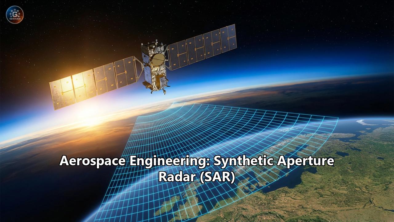
The clouds hung low over the Amazon basin, a thick, impenetrable blanket of white that had frustrated optical satellites for decades. Beneath the canopy, illegal logging operations moved with impunity, shielded by the persistent tropical cloud cover and the cloak of night. But in orbit, 500 kilometers above, a new generation of mechanical eyes was watching. They didn't need sunlight; they didn't care about clouds. They carried their own illumination, firing pulses of microwave energy that pierced the vapor, bounced off the machinery hidden below, and returned to space with a story encoded in phase and amplitude.
This is the world of Synthetic Aperture Radar (SAR), perhaps the most complex and powerful remote sensing technology ever devised by aerospace engineering. It is a discipline where physics, signal processing, and orbital mechanics collide to perform a magic trick: synthesizing an antenna miles wide from a spacecraft the size of a washing machine.
Part I: The Physics of the Invisible
To understand SAR, one must first discard the intuition of the human eye. Optical cameras are passive; they rely on the sun to illuminate a target. If it is dark, they are blind. If there are clouds, they see only the tops of the cotton balls. Radar is active. It brings its own flashlight—a flashlight that emits radiation in the microwave portion of the electromagnetic spectrum.
But a standard radar, like those used at airports to track planes, faces a fundamental limit of physics known as the diffraction limit. The resolution of a radar system—its ability to distinguish two objects on the ground—is directly proportional to the size of its antenna. To get a resolution of 1 meter from space using standard radar physics, you would need an antenna several kilometers long. Launching a structure the size of the Golden Gate Bridge into orbit is an impossibility of aerospace engineering.
In 1951, a mathematician named Carl Wiley at Goodyear Aircraft Company had a revelation. He realized that a moving radar platform (like a satellite or airplane) essentially occupies every point along its flight path sequentially. If you could record the radar echoes received at each of those points and mathematically stitch them together, you could simulate an antenna as long as the distance the aircraft flew while the target was in view. You weren't building a physical aperture; you were building a synthetic one.
The Doppler Symphony
The engine that drives this synthesis is the Doppler effect. As a satellite approaches a target on the ground, the reflected radar pulses return at a slightly higher frequency (blue shift). As it passes overhead and moves away, the frequency drops (red shift).
Every single point on the Earth's surface generates a unique "Doppler history" as the satellite flies over. A building slightly ahead of the satellite has a different Doppler shift than a tree slightly behind it. By processing these frequency shifts with immense computational power, SAR systems can pinpoint the location of an object along the flight path (azimuth) with exquisite precision. The result is a two-dimensional image where one dimension is determined by the time it takes the pulse to return (Range) and the other by the Doppler shift (Azimuth).
Part II: The Electromagnetic Palette
In optical photography, we speak of colors—red, green, blue. In SAR, we speak of Bands. The wavelength of the microwave pulse determines what the radar "sees." Choosing the right band is the first critical decision in aerospace mission design.
X-Band (2.4 – 3.75 cm wavelength)
The Precision Artist.X-Band pulses are short and bounce off small details. They interact with the leaves of trees, the shingles of roofs, and the choppy waves of the ocean.
- Aerospace Application: Urban monitoring and high-resolution surveillance. X-Band is the frequency of choice for commercial spy satellites and precise engineering monitoring. It can detect if a bridge has shifted by a few millimeters or identify the type of vehicle parked in a lot.
- Key Players: TerraSAR-X (Germany), COSMO-SkyMed (Italy), ICEYE (Finland/US).
C-Band (3.75 – 7.5 cm wavelength)
The Global Workhorse.C-Band sits in the "Goldilocks" zone. It offers a balance between resolution and coverage. It can penetrate loose topsoil and light vegetation but is still sensitive enough to map ice and ocean roughness.
- Aerospace Application: Global monitoring. It is the standard for European Space Agency (ESA) missions, monitoring sea ice extent, oil spills, and agricultural shifts.
- Key Players: Sentinel-1 (EU/ESA), RADARSAT (Canada).
L-Band (15 – 30 cm wavelength)
The Penetrator.L-Band waves are long enough to ignore the leaves on a tree. They pass right through the canopy and bounce off the sturdy branches and trunks, or even the ground beneath.
- Aerospace Application: Biomass estimation and flood detection. If a forest is flooded, X-band sees only trees. L-band sees the "double bounce" of energy hitting the water, then the tree trunk, and returning to the sensor, lighting up flooded forests like neon signs. It is also crucial for measuring soil moisture.
- Key Players: ALOS-2 (Japan), SAOCOM (Argentina), and the upcoming NASA-ISRO (NISAR) mission.
P-Band (30 – 100 cm wavelength)
The Deep Seer.The holy grail of sub-surface imaging. P-Band waves are so long they can penetrate dense jungle canopies entirely to map the bare earth below, and even penetrate dry sand to find buried archaeology or aquifers.
- Engineering Challenge: P-Band requires large antennas and faces interference from Earth's ionosphere, making it a difficult band to master from space.
- Key Players: The ESA BIOMASS mission is set to revolutionize this field.
Part III: Modes of Operation
A SAR satellite is not a static camera; it is a programmable instrument that can change its behavior instantly to suit the mission.
1. Stripmap ModeThe "standard" mode. The antenna points at a fixed angle relative to the flight path and records a continuous strip of the Earth. The resolution is determined by the antenna length, typically offering 3-5 meter resolution. It is like scanning a document with a handheld scanner.
2. Spotlight ModeThe "high-definition" mode. Here, the satellite mechanically or electronically steers its radar beam to stare at a specific point on the ground for a longer duration as it flies past. By holding its gaze, it increases the size of the synthetic aperture, dramatically improving resolution (down to 25cm or better) at the cost of covering a smaller area.
3. ScanSAR and TOPSThe "wide-angle" modes. The beam scans back and forth across a massive swath (hundreds of kilometers wide). This sacrifices resolution for coverage, allowing a single satellite to map an entire country in a few passes. This is essential for monitoring large-scale phenomena like hurricanes or oil spills.
Part IV: The Engineering Challenges of Spaceborne SAR
Putting a SAR system in orbit is one of the hardest tasks in aerospace engineering. The constraints are punishing.
1. The Power HungerOptical satellites are passive; they just open a shutter. SAR satellites must generate their own energy to fire high-power microwave pulses thousands of times a second. A typical SAR payload can consume kilowatts of power while transmitting.
- Design Implication: SAR satellites require massive solar arrays and heavy battery banks to store energy for operations during the eclipse (night side of orbit) or to handle peak loads. This drives up the mass and launch cost.
Generating that much microwave energy produces immense waste heat. In the vacuum of space, you cannot use fans to cool electronics.
- Design Implication: Engineers must design complex thermal radiators and heat pipes to dump excess heat into deep space, ensuring the sensitive transmit/receive modules (TRMs) don't melt.
A SAR sensor doesn't produce an image; it produces "phase history data"—a chaotic stream of complex numbers. A few seconds of operation can generate gigabytes of raw data.
- Design Implication: Satellites need massive onboard storage and high-speed downlinks (Ka-band or laser communications) to dump this data to ground stations. Increasingly, Edge Computing is being used to process data on the satellite, using AI chips to detect a ship or a flood and sending only that insight down, rather than the raw terabytes.
To get a strong signal, you need a large physical antenna. But rockets have small fairings.
- Design Implication: The antenna must be designed to fold up like complex origami for launch and unfurl with millimeter precision in zero gravity. The C-Band SAR antenna on Sentinel-1, for example, is a marvel of deployment mechanisms and rigid structural engineering.
Part V: Interferometry (InSAR) – Measuring the Breath of the Earth
If standard SAR is about seeing what the Earth looks like, Interferometric SAR (InSAR) is about seeing how the Earth moves.
Because SAR records the phase of the microwave signal (where the wave is in its oscillation cycle when it returns), it measures distance with an accuracy of a fraction of a wavelength. By taking two images of the same spot at different times and subtracting the phase, scientists can generate an Interferogram.
This technique can detect ground deformation of just a few millimeters.
- Volcanology: InSAR can see a volcano "breathing"—inflating with magma months before an eruption.
- Urban Engineering: It monitors subsidence in cities. In London and Mexico City, InSAR maps show exactly which buildings are sinking due to tunneling or groundwater extraction.
- Earthquakes: After a quake, InSAR generates "fringe maps" that look like psychedelic rainbows, showing exactly how the fault line slipped and how the crust deformed, guiding rescue efforts to the hardest-hit areas.
Part VI: The New Space Revolution
For decades, SAR was the domain of superpowers. Satellites like Envisat or Radarsat were the size of school buses, cost billions, and took a decade to build. They were "Battlestar Galactica" class engineering.
In the last five years, the script has flipped. We have entered the era of NewSpace SAR.
Companies like ICEYE, Capella Space, and Umbra realized that by using higher frequencies (X-band) and accepting slightly lower fidelity or shorter lifespans, they could shrink a SAR satellite to the size of a suitcase (under 100kg).
- The Constellation Approach: Instead of one billion-dollar satellite that passes over once every 3 days, they launch swarms of cheap satellites. A constellation of 30 small SAR satellites can provide hourly revisit rates.
- The Paradigm Shift: This changes SAR from a scientific mapping tool into a real-time monitoring service. We can now watch the progression of a flood hour-by-hour or track the movement of a military convoy in near real-time.
Part VII: Applications – Why It Matters
1. Military and IntelligenceThe "transparent battlefield." Camouflage nets might fool the eye, but metal reflects radar differently than leaves. SAR can detect tanks hidden in forests (using L-band) or track ships that have turned off their AIS transponders (Dark Fleets). The ability to image at night is the ultimate tactical advantage.
2. Environmental ProtectionSAR is the watchdog of the climate. It measures the speed of Antarctic glaciers (using InSAR to track flow), calculates the biomass of the Amazon to audit carbon credits, and detects illegal oil dumps in the ocean. Since oil smooths the water's surface, it appears as a black void in a SAR image against the bright, rough texture of the sea.
3. Disaster ResponseWhen a hurricane strikes, optical satellites see only clouds. SAR sees the floodwaters. Within hours of a disaster, SAR maps can distinguish between wet land and dry land, guiding first responders. After earthquakes, it identifies which bridges have structural damage invisible to the naked eye.
4. Maritime Economics90% of global trade moves by sea. SAR satellites track the global shipping fleet, monitoring port congestion, verifying insurance claims, and detecting illegal fishing activities in protected waters.
Part VIII: Future Horizons – 2026 and Beyond
As we look toward the latter half of the 2020s, aerospace engineers are pushing the boundaries of what radar can do.
- Video SAR: By steering the beam to dwell on a target for a long duration, satellites can create "videos" where you can actually see vehicles moving and turning. The physics of Doppler make moving objects appear displaced, but advanced algorithms are correcting this to allow for true motion tracking from space.
- Bistatic and Multistatic SAR: Currently, most satellites transmit and receive their own pulses (monostatic). The future is "bistatic"—one massive "illuminator" satellite blasts the earth with energy, and a swarm of tiny, silent "receiver" drones fly nearby to catch the echoes. This reduces power requirements for the swarm and allows for 3D tomographic imaging of the Earth.
- AI Integration: The bottleneck is no longer capturing data; it's understanding it. Neural networks are being trained to "read" SAR images, automatically identifying aircraft types, counting cars, or flagging deforestation without human intervention.
Conclusion
Synthetic Aperture Radar stands as a testament to the ingenuity of aerospace engineering. It is a technology that turned a limitation of physics—the diffraction limit—into a strength, using the very motion of the spacecraft to synthesize an eye capable of seeing the invisible.
From the frozen ice shelves of Antarctica to the dark, clandestine corners of conflict zones, SAR provides an unblinking, unclouded view of our changing world. As constellations grow and costs fall, we are moving toward a "Digital Twin" of Earth—a constantly updating, three-dimensional, all-weather model of our planet that will redefine how we understand our environment, our economy, and our security. The clouds, once a barrier to knowledge, are now just another layer of atmosphere to be seen through.
Reference:
- https://www.earthdata.nasa.gov/sites/default/files/imported/Satellite_Property_Tables.pdf
- https://detektia.com/en/sar-synthetic-aperture-radar/
- https://gisgeography.com/radar-bands/
- https://www.majumderfoundation.org/Study_Purdue/SAR_Wiley.pdf
- https://www.esa.int/About_Us/ESA_Publications/InSAR_Principles_Guidelines_for_SAR_Interferometry_Processing_and_Interpretation_br_ESA_TM-19
- https://en.wikipedia.org/wiki/History_of_synthetic-aperture_radar
- https://ursaspace.com/blog/the-origins-of-sar/
- https://www.earthdata.nasa.gov/learn/earth-observation-data-basics/sar
- https://www.sandia.gov/radar/pathfinder-radar-isr-and-synthetic-aperture-radar-sar-systems/what-is-sar/
- https://eartheye.space/understanding-sar-bands-x-c-and-l-explained/
- https://www.researchgate.net/publication/385728282_The_Latest_Development_of_Synthetic_Aperture_Radar_An_Overview
- https://en.wikipedia.org/wiki/Satellite_constellation
- https://en.wikipedia.org/wiki/Interferometric_synthetic-aperture_radar
- https://pmc.ncbi.nlm.nih.gov/articles/PMC3345867/
- https://ltb.itc.utwente.nl/580/concept/111325