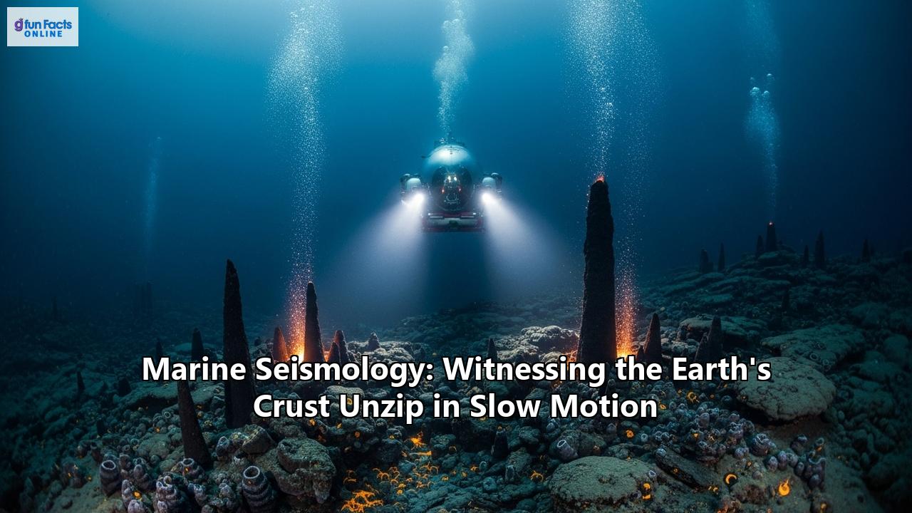
An expedition into the abyss, where the very bones of our planet are laid bare, is not for the faint of heart. It is a journey into a realm of crushing pressure and perpetual darkness, a world far removed from our own. Yet, it is here, in the silent depths of the ocean, that one of the Earth's most fundamental processes unfolds: the creation of new crust. This is the realm of marine seismology, a field of science dedicated to listening to the heartbeat of the planet, witnessing the very fabric of the Earth's crust unzip in spectacular slow motion.
For centuries, the ocean floor was a mystery, a blank canvas on which imaginations ran wild. The advent of marine geophysics, and specifically marine seismology, has peeled back the veil, revealing a world of towering underwater mountain ranges, deep trenches, and dynamic volcanic activity. It is a discipline that employs the principles of geophysics to probe the ocean basins and the continental margins, providing the crucial data that underpins our understanding of seafloor spreading and plate tectonics.
Marine seismic surveys are our primary tool for peering beneath the waves. In essence, these surveys are a sophisticated form of echolocation. A sound source, typically an array of air guns, releases a pulse of energy into the water. This sound travels down through the water column, penetrating the seafloor and reflecting off the various layers of rock and sediment beneath. These returning echoes are then recorded by sensitive hydrophones, often towed behind the research vessel in long streamers. By analyzing the time it takes for these sound waves to return, and the strength of the signal, scientists can construct a detailed image of the subsurface, much like a doctor uses an ultrasound to see inside the human body.
The applications of this technology are vast and varied. Marine seismology is instrumental in the exploration for oil and gas reserves, helping to identify potential hydrocarbon reservoirs deep beneath the seabed. It is also used for a myriad of other purposes, from mineral exploration and environmental monitoring to assessing geological hazards like earthquakes and tsunamis. Furthermore, it plays a vital role in climate change research, helping scientists to understand the history of our planet's climate as recorded in the layers of sediment on the ocean floor.
But perhaps the most profound contribution of marine seismology is its ability to provide tangible evidence for the theory of plate tectonics, allowing us to observe the process of seafloor spreading in unprecedented detail. It is through the lens of marine seismology that we can truly witness the Earth's crust unzipping at the seams, a process that has shaped our planet for eons and continues to do so today.
The Tools of the Trade: Listening to the Earth's Slow Rumble
To eavesdrop on the a a dynamic processes occurring deep within the Earth's oceanic crust requires a sophisticated toolkit of instruments and techniques. At the forefront of marine seismology are the methods of seismic reflection and refraction profiling, which, while similar in principle to their land-based counterparts, are adapted for the unique and challenging marine environment.
The fundamental principle behind both seismic reflection and refraction is the generation of seismic waves and the recording of their journey through the Earth. In seismic reflection, sound waves are bounced off of different geological layers, and the returning echoes are used to create a map of these boundaries. In seismic refraction, scientists analyze the waves that have been bent, or refracted, as they pass through different layers, which provides information about the velocity of the seismic waves and, by extension, the composition of the rock.
At the heart of any marine seismic survey is the seismic source. While early explorations used dynamite, the modern workhorse is the air gun. These devices work by rapidly releasing a bubble of highly compressed air into the water, creating a powerful pulse of sound. To create a more focused and powerful beam of sound, multiple air guns are often used together in a tuned array. While effective, the intense sound produced by air guns has raised concerns about its impact on marine life, a challenge the scientific community is actively addressing through the development of new, quieter technologies.
The "ears" of a marine seismic survey are the hydrophones. These are specialized underwater microphones designed to detect pressure changes in the water caused by returning seismic waves. In a typical survey, hundreds or even thousands of hydrophones are arranged in long cables called streamers, which can be several kilometers long and are towed behind the research vessel. More advanced techniques, such as 3D and 4D seismic surveys, utilize multiple streamers to create a more detailed and dynamic picture of the subsurface.
While towed streamers are ideal for mapping large areas, another crucial tool in the marine seismologist's arsenal is the Ocean-Bottom Seismometer, or OBS. As the name suggests, these instruments are placed directly on the seafloor to record the Earth's motion. An OBS is a self-contained unit, typically housed in a protective sphere, that includes a seismometer, a data logger, batteries, and an acoustic release mechanism that allows it to be retrieved after its deployment.
The working principle of a seismometer is based on inertia. A heavy mass is suspended on a spring between magnets. When the Earth moves, the seismometer's housing moves with it, but the mass remains stationary for a moment. This relative motion between the mass and the magnets generates an electrical current, which is what the instrument measures. OBSs are particularly valuable for studying earthquakes and the fine-scale structure of the Earth's crust in a specific location. They can be deployed for long periods, from days to over a year, providing a continuous record of seismic activity.
The combination of these instruments and techniques, from the powerful blast of an air gun to the subtle recordings of an OBS, allows scientists to piece together a comprehensive picture of the world beneath the waves. It is a testament to human ingenuity that we can listen to the faint rumbles of our planet from the surface of the ocean, and in doing so, unlock the secrets of its deep, dark heart.
The Unzipping of the Earth's Crust: Seafloor Spreading Revealed
The concept of the Earth's crust being in constant, albeit slow, motion is a cornerstone of modern geology. The engine of this motion is a process known as seafloor spreading, which occurs at the mid-ocean ridges, the longest mountain range on our planet. These vast, underwater chains of volcanoes wrap around the globe like the seams on a baseball, and it is here that new oceanic crust is born.
Mid-ocean ridges are located at divergent plate boundaries, where the Earth's tectonic plates are pulling apart. As the plates separate, magma from the mantle rises to fill the gap, erupting onto the seafloor as lava. This lava cools and solidifies, forming new oceanic crust. This process is continuous, with the newly formed crust being pushed away from the ridge as more magma wells up, causing the seafloor to "spread." This is the "unzipping" of the Earth's crust in action, a slow but relentless process that shapes the ocean basins and drives the continents apart. The rate of spreading can vary, from a leisurely 2 to 5 centimeters per year at the Mid-Atlantic Ridge to a more brisk 6 to 16 centimeters per year at the East Pacific Rise.
The evidence for seafloor spreading is compelling and comes from a variety of sources, with marine seismology playing a pivotal role. One of the most striking pieces of evidence is the pattern of magnetic stripes on the ocean floor. As the magma at the mid-ocean ridges cools, the magnetic minerals within the rock align with the Earth's magnetic field at that time. Since the Earth's magnetic field has reversed its polarity many times throughout history, this creates a symmetrical pattern of "normal" and "reversed" magnetic stripes on either side of the ridge. Marine seismic surveys, in conjunction with magnetic surveys, have mapped these stripes, providing a clear record of the seafloor's creation and movement over millions of years.
Another key piece of evidence provided by marine seismology is the age of the oceanic crust. By using seismic data to identify the location of the mid-ocean ridge and then collecting rock samples at various distances from it, scientists have been able to confirm that the youngest rocks are found at the ridge crest, and they get progressively older with increasing distance from the ridge. This is exactly what would be expected if new crust is being formed at the ridge and then moving away from it.
Furthermore, seismic surveys have allowed us to peer deep beneath the mid-ocean ridges and directly image the magma chambers that fuel the process of seafloor spreading. These studies, using advanced techniques like multichannel seismic reflection, have revealed the presence of molten rock bodies beneath the ridge axis, providing a direct glimpse of the engine of crustal formation. For example, studies at the East Pacific Rise have imaged a thin, molten sill, giving us a much clearer picture of how magma is supplied from the mantle.
Seismic refraction studies have also been crucial in determining the thickness of the oceanic crust as it moves away from the spreading center. These experiments have shown that the crust is thinnest at the ridge and thickens as it cools and moves away, another key prediction of the seafloor spreading model. By combining all of these lines of evidence, from the grand sweep of magnetic stripes to the fine details of crustal thickness, marine seismology has provided an undeniable confirmation of seafloor spreading, allowing us to witness, in a very real sense, the unzipping of our planet's crust.
Probing the Depths: Challenges and Triumphs of Marine Seismology
Venturing into the deep ocean to listen to the Earth's secrets is an endeavor fraught with challenges. The marine environment is unforgiving, and the logistical and technical hurdles of conducting seismic research in this realm are immense. Yet, for every challenge, the ingenuity of scientists and engineers has brought forth a triumph, pushing the boundaries of what we can learn about our planet.
One of the most significant challenges is the sheer cost and logistical complexity of marine seismic surveys. These expeditions require specialized research vessels equipped to tow powerful acoustic sources and long streamers of hydrophones, or to deploy and recover fleets of Ocean-Bottom Seismometers (OBS). Ship time is expensive and limited, making every moment at sea precious.
The deep-sea environment itself presents a formidable obstacle. The immense pressure at the bottom of the ocean requires instruments to be housed in robust, pressure-resistant casings. Furthermore, the ocean is a noisy place. The constant movement of waves and currents creates a significant amount of background noise that can interfere with the faint seismic signals scientists are trying to detect. This is particularly problematic for OBSs, which are susceptible to noise from bottom currents and the tilting of the instrument on the soft seafloor sediment.
Another major challenge, and a topic of considerable research and debate, is the environmental impact of marine seismic surveys. The powerful sound waves generated by air guns can potentially harm marine life, from the smallest zooplankton to the largest whales. This has led to a growing focus on developing more environmentally friendly seismic sources and implementing strict mitigation measures to minimize the impact on marine ecosystems.
Despite these challenges, the field of marine seismology has seen remarkable advancements. The development of 3D and 4D seismic imaging has revolutionized our ability to visualize the subsurface, providing a much more comprehensive and dynamic picture of geological structures. Wide-azimuth surveys, which use multiple vessels or sources to illuminate the subsurface from different angles, have significantly improved the quality of images in complex geological settings.
There have also been significant strides in the development of seismic instruments. Modern OBSs are becoming smaller, more powerful, and less expensive, allowing for the deployment of larger and denser arrays. The advent of autonomous and cabled OBS systems is providing new ways to collect data, with cabled observatories offering the potential for real-time data transmission.
The processing and analysis of seismic data have also been transformed by the integration of artificial intelligence and machine learning. These powerful computational tools can help to sift through vast amounts of data, identify subtle patterns, and improve the accuracy of our interpretations.
The future of marine seismology is bright, with many exciting developments on the horizon. The quest for more environmentally benign seismic sources continues, with innovations like marine seismic vibrators showing great promise. The use of autonomous underwater vehicles (AUVs) for seismic data acquisition is becoming more widespread, offering a more efficient and cost-effective way to explore the ocean depths. And the increasing focus on integrating marine seismology with other oceanographic disciplines promises a more holistic understanding of our planet's complex systems.
The journey of marine seismology is one of constant innovation and perseverance. For every obstacle encountered in the dark, cold depths, a new solution is devised, a new technology is born. It is a testament to our enduring curiosity and our relentless pursuit of knowledge about the planet we call home. Through these triumphs over adversity, we continue to listen to the Earth's slow, deep rumble, and in doing so, we gain a more profound appreciation for the immense and dynamic forces that have shaped, and continue to shape, our world.
Reference:
- https://www.frontiersin.org/journals/marine-science/articles/10.3389/fmars.2023.1222523/full
- https://wiki.aapg.org/Marine_seismic_data_acquisition
- https://www.sercel.com/en/news/new-wave-marine-seismic-source-technology
- https://www.utas.edu.au/about/news-and-stories/articles/2023/whales-stop-singing-and-rock-lobsters-lose-their-balance-how-seismic-surveys-can-harm-marine-life
- https://www.cbd.int/doc/meetings/mar/mcbem-2014-01/other/mcbem-2014-01-submission-seismic-airgun-en.pdf
- https://library.seg.org/doi/10.1190/1.1438746
- https://helenjaniszewski.squarespace.com/marine-seismology
- https://www.gcrc.uga.edu/wp-content/uploads/2021/02/Effect-of-Seismic-Surveys-on-Marine-Organisms.pdf
- http://en.earth-science.net/en/article/doi/10.1007/s12583-024-0075-3
- https://www.numberanalytics.com/blog/mastering-seismic-data-acquisition-techniques
- https://geoexpro.com/the-future-of-marine-seismic-acquisition/
- https://www.earthdoc.org/content/papers/10.3997/2214-4609.202242009
- https://cseg.ca/recent-advances-in-marine-seismic-acquisition-and-processing-technology/
- https://www.ncbi.nlm.nih.gov/books/NBK208801/
- https://www.satel.com/wp-content/uploads/2019/12/SATEL_casestory_satpos.pdf
- https://www.trackerlocating.com/unveiling-the-future-innovations-in-seismic-technology-driving-exploration/
- https://www.frontiersin.org/journals/marine-science/articles/10.3389/fmars.2022.736693/full
- https://en.wikipedia.org/wiki/Ocean-bottom_seismometer
- https://www.researchgate.net/publication/232747329_Challenges_in_Marine_Seismology_in_the_Aegean_Region
- https://www.usgs.gov/news/featured-story/rapid-response-seafloor-seismology
- https://pubs.geoscienceworld.org/ssa/bssa/article/105/1/300/323517/Removing-Noise-from-the-Vertical-Component-Records
- https://nhess.copernicus.org/articles/23/1433/2023/
- https://www.credenceresearch.com/report/marine-seismic-equipment-and-acquisition-market
- https://www.numberanalytics.com/blog/mastering-marine-seismic-acquisition
- https://seg.org/calendar_events/innovations-in-marine-seismic-sources-from-tradition-to-transformation/