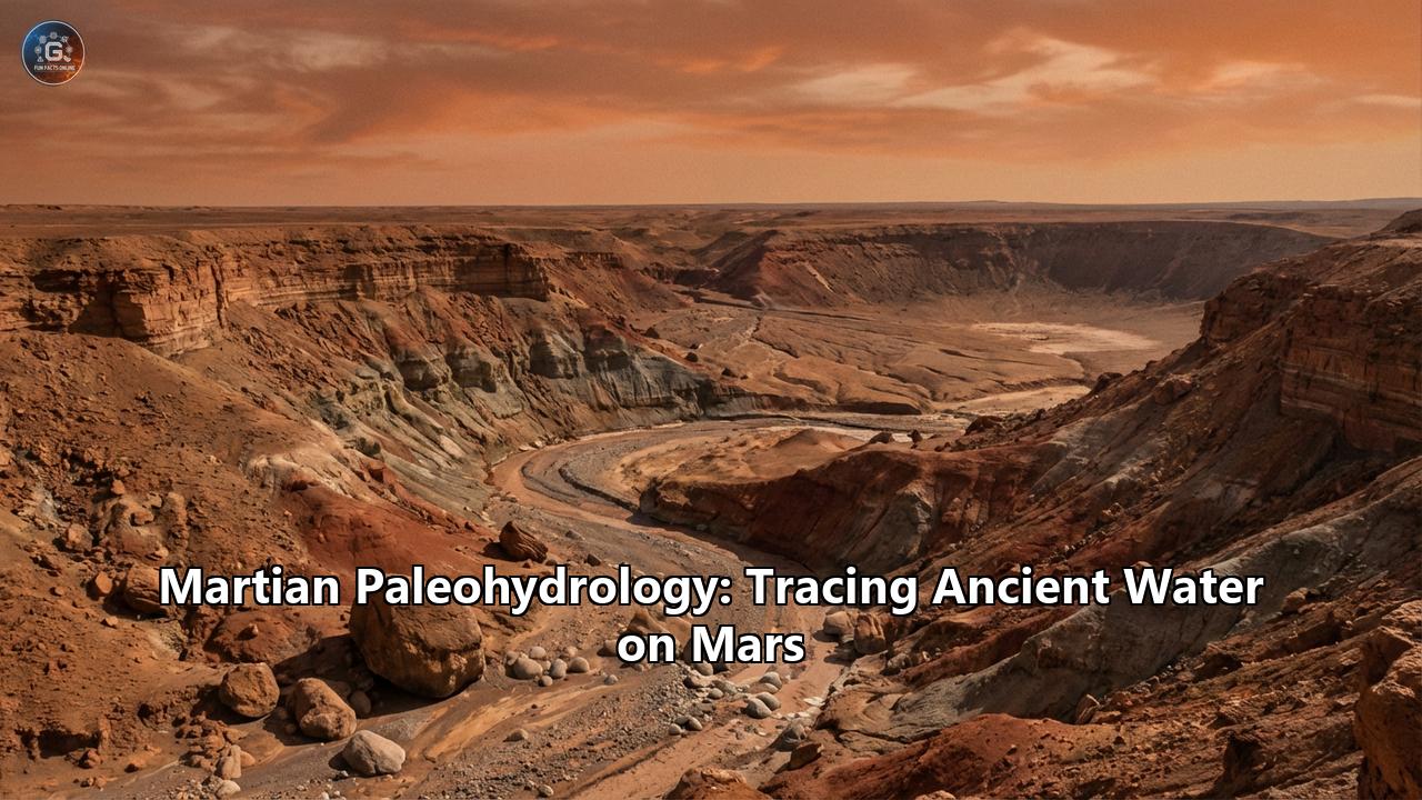
The Red Planet was not always red. Before the iron in its crust oxidized into the rust-colored dust that now coats its surface, and before the atmosphere thinned to a wisp of carbon dioxide, Mars was a world of blues and greys. It was a world of thundering rivers, silent, mirror-like lakes, and perhaps even a vast, northern ocean that reflected a younger, dimmer Sun. The story of water on Mars—Martian paleohydrology—is not merely a geological curiosity; it is a ghost story written in stone, a narrative of a planetary death, and the most compelling treasure map in the history of human exploration. To trace the ancient water of Mars is to walk the line between a dead world and a potentially living one, investigating a history that spans over four billion years.
I. The Phantom of the Canals: A Historical Prologue
The human fascination with water on Mars began long before the first rocket defied gravity. In the late 19th century, the astronomer Percival Lowell peered through his telescope in Flagstaff, Arizona, and saw—or believed he saw—a network of fine lines crisscrossing the Martian globe. He called them canali, inspired by the Italian astronomer Giovanni Schiaparelli. Lowell interpreted these as artificial irrigation canals, engineered by a dying civilization to transport water from the frozen polar caps to the arid equator. It was a romantic, terrifying vision that captivated the world.
While the space age shattered Lowell’s vision of a hydraulic empire—Mariner 4’s flyby in 1965 revealed a cratered, desolate wasteland more akin to the Moon than Earth—the core of his obsession was prophetic. Mars was a wet world. He was just billions of years too late. The channels were real, but they were not carved by Martians; they were carved by physics, time, and catastrophe.
The true reconnaissance began with the Viking orbiters in the 1970s, which sent back grainy black-and-white images of features that looked unmistakably like dried riverbeds. These "valley networks" in the southern highlands and the massive "outflow channels" emptying into the northern plains suggested that liquid water wasn't just a minor player in Martian history; it was a protagonist.
II. The Epochs of Water: A Chronological Framework
To understand Martian paleohydrology, one must understand the Martian calendar. Planetary geologists divide the history of Mars into three primary epochs, each defined by the state of water and the surface conditions.
The Noachian Period (4.1 to 3.7 Billion Years Ago): The Wet Marsnamed after Noachis Terra, this is the oldest and most battered terrain on Mars. During the Noachian, Mars was subject to the Late Heavy Bombardment, a solar system-wide rain of asteroids and comets. But amidst this violence, the Noachian was the "golden age" of Martian water. The atmosphere was dense, likely thicker than Earth's is today, providing enough pressure to keep liquid water stable on the surface.
During this epoch, rain—actual precipitation—likely fell on the highlands. It collected in craters, breached their rims, and cascaded down to lower elevations, carving the branching valley networks that resemble terrestrial river systems. This was a time of phyllosilicates (clays). The interaction between water and volcanic basalt created vast deposits of iron-magnesium smectites, minerals that only form in neutral-pH, long-standing water. If life ever emerged on Mars, it likely did so here, in the warm, muddy waters of the Noachian.
The Hesperian Period (3.7 to 3.0 Billion Years Ago): The Acid MarsAs the bombardment slowed, Mars began to change. The internal magnetic field—the planetary shield against the solar wind—collapsed. The atmosphere began to bleed away into space. Volcanism spiked, spewing massive amounts of sulfur dioxide into the air. The water did not disappear immediately, but it changed character. It became acidic.
The hydrological activity shifted from rain-fed rivers to catastrophic groundwater release. The "outflow channels," such as Kasei Valles and Ares Vallis, date to this era. These were not formed by slow erosion but by titanic floods, likely triggered by volcanic heat melting subsurface ice, releasing water volumes greater than the Amazon River in a matter of days. The chemistry shifted from clays to sulfates—minerals like gypsum and kieserite that form in acidic, evaporating brine. Mars was becoming a planetary salt pan.
The Amazonian Period (3.0 Billion Years Ago to Present): The Cold MarsThis is the Mars we know today. Cold, dry, and oxidized. Liquid water became unstable on the surface, sublimating instantly into gas or freezing into ice. Hydrological activity didn't stop entirely, but it became episodic and rare—perhaps a brief melt caused by a meteor impact or a volcanic trickle. The Amazonian is a frozen desert, where the water is locked away in the polar caps or buried deep underground, waiting.
III. The Mineralogical Diary: Reading the Rocks
Water is a chemist. When it interacts with rock, it leaves behind a signature, a mineralogical fingerprint that can persist for billions of years. By reading these minerals, scientists have reconstructed the pH, temperature, and salinity of ancient Martian waters.
Phyllosilicates (Clays):The discovery of widespread clay deposits by the OMEGA instrument on the Mars Express orbiter and the CRISM instrument on the Mars Reconnaissance Orbiter (MRO) revolutionized our understanding of Mars. Clays are the smoking gun of habitable water. They imply a high water-to-rock ratio and a neutral pH. We find these primarily in the oldest terrains, such as the walls of Valles Marineris and the rim of Jezero Crater. They tell us that early Mars was not just wet, but chemically benign.
Sulfates:As Mars dried out and volcanism increased, the water became briny and acidic. Sulfates like jarosite, found by the Opportunity rover, are minerals that form in the presence of acidic water. They are the "evaporites" of Mars, the bathtub rings left behind as the planet's lakes dried up. The presence of these salts indicates a shift to a harsher environment, challenging for life but still holding liquid water.
Hematite "Blueberries":One of the most famous discoveries came from the Opportunity rover in Meridiani Planum. It found small, spherical concretions rich in hematite, nicknamed "blueberries." These form when groundwater flows through porous rock, dissolving iron and reprecipitating it in concentrated spheres. They are literal stones formed by flowing water, proving that vast areas of the Martian subsurface were once saturated aquifers.
Hydrated Silica (Opal):Spirit rover, dragging a broken wheel, churned up bright white soil in Gusev Crater. It turned out to be nearly pure silica—opal. On Earth, such deposits form around hot springs or hydrothermal vents. This was the first strong evidence of a hydrothermal system on Mars, an environment where heat and water mix, providing a perfect energy source for microbial life.
Chlorides:Scattered across the southern highlands are deposits of chloride salts—essentially table salt. These are likely the last gasps of surface water, the remnants of the final ponds that evaporated as the Noachian turned into the Hesperian. They mark the locations of the last oases.
IV. The Orbital Perspective: Mapping the Ghost Waters
Before we could touch the surface, we had to map it. The fleet of orbiters circling Mars—Mars Global Surveyor (MGS), Mars Odyssey, Mars Express, and the Mars Reconnaissance Orbiter (MRO)—have provided a global view of the planet's hydrology.
The Northern Ocean Hypothesis (Oceanus Borealis):One of the most debated and tantalizing ideas in paleohydrology is the existence of a primordial ocean covering the northern lowlands. Mars possesses a "crustal dichotomy"—the southern hemisphere is rugged and elevated, while the north is smooth and low. Many scientists believe the northern basin, Vastitas Borealis, was once filled with water.
MRO and Mars Global Surveyor data have revealed features that look suspiciously like ancient shorelines (contact boundaries) wrapping around the northern plains. Delta formations at the dichotomy boundary, where rivers from the highlands would have emptied into the sea, support this. In 2025/2026, new analysis of "scarp-fronted deposits" in the Coprates Chasma and surrounding regions reinforced the "Deep Blue" theory, suggesting a connected oceanic system existed as late as 3.4 billion years ago. If true, Mars was not just a world of lakes, but a world of continents and seas.
Valley Networks:High-resolution imagery from MRO’s HiRISE camera has mapped thousands of valley networks. Unlike the canals of Lowell, these are dendritic—tree-like—branching structures that follow the topography. They obey the laws of gravity, draining from high to low. Their density in the southern highlands suggests that for a significant period, rainfall was heavy and persistent.
Outflow Channels:These are the giants of Martian hydrology. Features like Kasei Valles are hundreds of kilometers wide. They lack the tributary systems of the valley networks; instead, they emerge full-born from chaotic terrain—jumbled regions where the ground seemingly collapsed. The leading theory is that these were formed by the sudden release of pressurized aquifers, perhaps triggered by magma rising beneath the cryosphere. The water burst forth with cataclysmic power, tearing through the crust and reshaping the face of the planet in weeks.
V. Surface Exploration: The Ground Truth
While orbiters give us the "where," rovers give us the "what," "how," and "when." The progression of rover capabilities mirrors the deepening of our understanding.
Spirit and Opportunity: The GeologistsThe twin rovers, landing in 2004, were tasked with "following the water." Spirit landed in Gusev Crater, suspected to be an ancient lakebed. Initially, it found only volcanic basalt, a disappointment. But as it climbed the Columbia Hills, it found extensive evidence of water alteration, including the hydrothermal silica mentioned earlier.
Opportunity landed in Meridiani Planum and scored a hole-in-one, rolling into a small crater exposing bedrock. It found the "blueberries," jarosite, and cross-bedded sediments that clearly indicated flowing water. Opportunity confirmed that Mars had standing bodies of acidic water—shallow seas or playas that wetted the surface intermittently.
Curiosity (Mars Science Laboratory): The ChemistLanding in Gale Crater in 2012, Curiosity took the search to a new level. Gale is a massive impact basin with a central mountain, Mount Sharp (Aeolis Mons), composed of layered sediments. As Curiosity climbed the mountain, it read the layers like pages in a history book.
The rover found rounded pebbles—conglomerates—that were too heavy to be moved by wind. They had been tumbled smooth by a knee-deep stream flowing at a brisk pace. It found mudstones (lacustrine deposits) indicating that Gale Crater hosted a freshwater lake for millions to tens of millions of years. This lake was neutral, not acidic, and contained all the chemical ingredients necessary for life (carbon, hydrogen, nitrogen, oxygen, phosphorus, sulfur).
In the mid-2020s, Curiosity continued to stun scientists. It discovered "wave ripples"—undulating textures in the rock that proved the existence of shallow, ice-free bodies of water subject to wind. It found "boxwork" structures, mineral veins formed by groundwater circulation. Most shockingly, in 2025, it drove over a rock and cracked it open to reveal pure elemental sulfur crystals—a find that defied immediate explanation but pointed to a complex, chemically active subsurface water system.
Perseverance (Mars 2020): The BiologistPerseverance landed in Jezero Crater, a site chosen specifically for its clear hydrological features. Orbital images showed a river channel breaking through the crater wall and depositing a massive fan-shaped delta.
Perseverance confirmed the orbital hypothesis. It found that the delta was composed of sediments carried by a river that flowed into a standing lake. Ground-penetrating radar (RIMFAX) allowed the rover to "see" underground, revealing the sloping layers of the delta depositing into the lake floor.
The rover found a diversity of water-altered minerals: carbonates in the margin unit (excellent for preserving biosignatures), iron-magnesium smectites, and phosphates. At a site called "Wildcat Ridge," it sampled fine-grained mudstones that had the highest concentration of organic molecules yet found on Mars. These rocks were deposited in a low-energy lake environment, exactly the kind of quiet, muddy place where microbial life might thrive and be preserved.
Furthermore, Perseverance found evidence of the lake's violent end. Massive boulders, totally out of place in the fine lake sediments, were found sitting on top of the delta. These indicate that as the climate shifted, the gentle river became a raging torrent—super-floods that washed heavy rocks down into the drying crater.
Zhurong:China’s Zhurong rover, exploring Utopia Planitia, added another piece to the puzzle. It found evidence of hydrated minerals and sedimentary structures in the northern plains, supporting the theory that an ocean or at least vast ephemeral seas occupied the northern hemisphere during the Hesperian/Amazonian transition.
VI. The Great Drying: Where Did the Water Go?
If Mars had oceans, rivers, and rain, where is it now? This is the central mystery of atmospheric evolution.
Atmospheric Stripping:The MAVEN (Mars Atmosphere and Volatile EvolutioN) mission provided the answer. Mars is small; its gravity is only 38% of Earth's. More importantly, its core cooled rapidly. When the internal dynamo shut down, Mars lost its global magnetic field. Without this shield, the solar wind—a stream of charged particles from the Sun—slammed directly into the upper atmosphere.
MAVEN measured the rate of atmospheric loss and found that the solar wind has been stripping Martian air for billions of years. As the atmosphere thinned, the pressure dropped. Eventually, it crossed the "triple point" of water. Below this pressure, liquid water cannot exist; it boils away or freezes. The oceans didn't just dry up; they sublimated into space and were torn apart by solar radiation. The hydrogen escaped, and the oxygen reacted with the surface rocks, turning the planet red.
The Crustal Sponge:However, not all water was lost to space. A significant portion went down. Recent data from the InSight lander, which monitored "marsquakes," suggests that the Martian crust is porous and fractured. Seismic analysis in 2024/2025 pointed to the possibility of liquid water existing deep within the mid-crust (10-20km down). While this water is too deep to be easily accessed or to affect the surface today, it suggests that Mars is not dry on the inside—it is a "hidden" water world. The crust acted like a sponge, soaking up the oceans as the surface became uninhabitable.
VII. Modern Mars: A Planet of Ice and Brine
Mars today is not dead, merely dormant. Water exists in vast quantities, just not as liquid on the surface.
The Polar Caps:The north and south poles are capped with kilometers-thick sheets of water ice and dry ice (frozen CO2). Radar surveys by MRO have estimated that if melted, the polar caps alone possesses enough water to cover the entire planet in an ocean 20 to 30 meters deep.
Buried Glaciers:In the mid-latitudes, radar has detected massive aprons of debris-covered ice. These are essentially buried glaciers, protected from sublimation by a layer of dust and rock. Some of these deposits, like those in Hellas Planitia or Utopia Planitia, are vast reservoirs of relatively pure water ice, accessible resources for future human explorers.
Recurring Slope Lineae (RSL):In 2011, scientists noticed dark streaks appearing on sun-facing slopes during the Martian summer and fading in winter. They called them Recurring Slope Lineae. While initially thought to be flowing water, subsequent debate has oscillated between dry granular flows and brine seeps. The current consensus leans toward them being the result of hydrated salts absorbing atmospheric moisture (deliquescence) or small amounts of melting brines. While not "rivers," they show that the water cycle is still active, albeit weakly.
VIII. The Search for Life: Paleohydrology as a Guide
The mantra of astrobiology is "follow the water." Paleohydrology tells us where to look.
- Deltas (Jezero): Ideally suited for concentrating and preserving organic matter. The fine clays settle out, burying any microbes that lived in the water column.
- Hydrothermal Vents (Gusev): Energy-rich environments where chemotrophic life (life that eats rocks/chemicals) could survive even without sunlight.
- Subsurface Aquifers: If life retreated as the surface died, the deep crustal water identified by InSight might be the last refuge of Martian biology.
Perseverance is currently collecting samples from the Jezero delta, sealing them in titanium tubes. These samples include mudstones, carbonates, and igneous rocks. The plan is for the Mars Sample Return (MSR) mission to retrieve these tubes and bring them to Earth in the 2030s. Only in terrestrial labs can we analyze the isotopic ratios of the water trapped in minerals to definitively say if biology was involved.
IX. Conclusion: The Watery Past and Future
Martian paleohydrology is a discipline of reconstruction. From orbital maps of dry shorelines to the microscopic analysis of clay grains, we have pieced together a history of a world that was once startlingly Earth-like. Mars was a blue marble before it was a red one.
The tracing of ancient water is more than an academic exercise. It is the roadmap for our own future on the planet. The buried glaciers and hydrated minerals mapped by our orbiters will provide the water for astronauts to drink, the oxygen to breathe, and the hydrogen for rocket fuel. We follow the ancient water not just to learn where Mars has been, but to ensure that we can go there.
As rovers continue to climb the ancient sedimentary mounds and as orbiters pierce the crust with radar, the ghost waters of Mars become clearer. They tell us that the universe is capable of generating habitable worlds, even if it cannot always sustain them. And they whisper a tantalizing possibility: that in the deep, wet rocks, or in the frozen ancient muds, we are not alone.
Deep Dive: The Specifics of Martian Paleohydrology
To fully appreciate the complexity of this field, we must zoom in on the specific mechanisms and locations that define the story of water on Mars.
1. The Physics of Martian Water: A Alien Phase Diagram
On Earth, water is robust. It boils at 100°C and freezes at 0°C (at sea level). On Mars, the triple point of water dominates. The average surface pressure is 6 millibars, which is the exact pressure of the triple point. This means that if you placed a cup of liquid water on the surface of Mars today, it would likely boil and freeze simultaneously.
However, ancient Mars was different. Paleohydrology relies on "paleobarometry"—estimating ancient air pressure. The size of raindrops imprinted in fossilized mud (if found) or the depth of river channels suggests an atmosphere of at least 0.5 to 1 bar (Earth is 1 bar) during the Noachian.
Furthermore, Martian water was likely never pure. It was a brine. Salts lower the freezing point of water (freezing point depression) and lower the evaporation rate. This allowed "cold" liquid water to exist at temperatures far below 0°C. The widespread perchlorates (salts found by Phoenix and Curiosity) can keep water liquid down to -70°C. This means "wet Mars" might have actually been "sub-zero slush Mars" for much of its history.
2. Jezero Crater: The Case Study
Jezero is the most studied paleolake in the solar system. 3.7 billion years ago, it was a crater about 45 km wide. A river channel (Neretva Vallis) breached the western rim, filling the crater.
- The Delta: As the water entered the standing lake, it slowed down. Sand dropped out first, then silt, then fine clay. This built the fan structure Perseverance is driving on.
- The Outlet: The lake filled up until it breached the eastern rim, creating an outlet channel. This confirms it was an "open system" lake—fresh water flowed in, and water flowed out. This is crucial for habitability because closed lakes (like the Dead Sea) become hypersaline and toxic. Jezero was a flushing system, likely fresh enough for life.
- The Margin Unit: Around the edges of the lake, Perseverance found carbonates. On Earth, carbonates (limestone) usually form from life (shells, coral) or direct precipitation in shallow, warm water. The Jezero carbonates are likely the "bathtub ring" of the lake, and they are the prime target for finding microfossils.
3. Gale Crater: The Long-Lived Lake
Gale offers a different story. It is a closed basin. Water flowed in and pooled. The central mountain, Mount Sharp, is a paradox. It stands higher than the crater rim. How?
The leading theory is that the entire crater was filled with sediment (sand and mud) carried by water and wind, burying the central peak. Then, wind erosion over billions of years scooped the crater back out, leaving the mountain as an eroded remnant of the fill.
Curiosity’s traverse has shown a repeating cycle: wet, dry, wet, dry. It sees alternating layers of mudstone (deep lake), sandstone (beach/dune), and sulfate salts (drying pool). This "rhythmic" stratigraphy suggests that Mars’ climate fluctuated wildly, perhaps due to changes in its axial tilt (obliquity). When Mars tilts over, the poles warm up, releasing gas and thickening the atmosphere—allowing liquid water at the equator. When it stands up straight, the atmosphere collapses, and the equator dries. Gale Crater records these planetary wobbles.
4. The "Megafloods" and Tharsis
The Tharsis Montes are the largest volcanoes in the solar system (including Olympus Mons). Their formation weighed down the crust, causing stress fractures—the Valles Marineris. But they also acted as a heat engine.
Immense heat from Tharsis magma rising beneath the cryosphere (the frozen groundwater layer) likely triggered the catastrophic floods of the Hesperian. Imagine a layer of ice hundreds of meters thick suddenly melted from below. The water is under immense pressure. It explodes upward, shattering the rock.
This created the "chaotic terrain" (like Margaritifer Chaos). The ground collapsed into a jumble of blocks, and water rushed out, carving channels like Ares Vallis. These floods were powerful enough to carry boulders the size of apartment buildings and likely flowed at speeds of hundreds of kilometers per hour. They emptied into the Chryse Planitia basin, potentially forming a temporary, ice-covered sea.
5. Isotopic Evidence: The D/H Ratio
How do we know how much water was lost? We look at the hydrogen.
Water is H2O. But sometimes, a hydrogen atom is replaced by Deuterium (a heavy isotope of hydrogen with a neutron). This is HDO.
When solar wind strips the atmosphere, lighter normal Hydrogen escapes faster than heavy Deuterium. Over billions of years, the remaining water becomes enriched in Deuterium.
By measuring the D/H ratio in the Martian atmosphere and in ancient clays (which trapped ancient water), scientists found that current Mars water is about 8 times heavier (more Deuterium) than Earth's ocean water. Calculating backwards, this implies Mars started with a global equivalent water layer (GEL) of at least 137 meters—enough to cover the whole planet. Some estimates go much higher, up to 500 meters or more.
6. The Future of Paleohydrology: Drilling Deep
The next frontier is depth. Perseverance and Curiosity scratch the surface (literally, a few centimeters). To find the real story, and perhaps extant life, we need to go deep.
The Rosalind Franklin rover (ESA), scheduled for later in the decade, carries a drill capable of reaching 2 meters down. This is below the "sterilization zone" of cosmic radiation. At this depth, organic molecules from the ancient water epochs might be perfectly preserved.
Further out, mission concepts like "Mars Life Explorer" propose drilling into the mid-latitude ice sheets to look for pockets of brine.
The Human Element: Why We Care
Tracing ancient water on Mars is, fundamentally, a search for our own reflection. Earth and Mars were twins at birth—both rocky, both in the habitable zone, both with water. One thrived, becoming a blue jewel of biology. The other died, becoming a frozen, rusty desert.
By studying Martian paleohydrology, we are studying the fragility of habitability. We learn what makes a planet live or die. We learn about the resilience of water, how it hides in rocks and ice, waiting for a thaw.
And as we stand on the precipice of becoming a multi-planetary species, the ancient riverbeds of Mars serve as our highways. We will land near the ice. We will mine the hydrated sulfates. We will drink the water that once, billions of years ago, might have nurtured the first stirrings of alien life. The water of Mars is not just history; it is fuel for the future.
The story of Martian water is far from over. In fact, for us, it is just beginning. The dry riverbeds are waiting. The frozen oceans are waiting. And in the silence of the red deserts, the ghost of the blue planet whispers its secrets, inviting us to come and listen.
Reference:
- https://sci.esa.int/web/mars-express/-/55481-the-ages-of-mars
- https://www.space.com/the-universe/mars/what-happened-to-all-the-water-on-mars-the-debate-continues
- https://www.hou.usra.edu/meetings/ninthmars2019/pdf/6065.pdf
- https://www.futura-sciences.com/en/nasa-rover-just-sent-one-of-the-most-beautiful-images-ever-taken-of-mars_23489/
- https://www.youtube.com/watch?v=_L8aNPHk2vk
- https://hothardware.com/news/mars-rovers-stunning-discovery-suggests-red-planet-was-once-a-blue-planet
- https://en.wikipedia.org/wiki/Geological_history_of_Mars
- https://www.usgs.gov/publications/geologic-history-mars
- https://www.eurekalert.org/news-releases/1105686
- https://www.smithsonianmag.com/smart-news/curiosity-rover-spots-ancient-water-ripples-on-mars-hinting-at-a-past-with-shallow-ice-free-lakes-180985913/
- https://en.wikipedia.org/wiki/Perseverance_(rover))
- https://science.nasa.gov/resource/perseverance-exploring-the-front-of-the-delta/
- https://www.space.com/mars-rover-perseverance-confirms-lake-delta-jezero-crater
- https://www.innovationnewsnetwork.com/scientists-find-water-on-mars-billions-of-years-after-it-disappeared/50122/
- https://lasp.colorado.edu/2025/03/13/weighing-in-on-a-mars-water-debate/
- https://sci.esa.int/web/mars-express/-/51821-1-hydrated-minerals-ndash-evidence-of-liquid-water-on-mars