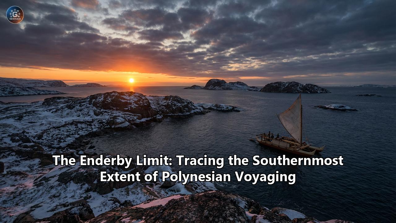
The Pacific Ocean is a universe of water, a blue void that covers one-third of the planet’s surface. For thousands of years, this liquid cosmos was the stage for the greatest migration in human history. The Polynesians, a people without compasses, sextants, or metal tools, solved the riddle of the ocean. They read the stars like a map, felt the swell of the sea like a pulse, and followed the flight of birds to find land where none was visible. They colonized the vast triangle of the Pacific, from the snow-capped peaks of Hawai'i in the north to the mysterious statues of Rapa Nui in the east, and the green expanse of Aotearoa (New Zealand) in the south.
But there is a line in the ocean where the tropical dream of Polynesia dies. It is a line where the warm trade winds are replaced by the violent, freezing gales of the "Roaring Forties" and the "Furious Fifties." It is a boundary where the familiar stars of the equatorial zenith sink low and strange, cold constellations rise to mock the navigator. This is the realm of the Southern Ocean, a place of gray mist, towering waves, and bitter cold.
For decades, archaeologists and historians believed that the Polynesian expansion stopped at the southern tip of New Zealand. The climatic barrier was deemed too great, the waters too hostile, the incentives too low. They were wrong.
Hidden in the peat and dunes of a small, windswept island at the bottom of the world lies the proof that the great voyagers pushed further than anyone dared to imagine. This is the story of Enderby Island, the Auckland Islands, and the psychological and physical frontier known as the Enderby Limit.
Part I: The Ghost in the Oral History
Long before Western science began to dig into the dunes of the sub-Antarctic, the memory of the southern ice existed in the oral traditions of the Māori and their Polynesian ancestors. History, for the Polynesians, was not written in books but carved into memory and chanted in whakapapa (genealogies).
Among these traditions is the legend of Hui Te Rangiora.
According to the oral histories of Rarotonga and New Zealand, Hui Te Rangiora was a navigator of immense skill and curiosity who lived perhaps as early as the 7th century AD, though some traditions place him later. He captained a vessel named Te Ivi o Atea (The Bone of Space) and is said to have sailed south from the warm waters of the central Pacific, driven not by the need for land, but by the desire to see what lay beyond the horizon.
The chant describes a voyage that descended into a world of "monstrous seas." It speaks of a place where the sun disappeared into a "foggy, misty, and dark place." But the most chilling and specific details of the legend are the descriptions of the ocean itself. Hui Te Rangiora reported seeing Te tai-uka-a-pia—"the sea like arrowroot." In Polynesia, arrowroot (pia) is a white, granular starch. When scraped and soaked, it forms a white, floating slush. To a tropical mariner who had never seen ice, the slushy "grease ice" or pancake ice of the Antarctic margins would look exactly like a sea of arrowroot.
The legend goes further. It speaks of "the hair of the woman dwelling in the waves," a poetic but accurate description of the massive strands of bull kelp (Durvillaea antarctica) that churn in the sub-Antarctic surf, looking like dark, writhing tresses. It mentions "rocks that grow out of the sea," which could be interpreted as icebergs—white, towering, and barren.
For a long time, Western academics dismissed these stories as myths or later embellishments. The idea that a canoe, held together with coconut fiber sennit and powered by a woven pandanus sail, could survive the Southern Ocean seemed physically impossible. The "frozen sea" was regarded as a metaphor, or perhaps a confusion with some other phenomenon.
But in the late 20th century, the spade of the archaeologist struck something hard and undeniable on a lonely beach 460 kilometers south of New Zealand. The myth was about to collide with reality.
Part II: The Discovery at Sandy Bay
The Auckland Islands are an archipelago of broken volcanoes. They sit at 50 degrees South latitude, squarely in the path of the relentless westerly winds that circle the bottom of the globe. The climate is punishing: rain falls on average 300 days a year, the mean temperature hovers around 6 to 11 degrees Celsius, and the wind rarely ceases its howling.
The main island, Auckland Island, is rugged and formidable, with towering cliffs that drop straight into the churning sea. But to the north lies a smaller, slightly more hospitable islet called Enderby Island. On the sheltered southern side of Enderby lies Sandy Bay, a rare crescent of white sand in a region of jagged rock. It is one of the few places in the entire archipelago where a waka (canoe) could be safely beached.
In 1998, a team led by Professor Atholl Anderson, a giant in the field of Pacific archaeology, began excavations at Sandy Bay. They were looking for evidence of early human presence, perhaps transient sealers or 19th-century Māori settlers. What they found rewrote the history books.
Buried beneath the layers of peat and windblown sand were umu—Polynesian earth ovens.
These were not the temporary campfires of shipwreck survivors desperate for warmth. These were large, purpose-built cooking pits, lined with stones that had been heated to extreme temperatures. Inside the ovens and in the refuse piles (middens) surrounding them, the team found the remains of a feast that had happened seven centuries ago.
The bones told a story of abundance and adaptation. There were the remains of Hooker’s sea lions and New Zealand fur seals—pups and adults alike—butchered with stone tools. There were the bones of albatrosses, shags, and petrels, birds that nest on the ground in these predator-free islands. There were fish bones, though fewer than one might expect, perhaps because fishing in the rough sub-Antarctic waters was dangerous and unnecessary given the abundance of seals on the beach.
Crucially, the team found artifacts. They unearthed flakes of basalt and chert—stone tools used for cutting meat and working wood. They found a fishhook made from bone, distinctively Polynesian in design. And they found the bones of a Polynesian dog (kurī). The presence of the dog was the smoking gun. A shipwrecked sailor might eat a seal, but they wouldn't have a Polynesian dog with them. The dog meant this was a planned voyage. It meant a vessel had arrived with livestock, likely intending to settle or at least explore with the capacity to stay.
Radiocarbon dating of the charcoal and bone placed the settlement between the 13th and 14th centuries (roughly 1250–1320 AD). This coincided perfectly with the main phase of Polynesian settlement of mainland New Zealand.
The "Enderby Limit" had been established. Polynesians had not just looked south; they had gone there. They had landed, built shelters, lit fires, and lived on the edge of the habitable world.
Part III: The Science of Extreme Wayfinding
To appreciate the magnitude of this achievement, one must understand the technology that got them there. Polynesian navigation is often romanticized, but it was, in reality, a rigorous science. It relied on the "star compass"—the memorization of the rising and setting points of hundreds of stars to create a mental card of direction.
In the tropics, the star paths are reliable. The celestial sphere rotates overhead, and stars rise and set at steep angles, making it easy to mark a bearing on the horizon. But as a voyager sails south, the geometry of the sky changes. The familiar zenith stars of the tropics drop behind the northern horizon. The Southern Cross rises higher, becoming a dominant marker. Crucially, as you approach the poles, stars no longer rise and set vertically; they skim the horizon at oblique angles, making them harder to use as precise directional pointers.
And then there is the weather. The star compass requires a sky. In the Auckland Islands, the sky is a thick blanket of stratocumulus clouds for weeks on end. The navigational cues that worked in Tahiti or Tonga—the reflection of stars in the water, the phosphorescence—would be obliterated by the gloom and the violence of the Southern Ocean swell.
So how did they do it?
The voyagers likely switched to "wave piloting." A skilled navigator can read the ocean swell like a topographic map. In the Southern Ocean, the dominant swell comes from the west—the long, rolling pulse of the Antarctic Circumpolar Current. By keeping their vessel at a constant angle to this master swell, the navigators could hold a course even when the sky was blind.
They also would have used "downwind sailing." Recent climate reconstructions suggest that around 1300 AD, during the Medieval Climate Anomaly, the wind patterns were different. There were "climate windows"—periods where the relentless westerlies weakened or shifted, allowing for easier travel to the south and, crucially, a return voyage.
They followed the birds. The sooty shearwater (tītī) migrates in the millions to the sub-Antarctic islands to breed. A navigator knowing the season could simply follow the river of birds in the sky. If the birds were flying south with full bellies, land was south.
The vessel itself, the waka hourua (double-hulled canoe), was a masterpiece of engineering. For these southern voyages, the design likely evolved. The light, lashed-together hulls that flexed over the gentle tropical swells needed to be more robust. The massive totara trees of New Zealand allowed for hulls of immense strength. The cross-beams would have been lashed with tighter, more complex bindings to withstand the racking forces of the chaotic southern seas. The sails, woven from flax (harakeke), were stronger than the pandanus mats of the tropics, capable of holding wind in a gale without shredding.
Part IV: Life on the Edge
What was it like for those first settlers on Enderby Island?
Imagine the shock of the cold. These were people whose genetic and cultural heritage was tropical. They wore garments made of bark cloth (tapa), which dissolves in rain and offers no insulation. In New Zealand, they adapted by weaving cloaks from flax and dog skin. On Enderby, they would have needed every layer they possessed.
Archaeological evidence suggests they wore cloaks of seal skin. The sheer abundance of seal bones in the middens implies that seals were not just food; they were survival. The thick fur of the fur seal and the hide of the sea lion would have been essential for warmth.
They likely built low, semi-subterranean shelters. Digging into the dunes offered protection from the biting wind. The "ovens" found by Anderson were huge, suggesting communal living and large-scale processing of meat. They were eating well—perhaps too well. The diet was high in protein and fat, a necessary adaptation to the cold.
But the island lacked one crucial resource: timber suitable for repairing a waka. The Auckland Islands are covered in rātā forest, a twisted, gnarled tree. While the wood is hard and burns hot, it does not grow in the long, straight boles needed for canoe hulls or masts. If a waka was damaged on the reef—a very real possibility in these waters—the settlers would be trapped.
There is no evidence of permanent gardening. The kumara (sweet potato), the staple crop of the Polynesian expansion, would not grow at 50 degrees south. The soil is acidic peat; the sun is too weak. They were forced to revert to a pure hunter-gatherer existence, a regression from the sophisticated agricultural society they had left behind in New Zealand.
This reliance on wild resources made them vulnerable. If the seal population crashed, or if the birds failed to return, they would starve.
Part V: The Mystery of the Departure
They did not stay.
The archaeological layer at Sandy Bay is thin. It represents a brief occupation—perhaps a single summer, perhaps a few years, at most a generation. There are no layers of rebuilding, no deep deposits of centuries of habitation.
Why did they leave?
The "Little Ice Age" is the most likely culprit. Around the early 14th century, the global climate began to cool rapidly. In the sub-Antarctic, this would have been catastrophic. The "climate windows" that allowed for easier voyaging slammed shut. The storms would have become more frequent, the temperature dropping those few crucial degrees that make the difference between a hard life and an impossible one.
The psychological toll must have been immense. The isolation of Enderby Island is absolute. There is no other land for hundreds of kilometers. The nights in winter are long and dark. For a people accustomed to the community and connection of the tribal web, this solitude at the end of the world may have been unbearable.
Perhaps they realized that this land, while rich in meat, was a dead end. It could not support the complex culture they carried with them. It could not grow their crops. It offered no timber for their ships. It was a trap.
So, they loaded their waka, perhaps waiting for a rare northerly wind, and pushed off from Sandy Bay. They left behind their ovens, their broken tools, and the bones of their dogs. They retreated back to the safety of Te Ika-a-Māui (the North Island) or Te Waipounamu (the South Island), leaving Enderby to the seals and the albatross.
Part VI: Did They Go Further?
This brings us to the most tantalizing question: Was Enderby Island truly the limit?
The Sandy Bay settlement proves they reached 50°S. Antarctica lies at 66°S (the circle) and the continent itself further still. The ocean gap between the Auckland Islands and Antarctica is 2,000 kilometers of the worst sea on the planet.
In 2021, a paper by Priscilla Wehi and colleagues reignited the debate, arguing that the oral histories of Hui Te Rangiora should be taken as evidence of an Antarctic sighting. They argued that the descriptions of the "frozen sea" were too specific to be coincidence.
Skeptics, including Atholl Anderson, urge caution. They argue that reaching the Auckland Islands is one thing; crossing the vast, iceberg-choked expanse to Antarctica is another. A waka, open to the elements, would expose its crew to hypothermia within days in those latitudes. Without a source of fresh water (icebergs can be melted, but fuel is needed), and without the ability to dry clothes, survival would be miraculous.
However, the "Enderby Limit" might not be a hard wall, but a porous frontier. It is entirely possible that a waka, driven by a storm or a daring captain, was blown further south. They may have seen the great ice shelf. They may have seen the icebergs described as "rocks growing from the sea."
But if they did, they likely did not return to tell the tale. The "limit" of voyaging is defined not just by where you go, but where you can return from. Enderby Island represents the limit of viable two-way voyaging. Anything beyond that was a one-way trip into the frozen unknown.
Part VII: The Legacy of the Limit
The Polynesian discovery of the sub-Antarctic islands is a testament to the unparalleled maritime capability of the ancestors of the Māori. At a time when European sailors were hugging the coasts of the Mediterranean and Atlantic, terrified of falling off the edge of the world, Polynesians were navigating the open ocean in the most hostile environment on Earth.
They identified the island, assessed its resources, exploited them, and then—demonstrating a wisdom that often escapes modern civilizations—they recognized its limitations and withdrew.
The story of Enderby Island has a strange postscript. In 1842, a group of Ngāti Mutunga Māori and their Moriori slaves from the Chatham Islands chartered a European ship to take them to the Auckland Islands. They sought a new life, away from the conflicts of the mainland. They settled at Port Ross, not far from the ancient Sandy Bay site. For over a decade, they lived there, attempting to farm and trade, unknowingly walking over the footsteps of their ancestors who had tried the same experiment 500 years earlier. They, too, eventually left, defeated by the climate and the isolation.
Today, Enderby Island is a nature reserve. The rātā forest is recovering from the ravages of introduced pests. The sea lions bask on the white sand of Sandy Bay, undisturbed. But if you stand on that beach and look north, you are looking along the invisible track of the waka. And if you look south, toward the gray wall of the Southern Ocean, you are looking at the final frontier—the Enderby Limit—where the greatest voyagers of the ancient world finally met a horizon they could not conquer, but brave enough to touch.
The Enderby Limit is not a mark of failure. It is the high-water mark of human courage and navigational genius. It proves that the Polynesian expansion was not a drift, but a deliberate, probing exploration of the entire Pacific basin, from the burning equator to the edge of the ice.
Reference:
- https://pmc.ncbi.nlm.nih.gov/articles/PMC4205595/
- https://en.wikipedia.org/wiki/Ui-te-Rangiora
- https://ir.canterbury.ac.nz/items/7a4fdc61-3a66-4c09-abf1-57218ee56e6d
- https://www.iflscience.com/hui-te-rangiora-old-maori-legend-suggests-they-may-have-discovered-antarctica-1000-years-before-europeans-79895
- https://pmc.ncbi.nlm.nih.gov/articles/PMC11485678/
- https://www.theguardian.com/world/2021/jun/11/new-zealands-maori-may-have-been-first-to-discover-antarctica-study-suggests
- https://www.worldatlas.com/islands/auckland-islands.html
- http://archaeopedia.com/wiki/index.php/Sandy_Bay
- https://songofurania.com/episode/046
- https://www.pgcruises.com/navigating-polynesia
- https://en.wikipedia.org/wiki/Polynesian_navigation
- https://farandawayadventures.com/ancient-polynesian-navigation-techniques-how-islanders-mastered-the-stars-and-ocean-currents/
- https://pacificarchaeology.org/index.php/journal/article/view/235
- https://www.learnz.org.nz/location192/bg-standard-f/polynesian-navigation
- https://teara.govt.nz/en/waka-canoes/print