The Unblinking Gaze: How Satellite Reconnaissance Shapes Our World
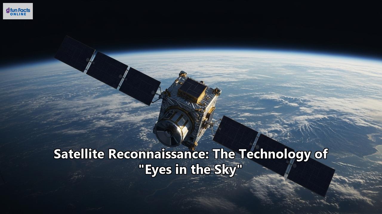
From the silent, frigid expanse of orbit, they watch. A vast and ever-growing constellation of "eyes in the sky" circles our planet, capturing images and data with a precision that was once the exclusive domain of science fiction. This is the world of satellite reconnaissance, a technology born from the tensions of the Cold War that has evolved into an indispensable tool shaping everything from international security and disaster response to the future of our climate and economy.
From Film Canisters to Digital Streams: A Technological Odyssey
The story of satellite reconnaissance began as a high-stakes game of cat and mouse between superpowers. In the late 1950s, with the fear of a "missile gap" gripping the United States, the need for reliable intelligence on the Soviet Union's military capabilities was paramount. The U-2 spy plane program, while effective, was vulnerable, as tragically demonstrated when Francis Gary Powers was shot down in 1960. A new, untouchable vantage point was needed: space.
This necessity gave birth to the CORONA program, a joint effort by the CIA and the U.S. Air Force. These early "Keyhole" (KH) satellites were marvels of engineering, but they were a world away from the instantaneous data of today. They used powerful panoramic cameras to capture images on massive rolls of film. Once a mission was complete, the satellite would eject a film canister, or "bucket," which would plummet back to Earth. In a daring and complex operation, U.S. Air Force planes would then snatch these capsules in mid-air using a trapeze-like hook system. The first successful mission in August 1960 returned more film than the entire U-2 program to that point, imaging 1.65 million square miles of Soviet territory and proving that the feared missile gap was a myth.
Throughout the Cold War, programs with codenames like GAMBIT and HEXAGON pushed the boundaries of photographic resolution. However, the real revolution came with the advent of digital imaging. The KH-11 KENNEN satellite, first launched in 1976, was the first American spy satellite to use electro-optical digital imaging, allowing it to transmit images back to Earth in near real-time. This eliminated the risky and time-consuming process of film recovery and marked the dawn of the modern era of satellite reconnaissance.
The Modern Toolkit: Seeing the Unseen
Today's reconnaissance satellites are equipped with a dazzling array of sensors that can perceive the world in ways far beyond human vision. These technologies are broadly categorized into several key areas:
Optical Imaging: This is the most familiar type of satellite reconnaissance, essentially a powerful telescope in orbit. Modern optical satellites, like Maxar's WorldView series, can achieve resolutions of 30-50 centimeters, allowing them to distinguish individual vehicles and other small details from hundreds of miles up. Synthetic Aperture Radar (SAR): Unlike optical satellites, which are dependent on sunlight and clear skies, SAR satellites are all-weather, day-and-night observers. They work by sending out a microwave radar beam and creating an image from the reflected signals. This allows them to "see" through clouds, smoke, and darkness, making them invaluable for monitoring persistently cloudy regions, tracking ship movements, and assessing damage after natural disasters. Companies like ICEYE are deploying constellations of SAR satellites that can deliver images with resolutions as fine as 50 centimeters. Multispectral and Hyperspectral Imaging: These advanced optical sensors capture data across numerous bands of the electromagnetic spectrum, far beyond the red, green, and blue light our eyes can see. Multispectral imagers, like those on the Landsat and Sentinel satellites, typically capture 5 to 15 bands and are workhorses for monitoring agriculture and land use. Hyperspectral sensors are even more powerful, capturing hundreds or even thousands of narrow, contiguous bands. This incredible detail allows analysts to identify specific materials on the Earth's surface, from different types of minerals to the chemical composition of plants, opening up new frontiers in environmental monitoring and resource management. Signals Intelligence (SIGINT): Not all reconnaissance is visual. SIGINT satellites are the "ears in the sky," designed to intercept electronic signals. These can range from communications intelligence (COMINT), such as radio and satellite phone conversations, to electronic intelligence (ELINT), which involves detecting signals from things like radar systems. This capability provides crucial insights into a nation's military operations, technological capabilities, and intentions.The New Space Race: Commercialization and Constellations
For decades, satellite reconnaissance was the exclusive domain of governments and their intelligence agencies like the National Reconnaissance Office (NRO) in the United States. However, the 21st century has witnessed a paradigm shift, often referred to as the "New Space" era. Private companies like Planet Labs, Maxar, ICEYE, and SpaceX have entered the scene, deploying vast constellations of smaller, cheaper satellites.
Planet operates the largest fleet of Earth-imaging satellites, with hundreds of "Dove" satellites capturing imagery of the entire Earth's landmass on a near-daily basis. This unprecedented frequency allows for the monitoring of rapid changes on the ground. SpaceX's Starlink, while primarily designed for global internet service, has significant military and reconnaissance applications. Its massive constellation of thousands of low-Earth orbit (LEO) satellites can provide resilient communications for military forces and is being leveraged by the U.S. military for reconnaissance and targeting.
This commercialization has democratized access to high-quality satellite data, making it available not just to intelligence agencies but to businesses, scientists, and non-governmental organizations. The NRO itself is now embracing this trend, launching its own proliferated constellations and partnering with commercial providers to augment its own powerful, bespoke systems. This shift towards more numerous, disaggregated constellations also enhances resilience; a network of hundreds or thousands of satellites is much harder to disable than a few large, exquisite ones.
A World Under the Watchful Eye: Diverse Applications
The data flowing from these orbital sentinels is being used in an ever-expanding array of applications that touch nearly every aspect of modern life.
National Security and Defense: This remains a primary driver of satellite reconnaissance. Satellites are used to monitor military buildups, track the development of advanced weaponry, verify compliance with arms control treaties, and provide critical intelligence for battlefield operations. Disaster Response and Management: When natural disasters strike, satellite imagery is often the first tool responders use to assess the scale of the devastation. Satellites can map the extent of flooding, track the spread of wildfires even through thick smoke, and identify damaged infrastructure, helping to guide rescue efforts and plan recovery operations. Environmental and Climate Change Monitoring: Satellites are on the front lines of monitoring the health of our planet. They track deforestation in the Amazon, the melting of polar ice caps, the bleaching of coral reefs, and the concentration of greenhouse gases in the atmosphere. This data is crucial for understanding the impacts of climate change and developing effective mitigation strategies. Agriculture: The agricultural industry has been revolutionized by satellite imagery. Farmers use this data to monitor crop health, identify areas under stress from drought or pests, and optimize the application of water and fertilizer. This leads to increased yields, reduced costs, and more sustainable farming practices. Economic Intelligence: The global economy can also be monitored from space. Analysts can track activity at ports by counting shipping containers, estimate oil reserves by observing the shadows cast by floating tank lids, and even monitor the number of cars in retailer parking lots to gauge consumer activity. This provides a new layer of real-time data for financial markets and economic forecasting.The Power of AI: Making Sense of the Data Deluge
The sheer volume of data produced by modern satellite constellations is staggering and far exceeds the capacity of human analysts to review. This is where artificial intelligence (AI) and machine learning (ML) are becoming indispensable. AI-powered systems can automatically scan vast amounts of imagery to detect and classify objects, such as ships, aircraft, or new construction.
These algorithms can identify patterns and flag anomalies that a human might miss, from the subtle signs of illegal logging to the movement of military forces. The NRO's "Sentient" system, for example, is described as an "artificial brain" that can autonomously analyze data from multiple sources and even "tip and cue" other satellites to get a closer look at something of interest without human intervention. For disaster response, AI can rapidly compare pre- and post-event imagery to generate accurate damage assessments. In agriculture, ML models analyze spectral data to predict crop yields. This automated analysis allows for insights to be extracted from the data torrent at a speed and scale previously unimaginable.
The Contested Heavens: Challenges and the Future
The increasing reliance on satellite reconnaissance has not gone unnoticed by global powers. Space is no longer a peaceful sanctuary but an increasingly contested domain. Several countries, including the United States, Russia, China, and India, have developed and tested anti-satellite (ASAT) weapons. These can range from ground-launched missiles that physically destroy a satellite to non-kinetic attacks involving lasers, high-powered microwaves, or cyberattacks.
The testing of destructive ASATs creates vast fields of orbital debris that can threaten all satellites for decades to come, a problem known as Kessler Syndrome. This has led to calls for international norms and treaties to ban such tests. The United States has unilaterally declared a moratorium on destructive ASAT testing, a move supported by many other nations.
Looking ahead, the future of satellite reconnaissance will be defined by several key trends:
- Increased Maneuverability and Servicing: Satellites are becoming more agile, with advanced propulsion systems allowing them to change orbits to avoid threats or respond to new intelligence needs. The development of on-orbit servicing (OOS) capabilities will allow for refueling, repairing, and upgrading satellites after they have been launched, extending their lifespans and enhancing their capabilities.
- Enhanced Resilience: The move toward large, proliferated constellations of smaller satellites will continue, making space architectures more resilient to attack.
- Smarter Satellites: AI will be increasingly integrated directly into the satellites themselves, allowing for on-board data processing and more autonomous operations.
The Legal and Ethical Frontier
The power of these "eyes in the sky" raises profound legal and ethical questions. While it is a settled principle of international law that a nation's sovereignty extends to its airspace, there is no such claim over outer space. The Outer Space Treaty of 1967 establishes space as free for exploration and use by all states, which has been interpreted as permitting satellite overflight and reconnaissance.
However, the increasing resolution and availability of commercial satellite imagery brings new challenges. The ability to see details on private property from space raises significant privacy concerns. There is an ongoing debate about where to draw the line between legitimate security and commercial interests and the individual's right to privacy. The militarization of space and the development of ASAT weapons also create a precarious strategic environment, where a conflict on Earth could quickly extend into orbit, with devastating consequences for the global infrastructure upon which we all depend.
The unblinking gaze of satellite reconnaissance has fundamentally transformed our world. It has provided unprecedented transparency, helped to stabilize international relations, empowered us to protect our planet, and driven economic innovation. Yet, this powerful technology also presents us with complex challenges. As we continue to expand our presence in the final frontier, the responsible and ethical stewardship of these "eyes in the sky" will be one of the most critical tasks of the 21st century.
Reference:
- https://just-access.de/military-satellites-fight-against-climate-change/
- https://www.satimagingcorp.com/applications/natural-resources/agriculture/
- https://landscape.satsummit.io/analysis/ml-ai-applications.html
- https://www.kratosdefense.com/constellations/articles/on-orbit-servicing-and-rpod-are-driving-satellite-propulsion-innovation
- https://www.precedenceresearch.com/on-orbit-satellite-servicing-market
- https://lieber.westpoint.edu/russias-nuclear-anti-satellite-weapon-international-law/
- https://www.computersciencejournals.com/ijcai/article/75/5-1-3-132.pdf
- https://www.maplibrary.org/1408/ethical-considerations-in-using-satellite-imagery/
- https://www.satimagingcorp.com/applications/artificial-intelligence-ai/
- https://www.ucs.org/sites/default/files/2019-09/debris-in-brief-factsheet.pdf
- https://vce.usc.edu/semester/summer-2024/eyes-in-the-sky-ethical-considerations-of-commercial-satellite-surveillance/
- https://telecomworld101.com/satellites-contested-spaces/
- https://lawjournal.mcgill.ca/wp-content/uploads/pdf/4913610-soraghan.pdf
- https://aerospace.csis.org/wp-content/uploads/2021/09/20210914_Duke_OSAM.pdf
- https://www.farm21.com/satellite-data-in-agriculture-farm21-premium-offer/
- https://www.listenfield.com/blog/what-are-the-benefits-of-using-satellite-imagery-in-agriculture
- https://www.quant-cube.com/insights-content-archive/esa-quantcube-partnership
- https://pasture.io/satellite-measurement/benefits-of-satellite-farming
- https://www.4earthintelligence.com/insights/ai-powered-satellite-imagery-analytics/
- https://ttms.com/ai-in-defense-the-image-reconnaissance-revolution/
- https://globalsecurityreview.com/beyond-the-atmosphere-strengthening-us-space-deterrence-in-a-contested-domain/
- https://en.wikipedia.org/wiki/Sentient_(intelligence_analysis_system))
- https://www.marketsandmarkets.com/ResearchInsight/ai-impact-analysis-on-satellite-data-services-industry.asp
- https://ourworld.unu.edu/en/how-things-work-environmental-satellites
- https://www.thalesgroup.com/en/global/corporate-responsibility/hse-health-safety-environment/innovative-solutions-fight-climate-2
- https://www.satimagingcorp.com/applications/global-warming/
- https://thefutureofthings.com/24481-using-satellite-imagery-for-real-time-environmental-monitoring/
- https://qaltivate.com/blog/satellite-imagery-in-agriculture/
- https://business.esa.int/projects/economic-intelligence-factory
- https://sdg.esa.int/activity/economic-intelligence-factory-4941
- https://pmc.ncbi.nlm.nih.gov/articles/PMC8769025/
- https://www.horizon-europe.gouv.fr/sites/default/files/2022-05/webinar-quantcube-compressed-pdf-6281.pdf
- https://www.artefact.com/blog/applying-machine-learning-algorithms-to-satellite-imagery-for-agriculture-applications/
- https://hir.harvard.edu/anti-satellite-weapons-and-the-emerging-space-arms-race/
- https://en.wikipedia.org/wiki/Anti-satellite_weapon
- https://docs.un.org/en/A/AC.294/2023/WP.13
- https://www.janss.kr/archive/view_article?pid=jass-42-1-1
- https://www.researchgate.net/publication/238189803_On-Orbit_Servicing_A_New_Value_Proposition_for_Satellite_Design_and_Operation
- https://www.justsecurity.org/86114/remote-sensing-from-space-what-norms-govern/
- https://ciasp.scholasticahq.com/article/91182-legalities-of-spying-from-satellites-and-high-altitude-balloons
- https://telecomworld101.com/privacy-data-protection-satellite/
- https://libraetd.lib.virginia.edu/downloads/v979v448r?filename=Galicia_Brandol_STS_Research_Paper.pdf
- https://journals.law.harvard.edu/hrj/2023/11/privacy-and-veracity-implications-of-the-use-of-satellite-imagery-from-private-companies-as-evidence-in-human-rights-investigations/
- https://blogs.icrc.org/law-and-policy/2023/08/15/war-law-outer-space-reduce-human-cost-of-military-space-operations/