highways or power grids. It provides the "geodetic intelligence" necessary to protect lives, secure a multi-trillion-dollar coastal economy, and guide the nation toward a more sustainable and resilient relationship with its most valuable asset: the sea.
Challenges and the Path Forward: Navigating an Uncertain Future
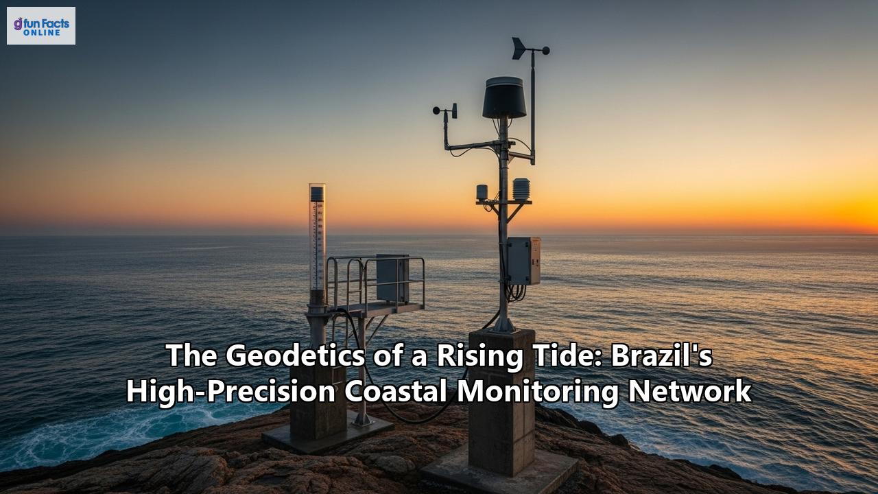
The establishment and operation of a high-precision coastal monitoring network on a continental scale is a monumental achievement, but it is not without its significant challenges. Technical hurdles, logistical complexities, and the constant need for financial investment require persistent effort and innovation. As Brazil looks to the future, addressing these challenges and capitalizing on new technological frontiers will be key to the network's continued success and relevance.
The Unification of Vertical Datums
One of the most significant and persistent geodetic challenges for Brazil is the existence of its two separate vertical datums, Imbituba and Santana. While over 95% of the country's High-Precision Altimetric Network (RAAP) is referenced to Imbituba, the inability to connect this network across the Amazon delta to the state of Amapá necessitated the separate Santana datum. This discrepancy is not just a theoretical problem. For creating a truly seamless national map of coastal vulnerability and for contributing to global sea-level models, a unified datum is essential.
The path forward involves moving beyond traditional leveling. The geodesy community is working towards connecting the datums by combining multiple techniques:
- GNSS on Leveling Benchmarks: Placing high-precision GNSS receivers on benchmarks in both datum zones.
- Gravimetric Geoid Models: Using gravity data from terrestrial, airborne, and satellite sources to create a highly accurate model of the geoid.
- Geopotential Numbers: Adopting a height system based on geopotential numbers, which reflects the physics of the Earth's gravity field.
The ultimate goal is to connect Brazil's vertical system to the International Height Reference Frame (IHRF), a global standard promoted by the International Association of Geodesy (IAG). This will ensure that Brazil's height measurements are fully compatible with global datasets, a crucial step for climate change research. Recent studies have made progress, estimating the offset between the datums, but achieving a final, rigorous unification remains a top priority.
Logistical and Financial Sustainability
Maintaining a distributed network of sophisticated scientific instruments in a harsh marine environment is a constant battle. The challenges are numerous:
- Vandalism and Damage: Moored buoys and even coastal stations are susceptible to vandalism and accidental damage from vessel traffic. The continuous operation of the National Buoy Program (PNBoia), for instance, has been hampered by such issues.
- Maintenance and Calibration: Sensors require regular maintenance and recalibration to ensure data quality. Replacing sensitive electronic components, many of which must be imported, is a significant and recurring cost.
- Data Gaps: The historical record of sea-level measurements in Brazil is not uniform. While some stations have long records, many others are more recent, and there are significant geographical gaps, particularly in the past. A 2017 report from the Brazilian Panel on Climate Change highlighted the lack of continuous and reliable historical records as a key uncertainty in measuring the full extent of sea-level rise.
Ensuring long-term financial commitment from government agencies and fostering public-private partnerships, like the one between PNBoia and the oil company Petrobras, are crucial for the network's sustainability and future expansion.
The Technological Frontier: AI, Big Data, and New Platforms
The future of coastal monitoring lies in the integration of ever-more powerful technologies and a move towards greater automation and predictive capability.
- Artificial Intelligence and Big Data: The sheer volume of data produced by the continuous monitoring network, combined with a decades-long archive of satellite imagery, is a prime candidate for machine learning and AI applications. These technologies can automate the process of shoreline extraction from images, detect anomalies in data streams, and identify complex patterns of coastal change that might be missed by human analysts.
- Integration of New Platforms: The use of Unmanned Aerial Vehicles (UAVs or drones) offers a way to bridge the gap between fixed-point measurements and broad satellite coverage. Drones can be deployed मौसम-dependent to create ultra-high-resolution digital elevation models of specific, rapidly changing areas, complementing the kinematic GNSS surveys.
- Enhanced Modeling and Forecasting: Initiatives like the Brazilian Sea Observatory (BSO) point the way forward. By assimilating real-time data from SiMCosta, RMPG, and satellites into high-resolution numerical models, these systems can move from simply monitoring what has happened to forecasting what is about to happen—predicting the path of an oil spill, the extent of a storm surge, or the areas most at risk of flooding in the next 24 hours.
As Brazil prepares to host the 2027 UN Ocean Decade Conference in Rio de Janeiro, it has a unique opportunity to showcase its commitment to ocean science. The continued development of its high-precision coastal monitoring network is a cornerstone of this commitment. By tackling its geodetic challenges, ensuring sustainable operation, and embracing the next wave of technology, Brazil can not only protect its own invaluable coastline but also provide a powerful model for how other nations can use the science of geodesy to confront one of the most defining challenges of the 21st century.
Conclusion: A Nation's Geodetic Shield Against the Tide
The Brazilian coastline, a magnificent and vital asset, is at a critical juncture. Besieged by the relentless rise of global sea levels and, in places, the alarming subsidence of its very foundation, the nation faces a future of profound environmental and socio-economic challenges. The stories of Maceió's sinking neighborhoods and Atafona's vanishing shores are not isolated incidents; they are potent warnings of a new reality unfolding along this immense 8,500-kilometer interface between land and sea.
In response, Brazil has forged a formidable shield, not of concrete and steel, but of data and precision. The nation's high-precision coastal monitoring network, a complex tapestry woven from the threads of geodesy, oceanography, and satellite technology, represents one of the most sophisticated efforts globally to understand and manage coastal change. Anchored by the robust framework of the Brazilian Geodetic System (SGB) and its altimetric network (RAAP), and driven by the operational prowess of initiatives like SiMCosta and the IBGE's RMPG, this system is a testament to the country's scientific and institutional commitment.
This network is far more than a collection of instruments. It is an integrated system that transforms the abstract science of geodesy into tangible, life-sustaining benefits. The continuous GNSS stations of the RBMC stand as silent sentinels, distinguishing the sinking of the land from the swelling of the sea. The radar tide gauges of SiMCosta and RMPG capture the ocean's pulse with millimeter accuracy, feeding critical information to port authorities, climate scientists, and disaster warning systems. Kinematic GNSS surveys paint dynamic portraits of beach erosion, empowering local governments to plan for a more resilient future, while from orbit, InSAR and altimetry satellites provide the sweeping, synoptic view that places local changes in a global context.
The data flowing from this network is the lifeblood of informed decision-making. It ensures that multi-billion dollar ports can operate safely and efficiently. It provides the evidence needed to guide urban development away from zones of unacceptable risk. It quantifies the immense, often-overlooked value of natural defenses like coral reefs and mangroves, making the economic case for他們的 conservation. It fuels the scientific research that will refine our understanding of climate change and supports the sustainable growth of a vibrant blue economy, from tourism to fisheries.
The path forward is laden with challenges—unifying vertical datums, ensuring long-term funding, and staying at the forefront of a rapidly evolving technological landscape. Yet, the resolve is clear. By integrating its monitoring efforts with global programs like GLOSS and embracing international collaborations, Brazil is not only addressing its national priorities but also making an indispensable contribution to our collective understanding of the planet's oceans.
In the grand chronicle of humanity's adaptation to a changing climate, Brazil's high-precision coastal monitoring network will be recorded as a landmark chapter. It is a story of how a nation, faced with the inexorable geodetics of a rising tide, chose to respond not with resignation, but with resolve, ingenuity, and the unblinking clarity of scientific measurement. It is a geodetic shield, meticulously crafted to protect a nation's heartland and navigate the turbulent waters of the 21st century.
Reference:
- https://resource.geospatialworld.net/casestudy/geodetic-and-radar-monitoring-solutions-for-tailings-dam-management-in-brazil
- https://www.un.org/oceancapacity/sites/www.un.org.oceancapacity/files/thesis_carina_abreu_31_12_pdf_1.pdf
- https://agenciabrasil.ebc.com.br/en/geral/noticia/2023-11/coral-reefs-northeast-brazil-prevent-brl-160-billion-damage
- https://www.ioc.unesco.org/en/brazil-strengthens-coastal-monitoring-network-18-stations-2026
- https://marine.copernicus.eu/services/use-cases/brazilian-coastal-service
- https://revistapesquisa.fapesp.br/en/the-progressive-destruction-of-brazilian-beaches/
- https://www.scielo.br/j/bcg/a/FhJ6BP8HJt6K9MX7ysCcqzK/?format=html&lang=en
- https://www.youtube.com/watch?v=hFFnWuL_IbQ
- https://www.scielo.br/j/bcg/a/GkGcmMSt4GH5QHQcMYctMwy/?format=pdf&lang=en
- http://www.gov.br/g20/pt-br/trilhas/trilha-de-sherpas/sustentabilidade_climatica_e_ambiental/technical-paper_adaptation_ecswg-docx.pdf/@@download/file
- https://www.scielo.br/j/bcg/a/sYD4dk4ByFgZ64vFBhZQYyq/?format=html&lang=en
- https://agenciadenoticias.ibge.gov.br/en/agencia-press-room/2185-news-agency/releases-en/12053-ibge-makes-simultaneous-adjustment-of-the-high-precision-altimetric-network
- https://www.ibge.gov.br/en/geosciences/geodetic-positioning/geodetic-networks/19307-geodetic-permanent-tide-gauge-network.html?edicao=20097
- https://linkinghub.elsevier.com/retrieve/pii/S0895981124002128
- https://geoftp.ibge.gov.br/metodos_e_outros_documentos_de_referencia/outros_documentos_tecnicos/apresentacoes_artigos/2016_Luz_Alt-Cient-&-Reaj-RAAP.pdf
- https://www.scielo.br/j/bcg/a/sYzk9wP3tmp6q7rqsTMLBYw/?lang=en
- https://www.ibge.gov.br/en/geosciences/geodetic-positioning/geodetic-networks/20079-brazilian-network-for-continuous-monitoring-gnss-systems.html
- https://agenciadenoticias.ibge.gov.br/en/agencia-news/2184-news-agency/news/41970-geodetic-permanent-tide-gauge-network-s-page-is-more-interactive
- https://www.frontiersin.org/journals/marine-science/articles/10.3389/fmars.2021.681619/full
- https://www.ioc-sealevelmonitoring.org/news.php?p=show&id=9448
- https://www.researchgate.net/publication/243111389_GNSS-based_monitoring_and_mapping_of_shoreline_position_in_support_of_planning_and_management_of_MatinhosPR_Brazil
- https://www.e3s-conferences.org/articles/e3sconf/pdf/2019/20/e3sconf_isgnss2018_01016.pdf
- https://meetings.pices.int/publications/presentations/Climate_Change_2008/Climate_Change_2008_S3_1/S3_1_Nicolodi.pdf
- https://www.researchgate.net/publication/278151702_Temporal_shoreline_series_analysis_using_GNSS
- https://www.gov.br/antaq/pt-br/central-de-conteudos/estudos-e-pesquisas-da-antaq-1/sumario_waycarbon_EN.pdf
- https://www.scielo.br/j/bcg/a/GkGcmMSt4GH5QHQcMYctMwy/?lang=en
- https://seer.ufu.br/index.php/revistabrasileiracartografia/article/download/56616/30790/248674
- http://www.ioc-sealevelmonitoring.org/index.php/news.php?p=show&id=9448
- https://www.researchgate.net/publication/392689979_Monitoring_marine_heatwaves_in_Salvador-BA_using_SiMCosta_data
- https://www.2020.submariner-network.eu/multi-frame-case-studies/91-multi-frame-cases/759-brazil-case-study-multi-frame
- https://www.researchgate.net/publication/325652795_Socioeconomic_Monitoring_for_Sustainable_Small-Scale_Fisheries_Lessons_from_Brazil_Jamaica_and_St_Vincent_and_the_Grenadines
- https://seer.ufu.br/index.php/revistabrasileiracartografia/article/download/64949/34593/296672
- https://simcosta.furg.br/wiki