The night sky is the oldest picture book of humanity, a canvas splashed with the chaotic brilliance of stars that, upon closer inspection, reveals a clockwork precision. For the modern urban dweller, the stars are often just faint, decorative glitter struggling against light pollution. But for our ancestors, the sky was the original internet—a vast, constantly updating source of information about time, navigation, agriculture, and the will of the gods.
Archaeoastronomy is the scientific discipline that seeks to decode this ancient relationship between humanity and the cosmos. It is not merely the history of astronomy—a dry recitation of when a planet was discovered—but the anthropology of astronomy. It asks not just what they saw, but how they saw it, and why it mattered so deeply that they moved mountains of stone to align with a single beam of light.
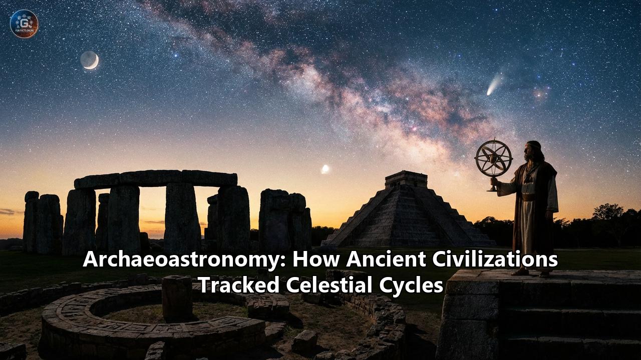
From the mist-shrouded peaks of the Andes to the arid deserts of Egypt, and from the dense jungles of Central America to the windswept plains of Salisbury, ancient civilizations developed sophisticated methods to track celestial cycles. They did this without telescopes, computers, or satellites. Their tools were shadow, stone, and an infinite patience that spanned generations. This article explores the ingenious ways these ancient sky-watchers locked their civilizations into the rhythm of the universe.
I. The Architecture of Light: Megalithic Timekeepers
Long before written language became common, humanity was writing in stone. The Neolithic peoples of Europe and the Americas understood that the sun was the ultimate pendulum of life. Its annual journey from the northernmost point of rising (summer solstice) to the southernmost (winter solstice) dictated the survival of the tribe.
The Solstice Engines: Stonehenge and Newgrange
Stonehenge, standing in the quiet plains of Wiltshire, England, is perhaps the most famous piece of astronomical hardware in the world. Built in stages starting around 3000 BCE, it is a masterpiece of engineering. While popular culture often associates it with Druids (who arrived millennia later), the builders were Neolithic farmers who needed a precise calendar.
The genius of Stonehenge lies in its "heel stone" alignment. On the summer solstice, the longest day of the year, an observer standing in the center of the circle sees the sun rise directly over the Heel Stone. However, recent archaeoastronomical research suggests the winter solstice was actually more important. The "Great Trilithon" frames the setting sun on the shortest day of the year. For a farming community, this was a message of hope: the sun had finished its retreat and would now begin its return, promising warmth and a new growing season.
Across the Irish Sea, the passage tomb of Newgrange (c. 3200 BCE) predates the Great Pyramid of Giza. It offers a more dramatic theatrical performance. Above the entrance is a "roof box," a specially engineered opening. For only a few days around the winter solstice, the rising sun aligns perfectly with this box. A beam of light penetrates the 19-meter passage, hitting the floor of the inner chamber and illuminating the triple-spiral carvings in the back. This event lasts only 17 minutes. It was a Neolithic special effect designed to capture the rebirth of the solar year in the womb of the earth.
The Sun Dagger of Chaco Canyon
In the American Southwest, the Ancestral Puebloans (often called the Anasazi) created an observatory of delicate precision at Fajada Butte in Chaco Canyon, New Mexico. Unlike the massive stones of Europe, this mechanism relied on a sliver of light.
High atop the butte, three large sandstone slabs lean against a cliff face, shielding a spiral petroglyph carved into the rock. This arrangement, known as the "Sun Dagger," utilizes the interaction of shadow and light. On the summer solstice, a single, dagger-shaped shaft of light pierces the center of the large spiral. On the winter solstice, two smaller daggers frame the spiral. This site functioned as a solar calendar, marking the extremes of the sun’s travel with an accuracy that rivals modern instruments. The site is so fragile that it is now closed to the public, a testament to the delicate balance between the ancient rock and the shifting sun.
II. The River and the Star: Ancient Egypt
In Ancient Egypt, astronomy was not an abstract science; it was a matter of life and death. The civilization depended entirely on the Nile River's annual flood to deposit the fertile black silt that allowed agriculture to flourish in the desert.
The Sothic Cycle and the Nilometer
The Egyptians noticed a celestial coincidence: the annual flooding of the Nile began almost exactly when the brightest star in the sky, Sirius (which they called Sopdet or Sothis), rose in the east just before dawn. This phenomenon, known as the "heliacal rising," marked the New Year.
Because their civil calendar was 365 days (lacking a leap year), it drifted by one day every four years. This meant the heliacal rising of Sirius would slowly drift through the calendar, only returning to the original date after a "Sothic Cycle" of approximately 1,460 years. Despite this drift, the rising of Sirius remained the anchor for their agricultural planning.
Pyramid Alignments and the Imperishable Stars
The Great Pyramid of Giza is aligned to true north with an accuracy of three-sixtieths of a degree—precision that is hard to achieve even today. The Egyptians achieved this by tracking the "Imperishable Stars" (the circumpolar stars that never set) using a simple sighting tool called a merkhet, which is essentially a palm rib with a slit in it, used in conjunction with a plumb line.
Inside the pyramids, "air shafts" (which likely served a symbolic rather than ventilating purpose) point to specific stars. In the King's Chamber, the northern shaft points to Thuban (the pole star of that era, in the constellation Draco), while the southern shaft points to Orion's Belt. Orion was associated with Osiris, the god of rebirth. The pyramid was thus a launchpad, aiming the pharaoh’s soul directly at the celestial destinations where he would reign eternally.
Ramesside Star Clocks
In the tombs of the Ramesside pharaohs (c. 1100 BCE), archaeologists found grids painted on the ceilings. These "Ramesside star clocks" were tables that allowed a user to tell time at night by observing the position of specific stars relative to a seated figure. If a star was over the figure's left ear, it was a certain hour; if it was over the heart, it was another. This system divided the night into 12 hours, a precursor to our modern 24-hour day.
III. The Mathematical Sky: Babylon and Mesopotamia
While the Egyptians were masters of alignment, the Babylonians were masters of data. In the fertile crescent of Mesopotamia (modern-day Iraq), priests served as the world’s first bureaucrat-astronomers.
The Enuma Anu Enlil
The Babylonians viewed the sky as a script written by the gods. To read it, they needed a dictionary. Over centuries, they compiled the Enuma Anu Enlil, a massive series of cuneiform tablets recording celestial phenomena and their corresponding terrestrial events (e.g., "If Mars is visible in month X, the King will die").
This desire for astrological prediction drove them to mathematical brilliance. They realized that celestial events were cyclic. By 700 BCE, they were using the "Saros cycle"—a period of approximately 18 years and 11 days—to predict lunar eclipses.
Zigzag Functions and the Trapezoid Rule
Recent discoveries have shown that Babylonian methods were even more advanced than previously thought. They did not use geometry like the Greeks; they used arithmetic. To track the variable speed of Jupiter (which slows down and speeds up as it moves across the sky), they used "zigzag functions"—arithmetic progressions that increase to a peak and then decrease.
Remarkably, a tablet analyzed in 2016 revealed that Babylonians used a form of calculus to calculate the distance Jupiter traveled. They drew a trapezoid on a graph representing velocity versus time and calculated its area. This "trapezoid rule" was thought to have been invented in 14th-century Europe, yet Babylonian priests were using it 1,500 years earlier to track the wandering star of their god Marduk.
IV. The Mesoamerican Cosmos: The Maya and the Venus Cycle
For the Maya civilization of Central America, time was a divine burden carried by the gods. Their obsession with cycles led to the creation of the most intricate calendar system in the ancient world.
The Venus Table of the Dresden Codex
The Maya were particularly obsessed with Venus. To them, Venus was not the goddess of love but a dangerous, warlike deity. They planned battles to coincide with key moments in Venus's cycle, such as its first appearance as the Morning Star.
The Dresden Codex, one of the few Maya books to survive the Spanish conquest, contains the famous "Venus Table." This table tracks the synodic cycle of Venus (584 days). However, the Maya astronomer-priests realized that the cycle is actually 583.92 days. Over decades, this small error would ruin their predictions.
The Codex reveals a stunning mathematical fix. The Maya inserted correction factors—essentially subtracting days at specific intervals—to keep the Venus cycle synchronized with the solar calendar. This level of precision allowed them to predict the position of Venus to within two hours over a period of 500 years.
Zenith Passage
Living in the tropics, the Maya experienced a phenomenon unknown to Europeans: the "Zenith Passage." Twice a year, the sun passes directly overhead, casting no shadow at noon. Maya architecture often features vertical tubes or "zenith tubes" (like those at Xochicalco) that allow a beam of light to illuminate an underground chamber only at the exact moment of the zenith passage. This event signaled the time to plant crops, linking the architecture of the city directly to the agricultural survival of the people.
V. Empire of the Sun: The Inca
High in the Andes, the Inca Empire (Tawantinsuyu) developed a unique form of astronomy that relied on the landscape itself.
The Ceque System
The capital city of Cusco was the center of a massive radial calendar. Imaginary lines called ceques radiated out from the Temple of the Sun (Coricancha). Along these lines were hundreds of huacas (sacred shrines)—rocks, springs, or hills. The ceque system was a landscape calendar; specific families were assigned to care for specific shrines, and the sun’s position relative to these lines marked the passage of the agricultural year.
Horizon Astronomy
The Inca practiced "horizon astronomy." They built pillars called sukankas on the ridges surrounding Cusco. By standing in the main plaza and watching where the sun rose or set relative to these pillars, they could determine the date with single-day accuracy. This was critical for high-altitude agriculture, where a frost could destroy the harvest if planting was mistimed.
Dark Constellations
Uniquely among ancient civilizations, the Inca saw pictures not just in the stars, but in the darkness. The Milky Way (which they called Mayu, the River) is so bright in the high Andes that it casts shadows. The Inca identified the dark dust lanes within the Milky Way as "Dark Constellations." They saw a Llama (with the star Alpha Centauri as its eye), a Toad, a Serpent, and a Fox. These animals were thought to be drinking from the celestial river.
Machu Picchu: The Intihuatana
At Machu Picchu, the famous Intihuatana stone ("Hitching Post of the Sun") is a masterpiece of abstract sculpture and astronomy. Its angles are aligned to the cardinal directions. At the winter solstice, the priest would perform a ceremony to "tie" the sun to the stone to prevent it from drifting away forever into the northern sky. The stone’s pillar is inclined at approx 13 degrees—the latitude of Machu Picchu—meaning that on the equinoxes, the sun sits directly above the pillar, casting no shadow.
VI. Navigators of the Infinite: Polynesian Wayfinding
While other civilizations used stone to track stars, the Polynesians used the stars to conquer the largest ocean on Earth. Their "monuments" were their double-hulled canoes (waka), and their observatories were their minds.
The Star Compass
Polynesian navigators did not use physical tools like sextants or magnetic compasses. Instead, they memorized a "Star Compass." They divided the horizon into 32 "houses" where specific stars rose and set.
A navigator knew that if the star Altair was rising in the "Manu" house (northeast), they could steer toward it to maintain a bearing. As the stars rotated across the sky, the navigator would switch to a new "steering star."
Zenith Stars and Latitude
Polynesian navigators also used "Zenith Stars." They knew that specific stars passed directly overhead at specific islands. For example, the star Arcturus (Hokule'a) passes directly over the zenith of Hawaii. To find Hawaii, a navigator would sail north until Arcturus was directly overhead, and then sail downwind (west) until the island appeared.
Reading the Ocean
Astronomy was only one layer of their system. They combined star positions with the reading of ocean swells. A wayfinder could sit inside the hull of the canoe and feel the "pulse" of the ocean—distinguishing between the main swell, the reflected swell bouncing off a distant island, and wind-driven chop. Combined with the observation of land-based birds (like terns and noddies), this allowed them to pinpoint tiny islands in thousands of miles of open water.
VII. The New Archaeoastronomy: LiDAR and the Future
Today, the field of archaeoastronomy is undergoing a revolution thanks to modern technology. We no longer rely solely on theodolites and patient observation.
LiDAR (Light Detection and Ranging) uses lasers fired from aircraft to strip away vegetation digitally, revealing the ground beneath. In 2018, LiDAR scans of the Maya Biosphere Reserve in Guatemala revealed over 60,000 previously unknown structures. This data showed that Maya cities were interconnected on a massive scale, with causeways and sightlines that may have further astronomical significance waiting to be decoded.Similarly, in 2024, LiDAR revealed high-altitude medieval cities (Tugunbulak and Tashbulak) along the Silk Road in Uzbekistan. These sites, hidden for centuries, are now being analyzed for their orientation and layout, potentially revealing how these trade hubs tracked the seasons in their harsh mountain environment.
Virtual Reality and 3D Modeling allow researchers to reconstruct sites as they appeared thousands of years ago. We can now simulate the sky of 3000 BCE (accounting for the precession of the equinoxes) and "walk" through a digital Stonehenge or Chaco Canyon to see alignments that are broken or eroded today.Conclusion: The Legacy of Looking Up
The study of archaeoastronomy teaches us that ancient people were not "primitive." They were keen observers who used the tools available to them to solve complex problems. They did not distinguish between science, religion, and art; the alignment of a temple was simultaneously an engineering challenge, a theological statement, and a survival necessity.
From the mathematically perfect calendars of the Maya to the shadow-casting stones of the Inca and the star-steering songs of the Polynesians, humanity has always looked up to find its way. These ancient celestial trackers remind us that we are part of a larger cycle, a clockwork of light and gravity that has been ticking long before us and will continue long after we are gone. When we look up at the night sky, we are not just seeing stars; we are seeing the same map that guided our ancestors home.
Reference:
- https://www.ticketmachupicchu.com/astronomy-and-calendar-inca/
- https://www.flycuscoperu.com/blog/intihuatana-at-machu-picchu-a-marvel-of-andean-astronomy
- https://www.machupicchu.org/machu-picchu-the-lost-astronomical-observatory-of-the-incas.htm
- https://npshistory.com/publications/chcu/brochures/fajada-butte-2022.pdf
- https://www.exploratorium.edu/never-lost/navigation/basics-wayfinding/set-course-which-way
- https://www.ancient-origins.net/history-ancient-traditions/sun-dagger-0016806
- https://annex.exploratorium.edu/ancientobs/chaco/HTML/fajada.html
- https://www.researchgate.net/publication/279367040_Babylonian_Mathematical_Astronomy_Procedure_Texts
- https://english.netmassimo.com/2016/08/18/a-mayan-codex-shows-this-civilizations-knowledge-of-mathematics-and-astronomy/
- https://www.hermetic.ch/cal_stud/maya/boehm/boehm51.htm
- https://www.peruforless.com/blog/inca-astronomy
- https://worldwidevoyage.hokulea.com/education-at-sea/polynesian-navigation/the-star-compass/
- https://hokulea.com/polynesian-wayfinding/
- https://shakatribeshop.com/pages/the-art-of-polynesian-navigation-exploring-ancient-seafaring-techniques
- https://www.aerial-precision.com/blogs/blog/discovering-hidden-histories-the-revolutionary-impact-of-lidar-technology-in-archaeology
- https://archaeologymag.com/2024/10/lidar-reveals-silk-road-cities-in-uzbekistan/