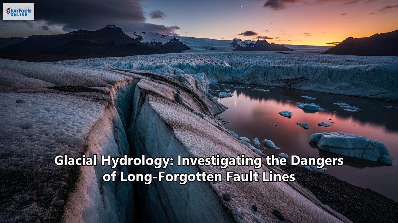
The Icy Veins of the Earth: How Glacial Hydrology is Awakening Long-Dormant Fault Lines
Deep beneath the serene and seemingly static expanse of our planet's glaciers and ice sheets lies a dynamic and powerful world. This hidden realm is governed by the intricate plumbing of glacial hydrology—the study of water's journey through these colossal bodies of ice. For millennia, the immense weight of these frozen giants has suppressed the earth's crust, keeping ancient fissures in the bedrock—long-forgotten fault lines—in a state of slumber. But as our climate warms at an unprecedented rate, this delicate balance is being catastrophically disturbed. The rapid melting of glaciers is not just causing sea levels to rise; it is awakening these sleeping giants, leading to a cascade of geological hazards that are only now beginning to be understood.
The very ground beneath our feet is becoming less stable, and the intricate dance between ice and water is at the heart of this emerging threat. The sheer weight of a glacier, which can be thousands of feet thick, presses down on the Earth's crust, a process that can keep fault lines from moving and triggering earthquakes. However, as this ice melts, the pressure is released, causing the ground to rebound in a process known as glacial isostatic adjustment (GIA). This "bouncing back" of the land can reactivate faults, some of which may have been dormant for thousands of years.
The story, however, is not just about the removal of weight. The vast quantities of meltwater produced by shrinking glaciers are playing a crucial and often more immediate role. This water can infiltrate deep into the earth, lubricating fault lines and increasing pore pressure within the rock, which can be enough to trigger an earthquake. This confluence of factors—the long-term geological response of GIA and the immediate hydrological pressures of meltwater—is creating a new and unpredictable seismic landscape in formerly glaciated regions across the globe.
The Double-Edged Sword of Glacial Melt: Isostatic Rebound and Hydrological Loading
The dangers emanating from the intersection of glacial hydrology and ancient fault lines are twofold, stemming from two distinct yet interconnected processes: glacial isostatic adjustment and direct hydrological loading.
Glacial Isostatic Adjustment (GIA): The Slow Unburdening of the Earth's CrustImagine placing a heavy weight on a soft mattress. The mattress sinks under the load and bulges at the sides. When the weight is removed, the mattress slowly returns to its original shape. The Earth's crust behaves in a similar fashion under the immense weight of an ice sheet. During periods of glaciation, the land beneath the ice is depressed, and the viscous mantle material below is pushed aside. As the glaciers retreat, this pressure is released, and the land begins to rise in a slow, ongoing process of isostatic rebound.
This rebound is not a uniform or gentle process. It can create significant stress on the Earth's crust, particularly along pre-existing weaknesses like fault lines. As the crust flexes and bends, these faults can be "unclamped," making them more likely to slip and cause an earthquake. This phenomenon is not merely theoretical; scientists have documented a clear link between post-glacial rebound and increased seismic activity in regions like Fennoscandia (encompassing Norway, Sweden, and Finland) and North America. In northern Fennoscandia, for instance, the retreat of the last great ice sheet triggered massive earthquakes, some with estimated magnitudes of up to 8, leaving behind visible fault scarps that are still present today. These were not just any faults; they were ancient lines of weakness in the crust, reawakened by the shifting weight of the ice.
Hydrological Loading: The Immediate and Insidious Influence of MeltwaterWhile GIA is a long-term process that unfolds over thousands of years, the hydrological effects of melting glaciers can be much more immediate and insidious. The sheer volume of meltwater being generated is staggering, and it has to go somewhere. This water forms complex drainage systems within and beneath the ice, including supraglacial streams on the surface, englacial channels within the ice, and subglacial rivers at the glacier's base.
This intricate network of icy veins can transport vast quantities of water to the glacier bed, where it can have a profound impact on the underlying geology. One of the most significant effects is the increase in pore pressure. Imagine a sponge filled with water. The water pressure within the sponge's pores pushes outward, reducing the friction between the sponge's internal structures. In a similar way, when meltwater seeps into the cracks and fissures of a fault zone, it increases the pressure within the rock pores. This elevated pore pressure can counteract the frictional forces that are holding the fault in place, effectively "lubricating" it and making it easier for the two sides to slip past each other.
This process is particularly concerning for faults that are already close to their breaking point. The added stress from increased pore pressure can be the final push that triggers an earthquake. This has been observed in the Alps, where intense glacier melt has been linked to an increase in micro-earthquakes. The meltwater infiltrates deep into the rock, weakening fault lines and making them more susceptible to seismic slips.
A World on Unsteady Ground: Case Studies from Around the Globe
The link between retreating glaciers and reawakened fault lines is not confined to one or two isolated regions. Evidence of this growing threat is emerging from mountainous and polar regions across the planet.
Alaska: Where Tectonic and Glacial Forces CollideSouthern Alaska is a natural laboratory for studying the interplay of glacial melt and seismic activity. The region is not only home to some of the world's largest glaciers but also sits on the boundary of the Pacific and North American tectonic plates, making it one of the most seismically active areas on Earth. For centuries, the immense weight of Alaska's glaciers helped to "clamp down" on the region's faults, potentially suppressing some seismic activity.
However, with glaciers in the region melting at an accelerated rate, this stabilizing force is being removed. A landmark study of the 1958 magnitude 7.8 earthquake in Lituya Bay, which triggered a massive tsunami, found that the widespread loss of glacier ice in the region likely helped to set the stage for the quake. The study revealed that the epicenter of the earthquake was located near the area that had experienced the most significant ice loss. The resulting isostatic rebound and the associated stresses are believed to have made the fault more likely to slip. More recent research has reinforced this connection, suggesting that glacial rebound has influenced the timing and location of numerous earthquakes with a magnitude of 5.0 or greater in the past century.
The European Alps: A Ticking Seismic ClockThe Alps, with their iconic snow-capped peaks, are also feeling the tremors of a changing climate. The mountain range is warming at about twice the global average, leading to a dramatic retreat of its glaciers. This has been accompanied by a startling increase in seismic activity. In the Mont Blanc massif, for example, the frequency of micro-earthquakes has increased tenfold since 2015.
Scientists have linked this surge in tremors to the infiltration of meltwater into the region's fault lines. Heatwaves accelerate glacier melt, and the resulting water seeps deep into the rock, increasing pore pressure and weakening faults. While these micro-earthquakes are currently too small to pose a major threat, they are a clear warning sign that the region's seismic stability is being compromised.
Fennoscandia: Echoes of the Last Ice AgeThe dramatic fault scarps that cut across the landscape of northern Fennoscandia are a stark reminder of the immense power of post-glacial rebound. These features were formed by a series of powerful earthquakes that occurred as the massive Weichselian ice sheet retreated around 10,000 years ago. The sheer scale of these ancient quakes, with some estimated to have been as large as magnitude 8, highlights the potential for catastrophic seismic events to be triggered by deglaciation.
While the most intense period of seismic activity in Fennoscandia has passed, the region continues to experience smaller intraplate earthquakes that are thought to be related to ongoing isostatic adjustment. These events demonstrate that the geological reverberations of the last ice age are still being felt today, and they offer a sobering glimpse into the potential long-term seismic consequences of our current era of rapid ice melt.
Antarctica: The Sleeping Giant StirsThe vast ice sheets of Antarctica, which hold the majority of the world's fresh water, are also showing signs of a seismic awakening. Research has shown that glacial isostatic adjustment has the potential to reactivate faults across the continent, particularly in areas like the Ross Sea. As the ice sheet thins and retreats, the underlying crust is responding, and ancient rift systems are showing an increased potential for fault reactivation. While the remoteness of Antarctica means that the immediate human impact of these potential earthquakes is low, the implications for the stability of the ice sheet itself are a major concern.
The Widening Circle of Danger: Beyond the Shaking Ground
The dangers posed by the reawakening of long-forgotten fault lines extend far beyond the immediate shaking of an earthquake. The complex interplay of glacial hydrology and seismic activity can unleash a cascade of secondary hazards that can be just as, if not more, destructive.
Glacial Lake Outburst Floods (GLOFs): A Deluge from the MountainsAs glaciers retreat, they often leave behind depressions in the landscape that can fill with meltwater, forming what are known as proglacial lakes. These lakes can grow to enormous sizes and are often dammed by unstable moraines—ridges of loose rock and sediment left behind by the glacier.
An earthquake can be a catastrophic trigger for the failure of these moraine dams. The ground shaking can destabilize the loose material, causing the dam to collapse and release a massive and sudden torrent of water, rock, and ice downstream. These events, known as glacial lake outburst floods or GLOFs, can travel for many miles, destroying everything in their path, including homes, infrastructure, and agricultural land. The Himalayas, in particular, are a hotspot for GLOFs, with a growing number of these hazardous lakes forming as the region's glaciers shrink. A GLOF in Nepal in 2025, for instance, washed away a key bridge and damaged hydropower projects, highlighting the significant risks these events pose to downstream communities.
Landslides and Avalanches: The Unstable Slopes Left BehindGlaciers not only carve out valleys but also act as a buttress, supporting the surrounding valley walls. As glaciers retreat, this support is removed, leaving behind over-steepened and unstable slopes. These slopes are highly susceptible to failure, and an earthquake can be the final straw that triggers a massive landslide or rock avalanche.
These mass movements can be incredibly destructive on their own, but they can also create a domino effect of further hazards. A landslide that crashes into a proglacial lake can displace a massive amount of water, creating a displacement wave that over-tops the moraine dam and triggers a GLOF. The combination of these hazards can lead to a truly catastrophic event, with a complex and far-reaching impact.
On Shifting Ground: Monitoring and Mitigation in a New Era of Seismic Risk
Given the growing evidence of a link between glacial retreat and seismic activity, the need for enhanced monitoring and proactive mitigation strategies has never been more urgent. Scientists are employing a range of cutting-edge technologies to keep a close watch on these dynamic and often remote environments.
Eyes on the Ice, Ears to the Ground: The Tools of Modern Glaciology and SeismologyMonitoring the intricate relationship between glacial hydrology and fault lines requires a multi-pronged approach that combines satellite observations with on-the-ground measurements.
- Seismic Monitoring: Networks of seismometers are crucial for detecting and locating even the smallest of earthquakes, providing a detailed picture of the seismic activity in a region. By analyzing the patterns of these "icequakes," scientists can gain insights into the processes that are occurring within and beneath the ice, from the fracturing of crevasses to the movement of subglacial water.
- GPS and Satellite Interferometry: Global Positioning System (GPS) stations placed on glaciers can track their movement with incredible precision, revealing both long-term trends and short-term accelerations that may be linked to hydrological events. Satellite-based techniques like Interferometric Synthetic Aperture Radar (InSAR) can create detailed maps of ground deformation over large areas, allowing scientists to monitor the slow uplift of isostatic rebound and identify areas where stress may be building on faults.
- Subglacial Probes and Radar: To understand what is happening at the base of a glacier, scientists can use specialized tools like subglacial probes that can be lowered down boreholes to measure water pressure, temperature, and conductivity. Ground-penetrating radar can also be used to map the subglacial environment and identify the presence of water channels and lakes.
While predicting the exact timing and location of an earthquake remains a significant challenge, there are steps that can be taken to mitigate the risks associated with this new era of glacier-related seismicity.
- Hazard Mapping and Risk Assessment: A critical first step is to identify the areas that are most at risk. This involves creating detailed maps of active and potentially active fault lines, as well as identifying unstable slopes and hazardous proglacial lakes.
- Early Warning Systems: For hazards like GLOFs, early warning systems can be a lifesaver. These systems can use a network of sensors to detect the signs of an impending flood, such as a sudden rise in lake level or ground vibrations from a landslide, and trigger alarms to give downstream communities time to evacuate.
- Infrastructure and Land-Use Planning: In areas that are deemed to be at high risk, it is crucial to incorporate these hazards into infrastructure planning and land-use regulations. This may mean avoiding the construction of critical infrastructure, such as hydropower dams or settlements, in the potential path of a GLOF or on unstable slopes.
- International Cooperation: The challenges posed by glacier-related hazards often transcend national borders. The Himalayan region, for example, is home to a number of transboundary rivers, and a GLOF that originates in one country can have a devastating impact on communities in another. This highlights the need for international cooperation in data sharing, risk assessment, and the development of joint mitigation strategies.
A Future Etched in Ice and Stone
The reawakening of long-forgotten fault lines is a stark and unsettling reminder of the profound and often-unforeseen consequences of a warming planet. The intricate dance between ice and water, which has shaped our world for millennia, is being thrown into disarray, and the geological reverberations of this change are only just beginning to be felt.
The scientific community is working tirelessly to understand and predict these emerging threats, but the challenges are immense. The complex and interconnected nature of the Earth's systems means that there are still many unknowns, and the pace of change is often faster than our ability to respond.
Ultimately, addressing the root cause of this problem—climate change—is the only long-term solution. But in the meantime, we must learn to live with the new realities of a world on unsteady ground. This will require a concerted effort to enhance our scientific understanding, invest in robust monitoring and early warning systems, and implement proactive mitigation strategies that can help to protect vulnerable communities from the growing dangers that are being unleashed from beneath the ice. The story of glacial hydrology and its influence on the Earth's crust is a powerful and cautionary tale, one that is being written in the shifting landscapes of our planet's frozen frontiers.
Reference:
- https://www.researchgate.net/publication/250075022_Intraplate_Seismicity_of_a_Recently_Deglaciated_Shield_Terrane_A_Case_Study_from_Northern_Ontario_Canada
- https://www.researchgate.net/publication/258465884_Deglaciation_Generated_Intraplate_Earthquakes_in_Fennoscandia_Why_Did_They_Occur_as_the_Ice_Retreated_and_Why_in_the_North_and_not_in_the_South
- https://www.researchgate.net/publication/248718728_Fault_reactivation_and_fluid_flow_along_a_previously_dormant_normal_fault_in_the_Northern_North_Sea
- https://pangea.stanford.edu/departments/geophysics/dropbox/STRESS/publications/MDZ%20PDF's/2000/geology_wiprutzoback.pdf
- https://figshare.utas.edu.au/articles/thesis/Active_glacier_processes_from_machine_learning_applied_to_seismic_records/23246837
- https://pubs.geoscienceworld.org/ssa/bssa/article/98/6/2828/342031/Intraplate-Seismicity-of-a-Recently-Deglaciated
- https://pubs.geoscienceworld.org/gsa/geology/article-abstract/43/7/611/131947/Intraplate-seismicity-in-northern-Central-Europe
- https://tc.copernicus.org/preprints/tc-2019-132/tc-2019-132-manuscript-version4.pdf
- https://www.usgs.gov/publications/monitoring-glacier-surface-seismicity-time-and-space-using-rayleigh-waves
- https://www.dubai-sensor.com/special-pressure-temperature-and-conductivity-sensors-for-subglocial-probes-in-monitoring-glaciers/
- https://pangea.stanford.edu/departments/geophysics/dropbox/STRESS/publications/MDZ%20PDF's/2001/GrollimunZobackGeology%202001PDF.pdf
- https://www.researchgate.net/publication/256422375_Monitoring_glacier_surface_seismicity_in_time_and_space_using_Rayleigh_waves
- https://egusphere.copernicus.org/preprints/2023/egusphere-2023-2253/egusphere-2023-2253.pdf
- https://www.tandfonline.com/doi/full/10.1080/15230430.2024.2335991
- https://tc.copernicus.org/articles/18/505/2024/tc-18-505-2024.pdf
- https://www.cambridge.org/core/journals/journal-of-glaciology/article/subglacial-water-pressure-and-icespeed-variations-at-johnsons-glacier-livingston-island-antarctic-peninsula/01D01F961CF2DF9FAC3C9ACEB351A073
- https://pmc.ncbi.nlm.nih.gov/articles/PMC10584099/
- https://www.fema.gov/emergency-managers/risk-management/hazard-mitigation-planning
- https://www.sjdz.org.cn/en/article/doi/10.19975/j.dqyxx.2021-002
- https://www.researchgate.net/publication/241062386_Automated_monitoring_of_subglacial_hydrological_processes_with_ground-penetrating_radar_GPR_at_high_temporal_resolution_Scope_and_potential_pitfalls