An incredible discovery has been made deep beneath the Atlantic Ocean, rewriting the history of our planet. Scientists have unearthed gigantic, 117-million-year-old "mud waves" that provide a unique window into the dramatic birth of the Atlantic Ocean. These are not waves of water, but colossal ripples of sediment, some a kilometer long and hundreds of meters high, buried deep beneath the seabed. This groundbreaking find, located about 400 kilometers off the coast of Guinea-Bissau in West Africa, is forcing geologists to rethink the timeline of the Atlantic's formation and its impact on global climate.
The story of these ancient mud waves begins with the breakup of the supercontinent Gondwana. During the Mesozoic Era, when dinosaurs roamed the Earth, the landmass that would become South America began to split away from the landmass that would become Africa. This colossal tectonic rift created a narrow seaway known as the Equatorial Atlantic Gateway. It was within this newly forming ocean basin that the mud waves were born.
A team of geologists from Heriot-Watt University, Dr. Débora Duarte and Dr. Uisdean Nicholson, made the discovery by analyzing a combination of modern seismic data and core samples from wells drilled back in 1975 by the Deep Sea Drilling Project (DSDP). What they found was a stunningly preserved record of a cataclysmic event in Earth's history.
The formation of these mud waves is attributed to a phenomenon described as a "giant waterfall" of dense, salty water. As the Equatorial Atlantic Gateway began to open, it connected the fresher waters of the Central Atlantic to the north with newly formed, extremely saline basins to the south. Just before this, vast salt deposits had formed in the nascent South Atlantic. When the gateway finally breached, the denser, saltier water from the south cascaded northward, flowing beneath the less dense fresher water. This powerful, deep-ocean current, laden with mud and sand, sculpted the seafloor into the massive waves that are still visible in the seismic data today.
This discovery has profound implications for our understanding of Earth's past. The presence of these 117-million-year-old mud waves provides direct sedimentary evidence that the marine connection between the North and South Atlantic was established much earlier than previously thought. Previous estimates placed the opening of the gateway between 113 and 83 million years ago. These findings push that date back by at least four million years.
Furthermore, the research suggests a strong link between the opening of the Atlantic and a period of significant global climate change. The establishment of this new ocean gateway is believed to have coincided with the onset of global climate cooling. Prior to the opening, vast amounts of carbon were likely stored in lakes and emerging basins in the Equatorial Atlantic. The breaching of the gateway would have disrupted this carbon storage, potentially leading to a period of warming between 117 and 110 million years ago as the gateway expanded and influenced ocean circulation patterns. This dynamic interplay between the opening of ocean gateways, ocean circulation, and climate change is a crucial area of study for understanding our planet's climate system.
The discovery of these ancient mud waves is a testament to the power of scientific inquiry and the enduring mysteries hidden within our planet's geological record. By re-examining old data with new perspectives and technologies, scientists continue to uncover astonishing secrets about the Earth's dramatic and dynamic past. These silent, buried giants of the deep are now speaking to us, revealing a story of continental breakup, ocean birth, and climate transformation that unfolded over millions of years.
The Colossal Underwater Dunes: A Closer Look at the Mud Waves
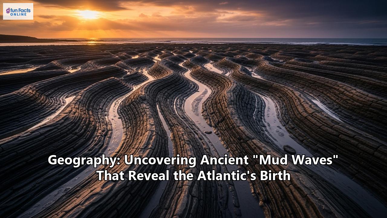
Deep beneath the waves, in a realm of perpetual darkness and immense pressure, lies a landscape of epic proportions that has been hidden from view for over a hundred million years. These are the ancient mud waves, colossal structures that dwarf many landforms on the surface. Imagine, if you can, a field of underwater dunes, not of sand, but of mud and finer sediments, with individual waves stretching for a kilometer in length and cresting at heights of several hundred meters. These are not fleeting features, but permanent geological formations, a testament to the powerful forces that shaped our planet's oceans.
These remarkable structures were discovered buried approximately one kilometer beneath the modern seafloor, about 400 kilometers off the coast of Guinea-Bissau, West Africa. This location is of immense geological significance as it sits at the "pinch-point" of the separating continents of South America and Africa, a region known as the Equatorial Atlantic Gateway. It was here that the final land bridge between the two continents was breached, giving birth to the Atlantic Ocean as we know it today.
The mud waves are a type of sedimentary deposit known as a "contourite drift." Unlike turbidites, which are sediments deposited by gravity-driven underwater avalanches that flow downslope, contourites are formed by the persistent, along-slope flow of deep-ocean currents. These currents, often driven by differences in water temperature and salinity (thermohaline circulation), act like slow-moving rivers on the ocean floor, transporting and depositing vast quantities of fine-grained sediment over geological timescales.
The discovery of these particular contourite drifts was made by geologists Dr. Débora Duarte and Dr. Uisdean Nicholson of Heriot-Watt University. They were analyzing seismic data, which uses sound waves to create an "x-ray" of the Earth's subsurface, when they noticed a striking layer of sediment. This layer contained vast fields of these sediment waves, a clear indication of powerful, ancient bottom currents. The researchers combined this seismic imaging with physical evidence from core samples drilled by the Deep Sea Drilling Project (DSDP) in 1975, which allowed them to date the formations and analyze their composition.
The sheer scale of these mud waves is difficult to comprehend. Dr. Nicholson has compared their size to the overland dunes of the Namib Desert, one of the most extensive dune fields on Earth. However, these underwater structures are composed of much finer material, primarily mud and sand, that was once suspended in the water column. The formation of such large-scale features required a sustained and powerful current, a force of nature that has been described as a "giant waterfall" beneath the ocean's surface.
The existence of these mud waves provides a direct, physical record of the oceanographic conditions at the time of the Atlantic's birth. They tell a story of a newly formed seaway, a dynamic and turbulent environment where vast quantities of water with different properties were mixing for the first time. The study of these buried giants is not just an exploration of the past; it is a key to understanding the fundamental processes of oceanography, sedimentology, and plate tectonics that continue to shape our world.
The "Underwater Waterfall": A Phenomenon of Epic Proportions
The creation of the colossal mud waves at the dawn of the Atlantic Ocean can be attributed to a truly awe-inspiring geological event: a massive, sub-oceanic "waterfall" of dense, salty water. This was not a waterfall in the conventional sense, with water cascading over a cliff in the open air. Instead, it was a powerful, gravity-driven flow of one body of water through another, a phenomenon made possible by a dramatic contrast in their densities.
The stage for this underwater spectacle was set by the unique geography of the newly forming Atlantic Ocean, approximately 117 million years ago. As the South American and African continents continued to tear apart, a narrow and restricted seaway, the Equatorial Atlantic Gateway, began to form. To the south of this gateway, in the nascent and still-constricted South Atlantic basin, the climate was arid, leading to high rates of evaporation. Over vast periods, this evaporation concentrated the salt in the seawater, creating a dense, hypersaline brine. In the Central Atlantic, to the north of the gateway, the waters were comparatively fresh and less dense.
For a time, a geological barrier, or sill, prevented these two distinct bodies of water from mixing. However, as the tectonic plates continued to separate, this barrier was finally breached. When the gateway opened, the laws of physics took over. The much denser, saltier water from the southern basins began to spill northward, sinking beneath the lighter, fresher water of the Central Atlantic. This created a powerful, deep-ocean cascade that flowed along the seafloor, a submerged torrent of saline water.
This underwater waterfall was not a gentle flow. The significant density contrast between the two water masses would have resulted in a strong and erosive current. This current picked up and transported vast quantities of sediment—mud, silt, and sand—from the seafloor. As this sediment-laden current flowed, it began to deposit its load in a series of massive, wave-like structures, the contourite drifts that we now recognize as the ancient mud waves. The process is akin to how wind sculpts sand dunes in a desert, but on a much grander and submerged scale.
The discovery of these mud waves, and the understanding of the underwater waterfall that created them, provides a vivid illustration of the dynamic and often violent processes that accompany the formation of new ocean basins. It also highlights the crucial role of thermohaline circulation—the movement of water driven by differences in temperature and salinity—in shaping the deep-ocean environment. Even today, similar, though less dramatic, processes of dense water cascading occur in various parts of the world's oceans, such as the flow of dense water out of the Mediterranean Sea at the Strait of Gibraltar.
The 117-million-year-old mud waves are a frozen snapshot of this incredible event. They are a direct and tangible record of the moment the Atlantic Ocean truly began to connect, a testament to the immense power of an underwater waterfall that raged for millennia, shaping a landscape that would remain hidden for eons.
A New Chapter in Earth's History: The Rewritten Timeline of the Atlantic's Birth
The discovery of the 117-million-year-old mud waves has sent ripples through the scientific community, compelling a significant revision of the accepted timeline for the birth of the Atlantic Ocean. This geological "birth certificate," as some have called it, pushes back the date of this pivotal event by at least four million years, a significant margin in the grand scheme of Earth's history.
For decades, the prevailing scientific consensus was that the Equatorial Atlantic Gateway, the crucial seaway that connected the nascent North and South Atlantic basins, opened sometime between 113 and 83 million years ago. This understanding was based on a variety of geological evidence, including the magnetic striping on the ocean floor and the analysis of rock formations on the continents. However, the discovery of these massive contourite drifts provides direct, unambiguous sedimentary evidence of a fully established marine connection at a much earlier date.
The mud waves, as we have seen, were formed by a powerful, deep-ocean current that could only have existed once the gateway was open and water was flowing between the northern and southern basins. By dating the sediments within these waves to 117 million years ago, scientists have established a new, firm "start date" for this critical phase of the Atlantic's formation. This finding demonstrates that the final separation of South America and Africa, and the subsequent establishment of a deep-water connection, happened earlier in the Cretaceous period than previously believed.
This revised timeline is not just a matter of adjusting dates on a geological chart. It has profound implications for our understanding of a wide range of Earth systems, from plate tectonics to ocean circulation and climate change. Knowing the precise timing of the opening of a major ocean gateway like the Equatorial Atlantic allows for more accurate reconstructions of past continental configurations and the forces that drove them apart.
The story of the Atlantic's formation is a key chapter in the larger saga of the breakup of the supercontinent Gondwana. This immense landmass, which once comprised present-day South America, Africa, Antarctica, Australia, India, and the Arabian Peninsula, began to fracture and drift apart around 180 million years ago. The separation of Africa and South America was a particularly significant event, leading to the creation of the South Atlantic Ocean. The new evidence from the mud waves provides a more precise timestamp for one of the final and most dramatic stages of this continental divorce.
Furthermore, a more accurate timeline for the Atlantic's birth allows for a better understanding of the evolution of life during this period. The creation of a new ocean basin would have created new marine habitats and altered the pathways of oceanic currents, influencing the distribution of marine organisms.
In essence, the ancient mud waves are a geological clock that has been reset. They have provided a crucial piece of the puzzle that is Earth's history, allowing scientists to refine their models and paint a more accurate picture of our planet's dynamic and ever-changing past. The discovery is a powerful reminder that even our most established scientific theories are subject to revision in the face of new and compelling evidence.
A World in Flux: The Climatic Consequences of the Atlantic's Opening
The birth of the Atlantic Ocean was not just a geological event of epic proportions; it was also a catalyst for significant and far-reaching changes in the global climate. The discovery of the 117-million-year-old mud waves has forged a stronger link between the opening of the Equatorial Atlantic Gateway and a period of climatic upheaval during the mid-Cretaceous, a time when dinosaurs still dominated the planet.
The research by scientists from Heriot-Watt University suggests that the establishment of this new ocean gateway coincided with a notable shift in the Earth's climate system. The direct sedimentary evidence indicates that the opening of the seaway at around 117 million years ago aligned with the onset of a period of global climate cooling. This finding is particularly intriguing as it adds a new layer of complexity to our understanding of the Cretaceous "greenhouse world," which was generally characterized by much warmer temperatures than today.
One of the key mechanisms through which the opening of the Atlantic may have influenced the climate is through its impact on the global carbon cycle. Before the gateway was fully breached, the restricted basins that were forming between the separating continents of South America and Africa are thought to have been sites of significant carbon burial. These basins, which may have resembled large lakes, would have accumulated vast amounts of organic matter over millions of years, effectively locking away carbon that would otherwise have been in the atmosphere as carbon dioxide.
The breaching of the gateway and the establishment of a vigorous, deep-ocean circulation system would have dramatically disrupted this process. The influx of saline water and the powerful currents, including the "underwater waterfall" that formed the mud waves, would have stirred up these carbon-rich sediments, potentially leading to the release of large quantities of greenhouse gases into the atmosphere. This could explain a period of global warming that is thought to have occurred between 117 and 110 million years ago, following the initial opening of the seaway.
As the gateway continued to widen, it would have fundamentally altered the patterns of ocean circulation, not just in the Atlantic but globally. The Atlantic Ocean's unique, north-south orientation allows it to play a crucial role in the transport of heat from the equator to the poles, a process that is a major driver of our planet's climate. The establishment of a full Atlantic circulation system would have eventually led to a long-term cooling trend during the Cretaceous period, as heat was more effectively distributed around the globe.
The climate of the Cretaceous period was a world of extremes, with high sea levels that flooded large parts of the continents and a generally warm and equable climate that allowed forests to grow in polar regions. However, the discovery of the mud waves and their connection to climatic shifts highlights that even in this greenhouse world, there were periods of significant and relatively rapid change.
Understanding these past climate events is of critical importance for us today. By studying the intricate feedback loops between plate tectonics, ocean circulation, and the carbon cycle in the geological past, scientists can improve the climate models that are used to predict future climate change. The ancient mud waves, therefore, are not just a record of a bygone era; they are a valuable natural laboratory for understanding the complex and often unpredictable behavior of our planet's climate system.
The Scientific Detective Work: Uncovering the Secrets of the Deep
The discovery of the 117-million-year-old mud waves is a compelling story of scientific detective work, a testament to how new insights can be gleaned from a combination of old data and modern analytical techniques. The researchers who pieced together this geological puzzle did not rely on a single piece of evidence, but rather on the careful integration of different lines of inquiry, much like detectives building a case.
The investigation was led by Dr. Débora Duarte and Dr. Uisdean Nicholson from the School of Energy, Geoscience, Infrastructure and Society at Heriot-Watt University in the UK. Their work highlights the power of re-examining historical data with fresh eyes and more advanced tools. A key part of their research involved analyzing data from the Deep Sea Drilling Project (DSDP), an ambitious international program that collected core samples from the ocean floor in the 1960s and 70s.
The DSDP cores are essentially long cylinders of rock and sediment that provide a vertical timeline of the geological history of a particular location. The researchers in the 1970s who first analyzed the cores from the site off West Africa provided crucial foundational data. However, the full significance of what they had collected was not yet understood.
Fast forward to the present day, and scientists like Duarte and Nicholson have access to a powerful array of new technologies. A crucial element of their research was the use of modern seismic reflection data. This technique is akin to creating an ultrasound or an X-ray of the Earth's crust beneath the ocean. A ship tows an array of instruments that emit sound waves, which travel down through the water and into the layers of sediment and rock below. These sound waves reflect off the different geological layers and are recorded by sensors. By analyzing the time it takes for the waves to return and their intensity, scientists can create detailed, two- and three-dimensional images of the subsurface geology.
When the Heriot-Watt team looked at the modern seismic data from the Equatorial Atlantic Gateway, they saw the unmistakable signature of the giant mud waves, buried deep beneath the seafloor. They then went back to the old DSDP cores, which had been physically drilled through these layers. By integrating the two datasets, they could link the physical reality of the core samples—their composition, age, and fossil content—with the vast, continuous picture provided by the seismic data. This allowed them to map out the extent of the mud wave field and, crucially, to confidently date its formation to 117 million years ago.
This approach, combining legacy data with modern technology, is becoming increasingly important in the Earth sciences. It is a cost-effective and environmentally friendly way to make new discoveries, as it leverages the vast archives of data that have been collected over decades of scientific exploration. It also underscores the importance of long-term data preservation.
The discovery of the mud waves is a perfect example of how scientific understanding is built incrementally, with each generation of researchers building on the work of their predecessors. The DSDP scientists who meticulously collected and described those deep-sea cores in 1975 could not have foreseen how their data would be used decades later to rewrite the history of the Atlantic Ocean. Their legacy, like the mud waves themselves, was buried, waiting for the right tools and the right questions to bring it to light.
A Glimpse into a Lost World: The Planet at the Time of the Atlantic's Birth
The formation of the ancient mud waves and the birth of the Atlantic Ocean took place in a world that was both alien and vaguely familiar. The mid-Cretaceous Period, around 117 million years ago, was a time of great transition, a "greenhouse world" of high temperatures, high sea levels, and colossal creatures that have long since vanished. Understanding this lost world provides a rich context for the geological drama that was unfolding in the deep ocean.
During the Cretaceous, the continents were on the move, continuing their slow dance of separation from the supercontinent Pangea, which had started to break apart in the preceding Jurassic Period. By the mid-Cretaceous, the world map was beginning to take on a more recognizable, albeit distorted, form. The landmasses were in different positions, and vast, shallow inland seas covered large portions of what are now continents. The Western Interior Seaway, for example, split North America in two for a significant part of this period.
The climate was one of the most striking differences from our own. It was significantly warmer, with little or no ice at the poles. This is evidenced by fossils of temperate rainforests, including conifers and ferns, found in regions that are now the frozen landscapes of Antarctica. This global warmth was driven by higher concentrations of greenhouse gases, such as carbon dioxide, in the atmosphere. The temperature difference between the equator and the poles was also much less pronounced than it is today, leading to a more equable, though not entirely stable, global climate.
Life on land was dominated by the dinosaurs. This was the age of some of the most iconic species, from the herbivorous giants to the fearsome predators that would evolve later in the period, like Tyrannosaurus rex. But dinosaurs were not the only life forms. Small, furry mammals scurried in the undergrowth, living in the shadow of the ruling reptiles. In the skies, pterosaurs soared on leathery wings, sharing the air with the first true birds. The plant world was also undergoing a major revolution with the rise of flowering plants, or angiosperms, which would eventually come to dominate the Earth's flora.
In the oceans, life was equally diverse and, in some cases, terrifying. The warm, shallow seas teemed with life. Giant marine reptiles like plesiosaurs and ichthyosaurs, which had been prevalent in the Jurassic, were still present, and the formidable mosasaurs were on the rise. The oceans were also home to a vast array of invertebrates, including ammonites, with their distinctive spiral shells, and belemnites, which were squid-like creatures. In the Tethys Sea, a vast ocean that separated the northern and southern continents, unusual bivalves called rudists formed massive reef-like structures, which are now important reservoirs for oil in the Middle East and elsewhere.
The opening of the Equatorial Atlantic Gateway at 117 million years ago would have been a pivotal event in this world. It created a new, deep-water connection between oceans, fundamentally altering circulation patterns and creating new habitats for marine life to colonize. The formation of the mud waves is a direct record of this change, a geological scar left by the powerful currents that were unleashed as the world's oceans began to reconfigure.
By studying these ancient sediments, scientists can not only reconstruct the physical environment of the past but also gain insights into the evolution of life and the intricate connections between the solid Earth, its oceans, and its climate. The mud waves are more than just a geological curiosity; they are a portal to a lost world, a world in flux, where the geography and the very climate of our planet were being forged in a crucible of tectonic and oceanographic change.
Reference:
- https://www.britannica.com/place/Atlantic-Ocean
- https://www.livescience.com/37285-gondwana.html
- https://www.sustainability-times.com/research/they-shouldnt-exist-scientists-just-found-117-million-year-old-structures-beneath-the-atlantic-that-rewrite-how-the-ocean-was-born-and-why-it-matters/
- https://en.wikipedia.org/wiki/Opening_of_the_North_Atlantic_Ocean
- https://www.britannica.com/place/Gondwana-supercontinent
- https://www.geo.fu-berlin.de/en/v/geolearning/gondwana/timeline/index.html
- https://www.hw.ac.uk/about/our-schools/energy-geoscience-infrastructure-and-society/research-institutes/geoenergy-engineering/research-themes/applied-geoscience
- https://www.wettropics.gov.au/gondwana
- https://oceanrep.geomar.de/id/eprint/35197/1/Hay1995.pdf
- https://en.wikipedia.org/wiki/Contourite
- https://www.researchgate.net/publication/327915931_Deep-Sea_Bottom_Currents_Their_Nature_and_Distribution
- https://oceanexplorer.noaa.gov/ocean-fact/currents/
- https://www.quora.com/What-are-deep-ocean-currents-How-are-they-formed
- https://www.youtube.com/watch?v=xBxCW1yzveg
- https://www.georgiasfossils.com/6a-birth-of-the-atlantic-ocean.html
- https://inalanature.com.au/the-story-of-gondwana/
- https://www.britannica.com/science/Cretaceous-Period/Paleoclimate
- https://en.wikipedia.org/wiki/Cretaceous
- http://www.gf.tmsoc.org/Documents/SP-5/Hass%201997%20North%20Atlantic%20Ocean.pdf
- https://www.livescience.com/29231-cretaceous-period.html
- https://www.nhm.ac.uk/discover/the-cretaceous-period.html
- https://www.hw.ac.uk/about/our-schools/energy-geoscience-infrastructure-and-society
- https://www.mdpi.com/2076-3417/13/16/9473
- https://pure.qub.ac.uk/files/222811875/geohazard.pdf
- https://library.seg.org/doi/abs/10.1190/1.9781560801580
- https://blogs.egu.eu/divisions/cl/2018/08/20/what-can-the-cretaceous-tell-us-about-our-climate/
- https://www.britannica.com/science/paleoceanography