The Unseen World: How Technology is Resurrecting Sunken Cities and Lost Harbors
Beneath the waves, shrouded in silence and sediment, lie the whispers of forgotten empires, the ghosts of bustling ports, and the outlines of cities once teeming with life. For centuries, these submerged realms were the exclusive domain of myth and legend, their secrets guarded by the unforgiving depths. But today, a revolution is underway. A new generation of explorers, armed not with treasure maps and diving bells, but with an arsenal of cutting-edge technology, is peeling back the ocean's veil. This is the world of marine archaeology, a field where science and history converge to resurrect the drowned past, revealing our shared human story in breathtaking detail.
From the Neolithic villages of the Mediterranean to the grand emporiums of ancient Egypt, the ocean floor is a vast museum, preserving moments in time with an intimacy that land-based sites can rarely match. The very forces that led to their demise—rising sea levels, catastrophic earthquakes, and the slow march of geological time—have also created unique preservational environments. In the cold, low-oxygen depths, organic materials like wood and fabric, which would have long since vanished on land, can survive for millennia, offering an unparalleled window into the daily lives, technologies, and economies of our ancestors.
This journey into the abyss is a story of human ingenuity, a testament to our relentless curiosity to understand where we come from. It is a narrative driven by a suite of sophisticated tools, from sound waves that paint three-dimensional pictures of the seabed to robotic submarines that can "see" and "touch" in the crushing pressures of the deep. This article will plunge into the heart of modern marine archaeology, exploring the technologies that are making these incredible discoveries possible. We will journey to some of the most significant submerged sites ever found, from the world's oldest sunken city to a harbor that defied the engineering limits of its time, and look ahead to the future of this exciting discipline, where artificial intelligence and advanced robotics promise to unlock even more of the ocean's secrets.
The Digital Eyes of the Deep: Acoustic and Magnetic Surveying
Before a single diver can enter the water, before any artifact is brought to the surface, the search for a lost city begins with a meticulous, high-tech hunt. The vast and often murky expanse of the ocean requires a different kind of seeing, one that can penetrate the water column and the seabed itself. This is the realm of geophysical surveying, where sound and magnetism become the archaeologist's primary tools.
Painting with Sound: Sonar Technology
Sonar, an acronym for Sound Navigation and Ranging, is the cornerstone of underwater exploration. By emitting sound pulses and analyzing the returning echoes, archaeologists can create detailed maps of the seafloor, revealing anomalies that could indicate the presence of human-made structures. The two most critical types of sonar in marine archaeology are side-scan and multibeam sonar.
Side-scan sonar operates by sending out fan-shaped pulses of sound from a towed device called a "towfish." As the towfish is pulled behind a survey vessel, it creates a detailed, almost photographic, image of the seafloor based on the intensity of the returning sound waves. Hard objects, like stone walls or shipwrecks, produce strong echoes, appearing as light areas on the sonograph, while softer materials, like sand and mud, absorb more sound and appear darker. Crucially, objects that protrude from the seabed cast "acoustic shadows," dark shapes that can reveal the height and form of a potential target. This method is exceptionally effective for surveying large areas and identifying potential sites for closer inspection. Multibeam sonar, on the other hand, provides the third dimension: depth. Instead of a single fan of sound, multibeam systems emit hundreds of narrow beams in a wide swath, measuring the depth at many points across the seafloor simultaneously. The result is a high-resolution, 3D topographic map, a bathymetric chart that can reveal not just the presence of an object, but its precise shape, size, and orientation. This level of detail is invaluable for understanding the layout of a submerged city or the structure of a collapsed harbor before excavation even begins.A more specialized acoustic tool is the sub-bottom profiler (SBP). Unlike other sonars that primarily map the surface of the seabed, the SBP uses low-frequency sound waves that can penetrate through layers of sediment. As these waves bounce off buried layers of different densities, they create a vertical profile of the subsurface, akin to a geological cross-section. For archaeologists, this is like having X-ray vision. It allows them to detect structures, such as ancient river channels or even building foundations, that are completely buried and invisible to other forms of sonar. This technology is particularly crucial for finding prehistoric landscapes that were inundated by rising seas and are now hidden beneath millennia of accumulated silt.
The Pull of the Past: Marine Magnetometers
While sonar maps the physical landscape, magnetometers hunt for a different kind of signature: the magnetic anomalies created by ferrous metals. These instruments are incredibly sensitive passive sensors that measure minute variations in the Earth's magnetic field. A large concentration of iron, such as a ship's cannons, anchors, or even the iron fasteners used in its construction, will create a detectable disturbance. Towed behind a survey vessel, magnetometers can detect these anomalies even if the source is buried deep within the sediment, making them an indispensable tool for locating shipwrecks. The data is used to create a magnetic contour map, where sharp spikes indicate the likely presence of a significant metal object, guiding archaeologists to promising targets. For example, an Overhauser magnetometer was instrumental in the investigation of Sebastos, the harbor of Caesarea Maritima, helping to identify components of the ancient Roman concrete.
Together, these remote sensing technologies form a powerful reconnaissance toolkit. They allow archaeologists to systematically and non-invasively survey vast tracts of the ocean, turning a seemingly featureless expanse of water into a map of possibilities, dotted with the ghostly outlines of history waiting to be explored.
Robotic Pioneers: Extending Our Reach into the Abyss
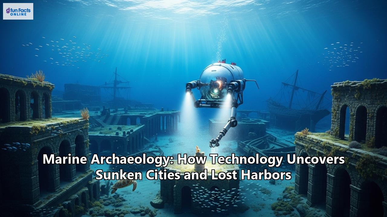
Once a potential site has been identified, the next step is to get a closer look. While scuba diving remains a vital part of underwater archaeology, it is limited by depth, time, and human endurance. To venture into the deeper, more hazardous frontiers where many of the most pristine sites lie, archaeologists turn to robotic allies: Remotely Operated Vehicles (ROVs) and Autonomous Underwater Vehicles (AUVs).
Remotely Operated Vehicles (ROVs) are unmanned, tethered submersibles controlled by a pilot on a surface vessel. They are the workhorses of deep-sea archaeology, serving as the eyes, hands, and tools of the exploration team. Equipped with high-definition cameras, powerful lights, and an array of sensors, ROVs can transmit live video footage, allowing archaeologists to "fly" over a submerged city and assess its condition in real-time. More advanced ROVs are fitted with manipulator arms that can perform delicate tasks, such as gently clearing away sediment with suction dredges, retrieving artifacts, or taking samples. Their ability to remain on-site for extended periods, far beyond the limits of human divers, makes them essential for the painstaking work of deep-water excavation and documentation. The first archaeological expedition to use an ROV was in 1989, when the Jason ROV investigated an ancient shipwreck in the Mediterranean. Autonomous Underwater Vehicles (AUVs) represent the next leap in underwater robotics. As their name suggests, AUVs are untethered and operate independently, following a pre-programmed survey route without direct human control. This autonomy makes them ideal for large-scale, systematic mapping missions. Equipped with sonar, magnetometers, and other sensors, AUVs can efficiently survey vast areas of the seabed, gathering high-resolution data with a precision that can be difficult to achieve with a towed system. They are often the first to explore a new area, creating the detailed maps that will guide subsequent ROV and diver investigations. In a collaborative study at Svalbard, for instance, AUVs were used to gather sonar data in the search for 17th-century whaling ships, with ROVs then sent to inspect the specific locations identified by the AUVs.The development of these robotic platforms has been nothing short of revolutionary. They have pushed the boundaries of exploration, opening up 98% of the world's ocean floor to archaeological study. In the crushing pressure and perpetual darkness of the deep sea, where some of the most significant discoveries are now being made, these robotic pioneers are our indispensable proxies, our connection to a world we cannot otherwise reach.
Case Study: The Twin Cities of the Nile Delta - Thonis-Heracleion
For centuries, they were cities of legend, mentioned in ancient texts but lost to the physical world. Thonis, the Egyptian name, and Heracleion, the Greek name, were thought by many to be two separate, bustling ports at the mouth of the Nile. It wasn't until the year 2000 that the truth was revealed, lying hidden for over 1,200 years beneath the waters of Abu Qir Bay. The discovery of Thonis-Heracleion is a spectacular example of how modern technology can resurrect a lost world.
The search, led by French underwater archaeologist Franck Goddio and his team from the European Institute for Underwater Archaeology (IEASM), began in 1996. It was a monumental undertaking, involving a systematic survey of a vast area. Using a suite of geophysical instruments, including side-scan sonar and highly sensitive magnetometers, the team painstakingly mapped the bay. It was these technologies that allowed them to "see" through the meters of sediment that had buried the city. The magnetometers detected the subtle magnetic signatures of buried structures, and sonar provided the first ghostly images of what lay beneath.
What they found was beyond all expectation. Not two cities, but one magnificent metropolis, known to the Egyptians as Thonis and the Greeks as Heracleion. The key to this revelation was the discovery of a stunning black granodiorite stele, a monumental slab inscribed with a decree from Pharaoh Nectanebo I. The inscription stated that the stele was to be placed in the city of Thonis, yet it was found in the great temple of Heracleion, definitively proving the two were one and the same.
Subsequent excavations, a painstaking process carried out by divers and ROVs, have revealed a city frozen in time. The entire city, built around a grand temple to the god Amun-Gereb, was crisscrossed by a network of canals, giving it the appearance of a lake dwelling. The team has uncovered colossal, five-meter-high statues of pharaohs, queens, and the god Hapi, the personification of the Nile's flood. They have found the remains of more than 75 shipwrecks, a testament to the city's role as Egypt's premier international trading port before the rise of Alexandria. Over 700 ancient anchors have been cataloged, along with a treasure trove of gold coins, jewelry, and exquisite ceramics from across the Greek world.
The city's demise was as dramatic as its existence. Sometime around the end of the second century B.C., a combination of factors, likely including a powerful earthquake, caused the unstable clay soil of the delta to liquefy, a phenomenon known as soil liquefaction. The city's massive stone buildings collapsed, and the ground itself gave way, swallowing the metropolis into the sea where it was eventually buried by sand and silt.
The exploration of Thonis-Heracleion is far from over; it is estimated that only 5% of the city has been excavated. Each new discovery, from a Greek sanctuary dedicated to Aphrodite to a Ptolemaic galley, adds another layer to our understanding of this vibrant, multicultural hub of the ancient world. It is a city brought back to life not by magic, but by the persistent application of science and technology, a stunning vindication of the power of modern marine archaeology.
Recreating the Past, Pixel by Pixel: 3D Photogrammetry
One of the greatest challenges in underwater archaeology is documentation. How do you accurately record a complex, three-dimensional site in an environment with often limited visibility, currents, and time constraints? The answer has come in the form of 3D photogrammetry, a revolutionary technique that is transforming how archaeologists see, study, and share submerged heritage.
Photogrammetry is the science of making measurements from photographs. In the underwater context, it involves capturing hundreds or even thousands of high-resolution, overlapping digital images of a site from multiple angles. This can be done by a diver meticulously swimming a pre-planned grid pattern or by an ROV equipped with high-quality cameras.
These images are then fed into specialized software that identifies common points across the photos. By triangulating the positions of these points, the software builds a dense "point cloud," a three-dimensional cluster of data points representing the surface of the site. This point cloud is then converted into a mesh, creating a solid 3D surface. Finally, the software "drapes" the original photographic textures onto this mesh, resulting in a stunningly realistic, fully navigable 3D model of the wreck or city.
The benefits of this technology are immense. It creates a permanent, millimeter-accurate digital record of a site at a specific moment in time. This is crucial for monitoring the condition of fragile sites and assessing the impact of environmental changes or human activity. Archaeologists can take precise measurements, study the relationships between different structures and artifacts, and even conduct "virtual excavations" without physically disturbing the site.
Furthermore, 3D photogrammetry makes these inaccessible underwater worlds available to everyone. Scientists can share detailed models with colleagues around the globe, and museums can create immersive virtual reality experiences that allow the public to "dive" on a Roman shipwreck or walk the streets of a sunken city.
Case Study: Pavlopetri - The World's Oldest Sunken City
Off the coast of southern Laconia in Greece, lying in just three to four meters of water, is a site that has rewritten the history of urbanism. This is Pavlopetri, the oldest known complete sunken city in the world, with a history stretching back over 5,000 years. Discovered in 1967 by Nicholas Flemming, the site is a unique time capsule, offering an almost complete town plan with streets, buildings, courtyards, and tombs.
While early surveys in 1968 provided a basic hand-drawn plan, it was a multi-year project starting in 2009 that truly revealed the city's complexity, thanks to a pioneering use of digital technology. A team from the University of Nottingham, in collaboration with Greek authorities, set out to map the site in unprecedented detail. They employed a sophisticated robotic survey instrument that combined sonar mapping with 3D digital survey techniques.
This advanced technology allowed the team to create a highly accurate, three-dimensional digital reconstruction of the entire city. The results were astonishing. The survey not only documented the known buildings with incredible precision but also uncovered over 9,000 square meters of new structures, including a large rectangular hall and a previously unknown street lined with buildings, expanding the known size of the city significantly.
The findings paint a picture of a flourishing port city that thrived for some 2,000 years during the Bronze Age. The city had a clear urban plan, with residential neighborhoods, administrative buildings, a complex water management system, and a bustling harbor that traded with the Minoan civilization on Crete. Analysis of recovered artifacts, including pottery and loom weights, suggests a thriving textile industry. The site even contains dozens of cist graves and rock-cut tombs, providing insights into the burial practices of its inhabitants.
The submergence of Pavlopetri was likely a gradual process, caused by a combination of earthquakes—the region is tectonically active—and a slow rise in sea level over centuries. This slow sinking, however, is precisely what helped preserve its remarkable layout, saving it from being overbuilt or disturbed by later agriculture. Today, the digital models created through advanced surveying serve not only as a vital research tool but also as a crucial instrument for the site's preservation, documenting its current state in the face of threats from pollution and boat anchors. Pavlopetri stands as a powerful example of how digital archaeology can not only rediscover the past but also help protect it for the future.
The Engineering Marvel of the Ancient World: Caesarea Maritima
Not all submerged sites were lost to disaster or the slow creep of time. Some, like the magnificent harbor of Caesarea Maritima on the coast of modern-day Israel, were simply victims of their own ambitious design and the relentless power of the sea. Built by Herod the Great between 22 and 10 BCE, Sebastos harbor (as it was known) was an engineering marvel, the largest artificial harbor constructed in the open sea at that time.
The challenge was immense. The coastline had no natural bays or protections, only a straight, sandy shore exposed to the full force of the Mediterranean. To create his port, Herod's engineers, likely with Roman expertise, pioneered the use of a revolutionary new material: hydraulic concrete. By mixing lime, sand, and a special volcanic ash called pozzolana (imported by the shipload from Italy), they created a concrete that could set and harden underwater.
Underwater excavations, which began in earnest in the 1980s, have revealed the ingenious methods used to construct the harbor's two massive breakwaters. Archaeologists discovered the remains of giant wooden forms, or caissons. These were floated into position, then filled with the hydraulic concrete mixture and intentionally sunk to the seafloor, creating massive, monolithic blocks that formed the foundation of the breakwaters. One particularly clever method involved building double-walled wooden boxes on shore, towing them into place, and then filling the gap between the walls with mortar to make them sink before the central cavity was packed with concrete.
For decades, teams of underwater archaeologists have been mapping these submerged structures. Divers and ROVs have explored the collapsed breakwaters, which now lie several meters below the surface due to a combination of earthquakes and subsidence. Their work has confirmed the descriptions of the ancient historian Josephus, who wrote of a harbor larger than Piraeus (the port of Athens), with broad quays, storage facilities, and a lighthouse tower. Discoveries within the harbor have been spectacular, including a 1,600-year-old cargo from a Late Roman merchant ship that wrecked at the harbor entrance, spilling its contents of bronze statues, coins, and metal fittings onto the seabed.
The study of Caesarea Maritima is a prime example of archaeology illuminating ancient technology. It demonstrates a level of engineering prowess and ambition that was unrivaled for centuries, a monumental effort to tame the sea itself. The submerged ruins of Sebastos are not a lost city, but a testament to a lost art of harbor construction, rediscovered and understood through the dedicated work of underwater explorers.
Glimpses of a Drowned Stone Age: The Neolithic Village of Atlit-Yam
Imagine a thriving village on the shores of the Mediterranean, 9,000 years ago. Its inhabitants are among the first to domesticate animals and cultivate crops, but they still draw much of their sustenance from the sea. They build sturdy rectangular houses, dig deep wells for fresh water, and arrange massive stone monoliths in a circle around a spring, perhaps for ritual purposes. This is not a fantasy; this is Atlit-Yam.
Discovered in 1984 by marine archaeologist Ehud Galili off the coast of Israel, Atlit-Yam is a submerged Neolithic settlement dating back to approximately 6900 BC. Today it lies 8 to 12 meters beneath the waves, an area of about 10 acres that offers one of the most detailed portraits of a late Stone Age community ever found. The site's incredible preservation is due to its submergence by the eustatic rise in sea levels following the last Ice Age, which covered it in a protective blanket of sand.
Underwater excavations have revealed a wealth of information about the lives of its people. Archaeologists have uncovered the foundations of stone-built houses, paved areas, and a 10.5-meter-deep stone-lined well, a remarkable feat of engineering for its time. The most enigmatic feature is a stone semicircle of seven megaliths, each weighing up to 600 kilograms, arranged around what was once a freshwater spring, hinting at the spiritual or ritual life of the community.
The artifacts and biological remains tell the story of a people in transition. Evidence of domesticated sheep, goat, and cattle, alongside traces of cultivated wheat, shows they were farmers. Yet, the discovery of over 6,000 fish bones and evidence of an ear condition in some skeletons caused by regular exposure to cold water, points to the continued importance of fishing. Atlit-Yam provides the earliest known evidence for this mixed agro-pastoral-marine subsistence system on the Levantine coast.
Tragically, the site also holds a darker secret. The skeletons of a woman and a child have revealed the earliest known cases of tuberculosis in human history, pushing back the known timeline of the disease by 3,000 years. Analysis suggests the mother passed the disease to her infant, a poignant, personal story from the dawn of the Neolithic period.
The reason for the village's abandonment is still debated. Piles of fish found ready for trade or storage suggest the departure was sudden. It may have been a tsunami triggered by a volcanic eruption on nearby Mount Etna, or simply the inexorable rise of the sea that finally forced the villagers to flee to higher ground. Whatever the cause, Atlit-Yam serves as a profound reminder of how profoundly human societies have been shaped by the changing ocean, a 9,000-year-old story brought to light by the careful work of underwater archaeology.
The Future of Marine Archaeology: New Frontiers and Deepening Insights
The field of marine archaeology is on the cusp of another technological leap forward. As remarkable as the discoveries of the past few decades have been, the tools and techniques now emerging promise to revolutionize the discipline yet again, taking us deeper and allowing us to understand our findings with unprecedented clarity.
The Rise of the Machines: AI and Machine LearningThe sheer volume of data generated by modern survey techniques is staggering. A single survey can produce terabytes of sonar, magnetic, and photographic information. Manually analyzing this data is a slow, painstaking process. This is where Artificial Intelligence (AI) and machine learning are set to make a massive impact.
Researchers are now developing AI algorithms capable of automatically detecting potential archaeological sites within these vast datasets. By training a machine learning model on thousands of images of known shipwrecks, for example, the AI can learn to recognize the subtle patterns and shapes that distinguish a wreck from the natural topography of the seafloor. This automated approach can rapidly sift through enormous areas, flagging potential targets for human archaeologists to investigate, dramatically speeding up the discovery process. AI is also being used to enhance and interpret sonar data, creating clearer 3D models and even predicting where the most significant artifacts might be located within a wreck site based on how it likely broke apart and settled.
Robotics and Haptics: Touching the PastThe next generation of underwater robots will be more than just remote eyes; they will be the skilled hands of the archaeologist. Humanoid robots like "Ocean One," developed at Stanford University, are designed to work at depths humans can never reach. Ocean One features two robotic arms and hands equipped with haptic feedback sensors. This allows an archaeologist on the surface to "feel" what the robot is touching, providing the tactile sensation needed to handle fragile artifacts with the necessary delicacy. This brings a human touch to deep-sea excavation, combining the endurance of a machine with the nuanced skill of an expert.
The Secrets in the Sediment: Ancient DNAPerhaps one of the most exciting new frontiers is the analysis of ancient DNA (aDNA) from underwater sites. Sediments, and the artifacts within them, can trap microscopic traces of organic material for thousands of years. Scientists are now able to extract and sequence this DNA, opening up a whole new realm of information.
By scraping the inside of a 2,400-year-old clay jar (amphora) from a shipwreck, researchers were able to identify DNA fragments from oregano and olives, revealing the contents of its long-vanished cargo. Another jar yielded DNA from the mastic plant, which was used to flavor and preserve wine. This technique offers the potential to understand ancient trade, diet, and agriculture with a specificity that was previously unimaginable. Environmental DNA (eDNA) found in the surrounding sediment can even help reconstruct the entire ecosystem of a site, identifying the plants and animals that were present thousands of years ago.
Challenges on the Horizon
Despite these incredible technological advances, marine archaeology faces significant challenges. The underwater environment remains inherently difficult and expensive to work in. Physical barriers like immense pressure, strong currents, and poor visibility are constant hurdles. Furthermore, the very act of bringing an artifact to the surface can be its undoing. Waterlogged organic materials, which may have been stable for millennia in a low-oxygen environment, can begin to decay rapidly when exposed to the air. This requires complex and costly conservation procedures to stabilize and preserve them for future study.
An even greater threat is the changing climate. Rising sea levels and increased storm activity are altering coastal and underwater environments at an alarming rate. Sites that were once protected by stable layers of sediment are now being exposed and eroded, a process that can destroy delicate archaeological evidence before it can ever be recorded. It has become a race against time for archaeologists to identify, document, and, where possible, protect these fragile underwater treasures before they are lost forever.
Conclusion: A Deeper Understanding
The sunken cities and lost harbors being unveiled by marine archaeology are more than just historical curiosities. They are vibrant, detailed chapters of our collective human story, chapters that were thought to be permanently lost. The ruins of Thonis-Heracleion reveal the intricate connections between ancient Egypt and the Greek world. The streets of Pavlopetri demonstrate that complex urban planning existed a thousand years before the Golden Age of Athens. The breakwaters of Caesarea showcase a mastery of engineering that challenges our perceptions of the ancient world's capabilities. And the humble village of Atlit-Yam provides a poignant, personal glimpse into the lives of our Stone Age ancestors as they navigated a world of profound environmental change.
These discoveries are made possible by a remarkable synergy of science, technology, and historical inquiry. Sonar, robotics, 3D modeling, and DNA analysis are the tools that allow us to read these submerged stories. They extend our senses into the abyss, allowing us to map, see, touch, and analyze a world that is otherwise inaccessible. As this technology continues to evolve, we can only imagine what new wonders and what deeper understanding of our own past lie waiting in the silent depths, ready to be brought into the light. The greatest museum on Earth has only just begun to reveal its secrets.
Reference:
- https://blueatlasrobotics.com/create-3d-models-of-your-underwater-assets-with-photogrammetry
- https://www.semanticscholar.org/paper/Sub-bottom-profiling-for-large-scale-maritime-An-Gr%C3%B8n-Boldreel/3eedbc158f68c303d297857cd272edafadaaeb53
- https://stellwagen.noaa.gov/maritime/archaeology.html
- https://fiveable.me/archaeology-of-the-age-of-exploration/unit-3/underwater-excavation-techniques/study-guide/muNoKAliBcUtwS4p
- https://scholars.unh.edu/cgi/viewcontent.cgi?article=1276&context=ccom
- https://maritimearchaeologytrust.org/bathymetry-and-side-scan-sonar/
- https://greenimtech.com/side-scan-sonar-vs-multibeam-sonar/
- https://oceanexplorer.noaa.gov/technology/sonar-multibeam/
- https://arcfieldlab.nl/en/technique/sub-bottom-profiler/
- https://oceanexplorer.noaa.gov/expedition-feature/20paleolandscapes-gomex-background-sub-bottom/
- https://oceanexplorer.noaa.gov/technology/magnetometer/
- https://www.marinetechnologynews.com/news/engineers-archaeologists-marine-magnetometers-484483
- https://www.jwfishers.com/industry-news/new-magnetometer-is-a-hit-with-archaeologists-divers
- https://en.wikipedia.org/wiki/Magnetic_survey_(archaeology))
- https://www.whoi.edu/ocean-learning-hub/ocean-topics/ocean-human-lives/underwater-archaeology/
- https://www.whoi.edu/cms/files/bfoley/2005/6/ENALIA_2002a_3325.pdf
- https://archeologie.culture.gouv.fr/archeo-sous-marine/en/robots-are-future
- https://www.splashcos.org/sites/splashcos.org/files/downloads/17_Photography_and_platforms.pdf
- https://www.blueyerobotics.com/blog/utilizing-underwater-drones-for-mapping-of-marine-archaeology
- https://www.actuia.com/en/news/a-machine-learning-model-to-identify-shipwrecks-in-underwater-archaeology-research/
- https://scispace.com/pdf/using-sector-scan-sonar-for-the-survey-and-management-of-1nystswec8.pdf
- https://www.researchgate.net/publication/315552357_Recent_Advances_in_Underwater_Archaeology
- https://www.thearchaeologist.org/blog/the-challenges-and-triumphs-of-digging-the-deep-blue-in-underwater-archeology
- https://oceanexplorer.noaa.gov/technology/photogrammetry/
- https://seaviews.fr/en/services-3/mapping/photogrammetry
- https://www.researchgate.net/publication/356507796_Monitoring_of_Underwater_Archaeological_Sites_with_the_use_of_3D_Photogrammetry_and_Legacy_Data_Case_study_HMS_Maori_Malta
- https://academic.oup.com/edited-volume/40217/chapter/345159499
- https://seamagination.com/underwater-photogrammetry/
- https://marinemagnetics.com/products/marine-magnetometers/explorer/
- https://www.researchgate.net/publication/261025018_Sub-bottom_profiling_for_large-scale_maritime_archaeological_survey_An_experience-based_approach
- https://crypticoceans.com/marine-archaeology-technologies/
- https://www.ancient-origins.net/artifacts-other-artifacts/underwater-archaeology-0018332
- https://www.researchgate.net/publication/351272238_Archaeologic_Machine_Learning_for_Shipwreck_Detection_Using_Lidar_and_Sonar
- https://oceanexplorer.noaa.gov/explainers/archaeology/
- https://medium.com/@evolwe.ai/ai-in-underwater-archaeology-discovering-hidden-treasures-beneath-the-sea-1ac94d9cea59
- https://core.tdar.org/collection/66618/deepwater-archaeology-advancements-opportunities-and-limitations
- https://www.mdpi.com/2072-4292/13/9/1759
- https://www.researchgate.net/publication/338586669_Ancient_DNA_Research_in_Maritime_and_Underwater_Archaeology_Pitfalls_Promise_and_Future_Directions
- https://www.mpg.de/18092942/1223-evan-dna-in-archaeological-sediments-150495-x
- https://openquaternary.wordpress.com/2020/01/25/dna-from-underwater-archaeological-sites/
- https://www.whoi.edu/oceanus/feature/dna-in-shipwrecked-jars-reveals-clues-to-ancient-world/
- https://pages.vassar.edu/the-mechanisms-and-challenges-of-marine-archaeology/
- https://unesdoc.unesco.org/ark:/48223/pf0000181557
- https://www.marinebiodiversity.ca/rising-seas-are-washing-away-ancient-underwater-treasures-heres-what-scientists-are-doing/