The Silent Sculptors: How Machine Learning is Unlocking the Secrets of Glacial Erosion
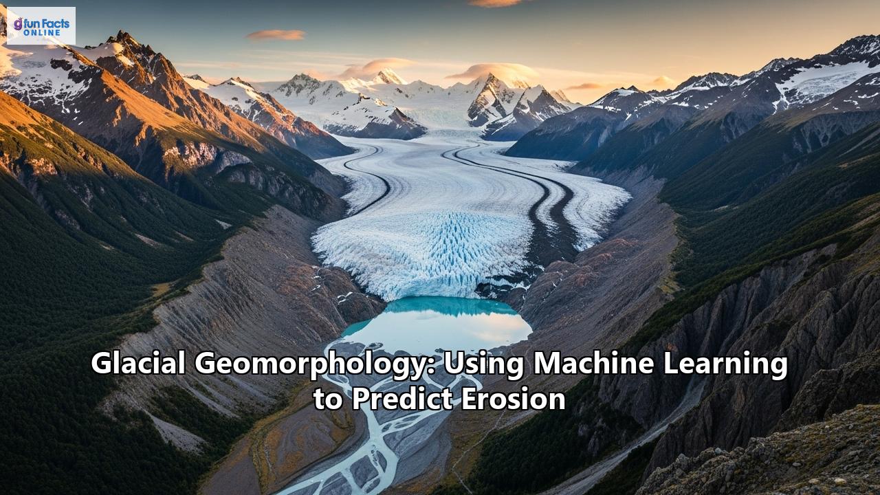
In the grand theater of geological time, glaciers are the master sculptors. These colossal rivers of ice, inching their way across continents and down mountain valleys, have carved some of the most dramatic and breathtaking landscapes on our planet. From the deep, U-shaped valleys of Yosemite to the jagged arêtes of the Alps, the immense power of glacial erosion is etched into the very fabric of the Earth. But understanding the precise mechanisms and predicting the rate of this erosion has long been a monumental challenge for scientists. Now, a powerful new tool is revolutionizing the field of glacial geomorphology: machine learning. By harnessing the pattern-recognizing capabilities of artificial intelligence, researchers are beginning to predict the erosive power of glaciers with unprecedented accuracy, offering vital insights into the past, present, and future of our changing planet.The Icy Art of Landscape Transformation: A Primer on Glacial Geomorphology
Glacial geomorphology is the scientific study of the landforms and landscapes created by the movement of glaciers. It's a field that blends geology, geography, and climatology to decipher the stories written in rock and ice. To comprehend how machine learning is transforming this discipline, we must first grasp the fundamental processes at play.
Glaciers are born from the accumulation of snow over many years, which compacts under its own weight to form dense glacial ice. Driven by gravity, these massive bodies of ice begin to flow, acting as immense conveyor belts of rock and sediment. This movement is the engine of glacial erosion, a process that primarily occurs through two powerful mechanisms: abrasion and plucking.
Abrasion is akin to a giant piece of sandpaper grinding across the land. Rocks and debris embedded in the base of the glacier scrape and scour the bedrock below, leaving behind tell-tale scratches known as glacial striations. These linear grooves, etched into the rock, serve as a compass, pointing in the direction of past ice flow. Plucking, on the other hand, is a more forceful process. As a glacier moves, meltwater seeps into cracks and fractures in the bedrock. When this water refreezes, it expands, wedging chunks of rock loose. The advancing ice then "plucks" these rock fragments away, incorporating them into its icy mass and carrying them for miles.The interplay of abrasion and plucking, combined with the immense weight and pressure of the ice, carves a distinctive suite of landforms. Towering, pyramid-shaped peaks known as horns are sculpted when multiple glaciers erode a single mountain from several sides. Sharp, knife-edge ridges called arêtes form between two adjacent glacial valleys. And perhaps most iconically, the classic V-shaped river valleys are transformed into broad, steep-sided U-shaped valleys.
As glaciers retreat, they leave behind a trail of depositional landforms, piles of unsorted rock and sediment known as till. These deposits form moraines, which are ridges of till that mark the former extent of the glacier. Other features, like elongated, teardrop-shaped hills called drumlins and sinuous ridges known as eskers, provide further clues about the dynamics of the vanished ice.
By studying these erosional and depositional features, geomorphologists can reconstruct the history of past glaciations, infer past climate conditions, and understand the powerful forces that have shaped our world. However, directly measuring the rate of erosion beneath active glaciers is incredibly difficult and often dangerous, leaving a significant gap in our understanding. This is where the predictive power of machine learning comes into play.
The Digital Revolution in Glaciology: Enter Machine Learning
The advent of remote sensing and the explosion of satellite data have provided glaciologists with a treasure trove of information. Satellites like Landsat, Sentinel, and ASTER continuously monitor the Earth's glaciers, providing data on their extent, thickness, velocity, and surface characteristics. This deluge of data, however, presents a new challenge: how to process and analyze it effectively. Traditional methods of manual analysis are time-consuming and often subjective.
Artificial intelligence, and specifically machine learning, offers a powerful solution. These algorithms are designed to learn patterns from vast datasets, making them ideal for a wide range of applications in glaciology. Initially, machine learning was primarily used for tasks like glacier inventory and mapping. Deep learning models, such as the U-Net architecture, have proven to be highly effective at segmenting satellite images to automatically delineate glacier boundaries. This is particularly useful for mapping debris-covered glaciers, where the spectral signature of the ice is obscured by a layer of rock and sediment, making them difficult to identify using traditional methods.
Beyond simple mapping, machine learning is also being used to monitor glacier evolution. By analyzing time-series satellite data, AI algorithms can track changes in glacier extent, volume, and flow velocity, providing crucial insights into how glaciers are responding to climate change. For example, scientists have used AI to track the formation of crevasses—fractures in the ice—on the Thwaites Glacier in Antarctica, a key indicator of stress and potential instability.
The most exciting frontier, however, is the use of machine learning to predict glacial erosion. By feeding these algorithms a diverse range of data, scientists can train them to understand the complex interplay of factors that control how quickly a glacier erodes the landscape beneath it.
The Anatomy of a Predictive Model: Data and Algorithms
Building a machine learning model to predict glacial erosion is a multi-step process that begins with gathering the right data. These models are only as good as the information they are trained on, so a comprehensive and diverse dataset is crucial. The primary types of data used include:
- Topographic Data: Digital Elevation Models (DEMs) are a cornerstone of glacial geomorphology and are essential for machine learning applications. Derived from sources like the Shuttle Radar Topography Mission (SRTM) and ASTER satellites, DEMs provide high-resolution 3D representations of the Earth's surface. From these models, a variety of morphometric parameters can be extracted, such as slope, aspect (the direction the slope faces), and curvature, all of which influence ice flow and erosion.
- Satellite Imagery: A wealth of information can be gleaned from satellite images.
Optical Imagery: Satellites like Landsat and Sentinel-2 capture images in the visible and near-infrared parts of the spectrum. This data can be used to map glacier extent, identify different surface features like snow, clean ice, and debris, and track changes over time.
Radar (SAR) Imagery: Synthetic Aperture Radar (SAR) from satellites like Sentinel-1 is particularly valuable because it can penetrate cloud cover and operate day or night. This allows for continuous monitoring of glacier velocity and surface texture, even in remote and cloudy regions.
Multispectral and Hyperspectral Imagery: These sensors capture data in a wide range of spectral bands, allowing for a more detailed classification of surface materials.
- Climate Data: Climate is a primary driver of glacier dynamics and erosion. Machine learning models often incorporate climate data, such as temperature and precipitation, to better understand the relationship between climate and glacial processes.
Once the data is gathered, it is fed into a machine learning algorithm. Several types of algorithms have proven effective in glacial geomorphology:
- Random Forest: This is a versatile and widely used algorithm that consists of a multitude of decision trees. It is particularly adept at handling large datasets with numerous variables and can provide insights into the relative importance of different factors in predicting an outcome. In glaciology, Random Forest has been successfully used to map debris-covered glaciers and identify different ice facies.
- Support Vector Machines (SVMs): SVMs are powerful classifiers that work by finding the optimal boundary between different classes of data. They have been used to distinguish between different types of ice and snow on glaciers and to differentiate glacial valleys from fluvial valleys based on their topographic profiles.
- Convolutional Neural Networks (CNNs): CNNs are a type of deep learning model that is particularly well-suited for image analysis. Inspired by the human visual cortex, CNNs can automatically learn hierarchical features from images, making them ideal for tasks like identifying geomorphological features in satellite imagery and DEMs. The U-Net architecture, a specific type of CNN, is widely used for image segmentation in glaciology.
- Artificial Neural Networks (ANNs): ANNs are complex networks of interconnected "neurons" that can learn non-linear relationships in data. Deep learning models, which are ANNs with many layers, have been used to model glacier mass balance and ice flow dynamics with remarkable speed and accuracy.
A Landmark Study: Predicting Erosion for the World's Glaciers
A groundbreaking study led by geographer Sophie Norris at the University of Victoria provides a compelling example of the power of machine learning to predict glacial erosion on a global scale. Published in Nature Geoscience*, the study used a machine learning-based analysis to estimate the rate of future erosion for over 180,000 glaciers worldwide.
The research team found that the factors influencing glacial erosion are far more complex than previously understood. Their model revealed that a combination of variables, including temperature, the amount of water at the base of the glacier, the type of bedrock, and even the amount of heat emanating from within the Earth, all play a significant role in determining erosion rates.
The model's predictions were striking: 99% of the world's glaciers erode at a rate of between 0.02 and 2.68 millimeters per year, roughly the thickness of a credit card. This study is a monumental step forward, as it provides the first comprehensive, data-driven estimates of glacial erosion for remote and inaccessible regions across the globe. The findings have profound implications for a range of fields, from landscape management and the monitoring of sediment and nutrient cycles to the long-term safety of geological repositories for nuclear waste.
The Road Ahead: Challenges and the Future of AI in Glacial Geomorphology
Despite the remarkable progress, the application of machine learning in glacial geomorphology is not without its challenges. One of the most significant hurdles is the availability and quality of data. Machine learning models, particularly deep learning models, require vast amounts of labeled data for training, and in many parts of the world, detailed glaciological data is scarce. The lack of "ground-truth" data—direct, on-the-ground measurements—to validate model predictions is a major limitation.
Furthermore, the complexity of glacial systems themselves poses a challenge. The processes of erosion are non-linear and involve a multitude of interacting factors, making them inherently difficult to model. There is also the issue of "black box" models, where the internal workings of a complex neural network can be difficult to interpret, making it challenging to understand the physical basis for a model's predictions.
Despite these challenges, the future of machine learning in glacial geomorphology is incredibly bright. The continued development of remote sensing technologies, with new satellites providing ever-higher resolution imagery, will provide a continuous stream of data to train more sophisticated models. Emerging techniques, such as physics-informed neural networks (PINNs), offer a promising path forward. These models are designed to incorporate our understanding of the physical laws governing glacial processes directly into the machine learning framework, leading to more robust and physically plausible predictions.
The ability to accurately predict glacial erosion has far-reaching implications. For climate change research, it can help us to better understand how landscapes will evolve in a warming world and how the melting of glaciers will impact sediment delivery to rivers and oceans, with consequences for both ecosystems and coastal communities. In terms of geological risk management, these models can be used to assess the stability of mountain slopes as glaciers retreat and to predict the likelihood of glacial lake outburst floods (GLOFs), a significant hazard in many high-mountain regions.
In conclusion, the marriage of glacial geomorphology and machine learning represents a paradigm shift in our ability to understand and predict the powerful forces that shape our planet. By leveraging the vast amounts of data from our ever-watchful satellites and the remarkable pattern-recognizing capabilities of artificial intelligence, we are beginning to decipher the intricate language of the ice. The insights gained from this burgeoning field will be invaluable as we navigate the challenges of a changing climate and strive to be better stewards of the magnificent and dynamic landscapes that glaciers have so masterfully sculpted.Reference:
- https://www.mdpi.com/journal/remotesensing/special_issues/remotesensing_glaciers
- https://www.researchgate.net/publication/266202487_Data_and_knowledge_gaps_in_glacier_snow_and_related_runoff_research_-_A_climate_change_adaptation_perspective
- https://www.esa.int/Applications/Observing_the_Earth/Copernicus/Sentinel-1/Sentinel-1_and_AI_uncover_glacier_crevasses
- https://www.mdpi.com/journal/remotesensing/special_issues/56DMLB4YLO
- https://www.numberanalytics.com/blog/glacier-remote-sensing-guide
- https://www.bas.ac.uk/data/our-data/publication/global-data-gaps-in-our-knowledge-of-the-terrestrial-cryosphere/
- https://www.frontiersin.org/journals/climate/articles/10.3389/fclim.2021.689823/full
- https://www.antarcticglaciers.org/glaciers-and-climate/observing-and-monitoring-glaciers-and-ice-sheets/observing-glacier-change-space/
- https://www.ige-grenoble.fr/Artificial-intelligence-helps-scientists-better-predict-glacier-evolution-in
- https://www.sciencenordic.com/artificial-intelligence-climate-change/is-ai-our-new-oracle-predicting-how-fast-the-ice-is-melting/2451960
- https://news.climate.columbia.edu/2022/03/25/machine-learning-techniques-can-speed-up-glacier-modeling-by-a-thousand-times/
- https://www.mdpi.com/2073-4441/16/16/2272
- https://www.keele.ac.uk/sustainable-futures/newsandevents/news/2020/february/newresearchidentifiestheimpactclimatehasonglaciererosionrates/glacier-erosion.php
- https://www.youtube.com/watch?v=esDJm9nKO_c
- https://www.mdpi.com/2072-4292/11/4/452
- https://www.inrae.fr/en/news/artificial-intelligence-helps-scientists-better-predict-evolution-glaciers-under-climate-change
- https://www.frontiersin.org/journals/climate/articles/10.3389/fclim.2022.841103/full
- https://think.taylorandfrancis.com/special_issues/intelligent-risk-assessment-for-geological-disasters/
- https://eos.org/opinions/glacial-knowledge-gaps-impede-resilience-to-sea-level-rise
- https://esurf.copernicus.org/articles/12/801/2024/
- https://www.ias.ac.in/public/Volumes/jess/133/00/0082.pdf
- https://lifestyle.sustainability-directory.com/question/what-are-ais-limitations-in-predicting-climate-change/
- https://pmc.ncbi.nlm.nih.gov/articles/PMC3357844/
- https://www.researchgate.net/publication/362028081_Need_for_Development_of_AI-based_Integrated_Warning_System_IWS_for_Mitigation_of_GlaciersGlacial-lakes_Related_Hazards_with_Special_Reference_to_Uttarakhand_Himalaya
- https://timesca.com/artificial-intelligence-to-monitor-kyrgyzstans-glacial-lakes-to-prevent-outburst-flooding/