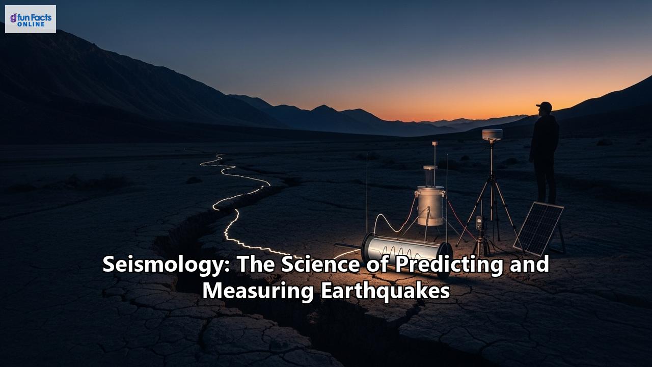
Seismology: Unraveling the Science of Earth's Tremors
Our planet is a dynamic and ever-changing world. Beneath our feet, colossal tectonic plates are in constant, albeit slow, motion. When the immense stress built up along the boundaries of these plates is suddenly released, the ground shakes with terrifying force. This phenomenon, known as an earthquake, has captivated and terrified humanity for millennia. In the quest to understand and mitigate the destructive power of these telluric events, a dedicated field of science has emerged: seismology. This comprehensive exploration delves into the fascinating world of seismology, from its historical roots and the intricate science of measuring and predicting earthquakes to the profound impacts these events have on societies and the innovative strategies being developed to safeguard our future.
A Journey Through Time: The History of Seismology
The study of earthquakes, or seismology, has a history that stretches back thousands of years, with early writings on their causes dating back to 585 BCE. For much of human history, earthquakes were shrouded in myth and superstition, often attributed to the wrath of gods or the movements of mythical creatures. However, the seeds of a scientific approach were sown as early as the 2nd century CE in China, with the invention of the first known seismic recording device.
A pivotal moment in the evolution of seismology was the devastating Lisbon earthquake of 1755. This catastrophic event, which triggered a massive tsunami and widespread fires, not only destroyed the city but also shook the foundations of philosophical and religious beliefs across Europe. In its aftermath, scholars began to seek natural explanations for such phenomena, marking the dawn of modern seismology.
The 19th century witnessed significant strides in the field. Irish engineer Robert Mallet, considered by many to be the father of seismology, conducted pioneering experiments with explosions to measure the speed of seismic waves through the Earth. He also coined the term "seismology" and introduced the concept of the "epicenter," the point on the Earth's surface directly above the earthquake's origin. The first true seismograph, an instrument capable of recording the ground's motion, was developed by Italian physicist Filippo Cecchi in 1875. This invention, which recorded the relative motion of a pendulum as a function of time, allowed for the determination of an earthquake's onset and duration.
Further advancements came from British scientists working in Japan in the 1880s. John Milne, an English geologist and influential seismologist, developed a more reliable seismograph and established a network of seismological stations across Japan, a country prone to frequent earthquakes. By 1910, 52 of his instruments were operating worldwide, enabling him to begin mapping global earthquake regions. The first teleseismic record, a recording of an earthquake at a great distance from its source, was identified in 1889 by Ernst von Rebeur-Paschwitz in Germany, from a quake that originated in Japan. This event demonstrated that seismic waves could travel through the entire planet, opening up new avenues for understanding Earth's deep interior.
The 20th century saw an explosion of knowledge in seismology. Key figures like Harry Fielding Reid developed the elastic rebound theory in 1911, which explains how stress builds up along faults and is suddenly released during an earthquake. Charles F. Richter, an American physicist and seismologist, created the famous Richter scale in 1935 to measure earthquake magnitude. Danish seismologist Inge Lehmann discovered the Earth's solid inner core in 1936 by analyzing seismic wave data. The advent of the Cold War and the need to detect underground nuclear tests led to the establishment of the Worldwide Standardized Seismograph Network (WWSSN) in the 1960s, a global network of over 100 stations that provided a wealth of high-quality data. This network, and its successors like the Global Seismographic Network (GSN), have been instrumental in advancing our understanding of plate tectonics and the Earth's structure.
Today, seismology is a sophisticated, interdisciplinary science that leverages advanced technologies, including satellite geodesy, GPS, and artificial intelligence, to monitor our planet's every tremor.
The Restless Earth: What Causes Earthquakes?
The primary driver of most earthquakes is the theory of plate tectonics. The Earth's outermost layer, the lithosphere, is not a single, solid shell but is broken into about 15 major tectonic plates. These plates are in constant, slow motion, driven by convection currents in the underlying mantle. As they move, they interact with each other along their boundaries, leading to the buildup of immense stress.
There are three main types of plate boundaries, each associated with distinct types of faults and earthquake activity:
- Convergent Boundaries: Here, two plates collide. The immense pressure can cause the edges of the plates to buckle and fold, forming mountain ranges like the Himalayas. In many cases, one plate, typically denser oceanic crust, is forced to slide beneath the other in a process called subduction. Subduction zones are responsible for some of the world's largest and most destructive earthquakes, as well as volcanic activity. The "Ring of Fire," a zone of intense seismic and volcanic activity encircling the Pacific Ocean, is a prime example of a series of convergent boundaries. Reverse faults, where the rock above the fault is pushed up relative to the rock below, are common at these boundaries.
- Divergent Boundaries: At these boundaries, two plates move away from each other. As the plates separate, molten rock, or magma, rises from the mantle to create new crust. This process, known as seafloor spreading, is most active along mid-ocean ridges, such as the Mid-Atlantic Ridge. Earthquakes at divergent boundaries are common but are generally less powerful than those at convergent boundaries. Normal faults, where the rock above the fault moves down relative to the rock below, are characteristic of these zones.
- Transform Boundaries: At these boundaries, plates slide horizontally past each other. The friction between the plates prevents them from sliding smoothly. Instead, stress builds up until it is suddenly released in an earthquake. The San Andreas Fault in California is a famous example of a transform boundary between the Pacific and North American plates. Strike-slip faults, where the blocks of rock on either side of the fault move horizontally, are the dominant fault type at transform boundaries.
The energy released during an earthquake radiates outward from the hypocenter, or focus, the point within the Earth where the rupture begins. The point on the Earth's surface directly above the hypocenter is called the epicenter. This sudden release of energy generates seismic waves that travel through the Earth and cause the ground shaking we feel.
Riding the Waves: The Science of Seismic Waves
The energy from an earthquake travels in the form of seismic waves. Seismologists use seismographs to record these waves, and by analyzing them, they can determine an earthquake's location, magnitude, and even gain insights into the Earth's internal structure. There are two main categories of seismic waves: body waves and surface waves.
Body Waves: These waves travel through the Earth's interior. There are two types of body waves:- P-waves (Primary Waves): These are the fastest seismic waves and are the first to be recorded by a seismograph. P-waves are compressional waves, meaning they cause particles of rock to move back and forth in the same direction that the wave is traveling, similar to a sound wave. They can travel through solids, liquids, and gases.
- S-waves (Secondary Waves): These waves arrive after the P-waves. S-waves are shear waves, causing rock particles to move perpendicular to the direction of wave propagation, in an up-and-down or side-to-side motion. Unlike P-waves, S-waves can only travel through solid materials. This property is crucial as it provides evidence for the liquid nature of the Earth's outer core.
- Love Waves: Named after the British mathematician A.E.H. Love, these waves have a horizontal, side-to-side motion that is perpendicular to the direction of wave travel. Their high amplitude and transverse motion make them particularly damaging to the foundations of structures.
- Rayleigh Waves: Named after Lord Rayleigh, these waves produce a rolling motion of the ground, similar to waves on the surface of water. The particle motion is elliptical and retrograde, meaning it moves in a counter-clockwise direction when the wave is propagating from left to right.
The different arrival times of P-waves and S-waves at various seismograph stations are used to pinpoint the earthquake's epicenter. The time difference between the arrival of the P-wave and the S-wave increases with distance from the earthquake. By using data from at least three seismograph stations, scientists can triangulate the location of the epicenter.
Measuring the Unmeasurable: Quantifying an Earthquake's Power
Quantifying the size of an earthquake is crucial for understanding its potential impact and for scientific study. Seismologists use two primary types of scales: magnitude scales, which measure the energy released at the earthquake's source, and intensity scales, which describe the effects of the shaking at a particular location.
Magnitude Scales:- The Richter Scale: Developed by Charles F. Richter in 1935, this was the first widely used magnitude scale. It is a logarithmic scale, meaning that for each whole number increase on the scale, the measured amplitude of the seismic waves increases by a factor of 10. The Richter scale is based on the amplitude of the largest seismic wave recorded on a specific type of seismograph at a certain distance from the epicenter. While historically significant, the Richter scale has limitations. It is most effective for measuring moderate, regional earthquakes and tends to underestimate the size of very large earthquakes.
- The Moment Magnitude Scale (Mw): Today, the Moment Magnitude Scale is the preferred scale for measuring large earthquakes. Developed in the late 1970s, it provides a more accurate and consistent measure of an earthquake's total energy release. The moment magnitude is calculated based on the seismic moment, which is a product of the area of the fault that ruptured, the average amount of slip or movement on the fault, and the rigidity of the rock. This scale is more directly related to the physical parameters of the earthquake and does not "saturate" for large events, meaning it can accurately measure the largest earthquakes.
- The Modified Mercalli Intensity (MMI) Scale: Unlike magnitude scales, which have a single value for each earthquake, intensity scales describe the effects of the shaking at different locations. The MMI scale uses Roman numerals from I (not felt) to XII (catastrophic destruction) to rank the observed effects of an earthquake on people, buildings, and the environment. It is a qualitative scale based on eyewitness accounts and observations of damage. For example, an MMI of IV would be felt indoors by many, with a rattling of windows and doors, while an MMI of IX would cause considerable damage to well-designed structures and the collapse of poorly built ones. This scale is particularly useful for engineers and emergency responders as it provides a direct measure of the impact of an earthquake on a community.
The Holy Grail of Seismology: The Challenge of Earthquake Prediction
The ability to accurately predict the time, location, and magnitude of a major earthquake would be a monumental achievement, potentially saving countless lives and minimizing economic devastation. However, despite decades of research and significant advances in our understanding of seismic processes, reliable earthquake prediction remains an elusive goal.
The scientific community distinguishes between "prediction" and "forecasting." A prediction implies a specific statement about when, where, and how large an earthquake will be. A forecast, on the other hand, is a probabilistic statement about the likelihood of an earthquake occurring in a particular area over a given period. While seismologists can produce increasingly sophisticated earthquake forecasts, short-term prediction is not yet possible.
The challenges in earthquake prediction are immense. The processes that lead to an earthquake occur deep within the Earth's crust, making them difficult to observe directly. The geological conditions along fault zones are incredibly complex and heterogeneous.
Despite these challenges, scientists continue to investigate potential earthquake precursors, which are physical or chemical changes that may occur before a large earthquake. Some of the phenomena studied as potential precursors include:
- Foreshocks: Small earthquakes that sometimes precede a larger mainshock.
- Ground Deformation: Changes in the shape of the ground, such as tilting or uplift, which can be measured with sensitive instruments like GPS and InSAR (Interferometric Synthetic Aperture Radar).
- Changes in Groundwater Levels: Fluctuations in the water level of wells have been reported before some earthquakes.
- Radon Gas Emissions: Some studies have suggested that an increase in the emission of radon gas from the ground may precede an earthquake.
- Electromagnetic Field Variations: Changes in the Earth's electromagnetic field have also been investigated as a potential precursor.
However, none of these precursors have been shown to be consistently reliable. They do not always occur before an earthquake, and when they do, they do not always lead to a large event. This makes it difficult to issue a public warning without a high risk of false alarms, which could lead to public complacency and economic disruption.
The Rise of the Machines: AI and the Future of Earthquake Forecasting
In recent years, the fields of artificial intelligence (AI) and machine learning have emerged as powerful new tools in the quest to better understand and forecast earthquakes. By analyzing vast amounts of seismic data, AI algorithms can identify subtle patterns and correlations that may be missed by human observers.
Here are some of the ways AI is being applied in seismology:
- Enhanced Earthquake Detection: Machine learning models can be trained to distinguish between seismic signals and background noise, leading to the detection of many more, and much smaller, earthquakes. This provides a more complete picture of seismic activity and can help to identify active fault zones.
- Improved Earthquake Early Warning (EEW) Systems: AI can help to more quickly and accurately determine the location and magnitude of an earthquake in its initial seconds. This can provide precious seconds of warning for people in affected areas, allowing them to take protective measures.
- Advanced Seismic Hazard Assessment: AI can analyze a wide range of data, including historical earthquake catalogs, geological maps, and satellite imagery, to create more accurate and detailed seismic hazard maps.
- Pattern Recognition and Forecasting: By sifting through massive datasets of historical seismic activity and other geophysical data, machine learning algorithms can identify potential precursor patterns that may be associated with future earthquakes.
While AI holds immense promise, it is not a silver bullet for earthquake prediction. Some of the challenges include the limited availability of high-quality training data for large earthquakes (as they are relatively rare events), the "black box" nature of some AI models (making it difficult to understand the physical basis for their predictions), and the potential for false alarms.
Beyond the Shaking: The Devastating Impacts of Earthquakes
The immediate and most obvious impact of an earthquake is ground shaking, which can cause buildings and other structures to collapse. However, earthquakes can also trigger a cascade of secondary hazards that can be just as, or even more, destructive.
- Tsunamis: Large earthquakes that occur under the ocean, particularly at subduction zones, can displace a massive volume of water, generating a series of powerful waves known as a tsunami. These waves can travel across entire oceans and cause catastrophic flooding and devastation in coastal areas. The 2004 Indian Ocean tsunami, triggered by a magnitude 9.1 earthquake, is a tragic example of the destructive power of tsunamis.
- Landslides: The intense shaking from an earthquake can destabilize slopes, triggering landslides, rockfalls, and debris flows. These can bury entire communities, block roads and rivers, and cause significant damage to infrastructure.
- Liquefaction: In areas with loose, water-saturated soils, such as sand or silt, the ground shaking from an earthquake can cause the soil to temporarily lose its strength and behave like a liquid. This phenomenon, known as liquefaction, can cause buildings to sink or tilt, and underground pipes and tanks to float to the surface.
- Fires: Earthquakes can rupture gas lines and damage electrical wiring, leading to widespread fires. The 1906 San Francisco earthquake is a stark reminder of how post-earthquake fires can cause more destruction than the initial shaking.
- Socio-Economic and Psychological Impacts: The consequences of a major earthquake extend far beyond the immediate physical destruction. The loss of life and homes can have a devastating and long-lasting psychological impact on survivors. Earthquakes can cripple local economies, destroy businesses, and disrupt essential services like healthcare and education. The process of recovery and rebuilding can take many years and can place a significant financial strain on individuals, communities, and entire nations. Studies have also shown that prenatal exposure to the stress of an earthquake can have long-term negative effects on educational attainment.
- Environmental Consequences: Earthquakes can also have significant and long-lasting impacts on the environment. They can alter landscapes, change the course of rivers, and contaminate water sources. The destruction of forests and other habitats can lead to a loss of biodiversity.
Building Resilience: Mitigation and Preparedness
While we cannot prevent earthquakes, we can take significant steps to reduce their impact. Earthquake mitigation and preparedness are crucial for saving lives, protecting property, and ensuring a more resilient future.
Mitigation Strategies:- Earthquake-Resistant Construction: The most effective way to reduce earthquake damage is to design and construct buildings that can withstand strong ground shaking. Modern building codes in earthquake-prone regions incorporate seismic design principles to ensure that structures are strong, ductile (able to deform without collapsing), and well-tied together.
- Seismic Retrofitting: Older buildings that were not built to modern seismic standards can be strengthened through a process called seismic retrofitting. Common retrofitting techniques include:
Base Isolation: Installing flexible bearings between the building and its foundation to absorb seismic energy.
Shear Walls and Steel Bracing: Adding structural elements to increase a building's stiffness and strength.
Foundation Reinforcement: Strengthening the foundation to prevent the building from shifting or collapsing.
Fiber-Reinforced Polymer (FRP) Wrapping: Using composite materials to strengthen columns and other structural elements.
- Land-Use Planning: Avoiding construction in high-hazard areas, such as on active fault lines or in areas prone to liquefaction or landslides, is a critical mitigation strategy. Seismic hazard maps can guide land-use decisions and help to create safer communities.
- Public Education and Awareness: Educating the public about earthquake risks and how to prepare is essential. This includes teaching people how to "Drop, Cover, and Hold On" during an earthquake, how to create a family disaster plan, and how to assemble an emergency kit.
- Earthquake Early Warning (EEW) Systems: As mentioned earlier, EEW systems can provide a few to tens of seconds of warning before strong shaking arrives. This may not seem like a lot of time, but it can be enough for people to take protective actions, for automated systems to shut down critical infrastructure (such as gas lines and high-speed trains), and for surgeons to pause delicate procedures.
- Emergency Response Planning: Communities need to have well-developed emergency response plans in place to coordinate search and rescue efforts, provide medical care, and distribute food, water, and shelter in the aftermath of an earthquake.
A Global Effort: International Cooperation and Citizen Seismology
The challenges posed by earthquakes are global in nature, and so too are the efforts to address them. International cooperation plays a vital role in all aspects of seismology, from the operation of global seismic networks to post-disaster response and recovery. Organizations like the United Nations and various international non-governmental organizations (NGOs) work to coordinate humanitarian aid, share expertise, and help countries rebuild after a major earthquake.
In recent years, a new and exciting development has emerged in the field of earthquake monitoring: citizen seismology. This involves the participation of ordinary citizens in the collection of seismic data. Low-cost, personal seismometers, such as the Raspberry Shake, are allowing individuals to contribute to a growing global network of seismic sensors. This can be particularly valuable in regions with sparse official seismic networks.
Furthermore, the internet and social media have become powerful tools for gathering information about the effects of earthquakes. Platforms like the USGS "Did You Feel It?" system allow people to report their experiences of shaking, providing valuable data for creating intensity maps and understanding the impact of an earthquake.
The Unfolding Future of Seismology
The science of seismology is constantly evolving. Advances in technology, from new sensing techniques like fiber optic cables to the ever-increasing power of computers, are providing unprecedented insights into the workings of our planet. The integration of AI and machine learning is revolutionizing how we analyze seismic data and is bringing us closer to the goal of more accurate and reliable earthquake forecasting.
The future of seismology will likely involve a multi-pronged approach, combining traditional seismological methods with cutting-edge technologies and a greater emphasis on international collaboration and public engagement. While the complete prediction of earthquakes may remain a distant goal, the continued dedication of seismologists and the growing power of technology offer hope for a future where we can better understand, anticipate, and live more safely with the powerful forces that shape our world.
Reference:
- https://www.usgs.gov/publications/global-seismic-networks-operated-us-geological-survey
- https://sathee.iitk.ac.in/article/physics/physics-seismograph/
- https://indiaai.gov.in/article/researchers-explore-how-ai-and-iot-aid-in-earthquake-prediction
- https://gkcevre.com/en/earthquakes-and-environmental-effects/
- https://www.britannica.com/biography/John-Milne
- https://en.wikipedia.org/wiki/List_of_geophysicists
- https://crossnet.potres.hr/index.php/en/development-of-seismometry/
- https://pubs.geoscienceworld.org/ssa/bssa/article-abstract/59/1/183/101553/The-early-history-of-seismometry-to-1900
- https://science.gc.ca/site/science/en/educational-resources/history-geological-survey-canada-175-objects/48-first-seismographs-1897
- https://www.britannica.com/browse/biographies/sciences/seismology
- https://en.wikipedia.org/wiki/Charles_Richter
- https://eos.org/editors-vox/global-seismic-networks-recording-the-heartbeat-of-the-earth
- https://www.iris.edu/hq/prograMs/gsn
- https://www.seismosoc.org/news/global-seismology-taking-the-pulse-of-the-planet/
- https://pubs.geoscienceworld.org/ssa/srl/article/95/3/1578/629904/Global-Seismic-Networks-Operated-by-the-U-S
- https://iitr.ac.in/Departments/Earthquake%20Department/static/e-learning/seismic_retrofitting_p1.pdf
- https://www.atcouncil.org/docman/atc-15-16-papers/189-p4-02-french/file
- https://www.ebrd.com/content/dam/ebrd_dxp/assets/pdfs/office-of-the-chief-economist/working-papers/working-papers-2024/WP-293-V1.pdf
- https://www.frontiersin.org/journals/earth-science/articles/10.3389/feart.2020.610813/full
- https://saundersseismic.com/blog/key-techniques-for-seismic-retrofitting/
- https://www.researchgate.net/publication/395695808_Advantages_and_limitations_of_AI-based_earthquake_forecasting
- https://meetingorganizer.copernicus.org/EGU2015/EGU2015-12695.pdf
- https://www.preventionweb.net/news/citizen-science-seismometers-could-revolutionise-earthquake-monitoring-new-research-shows
- https://fiveable.me/lists/seismic-retrofitting-techniques
- https://en.wikipedia.org/wiki/Seismometer
- https://crisisintel.com/international-cooperation-in-disaster-response/
- https://eaiepl.com/blog/f/earthquake-prediction-through-modern-ai%E2%80%93challengesopportunities
- https://en.wikipedia.org/wiki/Earthquake_environmental_effects
- https://www.stoneandstryder.com/seismic-retrofitting-techniques/
- https://www.semanticscholar.org/paper/Application-of-Artificial-Intelligence-in-and-Banna-Taher/166bc8227ce2beadb0ca4c2e6f19cb98c4798569
- https://www.cambridge.org/core/journals/prehospital-and-disaster-medicine/article/abs/socioeconomic-and-psychological-aspects-of-disasters/9209C045592AC792026DD4569902AAF6
- https://books.google.com.hk/books/about/The_Founders_of_Seismology.html?id=_FoHAwAAQBAJ&redir_esc=y
- https://blog.ringfeder.com/earthquakes-and-their-effects-on-the-environment
- https://www.cambridge.org/core/books/abs/international-law-of-disaster-relief/role-of-international-organizations-in-disaster-response-a-case-study-of-recent-earthquakes-in-japan/0B00FBF05E7A938AF0493F9C8CF84809
- https://fiveable.me/earthquake-engineering/unit-13
- https://www.internetgeography.net/cambridge-igcse-geography/cambridge-igcse-the-natural-environment/what-are-the-effects-of-earthquakes-and-volcanoes-on-people-and-the-environment/
- https://www.researchgate.net/profile/Stephen-Platt-6/publication/331131945_Earthquakes_and_their_Socio-Economic_Consequences/links/5f7d81a6299bf1b53e1325db/Earthquakes-and-their-Socio-Economic-Consequences.pdf
- https://www.muslimaid.org/media-centre/blog/the-effects-of-earthquakes-on-developing-communities/
- https://www.preventionweb.net/news/role-international-cooperation-disaster-risk-reduction
- https://www.unesco.org/en/disaster-risk-reduction/post-disaster