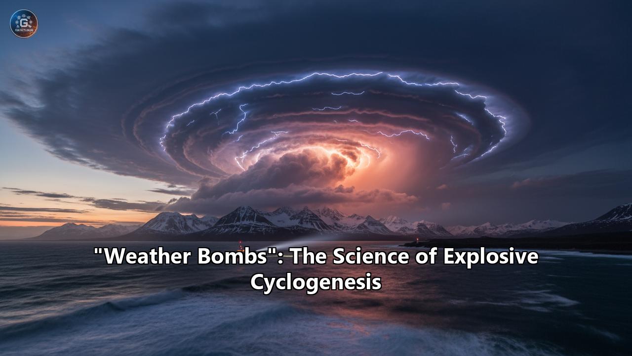
"Weather Bombs": The Science of Explosive Cyclogenesis
The term "weather bomb" conjures images of meteorological mayhem, a sudden and violent onslaught of nature's fury. While the name might sound like a media invention, it is rooted in a very real and powerful atmospheric phenomenon known as explosive cyclogenesis. These rapidly intensifying storms can unleash hurricane-force winds, torrential precipitation, and treacherous sea conditions, often with little warning. This article delves into the science behind these meteorological bombs, exploring their formation, characteristics, and the profound impacts they have on our world.
What is a "Weather Bomb"?
A weather bomb, or bomb cyclone, is an unofficial but widely used term for a mid-latitude cyclone that intensifies with incredible speed. The more formal meteorological term is explosive cyclogenesis. The "bomb" in the name refers to the explosive rate at which the storm's central atmospheric pressure plummets—a process called bombogenesis. To be classified as a bomb cyclone, the central pressure of a storm system must drop by at least 24 millibars in 24 hours. This rapid pressure drop is the engine that drives the storm's intensification, leading to severe weather conditions.
These storms are a distinct phenomenon from tropical cyclones like hurricanes. While both are powerful low-pressure systems, their formation and energy sources differ. Tropical cyclones form over warm tropical waters and are fueled by the release of latent heat from moist air. In contrast, bomb cyclones are "cold-core" storms that derive their energy from the clash of different air masses in the mid-latitudes, typically during the colder months.
The Birth of a Bomb: The Meteorology of Explosive Cyclogenesis
The formation of a weather bomb is a complex interplay of atmospheric ingredients. Several key factors must align to trigger the rapid intensification that defines explosive cyclogenesis.
The Role of Air Masses and Fronts
At its core, explosive cyclogenesis is a result of the interaction between contrasting air masses: one cold and dry, the other warm and moist. The boundary between these air masses is known as a front. When a cold air mass collides with a warm air mass, the warmer, less dense air is forced to rise over the colder air. This upward movement of air is a crucial first step in the formation of a low-pressure system. As the warm, moist air rises, it cools and the water vapor within it condenses, forming clouds and releasing latent heat, which further fuels the storm's development.
The Jet Stream's Crucial Influence
The jet stream, a high-altitude river of fast-flowing air, plays a pivotal role in the development of bomb cyclones. These strong winds, often exceeding 200 km/h, meander across the globe, and their movements can create areas of divergence and convergence in the upper atmosphere. For a bomb cyclone to form, an area of low pressure at the surface needs to be positioned under an area of divergence in the upper-level jet stream. This upper-level divergence acts like a vacuum, pulling air up from the surface and causing the surface pressure to drop even more rapidly.
Within the jet stream, there are even faster flowing corridors of air known as jet streaks. The position of a developing surface low relative to a jet streak is critical. The left-exit and right-entrance regions of a jet streak are areas of enhanced upper-level divergence, and if a surface low moves into one of these "sweet spots," it can experience explosive intensification.
Baroclinic Instability: The Engine of Intensification
The process that drives the intensification of mid-latitude cyclones, including bomb cyclones, is known as baroclinic instability. This instability arises in the atmosphere where there is a strong horizontal temperature gradient, which in turn creates a vertical shear in the wind (wind speed and/or direction changing with height). This shear is a source of potential energy that can be converted into the kinetic energy of the storm's winds. As the warm air rises and the cold air sinks, this potential energy is released, causing the cyclone to spin faster and its central pressure to drop.
The Fuel of Warm Ocean Currents
The world's most active regions for explosive cyclogenesis are often found over warm ocean currents, such as the Gulf Stream in the North Atlantic and the Kuroshio Current in the Northwest Pacific. These currents provide a crucial source of heat and moisture, which are essential ingredients for a developing storm. The stark temperature contrast between the cold continental air and the warm, moist air over these currents creates a highly baroclinic environment, ripe for the development of explosive cyclones. The latent heat released as water vapor from the warm ocean surface condenses into clouds provides a significant energy boost to the storm.
The Anatomy of a Weather Bomb
A mature bomb cyclone is a formidable weather system, often exhibiting a characteristic comma-shaped cloud pattern in satellite imagery. The "head" of the comma is typically where the most intense precipitation and strongest winds are found, while the "tail" is a band of clouds and precipitation extending outwards from the center.
Wind Speeds Comparable to Hurricanes
The rapid pressure drop in a bomb cyclone creates a steep pressure gradient between the storm's center and its periphery, which in turn generates powerful winds. The wind speeds in a strong bomb cyclone can be comparable to those of a Category 1 or even a Category 2 hurricane on the Saffir-Simpson Hurricane Wind Scale. These winds can cause widespread damage to buildings, trees, and power lines.
A Deluge of Precipitation: Rain, Snow, and Ice
Bomb cyclones are capable of producing a wide variety of precipitation types, depending on the temperature profile of the atmosphere. The rapid upward motion of air leads to the formation of deep clouds and intense precipitation.
- Heavy Rain: In the warmer sector of the storm, where temperatures are above freezing, a bomb cyclone can unleash torrential rainfall, leading to widespread flooding.
- Blizzards: In the colder parts of the storm, a bomb cyclone can produce heavy snowfall and strong winds, creating blizzard conditions with near-zero visibility. The weight of the heavy, wet snow can also lead to roof collapses and bring down trees and power lines.
- Freezing Rain and Sleet: In situations where there is a layer of warm air aloft and sub-freezing temperatures at the surface, precipitation can fall as freezing rain or sleet. Freezing rain can coat surfaces with a layer of ice, creating extremely hazardous travel conditions and leading to widespread power outages as ice-laden branches and power lines snap.
Forecasting the precise type of precipitation within a winter storm is one of the biggest challenges for meteorologists, as a difference of just one degree can be the difference between rain, snow, or a dangerous icy mix.
Coastal Threats: Storm Surge and Erosion
When a bomb cyclone strikes coastal areas, it can bring a significant storm surge, which is an abnormal rise in sea level generated by the storm's strong winds and low pressure. This can lead to severe coastal flooding, especially when it coincides with high tide. The powerful waves generated by the storm can also cause significant beach erosion and damage to coastal infrastructure.
A History of Explosive Events: Notable Weather Bombs
History is replete with examples of devastating weather bombs that have left a lasting impact on the regions they have struck.
The Great Storm of 1987 (United Kingdom)
On the night of October 15-16, 1987, a powerful extratropical cyclone, which underwent explosive cyclogenesis, struck southern England and northern France. The storm was notable for the intensity of its winds, with gusts of up to 100 mph recorded. The storm caused widespread devastation, with an estimated 15 million trees blown down, extensive damage to buildings, and widespread power outages affecting millions of homes. The storm resulted in 18 fatalities in England and 4 in France. The Great Storm of 1987 is also remembered for the controversy surrounding its forecast, as some weather reports failed to predict the storm's severity. This event led to significant improvements in weather forecasting in the UK.
The "Perfect Storm" of 1991
This infamous storm, which inspired a best-selling book and a Hollywood movie, was a complex system that involved the merger of an extratropical cyclone with the remnants of Hurricane Grace. The storm underwent explosive cyclogenesis, becoming an incredibly powerful nor'easter off the coast of North America. The storm's most significant impact was the generation of massive waves, with heights of 30 feet being common and some rogue waves estimated to be as high as 100 feet. The storm caused extensive coastal flooding and erosion from North Carolina to Nova Scotia. The most tragic outcome of the storm was the sinking of the swordfishing boat Andrea Gail and the loss of its six-person crew.
The Braer Storm of 1993
The Braer Storm, which occurred in January 1993, is notable for being one of the most intense extratropical cyclones ever recorded over the North Atlantic, with a central pressure that dropped to an estimated 914 millibars. The storm developed rapidly and was well-forecasted by meteorologists in the United Kingdom. While the storm itself caused blizzards across Scotland, its most significant impact was on the oil tanker MV Braer. The tanker had run aground in the Shetland Islands in a previous storm, and the immense waves and powerful winds of the Braer Storm caused the ship to break apart, releasing its entire cargo of 84,700 tonnes of crude oil into the sea. Miraculously, the storm's ferocity also helped to disperse the oil, mitigating what could have been a far worse environmental disaster.
The January 2018 North American "Bomb Cyclone"
In early January 2018, a powerful bomb cyclone brought blizzard conditions and severe disruption to the East Coasts of the United States and Canada. The storm underwent one of the most rapid intensifications ever observed in the Western Atlantic, with its central pressure dropping by 53 millibars in just 21 hours. The storm brought heavy snow to regions as far south as Florida and Georgia, a rare event for those areas. In Boston, the storm produced hurricane-force wind gusts and a record-breaking storm tide that flooded parts of the financial district. The storm was responsible for at least 22 fatalities and caused an estimated $1.1 billion in damages.
The October 2021 Pacific Northwest Bomb Cyclone
In late October 2021, an exceptionally powerful bomb cyclone struck the Pacific Northwest of the United States and Western Canada. The storm's central pressure dropped to 942 millibars, making it the most intense cyclone ever recorded in the Northeast Pacific. The storm was accompanied by a significant atmospheric river, a narrow corridor of concentrated moisture, which led to extremely heavy rainfall and flooding. The storm brought hurricane-force winds, toppling trees and causing widespread power outages for over 370,500 customers. The storm was responsible for at least two deaths and was compared in its ferocity to the infamous Columbus Day Storm of 1962.
Forecasting the Fury: The Science of Prediction
Predicting the formation and intensification of weather bombs is a significant challenge for meteorologists, but advancements in technology and scientific understanding have led to vast improvements in forecasting these powerful storms.
Numerical Weather Prediction Models
Modern weather forecasting relies heavily on numerical weather prediction (NWP) models. These complex computer models use the fundamental equations of atmospheric motion and thermodynamics to simulate the future state of the atmosphere. The history of NWP dates back to the 1920s, but it was the advent of computers in the 1950s that made operational weather forecasting a reality. Over the decades, NWP models have become increasingly sophisticated, with higher resolutions and more accurate representations of physical processes like cloud formation and precipitation. Global models like the American Global Forecast System (GFS) and the European Centre for Medium-Range Weather Forecasts (ECMWF) model are crucial for predicting the large-scale atmospheric patterns that lead to explosive cyclogenesis. Regional models, which focus on a smaller area with higher resolution, can provide more detailed forecasts of the storm's track, intensity, and precipitation.
Despite these advancements, forecasting the exact track and intensity of bomb cyclones remains a challenge. The rapid intensification of these storms makes them particularly sensitive to small errors in the initial conditions fed into the models. Furthermore, accurately modeling the complex interactions between the atmosphere and the ocean, which are crucial for the development of bomb cyclones, is an ongoing area of research.
The View from Above: Satellite Imagery
Satellite imagery is an indispensable tool for observing and forecasting weather bombs. Geostationary satellites, like the GOES series, provide continuous imagery of the Earth, allowing meteorologists to track the development of storms in real-time. Satellite imagery reveals the characteristic cloud patterns associated with explosive cyclogenesis, such as the comma-shaped cloud head and the dry slot, which is an area of sinking dry air that wraps into the storm's circulation. Different types of satellite imagery provide different information. Visible imagery shows the clouds as they would appear to the human eye, while infrared imagery detects the temperature of the cloud tops, which can indicate the height and intensity of the clouds. Water vapor imagery shows the distribution of moisture in the atmosphere, which is crucial for identifying the dry air intrusions that can fuel a storm's intensification. Advanced satellite products, such as those that measure wind speeds over the ocean, provide vital data for initializing and verifying NWP models.
Weather Bombs in a Changing Climate
A pressing question in meteorology and climate science is how climate change will affect the frequency and intensity of explosive cyclogenesis. While the science is still evolving, there is growing evidence to suggest that a warming world could lead to more intense extratropical cyclones.
The Link to Warmer Oceans and a Changing Jet Stream
Climate models, such as those used in the Coupled Model Intercomparison Project (CMIP5 and CMIP6), project that sea surface temperatures will continue to rise. Warmer oceans provide more fuel in the form of heat and moisture for developing storms, which could lead to more intense cyclones. Some studies suggest that while the overall number of extratropical cyclones may decrease, the number of the most intense storms could increase.
The impact of climate change on the jet stream is more complex. The Arctic is warming faster than the rest of the planet, which reduces the temperature contrast between the poles and the equator. This could potentially weaken the jet stream and make it more "wavy," leading to more persistent weather patterns. However, other factors, such as changes in the stratosphere, could also influence the jet stream's behavior. The precise impact of these changes on the frequency and location of explosive cyclogenesis is an active area of research.
The Growing Threat of Compound Events
A significant concern is the potential for more frequent and intense compound events, where a bomb cyclone occurs in conjunction with other extreme weather phenomena, such as atmospheric rivers. The October 2021 Pacific Northwest storm is a prime example of such an event, where the combination of a powerful bomb cyclone and a potent atmospheric river led to devastating rainfall and flooding. As the climate warms, the atmosphere can hold more moisture, which could make atmospheric rivers even more intense, amplifying the impacts of future bomb cyclones.
Staying Safe in the Face of the Storm
Given the destructive potential of weather bombs, it is crucial for individuals and communities to be prepared.
Heeding Warnings and Staying Informed
The first line of defense is to stay informed about weather forecasts and to heed any warnings issued by meteorological services and emergency management agencies. Effective communication of weather risks is vital for ensuring that people take the necessary precautions.
Preparing Your Home and Property
There are several steps you can take to prepare your home for a bomb cyclone:
- Secure outdoor objects: Bring in or tie down anything that could be blown around by strong winds, such as patio furniture, garbage cans, and toys.
- Strengthen your home: If you live in a coastal area, consider installing storm shutters or boarding up your windows. Ensure your roof is in good repair.
- Clear gutters and drains: This will help prevent flooding from heavy rain.
- Prepare for power outages: Have a well-stocked emergency kit with flashlights, batteries, a first-aid kit, and a battery-powered radio. If you have a generator, make sure it is in good working order and that you know how to use it safely.
Evacuation and Shelter
In some cases, the safest course of action may be to evacuate. If you live in a low-lying coastal area that is vulnerable to storm surge, be prepared to evacuate to higher ground if instructed to do so by authorities. Know your evacuation routes and have a plan for where you will go. If you are staying home, take shelter in a small, interior room on the lowest level of your house, away from windows and doors.
The Societal and Economic Toll
The impacts of weather bombs extend far beyond the immediate damage to property and infrastructure. These storms can have significant and long-lasting societal and economic consequences.
Economic Costs
The economic costs of a major bomb cyclone can be staggering. These costs include the direct damage to homes, businesses, and public infrastructure, as well as the indirect costs associated with business interruption, supply chain disruptions, and the costs of emergency response and recovery. The insurance industry is facing increasing challenges from the rising costs of extreme weather events, which can lead to higher premiums and reduced coverage in high-risk areas.
Human and Social Impacts
The human cost of weather bombs can be devastating. These storms can cause fatalities and injuries, and they can displace people from their homes. The stress and trauma of living through a major disaster can also have long-term psychological impacts on individuals and communities. Socially vulnerable populations, such as the elderly, low-income communities, and those with disabilities, are often the most severely affected by extreme weather events.
Ecological Consequences
The powerful winds of a bomb cyclone can have profound and long-lasting impacts on forest ecosystems. Widespread treefall can alter the structure and composition of forests, creating opportunities for some species while harming others. While some ecosystems are resilient and can recover over time, the increasing frequency and intensity of severe storms could push some forests beyond their ability to adapt.
Conclusion: A Force to be Reckoned With
"Weather bombs" are a stark reminder of the immense power of the atmosphere. These rapidly intensifying storms are a complex and fascinating meteorological phenomenon, driven by the intricate dance of air masses, jet streams, and ocean currents. As our understanding of explosive cyclogenesis continues to grow, so too does our ability to forecast these dangerous storms and to mitigate their impacts. In a world where the climate is changing, the threat posed by weather bombs and other extreme weather events is likely to increase. By investing in scientific research, improving our forecasting capabilities, and taking proactive steps to prepare our communities, we can better weather the storms that lie ahead.
Reference:
- https://www.cbsnews.com/news/what-is-bomb-cyclone-winter-storm-weather-explained/
- https://www.unitedrestorationfl.com/how-to-prepare-for-a-bomb-cyclone-before-it-happens/
- https://restorationmasterfinder.com/restoration/what-happens-in-a-bomb-cyclone/
- https://www.firstcoastnews.com/article/weather/what-is-a-bomb-cyclone-pacific-northwest/77-3db0d141-cf50-4872-8389-90e7b77bec58
- https://blog.commercialrestoration.com/what-is-a-bomb-cyclone
- https://journals.ametsoc.org/view/journals/wefo/18/6/1520-0434_2003_018_1052_tetotc_2_0_co_2.xml
- https://www.theskimm.com/news/thing-to-know-storm-terms
- https://www.vos.noaa.gov/MWL/dec_07/weatherprediction.shtml
- https://commons.erau.edu/pr-meteorology/4/
- https://scholarsjunction.msstate.edu/cgi/viewcontent.cgi?article=7249&context=td
- https://www.researchgate.net/publication/291401053_The_Extratropical_Transition_of_Tropical_Cyclones_Structural_Characteristics_Downstream_Impacts_and_Forecast_Challenges
- https://acquire.cqu.edu.au/articles/chapter/Ecological_effects_of_strong_winds_on_forests/28139429
- https://www.researchgate.net/publication/221912131_The_Complexity_of_Catastrophic_Wind_Impacts_on_Temperate_Forests
- https://domesticpreparedness.com/articles/three-keys-to-life-saving-hurricane-season-communication
- https://pmc.ncbi.nlm.nih.gov/articles/PMC7787386/
- https://resources.eumetrain.org/satmanu/CM4SH/Australia/ExCy/navmenu.php
- https://efi.int/sites/default/files/files/publication-bank/2018/efi_wsctu3_2013.pdf
- https://www.severe-weather.eu/mcd/remarkable-satellite-presentation-explosive-cyclogenesis-nw-atlantic-mk/
- https://www.usi.com/executive-insights/executive-series-articles/featured/personal-risk/q1-2024/extreme-weather-understand-the-ripple-effects-on-your-insurance/
- https://www.redcross.org/about-us/news-and-events/news/2024/stay-safe-as-bomb-cyclone-atmospheric-river-blast-pacific-northwest-northern-california.html
- https://www.researchgate.net/publication/330894583_The_Long-Term_Effects_of_Wind_Disturbance_on_a_Sitka_Spruce-Western_Hemlock_Forest
- https://www.ceres.org/resources/reports/stormy-future-insurers-growing-costs-and-risks-extreme-weather-events
- https://www.habitat.org/our-work/disaster-response/disaster-preparedness-homeowners/hurricanes
- https://www.noaa.gov/jetstream/tc-safety
- https://ideas.repec.org/p/eth/wpswif/23-382.html
- https://www.cbiz.com/insights/article/extreme-weather-events-influencing-your-insurance-policies
- https://severeweather.wmo.int/TCFW/RAIV_Workshop2018/12a_Extratropical%20Transition_MichaelBrennan.pdf
- https://m3ins.com/the-new-reality-of-weather-and-insurance/
- https://eprints.whiterose.ac.uk/id/eprint/129272/3/IJDRR%2520special%2520issue%2520editorial_final.pdf
- https://assets.cambridge.org/97805217/96293/excerpt/9780521796293_excerpt.pdf
- https://familytreemagazine.com/history/the-weather-report/
- https://en.wikipedia.org/wiki/Numerical_weather_prediction
- https://en.wikipedia.org/wiki/History_of_numerical_weather_prediction
- https://cimss.ssec.wisc.edu/satellite-blog/archives/26592
- https://www.worldscientific.com/doi/10.1142/9789814293488_0005
- https://hepex.org.au/risk-communication-for-cyclone-early-warning/
- https://www.tandfonline.com/doi/abs/10.1080/09640561003613138
- https://scispace.com/pdf/economic-costs-of-extratropical-storms-under-climate-change-3ve9ylvrh7.pdf
- https://www.bankrate.com/insurance/homeowners-insurance/extreme-weather-transforming-insurance-industry/
- https://unfccc.int/sites/default/files/resource/casestudy_samoa_cyclone_evan.pdf