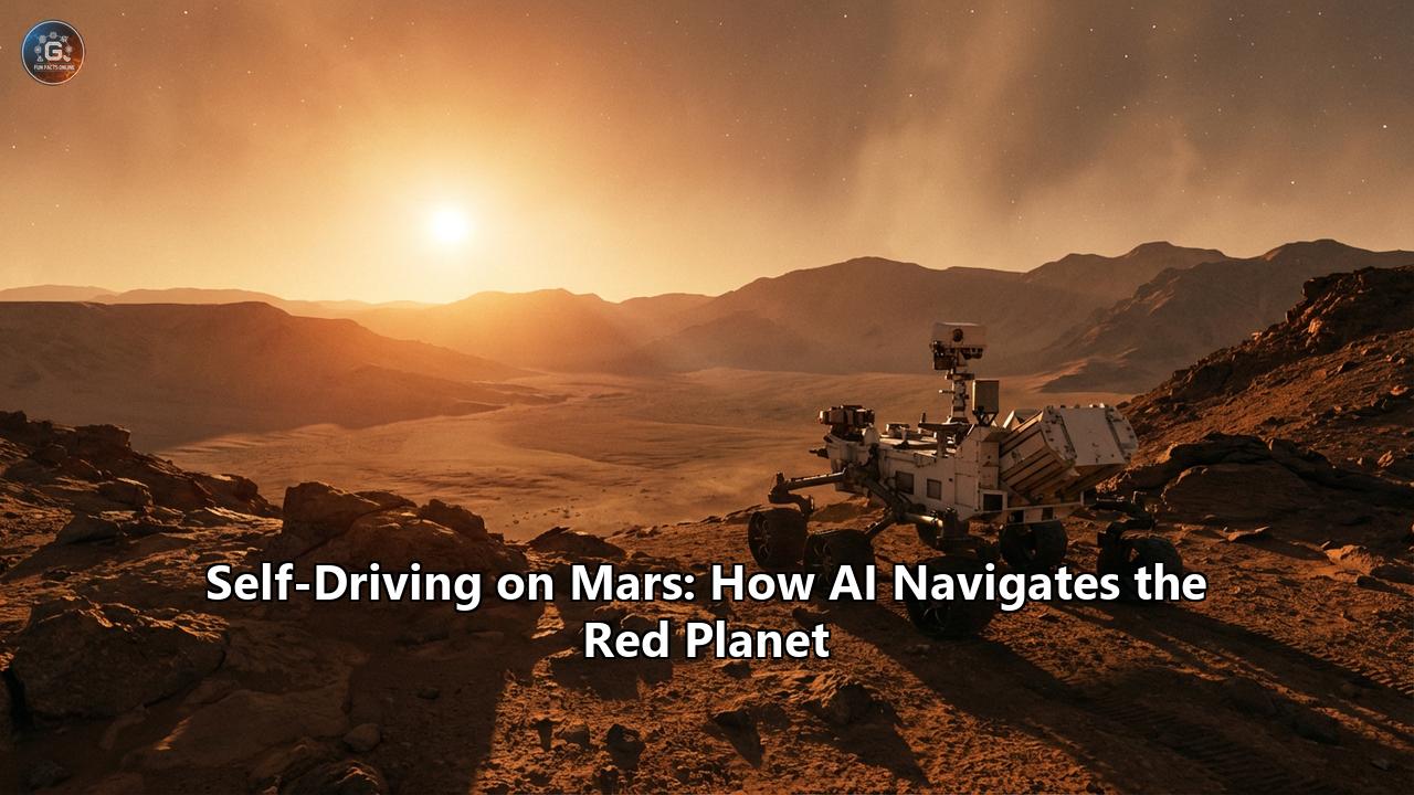
In December 2025, a quiet revolution took place on the floor of Jezero Crater. For the first time in history, a robot on another world moved not just according to a rigid set of commands uplinked from Earth, but guided by a path dreamt up by an artificial intelligence. NASA’s Perseverance rover, a one-ton nuclear-powered geologist, executed a series of drives—covering over 450 meters in two days—following waypoints generated by a Large Language Model (LLM) and Vision-Language Model (VLM).
To the casual observer, the tracks in the Martian dust looked no different than any others left over the last decade. But to roboticists and space engineers, those tracks marked a paradigm shift. We have moved from the era of "tele-operation," where humans agonizingly joystick every meter of progress, to the era of true "self-driving" planetary exploration.
Driving on Mars is the ultimate edge case. There are no lanes, no GPS, no traffic signs, and no roadside assistance. The "commute" involves dodging wheel-shredding ventifacts (sharp, wind-carved rocks) and navigating sand ripples that can swallow a rover whole, all while dealing with a communication lag that makes real-time braking impossible. This article explores the deep technical reality of how AI navigates the Red Planet—from the humble "bump-and-go" logic of the 1990s to the FPGA-accelerated "thinking-while-driving" brains of today, and the generative AI future that promises to unlock the rest of the solar system.
Part I: The tyranny of Light and Lag
To understand why AI is necessary on Mars, one must first understand the physics of the problem. Mars is currently, on average, about 140 million miles (225 million kilometers) from Earth. Radio signals, travelling at the speed of light, take anywhere from 4 to 24 minutes to cross that void.
If a human operator on Earth sees a cliff approaching through the rover's eyes and hits the "STOP" button, that command will arrive 20 minutes later. By then, the rover has already fallen off the cliff and has been tumbling for 19 minutes and 59 seconds.
This "light-speed limit" dictates that real-time joystick control is physically impossible. For the first few generations of rovers, this meant an excruciatingly slow "move, wait, think" cycle:
- Downlink: The rover sends images of its surroundings to Earth.
- Analysis: Human "Rover Planners" (RPs) don 3D glasses, stare at stereo images, and map out a safe path for the next few meters.
- Uplink: The commands are beamed back to Mars the next day.
- Execution: The rover drives that short distance blindly and stops.
This method is safe but agonizingly slow. It limited the 1997 Sojourner rover to driving just 100 meters in total over its entire 83-day mission. To explore the geological history of an entire planet, we needed robots that could think for themselves.
Part II: The Evolution of the Martian Driver
The history of Mars navigation is a history of trusting the machine a little bit more with each mission.
Sojourner (1997): The Toddler
Sojourner, the size of a microwave oven, had a navigation system that was less "AI" and more "reflex." It used a laser striping system to detect hazards. If a laser stripe was broken by a rock, the rover stopped. It was a binary, reactive system. It didn't "know" where it was going; it only knew what it had just hit.
Spirit and Opportunity (2004): The Teenagers
The Mars Exploration Rovers (MER) introduced the first true "AutoNav" (Autonomous Navigation). They used stereo cameras to build a 3D map of their immediate surroundings (a "goodness map"). The algorithm, GESTALT (Grid-based Estimation of Surface Traversability Applied to Local Terrain), would evaluate dozens of possible arcs.
- The Limitation: These rovers had 20MHz processors—slower than a modern smart toaster. They couldn't process images and drive at the same time. They had to stop, take a picture, crunch the numbers for 2-3 minutes, drive 50 centimeters, and repeat. This "stop-and-go" driving limited their autonomous speed to about 10 meters per hour.
Curiosity (2012): The Cautious Adult
Curiosity (Mars Science Laboratory) carried more computing power (a 200MHz RAD750), but its navigation software was initially conservative. It used "Visual Odometry" (VO) to track its own slip. By comparing features in successive images, it could tell if its wheels were spinning in sand. However, like its predecessors, it still had to stop to think. The math for checking hazards was complex, and the CPU was busy keeping the rover alive (thermal management, power, comms). Curiosity rarely drove more than 100 meters autonomously in a single day.
Part III: Perseverance and the Era of "Thinking-While-Driving"
Perseverance ("Percy"), which landed in 2021, represented a quantum leap in robotic autonomy. The engineers at NASA JPL realized that to reach the scientifically rich Jezero Delta, the rover needed to cover huge distances—far more than human planners could micromanage.
The Hardware: A Second Brain
Unlike Curiosity, Perseverance was given a dedicated "co-pilot." While the main computer (the radiation-hardened RAD750) handles the health and safety of the rover, a separate computer called the Vision Compute Element (VCE) handles the driving.
- The VCE: This box contains a commercial-grade processor (similar to a smartphone chip from 2014) and, crucially, Field Programmable Gate Arrays (FPGAs).
- The FPGA Advantage: Image processing is computationally expensive. Rectifying stereo images, calculating disparity maps, and identifying geometric hazards takes billions of operations. On a general-purpose CPU, this takes seconds. On an FPGA, the algorithms are "baked" into the hardware circuits. The VCE can process navigation images in milliseconds.
The Capability: Thinking-While-Driving
Because of the VCE, Perseverance doesn't need to stop to process data. It captures images, processes them, updates its internal map, and calculates the next steering arc while the wheels are still turning.
This allows Percy to drive continuously at its top speed of 120 meters per hour (0.07 mph). That sounds slow, but in the world of planetary exploration, it is blistering. It is the difference between walking and sprinting.
The Algorithm: ENav
Perseverance replaced the older GESTALT system with ENav (Enhanced Navigation). ENav doesn't just look for obstacles; it understands the entire geometry of the terrain.
- Global Path: The rover is given a distant goal (e.g., "Drive to that hill 500 meters away").
- Local Map: As it drives, it builds a 30x30 meter grid of the terrain's "cost." High rocks have high cost; flat sand has low cost.
- Path Selection: It essentially runs a continuous A search (a pathfinding algorithm), constantly updating the best route to the goal as new obstacles appear.
In its first two years, Perseverance shattered every driving record, regularly knocking out 300+ meter drives in a single Martian day (Sol), navigating boulder fields nicknamed "Snowdrift Peak" that would have paralyzed previous rovers for weeks.
Part IV: The "Claude" Experiment (December 2025)
By late 2025, Perseverance had proven it could avoid rocks. But planning the route—deciding "go left around that crater, not right"—was still a human job. Human planners spent hours analyzing satellite imagery (HiRISE) to plot a general corridor for the AutoNav to follow.
This "strategic planning" bottleneck was the next target for automation. Enter Generative AI.
In a groundbreaking experiment on Sol 1707 and 1709 (December 8 and 10, 2025), NASA handed the strategic keys to an AI model from Anthropic: Claude.
The Problem: The Blank Map
AutoNav is great at "tactical" driving (don't hit that rock in front of you), but it has no "strategic" awareness. It doesn't know that the flat path to the left leads to a dead-end box canyon 200 meters later. Humans provide that strategic context. Could a Vision-Language Model (VLM) do the same?
The Solution: VLM-Based Route Planning
The JPL team, collaborating with Anthropic, didn't just ask a chatbot to "drive the rover." They built a sophisticated pipeline:
- Input: The AI was fed high-resolution orbital imagery (HiRISE) and Digital Elevation Models (DEMs) of the terrain ahead.
- Prompting: The model was tasked with identifying semantic terrain features: "sand ripples" (high slip risk), "bedrock" (good traction), and "boulder fields" (high obstacle density).
- Output: Instead of text, the AI generated a series of GPS-like waypoints—a "breadumb trail" for the rover to follow.
The Digital Twin Validation
NASA doesn't gamble with $2.7 billion hardware. Before those AI-generated waypoints were beamed to Mars, they went through a rigorous "Digital Twin" validation.
Using a simulation software likely based on ROAMS (Rover Analysis, Modeling, and Simulation), engineers simulated the drive. They checked over 500,000 telemetry variables.
- Energy Consumption: Would this route drain the batteries too fast?
- Tilt: Would the rover tip over?
- Thermal: Would the motors overheat on the steep slopes?
The result? The AI's plan was nearly perfect. Humans made only minor tweaks (adjusting for a small hazard visible in ground-level photos the satellite missed).
The "Blue vs. Magenta" Line
On December 10, Perseverance executed the drive. The telemetry returned a fascinating image:
- The Magenta Line: The path planned by the AI.
- The Orange Line: The path actually driven by Perseverance.
- The Blue/Black Lines: The options considered by AutoNav in real-time.
The rover followed the AI's strategic corridor (Magenta) but constantly micro-adjusted (Orange) to dodge rocks the AI couldn't see from orbit. This successful "handshake" between a massive AI model on Earth (Strategic) and the specialized ENav chip on Mars (Tactical) proved that generative AI could effectively act as a "Rover Planner," potentially doubling the amount of science that can be done by cutting planning time in half.
Part V: Flying Blind (and Seeing) with Ingenuity
While Perseverance conquered the ground, a 1.8kg collection of carbon fiber and off-the-shelf smartphone parts conquered the air. Ingenuity, the Mars Helicopter, faced an even harder navigation challenge than the rover.
The Helicopter Problem
A rover can stop if it gets confused. A helicopter cannot. If Ingenuity's navigation loop lags for even a fraction of a second, it falls out of the sky. Furthermore, Mars has no magnetic field to speak of, so compasses don't work. GPS is non-existent.
Visual-Inertial Navigation
Ingenuity navigates using a method called Visual-Inertial Odometry (VIO).
- IMU (Inertial Measurement Unit): Accelerometers and gyroscopes feel the helicopter moving. This is fast (500Hz) but drifts quickly.
- Downward Camera: A black-and-white camera snaps 30 photos a second of the ground.
- Feature Tracking: The software picks out "features" (rocks, shadows, sand textures) and tracks how they move across the frame. If a rock moves from the top to the bottom of the image, the helicopter knows it is moving forward.
By fusing the "feel" of the IMU with the "sight" of the camera, Ingenuity knows where it is relative to where it took off. It doesn't know where it is on Mars (latitude/longitude), only how far it has moved.
The "Death Loop" Anomaly
This system is robust, but not perfect. On Flight 6, a single image frame was dropped due to a camera glitch. The timestamp on the images got out of sync with the IMU. The helicopter thought it was swinging wildly back and forth, so it corrected by actually swinging wildly back and forth. The onboard AI fought the "phantom" motion, leading to a wild joyride that tested the limits of the control algorithms. The system survived because the "stability" loops (keep upright) were prioritized over the "navigation" loops (go to X).
Part VI: The Future – Mars Sample Return and Beyond
The success of AutoNav and the Claude experiment has reshaped the architecture of future missions, most notably Mars Sample Return (MSR).
The Death of the Fetch Rover
originally, MSR included a specialized "Fetch Rover"—a fast, nimble robot designed to sprint around Jezero Crater, pick up the sample tubes Perseverance dropped, and rush them back to a rocket.
However, Perseverance's autonomous performance was so good (and its reliability so high) that NASA canceled the Fetch Rover. They decided Percy could drive the samples back itself.
The Rise of the Science Helicopter
To back up Perseverance, the new plan involves Sample Recovery Helicopters. These aren't just copies of Ingenuity; they are conceptualized as larger hexacopters or advanced coaxial drones.
- Map-Based Localization (MbL): Unlike Ingenuity, which only knows relative motion, future helis will likely use MbL. They will carry a map of the terrain (from satellite images) in their memory. As they fly, they will match the camera view to the map—giving them a "True Mars GPS." This will allow them to fly kilometers away from the rover and return safely, acting as long-range scouts.
Energy-Aware Autonomy (PARC-MRS)
Future algorithms are moving beyond just geometry. New research into PARC-MRS (Power Aware Resource Constrained Mars Rover Scheduling) integrates energy physics into the navigation.
Current rovers might choose the shortest path. Future AI will choose the most energy-efficient* path. It might drive a longer route to avoid soft sand (which causes high wheel slip and burns battery) or stay on sun-facing slopes to keep the solar panels illuminated. The AI becomes not just a driver, but an energy manager.
Part VII: Conclusion
We have entered the "golden age" of Martian robotics. We are no longer remote-controlling toys; we are collaborating with intelligent partners.
When Perseverance drives today, it is a symphony of layered intelligence.
- Earth-based Generative AI (Claude) dreams up the path, analyzing the landscape like a seasoned geologist.
- The Digital Twin (ROAMS) validates that dream against the harsh laws of physics.
- The Onboard FPGA (VCE) executes the dream, processing the reality of the Martian surface in milliseconds, deciding in real-time whether to crush a rock or drive around it.
This hierarchy—Strategic AI on Earth, Tactical AI on Mars—is the blueprint for how we will explore the outer solar system. When we eventually send submarines to the oceans of Europa or drones to the mists of Titan, the communication delays will be measured in hours, not minutes. Tele-operation will be impossible. Those robots will be on their own.
But thanks to the tracks currently being laid in the dust of Jezero Crater, they will be ready to drive themselves.
Reference:
- https://science.nasa.gov/photojournal/visualizing-perseverances-ai-planned-drive-on-mars/
- https://www.nasa.gov/missions/mars-2020-perseverance/perseverance-rover/nasas-perseverance-rover-completes-first-ai-planned-drive-on-mars/
- https://science.nasa.gov/blog/driving-farther-and-faster-with-autonomous-navigation-and-helicopter-scouting/
- https://eu.36kr.com/en/p/3665841565426308
- https://ieeexplore.ieee.org/iel8/10495159/10576056/11265757.pdf
- https://www.theregister.com/2026/01/31/nasa_taps_claude_to_conjure/
- https://www.jpl.nasa.gov/edu/resources/project/code-a-mars-landing/