An awesome power, capable of reshaping landscapes and altering global climates, lies dormant beneath our feet. Volcanoes, in their majestic and often terrifying displays of Earth's inner fury, have captivated and threatened civilizations for millennia. The sudden, explosive awakening of a seemingly peaceful mountain can unleash catastrophic consequences, from pyroclastic flows moving at hurricane speeds to far-reaching ash clouds that disrupt air travel and agriculture. For the more than one billion people living within the potential reach of an active volcano, the pressing question is not if, but when the next eruption will occur.
In the high-stakes endeavor of forecasting these deadly events, scientists have turned to the subtle and often imperceptible tremors that emanate from deep within the Earth. This field, known as volcanic seismology, is at the forefront of our efforts to understand and predict the behavior of these geological giants. By listening to the seismic whispers of moving magma, cracking rock, and escaping gases, volcanologists can piece together a picture of the turmoil brewing miles below the surface. These seismic signals, invisible to the naked eye but captured by sensitive instruments, are often the earliest and most reliable indicators of an impending eruption.
This article delves into the fascinating world of volcanic seismology, exploring how the Earth's own tremors are harnessed to forecast deadly eruptions. We will journey from the fundamental principles of volcanic earthquakes to the sophisticated technologies that detect them, and from the dramatic successes of eruption prediction to the tragic failures that underscore the immense challenges that remain. We will also look to the future, where artificial intelligence, novel sensing technologies, and the power of citizen science are shaping the next generation of volcano monitoring and hazard mitigation.
The Tell-Tale Tremors: A Symphony of Subterranean Signals
Unlike the singular, powerful jolts of tectonic earthquakes caused by the slip of tectonic plates, volcanic earthquakes are a complex symphony of different seismic signals, each providing a unique clue to the processes occurring within a volcano's plumbing system. These signals are the audible manifestations of magma's relentless journey towards the surface, a journey that fractures rock, resonates through conduits, and releases pressurized gases. Understanding this seismic language is the cornerstone of volcanic seismology.
Volcano-Tectonic Earthquakes: The Cracking of the Crust
The most common type of volcanic earthquake is the volcano-tectonic (VT) earthquake. These are caused by the brittle failure of rock as magma and associated fluids force their way upwards. As the molten rock ascends, it increases stress on the surrounding crust, causing it to crack and shift. This process generates high-frequency seismic waves, similar to those produced by tectonic faults.
VT earthquakes often occur in swarms, with dozens or even hundreds of small-magnitude events happening in a concentrated area. While the majority of these swarms do not culminate in an eruption, they are a clear sign of volcanic unrest and are closely monitored by scientists. The location and migration of these earthquake swarms can provide crucial information about the movement of magma. For instance, a swarm of VT earthquakes that progressively gets shallower can indicate that magma is rising towards the surface, increasing the likelihood of an eruption.
Long-Period Earthquakes: The Rumblings of Moving Fluids
Another critical type of volcanic seismic signal is the long-period (LP) earthquake. As their name suggests, LP events are characterized by lower frequency waves compared to VT earthquakes. These signals are not caused by the brittle fracturing of rock, but rather by the movement of magma, gases, and other fluids within the volcano's plumbing system.
The injection of magma into the surrounding rock, the resonance of volcanic gases in cracks and conduits, and the unsteady transport of magma can all generate LP earthquakes. These events are often seen as a more direct indicator of magma movement and can be a precursor to an eruption. For example, months before the 1980 eruption of Mount St. Helens, the volcano exhibited a significant increase in LP earthquakes, providing an early warning of the impending catastrophe.
Volcanic Tremor: A Continuous Hum of Activity
When long-period earthquakes occur so closely together that they merge into a continuous seismic signal, it is known as volcanic tremor. This sustained, rhythmic ground shaking can last for minutes, hours, or even days and is often associated with the steady movement of magma or the venting of volcanic gases. The appearance of volcanic tremor is a significant development during a period of volcanic unrest, often signaling that an eruption is imminent or already underway.
Harmonic tremor is a specific type of volcanic tremor with a very pure, sinusoidal waveform, giving it a "musical" quality. This type of tremor is thought to be generated by the resonance of magma in a well-defined conduit or chamber and is a strong indicator of sustained magma flow. The successful prediction of the 1991 eruption of Mount Pinatubo was aided by the detection of volcanic tremor in the days leading up to the cataclysmic event.
Other Seismic Signals: A Diverse Vocabulary of a Volcano
Beyond these primary types of volcanic earthquakes, a volcano's seismic repertoire includes a variety of other signals. Explosion quakes are sharp, distinct seismic events caused by the explosive release of pressure at the volcanic vent. The seismic noise from pyroclastic flows, the terrifyingly fast-moving currents of hot gas and volcanic matter, can also be recorded and analyzed. Even the rumbling of lahars, or volcanic mudflows, generates a seismic signature that can be used for tracking and early warning.
The Tools of the Trade: Listening to the Earth's Heartbeat
To capture this diverse array of seismic signals, volcanologists rely on a sophisticated arsenal of instruments and analytical techniques. The ability to detect and interpret these subtle tremors is a testament to the advancements in seismological technology and our growing understanding of volcanic processes.
Seismometers: The Ears of Volcanology
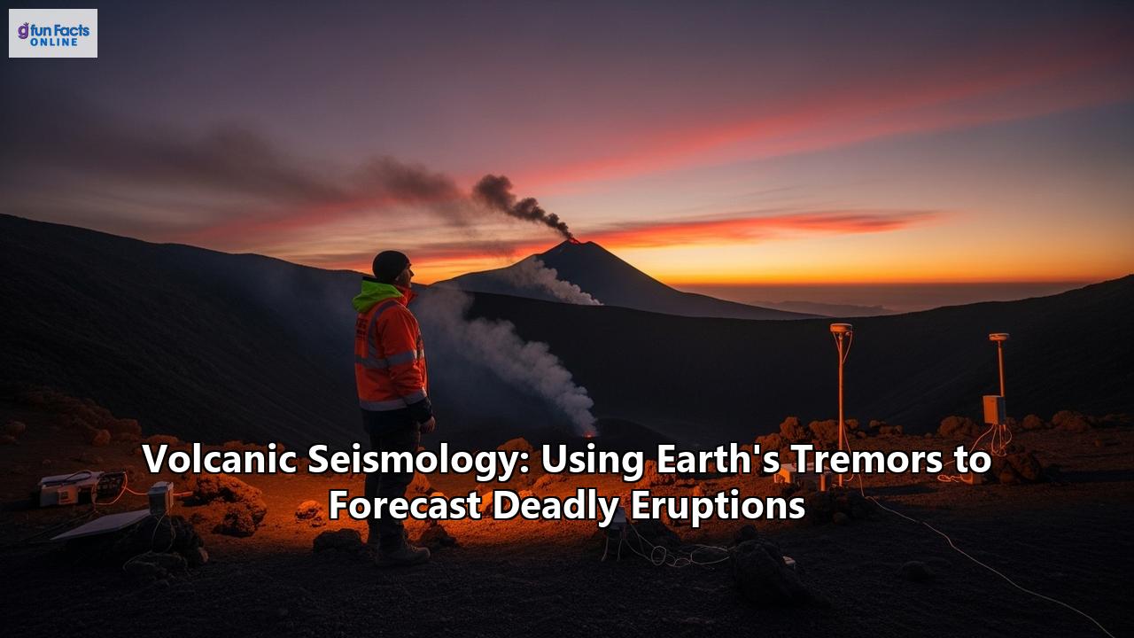
The workhorse of volcanic seismology is the seismometer, an instrument that detects and records ground motion. Modern volcano monitoring networks consist of a series of seismometers strategically placed around an active volcano. A typical network for basic monitoring requires 6 to 8 seismometers within a 20-kilometer radius of the volcano. For volcanoes that pose a very high threat, the number of seismometers can be doubled to ensure high-accuracy tracking of earthquake locations.
These networks are designed to capture a wide range of seismic frequencies, from the high-frequency snaps of volcano-tectonic earthquakes to the low-frequency rumbles of long-period events and volcanic tremor. For this reason, modern networks often include both short-period and broadband seismometers. Broadband seismometers are particularly important for detecting the low-frequency signals that are often direct indicators of magma movement.
The data from these seismometers are transmitted in real-time to volcano observatories, where they are continuously analyzed by seismologists. This real-time data stream allows for the rapid detection of changes in a volcano's seismic activity, which is crucial for issuing timely eruption warnings.
Unveiling the Volcano's Innards: Advanced Analytical Techniques
Simply detecting volcanic earthquakes is only the first step. The real challenge lies in interpreting what these signals mean. To do this, volcanologists employ a range of advanced analytical techniques to transform raw seismic data into a detailed picture of the volcano's inner workings.
One of the most powerful of these techniques is seismic tomography. Similar to a medical CT scan, seismic tomography uses the seismic waves generated by earthquakes to create a three-dimensional image of the volcano's subsurface. Seismic waves travel at different speeds through different materials; they slow down when passing through hot or molten rock. By analyzing the travel times of seismic waves from numerous earthquakes recorded at multiple seismometers, scientists can map out areas of anomalously low seismic velocity, which often correspond to magma reservoirs. This technique has been used to discover and study magma chambers beneath dozens of volcanoes worldwide.
Another important analytical tool is moment tensor analysis. The moment tensor is a mathematical representation of the forces that generate an earthquake. By analyzing the moment tensor of a volcanic earthquake, seismologists can determine the type of faulting that occurred and gain insights into the physical processes driving the seismicity. For example, a non-double-couple moment tensor can indicate processes other than simple shear faulting, such as the opening of a fluid-filled crack, which is directly related to magma movement.
A Multidisciplinary Approach: The Power of Synergy
While seismic monitoring is a cornerstone of eruption forecasting, it is most powerful when integrated with other monitoring techniques. A holistic understanding of a volcano's behavior requires a multidisciplinary approach, combining insights from seismology, geodesy (the study of ground deformation), gas geochemistry, thermal monitoring, and satellite remote sensing.
The Swelling of the Earth: Geodetic Measurements
As magma rises and accumulates beneath a volcano, it causes the ground surface to deform, often by just a few millimeters or centimeters. Detecting this subtle swelling is a key indicator of an impending eruption. Two of the primary tools for measuring ground deformation are the Global Positioning System (GPS) and Interferometric Synthetic Aperture Radar (InSAR).
GPS networks consist of a series of receivers placed on the volcano's flanks that can measure their position with millimeter-level accuracy. By tracking changes in the positions of these receivers over time, scientists can detect even the slightest inflation or deflation of the volcano.
InSAR is a satellite-based technique that uses radar images to create detailed maps of ground deformation over large areas. By comparing radar images taken at different times, InSAR can reveal patterns of uplift or subsidence with centimeter to sub-centimeter accuracy. The combination of the high temporal resolution of GPS and the high spatial resolution of InSAR provides a comprehensive picture of how the ground is deforming in response to magma movement.
The Breath of the Volcano: Gas Geochemistry
As magma rises, the decreasing pressure allows dissolved gases to escape. The composition and emission rate of these volcanic gases can provide crucial clues about the state of the magmatic system. The primary gases monitored are sulfur dioxide (SO2) and carbon dioxide (CO2).
An increase in the emission rate of SO2 is often a sign that magma is rising to a shallow depth. Changes in the ratio of different gases can also be indicative of changes in the magmatic system. Gas monitoring can be done on the ground using specialized sensors or from the air using instruments mounted on helicopters or drones. Satellites equipped with atmospheric sensors can also track the release of volcanic gases, particularly large plumes of SO2.
The Heat Within: Thermal Monitoring
The movement of magma towards the surface is often accompanied by an increase in heat. This thermal energy can be detected at the surface in the form of hot springs, fumaroles (gas vents), and heated ground. Thermal monitoring involves measuring these temperature changes over time.
This can be done directly on the ground using thermal cameras or by using satellite-based infrared sensors. Satellites like NASA's MODIS and the Copernicus Sentinels can detect thermal anomalies on a global scale, making them particularly useful for monitoring remote or inaccessible volcanoes. An increase in the size or temperature of a thermal anomaly can be a sign that magma is nearing the surface.
The Big Picture: Satellite Remote Sensing
Satellite remote sensing has revolutionized volcano monitoring by providing a global, synoptic view of volcanic activity. In addition to InSAR, gas monitoring, and thermal imaging, satellites provide a wealth of other data. Optical sensors can track the dispersal of ash clouds, which is critical for aviation safety. Radar can penetrate clouds, allowing for the monitoring of eruptive activity even in bad weather. The high-resolution imagery provided by modern satellites allows scientists to observe changes in a volcano's morphology, such as the growth of a lava dome or the collapse of a crater wall.
The true power of this multidisciplinary approach lies in the synergy between the different datasets. An increase in seismic activity, coupled with ground deformation, a change in gas emissions, and the appearance of a thermal anomaly, provides a much more robust and reliable forecast than any single dataset alone. It is this integrated approach that has led to some of the most significant successes in eruption forecasting.
Case Studies: Triumphs and Tragedies
The history of volcanic seismology is marked by both stunning successes that have saved thousands of lives and sobering failures that highlight the inherent uncertainties in predicting the behavior of these complex natural systems. The contrasting stories of Mount Pinatubo in 1991 and Nevado del Ruiz in 1985 serve as powerful illustrations of the life-and-death stakes of eruption forecasting.
The Triumph of Pinatubo: A Forecast That Saved Thousands
The 1991 eruption of Mount Pinatubo in the Philippines was the second-largest volcanic eruption of the 20th century. After more than 600 years of dormancy, the volcano began to stir in early April 1991 with a series of small steam explosions. In the weeks that followed, a team of scientists from the Philippine Institute of Volcanology and Seismology (PHIVOLCS) and the U.S. Geological Survey (USGS) mounted an intensive monitoring campaign.
Seismic monitoring was at the heart of their efforts. Swarms of volcano-tectonic earthquakes were detected beneath the volcano, indicating that magma was on the move. Tiltmeters recorded the swelling of the volcano as magma accumulated at a shallow depth. Airborne measurements showed a dramatic increase in the emission of sulfur dioxide gas.
Based on this converging evidence, the scientists issued a series of warnings to the local authorities. As the seismic activity escalated and volcanic tremor appeared, the warnings became more urgent. A 10-kilometer-radius danger zone was established, and then expanded. In the days leading up to the cataclysmic eruption on June 15, tens of thousands of people, including 20,000 indigenous Aeta people who lived on the volcano's slopes and 15,000 U.S. military personnel and their families at the nearby Clark Air Base, were evacuated.
The eruption itself was immense, sending a column of ash and gas 40 kilometers into the atmosphere and unleashing devastating pyroclastic flows. While the eruption caused immense destruction, the successful forecast is credited with saving at least 5,000 lives and preventing property losses estimated at $250 million. The Pinatubo story is a testament to the power of multidisciplinary volcano monitoring and the crucial role of effective communication between scientists and public officials.
The Tragedy of Nevado del Ruiz: A Warning Unheeded
In stark contrast to the success at Pinatubo stands the tragic eruption of Nevado del Ruiz in Colombia in 1985. The eruption itself was relatively small, but it melted the volcano's summit glacier, generating a series of deadly lahars that raced down the mountain's slopes. These volcanic mudflows inundated the town of Armero, killing more than 23,000 people in one of the worst volcanic disasters of the 20th century.
The tragedy of Nevado del Ruiz is that it was a predictable and preventable disaster. In the year leading up to the eruption, the volcano had shown clear signs of unrest. There were swarms of earthquakes, steam explosions, and increased fumarolic activity. Scientists had warned of the lahar hazard and had even prepared a hazard map that accurately depicted the areas that would be inundated.
However, a combination of factors led to a catastrophic failure of risk communication and emergency response. There was a lack of a clear and consistent warning system. Public officials were hesitant to order an evacuation, partly due to the economic disruption it would cause and partly due to a lack of understanding of the volcanic risk. On the night of the eruption, even as the lahars were descending, conflicting and confusing messages were broadcast to the residents of Armero. By the time the danger was clear, it was too late.
The Nevado del Ruiz disaster served as a brutal lesson in the importance of not only scientific monitoring but also effective communication, public education, and political will in mitigating volcanic risk. It underscored the fact that a successful forecast is useless if it is not translated into timely and effective action.
The Unpredictable Giant: Challenges and Limitations
Despite the remarkable advances in volcanic seismology, forecasting eruptions remains a formidable challenge. Volcanoes are incredibly complex and dynamic systems, and each one has its own unique personality and eruptive history. The path from scientific understanding to accurate prediction is fraught with difficulties and uncertainties.
One of the fundamental challenges is the "non-uniqueness" problem. Different subsurface processes can sometimes produce similar seismic signals, making it difficult to definitively interpret the data. An increase in seismicity might signal the ascent of magma, but it could also be caused by the movement of hydrothermal fluids or tectonic stresses unrelated to an impending eruption. This ambiguity can lead to false alarms, which can erode public trust and make it more difficult to implement evacuations when a real threat emerges.
The harsh and remote environments where many volcanoes are located also pose significant logistical challenges. Installing and maintaining a dense network of seismometers on the steep, unstable slopes of a volcano can be dangerous and expensive. In many parts of the world, particularly in developing countries, a lack of resources means that many dangerous volcanoes are under-monitored or not monitored at all.
Furthermore, even with the best monitoring data, predicting the exact timing, size, and style of an eruption is often impossible. A volcano can show signs of unrest for weeks, months, or even years before an eruption, or it can erupt with little or no warning. The 2019 eruption of Whakaari/White Island in New Zealand, which killed 22 people, occurred with no immediate, clear precursors, highlighting the inherent unpredictability of some volcanic systems.
Finally, the communication of volcanic risk and uncertainty to the public and to decision-makers is a major challenge. Scientists must convey complex and often uncertain information in a way that is understandable and actionable. The decision to evacuate a community is a difficult one, with significant social and economic consequences. The challenge for scientists is to provide the best possible information to allow for informed decision-making in the face of uncertainty.
The Future of Volcanic Seismology: A Glimpse into Tomorrow's Forecasts
The field of volcanic seismology is constantly evolving, with new technologies and analytical techniques continually pushing the boundaries of what is possible. The future of eruption forecasting promises to be even more sophisticated, data-driven, and integrated.
The Rise of Artificial Intelligence and Machine Learning
One of the most exciting new frontiers in volcanic seismology is the application of artificial intelligence (AI) and machine learning. The sheer volume of seismic data generated by modern monitoring networks is immense, and AI algorithms are proving to be powerful tools for sifting through this data to identify subtle patterns and precursors that might be missed by human analysts.
Machine learning models can be trained on vast datasets of seismic signals from past eruptions to learn the "fingerprints" of different types of volcanic activity. These models can then be used to automatically classify new seismic events and to forecast the probability of an eruption in real-time. Recent studies have shown that machine learning can significantly improve the accuracy of eruption forecasts, particularly when integrated with other data streams like gas emissions and ground deformation.
Novel Sensing Technologies: A New Era of Observation
The development of new sensing technologies is also revolutionizing how we monitor volcanoes. Fiber optic sensing, for example, is an emerging technology that uses standard telecommunication cables to measure ground strain with unprecedented spatial resolution. A single fiber optic cable can act as a network of thousands of seismometers, providing a much more detailed picture of how the ground is deforming in response to magma movement. This technology has the potential to transform volcano monitoring, particularly in remote or submarine environments where deploying traditional seismometers is difficult.
Drones, or unmanned aerial vehicles (UAVs), are also becoming increasingly important tools for volcano monitoring. Equipped with a variety of sensors, including cameras, gas detectors, and thermal imagers, drones can be flown into hazardous areas to collect high-resolution data without risking human lives. They are particularly useful for monitoring changes in active lava flows, gas plumes, and the morphology of volcanic craters.The Power of the Crowd: Citizen Science
In an era of increasing connectivity, citizen science is emerging as a valuable tool for volcano monitoring and risk reduction. Citizen science projects engage the public in the collection of scientific data, from reporting observations of volcanic activity to collecting ash samples. Smartphone apps like myVolcano allow people to submit real-time observations of volcanic phenomena, providing a valuable source of on-the-ground information that can supplement instrumental monitoring.
Beyond data collection, citizen science can play a crucial role in building community resilience to volcanic hazards. By involving local communities in the monitoring process, these projects can increase scientific literacy, improve risk awareness, and foster a greater sense of ownership over disaster preparedness efforts.
Conclusion: A Continuous Vigil
The restless Earth will continue to churn, and volcanoes will continue to erupt. The threat they pose to human life and livelihoods is a constant reminder of the power of nature. Yet, we are not powerless in the face of this threat. Volcanic seismology, born from the desire to understand and anticipate these awesome and terrible events, has given us an unprecedented ability to peer into the heart of a volcano and decipher its secrets.
From the first rudimentary seismographs to the sophisticated global networks and satellite systems of today, our capacity to listen to the Earth's tremors has grown immensely. We have learned to distinguish the subtle crackle of fracturing rock from the deep rumble of moving magma. We have seen how the synergy of seismic data with other geophysical measurements can paint a vivid picture of a volcano on the brink of eruption. The successful forecast of the Mount Pinatubo eruption stands as a powerful symbol of what is possible when science, technology, and effective communication come together.
But the tragedy of Nevado del Ruiz serves as a stark and enduring reminder of the challenges that remain. Prediction is not a perfect science. Every volcano is a unique and complex individual, and the language of its seismic whispers can be ambiguous and difficult to interpret. The path from a scientific forecast to a life-saving action is often fraught with social, economic, and political obstacles.
As we look to the future, the integration of artificial intelligence, the development of groundbreaking new sensor technologies, and the engagement of citizen scientists promise to further revolutionize our ability to forecast deadly eruptions. Yet, the fundamental challenge will remain the same: to listen intently to the Earth's tremors, to translate those whispers into a clear and compelling warning, and to ensure that that warning is heeded. The silent vigil of the volcano seismologist, a sentinel listening to the heartbeat of a sleeping giant, will continue to be one of our most vital defenses against the fiery power that lies beneath our feet.
Reference:
- https://understandrisk.org/communicating-volcanic-risk/
- http://eprints.bice.rm.cnr.it/23324/
- https://archimer.ifremer.fr/doc/00891/100297/110604.pdf
- https://papers.sif.it/?pid=ncc13096
- https://www.researchgate.net/publication/378039848_Monitoring_underwater_volcano_degassing_using_fiber-optic_sensing
- https://epicgeography.wordpress.com/2017/03/14/volcano-case-study-nevado-del-ruiz-colombia/
- https://www.slideshare.net/slideshow/nevado-del-ruiz-case-study/25235375
- https://www.frontiersin.org/research-topics/44344/challenges-in-seismology-to-our-understanding-of-volcanic-islands-and-their-magmatic-unrest/magazine
- https://impact.ref.ac.uk/casestudies/CaseStudy.aspx?Id=32203
- https://fr.scribd.com/doc/14806257/Nevado-Del-Ruiz-Case-Study-Copy
- https://academic.oup.com/astrogeo/article/54/5/5.7/249538
- https://www.iavceivolcano.org/content/uploads/2023/03/13-thelen-et-al-trends-in-volcano-seismology.pdf
- https://www.laserfocusworld.com/science-research/article/14270707/fiber-optic-sensor-effectively-monitors-volcanic-activity
- https://www.geoengineer.org/news/the-future-of-volcanology-ai-and-machine-learning-take-the-lead
- https://eartharxiv.org/repository/view/1537/
- https://www.usgs.gov/publications/trends-volcano-seismology-2010-2020-and-beyond
- https://www.internetgeography.net/topics/the-1991-eruption-of-mount-pinatubo/
- https://www.preventionweb.net/collections/colombia-1985-nevado-del-ruiz-eruption
- https://understandrisk.org/event-session/communicating-volcanic-risk/
- https://www.researchgate.net/publication/358565623_Trends_in_volcano_seismology_2010_to_2020_and_beyond
- https://www.gfz.de/en/press/news/details/vulkanueberwachung-mit-glasfaserkabeln
- https://www.fishersci.ca/ca/en/publications/lab-reporter/2024/issue-2/eruption-disruption-exploring-new-volcano-monitoring-technology.html
- https://www.earthdata.nasa.gov/news/feature-articles/sensing-remote-volcanoes
- https://recovery.preventionweb.net/collections/recovery-collection-philippines-mount-pinatubo-eruption-1991
- https://www.adrc.asia/publications/recovery_reports/pdf/Pinatubo.pdf
- https://pubs.usgs.gov/fs/1997/fs115-97/
- https://www.earthmagazine.org/article/benchmarks-november-13-1985-nevado-del-ruiz-eruption-triggers-deadly-lahars/
- https://www.gfz.de/en/press/news/details/artificial-intelligence-fit-to-monitor-volcanoes
- https://www.preventionweb.net/news/how-stories-can-help-communicate-volcanic-risk-communities
- https://www.researchgate.net/publication/314694957_Imagining_the_Unimaginable_Communicating_Extreme_Volcanic_Risk
- https://www.forbes.com/sites/davidbressan/2025/08/27/ai-helps-researchers-to-peak-into-the-heart-of-an-active-volcano/
- https://nora.nerc.ac.uk/id/eprint/519469/1/OR17045.pdf
- https://www.bgs.ac.uk/geology-projects/volcanoes/citizen-science-for-multi-hazards/