Beneath the placid surface of our planet's oceans lies a dramatic and surprisingly detailed history book, one written not in ink, but in colossal waves of mud. These are not the waves that crash on our shores, but giant, slow-moving ripples of sediment sculpted by immense forces deep beneath the sea. This is the realm of marine paleoseismology, a fascinating field of geoscience where researchers read the stories of ancient, powerful earthquakes and tectonic shifts recorded in the quiet solitude of the deep sea floor.
For coastal communities, understanding the frequency and magnitude of large earthquakes is a matter of life and death. However, our written and instrumental records of these events only span a few hundred, or at best, a few thousand years. This is a mere blink of an eye in geological time. To truly grasp the long-term behavior of earthquake-prone regions, scientists must look for natural archives that preserve a much longer history. On land, they might excavate trenches across fault lines, but the ocean floor holds its own, often more complete, record.
The Undersea Library: Turbidites as Pages of History
The key to this underwater archive lies in a phenomenon known as a turbidity current. When the seafloor is violently shaken by a large earthquake, it can trigger immense submarine landslides. Slopes on the continental shelf, laden with accumulated sediment, become unstable and collapse, sending a turbulent, dense slurry of sand, silt, and mud cascading down into the deep ocean basins.
As this underwater avalanche loses energy, the sediments settle out of the water in a distinct, graded layer known as a "turbidite." The coarsest, heaviest particles drop first, followed by progressively finer grains. This process creates a geological signature, a single "page" in the seafloor's historical record. In the otherwise slow and steady rain of fine sediment that blankets the deep ocean, these turbidite layers stand out as sudden, catastrophic events. By drilling long, cylindrical cores of sediment from the seabed—akin to using a giant straw—scientists can extract these layered records and read the history of past seismic activity.
Synchronicity: The Earthquake's Telltale Signature
A crucial assumption in turbidite paleoseismology is the concept of a widespread, synchronous trigger. While a localized storm or a river flood might cause a small, isolated turbidity current, a massive earthquake, particularly a subduction zone earthquake where one tectonic plate grinds beneath another, will shake a vast area of the seafloor simultaneously. This widespread shaking triggers multiple turbidity currents all along the fault's rupture zone. These currents flow down numerous submarine canyons and channels, eventually depositing a single, extensive turbidite layer across the ocean basin.
Finding the same distinctive turbidite layer in sediment cores taken from different, independent channel systems is the "smoking gun" for a great earthquake. Scientists use a variety of methods to correlate these layers across vast distances. They can use the visual "barcode" or signature of the layer itself, its thickness, and its composition. Advanced techniques like CT (Computed Tomography) scans of the cores reveal intricate details of the internal layering, showing multiple pulses of sediment that might indicate a massive, single event or a series of powerful aftershocks. By dating the fine-grained organic material, like the shells of tiny foraminifera, in the normal sediment layers just above and below the turbidite, geologists can estimate when the earthquake occurred. While these dates can have uncertainties of tens to hundreds of years, the stratigraphic sequence—the order of the layers—is undeniable.
Case Studies in Mud: From Cascadia to Japan
This technique has been famously applied in the Cascadia Subduction Zone, stretching from Northern California to British Columbia. For a long time, there was a debate about whether this region could produce the kind of magnitude 9 "megathrust" earthquakes seen elsewhere in the world. The answer lay in the mud. Geologists found a remarkably consistent record of 13 large turbidites in sediment cores up and down the coast, indicating 13 massive, coast-wide earthquakes over the last several thousand years. The timing of these events, with an average recurrence of about 590 years, closely matched evidence of sudden coastal subsidence found on land, painting a clear picture of Cascadia's violent seismic past.
More recently, after the devastating magnitude 9.1 Tōhoku earthquake off the coast of Japan in 2011, researchers embarked on expeditions like IODP Expedition 386. By drilling into the Japan Trench, in some cases to record-breaking depths of over 8,000 meters, they collected sediment cores to build a catalog of major earthquakes stretching back thousands of years. The goal is to understand the frequency of these enormous quakes, providing crucial information that can help mitigate the hazards from future events.
Even in the relatively slow-moving plate boundary of the Mediterranean, turbidite records off the coast of Algeria have revealed that earthquakes can occur in clusters. The data shows periods with multiple large earthquakes happening every 300-600 years, separated by long, quiet periods of around 1,600 years. This discovery of "supercycles" of strain release and quiescence challenges traditional models and calls for a revision of seismic hazard assessments.
Beyond Earthquakes: Echoes of a Planet's Formation
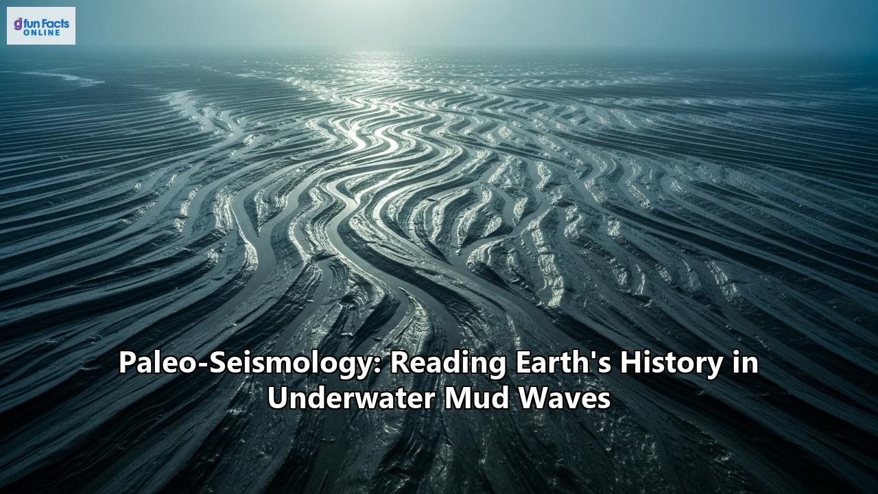
The story told by underwater sediments is not just about earthquakes. In a stunning discovery off the coast of West Africa, scientists analyzing seismic data and old drill cores found the imprint of giant underwater mud waves dating back 117 million years. Located a kilometer below the modern seabed, these colossal waves—some a kilometer long and hundreds of meters high—were not formed by earthquakes, but by the very birth of the Atlantic Ocean.
They were created during the opening of the Equatorial Atlantic Gateway, the seaway that formed as South America and Africa were torn apart during the breakup of the supercontinent Pangea. As the continents separated, dense, salty water from newly formed basins cascaded through the narrow gateway, creating what researchers described as a "giant waterfall" beneath the ocean's surface. The immense power of this flow sculpted the seafloor into massive waves of mud and sand. This discovery provides a more precise timeline for when the Atlantic began to form, a key event in our planet's history that dramatically influenced ocean circulation and global climate.
Challenges and the Future of Deep-Sea Seismology
Marine paleoseismology is not without its challenges. Distinguishing a turbidite triggered by an earthquake from one caused by a severe storm, flood, or random slope failure can be complex. The principle of synchronous, widespread triggering remains the most reliable indicator of a seismic origin. Furthermore, dating the events precisely is an ongoing effort, with researchers constantly refining their techniques to narrow the window of uncertainty.
The field is rapidly advancing, benefiting from remarkable technological developments. High-resolution acoustic mapping techniques can create detailed 3D images of the seafloor and the sediment layers beneath, revealing fault scarps and landslide deposits with stunning clarity. Underwater photogrammetry can create detailed maps of active faults on the seafloor. Geotechnical analysis of sediment cores helps scientists calculate the intensity of shaking required to trigger a landslide, providing clues about the magnitude of past earthquakes.
From deciphering the seismic heartbeat of our planet's most dangerous fault zones to uncovering the echoes of continental breakup, the mud and sediment of the deep ocean hold a rich and vital archive of Earth's history. Each sediment core brought to the surface is a new chapter, offering a deeper understanding of the immense forces that shape our world and providing the crucial long-term perspective needed to prepare for its future.
Reference:
- https://nhess.copernicus.org/articles/special_issue154.html
- https://nhess.copernicus.org/articles/13/3469/2013/nhess-13-3469-2013.pdf
- https://www.pnsn.org/outreach/earthquakesources/csz/turbiditeevidence
- https://www.youtube.com/watch?v=mieTWhOkVnw
- https://eos.org/science-updates/submarine-avalanche-deposits-hold-clues-to-past-earthquakes
- https://news.osu.edu/undersea-sediment-reveals-clues-about-seismic-activity/
- https://pubs.geoscienceworld.org/gsa/geology/article/43/4/331/131855/Holocene-turbidites-record-earthquake-supercycles
- https://archimer.ifremer.fr/doc/00254/36558/35105.pdf
- https://pubs.geoscienceworld.org/gsa/gsabulletin/article/137/1-2/29/645040/Turbidite-correlation-for-paleoseismology
- https://www.agu.org/user-profile/research?cstkey=9945cfd6-a47b-49b1-a526-7c0a6c949e14
- https://www.iflscience.com/117-million-year-old-sediment-waves-near-africa-show-how-atlantic-ocean-was-formed-79079
- https://www.researchgate.net/publication/261018372_Preface_Marine_and_Lake_Paleoseismology
- https://paleoseismicity.org/new-papers-on-paleoseismology-active-tectonics-and-archaeoseismology-dec-2024/
- https://pdfs.semanticscholar.org/5e8d/721b60ec5762a218d74b9ed7a43a2f2d0e1a.pdf