Our planet is a dynamic system, with immense forces constantly reshaping its surface and interior. Earthquakes and volcanic eruptions are dramatic manifestations of these forces. Understanding and predicting these events is crucial for mitigating their risks. Fortunately, rapid advancements in seismology and volcanology, driven by new technologies and analytical methods, are enhancing our ability to listen to the Earth and interpret its signals.
Revolutionizing Seismic Monitoring with Fiber OpticsA groundbreaking technology transforming seismology is Distributed Acoustic Sensing (DAS). DAS repurposes standard fiber-optic cables, like those used for telecommunications, into dense arrays of seismic sensors. An instrument called an interrogator sends laser pulses down the cable. Imperfections in the fiber cause light to scatter back (Rayleigh backscattering). When seismic waves or other vibrations cause tiny stretches or compressions in the cable, they alter the phase of this backscattered light. By analyzing these changes, DAS can detect ground motion, essentially turning kilometers of fiber into thousands of individual seismometers spaced just meters apart.
DAS offers unprecedented spatial resolution, allowing for detailed imaging of subsurface structures and real-time monitoring of seismic activity, including subtle foreshocks that might precede larger earthquakes. It's particularly valuable in environments where traditional seismometers are difficult to deploy, such as urban areas (using existing "dark fiber" networks), boreholes deep underground, or on the seafloor. Seafloor DAS deployments hold promise for improving tsunami early warning systems by detecting offshore earthquakes more effectively. This technology is not just for hazard monitoring; it's also used to study glaciers, groundwater flow, and even detect marine mammal calls or ship traffic.
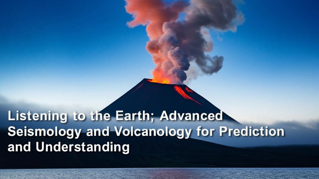
Advanced Techniques in VolcanologyMonitoring volcanoes involves tracking subtle changes that may herald an eruption. Modern volcanology integrates multiple techniques:
- Seismic Monitoring: Increased frequency and intensity of earthquakes, along with specific patterns like harmonic tremor, almost always precede eruptions as magma moves beneath the surface. Advanced seismology, including broadband seismometers and techniques like DAS, provides richer data on these precursors.
- Ground Deformation: As magma accumulates or moves, it can cause the ground surface to swell or tilt. Techniques like GPS (Global Positioning System), tiltmeters, and especially Interferometric Synthetic Aperture Radar (InSAR) are crucial. InSAR uses satellite radar data to create detailed maps of ground deformation over large areas with centimeter-level accuracy, even through clouds or at night. This is invaluable for monitoring remote or hazardous volcanoes.
- Gas Emissions: Changes in the composition and quantity of gases released from volcanic vents (fumaroles), particularly sulfur dioxide (SO2), can indicate magma rising closer to the surface. Improved field spectrometers and satellite sensors enhance gas monitoring capabilities.
- Thermal Monitoring: Satellites (like NASA's ASTER sensor) and drone-mounted thermal cameras can detect changes in surface temperature, indicating increased heat flow associated with volcanic unrest.
- Drone Technology: Uncrewed aerial vehicles (UAVs or drones) allow scientists to safely collect high-resolution imagery, create detailed 3D maps (using techniques like LiDAR), measure gas emissions, and monitor thermal changes in hazardous or inaccessible areas.
The vast amounts of data generated by modern monitoring networks present a significant challenge. Artificial Intelligence (AI) and Machine Learning (ML) are becoming indispensable tools for processing and interpreting this data deluge.
- Pattern Recognition: ML algorithms excel at identifying subtle patterns in complex datasets that might be missed by human analysts. They can detect faint seismic precursors, classify different types of volcanic earthquakes, and correlate various monitoring signals (seismic, deformation, gas) to recognize pre-eruptive unrest.
- Improved Forecasting: AI models are being trained on historical eruption data and real-time monitoring streams to improve forecasting. Recent studies show promise in using ML to identify universal seismic precursors, potentially allowing forecasts for volcanoes with limited monitoring history by transferring knowledge from well-studied ones. Machine learning enhances early earthquake magnitude estimations and improves the performance of Earthquake Early Warning (EEW) systems.
- Data Processing: AI automates tasks like seismic phase picking (identifying P-wave and S-wave arrivals) and event detection, freeing up scientists for more complex analysis.
- Hazard Assessment: AI aids in processing satellite imagery (like InSAR) for deformation analysis and creating susceptibility maps for related geohazards like landslides.
Despite significant progress, predicting the exact time, location, and magnitude of earthquakes remains a major scientific challenge due to the complex and potentially chaotic nature of fault systems. While short-term (days to weeks) eruption forecasting has seen successful examples thanks to intensive monitoring, pinpoint prediction is often elusive, and forecasts are typically probabilistic.
Future advancements will likely involve:
- Integrating Diverse Data: Combining data from seismology, geodesy (ground deformation), gas geochemistry, thermal monitoring, and geological history into more sophisticated physics-based and AI-driven models.
- Expanding Monitoring Networks: Increasing the density and coverage of sensor networks, particularly utilizing DAS on existing fiber infrastructure and improving seafloor monitoring.
- Hybrid Models: Developing models that blend physics-based understanding of Earth processes with the pattern-recognition power of AI.
- Improved Communication: Translating complex scientific forecasts into clear, actionable information for emergency managers and the public remains crucial.
By continuously refining our "listening" tools and analytical techniques, scientists are gaining deeper insights into the intricate workings of our planet, paving the way for better understanding and improved forecasting of earthquakes and volcanic eruptions, ultimately enhancing safety and resilience in hazard-prone regions.