The ocean, a vast and enigmatic realm, is far more than a tranquil expanse of blue. Beneath its often-calm surface lies a world of intricate and powerful forces, a complex dance of currents, eddies, and fronts that shape our planet's climate and marine ecosystems. Among these, submesoscale ocean dynamics – relatively small and short-lived features – have long remained elusive, their secrets veiled by their fleeting nature and challenging observational scales. However, a new era of satellite technology is piercing this veil, offering unprecedented insights into these hidden sea forces and revolutionizing our understanding of the ocean's intricate machinery.
Diving into the Submesoscale: A Realm of Intense Activity
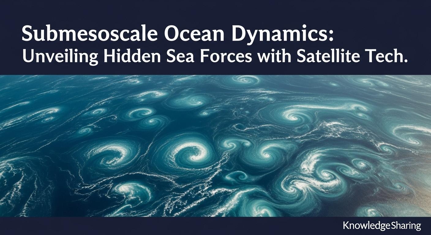
Submesoscale processes are oceanic motions that occur on spatial scales of roughly 0.1 to 10 kilometers (or up to 100 km by some definitions) and time scales of hours to days. These are the "smaller cousins" to the more widely studied mesoscale eddies, which span tens to hundreds of kilometers and persist for weeks to months. While smaller, submesoscale features like fronts (sharp boundaries between different water masses), filaments (long, thin tendrils of water), and small vortices are characterized by intense activity. They are regions of strong vorticity (the spin of fluid parcels) and strain, leading to significant vertical velocities – sometimes as much as 100 meters per day.
These dynamics are not just a curiosity for oceanographers; they play a crucial role in the ocean's overall functioning. Submesoscale processes are vital for:
- Vertical Transport: They act as powerful elevators, transporting heat, salt, oxygen, carbon, and crucially, nutrients between the sunlit surface layers and the deeper ocean. This vertical exchange is fundamental for marine life and the ocean's role in climate regulation.
- Energy Cascade: They form a critical link in the ocean's energy cascade, mediating the transfer of energy from larger mesoscale eddies down to smaller scales where it eventually dissipates as turbulence.
- Biogeochemical Cycles: By influencing nutrient availability in the euphotic zone (the sunlit upper layer where photosynthesis occurs), submesoscale dynamics profoundly impact phytoplankton productivity, the base of the marine food web. They can create localized blooms and structure marine ecosystems.
- Ocean-Atmosphere Interaction: The strong gradients and mixing associated with submesoscale features can influence air-sea fluxes of heat and gases.
The Challenge of Seeing the "Invisible"
For decades, studying submesoscale dynamics was a significant challenge. Traditional ship-based measurements are often too slow and localized to capture these rapidly evolving and spatially complex features. While conventional satellite altimeters, which measure sea surface height, have revolutionized our understanding of larger mesoscale eddies since the 1990s, they lacked the resolution to adequately resolve the finer details of the submesoscale. These smaller features remained largely "hidden" in the gaps between satellite tracks or were blurred by the limited resolution of earlier sensors.
Satellite Technology: Our New Eyes on the Ocean's Subtleties
The game-changer has been the advent of new and improved satellite technologies, offering higher spatial and temporal resolution. These "eyes in the sky" are now providing a more comprehensive and detailed view of submesoscale phenomena across the vastness of the global ocean.
Key satellite technologies include:
- High-Resolution Ocean Color and Sea Surface Temperature (SST) Sensors: Satellites carrying instruments like the Moderate Resolution Imaging Spectroradiometer (MODIS) can detect variations in ocean color (indicating phytoplankton concentrations) and sea surface temperature with resolutions approaching a few hundred meters to a kilometer. These images often reveal intricate patterns of fronts, filaments, and eddies, tracing the submesoscale structures. Landsat imagery, with even finer resolution (e.g., 30 meters), is further enhancing our ability to distinguish these features.
- Synthetic Aperture Radar (SAR): SAR instruments can "see" the ocean surface regardless of cloud cover or daylight. They detect changes in sea surface roughness caused by currents, winds, and the presence of surfactants (natural films on the water). This allows SAR to image submesoscale eddies, fronts, and internal waves with remarkable detail. Studies have used SAR imagery to identify thousands of submesoscale eddies, revealing their distribution and characteristics in various regions.
- Advanced Satellite Altimetry (Wide-Swath Altimetry): This is perhaps the most significant recent leap. The Surface Water and Ocean Topography (SWOT) satellite mission, a collaboration between NASA and the French space agency CNES, launched in December 2022, is a prime example. SWOT employs a Ka-band radar interferometer (KaRIn) that measures sea surface height over a wide swath (120 km), providing unprecedented two-dimensional detail down to scales of 15-20 km globally. This technology is finally allowing direct global observation of submesoscale eddies and internal waves, revealing that they are far more energetic and prevalent than previously thought. Early results from SWOT suggest these small-scale features have a much larger impact on ocean energetics, marine ecosystems, and the climate system than anticipated.
The Synergy of Data and Models: A Holistic Understanding
While satellite observations provide a wealth of surface information, a complete understanding of three-dimensional submesoscale dynamics requires integrating this data with numerical models and in-situ observations. High-resolution numerical models can simulate the development and evolution of submesoscale features, helping to interpret satellite imagery and understand the underlying physics. Data assimilation techniques, which combine observational data (including satellite data) with models, are crucial for producing accurate 4D representations of ocean circulation.
Field campaigns, like the Sub-Mesoscale Ocean Dynamics Experiment (S-MODE), are also vital. These experiments deploy a combination of airborne remote sensors, ship-based instruments, and autonomous underwater vehicles (AUVs) and drifters to gather comprehensive datasets of specific regions. These intensive observational periods provide crucial ground-truthing for satellite data and model simulations, helping to refine our understanding of the three-dimensional structure and impacts of submesoscale processes.
Why Unveiling These Hidden Forces Matters
The growing ability to observe and understand submesoscale dynamics has profound implications:
- Improving Climate Models: Submesoscale processes significantly influence vertical heat and carbon transport, which are critical components of the climate system. Incorporating these dynamics more accurately into climate models is essential for improving projections of future climate change. The SWOT mission, for instance, is expected to significantly improve ocean forecasting models.
- Understanding Marine Ecosystems: The transport of nutrients by submesoscale features directly fuels primary production and shapes the distribution of marine life, from plankton to fish and larger predators. This knowledge is vital for fisheries management and conservation. Submesoscale currents can act as "motors for marine biodiversity" by bringing different species together and mixing resources.
- Predicting and Managing Pollution: Understanding how submesoscale currents transport materials is crucial for predicting the spread of pollutants like oil spills or plastic debris, aiding in mitigation efforts.
- Enhancing Maritime Safety and Operations: More accurate knowledge of surface currents, including the often strong and unpredictable flows associated with submesoscale features, can improve safety and efficiency for shipping and other maritime activities.
- Weather Prediction: The ocean and atmosphere are intricately linked. The influence of submesoscale ocean features on air-sea interaction can affect local and regional weather patterns, including the development and intensification of storms.
The Future is High-Resolution: Emerging Technologies and Next Steps
The field of submesoscale oceanography is vibrant and rapidly evolving. Future advancements are expected from:
- New and Improved Satellite Missions: Missions like SWOT are just the beginning. The proposed SEASTAR mission concept aims to provide even more detailed synoptic measurements of ocean surface currents and winds at the critical 1 km scale. Continued development in sensor technology and an increasing number of satellites will provide even richer datasets.
- Advanced Data Processing and AI: The sheer volume of data generated by modern satellites requires sophisticated data processing techniques. Artificial intelligence (AI) and machine learning are becoming increasingly important tools for analyzing satellite imagery, identifying features, and extracting meaningful information. For example, AI can help analyze the vast datasets from missions like SWOT and assist in designing future missions.
- Integration with Autonomous Platforms: The synergy between satellite remote sensing and autonomous in-situ platforms (like gliders, floats, and AUVs) will continue to be crucial for obtaining a 3D understanding of these dynamic features.
- Finer Resolution Models: As computational power increases, ocean models will be able to resolve even finer scales, leading to more realistic simulations of submesoscale processes and their interactions with the broader ocean-atmosphere system.
A New Dawn for Oceanography
The ability to unveil the ocean's submesoscale dynamics through advanced satellite technology marks a new dawn for oceanography. What were once considered minor, almost invisible, sea forces are now understood to be critical players in the ocean's grand symphony. As we continue to sharpen our technological gaze from space, we unlock ever more secrets of this dynamic realm, paving the way for better climate predictions, more effective marine resource management, and a deeper appreciation for the intricate and powerful forces that shape our blue planet. The journey to understand these hidden sea forces is not just an academic pursuit; it is essential for navigating the challenges of a changing world.
Reference:
- https://os.copernicus.org/articles/17/849/
- https://scripps.ucsd.edu/research/topics/upper-ocean-and-submesoscale-processes
- https://www.mdpi.com/journal/fluids/special_issues/submesoscale_processes_ocean
- https://www.frontiersin.org/journals/marine-science/articles/10.3389/fmars.2019.00384/full
- https://archimer.ifremer.fr/doc/00087/19847/17767.pdf
- https://www.frontiersin.org/journals/marine-science/articles/10.3389/fmars.2019.00457/full
- https://mahadevan.whoi.edu/wp-content/uploads/sites/32/2020/06/Mahadevan_annurev-marine-2016.pdf
- https://mahadevan.whoi.edu/wp-content/uploads/sites/32/2020/06/ThomasTandonMahadevan_AGUchap4_2008.pdf
- https://www.annualreviews.org/content/journals/10.1146/annurev-fluid-031422-095147
- https://www.cnrs.fr/en/press/submesoscale-currents-motors-marine-biodiversity
- https://airsea.ucsd.edu/fieldwork/s-mode/
- https://podaac.jpl.nasa.gov/DataAction-2023-08-29-A-Closer-Look-at-the-Sub-Mesoscale-Ocean-Dynamics-Experiment-S-MODE
- https://archimer.ifremer.fr/doc/00087/19847/17497.pdf
- https://www.aviso.altimetry.fr/fileadmin/documents/OSTST/2011/poster/InversionSubmesoscaleInformationFromSSTandOcean_JVerron.pdf
- https://www.researchgate.net/journal/Geophysical-Research-Letters-1944-8007/publication/390202340_Effect_of_Satellite_Spatial_Resolution_on_Submesoscale_Variance_in_Ocean_Color_and_Temperature/links/67e432bbf966c17052a565b3/Effect-of-Satellite-Spatial-Resolution-on-Submesoscale-Variance-in-Ocean-Color-and-Temperature.pdf?origin=journalDetail
- https://www.mdpi.com/2072-4292/12/4/711
- https://www.researchgate.net/figure/Overview-of-global-submesoscale-structures-and-distributions-a-Satellite-image-of-a_fig1_323343504
- https://www.ifm.uni-hamburg.de/institute/staff/gade/documents-gade/2013-submesoscale-eddies-seen.pdf
- https://www.tandfonline.com/doi/full/10.1080/01431161.2024.2449477?src=
- https://www.mdpi.com/2077-1312/12/5/761
- https://www.researchgate.net/publication/384731771_Global_Submesoscale_Ocean_Dynamics_Unveiled_by_Wide-Swath_Satellite_Altimetry
- https://stories.tamu.edu/news/2025/05/27/small-currents-big-impact-satellite-breakthrough-reveals-hidden-ocean-forces/
- https://www.mercator-ocean.eu/en/news/swot-satellite-launched/
- https://www.mdpi.com/2072-4292/15/16/3939
- https://www.jpl.nasa.gov/news/nasa-french-swot-satellite-offers-big-view-of-small-ocean-features/
- https://www.maritimemagazines.com/marine-technology/202202/s-mode-gathering-ocean-intel-from-above-on-and-under-the-waves/
- https://wenegrat.github.io/publications/FarrarEtAl2020.pdf
- https://journals.ametsoc.org/view/journals/bams/106/4/BAMS-D-23-0178.1.xml
- https://artsci.tamu.edu/news/2025/05/research-by-texas-am-oceanographer-jinbo-wang-featured-on-nature-cover.html
- https://egusphere.copernicus.org/preprints/2025/egusphere-2025-356/egusphere-2025-356.pdf