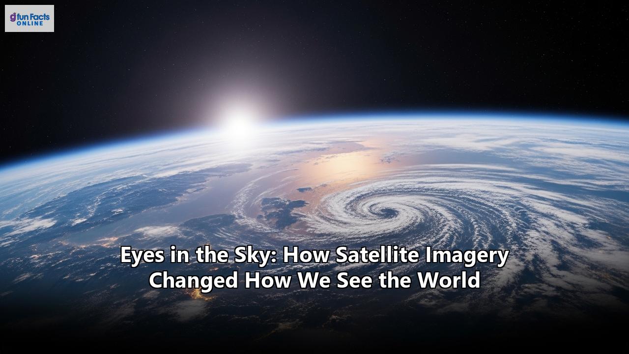
From the first grainy black-and-white snapshots of our planet to the vibrant, high-resolution streams of data available today, satellite imagery has fundamentally transformed our relationship with the world. These "eyes in the sky" have not only altered how we see Earth but have also reshaped our understanding of its intricate systems and our impact upon them. Once the exclusive domain of governments and intelligence agencies, this technology is now a powerful tool in the hands of scientists, businesses, and even ordinary citizens, driving innovation and fostering a new global consciousness.
A New Perspective: From Cold War Curiosities to Global Sentinels
The journey of satellite imagery began in the nascent days of the space race. The first crude image of Earth was transmitted from the US Explorer 6 satellite on August 14, 1959, from an altitude of about 27,000 kilometers. This was followed by NASA's TIROS-1 mission in 1960, which delivered the first true satellite image of our planet, proving that satellites could be invaluable for observing weather patterns. These early images, though revolutionary, were low-resolution and primarily showed the boundaries between land, water, and clouds.
A pivotal moment arrived in 1972 with the launch of the first satellite in the Landsat program. This program, a joint effort between NASA and the U.S. Geological Survey, was the first to meet all the requirements for global land observation and marked a new era of remote sensing from space. For over five decades, the Landsat series has provided a continuous and invaluable record of our planet's surface, allowing us to track changes over time with increasing detail and precision. The "Blue Marble" photograph, also taken in 1972, became an iconic symbol of environmentalism, offering a powerful, holistic view of a fragile Earth suspended in the vastness of space.
The technology continued to evolve with the introduction of Synthetic Aperture Radar (SAR) in 1978, which allowed for imaging regardless of weather or light conditions. The commercialization of satellite imagery in 1984, spurred by the Land Remote Sensing Policy Act of 1992, opened the floodgates for private companies to enter the field, further accelerating innovation and accessibility.
A World of Applications: From Protecting the Planet to Uncovering the Past
The applications of satellite imagery are as vast and varied as the landscapes they capture. This technology has become an indispensable tool across numerous sectors, revolutionizing how we monitor, manage, and interact with our environment.
Environmental Guardianship: Satellites serve as our planet's sentinels, tirelessly tracking its health. They monitor deforestation in the Amazon, the retreat of glaciers, and the health of vital ecosystems like coral reefs and wetlands. By measuring sea levels with millimeter precision and tracking greenhouse gas concentrations, satellite data provides undeniable evidence of climate change and its impacts. This information is crucial for conservation efforts, enabling authorities to identify illegal logging operations, monitor water quality, and manage natural resources more sustainably. Disaster Management and Relief: When natural disasters strike, satellite imagery becomes a critical tool for emergency responders. High-resolution images, often available within hours of an event, allow for rapid damage assessment of infrastructure like roads and buildings. By comparing pre- and post-disaster images, authorities can identify the hardest-hit areas, plan evacuation routes, and allocate resources more effectively. This capability is vital for responding to a range of calamities, including earthquakes, hurricanes, floods, and wildfires. Feeding a Growing Population: In agriculture, satellite data helps farmers optimize crop yields and reduce costs. By monitoring crop health, soil moisture, and even detecting early signs of pests and diseases, this technology supports precision farming, allowing for more efficient use of water and fertilizers. Shaping Our Cities: Urban planners and managers use satellite imagery to monitor the growth of cities, track population density, and identify suitable areas for development. This data is essential for sustainable urban planning, helping to create more resilient and livable cities. Unearthing Ancient Secrets: Archaeology has also been transformed by this technology. Satellite imagery allows researchers to identify potential archaeological sites that are invisible to the naked eye. Subtle variations in soil, vegetation, and terrain can reveal the outlines of buried structures, leading to the discovery of lost cities and a deeper understanding of our ancient past. These non-invasive techniques are crucial for mapping and protecting our cultural heritage from threats like urbanization and looting.The Commercial Revolution and the Future in High-Resolution
The 21st century has witnessed a dramatic shift in the satellite imagery landscape with the rise of commercial players. Companies like Planet Labs and Maxar have launched constellations of smaller, more affordable satellites, democratizing access to high-resolution Earth observation data. This "small satellite revolution" has drastically increased the frequency of image capture, with some services now capable of imaging the entire Earth's landmass daily.
The future of satellite imagery is poised for even greater advancements. The integration of artificial intelligence and machine learning is revolutionizing data analysis, enabling the automated detection of patterns and changes. Next-generation satellites promise even higher resolutions, with some planned to capture details as small as 10-20 centimeters per pixel. Technologies like hyperspectral imaging, which captures data across a wider range of the electromagnetic spectrum, will provide even more detailed information about the materials and conditions on Earth's surface.
The Overview Effect: A Shift in Consciousness
Beyond the practical applications, seeing our planet from space has had a profound psychological impact, a phenomenon known as the "overview effect." Astronauts who have experienced this often describe a cognitive shift, a feeling of awe, and a deep sense of connection to humanity and the Earth as a whole. The images they captured have allowed those of us on the ground to share in a milder version of this experience, fostering a greater appreciation for our planet's beauty and fragility. This perspective has been credited with helping to launch the modern environmental movement and continues to inspire a sense of shared responsibility for our planetary home.
From its origins as a tool of the Cold War to its current role as a vital instrument for global understanding and stewardship, satellite imagery has undeniably changed how we see the world. As this technology continues to evolve, it will undoubtedly unlock new possibilities, further empowering us to address the challenges of our time and build a more sustainable future for all.
Reference:
- https://www.pgc.umn.edu/guides/commercial-imagery/intro-satellite-imagery/
- https://natoassociation.ca/the-rise-of-commercial-satellite-imaging-implications-for-defense/
- https://storymaps.arcgis.com/stories/eb19cef2fd9848f1adfa15f2fe5c732a
- https://www.blacksky.com/satellite-imagery-history/
- https://www.weforum.org/stories/2022/07/landsat-satellites-images-world/
- https://www.maps.com/landsat-map-unlocks-40-years-of-earth-imagery/
- https://en.wikipedia.org/wiki/Satellite_imagery
- https://longnow.org/ideas/whole-earth-overview-effect/
- https://www.innovationnewsnetwork.com/how-earth-observation-technology-is-transforming-disaster-relief/57133/
- https://edgybees.com/unveiling-the-power-of-georegistration-in-commercial-satellite-imagery-a-game-changer-for-businesses/
- https://www.arlula.com/why-is-satellite-imagery-useful/
- https://www.numberanalytics.com/blog/satellite-imagery-environmental-remote-sensing
- https://earthsky.org/earth/satellite-images-show-earth-changing/
- https://telecomworld101.com/satellites-environmental-monitoring/
- https://space-solutions.airbus.com/resources/case-studies/forestry-environment/satellite-imagery-for-sustainable-solutions/
- https://xrtechgroup.com/satellite-imagery-for-disaster-management/
- https://satpalda.com/applications-of-satellite-imagery-in-disaster-management/
- https://geospatialworld.net/prime/business-and-industry-trends/use-cases-satellite-imagery-across-sectors/
- https://satpalda.co/applications-of-satellite-imagery/
- https://satpalda.com/unveiling-hidden-archaeological-sites-with-satellite-imaging-a-modern-treasure-hunt/
- https://en.wikipedia.org/wiki/Remote_sensing_in_archaeology
- https://researchoutreach.org/articles/archaeology-space-using-earth-observation-data-unearth-past/
- https://apogeospatial.com/the-small-satellite-revolution/
- https://www.numberanalytics.com/blog/future-satellite-imagery-weather-forecasting
- https://opiniojuris.org/2025/01/14/from-space-to-the-courtroom-ai-enhanced-satellite-imagery-and-the-future-of-accountability/
- https://geoawesome.com/eo-hub/a-revolution-is-coming-in-satellite-imagery-why-30cm-satellites-are-set-to-transform-the-industry/
- https://en.wikipedia.org/wiki/Overview_effect
- https://www.itsnicethat.com/articles/overview-photography-140120