In the rarefied air of the Malguzar Mountains, a spur of the Pamir-Alay range in southeastern Uzbekistan, the wind cuts through the valleys with a sharpness that feels ancient. For centuries, local shepherds have walked these high-altitude pastures, their flocks grazing on the sparse grass that covers the rolling, lumpy terrain. To the untrained eye, these mounds were just part of the natural topography—wrinkles in the earth created by time and geology. But for Michael Frachetti, an archaeologist from Washington University in St. Louis, and Farhod Maksudov, director of Uzbekistan’s National Center of Archaeology, these mounds whispered of something else. They whispered of a ghost.
For decades, history books have told a specific story about the Silk Road. It was a network of trade routes that strung together the glittering oases of the lowlands—Samarkand, Bukhara, Tashkent. The mountains were seen as barriers, dangerous obstacles to be crossed as quickly as possible or avoided entirely. The people of the mountains were viewed as simple nomads, peripheral figures in the grand theater of empires and commerce.
But in 2024, a drone flying 2,000 meters above sea level changed everything.
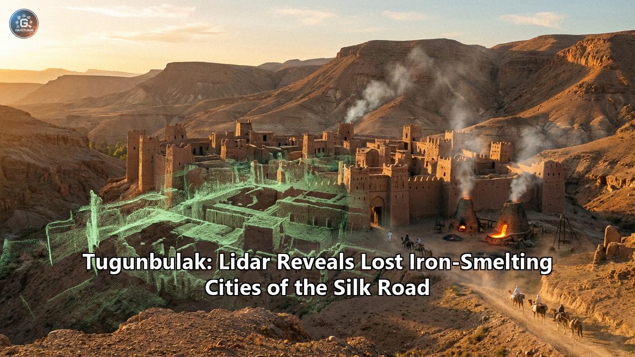
Armed with Lidar (Light Detection and Ranging) technology, Frachetti and Maksudov peered through the veil of grass and soil to reveal a shocking truth. Beneath the shepherd’s feet lay the ghostly footprint of a massive medieval metropolis—a city of stone and steel, of fortresses and furnaces, that rivals the size of the legendary Samarkand. This was Tugunbulak, a lost industrial powerhouse that churned out iron and steel for the armies and merchants of the Silk Road, hiding in the clouds for a millennium.
This discovery is not just a new dot on a map; it is a rewriting of history. It suggests that the highlands of Central Asia were not a desolate periphery, but the beating industrial heart of a forgotten empire. This is the story of how that city was found, who built it, and why it vanished.
Part I: The Legend of Marsmanda
To understand the magnitude of the discovery at Tugunbulak, we must first look to the dusty scrolls of history. For centuries, scholars have puzzled over references in 10th-century Arab geographies to a city called Marsmanda.
The chroniclers described Marsmanda not as a simple village, but as a bustling metropolis. It was a place of immense strategic importance, famous for its iron production. The texts spoke of a city located "where the rivers froze," a cryptic description that baffled historians who looked for it in the temperate lowlands. It was said to host a massive monthly market, a fair so large that merchants would travel from "faraway places" to buy its prized steel weapons and tools.
Yet, despite these vivid descriptions, Marsmanda had vanished. No ruins in the valleys matched its description. It became a kind of Atlantis of the Steppe, a place that existed in ink but not in earth.
When Frachetti and Maksudov began their work in the Malguzar Mountains, they weren't looking for Marsmanda. They were investigating the history of nomadic pastoralists, trying to understand how mobile peoples interacted with the sedentary empires of the lowlands. In 2011, they stumbled upon a smaller site called Tashbulak, a high-altitude settlement that dated back to the Qarakhanid era (8th–11th centuries AD). It was a significant find—a town at 2,100 meters (6,800 feet) with a large cemetery and evidence of trade.
But it was only a prelude.
While working at Tashbulak, a local forestry inspector approached the team with a tip. He spoke of another site, just a few miles away, where the ground was littered with pottery shards. Intrigued, the archaeologists hiked over the ridge to a bowl-shaped plateau known locally as Tugunbulak.
What they saw on the surface was promising but confusing. There were mounds, certainly, and the ground was crunchy with ceramics. But the scale was impossible to grasp from the ground. The site was covered in centuries of erosion and sediment; the walls had melted into berms, the streets into gullies.
It was the "invisible city" problem. When a city is built of mud-brick and rammed earth, and then abandoned to the harsh freeze-thaw cycles of the high mountains, it dissolves. It doesn't leave the romantic marble columns of Rome or the stone temples of Machu Picchu. It leaves bumps.
To see the city, they needed to strip away the skin of the earth. They needed Lidar.
Part II: The Eye in the Sky
Lidar technology has been the golden key of modern archaeology. Famous for revealing the sprawling Maya megalopolises beneath the Guatemalan jungle, it works on a principle of echolocation with light. A drone flies over a landscape, firing hundreds of thousands of laser pulses per second at the ground. These pulses bounce off everything—leaves, grass, rocks, and earth—and return to a sensor.
By calculating the time it takes for the light to return, the system creates a 3D point cloud of the surface. Crucially, digital filters can then "mow the lawn," removing the data points created by vegetation to reveal the naked terrain underneath.
In 2022, after navigating the complex bureaucracy of flying drones in a sensitive border region, the team launched their Lidar-equipped drone over Tugunbulak.
The results, published in Nature in late 2024, were breathtaking.
As the data was processed, the shapeless mounds on the computer screen sharpened into a high-resolution map of a medieval urban planner's dream. The "bumps" became watchtowers. The "gullies" became organized streets. The "ridges" became massive fortification walls, some three meters thick, enclosing a central citadel that would have been impregnable in its day.
The scan revealed a city that spanned 120 hectares (approx. 300 acres). To put that in perspective, this high-altitude "outpost" was roughly the same size as the main urban core of Samarkand during the same period. It was larger than many of the famous cities of medieval Europe.
The map showed:
- Five massive watchtowers connected by defensive walls running along the ridgelines.
- A central fortress (citadel) protected by steep slopes and stone walls.
- Terraced residential quarters designed to maximize the limited flat space of the mountain plateau.
- Plazas and public spaces where the famed markets likely took place.
- Industrial zones dedicated to the smelting of iron.
This was no seasonal camp for shepherds. This was a permanent, fortified, industrial city sitting at an altitude where oxygen is thin and winter is brutal. It was a "unicorn" in archaeology—a site that shouldn't exist according to the traditional models of civilization.
III. The City of Steel: An Industrial Revolution in the Clouds
Why build a metropolis at 2,000 meters? The winters are harsh, the growing season is short, and the terrain is rugged. The answer lies in the geology beneath the city and the forests that once surrounded it.
Tugunbulak was not a city of farmers; it was a city of smiths.
The Lidar scans, combined with preliminary excavations, revealed that Tugunbulak was a massive factory for iron and steel. The archaeologists found huge mounds of slag—the stony waste product left over after metal is separated from ore. They found the remains of furnaces and kilns that would have burned day and night, lighting up the mountain sky with an eerie orange glow.
The Physics of Mountain Smelting
To produce iron in the medieval world, you needed three things:
- Ore: The Malguzar Mountains are rich in iron ore deposits.
- Fuel: Smelting requires immense amounts of charcoal to reach the temperatures necessary to separate iron (over 1,200°C).
- Wind: To get a fire that hot, you need a constant, powerful draft.
Tugunbulak had all three. The location, which seems inhospitable to us, was perfect for industry. The strong mountain winds acted as a natural bellows, driving the furnaces to temperatures that lowland smiths would struggle to achieve without complex machinery. The surrounding juniper forests (which are now largely gone, a point we will return to) provided the endless supply of charcoal needed to feed the fires.
The archaeologists believe the smiths of Tugunbulak were producing crucible steel, a high-quality alloy that was legendary in the medieval world. This wasn't just soft wrought iron; this was the material of the famous "Damascus" swords—hard, sharp, and flexible.
In the 8th, 9th, and 10th centuries, steel was the nuclear technology of the day. It made the best swords, the strongest armor, and the most durable tools. A city that could mass-produce steel was a city of immense wealth and power.
This explains the mystery of "Marsmanda." The Arab texts mentioned a city "where the rivers froze" (high altitude) that sold iron to the world. Tugunbulak fits the profile perfectly. It was an industrial powerhouse that turned the "disadvantage" of the mountains—the wind and the cold—into an economic engine.
IV. Nomads in the Sky: Rethinking the Silk Road
The discovery of Tugunbulak forces a radical rethinking of the political landscape of Central Asia.
We often think of the Silk Road as a trade route between "civilizations"—China on one side, Rome/Persia/Europe on the other—with the "barbarian" nomads in the middle acting as middlemen or raiders. Tugunbulak smashes this stereotype.
The people who built this city were likely Turkic semi-nomads. During the 6th to 10th centuries, this region was dominated by a succession of powerful Turkic khaganates (the Göktürks, the Türgesh, and later the Qarakhanids). These were not unwashed barbarians living only in tents. They were sophisticated political entities capable of complex urban planning.
Tugunbulak represents a unique form of "Nomadic Urbanism."
- The Mobile City: While the buildings were permanent, the population likely fluctuated. The city might have been a bustling hive of tens of thousands in the summer—when the high passes were open and the trade caravans arrived—and a smaller garrison town in the winter.
- The Symbiosis: The city didn't grow its own food. It relied on a symbiotic relationship with the surrounding pastoralists who provided meat, wool, and dairy, and trade with the lowlands for grain.
- The Power Center: This wasn't a city that served the lowlands; it was a rival to them. The Qarakhanids and their predecessors understood that controlling the source of iron meant controlling the balance of power. By building their capital in the mountains, they were protected from the cavalry armies of the plains while sitting on top of the most strategic resource of the age.
The artifacts found at the nearby site of Tashbulak reinforce this picture of cosmopolitanism. Archaeologists found:
- Chinese mirrors: Evidence of direct trade with the Tang Dynasty.
- Sogdian pottery: Links to the great merchants of Samarkand.
- Cowrie shells: From the Indian Ocean, thousands of miles away.
- Glass beads: Likely from the Mediterranean or Middle East.
These mountain people were drinking tea from China, wearing jewelry from India, and fighting with steel made in their own backyard.
V. Tashbulak: The Spiritual Sister
While Tugunbulak was the industrial giant, its smaller neighbor, Tashbulak, offers a glimpse into the spiritual and cultural life of these highlanders.
Located just 5 kilometers away, Tashbulak is about one-tenth the size of Tugunbulak. But it holds a secret that Tugunbulak lacks: a massive cemetery.
The cemetery at Tashbulak contains over 400 graves. What is remarkable is that these are among the earliest Islamic burials ever found in high-altitude Central Asia.
This tells us a fascinating story about the spread of religion. Islam arrived in Central Asia in the 8th century, brought by the armies of the Umayyad and Abbasid Caliphates. We usually assume it spread slowly from the cities to the countryside. But the graves at Tashbulak suggest that the mountain nomads converted relatively early.
The graves are oriented towards Mecca. The burial rites are distinctively Muslim. Yet, the people buried there were clearly locals. This suggests that Tashbulak might have been a spiritual center or a pilgrimage site—a place where the chaotic, industrial energy of Marsmanda/Tugunbulak was balanced by the quiet of the grave and the mosque.
It paints a picture of a society in transition: a Turkic warrior caste, traditionally worshippers of the sky god Tengri, adopting the new monotheism of Islam and weaving it into their mountain existence.
VI. The Collapse: An Environmental Warning
For 500 years, Tugunbulak roared with the sound of hammers and the heat of furnaces. And then, around 1000-1050 AD, the fires went out. The city was abandoned.
Why?
There were no signs of a massive invasion or a singular catastrophic war that leveled the city. Instead, Frachetti and Maksudov propose a theory that resonates chillingly with our modern world: Ecological Suicide.
The iron industry is hungry. To smelt steel, you need charcoal. To make charcoal, you need trees.
When the city was founded in the 6th century, the Malguzar Mountains were likely covered in dense forests of juniper. These slow-growing, resinous trees were perfect fuel. But a city of tens of thousands, running industrial furnaces day and night for centuries, would have consumed forests at a voracious rate.
As the trees disappeared, two things happened:
- Fuel Scarcity: The smiths had to go further and further to find wood, making the iron production more expensive and difficult.
- Disaster: Trees hold the mountain soil together. When the forests were stripped bare, the steep slopes became unstable. The region is prone to flash floods and avalanches. Without the root systems of the juniper forests to act as a sponge and a net, the spring melts would have turned into torrents of mud and debris.
The Lidar scans show evidence of massive sediment shifts that could be consistent with landslides or mudflows burying parts of the city. It is very likely that the inhabitants of Tugunbulak simply consumed their own ecosystem until it could no longer support them. They mined the ore, but they mined the environment to death.
By the 11th century, the "City of Steel" had become a trap. The people packed up their yurts, abandoned their stone fortresses, and descended back into the lowlands or dispersed into smaller nomadic groups, leaving their great metropolis to be reclaimed by the grass.
VII. Why This Matters Today
The discovery of Tugunbulak is more than just an archaeological curiosity. It challenges the "Lowland Bias" of history. We have always assumed that civilization happens in the valleys, where it is warm and easy to farm, and that the mountains are wild places.
Tugunbulak proves that human ingenuity can thrive in the most hostile environments. It shows that the "Silk Road" was not just a line on a map for moving luxury goods, but a three-dimensional network of production and power that reached into the clouds.
It also serves as a somber time capsule. The ghostly mounds of Tugunbulak are a monument to a society that rose to greatness on the back of resource extraction, only to collapse when they pushed their environment too far.
Today, as you stand on the windswept plateau of the Malguzar Mountains, there is nothing but silence and the bleating of sheep. The fires are long out. The steel is rusted to dust. But thanks to the laser vision of Lidar, the ghost of Marsmanda has risen again, reminding us that even the greatest cities can disappear if they forget the land that sustains them.
Key Facts at a Glance
| Feature | Detail |
| :--- | :--- |
| Name | Tugunbulak (likely the historical Marsmanda) |
| Location | Malguzar Mountains, Uzbekistan |
| Elevation | ~2,000–2,200 meters (6,500–7,200 ft) |
| Time Period | 6th – 11th Centuries AD (approx. 550–1050 AD) |
| Size | ~120 Hectares (300 acres) |
| Population | Estimated tens of thousands (seasonal/permanent mix) |
| Primary Industry | Iron and Steel Smelting |
| Discovery Tech | Drone-mounted Lidar (Light Detection and Ranging) |
| Researchers | Michael Frachetti (USA) & Farhod Maksudov (Uzbekistan) |
Reference:
- https://allthatsinteresting.com/uzbekistan-marsmanda-lost-silk-road-city
- https://arkeonews.net/surprisingly-high-altitude-silk-road-cities-discovered-in-uzbek-mountains/
- https://www.smithsonianmag.com/history/archaeologists-may-have-found-the-lost-city-of-the-silk-road-180987637/
- https://caspianpost.com/uzbekistan/smithsonian-highlights-major-archaeological-discovery-in-uzbekistan-s-highlands
- https://www.deccanherald.com/world/scientists-document-lost-mountain-cities-on-silk-road-in-uzbekistan-3248791
- https://en.wikipedia.org/wiki/Iron_Age
- https://timesca.com/two-lost-silk-road-cities-unearthed-in-uzbekistan/
- https://en.wikipedia.org/wiki/Ferrous_metallurgy
- https://www.youtube.com/watch?v=LN09705D204
- https://archaeology.org/issues/march-april-2025/digs-discoveries/silk-road-mountain-towns/
- https://www.researchgate.net/publication/283808652_The_Investigation_of_Archaeometallurgical_Slag