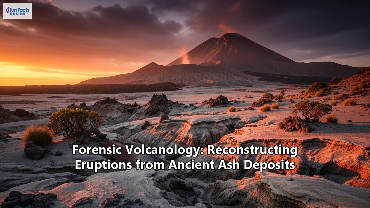
Unearthing Eruptions: The Science of Forensic Volcanology
Locked within layers of earth, like silent witnesses, lie the remnants of colossal explosions that reshaped landscapes and altered the course of history. These are the ancient ash deposits, the geological fingerprints of volcanic eruptions long past. For most, they are merely layers of dust and rock, but for a unique brand of scientific detective, the forensic volcanologist, they are crime scenes frozen in time. Forensic volcanology is the captivating field dedicated to reconstructing these ancient eruptions, piecing together the story of a volcano's fury from the subtle clues left behind in its ash. By meticulously examining these ancient deposits, scientists can unravel the magnitude, intensity, and style of eruptions that occurred thousands of years ago, providing crucial insights into the behavior of these powerful natural giants and helping us prepare for the threats they pose today.
The core of this investigative work lies in the study of tephra—the catch-all term for the fragmented material ejected during an explosive volcanic eruption, from fine dust to large blocks. Each eruption produces a tephra layer with a distinct chemical and mineralogical "fingerprint," a unique signature that can be traced across vast distances. This principle forms the foundation of tephrochronology, a key dating technique that uses these widespread, instantaneously deposited ash layers as time-markers to link and synchronize geological, environmental, and archaeological records from different locations. Just as a detective matches a suspect's fingerprint to a crime scene, a forensic volcanologist matches the chemical signature of a tephra layer found in a lakebed or an archaeological dig to a specific volcanic eruption, thereby dating the surrounding sediments and any artifacts or fossils they contain.
This journey into the past is not merely an academic exercise. Understanding the history of a volcano is one of the most critical tools for assessing its future threat. Many of the most dangerous volcanoes are those with long periods of dormancy, their past fury forgotten over centuries. By reconstructing their eruptive histories, scientists can create detailed hazard maps, identifying which areas are most at risk from pyroclastic flows, lahars (volcanic mudflows), and ashfall in a future eruption. Furthermore, the data gleaned from these ancient ashes—particularly the volume of gases like sulfur dioxide released—are vital inputs for climate models. By understanding how massive prehistoric eruptions affected global temperatures and weather patterns, scientists can better predict the potential climatic consequences of future large-scale volcanic events. It is a science that bridges deep time with the pressing concerns of our modern world, turning ancient dust into a roadmap for future resilience.
The Suspects: A History of Scientific Inquiry
The concept of reading stories in layers of rock is fundamental to geology, but the specific focus on volcanic ash as a chronological tool began to take shape in the early 20th century. The term "tephrochronology" itself was coined by the Icelandic scientist Sigurdur Thorarinsson in the 1940s. Thorarinsson, working in a landscape literally built and repeatedly buried by volcanoes, was a pioneer in using tephra layers to create a timeline for both geological and archaeological events in his native Iceland. His work laid the conceptual groundwork for the field.
The discipline gained international momentum in the 1960s, largely through the efforts of Japanese researcher Kunio Kobayashi, who championed the formation of an international commission dedicated to tephra studies in 1961. This global collaboration was essential, as tracking ash layers across continents required a standardized approach. In the following decades, researchers like Christer Persson in Scandinavia began identifying tephra deposits that were not visible to the naked eye, so-called "cryptotephra," expanding the reach of the technique.
A major leap forward came in the late 1990s with the development of techniques by scientists like Chris S. M. Turney and Andrew Dugmore to systematically extract and analyze these hidden microtephra shards. This revolutionized the field, allowing for the correlation of records with unprecedented precision. These pioneers and their successors transformed tephrochronology from a regional curiosity into a powerful global dating tool, essential for understanding everything from past climate change to human migration.
The Crime Scene: Anatomy of an Ash Deposit
When a volcano erupts explosively, it doesn't just spew a uniform cloud of dust. It unleashes a complex mixture of materials whose characteristics provide a detailed account of the eruption's mechanics. The resulting ash deposit is the primary "crime scene" for a forensic volcanologist, and every feature, from its thickness to the shape of its individual grains, is a clue.
The Layers Tell a Story
The first step in any investigation is to examine the stratigraphy—the sequence of layers. An eruption is rarely a single, continuous event; it often consists of multiple phases with changing intensity. This is reflected in the deposit. For example, the iconic A.D. 79 eruption of Vesuvius began with a sustained "Plinian" phase, which deposited a thick layer of light-colored pumice fall, followed by a switch to gray pumice, indicating a change in the magma being tapped. Later, the eruption style shifted dramatically, producing fast-moving, ground-hugging pyroclastic flows that left behind entirely different types of deposits. By carefully logging these distinct units, geologists can reconstruct the hour-by-hour timeline of an eruption that happened nearly two millennia ago.
The thickness of these layers is also a crucial piece of evidence. A tephra layer that is tens of meters thick near the volcano can thin to just millimeters a hundred kilometers away. By mapping these thickness variations and creating "isopach maps" (lines of equal thickness), scientists can estimate the total volume of erupted material, a key measure of the eruption's magnitude (Volcanic Explosivity Index, or VEI). They can also infer the direction of the prevailing winds at the time of the eruption.
The Evidence Under the Microscope
The real detective work begins when the ash is brought back to the lab. Under a microscope, a seemingly uniform powder reveals a diverse collection of particles, each telling a part of the story. Volcanic ash is typically composed of three main components:
- Vitric particles (Volcanic Glass): These are fragments of the magma itself, quenched into glass as it was violently ejected and cooled. They are the most informative component for forensic analysis.
- Crystalline particles (Minerals): These are crystals that had already formed within the magma before the eruption. Their types and abundance provide clues about the magma's composition and temperature.
- Lithic particles: These are bits of older, solid rock torn from the volcano's conduit or crater during the explosive ascent of magma. An increase in lithic fragments can signal that the vent is widening or that the eruption is becoming more violent.
The morphology, or shape, of the glass shards is a direct window into the fragmentation process. Magma with high gas content and high viscosity, like that of many explosive eruptions, tends to shatter into angular, bubble-rich (vesicular) fragments. The shapes of these shards are often dictated by the walls of the gas bubbles that were rapidly expanding just before the magma disintegrated.
In contrast, low-viscosity magmas, like basalt, can produce smoother, more droplet-like particles shaped by surface tension as they are thrown through the air. A particularly telling clue is the presence of blocky or pyramidal-shaped particles, which often indicates a "phreatomagmatic" eruption—one where the magma has interacted violently with external water, such as groundwater, a crater lake, or a glacier. The rapid flashing of water to steam creates a unique style of fragmentation, leaving a distinct morphological signature in the ash.
By meticulously counting and categorizing the shapes of thousands of particles, often with the help of modern image analysis software and even artificial intelligence, scientists can deduce the eruption style—whether it was a "dry" magmatic explosion or a "wet" phreatomagmatic one, or a complex sequence of both.
The Forensic Toolkit: Unlocking Chemical Secrets
To definitively identify an ash layer and reconstruct the eruption that created it, volcanologists employ a sophisticated array of analytical techniques, turning their samples into a wealth of geochemical data.
Chemical Fingerprinting
The most powerful tool for correlating tephra layers is "fingerprinting" their chemical composition. Each batch of magma has a unique mix of major and trace elements, which serves as an indelible signature. Even if two eruptions from the same volcano occur thousands ofyears apart, subtle shifts in their magma chemistry can be enough to distinguish them.
The workhorse for this analysis is the Electron Probe Microanalyzer (EPMA). This instrument fires a focused beam of electrons at a tiny spot on a glass shard and measures the resulting X-rays. Each element emits X-rays at a characteristic energy, allowing for a precise measurement of major elements like silicon, aluminum, iron, and potassium. This provides a robust chemical fingerprint that can be compared to a library of known eruption deposits.
For even greater detail, scientists turn to Laser Ablation Inductively Coupled Plasma Mass Spectrometry (LA-ICP-MS). This technique uses a powerful laser to vaporize a microscopic portion of a glass shard. The vapor is then passed through an incredibly hot plasma, which ionizes the atoms, and a mass spectrometer separates and counts the ions based on their mass. This allows for the measurement of a wide range of trace elements at concentrations of parts per million or even lower, adding another layer of specificity to the chemical fingerprint.
Unlocking Trapped Gases: Melt Inclusions
One of the most exciting areas of forensic volcanology involves analyzing melt inclusions. These are microscopic bubbles of magma that were trapped inside growing crystals deep within the magma chamber, long before the eruption began. These inclusions are like tiny time capsules, perfectly preserving a sample of the pre-eruptive magma, including the dissolved gases, or "volatiles," that are otherwise lost to the atmosphere during the eruption.
Volatiles like water (H₂O), carbon dioxide (CO₂), and sulfur dioxide (SO₂) are the primary driving force behind explosive eruptions. The amount of these dissolved gases dictates the eruption's power. By carefully heating the host crystal in a lab and analyzing the gases released from the melt inclusion, or by using techniques like Secondary Ion Mass Spectrometry (SIMS), scientists can directly measure the pre-eruptive volatile content. This information is crucial for understanding how and why the magma erupted so explosively and for accurately modeling the climate impact of the released sulfur gases.
Case File #1: The People's Plaster Casts of Pompeii (Vesuvius, A.D. 79)
Perhaps no eruption is more famous than that of Mount Vesuvius in A.D. 79. The eyewitness account of Pliny the Younger and the haunting archeological remains of Pompeii and Herculaneum provide a vivid snapshot of the disaster. However, it is through forensic volcanology that we can reconstruct the minute-by-minute timeline of the eruption and understand the precise mechanisms of its destructive power.
The investigation begins with the deposits. The initial phase of the eruption, which started around midday, was a classic Plinian eruption, named in honor of Pliny. It sent a towering column of gas and ash an estimated 33 kilometers into the stratosphere. For about 18-20 hours, this column rained pumice and ash downwind, primarily to the southeast of the volcano.
Scientists have meticulously studied these fallout deposits, identifying distinct layers that show a change in the eruption. The first layers are composed of white pumice, followed by a switch to gray pumice. This shift represents a change in the magma being erupted; the volcano was tapping deeper, less-evolved magma from its chamber as the eruption progressed. The sheer weight of this accumulating pumice—reaching nearly 3 meters in Pompeii—caused roofs to collapse. This long, drawn-out pumice fall, while destructive to property, was survivable, and it afforded many residents a window of opportunity to escape.
But the most lethal phase was yet to come. On the second day, the dynamics of the eruption changed catastrophically. The eruption column, no longer able to sustain its own immense height, collapsed. This generated a series of pyroclastic flows and surges—ground-hugging, turbulent avalanches of superheated gas and ash that raced down the volcano's flanks at incredible speeds.
The deposits from these flows are starkly different from the pumice fall. They are poorly sorted, containing a chaotic mix of fine ash, pumice, and dense rock fragments. Forensic analysis of these deposits, including the orientation of fragments and the presence of dune-like structures, tells of a violent, high-energy emplacement. It was these surges that were the primary killers. The fine ash they carried was inhaled by those who remained, and the intense heat—estimated to be between 250-330°C even on the outskirts of Pompeii—caused instantaneous death. The famous plaster casts of the victims, capturing their final moments, are direct evidence of this phase; the fine ash from the surges encased the bodies, creating molds that archeologists later filled with plaster. By mapping the extent and characteristics of at least six distinct surge deposits, volcanologists have reconstructed the terrifying final hours of Pompeii, providing a harrowing forensic account of how the city and its remaining inhabitants were ultimately lost.
Case File #2: The Lost World of Atlantis? (Thera, c. 1600 B.C.)
Around 3,600 years ago, one of the largest volcanic eruptions in human history occurred in the Aegean Sea. The eruption of Thera, on the island now known as Santorini, was a cataclysmic event that obliterated a flourishing Bronze Age Minoan settlement at Akrotiri and has been speculatively linked to the legend of Atlantis. Forensic analysis of its widespread ash deposits has been crucial in understanding the eruption's scale and its devastating impact on the ancient world.
The eruption was enormous, estimated to be a VEI 7, a hundred times larger than the A.D. 79 Vesuvius event. It ejected an immense volume of ash and pumice—up to 86 cubic kilometers—that buried the island and was dispersed across the entire Eastern Mediterranean. This tephra layer is the key forensic evidence. It has been found in seafloor sediments, in lakebeds, and at archaeological sites in Crete, Turkey, and even the Nile Delta.
Finding and identifying this ash layer is the first step. For decades, a major debate raged between archaeologists and scientists over the eruption's precise date. Archaeological evidence, based on pottery styles and connections with Egyptian chronologies, suggested a date in the 16th century B.C. However, radiocarbon dating of organic material found just beneath the ash layer, like an olive branch buried by the eruption, consistently pointed to an older date, in the late 17th century B.C. Recent, highly detailed analysis using tree rings has helped reconcile these dates, confirming that the radiocarbon evidence is compatible with an eruption in the 16th century B.C., a testament to the power of combining multiple forensic techniques.
The ash itself tells the story of the eruption's impact. Analysis of ash shard morphology reveals that the eruption had significant phreatomagmatic phases, as seawater poured into the collapsing caldera and interacted explosively with the magma. This would have generated powerful, laterally-moving clouds of steam and ash and contributed to the subsequent tsunamis. At the archaeological site of Çeşme-Bağlararası on the Turkish coast, scientists discovered a chaotic layer of tsunami debris mixed with Theran ash. Tragically, within this layer, they found the first identified human victim of the eruption, whose skeleton was found amongst the rubble of the tsunami-destroyed walls.
The fallout had far-reaching consequences. Ash layers up to 15 cm thick on parts of Crete would have smothered crops and pastures, leading to agricultural collapse. The vast amount of sulfur dioxide injected into the stratosphere would have caused significant short-term climate cooling, further stressing ancient societies. While the eruption didn't directly cause the final collapse of the Minoan civilization on Crete, which occurred later, the economic disruption and agricultural devastation it wrought almost certainly contributed to their decline. By tracking the "fingerprint" of this single ash layer across thousands of square kilometers, forensic volcanologists have pieced together the story of a regional catastrophe and its profound impact on the course of human history.
Case File #3: The Sideways Blast (Mount St. Helens, 1980)
The May 18, 1980, eruption of Mount St. Helens in Washington state is one of the most significant geological events in modern U.S. history. Unlike the vertical columns of Vesuvius or Thera, this eruption began with a massive landslide and a devastating lateral blast. The event was meticulously monitored, but it was the forensic analysis of its tephra deposits that provided the deepest understanding of the eruption's unique and complex mechanics.
For two months leading up to the main event, magma intruded at a shallow depth beneath the volcano's north flank, creating a conspicuous and growing bulge. At 8:32 a.m. on May 18, a magnitude 5.1 earthquake triggered the entire unstable north face to collapse in the largest landslide ever recorded.
This catastrophic failure acted like popping the cork on a champagne bottle. It instantly depressurized the superheated, gas-rich magma that had been sitting just beneath the bulge. The result was a northward-directed blast that sent a hurricane-force wave of hot gas, ash, and rock fragments screaming across the landscape at hundreds of kilometers per hour, leveling 550 square kilometers of dense forest.
The deposits from this lateral blast are distinct. Forensic examination reveals a chaotic, poorly sorted layer of material, thickest near the volcano and thinning with distance. The grain size of the material also systematically decreases away from the vent, providing clues about how the blast lost energy as it traveled.
Crucially, following the blast, the eruption transitioned into a more conventional, vertical Plinian phase that lasted for nine hours. This phase ejected a towering column of ash that was carried eastward by the wind, depositing a blanket of tephra across several states. Scientists faced the challenge of distinguishing the deposits from the initial blast from the subsequent airfall tephra. They did so by carefully examining the stratigraphy: the blast deposit is always at the bottom, directly overlying the pre-1980 soil, and is in turn overlain by the finer, better-sorted ash from the Plinian column. Chemical analysis of the glass in both deposits also helped to track the evolution of the magma being erupted throughout the day.
The forensic study of the Mount St. Helens deposits had profound implications for volcanic hazard assessment. It was a stark reminder that volcanoes do not always erupt straight up. The concept of a high-velocity, laterally-directed blast became a critical scenario to consider in hazard maps for other similar "stratovolcanoes" around the world, which often have steep, unstable flanks susceptible to collapse. The detailed reconstruction of this event, made possible by analyzing its tephra, fundamentally changed our understanding of volcanic hazards.
Challenges of a Cold Case: When the Evidence Fades
Reconstructing an eruption from deposits that are thousands or even millions of years old is fraught with challenges. The "crime scene" is almost never pristine. Just as evidence degrades over time in a criminal investigation, geological evidence is subject to the relentless processes of nature.
One of the biggest hurdles is diagenesis, the collective term for the physical and chemical changes that sediments undergo after deposition. Volcanic glass, the primary source of forensic information, is inherently unstable. Over time, it can alter into clay minerals, a process that can change its chemical composition and erase the original magmatic signature. Scientists must be meticulous in selecting the freshest, least-altered glass shards for analysis and use sophisticated techniques to see through the chemical "noise" of alteration.
Erosion and reworking also obscure the record. The initial blanket of ash deposited by an eruption is rarely preserved perfectly. Wind and water can quickly begin to erode the tephra, especially from steep hillslopes, and redeposit it elsewhere. This makes it incredibly difficult to accurately calculate the original volume of the eruption. Scientists have to painstakingly account for this erosion, often by studying deposits in protected environments like lake bottoms or peat bogs where the record is more complete. Furthermore, it is essential to distinguish between a primary ash layer (deposited directly from the eruption cloud) and a secondary layer (reworked and redeposited later), as only the primary layer provides an accurate time-marker for the eruption itself.Another significant challenge is distinguishing between different eruption layers. In volcanically active regions, the geological record can be a thick sequence of numerous tephra layers from different eruptions and even different volcanoes. If two eruptions are close in age and have similar chemical compositions, telling their deposits apart can be extremely difficult. This requires high-precision chemical fingerprinting, often involving a wide suite of trace elements, to find the subtle differences that can definitively link a layer to its source.
Modern Applications: From Hazard Maps to Global Climate
The forensic investigation of ancient eruptions is far more than an academic pursuit; it has profound practical applications that help safeguard lives and understand our planet's complex systems.
Improving Hazard Assessments and Risk Mitigation
One of the most direct benefits is the improvement of volcanic hazard maps. By reconstructing the frequency, magnitude, and style of a volcano's past eruptions, scientists can build a probabilistic forecast of its future behavior. Forensic analysis reveals the "personality" of a volcano. Has it historically produced massive Plinian columns and widespread ashfall? Or is it prone to dome collapse and deadly pyroclastic flows?
This detailed knowledge allows authorities to create zoning maps that delineate high-risk areas. For example, the reconstruction of the lateral blast at Mount St. Helens led to a re-evaluation of the hazards around similar volcanoes worldwide. The knowledge of where pyroclastic flows traveled in the past is the best guide for predicting where they might go in the future. This information is vital for land-use planning, developing evacuation routes, and ultimately, saving lives when a volcano reawakens.
Informing Climate Models
Volcanoes are powerful agents of climate change. Large explosive eruptions can inject massive quantities of sulfur dioxide (SO₂) into the stratosphere, where it forms sulfate aerosols that reflect sunlight and can cause significant, albeit temporary, global cooling. The 1815 eruption of Tambora in Indonesia, for example, led to the "Year Without a Summer" in 1816.
To accurately model the potential climate impact of future eruptions, scientists need data from past events. Forensic volcanology provides this crucial data. By analyzing melt inclusions and estimating the total volume of erupted magma, scientists can reconstruct the sulfur yield of prehistoric "super-eruptions" like the eruption of Toba in Indonesia around 74,000 years ago.
The Toba eruption was the largest in the last two million years, and for a long time, it was hypothesized to have caused a catastrophic "volcanic winter" that created a bottleneck in human evolution. However, recent, more sophisticated climate models, fed with refined data from the Toba ash deposits, have painted a more nuanced picture. These models show that while the cooling was severe in the Northern Hemisphere, regions in Africa and India, where early human populations were thriving, were relatively sheltered from the worst effects. This work, a direct result of forensic volcanology, has reconciled the geological evidence with the archaeological record and refined our understanding of both climate dynamics and human resilience.
The Future of Volcanic Investigation
The field of forensic volcanology continues to evolve, driven by technological advancements and an increasing need to understand our planet's hazards. The analytical tools are becoming ever more powerful, allowing scientists to extract chemical fingerprints from smaller and smaller samples with greater precision. Automated image analysis and artificial intelligence are accelerating the process of classifying ash particles, enabling quicker assessments of eruption style.
As we look to the future, the work of these geological detectives will become even more critical. With a growing global population and increasing urban development on the flanks of active volcanoes, the need for accurate hazard assessments has never been greater. And as we grapple with the complexities of anthropogenic climate change, understanding the powerful natural forces that have shaped Earth's climate in the past provides an essential baseline for our predictions of the future. The silent layers of ancient ash, spread across continents and ocean floors, still hold countless stories. For the forensic volcanologist, the investigation has only just begun.
Reference:
- https://en.wikipedia.org/wiki/Tephra
- https://en.wikipedia.org/wiki/Tephrochronology
- https://teara.govt.nz/en/volcanoes/page-7
- https://legacy.geog.ucsb.edu/tephrochronology-volcanic-ash-as-a-chronological-tool/
- https://www.britannica.com/science/tephrochronology
- https://www.geo.mtu.edu/volcanoes/vc_web/overview/o_health.html
- https://www.geo.mtu.edu/volcanoes/boris/mirror/mirrored_html/VESUVIO_79.html
- https://www.studysmarter.co.uk/explanations/environmental-science/geology/volcanic-mapping/
- https://nora.nerc.ac.uk/id/eprint/509938/1/WC00020.pdf
- https://www.ch.cam.ac.uk/news/climate-models-reveal-effects-ancient-eruption
- https://www.rutgers.edu/news/huge-volcanic-eruption-disrupted-climate-not-human-evolution
- https://www.pnas.org/doi/10.1073/pnas.2013046118
- https://hgss.copernicus.org/articles/13/93/2022/
- https://www.forbes.com/sites/drsarahbond/2016/08/24/august-24-79-an-hour-by-hour-account-of-vesuvius-eruption-on-the-1937th-anniversary/
- https://en.wikipedia.org/wiki/Eruption_of_Mount_Vesuvius_in_79_AD
- https://www.youtube.com/watch?v=e-fInA8tK9U
- https://www.naturalhazards.govt.nz/news/mapping-volcanic-ash-fall-for-all-weathers/
- https://en.wikipedia.org/wiki/Volcanic_ash
- https://www.ancientportsantiques.com/wp-content/uploads/Documents/PLACES/GreeceIslands/SantoriniEruptionLetoon-Aydar2021pdf.pdf
- https://www.google.com/search?q=time+in+Portland,+OR,+US
- https://lamont.columbia.edu/news/volcanic-explosion-520000-years-ago-dwarfed-one-devastated-minoan-civilization
- https://mynasadata.larc.nasa.gov/mini-lessonactivity/analyzing-volcanic-ash-model
- https://www.pnas.org/doi/10.1073/pnas.2114213118
- https://www.volcanocafe.org/the-enigma-of-the-79-ad-eruption-of-vesuvius/
- https://www.tandfonline.com/doi/full/10.1080/00288306.2021.1908368
- https://www.forbes5.pitt.edu/article/eruption-thera
- https://news.arizona.edu/news/dating-ancient-minoan-eruption-thera-using-tree-rings
- https://en.wikipedia.org/wiki/1980_eruption_of_Mount_St._Helens
- https://pubs.usgs.gov/gip/msh/lateral.html
- https://faculty.washington.edu/bcollins/publications_pdfs/Collins%20and%20Dunne%202019%20Thirty%20years%20of%20tephra%20erosion%20following%20the%201980%20eruption%20of%20Mount%20St%20Helens.pdf
- https://faculty.washington.edu/bcollins/publications_pdfs/Collins%20and%20Dunne%201986%20Erosion%20of%20tephra%20from%20the1980%20eruption%20of%20Mount%20St.%20Helens.pdf
- https://www.rgs.org/media/b4eb15bv/level8sthelensessay.pdf
- https://www.fs.usda.gov/pnw/pubs/science-update-19.pdf
- https://pubs.geoscienceworld.org/gsa/gsabulletin/article/89/2/197/202240/Diagenesis-and-distribution-of-late-Cenozoic
- https://www.lyellcollection.org/doi/10.1144/sp520-2021-50
- https://www.bgs.ac.uk/discovering-geology/earth-hazards/volcanoes/volcanic-hazards/
- https://www.britannica.com/science/volcanic-ash
- https://experts.illinois.edu/en/publications/environmental-impact-of-the-73-ka-toba-super-eruption-in-south-as