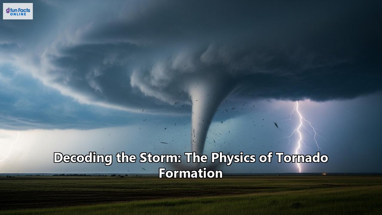
Tornadoes, often called nature's most violent storms, are a terrifying and fascinating display of atmospheric power. These rapidly rotating columns of air, extending from a thunderstorm to the ground, can unleash devastating winds capable of leveling entire communities. For centuries, their formation was a subject of folklore and fear. Today, thanks to the tireless work of scientists and advancements in technology, we are beginning to decode the complex physics behind these incredible phenomena. This article delves into the heart of the storm, exploring the ingredients, processes, and cutting-edge science behind tornado formation.
The Cauldron of Creation: Essential Ingredients for a Tornado
Tornadoes do not materialize out of thin air. They are the product of a specific and volatile mix of atmospheric conditions, most often within a powerful type of thunderstorm known as a supercell. The key ingredients that set the stage for a tornado are:
- Instability: At its core, a thunderstorm needs an unstable atmosphere to form. This occurs when warm, moist air near the ground is situated beneath a layer of cooler, drier air. This warm, buoyant air acts like a hot air balloon, wanting to rise rapidly. As it ascends, the moisture within it condenses, releasing heat. This process, known as latent heat release, further fuels the updraft, making the air column even more unstable and creating the towering cumulonimbus clouds characteristic of thunderstorms.
- Wind Shear: This is perhaps the most crucial ingredient for the formation of the rotating thunderstorms that spawn the most powerful tornadoes. Wind shear is a change in wind speed and/or direction with height. Imagine a scenario where winds near the surface are blowing from the southeast at 20 mph, while winds a few thousand feet higher are blowing from the west-southwest at 55 mph. This difference in wind speed and direction creates a horizontal rolling motion in the lower atmosphere, much like rolling a pencil between your hands. This invisible, horizontal tube of spinning air is the seed of the tornado's rotation.
- A Lifting Mechanism: To get the storm started, a "trigger" is needed to give the warm, moist surface air an initial push upwards. This can be a cold front, a dry line (the boundary between moist and dry air), or other low-level zones where winds converge. Once lifted, the instability takes over, and the air continues its rapid ascent.
The Supercell: A Tornado's Terrifying Cradle
While all thunderstorms require instability and a lifting mechanism, it is the presence of significant wind shear that can transform a regular thunderstorm into a supercell. Supercells are a special and dangerous breed of thunderstorm characterized by a deep, persistently rotating updraft called a mesocyclone. Only about 30% or fewer of supercells produce tornadoes, but they are responsible for the vast majority of strong and violent tornadoes (EF2 and stronger).
The formation of a mesocyclone is a critical step towards tornadogenesis. Here's a simplified step-by-step look at how it happens:
- Horizontal Spin: As mentioned earlier, wind shear creates horizontal tubes of spinning air in the atmosphere.
- Tilting the Spin: The powerful updraft of the developing thunderstorm acts like a giant hand, tilting this horizontal tube of air into a vertical position.
- The Birth of the Mesocyclone: This tilted, now-vertical column of rotating air within the thunderstorm is the mesocyclone. It can be several miles in diameter and extend high into the storm cloud. On Doppler radar, a mesocyclone can sometimes be identified as a "hook echo," a distinctive hook-shaped pattern of precipitation wrapping around the rotating updraft.
From Mesocyclone to Tornado: The Final, Violent Descent
The presence of a mesocyclone indicates that a storm has the potential to produce a tornado, but it's not a guarantee. The final and still not fully understood stage is the formation of the tornado itself. Several processes are believed to contribute to this final, violent descent:
- The Role of Downdrafts: Descending currents of air within the storm, known as downdrafts, are thought to play a crucial role. The rear-flank downdraft (RFD), a region of sinking air on the back side of the storm, can wrap around the mesocyclone. This surge of air can help to concentrate the rotation and bring it down to the ground.
- Conservation of Angular Momentum: As the rotating column of air is stretched vertically and narrowed by the dynamics of the storm, it begins to spin faster. This is the same principle that causes a figure skater to spin faster when they pull their arms in. This intensification of the rotation is a key step in the formation of the tornado vortex.
- Ground-Up or Top-Down?: For a long time, the prevailing theory was that tornadoes formed from the top down, with the funnel cloud descending from the storm's base. However, recent research and high-resolution computer models suggest that many tornadoes, perhaps most, form from the ground up, or simultaneously along a column between the ground and the cloud base. This new paradigm suggests that rotation near the ground can be intensified and lifted by the storm's updraft to form the tornado.
Once the rotating column of air makes contact with the ground, it is officially classified as a tornado. The visible funnel is actually composed of condensed water droplets, dust, and debris sucked into the vortex. In some cases, a tornado can be on the ground and causing damage even without a visible funnel.
A Spectrum of Twisters: Beyond the Supercell
While supercells produce the most powerful tornadoes, they are not the only source. Other, typically weaker, types of tornadoes can form through different mechanisms:
- Landspouts: These tornadoes are not associated with a mesocyclone and form in a manner similar to waterspouts. They develop when a growing cumulus cloud's updraft stretches a pre-existing area of rotation at the surface. This surface rotation can be caused by colliding air boundaries, such as a cold front outflow. Landspouts are generally weaker and shorter-lived than supercell tornadoes, often appearing as a narrow, rope-like tube.
- Waterspouts: As the name suggests, these are tornadoes that form over water. "Fair-weather" waterspouts are similar to landspouts in their formation, developing in moist environments with little vertical wind shear. "Tornadic" waterspouts, on the other hand, are essentially supercell tornadoes that happen to form over or move onto a body of water.
Measuring the Mayhem: The Enhanced Fujita Scale
To classify the intensity of tornadoes, meteorologists use the Enhanced Fujita (EF) Scale. This scale, implemented in the United States in 2007, is a revised version of the original Fujita Scale developed by Dr. Tetsuya "Ted" Fujita. The EF Scale rates tornadoes from EF0 to EF5 based on the damage they cause, with wind speed estimates derived from that damage. It is important to note that the rating is assigned after the tornado has passed and the damage has been surveyed by National Weather Service personnel.
The EF Scale uses 28 Damage Indicators (DIs), such as different types of buildings, trees, and structures, and multiple Degrees of Damage (DoD) for each indicator. This allows for a more nuanced and accurate assessment of a tornado's intensity.
Here is a breakdown of the EF Scale categories:
- EF0 (65-85 mph winds): Light damage. Shingles peeled off roofs, damage to gutters or siding, branches broken off trees.
- EF1 (86-110 mph winds): Moderate damage. Roofs severely stripped, mobile homes overturned, broken windows.
- EF2 (111-135 mph winds): Considerable damage. Roofs torn off well-built houses, mobile homes completely destroyed, large trees snapped or uprooted.
- EF3 (136-165 mph winds): Severe damage. Entire stories of well-constructed houses destroyed, severe damage to large buildings.
- EF4 (166-200 mph winds): Devastating damage. Well-constructed houses leveled, cars thrown significant distances.
- EF5 (Winds over 200 mph): Incredible damage. Strong frame houses lifted off foundations and swept away; steel-reinforced concrete structures badly damaged.
While violent tornadoes (EF3 and above) are rare, accounting for only about 5% of all tornadoes in the U.S., they are responsible for a disproportionately high number of fatalities.
The Hunt for the Twister: Detection and Forecasting
Predicting the exact time and location a tornado will strike is still beyond the reach of modern science. However, the ability to forecast the conditions conducive to tornado formation and detect them once they develop has improved dramatically, saving countless lives. The key tools in the tornado forecaster's arsenal include:
- Doppler Radar: This is the cornerstone of tornado detection. Doppler radar can measure the speed and direction of precipitation particles within a storm, allowing meteorologists to "see" the rotation of a mesocyclone. The development of dual-polarization radar has further enhanced this capability. By sending out both horizontal and vertical radar pulses, it can provide a better sense of the size and shape of objects in the air, helping to differentiate between rain, hail, and even the debris lofted by a tornado – a clear sign that a tornado is on the ground.
- Satellites: Geostationary satellites provide a continuous eye in the sky, monitoring weather patterns and identifying the atmospheric "triggers" for severe weather. While satellites cannot see tornadoes directly, they can detect features in the cloud tops, such as "overshooting tops" where the updraft is so strong it punches through the highest level of the thunderstorm, which can indicate a particularly severe storm with the potential for tornadoes.
- Computer Models: Meteorologists rely on powerful computer models, known as numerical weather prediction (NWP) models, to forecast when and where the ingredients for severe weather will come together. These models use vast amounts of data from weather balloons, satellites, and surface stations to simulate the future state of the atmosphere. Newer, high-resolution models, called convection-allowing models (CAMs), are even capable of predicting the development of individual thunderstorms. Researchers are also developing "Warn-on-Forecast" models that aim to predict the likelihood of a tornado forming within a specific storm up to an hour in advance.
- Human Spotters: In the final analysis, there is no substitute for a trained human observer. Storm spotters, often volunteers, provide real-time reports of funnel clouds, tornadoes, and the damage they are causing. These on-the-ground reports are crucial for confirming what the radar is seeing and for issuing timely warnings.
A Global Phenomenon with a Notorious Hotspot
Tornadoes have been recorded on every continent except Antarctica. However, the United States experiences the most tornadoes of any country, with an average of over 1,000 each year. The central and southern plains of the U.S., often referred to as "Tornado Alley," is a notorious hotspot for tornado activity, where the unique geography allows for the frequent clash of warm, moist air from the Gulf of Mexico, cool, dry air from the Rockies, and strong upper-level winds.
Other parts of the world with frequent tornadoes include Canada, which sees the second-highest number of tornadoes annually, as well as parts of Argentina, Brazil, Bangladesh, and Europe. The United Kingdom has the most tornadoes per land area, though they are typically weak.
The Future of Tornado Science
While our understanding of tornado formation has come a long way, many questions remain. Scientists continue to use advanced computer models, sophisticated radar systems, and in-field research, including storm chasing, to unravel the remaining mysteries of tornadogenesis. The goal is to improve forecasting, increase warning lead times, and ultimately, to better protect lives and property from these powerful and destructive storms. The decoding of the storm is an ongoing process, a testament to human curiosity and the enduring quest to understand the awesome power of nature.
Reference:
- https://www.weather.gov/ffc/torntext
- https://www.cmich.edu/blog/all-things-higher-ed/20-amazing-facts-you-didnt-know-about-tornadoes-and-hurricanes
- https://www.nssl.noaa.gov/education/svrwx101/tornadoes/forecasting/
- https://en.wikipedia.org/wiki/Tornado_climatology
- https://www.numberanalytics.com/blog/science-behind-tornado-forecasting
- https://en.wikipedia.org/wiki/Enhanced_Fujita_scale
- https://www.ducksters.com/science/earth_science/tornadoes.php
- https://www.weather.gov/tae/ef_scale
- https://www.uwo.ca/ntp/faqs/how_are_tornadoes_rated_using_the_efscale.html
- https://www.vaia.com/en-us/textbooks/geography/geosystems-an-introduction-to-physical-geography-8-edition/chapter-8/problem-15-describe-the-formation-process-of-a-mesocyclone-h/
- https://www.accuweather.com/en/blogs-webinars/tornado-measurement-and-strength-decoding-the-ef-scale/1678027
- https://www.britannica.com/science/tornado/Prediction-and-detection-of-tornadoes
- https://www.nssl.noaa.gov/education/svrwx101/tornadoes/detection/
- https://www.weather.gov/oun/efscale
- https://stormaware.mo.gov/tornado-facts-history/
- https://blogs.und.edu/jdosas/2019/08/a-new-paradigm-for-forecasting-tornadoes/?print=print
- https://en.wikipedia.org/wiki/Landspout
- https://skybrary.aero/articles/landspout
- https://www.home-weather-stations-guide.com/waterspouts.html
- https://www.numberanalytics.com/blog/weather-radar-in-severe-weather-events
- https://en.wikipedia.org/wiki/Waterspout
- https://www.foxweather.com/learn/how-are-tornadoes-rated-the-enhanced-fujita-scale-explained
- https://www.nssl.noaa.gov/tools/radar/dualpol/
- https://www.mwcog.org/file.aspx?D=t3AS6Zv7RDtvFHW%2BHGAllGt2csiM50koYkJstmCXOog%3D&A=Za5%2FZ996l7jj7wEWrcgG1TUhm5JbsIZzUfKmDjGpLag%3D
- https://www.nesdis.noaa.gov/news/how-noaa-satellites-help-us-stay-ahead-of-severe-weather-season
- https://www.numberanalytics.com/blog/ultimate-guide-satellite-observations-weather-forecasting
- https://www.nssl.noaa.gov/tools/forecast/
- https://www.britannica.com/science/tornado
- https://worldpopulationreview.com/country-rankings/what-countries-have-tornadoes
- https://dosomething.org/article/11-facts-about-tornadoes